Author - Darren McLean

Guyana Travel Guide

A rainbow over Kaieteur Falls, Guyana.

Guyana Travel Guide

Welcome to the taste2travel Guyana Travel Guide!

Date of visit: January 2015 &  October 2015

Introduction

Guyana is the fourth-smallest country in South America (after Uruguay, Suriname and French Guiana). It is bordered by the Atlantic Ocean to the north, Brazil to the south and southwest, Suriname to the east and Venezuela to the west. It’s capital and largest city is Georgetown.

History

Originally inhabited by several indigenous groups, Guyana was settled by the Dutch before coming under British control in the late 18th century. It was governed as the plantation economy of British Guiana until independence in 1966.

The legacy of British rule is reflected in the country’s diverse population, which includes Indian, African, Chinese, Portuguese, Amerindian, and European groups.

Guyana also has the distinction of being the only South American nation in which English is the official language. The majority of the population, however, speak Guyanese Creole, an English-based creole language with slight Dutch, Arawakan and Caribbean influences.

Guyana is called the ‘Bread Basket’ of the Caribbean. Major crops include rice, sugar, coffee, cocoa, coconuts, edible oils, copra, fruit, vegetables, and tobacco. Livestock include cattle, sheep, pigs, goats, and chickens.

In addition to being part of the Anglophone Caribbean, Guyana is one of the few Caribbean countries that is not an island in the West Indies.

The Caribbean Community (CARICOM), of which Guyana is a member, is headquartered in Georgetown.
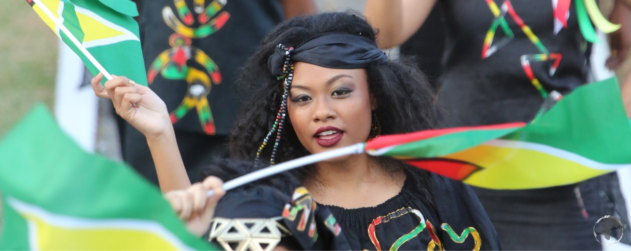
Guyana Travel Guide: Fashion Parade in Georgetown

Fashion Parade in Georgetown

Guyana or Guiana
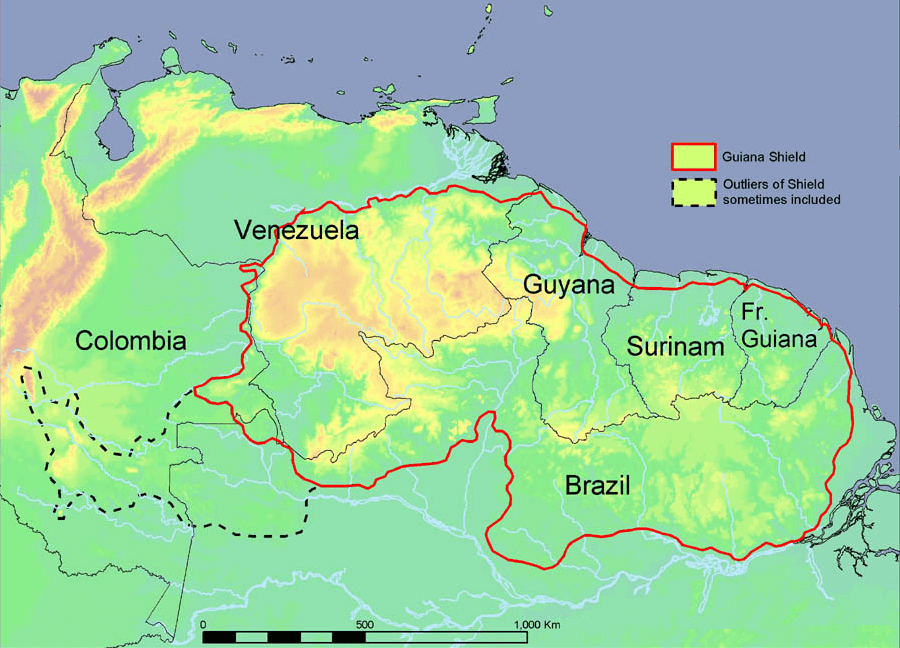
A map of the Guyana shield.

A map of the Guyana shield.
Source: Wikipedia

‘Guyana’ is derived from an Amerindian language and means “land of many waters”. The region comprised the large shield landmass north of the Amazon River and east of the Orinoco River.

In colonial times, there were five Guiana’s, these were (in geographical order along the coast):

  • Spanish Guiana – now the Guayana region of Venezuela
  • British Guiana – now the sovereign nation of Guyana
  • Dutch Guiana – now the sovereign nation of Suriname
  • French Guiana – now a French department known in French as ‘Guyane’
  • Portuguese Guiana – now the Brazilian state of Amapa

When Guyana declared independence, it changed its name from British Guiana to Guyana.
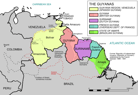
An historical map showing the five Guyanas.

An historical map showing the five Guyanas.

Flag
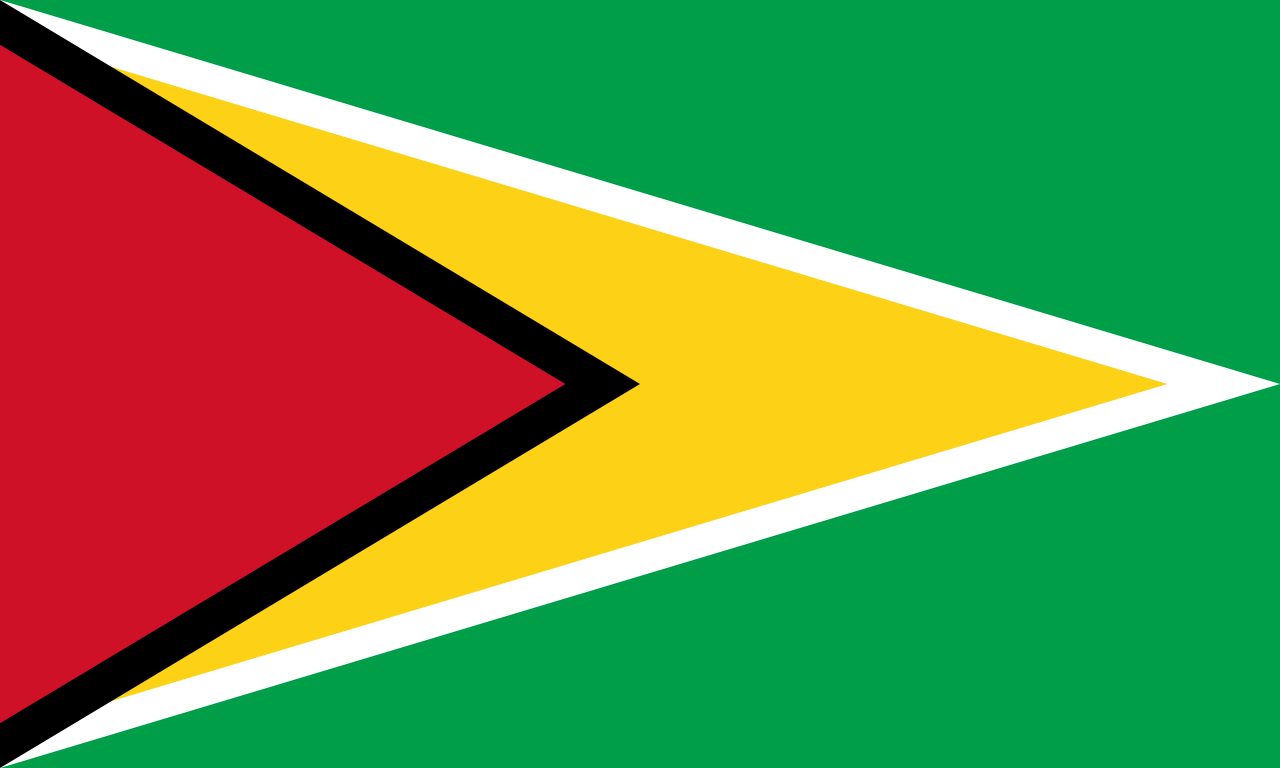
The flag of Guyana.

The flag of Guyana.

The flag of Guyana, known as The Golden Arrowhead, has been the national flag since the country become independent from the Great Britain in 1966.

Following a competition, the winning design for the flag was one created by an American, Whitney Smith, who later became a prominent vexillologist (flag historian).

The flag features a red background, green hoist triangle, and stylised yellow arrowhead. The Guyanese reversed the green and red and added a black fimbriation (narrow border) to the triangle and one of white to the arrowhead.

The green represents the jungles and fields that cover most of the country, as reflected in the national anthem, “Green Land of Guyana”. The white symbolises the many rivers, which provide the basis for the indigenous name Guyana (“land of waters”), while red represents zeal and sacrifice in nation-building, and the black symbolises perseverance.

The yellow arrowhead recalls the original Amerindian population of the area but also represents the golden future that citizens are committed to building on the basis of national mineral resources.

Georgetown

Georgetown is Guyana’s largest city (population: 250,000) and its capital. It is situated on the Atlantic Ocean coast at the mouth of the Demerara River and it was nicknamed ‘Garden City of the Caribbean’.

Through the years, Georgetown has been governed by the Dutch, the French, the Dutch again and finally the English until independence.

Georgetown was named in 1812 in honour of King George III.

The city is located on a flat coastal plain. The elevation of the land is one metre below the high tide level. This low elevation is protected by a retaining wall known as the seawall (originally constructed by the Dutch) to keep the ocean out and an innovative network of canals with kokers to drain the city of excess water.

Most of the sites of interest are conveniently located in the compact city centre and can be seen on foot within a day. The streets of the city are arranged on a grid format so orientation is easy. The best way to explore the city is to meander the tree-lined streets, exploring the beautiful wooden colonial buildings and churches.

Christ Church in Georgetown, Guyana.

Christ Church in Georgetown, Guyana.

The centre of the city is dominated by the large Stabroek Market (1792) containing the prominent cast-iron clock tower. Stabroek was the name the Dutch gave to the city the 2nd time they took control. The market is interesting but you should be extra vigilant with your personal belongings here. Likewise in the immediate neighbourhood where the streets are chaotic, crowded, rough and edgy.
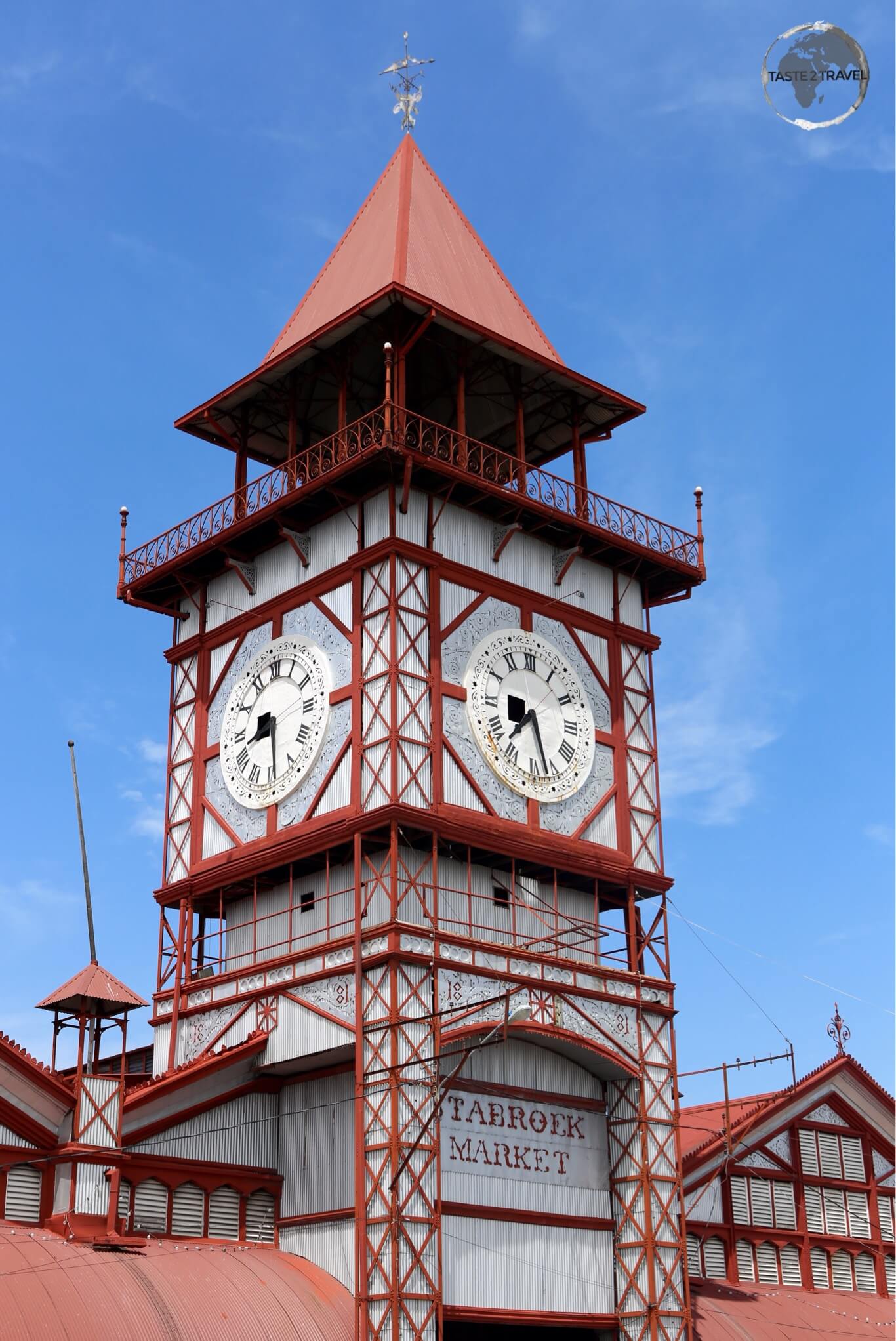
The iconic wrought-iron clock tower of Stabroek Market in Georgetown.

The iconic wrought-iron clock tower of Stabroek Market in Georgetown.

For the best coffee in town (not to mention great food and good WiFi), you can not beat Oasis cafe. It’s located downtown on Carmichael street.

Kaieteur Falls
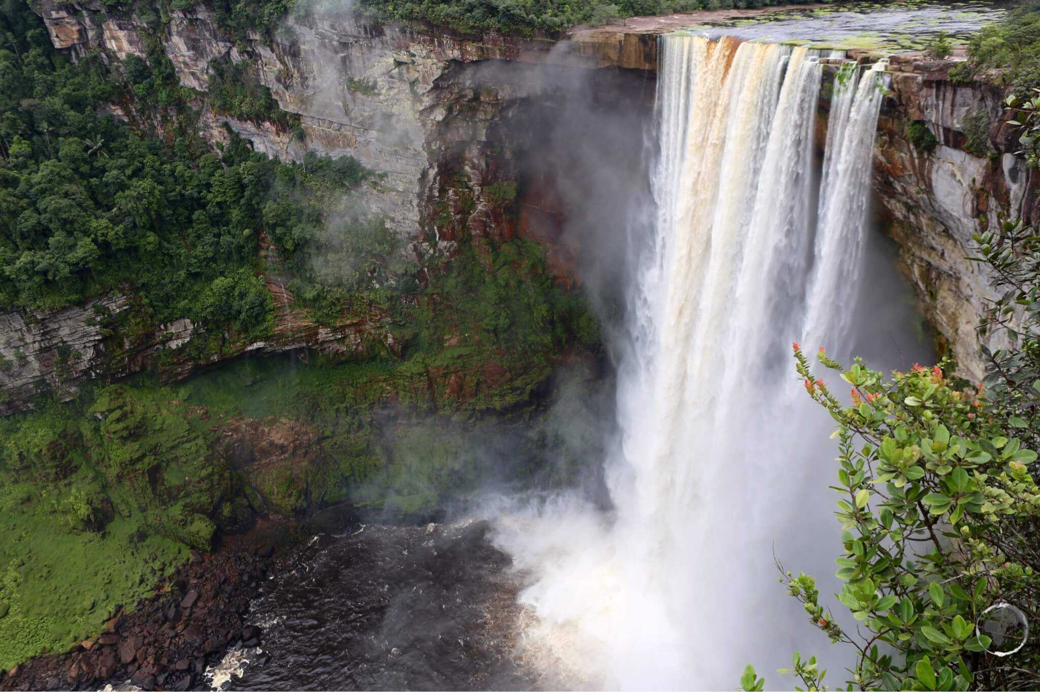
The majestic and awe-inspiring, Kaieteur Falls - a truly spectacular sight.

The majestic and awe-inspiring, Kaieteur Falls – a truly spectacular sight.

If there is one ‘must see’ attraction in Guyana then without a doubt it is the majestic and incredible Kaieteur falls. This is a site that must be seen to be believed and there is no better way of approaching it than from the air.

The falls are not accessible by road so they have largely escaped commercialism and development. On the day I visited there were just 8 other visitors – my fellow passengers on the Air Services flight.
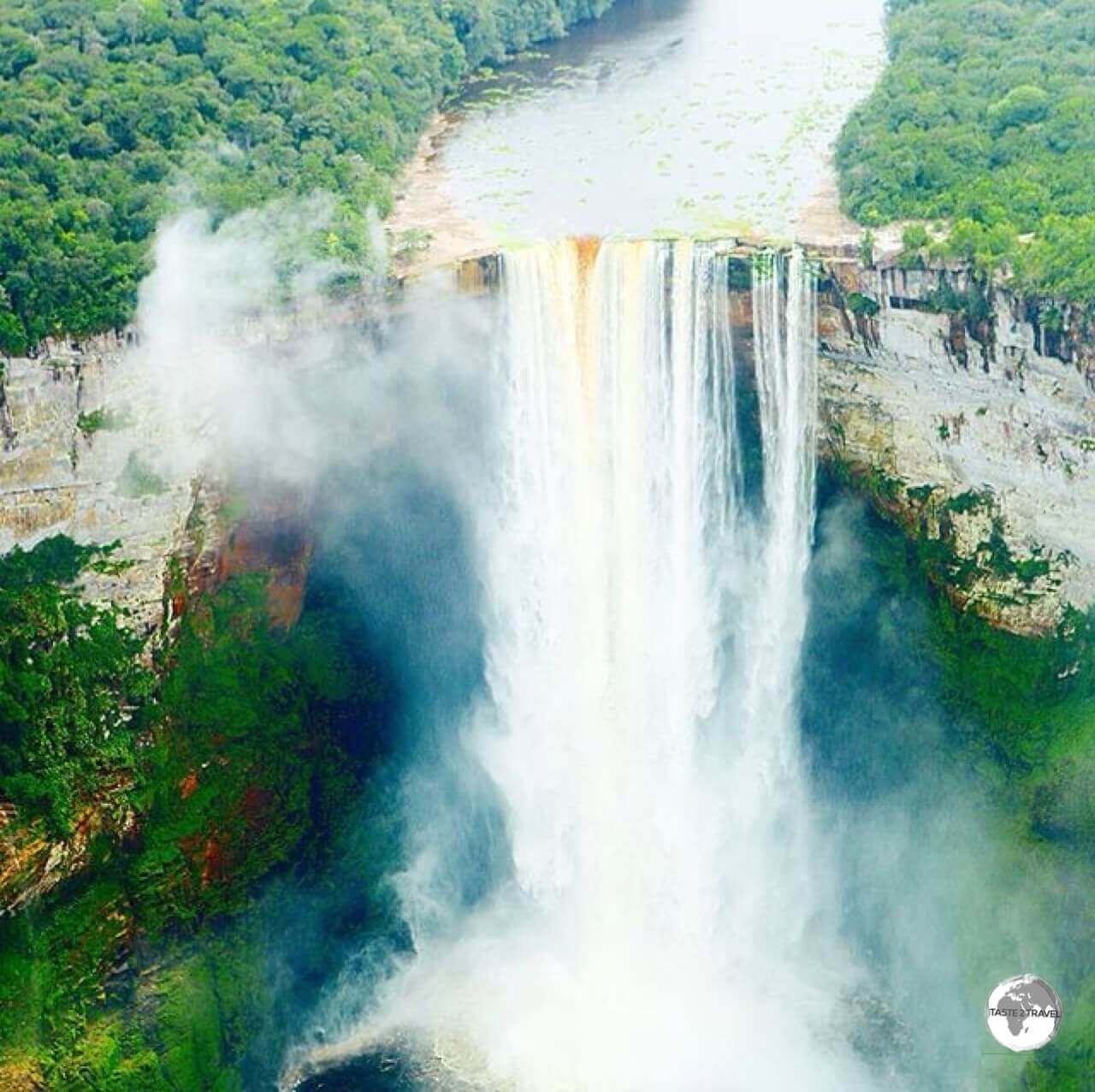
Kaieteur Falls is the world's widest single drop waterfall. The falls plunge 226 metres in a single drop.

Kaieteur Falls is the world’s widest single drop waterfall. The falls plunge 226 metres in a single drop.

The falls are located in the middle of a huge, remote forest. It is four times higher than Niagara Falls and about twice the height of Victoria Falls. It is a very impressive single drop waterfall.

Depending on the season, Kaieteur falls vary in width from 76 metres (250 ft) to 122 metres (400 ft).

Depending on the season, Kaieteur falls vary in width from 76 metres (250 ft) to 122 metres (400 ft).

The 6 km trail approaching the falls is home to a variety of birds, and the minuscule golden poison frog, which produces a potentially fatal poison. The frogs live inside the leaves of the Giant Tank Bromeliads, which act as natural cisterns.
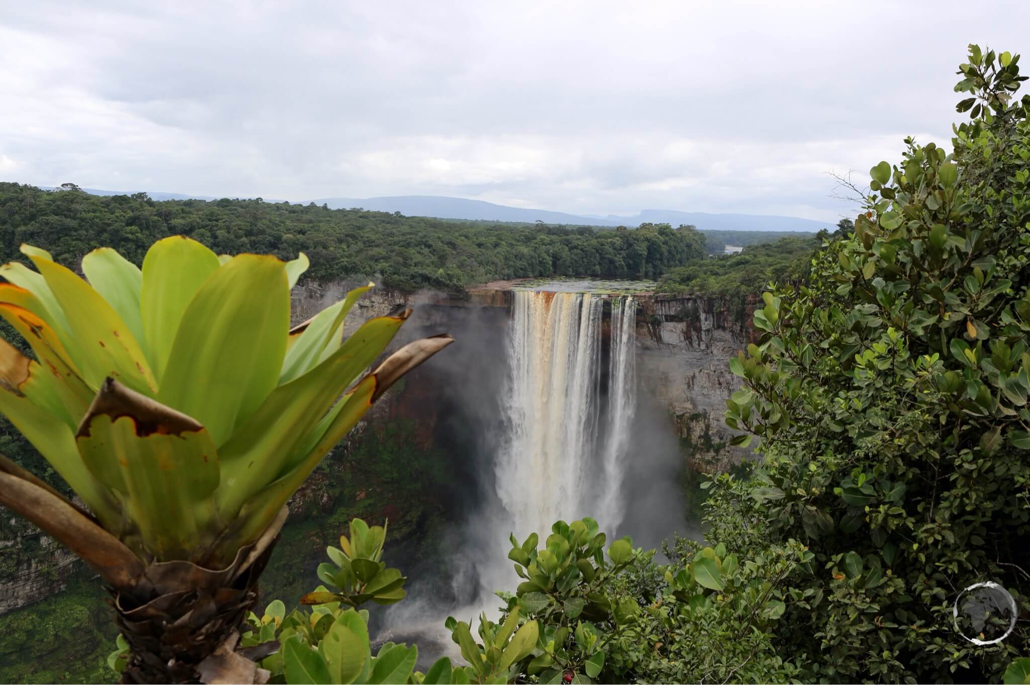
Giant-tank Bromeliads provide the perfect habitat for the Golden poison frog.

Giant-tank Bromeliads provide the perfect habitat for the Golden poison frog.


A Golden poison frog, a member of the Poison Dart Frog family at Kaieteur Falls.

A Golden poison frog, a member of the Poison Dart Frog family at Kaieteur Falls.

The golden poison frog’s skin is densely coated in an alkaloid toxin, one of a number of poisons common to dart frogs. This poison prevents its victim’s nerves from transmitting impulses, leaving the muscles in an inactive state of contraction. This can lead to heart failure or fibrillation. Some native people use this poison to hunt by coating darts with the frog’s poison.
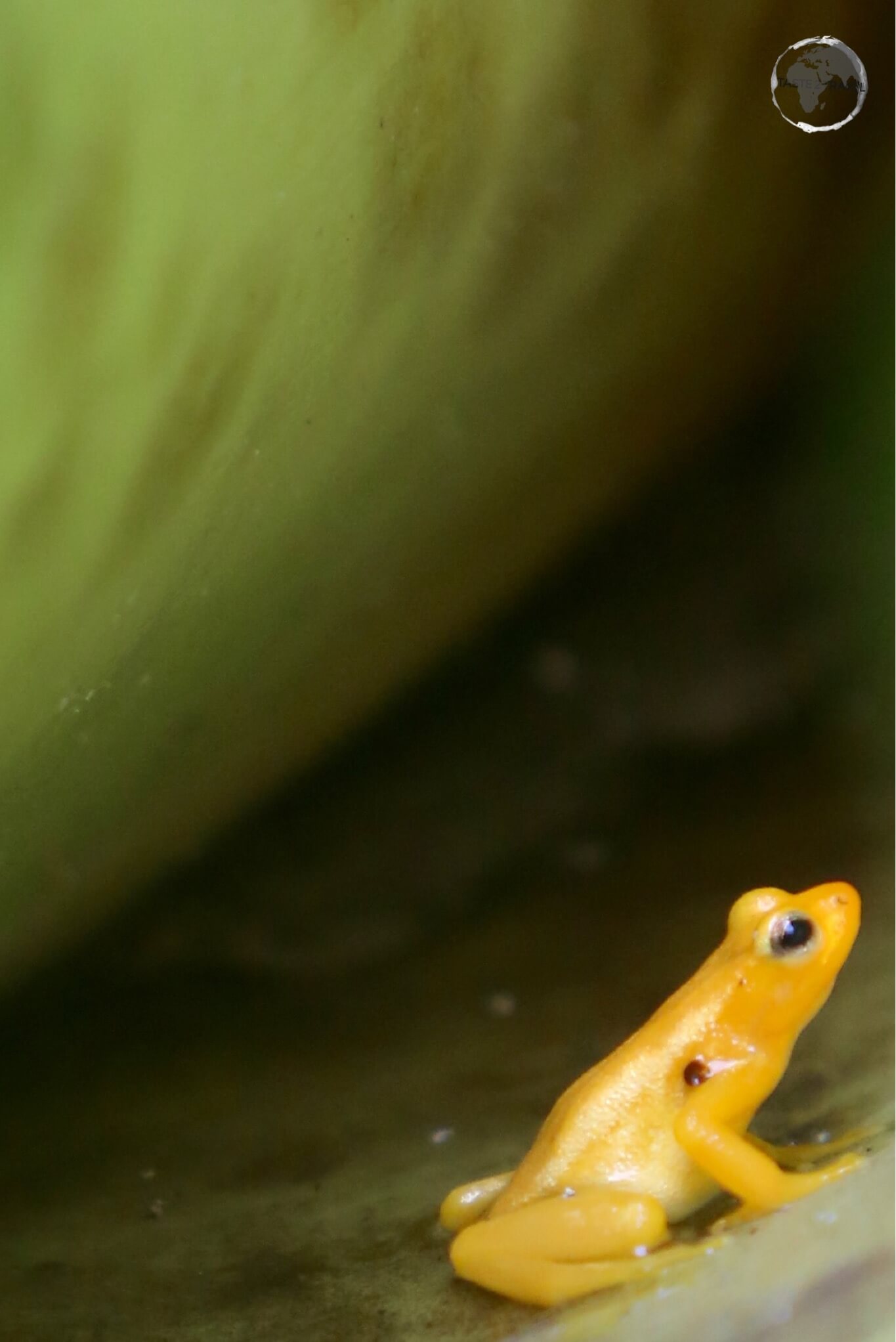
A Golden poison frog inside a Giant-tank Bromeliads at Kaieteur falls.

A Golden poison frog inside a Giant-tank Bromeliads at Kaieteur falls.

Getting There

You can reach the falls either by boat along the lower reaches of the Potaro river, or the easy – and most popular way – by one hour flight in a small aircraft from Georgetown.

Flights from Ogle Airport are currently offered by Air Services Limited. Refer to their website for schedule and pricing.

Flights leave Georgetown at 1 pm and return at 5 pm. Included in the cost is a two-hour guided nature walk conducted by a local Amerindian guide.

There are two ways to purchase your ticket:

Local way: book direct with the airline for $145.

Tourist way: book with your hotel or a downtown travel agent and pay about $190. This includes return airport transfers plus lunch at the airport.

Iwokrama Forest

A Parrot Snake at Iwokrama Forest.

A Parrot Snake at Iwokrama Forest.

Covering 3710 square kilometres of central Guyana, the Iwokrama Forest is one of the four last pristine tropical forests in the world.

Access to the forest is either via private vehicle or one of the micro buses running from Georgetown to Lethem.
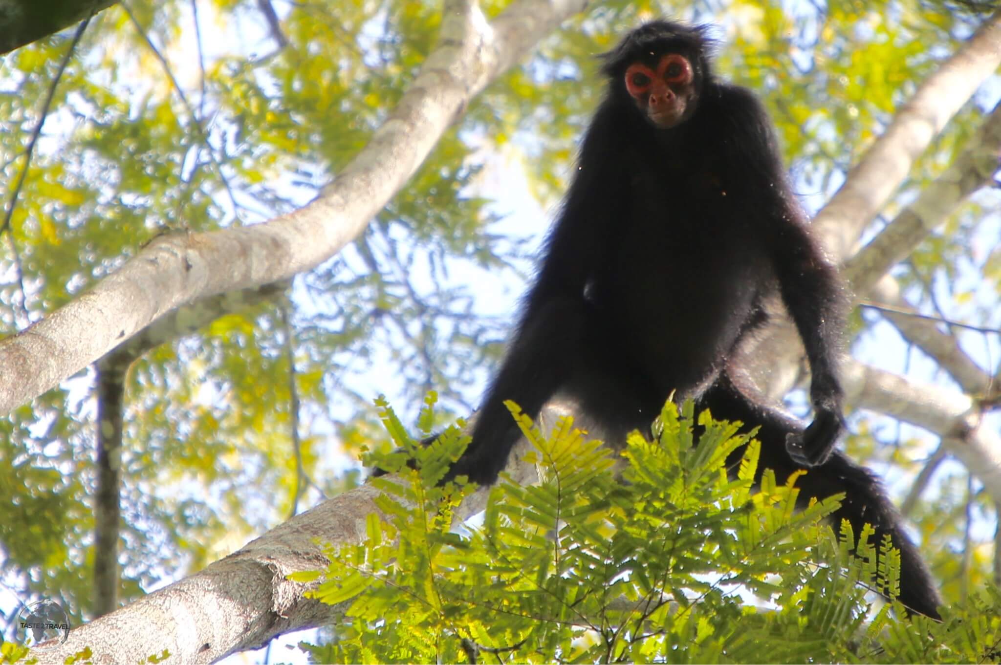
A curious Spider Monkey nearby the Atta Lodge in the heart of the Iwokrama Forest.

A curious Spider Monkey nearby the Atta Lodge in the heart of the Iwokrama Forest.

I stayed at Atta Lodge, which is located at the Iwokrama Canopy Walkway, Guyana’s only canopy walk. The walkway is suspended 30 m above the forest floor and provides an excellent viewing platform for birds, primates etc.

All lodge reservations plus transport arrangements must be booked and paid for in advance in Georgetown. I made my arrangements through Wilderness Explorers.
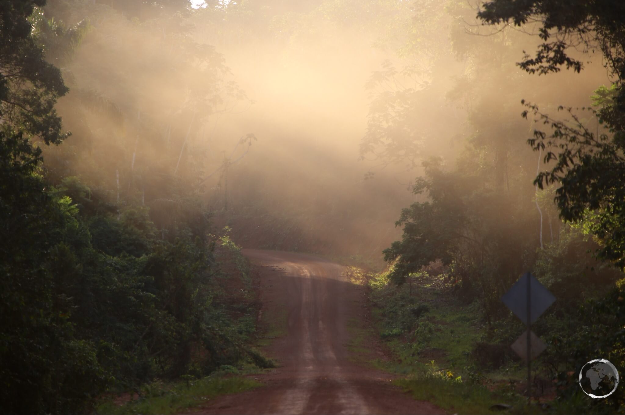
The 'highway' connecting Guyana and Brazil passes through the Iwokrama forest

The ‘highway’ connecting Guyana and Brazil passes through the Iwokrama Forest

Note: There are no transport options out here unless you hire an (expensive) private 4WD. You could try your luck hitching a ride on the Georgetown – Lethem road

Lethem

Lethem lies on the Takutu River, which forms the border with Brazil, opposite the Brazilian town of Bonfim. It’s a sleepy transit town. If you get stuck here there are a couple of hotel options.

For more on crossing the border, see the ‘Getting There‘ section below.

Accommodation

Like the other countries in the Guiana’s, accommodation in Guyana is limited. It’s best to book in advance using an online agent such as booking.com

In Georgetown I have stayed at Herdmanston Lodge, which is a well known favourite and the more centrally located Halito Hotel & Residence (my preference).

Eating Out

Food in Guyana is influenced by the different ethnic groups and is typical of other Anglo Caribbean countries. Curry and Chinese are popular.

Visa Requirements

Some nationalities require visas for Guyana – check your visa requirements prior to arrival.

Getting There

By Air

International flights arrive at Cheddi Jagan International Airport. The airport is located 41 kilometres (25 mi) south of Guyana’s capital, Georgetown.

The following airlines provide international flights to Timehri:

Ogle International Airport is primarily used for domestic flights and is located on the Atlantic Ocean coast 10 km from Georgetown. Flights to Kaieteur Falls depart from this airport.

The following airlines provide international flights to Ogle:

  • LIAT – flies to/from Barbados
  • Trans Guyana Airways – flies to/from Paramaribo (Zorg en Hoop) plus domestic destinations in Guyana.

From either airport you can get downtown via taxi.

By Road/ River

To/ From Suriname

The ferry service between Guyana (Molson Creek – Corentyne) and Suriname (South Drain) is operated by the Canawaima Ferry Company.

Services are either once a day or twice a day in each direction, depending on season. There is usually a ferry from Guyana at 1 pm.

South Drain is located 32 km south of Nieuw Nickerie on a fast paved road.

On either side you will find taxis and shared buses to transport you to Georgetown (3 hours), Paramaribo (5 hours) or Nieuw Nickerie (30 mins). Roads are paved and in excellent condition on both sides, although the driving is erratic and risky.

Most nationalities require either a tourist card or a visa for Suriname – check your requirements prior to arrival.

To/ From Brazil

The border between Brazil and Guyana is the bridge over the Takutu river between the Brazilian town of Bonfim and the Guyanese town of Lethem. The bridge includes a neat lane-changing design to get you from the left side of the road onto the right side.

Formalities are conducted on the respective sides of the river. There are local taxis, which will ferry you between the two posts.

On the Brazilian side you have shared taxis or buses which will take you to the city of Boa Vista, the capital of Roraima state.

On the Guyanese side you have micro buses that will transport you to Georgetown (20 hours) via the Iwokrama Rain forest (6 hours).

Note: Do not cross the border into Brazil with Guyanese dollars – they are impossible to change outside of Guyana.

Some nationalities require visas for Brazil – check your visa requirements prior to arrival.

Getting Around

There are frequent mini buses connecting all of the main centres in Guyana. Most buses from Georgetown commence their journey on the crowded, chaotic streets outside Stabroek market.

All taxis are registered under the term “Hackney Carriage” and carry the letter H at the beginning of their number plates. You can flag these in the street.


That’s the end of my Guyana Travel Guide.

If you wish to leave feedback/ comments, you can do so using the form below.

Safe Travels!
Darren


Further Reading

Other travel reports from the region include:

Guyana Travel Guide Guyana Travel Guide Guyana Travel Guide Guyana Travel Guide Guyana Travel Guide Guyana Travel Guide

Suriname Travel Guide

Dutch-style colonial buildings in the UNESCO-listed old town of Paramaribo.

Suriname Travel Guide

Welcome to the Taste2Travel Suriname Travel Guide!

Date of Visit: January 2015

Introduction

Suriname is the smallest country in South America, covering approximately 163,820 square kilometres. Despite its small size, this fascinating country boasts remarkable ethnic and cultural diversity. Its population includes descendants of Indigenous peoples, enslaved Africans, Dutch and British colonists, and indentured workers from India, Indonesia and China.

The capital, Paramaribo, lies at the heart of the country. Here, you’ll discover beautiful Dutch colonial architecture, historic wooden buildings and leafy public squares. In fact, the streets of its photogenic old town look more like a Dutch settlement than a city on the edge of a tropical rainforest!

Between sightseeing stops, you can sample the country’s diverse cuisine at restaurants throughout the historic centre. Meanwhile, beer lovers should try Parbo, the local brew produced by Heineken. In my opinion, it tastes even better after a hot day of exploring!

Beyond the capital, Suriname offers a completely different experience. The vast tropical forests provide excellent opportunities for hiking and wildlife watching. For example, Brownsberg Nature Park offers scenic trails, spectacular views and the chance to spot colourful frogs and other fascinating wildlife.

Location

Suriname occupies the northeastern corner of South America, along the Atlantic coast. It shares borders with French Guiana to the east, Guyana to the west and Brazil to the south. Together with French Guiana and Guyana, Suriname forms part of a region known as the Guianas.

Dense tropical rainforest covers much of the country’s interior. This vast wilderness forms part of the Guiana Shield, one of the world’s most important areas of tropical biodiversity.

Lotus Flower in Nieuw Amsterdam.

Lotus Flower in Nieuw Amsterdam.

Most Surinamese people live along the northern coast, where the capital and main population centres offer access to transport, services and the Atlantic Ocean. In contrast, the sparsely populated interior contains extensive rainforest, remote river communities and Indigenous settlements.

History

Historic Dutch church in Paramaribo.

Historic Dutch church in Paramaribo.

Indigenous peoples inhabited Suriname long before European explorers arrived. During the colonial era, European powers competed for control of the territory. Eventually, the Dutch established lasting colonial rule in the 17th century.

Plantation agriculture became central to the colonial economy. Dutch plantation owners relied heavily on enslaved Africans to produce crops such as sugar and coffee. After the abolition of slavery, colonial authorities brought indentured workers from India, Java and China to replace the plantation workforce.

These successive waves of migration shaped Suriname’s distinctive cultural identity. Today, the country reflects a remarkable blend of African, South Asian, Javanese, Chinese, European and Indigenous influences.

Suriname gained independence from the Netherlands on 25 November 1975. Dutch remains the official language, making Suriname the only sovereign country in South America where Dutch holds official-language status.

Although geographically located in South America, Suriname also shares strong cultural and historical connections with the Caribbean. It is a member of the Caribbean Community (CARICOM), which promotes cooperation among Caribbean countries.

People

The colourful Arya Dewaker Hindu temple, Meerzorg, Paramaribo.

The colourful Arya Dewaker Hindu temple, Meerzorg, Paramaribo.

Suriname is one of South America’s most culturally diverse countries. Its population includes several major ethnic communities, each with its own traditions, cuisine and religious heritage.

The country’s colonial history largely explains this diversity. During the plantation era, enslaved Africans formed a significant part of the workforce. Later, following the abolition of slavery, colonial authorities recruited indentured workers from other parts of the world.

The Dutch brought workers from India through arrangements with the British, as well as from the Dutch East Indies, now Indonesia. Smaller numbers also arrived from China and the Middle East during the late 19th and early 20th centuries.

Today, Suriname’s population includes Creoles, Hindustanis, Javanese, Maroons, Indigenous peoples and Chinese communities, alongside people of mixed and European ancestry.

The biggest mosque in the country is located on the Keizerstraat in Paramaribo.

The biggest mosque in the country is located on the Keizerstraat in Paramaribo.

This cultural diversity is especially visible in Paramaribo, where Hindu temples, mosques, Christian churches and synagogues reflect the country’s varied religious traditions.

Interestingly, the English spelling of the country’s name changed from Surinam to Suriname in January 1978. Nevertheless, the older spelling survives in some names, including the national airline, Surinam Airways.

Flag

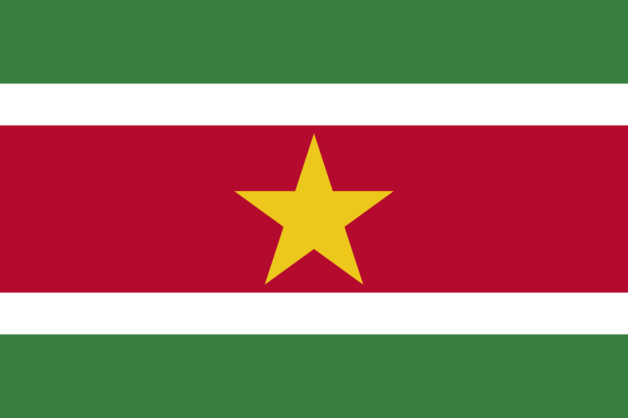
The flag of Suriname.

The flag of Suriname.

Suriname adopted its national flag on 25 November 1975, the day the country gained independence from the Netherlands.

The flag features five horizontal stripes arranged in this order: green, white, red, white and green. A large yellow, five-pointed star sits in the centre of the red stripe.

Each colour carries a particular meaning:

  • Green: Represents hope and fertility.
  • White: Symbolises peace and justice.
  • Red: Represents progress and love.
  • Yellow star: Symbolises the unity of Suriname’s diverse ethnic communities.

Together, these colours reflect the country’s hopes for prosperity, harmony and a united future.

Currency

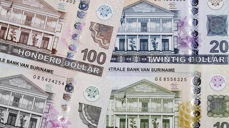
The official currency of Suriname is the Surinamese dollar.

The official currency of Suriname is the Surinamese dollar.

The official currency of Suriname is the Surinamese dollar (SRD).

The Central Bank of Suriname issues the country’s banknotes. The dollar divides into 100 cents, although the availability and use of individual coin denominations can vary.

Because exchange rates fluctuate, check the latest rate before travelling. You can consult the Central Bank of Suriname for official financial information or use a currency converter to estimate your travel budget.

I recommend carrying some local currency for everyday purchases, particularly when visiting smaller towns and remote communities. However, confirm payment options with your accommodation and tour operators before travelling into the interior.

Paramaribo

Dutch colonial buildings in the UNESCO-listed old town of Paramaribo.

Dutch colonial buildings in the UNESCO-listed old town of Paramaribo.

Paramaribo is Suriname’s capital and largest city. It stands on the banks of the Suriname River, close to where the river flows into the Atlantic Ocean.

The city is the country’s main commercial and cultural centre. Its historic district, famous for its Dutch colonial architecture, became a UNESCO World Heritage Site in 2002.

I arrived in Paramaribo from the border town of Albina. The city immediately struck me as the focal point of the country, combining a fascinating colonial past with the everyday bustle of a modern South American capital.

Paramaribo Old Town

The historic centre is both grand and charming. Wooden colonial buildings line the streets, while grassy squares and leafy spaces provide welcome shade in the tropical heat. Although many historic buildings have undergone restoration, others still need attention.

The wooden interior of St. Peter and St. Paul Basilica in Paramaribo.

The wooden interior of St. Peter and St. Paul Basilica in Paramaribo.

One of the city’s main attractions is Fort Zeelandia, which stands beside the river. The fort has a complex colonial history: the French originally built it, the British later occupied it, and the Dutch eventually took control.

Fortunately, Paramaribo’s historic centre is relatively compact. You can explore many of its main sights on foot in a day, making it an excellent destination for travellers who enjoy walking tours and photography.

Old Dutch letterbox in Paramaribo.

Old Dutch letterbox in Paramaribo.

As you move away from the historic centre and towards the busier commercial areas, the atmosphere changes. Markets, shops and everyday street activity take centre stage, offering a glimpse of modern Surinamese life.

Historic Dutch Colonial architecture can be seen throughout Paramaribo.

Historic Dutch Colonial architecture can be seen throughout Paramaribo.

Paramaribo’s population reflects the country’s wider ethnic diversity. Creoles, Hindustanis, Maroons, Javanese, Indigenous peoples, Chinese communities and people of mixed ancestry all contribute to the city’s distinctive character. In addition, more recent migrants from Brazil, Guyana and China have added to its cosmopolitan atmosphere.

Outside Paramaribo

After spending my first day exploring the historic centre, I hired a bicycle on the second day and headed into the countryside. I took the bike across the river on a traditional pirogue and cycled to the historic village of Nieuw Amsterdam.

This makes a pleasant day trip from the capital. The countryside on the river’s opposite bank feels much more rural, and you can explore an old fort and an interesting historical museum at Nieuw Amsterdam.

Brownsberg

Three-striped poison dart frog at Brownsberg National Park.

Three-striped poison dart frog at Brownsberg National Park.

If you want to escape the city, I recommend visiting Brownsberg Nature Park. Located approximately 130 km south of Paramaribo, this protected area offers an excellent introduction to Suriname’s tropical rainforest.

You can arrange guided trips through local tour operators and some hostels. Depending on the package, excursions may include transport, a guide and lunch.

Brownsberg’s main attraction is its spectacular natural scenery. Trails wind through the forest, leading to waterfalls, wildlife-viewing opportunities and viewpoints overlooking the Brokopondo Reservoir.

The park also offers excellent opportunities for nature photography. Keep your eyes open for birds, insects, frogs and other rainforest inhabitants as you walk along the trails.

Hoogmoed harlequin toad at Brownsberg National Park.

Hoogmoed harlequin toad at Brownsberg National Park.

Remember to wear sturdy footwear and bring drinking water, insect repellent and protection from the rain. A local guide can also help you spot wildlife that you might otherwise overlook.

Nieuw Nickerie

Nieuw Nickerie is Suriname’s third-largest city and an important centre in the country’s western coastal region. It lies near the mouth of the Nickerie River, close to the border with Guyana.

Across the Corantijn River, the Guyanese town of Corriverton, also known as Springlands, provides a connection to the neighbouring country. A ferry service links the two sides, making Nieuw Nickerie a useful stop for travellers crossing between Suriname and Guyana.

For further information about crossing the border, see the Getting There section below.

Bigi Pan

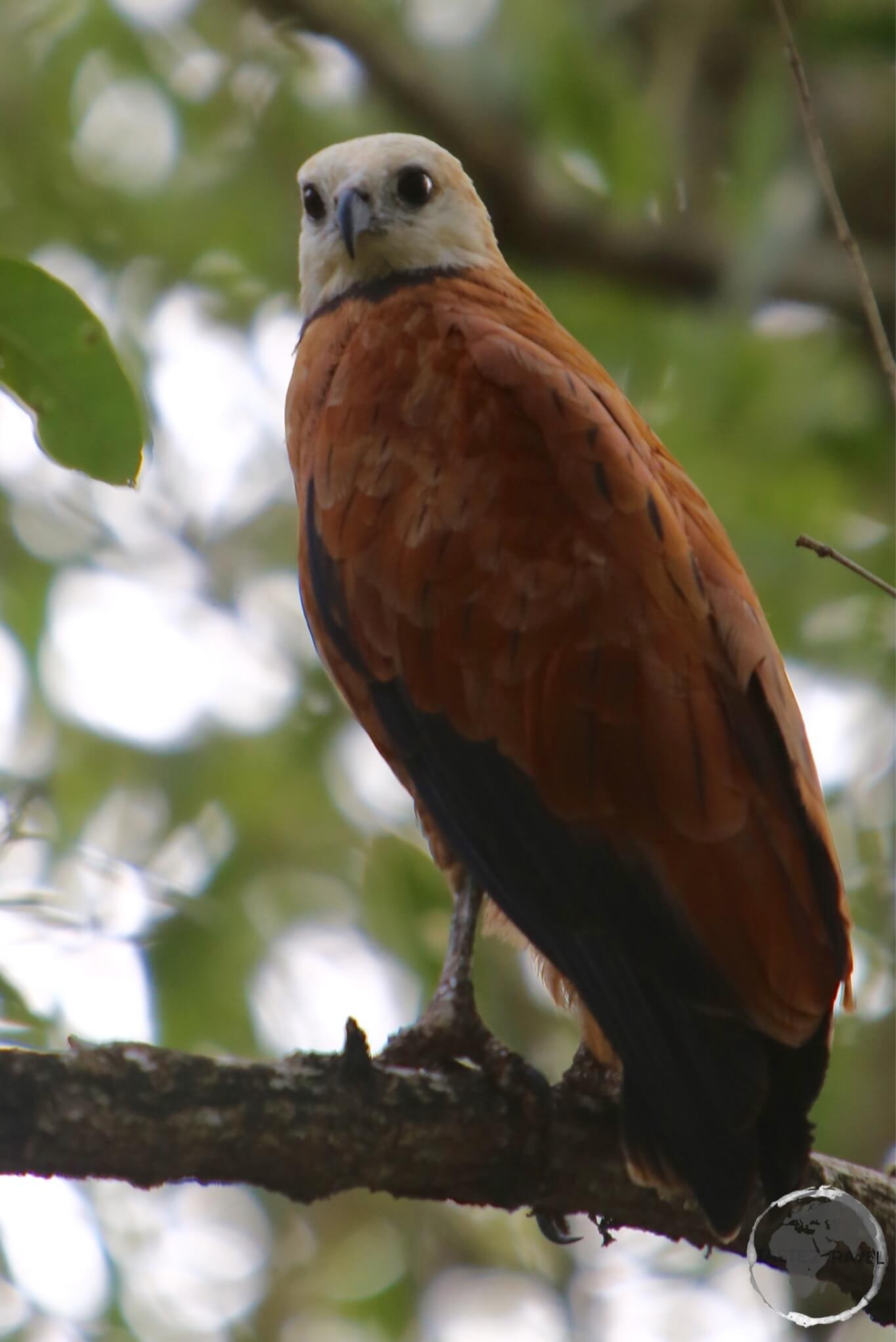
Black-collared hawk at Bigi Pan Nature Reserve.

Black-collared hawk at Bigi Pan Nature Reserve.

The main reason to visit Nieuw Nickerie is to explore nearby Bigi Pan Nature Reserve, an important wetland area renowned for its birdlife.

The reserve covers approximately 135,000 hectares and includes a large coastal lagoon. Tides bring seawater into the lagoon, while freshwater flows down from the interior. As a result, the reserve supports a rich variety of wetland habitats and attracts numerous bird species.

Caribbean flamingos at Bigi Pan Nature Reserve.

Caribbean flamingos at Bigi Pan Nature Reserve.

During my visit, I arranged a boat trip through my hotel. The excursion took us through the wetlands, where we spotted flamingos, scarlet ibis, black-collared hawks, woodpeckers and other birds. The tour also included lunch, making it an enjoyable way to spend a day exploring the reserve.

An adult Scarlet Ibis at Bigi Pan Nature Reserve.

An adult Scarlet Ibis at Bigi Pan Nature Reserve.

Bigi Pan is particularly appealing to birdwatchers and wildlife photographers. The mix of open water, mangroves and wetlands creates excellent opportunities to observe birds in their natural habitat.

A juvenile Scarlet Ibis at Bigi Pan Nature Reserve.

A juvenile Scarlet Ibis at Bigi Pan Nature Reserve.

If you want to spend more time here, you can also look for accommodation in guesthouses built on stilts above the lagoon. Staying overnight allows you to experience the wetlands beyond a short boat excursion.

Accommodation

Accommodation options in Suriname are more limited than in many established tourist destinations. Therefore, I recommend booking ahead, particularly if you plan to visit during a busy period or need a specific type of accommodation.

In Paramaribo, you’ll find hotels, guesthouses, apartments and smaller locally run properties. Outside the capital, options become more limited, especially in remote areas of the interior.

During my visit, I stayed in a private apartment in Paramaribo, which I booked through Booking.com.

For trips into the rainforest, check whether your accommodation includes meals, transfers or guided excursions. These services can make a significant difference when travelling in remote areas.

Eating Out

Suriname’s multicultural population has created a wonderfully varied food scene. In Paramaribo, you can sample dishes influenced by Indian, Indonesian, Chinese, Dutch and Creole cooking.

Indian roti, Indonesian satay, Javanese noodle dishes and Dutch snacks all feature in the local food scene. Consequently, eating out offers a great way to discover the country’s cultural heritage.

You’ll find the widest choice of restaurants in the capital. However, when travelling outside Paramaribo, plan ahead because dining options can become limited, particularly in remote communities.

Brewed by Heineken, the local brew, Parbo, is very quaffable and a nice way to cool down on a hot humid day.

Brewed by Heineken, the local brew, Parbo, is very quaffable and a nice way to cool down on a hot humid day.

Of course, you should also try the local beer, Parbo. Brewed by Heineken, it’s a refreshing choice after a hot and humid day of sightseeing.

Visa Requirements

Visa policy map of Suriname.

Visa policy map of Suriname.

Most visitors to Suriname may enter without a visa for up to 90 days. However, visitors from certain countries must obtain an e-Visa.

Those nationalities highlighted in green on the above Visa Policy map can enter Suriname visa-free while those highlighted in light green need to apply for an e-Visa.

Depending on your circumstances, you may need a visa, an entry fee or another form of travel authorisation before arriving in Suriname. Therefore, check the latest requirements well before departure.

For official information, consult the relevant Surinamese authorities and confirm that your passport meets the required validity conditions.

Getting There

By Air

International flights arrive at Johan Adolf Pengel International Airport (formerly called Zanderij International Airport). It is located 45 km south of Paramaribo and serves as the base for the national carrier Surinam Airways.

The following airlines provide connections to/ from Paramaribo:

  • Caribbean Airlines – flies to/ from Port of Spain
  • Copa Airlines – flies to/ from Panama City
  • Fly All Ways – flies to/ from Camaguey, Havana, Santiago de Cuba
  • Gol Transportes Aéreos – flies to/ from Belem
  • KLM – flies to/ from Amsterdam
  • Surinam Airways – flies to/ from Amsterdam, Aruba, Belém, Cayenne, Curaçao, Georgetown–Cheddi Jagan, Miami, Port of Spain
  • Trans Guyana Airways – flies to/ from Georgetown (Guyana)
  • TUI fly Netherlands – flies to/ from Amsterdam

Important: Airline routes change frequently. Check the airport’s current services and individual airline websites before booking, as this list reflects routes reported around the time of my visit rather than a confirmed current schedule.

Airport Transport

The most convenient option is to pre-book a transfer through your hotel or a local taxi company. Drivers can meet you at arrivals and take you directly to your accommodation. Agree on the fare in advance, as there is no standard metered airport-taxi tariff.

By Road or River

Suriname shares land and river borders with French Guiana and Guyana. Travellers can cross these borders by boat or ferry, depending on the route.

To and From French Guiana

You can cross the Maroni River between Albina in Suriname and Saint-Laurent-du-Maroni in French Guiana using local pirogues.

The immigration offices stand on opposite riverbanks, so you’ll need to complete the relevant exit and entry procedures before continuing your journey.

Once you reach the other side, taxis and shared transport can take you onwards. From Albina, you can travel to Paramaribo; from Saint-Laurent-du-Maroni, you can continue towards Cayenne, the capital of French Guiana.

When I made this crossing, I found it straightforward. Nevertheless, allow time for immigration formalities and confirm local boat availability before setting off.

Remember that French Guiana follows French and European entry rules. Depending on your nationality, you may need a visa or other travel authorisation, even if you can enter Suriname without one.

To and From Guyana

A ferry service connects South Drain in Suriname with Molson Creek in Guyana, near the Corentyne River border. The Canawaima Ferry Company has historically operated this route.

South Drain lies approximately 32 km south of Nieuw Nickerie, along a paved road. You can reach the ferry terminal by taxi or bus.

When I crossed the border, I arrived at the port at 8 a.m., when the immigration office opened, and caught the 9 a.m. ferry to Guyana. At that time, a return service generally operated in the early afternoon.

However, ferry schedules and border procedures can change. Confirm the latest timetable, ticket arrangements and immigration requirements before travelling.

After crossing, you can arrange onward transport to Georgetown in Guyana, Paramaribo or Nieuw Nickerie. Journey times depend on the route, road conditions and connections.

As always, check the entry requirements for both countries before making the crossing. A visa for Suriname does not automatically grant permission to enter Guyana, or vice versa.

Getting Around

Suriname’s main population centres are connected by minibuses, shared taxis and private transport. These options can provide affordable ways to travel between towns, although schedules and comfort levels vary.

In Paramaribo, taxis and local buses can help you reach destinations beyond the historic centre. Meanwhile, guided excursions offer a convenient way to visit places such as Brownsberg and Bigi Pan.

Travel becomes more challenging in the remote interior, where rivers often serve as important transport routes. For these areas, you may need to arrange a boat transfer or join an organised tour.

I recommend confirming transport arrangements before travelling to remote destinations. That way, you can plan your journey around local schedules and avoid unnecessary delays.


That’s the end of my Suriname Travel Guide.

If you have any feedback or comments, please feel free to leave them using the form below.

Safe Travels!

Darren


Further Reading

Other travel reports from the region include:

French Guiana Travel Guide

A red Macaw on Îles du Salut.

French Guiana Travel Guide
Welcome to the taste2travel French Guiana Travel Guide!

Date of Visit: January 2015

Introduction

French Guiana (French: Guyane) is an overseas department and region of France. It lies on the north Atlantic coast of South America, in the region known as the Guianas.

At the time of my visit, the territory had a population of about 250,000 people. Around half lived in the capital, Cayenne.

The name ‘Guyana’ comes from an Amerindian language and means “land of many waters”. The name is appropriate because several large rivers reach the Atlantic along the coast.

As a result, French Guiana is not really a traditional beach destination. The coastal waters are often brown because of the sediment carried by the rivers. If you are looking for clear blue water, the Caribbean is a better option.

French Guiana has been part of France since 1946. It uses the euro and is part of the European Union.

The territory has one of the strongest economies in South America. Much of its economy is connected to the Guiana Space Centre near Kourou. The space centre is located close to the equator and is an important European launch site.

Location

French Guiana is located on the northeastern coast of South America, along the Atlantic Ocean. It lies between Brazil to the south and east and Suriname to the west. Its northern coastline faces the Atlantic Ocean.

Geographically, French Guiana forms part of the Guianas, together with Guyana and Suriname. The territory is largely covered by dense Amazon rainforest, particularly in its southern interior, while most of the population lives along the coastal plain.

French Guiana is separated from Brazil by the Oyapock River and from Suriname by the Maroni River.

Its capital, Cayenne, is located on the northern coast. The territory is also close to the Equator, which passes just south of its borders.

With an area of approximately 83,500 square kilometres, French Guiana is one of the largest territories on the South American coast.

Geographically, it is part of South America, although politically it is an overseas department and region of France.

Sightseeing

Saint Georges

The newly-opened Oiapoque bridge connects Brazil and French Guiana.

The newly-opened Oiapoque bridge connects Brazil and French Guiana.

I crossed the Oiapoque River from Brazil into the French Guianese town of Saint Georges.

It was a strange feeling to arrive in a South American town and see both the French flag and the European Union flag flying in the main square.

Saint Georges is a small and quiet transit town. There is not a great deal to see, but it is an important entry point from Brazil. It is also where you can arrange onward transport.

After arriving, I went to the immigration office. A friendly French gendarme stamped my passport in less than 30 seconds. It was a very easy entry for me. However, visa requirements vary by nationality, so check the latest requirements before travelling.

I then went to the bank to withdraw some euros. This was when I discovered that the cost of living in this French territory is very European.

I arrived in Saint Georges early in the morning. Local residents were already walking out of the town’s boulangeries with freshly baked baguettes under their arms.

It was a very French sight and a big contrast to Brazil, where breakfast often consists of chocolate cake.

I had to wait for my minibus to fill with passengers before travelling to Cayenne. The journey took about two hours along an excellent road.

While I waited, I had breakfast at a pleasant café on the main square. Fortunately, Saint Georges is small enough to explore on foot. Everything is within about a five-minute walk.

From Saint Georges, I continued to the capital, Cayenne.

The newly-opened Oiapoque bridge connects Brazil and French Guiana.

Cayenne

Place du Coq, Cayenne.

Place du Coq, Cayenne.

I arrived in Cayenne overland from Brazil. Almost immediately, I realised that I had entered a very different part of the world.

The population is mainly Creole, with Haitian, Brazilian, European and Asian communities also adding to the city’s cultural mix.

The architecture is equally distinctive. Many colourful wooden houses are painted in tropical shades of turquoise, pink and yellow.

The music and culture also have strong Creole influences. In many ways, Cayenne felt more like the Caribbean than South America.

Cayenne is compact, welcoming and relaxing. Most of the main sights can be visited on foot in a single day.

At the time of my visit, the city had a population of around 56,000. Traffic was light, so getting around was easy.

If you visit Cayenne during , which takes place between January and March, make sure you see the Sunday parade.

Located in downtown Cayenne, Place du Coq is named after the rooster that sits on top of a column in the centre of the square.

Cayenne Pepper

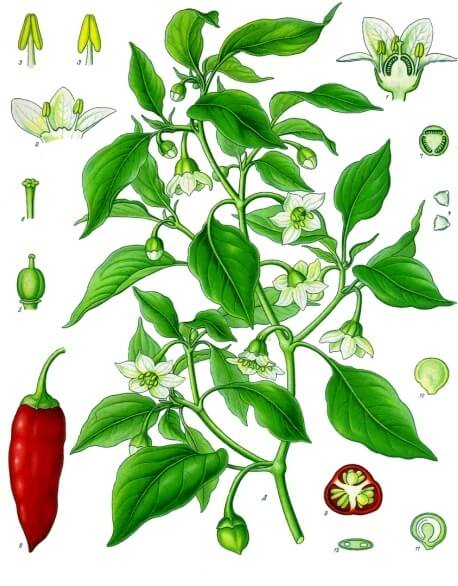
A Cayenne Pepper Plant.

A Cayenne Pepper Plant.

A Cayenne Pepper Plant. Image: Franz Eugen Köhler, Köhler’s Medizinal-Pflanzen

What is Cayenne pepper?

For more information and facts about the pepper, you can refer to this site.

Although the pepper is named after Cayenne, most Cayenne peppers are now grown elsewhere in the world.

Interestingly, there are no specific Cayenne pepper shops or major pepper producers in Cayenne itself.

From Cayenne, I travelled along the coast to Kourou. The town is home to the Guiana Space Centre and is also the departure point for trips to the Îles du Salut.

Kourou

The Guiana Space Centre at Kourou.

The Guiana Space Centre at Kourou.

The Centre Spatial Guyanais (CSG) is a French and European spaceport located near Kourou.

The location was chosen for two important geographical reasons.

First, the space centre is close to the equator. This allows rockets launched eastward to benefit from the Earth’s rotation and gain additional speed.

Inside the launch control centre at the Kourou Space Centre.

Inside the launch control centre at the Kourou Space Centre.

Second, the area has large sections of uninhabited land and open ocean to the east. This reduces the risk of rocket stages or debris falling on populated areas.

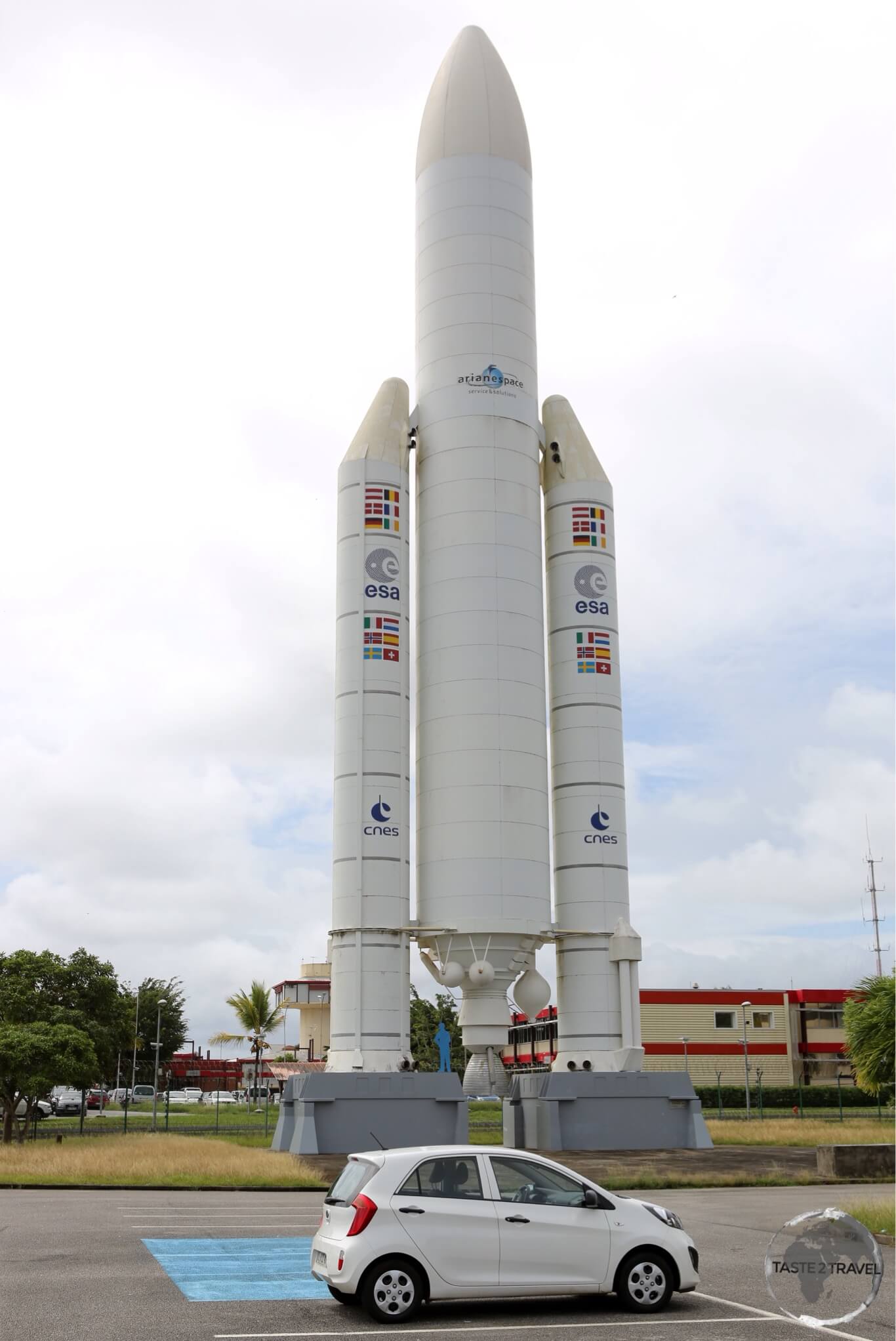
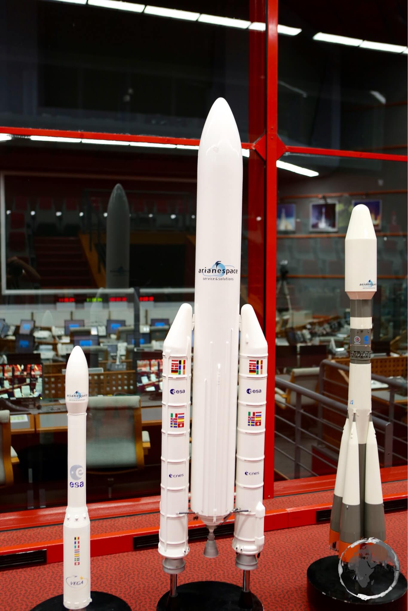
This Ariane rocket can carry a payload of 10t into space - enough to lift my car (foreground) into orbit.

This Ariane rocket can carry a payload of 10t into space – enough to lift my car (foreground) into orbit.

This Ariane rocket can carry a payload of 10 tonnes into space – enough to lift my car in the foreground into orbit.

You can visit the space centre on a guided tour. It is well worth doing if you have an interest in space or technology.

Tours are popular and places are limited. Therefore, it is best to book in advance. You can arrange a visit by contacting .

Inside the launch control centre at the Kourou Space Centre.

Îles du Salut

Entrance to prison cells on Îles du Salut.

Entrance to prison cells on Îles du Salut.

The Îles du Salut, or Islands of Salvation, are a group of small islands about 11 km off the coast near Kourou.

The islands were given their name after missionaries went there to escape an outbreak of plague on the mainland.

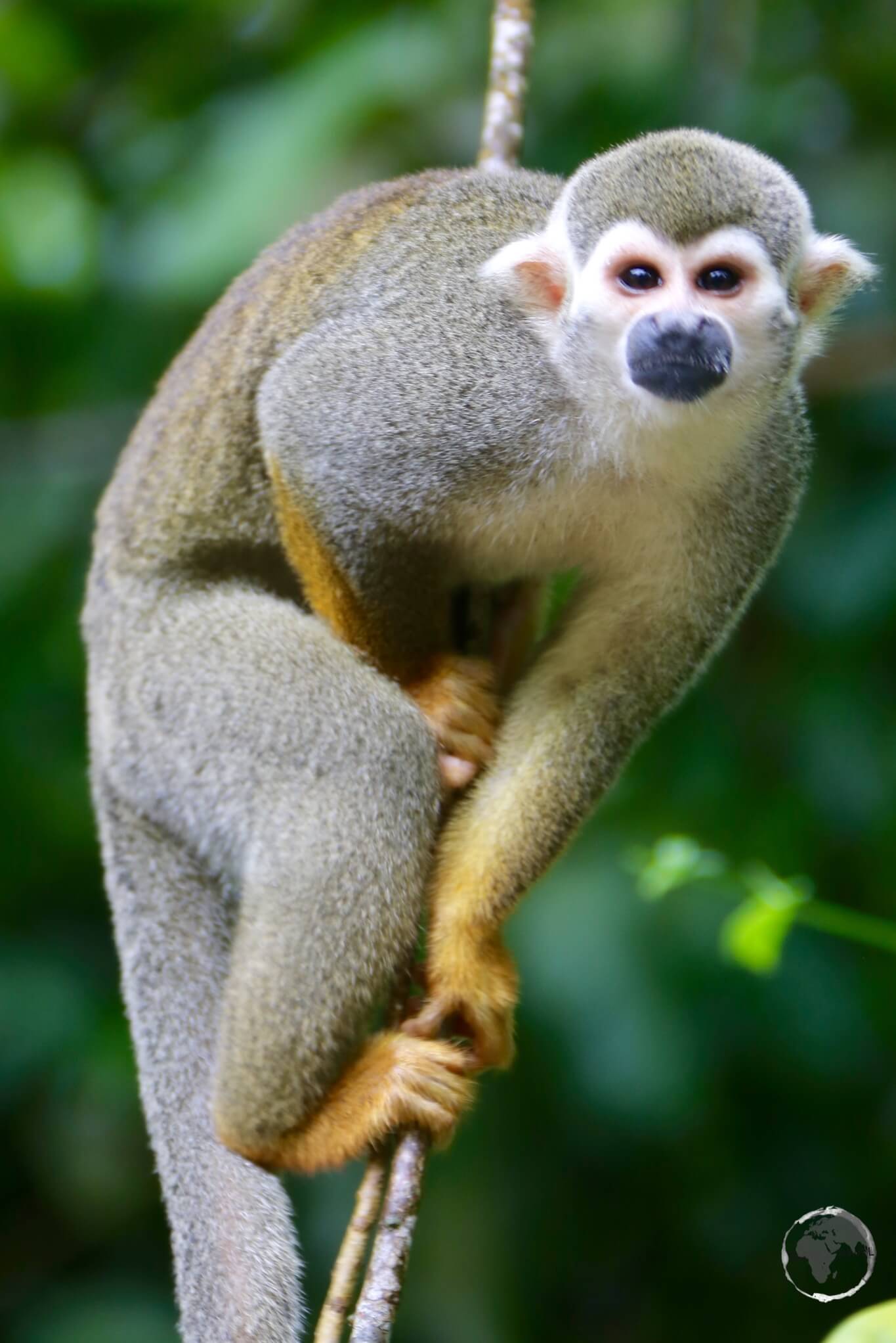
Squirrel Monkey on Îles du Salut.

The islands are best known for their dark history.

From 1852, they formed part of a notorious French penal colony. The prison system was used for some of France’s most serious criminals.

The islands also feature prominently in the famous novel Papillon by Henri Charrière. Charrière claimed that he spent nine years imprisoned there.

Capuchin monkey on Îles du Salut.

Capuchin monkey on Îles du Salut.

The prison closed in 1953. Today, the islands are a popular tourist attraction and are home to abundant wildlife.

You can reach the Îles du Salut by catamaran from Kourou. It is important to reserve and pay for your trip in advance.

I visited with Tropic Alizés of Kourou, who I would recommend.

Squirrel Monkey on Îles du Salut.

Squirrel Monkey on Îles du Salut.

Mana

The small town of Mana lies north of Saint-Laurent-du-Maroni. It is home to a remarkable restaurant called Le Buffalo.

If you are travelling through this part of French Guiana, the restaurant is worth the detour.

Le Buffalo occupies a simple wooden building on a quiet side street. The interior is equally simple.

However, the food is something special.

The chef is a professionally trained French chef who moved to Mana and brought his culinary skills with him.

During my meal, he came into the restaurant wearing his white chef’s uniform and traditional toque. He wanted to make sure that everyone was enjoying their meals.

I especially recommend the buffalo carpaccio.

Local expatriates also drive from nearby towns to enjoy weekend lunches here.

Tel: 594344280
Address: 36 Rue Javouhey, Mana 97360, French Guiana

The beaches around Mana are also important nesting sites for huge leatherback turtles.

From Mana, I made the short journey south to Saint-Laurent-du-Maroni, where I left French Guiana.

Saint-Laurent-du-Maroni

Camp de la Transportation in Saint Laurent du Maroni.

Camp de la Transportation in Saint Laurent du Maroni.

Saint-Laurent-du-Maroni has around 40,000 inhabitants. It is the second-largest town in French Guiana and an important border crossing to Suriname.

The town was founded in 1858. It later became an arrival point for prisoners sent to the French penal colony.

Today, you can visit the restored buildings of the former Camp de la Transportation.

Saint-Laurent-du-Maroni is small and compact. You can see most of the town in about half a day.

From here, you can also cross into Suriname. See the Getting There section below for more information.

Accommodation

Hotels are in relatively short supply in Cayenne and elsewhere in French Guiana.

For this reason, it is best to book your accommodation in advance. An online booking agent such as booking.com can be useful.

In Cayenne, I stayed downtown at Hotel Le Dronmi. I would recommend it because of its convenient location.

The hotel is within easy reach of the main places of interest.

Eating Out

French Guiana was once a French colony and its cuisine still reflects that heritage.

As a result, you can find plenty of good food throughout the territory.

French, Creole, Brazilian and other influences combine to create a varied food scene.

Visa Requirements

Visa requirements for French Guiana depend on your nationality.

Some nationalities require a visa before arrival. Therefore, check the latest requirements before travelling.

You can check the available information about before your trip.

Getting There

Air

French Guiana’s main international airport is Cayenne – Félix Eboué Airport, located south of the city centre.

The following airlines provide flights to/ from Cayenne:

  • Air Caraïbes – flies to/ from Fort-de-France, Paris-Orly, Pointe-à-Pitre
  • Air France – flies to/ from Fort-de-France, Paris-Orly, Pointe-à-Pitre, Miami
  • Air Guyane – flies to/ from Grand Santi, Maripasoula, Paramaribo, Saint-Laurent du Maroni, Saül
  • Azul Brazilian Airlines – flies to/ from Belém, Fortaleza
  • Surinam Airways – flies to/ from Belém, Paramaribo

There are no bus services to the airport and of course the local taxi’s take full advantage of this by charging a flat fare of €35 to downtown Cayenne.

By Road / River

To / From Suriname

Crossing the Maroni River between Saint-Laurent-du-Maroni in French Guiana and Albina in Suriname is relatively straightforward.

The immigration posts for the two countries are located on opposite sides of the river.

Several private pirogues operate crossings between the two towns.

After crossing the river, taxis and shared transport can take you to Paramaribo in about two hours.

Alternatively, you can travel to Cayenne in around three and a half hours.

The roads on both sides of the border were in excellent condition during my visit.

Some nationalities require visas for Suriname. For example, Australian citizens required a visa at the time of my visit.

Check the latest before travelling.

To / From Brazil

Update: Since this article was originally written, the long-unused suspension bridge between Saint-Georges-de-l’Oyapock in French Guiana and Oiapoque in Brazil has become operational.

When I made the journey, however, the bridge was not yet open.

There were nightly buses from Macapá to the Brazilian border town of Oiapoque. The road was mostly paved and the journey took around 10 hours.

I arrived at the small bus station in Oiapoque at about 5 am where I learnt that the Brazilian immigration office would not open until 8 am.

This meant the only option was to find a comfortable bench at the bus station and rest until immigration opened in the morning.

At 8 am, I took a taxi to the immigration office to obtain my Brazilian exit stamp.

I then travelled to the port, where I crossed the river by pirogue to Saint Georges.

From the river, I could see the huge new bridge linking French Guiana and Brazil.

The bridge had been completed in 2011 at a cost of approximately $33 million. At the time of my visit, however, it remained unopened.

Once I reached the dock at Saint Georges, several minibus drivers were waiting for passengers travelling to Cayenne.

Before continuing, I needed to have my passport stamped at the Gendarmerie, or police station.

The police station was inconveniently located on the outskirts of town, about a 15-minute walk from the centre.

Some nationalities require visas for Brazil. Australian citizens, for example, required a visa at the time of my visit.

Check the latest before travelling.

Getting Around

Public transport is limited and can be sporadic outside the main towns.

For this reason, hiring a car is probably the best option if you want to make the most of your time and explore more of French Guiana.

In addition, having your own vehicle gives you greater flexibility to stop at places along the way.

During my visit, for example, I hired a car in Cayenne and, afterwards, returned it in Saint-Laurent-du-Maroni.

This one-way rental gave me the freedom to travel along the coast and stop at places along the way.


That’s the end of my French Guiana Travel Guide.

If you wish to leave feedback or comments, you can do so using the form below.

Safe Travels!

Darren


Further Reading

Other travel reports from the region include:

Cayenne Carnival

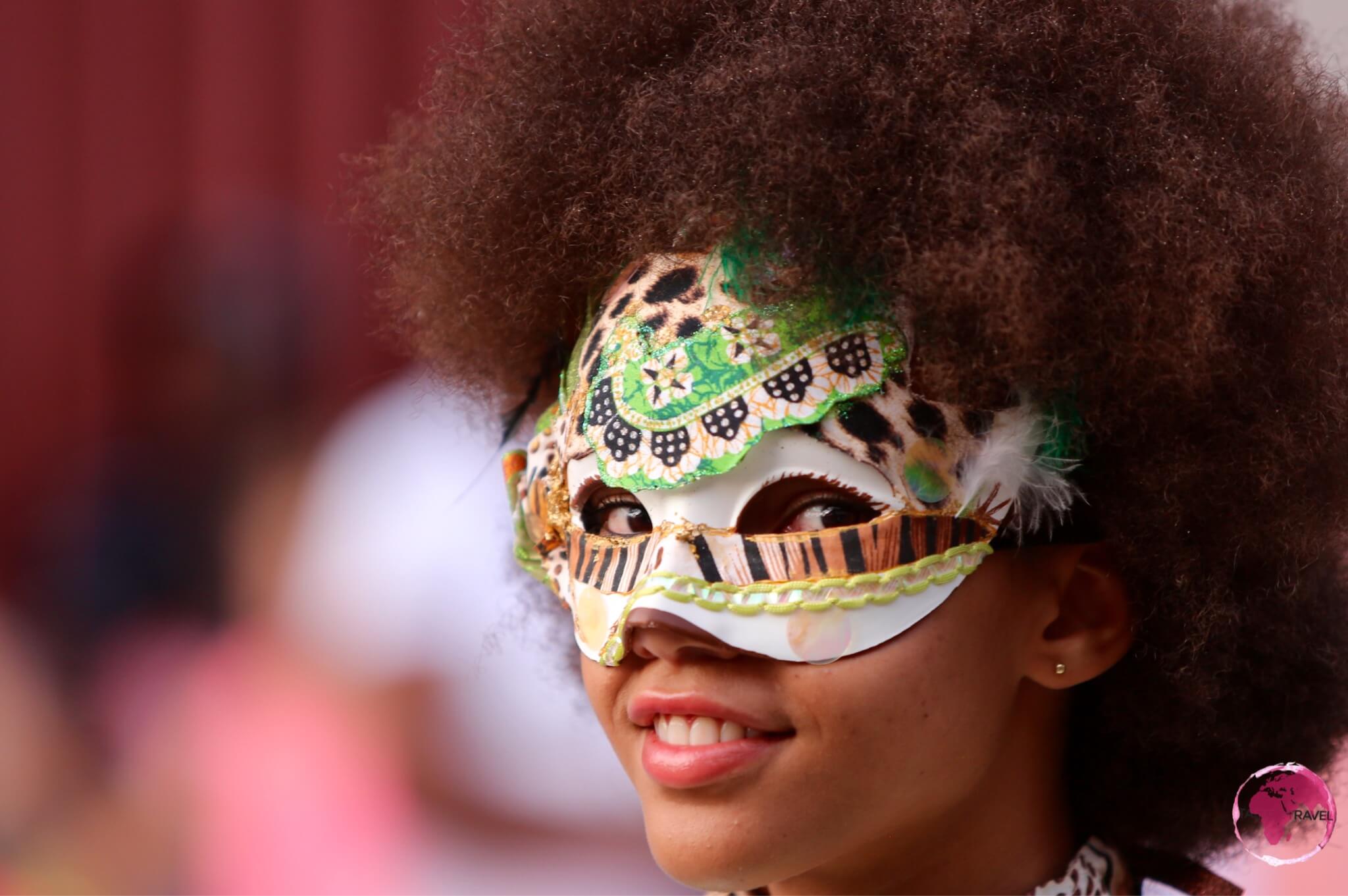
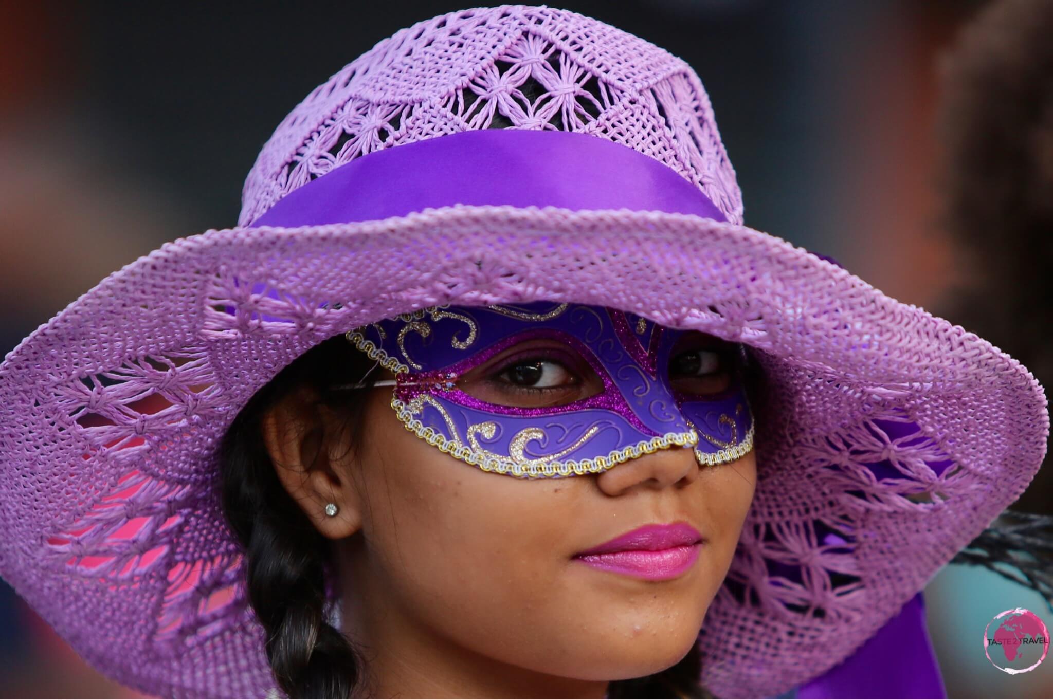
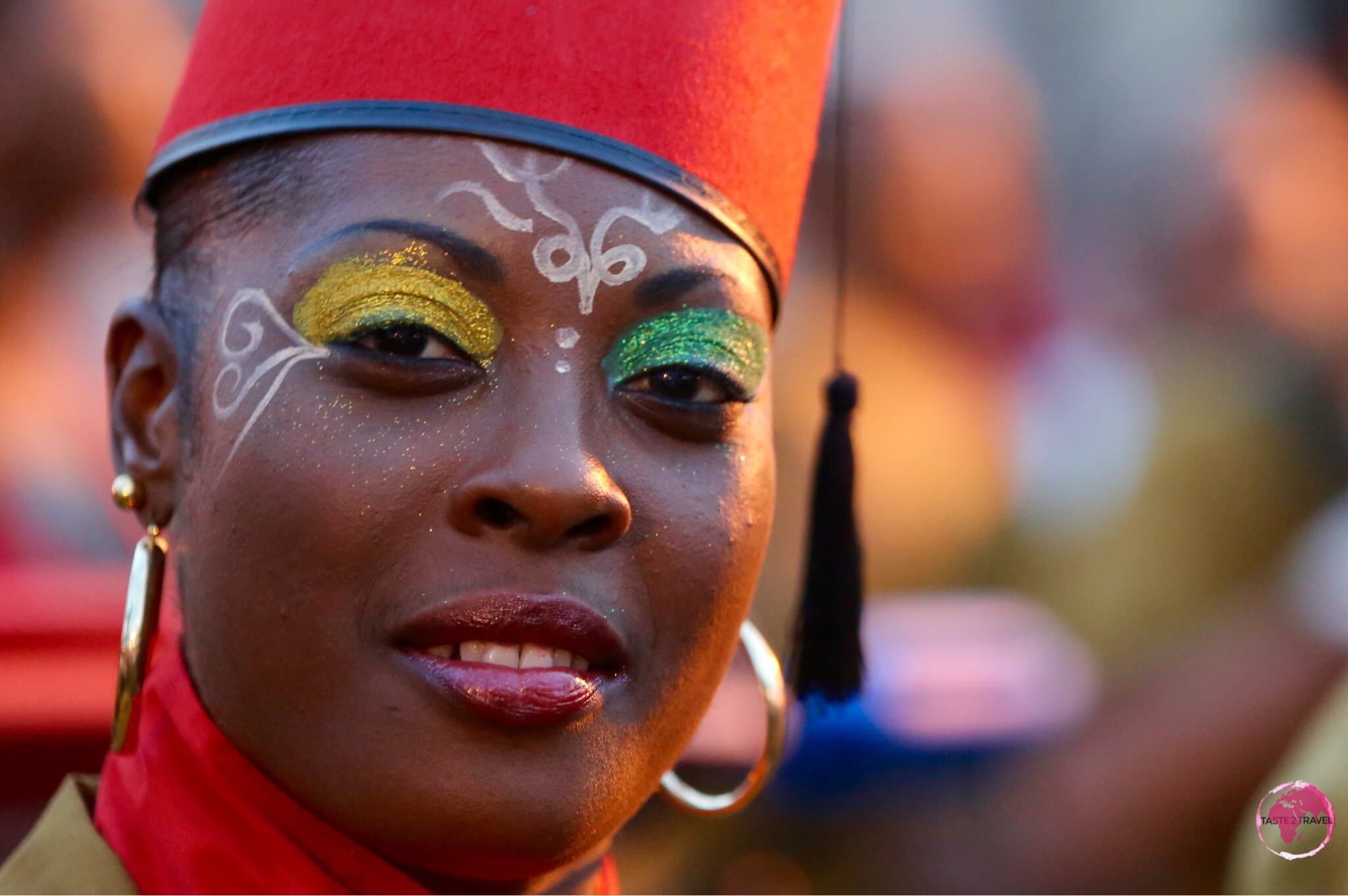
A Cayenne Carnival Participant.

Cayenne Carnival

Welcome to the taste2travel Cayenne Carnival feature!

Date of Visit: January 2015

Introduction

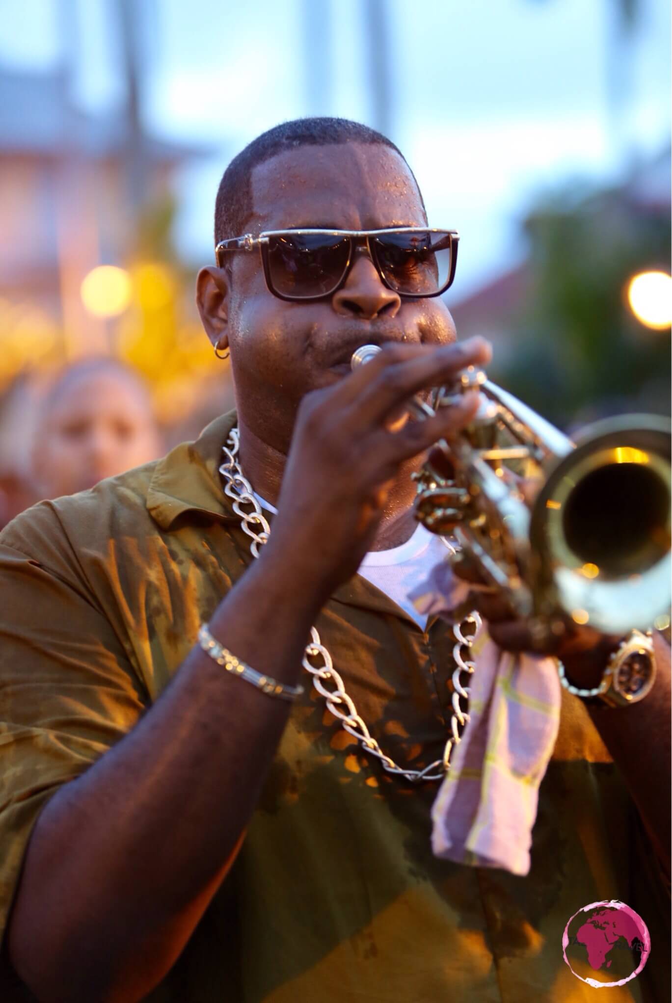
Carnival in French Guiana takes place each year between Epiphany in early January and Ash Wednesday in February or March. Every Sunday during this period, there is a parade on the streets of Cayenne, making this the longest running of any carnival in the Caribbean region.

Feature: Cayenne Carnival

Carnival à la Cayenne is a cultural tradition of the French Guianese Creole, its origin traced to carnival customs long practised in Europe. It debuted during the beginning of colonisation when settlers took part in carnival, forbidding the slaves from participating. Defying the ban, the slaves practised carnival in clandestine ways, seeing it as a way to regain some freedom.

French Guiana

The ornate handmade masks continue being/ are an integral part of Mardi Gras culture. To this day they symbolise the notion of freedom, of escaping class constraints and social demands. Wearing masks during the festivities lets us all become equal, individuals can mingle with the masses and ultimately everyone can be whoever they’d like, at least for a few weeks.

Feature: Cayenne Carnival

Feature: Cayenne Carnival

Feature: Cayenne Carnival


Accommodation

Hotels are in short supply in Cayenne (and elsewhere in the territory). It’s always best to book in advance using an online agent such as booking.com

I stayed downtown at Hotel Le Dronmi, which I would recommend. The hotel is conveniently located to everything of interest plus it’s on the parade route.

Eating Out

This is a former French colony – need I say more. Lots of good food available in this town.

A great place to chill out and people watch is the terrace at Les Palmistes. This is the quintessential bar/restaurant in Cayenne. Located across from the square of the same name.

Visa Requirements

Some nationalities require visas for French Guiana – check your requirements prior to arrival.

Getting There

By plane

French Guiana’s main international airport is Cayenne – Félix Eboué Airport, located south of the city centre. There are two flights a day to Paris served by Air France and Air Caraïbes with services also to Martinique, Guadeloupe, Paramaribo (Suriname) and Belém (Brazil).

While there are no buses serving the airport, you can either rent a car or pay an extortionate amount (€35 to central Cayenne) for an airport taxi.

By road

From both neighbouring countries (Brazil and Suriname), you will need to cross a river by ferry into French Guiana. The border crossings are easy and straight-forward.

From Brazil, you will arrive in Saint-Georges de l’Oyapock from where you can travel by bus to Cayenne. In 2011, a newly built bridge was completed (at a cost of $33 million) linking Brazil and French Guiana, but it is still yet to be opened.

From Suriname you will step off the ferry in Saint-Laurent-du-Maroni from where you can take a bus to Iracoubo and transfer to another going to Cayenne.

Getting Around

Public transport is sporadic throughout the country.

The best option is to hire a car.

This is a French territory so roads are in excellent condition.


That’s the end of my Cayenne Carnival guide.

If you wish to leave feedback/ comments, you can do so using the form below.

Safe Travels!
Darren


Further Reading

Other travel reports from the region include: