
Cape Verde Travel Guide
This is a Cape Verde Travel Guide from taste2travel.com
Date Visited: March 2022
Introduction
Rising up from the depths of the Atlantic Ocean, 620 km (385 miles) off the coast of West Africa, the remote and isolated archipelago of Cape Verde remained uninhabited until discovered by the Portuguese in the 15th century.
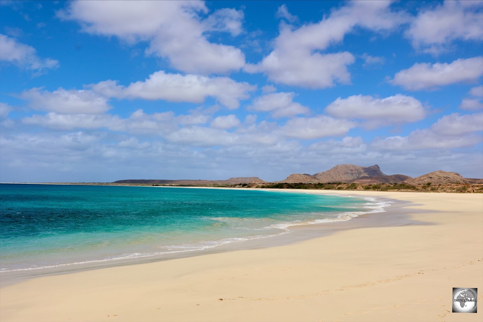
The stunning Santa Monica beach is one of the finest on Boa Vista.
Once a centre for the African slave trade and an important stopover port for a who’s who of famous navigators, Cape Verde today is redefining itself.
A popular tourism destination offering world-class beaches and resorts, flights carrying European holiday makers arrive every day on the tourism hubs of Sal and Boa Vista. It’s these flights which offer the best value means of accessing what is normally a remote and expensive destination.

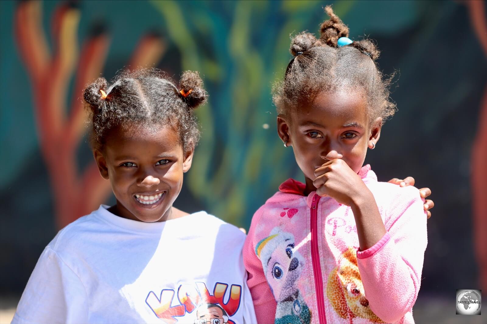
The children of Cape Verde love posing for the camera.
Comprised of 10 diverse, volcanic islands, Cape Verde is a fascinating travel destination.
From Creole culture, history, stunning and remote beaches, desert islands, kite surfing, hiking, fishing, scuba diving, snorkelling and so much more – Cape Verde offers something for everyone.

A panoramic view of the ‘Salinas de Pedra de Lume’, a salt mine located inside a volcanic crater.
While on Cape Verde, I had the opportunity to explore the islands of Santiago, Sal and Boa Vista. These are included in this article. I look forward to returning again one day to spend more time exploring the other islands.

Ethnically, Cape Verdeans are a mix of African and Portuguese.
It should be noted that expensive domestic flights are the only means of travel between most islands, although a less-than-reliable ferry service does operate on occasion.

A hand-painted ‘Strela’ beer advertisement, covers the side of a building in Sal Rei, Boa Vista.
Flights are very limited and sell out weeks in advance. If you plan to do any island hopping, you need to book flights well in advance. Please refer to the ‘Getting Around‘ section for more on domestic flights.

A kite surfer enjoying the breezy conditions at the aptly named Kite beach, a major tourist draw on Sal Island.
As for travel costs – Cape Verde is not your typical African destination. It is one of the most developed countries in Africa and, as such, much pricier, with a budget of €100/day (USD$110) being reasonable. This is not a place for those on a shoestring budget!
Location
Praia, Cape Verde
Located 620 km (385 miles) off the west coast of Africa, Cape Verde is named for the westernmost cape of Africa, Cape Verde (French: Cap Vert; Portuguese: Cabo Verde), which is located in nearby Senegal and is the nearest point on the African continent to the island nation.

A map of Cape Verde, indicating the Barlavento and Sotavento island groups.
Source: Nations Online Project.
Consisting of 10 islands – nine inhabited, one uninhabited, this archipelago nation is divided into the Barlavento (Windward) group to the north and the Sotavento (Leeward) group to the south.
The Barlavento Islands include Santo Antão, São Vicente, Santa Luzia (which is uninhabited), São Nicolau, Sal, and Boa Vista, together with the islets of Raso and Branco.
The Sotavento Islands include Maio, Santiago, Fogo, and Brava and the three islets called the Rombos—Grande, Luís Carneiro, and Cima.
History

A panoramic view over Cidade Velha from Forte Real de São Filipe, which was built following a raid by Sir Francis Drake.
The Cape Verde archipelago was uninhabited until the 15th century, when Portuguese explorers discovered and colonised the islands in 1456, thus establishing the first European settlement in the tropics.
In 1462, Portuguese settlers arrived on the island of Santiago and founded a settlement they called Ribeira Grande, which is today called Cidade Velha (Old City).

Fishing boats at Cidade Velha, Santiago Island.
The ruins of Cidade Velha, which lies on the south coast, 15 km west of the capital, Praia, are the site of the only UNESCO World Heritage site in Cape Verde.
Due to its location, Cidade Velha was an important stop-over port for a who’s-who of famous navigators. In its heyday, this vital port hosted Christopher Columbus, who spent time here on his 3rd voyage to the Americas. Ferdinand Magellan stopped over at the beginning of what would become his world-record setting circumnavigation of the world.
The port, which was used as a transit warehouse for the storage of riches from the new world, also attracted famous pirates and privateers such as Sir Francis Drake who sacked Cidade Velha and other towns on Santiago between the 11th and 28th of November 1585.
He then continued on to raid and sack various Spanish ports in the Americas. You can read more about the exploits of Sir Francis Drake in my guides to the Dominican Republic and the British Virgin Islands.
The large fort, Forte Real de São Filipe, which overlooks Cidade Velha, was built shortly after the raid by Sir Francis Drake.
Erected in 1512 in the main square of Cidade Velha, the marble Pelourinho was used to punish rebellious slaves by public flogging.
Located a short distance from Africa, Cidade Velha played a significant role in the Atlantic slave trade with many slave ships stopping in the port to gather supplies before sailing across the Atlantic to the New World.
A reminder of the slave trade can be seen in the main square of Cidade Velha where the marble Pelourinho (Portuguese for ‘pillory’), which dates from 1512, was used as a symbol of municipal power, and of slavery, with rebellious slaves being chained up and publicly flogged.
Following the demise of the slave trade, Cape Verde suffered an economic decline. Its fortunes were somewhat revived with it playing a role as a ship re-supply store. Cape Verde was the first stop of Charles Darwin’s epic voyage with the HMS Beagle in 1832.

A sculpture of former Portuguese Governor General Alexandre Alberto da Rocha de Serpa Pinto, Albuquerque Square, Praia, Santiago.
With few resources, and little investment from Portugal, Cape Verdeans became discontent and demands for independence grew.
In 1956, Amilcar Cabral formed an independence movement which had the aim of securing independence for both Cape Verde and Guinea-Bissau (another Portuguese colony in West Africa). On January 20, 1973, Cabral was assassinated.
Cape Verde eventually achieved full independence on July 5, 1975.
People

Children on the island of Boa Vista with their classic mestiço features.
Previously uninhabited, Cape Verde never sustained a native population but has been populated by European and African migrants.

Girls playing among the ruins of Cidade Velha, on the island of Santiago.
The modern population of Cape Verde descends from the mixture of European settlers and African slaves who were brought to the islands to work on Portuguese plantations.

A young girl on the island of Boa Vista.
The overwhelming majority of the population is of mixed European and African descent and is often referred to as mestiço or creole.
Young girls on the island of Santiago. The children of Cape Verde love being photographed.
The last official Census in 2013 recorded a total population of 512,096 inhabitants with almost half (236,000) living on the main island of Santiago.

Visitors can expect to be greeted by warm smiles in Cape Verde.
The capital, Praia, is home to a quarter of the country’s population, while the population of the islands of Sal and Boa Vista is 40,000 and 6,300 respectively.

Young girl in Cidade Velha, Santiago Island.
West African Migration

A souvenir shop in Sal Rei, one of many such shops runs by West African migrants.
Due to its relative prosperity, compared to its African neighbours, many West Africans have found their way to Cape Verde in search of work, and other opportunities, which are not readily available in their own countries.
Many of these migrants run handicraft shops, especially on the tourist islands of Boa Vista and Sal, which sell arts and crafts from West Africa.
Flag

A very elongated version of the Cape Verde flag, flying outside the presidential palace in Praia.
The National Flag of the Republic of Cape Verde consists of five unequal horizontal bands of blue, white, and red, with a circle of ten yellow five-pointed stars.
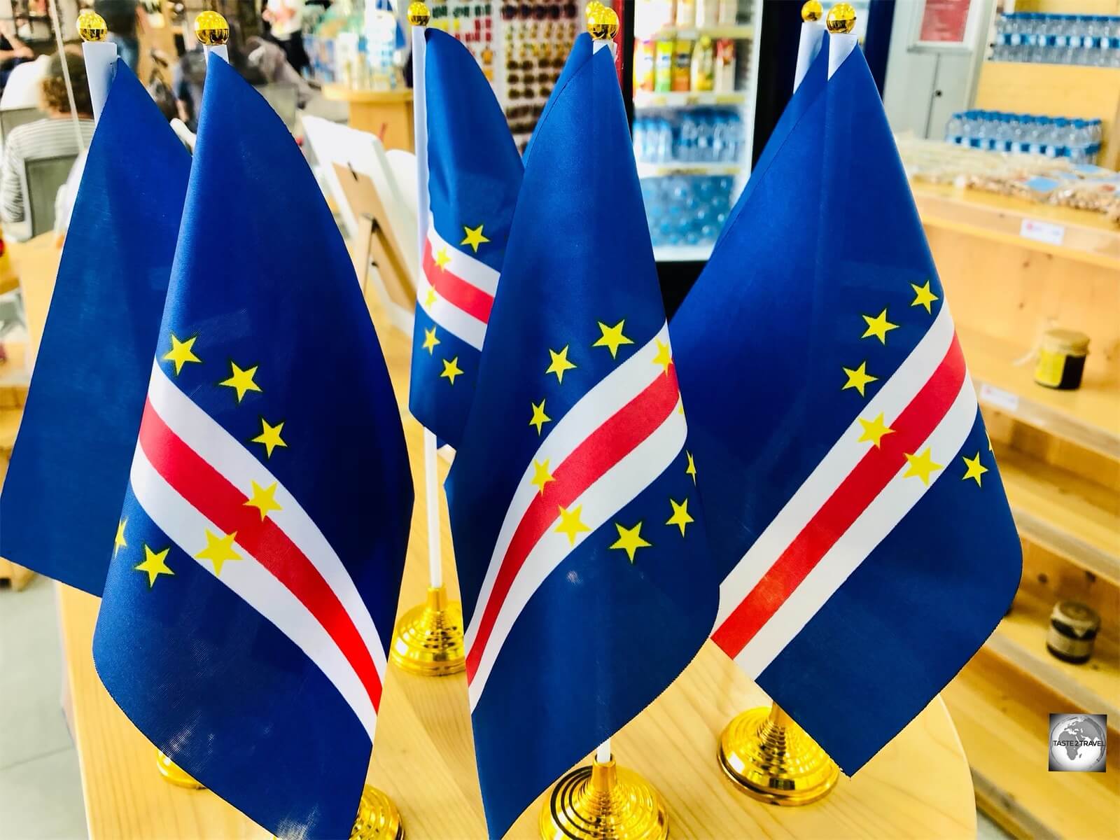
Souvenir flags of Cape Verde, which make an ideal gift for a visiting vexillologist.
The ten yellow stars represent the main islands of Cape Verde while the blue bands represent the ocean and the sky.
The band of white and red represents the road toward the construction of the nation, with white representing ‘peace’ and red representing ‘effort’.
One of the more impressive flags, which is super-elongated, can be seen flying outside the presidential palace in Praia.
Currency

Cape Verde banknotes feature cultural icons, including Cesária Évora who appears on the CVE2,000 note.
The official currency of Cape Verde is the escudo, which has the international currency code of CVE. The currency sign is the cifrão, which is similar to the dollar sign but always written with two vertical lines: ![]() .
.
Exchange Rates
Click to view current rates:
The escudo is pegged to the euro at a rate of €1 = CVE110. The euro circulates freely on Cape Verde where, for convenience sake, it is accepted at a slightly discounted rate of €1 = CVE100.
On the main tourist islands of Sal and Boa Vista, local businesses, taxis etc, accept payment in both euro and escudos and will often provide change in either one currency or a mixture of the two.

The Cape Verdean escudo is the official currency of Cape Verde.
The current series of banknotes were issued by the Banco de Cabo Verde (BCV) on the 22 December 2014. The notes honour Cape Verdean figures in the fields of literature, music, and politics.
Banknotes consist of denominations of CVE200, CVE500, CVE1000, CVE2000 and CVE5000 with the CVE5,000 note rarely seen and not even held by most banks.

The polymer version of the CVE200 banknote features Henrique Teixeira de Sousa, a prominent doctor and literary figure.
The CVE200 note, which features a portrait of Henrique Teixeira de Sousa, a prominent doctor, novelist, poet, and essayist was re-released in polymer, the first polymer banknote released in Cape Verde.
In a decision, which runs counter to world-wide currency trends, the BCV recently decided to re-issue the CVE200 note on paper after the bank received a large number of complaints from locals who didn’t like handling the polymer note.
Banking
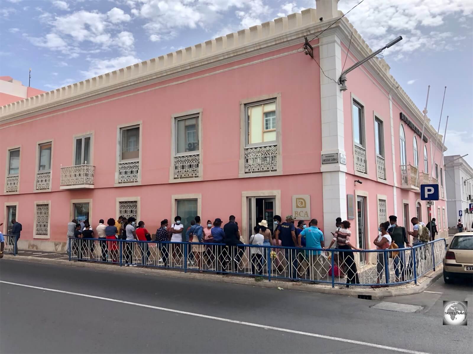
A typical queue, outside a bank in downtown Praia.
Banks in Cape Verde are easily identified due to their unfortunate queues which see locals standing around for long periods of time, in the blistering sun, waiting their turn to enter the bank.
Banks in Cape Verde should be avoided at all costs, unless you wish to spend your holiday in a queue.
Costs
Not Cheap!
An average daily budget for Cape Verde is around €100 (CVE11,000)! This would allow you to stay in a decent mid-range hotel, rent a car, dine in decent restaurants and enjoy a drink or two with dinner.
The best way to reduce costs is to dine in local restaurants where a tasty meal costs no more than €5.

A menu at a local restaurant on the island of Boa Vista.
If you plan on doing any island-hopping, inter-island flights will add a considerable amount to your travel costs. Not only are flights expensive, they are very infrequent and often sold-out weeks in advance.
See the “Getting Around” section below for more details (and warnings) on domestic flights.

Domestic flights on Cape Verde are operated by TICV who have just two ATR-72’s in service. Flights are infrequent and expensive!
Suggested daily budgets:
- Backpacker: CVE4500 per day (hardly feasible for Cape Verde!)
- Flashpacker: CVE4500-CVE11,000 per day.
- Top-end: CVE11,000+ per day.
Sample costs:
- Coca Cola (0.33 litre bottle): CVE150 (€1.50)
- Water (0.5 litre bottle): CVE100 (€1.00)
- Cappuccino: CVE150 (€1.50)
- Local Beer (small glass of the excellent ‘Strela‘ draft): CVE100 (€1.00)
- Imported Beer (small bottle of Heineken): CVE250 (€2.50)
- Taxi from airport to town centre: a flat fare of CVE1,000 (€10)
- Car Rental (per day): CVE5,500 – CVE6,600 (€50 – 60)
- Fuel (1 litre): CVE128 (€1.28)
- Meal (inexpensive restaurant): CVE300-500 (€3.00-5.00)
- Meal (mid-range restaurant): CVE2,000 (€20)
- Room in a mid-range hotel (per night): Hotel Santa Maria, Praia – CVE4,600 (€42)
- Room in a top-end hotel (per night): Hilton Cabo Verde Sal Resort – CVE24,600 (€222)
Sightseeing
Santiago Island
Located 640 km (400 miles) off the West African coast, Santiago Island is the largest and most populous island of Cape Verde.
First discovered in 1460 by the Italian navigator, António de Noli, the island is home to the first colonial settlement established anywhere in the tropics, Cidade Velha, which is also the only UNESCO World Heritage Site in the country.
It is also the location of the capital city, Praia, and home to almost 50% of the entire population.
A volcanic island, Santiago is Cape Verde’s most agriculturally productive island, with much of the produce making its way to Sucupira market in downtown Praia.
The island is very mountainous, with jagged razorback peaks dominating the view. The drive from the southern city of Praia to the northern city of Tarrafal winds its way over the Serra Malagueta, a steep mountain range which peaks at 1064 m (3,490 ft).
If you have any interest in the history and culture of Cape Verde, spending time on Santiago is essential!
Praia
In 1770, following numerous pirate attacks on nearby Cidade Velha, and due to its strategic position on a high plateau, Praia was chosen as the new capital of Cape Verde.
The city is located on the southern coast of Santiago Island. The old town centre, which is built on the plateau, overlooks the Atlantic Ocean. The main street is the pedestrianised Avenida 5 de Julho (5th of July Avenue).
The international airport, Nelson Mandela International Airport (IATA: RAI), is located 3 km from Praia.
Avenida 5 de Julho

Avenida 5 de Julho is the main pedestrian street in downtown Praia.
Avenida 5 de Julho is a pedestrian street which lies at the heart of the historic ‘plateau’ district of Praia. It is here that you’ll find most hotels, restaurants, bars, shops, banks and sights of interest.
The whole avenue is lined with impressively sculptured hedges.
Sucupira Market

“Produce Central” – Sucupira market in downtown Praia.
There are few sights in downtown Praia but one which shouldn’t be missed is the central Sucupira market, which is the largest produce market in Cape Verde. The market is located on the pedestrian street – Avenida 5 de Julho.
While staying on the desert islands of Sal and Boa Vista, I was amazed at the range of fresh produce available – especially considering those islands sustain zero agriculture.
It was during my visit to Sucupira market, and Santiago, that I realised from where the produce originated.
Presidential Palace

Located in the historic heart of Praia, the Palácio da Presidência da República serves as the residence of the President of Cape Verde.
The current President of Cape Verde is José Maria Pereira Neves, who previously served as Prime Minister from 2001 to 2016. He is a member of the African Party for the Independence of Cape Verde (PAICV).
The President resides in the Palácio da Presidência da República (Palace of the Presidency of the Republic), a beautiful neoclassical style palace which was constructed in 1894. It is situated on Rua Serpa Pinto, at the southern end of Plateau, the historic district of Praia.
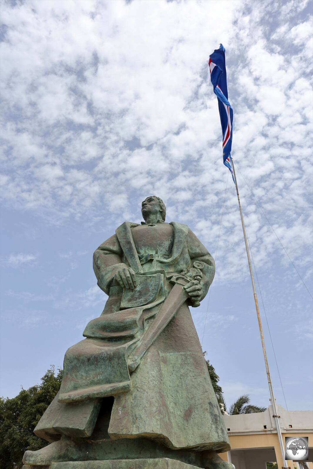
A statue of Diogo Gomes, the Portuguese navigator who is credited with discovering the island of Santiago.
The large statue located next to the Presidential Palace is of Diogo Gomes, a Portuguese navigator who is credited with discovering some of the islands of Cape Verde, along with the Italian navigator António de Noli.
Cidade Velha

Fishing boats line the harbour of Cidade Velha.
I have already mentioned Cidade Velha (Portuguese for “old city”) in the ‘History‘ section, so I’ll keep this section brief.
For anyone interested in the history of Cape Verde, Cidade Velha is a compulsory stop.

A young girl in Cidade Velha.
Conveniently located 10 km west of Praia, Cidade Velha has the distinction of being the first colony established in the tropics.

Laundry day in Cidade Velha.
It served as an important stopover port for many of the famous navigators, such as Christopher Columbus, who were busy discovering and mapping the ‘New World’.
Forte Real de São Filipe

Overlooking Cidade Velha, Forte Real de São Filipe was built to defend the settlement against pirate raids.
Located on a hill, 120 metres above Cidade Velha, Forte Real de São Filipe was constructed between 1587–93, following a raid by the English privateer, Sir Francis Drake.

A view of the gorge created by the Ribeira Grande de Santiago River, from Fortaleza Real de São Filipe.
Access to the fort is either by foot from town, climbing up 120 metres, or from the top of the ridge by car.
Sé Cathedral

The Sé Cathedral, one of the many ruined complexes which comprises the only UNESCO World Heritage Site on Cape Verde.
Overlooking Cidade Velha, the ruined Sé Cathedral had a short-lived existence. It was constructed by the Portuguese between 1556 and 1705. However, in 1712, it was pillaged by pirates and abandoned soon after!

A highlight of Cidade Velha, the ruined Sé Cathedral, part of the UNESCO World Heritage Site.
The church was built in the Mudéjar-style, the first of its kind on African soil.
Mudéjar style, refers to a type of ornamentation and decoration used in the Iberian Christian kingdoms, primarily between the 13th and 16th centuries. It was based on decorative motifs derived from those that had been brought to or developed in Islamic Iberia or Al-Andalus.
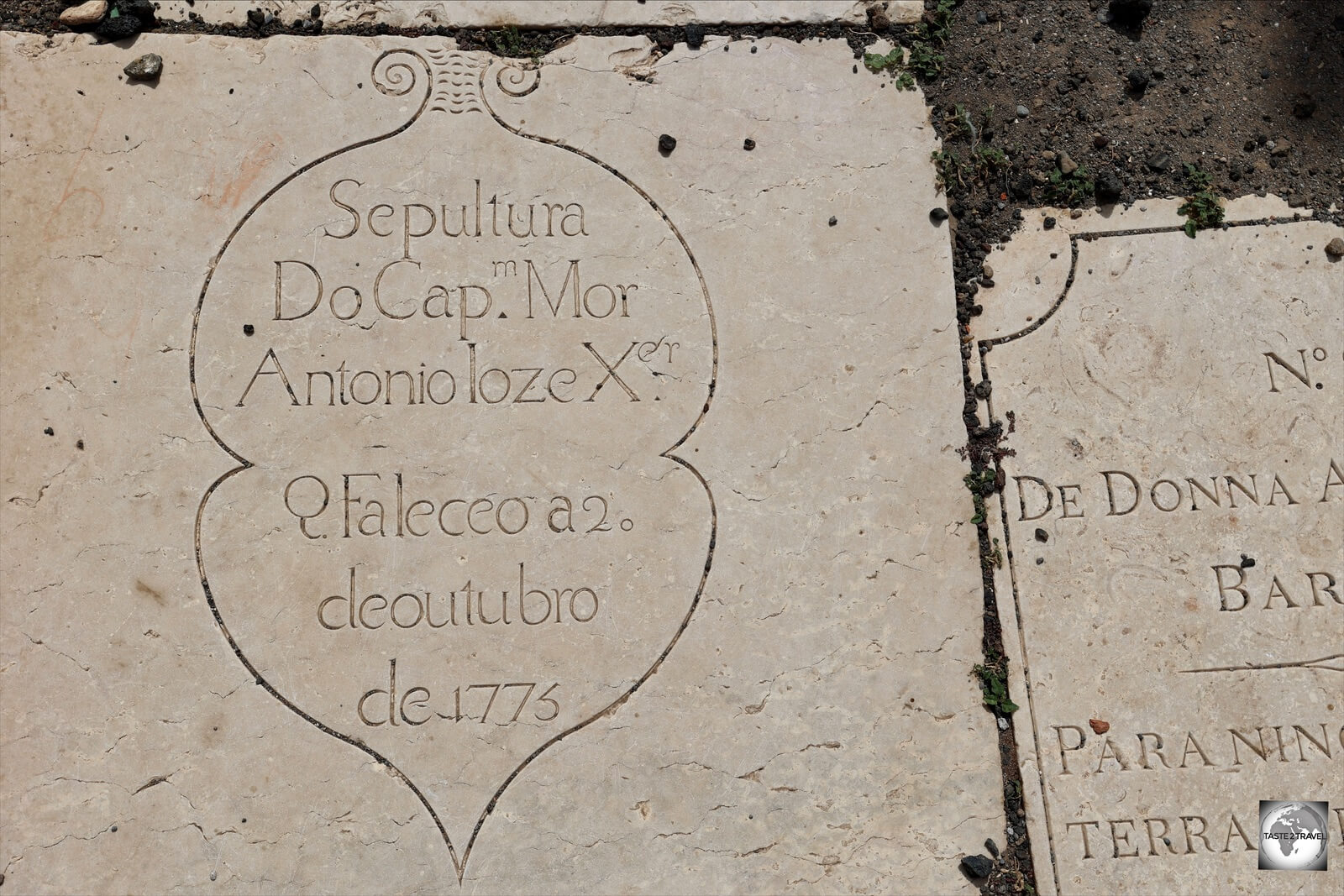
A tombstone dated from 1775 inside the former Sé Catedral, Cidade Velha.
Now surrounded by residential buildings, the Sé cathedral was 60 metres long and featured fine stone sculptures and various floor tombs which remain in place.
Nossa Senhora do Rosário Church

The oldest church in the colonial world, the Nossa Senhora do Rosario church, Cidade Velha.
Built in 1495, the beautifully serene Nossa Senhora do Rosario church has the distinction of being the oldest colonial church in the world.

The interior of Nossa Senhora do Rosario church, Cidade Velha.
By comparison, the oldest church in the Americas, the Catedral Primada de América in Santo Domingo, Dominican Republic, was constructed between 1512 and 1540. For photos of this cathedral, please see my Dominican Republic Travel Guide.

The interior of Nossa Senhora do Rosario church features Portuguese tiles, known as Azulejos.
The church, whose walls are lined with Portuguese tiles, known as Azulejos, was built in the Manueline Gothic style.
It’s interesting to note that many Africans were prominent members of Cidade Velha society, with pastors of the church often being African rather than European.

Colourful houses in Cidade Velha.
Porto Mosquito

Boats on the beach in the fishing village of Porto Mosquito.
If you continue 11 km further west from Cidade Velha, you’ll reach the end of the cobble-stone road which runs along the south-west coast at the quaint fishing village of Porto Mosquito.

A mural in Porto Mosquito celebrates a visit by Jacques-Yves Cousteau.
In the heart of the village, a mural of Jacques-Yves Cousteau, complete with a beaming smile, celebrates a visit made to Porto Mosquito by the famous French oceanographer, aboard the infamous Calypso, in November of 1948.
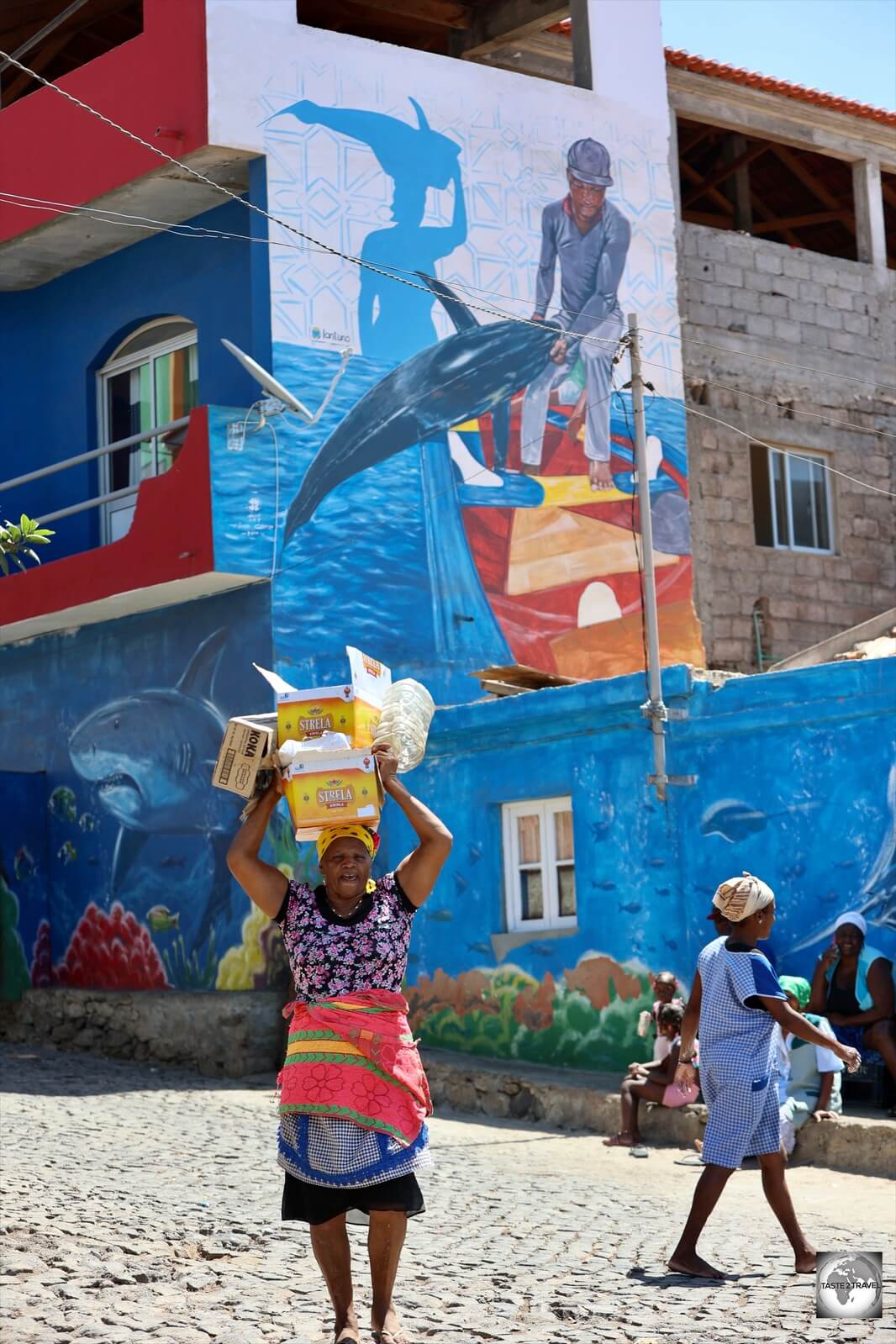
Beautiful images of aquatic life can be seen painted on the facades of houses in Porto Mosquito.
The colourful aquatic-themed murals continue throughout the village with no less than 17 houses covered in artwork.

Local fisherman ‘corking’ his wooden fishing boat.
Porto Mosquito is a working fishing village and during my visit I was able to watch the local fishermen ‘corking‘ (i.e. water-sealing) their wooden boats using nothing more than a length of string, a rock (as a hammer) and a knife. Once the string was in place, a sealant was applied.
Fishing boats on the beach at Port Mosquito.
If you have any interest in boats, the black volcanic-sand beach at Porto Mosquito is covered in the most beautifully painted wooden boats.

Pigs, on the beach in Porto Mosquito, feeding on crabs.
Also of interest were a few local pigs who were sniffing around in the sand on the beach. I saw that they were using their keen sense of smell to locate crabs, which they seemed to enjoy eating.
Tarrafal
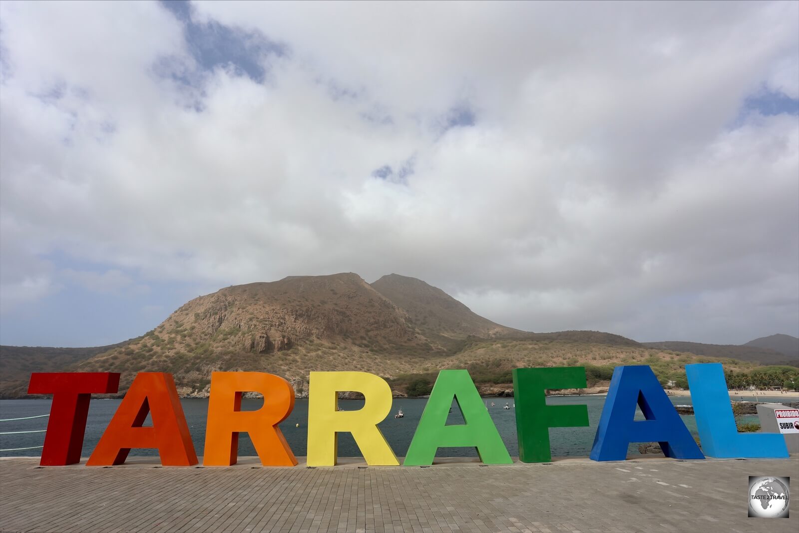
All visitors stop to photograph the colourful TARRAFAL sign.
The highway from the capital, Praia to the northern city of Tarrafal traverses the length of Santiago island – a distance of just 67 km but a journey time of 1.5 hours.
Why so long? The single-lane highway winds its way up and down several steep mountain passes with lots of slow hair-pin turns.
Before arriving in Tarrafal (population: 6,656), the highway tops out over the lofty Serra Malagueta pass (1064 metres).
Life in the mountains is much different from life on the coast, with much cooler temperatures, heavy fog and the locals rugged up against the cold. Not at all tropical!

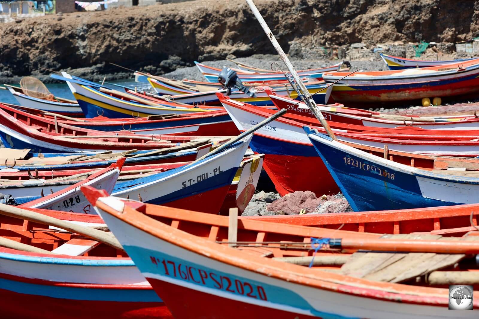
Fishing boats on the beach at Tarrafal.
Tarrafal is located on Tarrafal Bay, with the 643-metre high (2,109 ft) Monte Graciosa forming the perfect backdrop. The town is popular with locals, especially on weekends when the whole place is overrun by day-trippers from Praia (where else to go when you live on an island?).

Fishing boats on the beach at Tarrafal.
Tarrafal is an important fishing village and, as with other fishing villages on Santiago, the town beach is lined with colourful, wooden fishing boats.

Located at the top of Santiago Island, Tarrafal is an important fishing village with a growing tourism industry.
The mural painters from Porto Mosquito also seemed to have applied their colourful, magic touch to some of the buildings in Tarrafal.
Boa Vista Island

A young boy in Sal Rei, Boa Vista.
The arid, desert-island of Boa Vista (“Good View” in Portuguese) is the third largest island in Cape Verde, after Santo Antão and Santiago, with an area of 631 square kilometres (243 square miles).
Being the most easterly, it is also the closest island to West Africa, lying just 450 km west of Senegal.
Video:
Taking a taxi from Boa Vista airport to my hotel.
This remote and uninhabited island was discovered by António de Noli (Italian) and Diogo Gomes (Portuguese) in 1460. If you’re visiting Praia, a towering statue of Diogo Gomes can be seen outside the Presidential Palace (see the “Praia” section above).
In 1620, the first settlement was established on the island whose purpose was to exploit local salt deposits. The capital was established on a natural harbour and named Sal Rei (translates as “Salt King”).
Sal Rei

A view of Praia do Estoril, the main beach in Sal Rei, Boa Vista.
As the main town on Boa Vista (population: 5,778), laid-back and relaxed, Sal Rei is the centre of activity and the only real accommodation option for those not booked into a beach resort.
All services on the island (hotels, restaurants, supermarkets, banks, petrol stations, laundries) are located in Sal Rei, whose compact town centre is easily covered on foot.
Note: If you’re driving a car on the island, the only petrol stations are located in Sal Rei. Best to fill up before heading out into the remote countryside (where mobile phone signal is non-existent)!
Many of the locals who inhabit Sal Rei leave town each day on minibuses to work in the three large Riu resorts which are located south of town.

Fishing boats in Sal Rei harbour.
Sal Rei is built on a natural harbour which is a major fishing port. To the south-east, the beautiful, and normally quiet town beach – Praia do Estoril – is lined with hotels and rooftop bars/ restaurants which are the perfect place for watching the sunset over the bay.
My hotel and bar recommendations are included in the ‘Accommodation‘ and ‘Eating Out‘ sections below.

Colourful houses line the streets of Sal Rei, Boa Vista.
Sal Rei has few sights of interest but is full of charm and is a great place to meander.
The dusty, sandy streets are normally a buzz of activity with men playing board games and children playing football or rolling tyres (so very African)!

Young boys rolling tyres in Sal Rei – a typically African scene!
The port is alive each morning with fishermen selling their catch. The fishermen, fishing boats and local children make for wonderful photography opportunities.

Warm smiles greeted me everywhere in Sal Rei.
In the port area, several cafes and restaurants are a magnet for tourists who can relax and watch the activity while eating a meal or drinking a glass of Strela beer.
The very good Caffè del Porto is a popular choice and is covered in the ‘Eating Out‘ section below.

Located a short walk from the municipal market, the Centro de Artes e Cultura (CAC) is the one cultural centre on Boa Vista.
Along with occasional performances, the centre sells locally made crafts and has a restaurant/ cafe which serves very good lunches with a focus on simple Cape Verdean fare at reasonable prices (see the ‘Eating Out‘ section below for more information).
Santa Mónica Beach / Boca Beach

A rough gravel road leads to the sweeping expanse of Santa Monica beach which exists in splendid isolation – but not for much longer!
Located on the isolated south-west coast of Boa Vista, at the end of a long gravel road (follow the sign for ‘Boca Beach‘ from the roundabout on the paved highway), the stunningly beautiful Santa Monica beach appears as a mirage on the horizon.
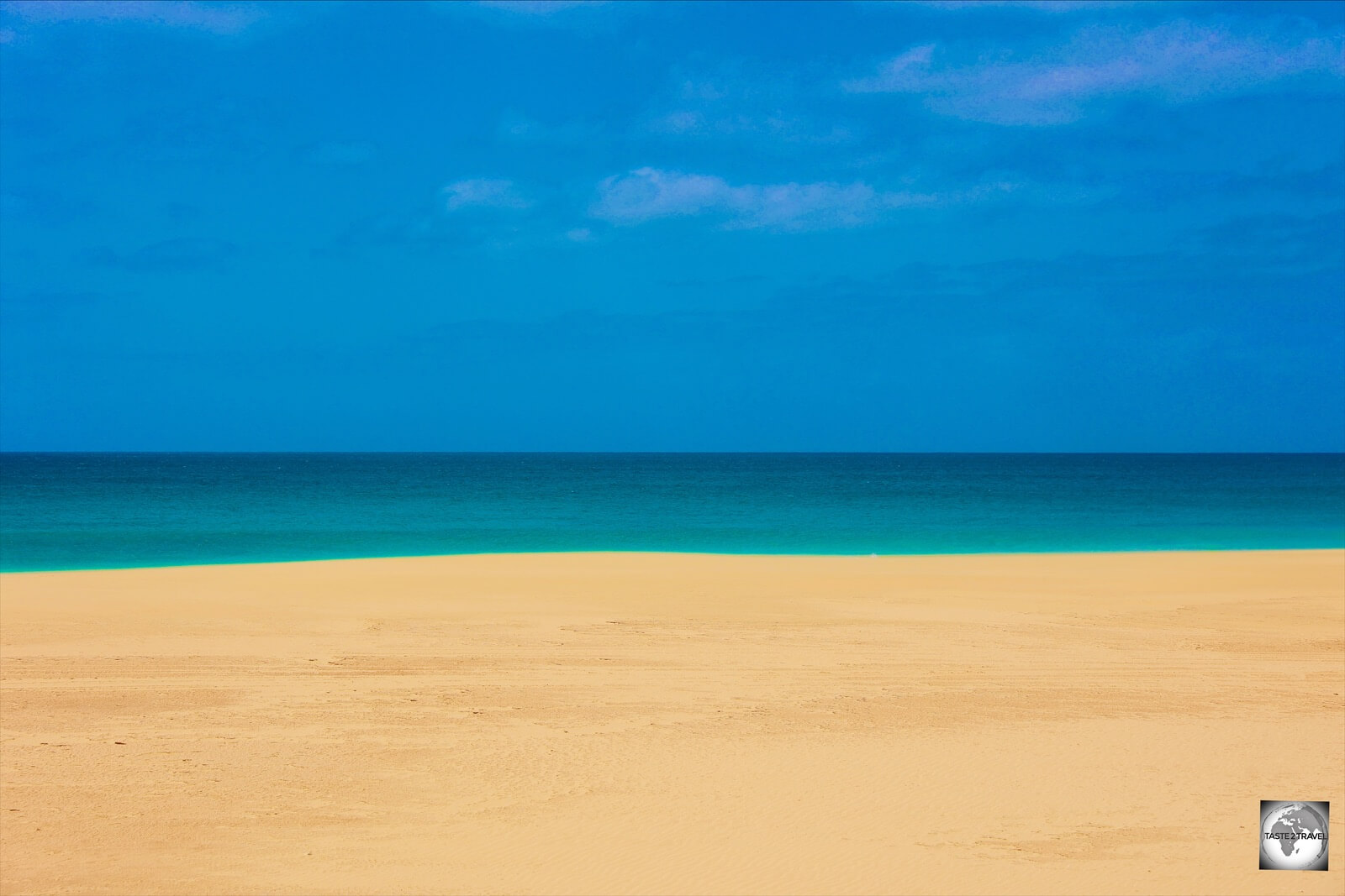
A photo, a dream or a Mark Rothko painting? The very real Santa Monica beach on Boa Vista!
As you approach from the dusty interior, it’s hard to believe something so beautiful exists. It is dreamlike and I was forced to look again to confirm that what I was seeing was indeed real.
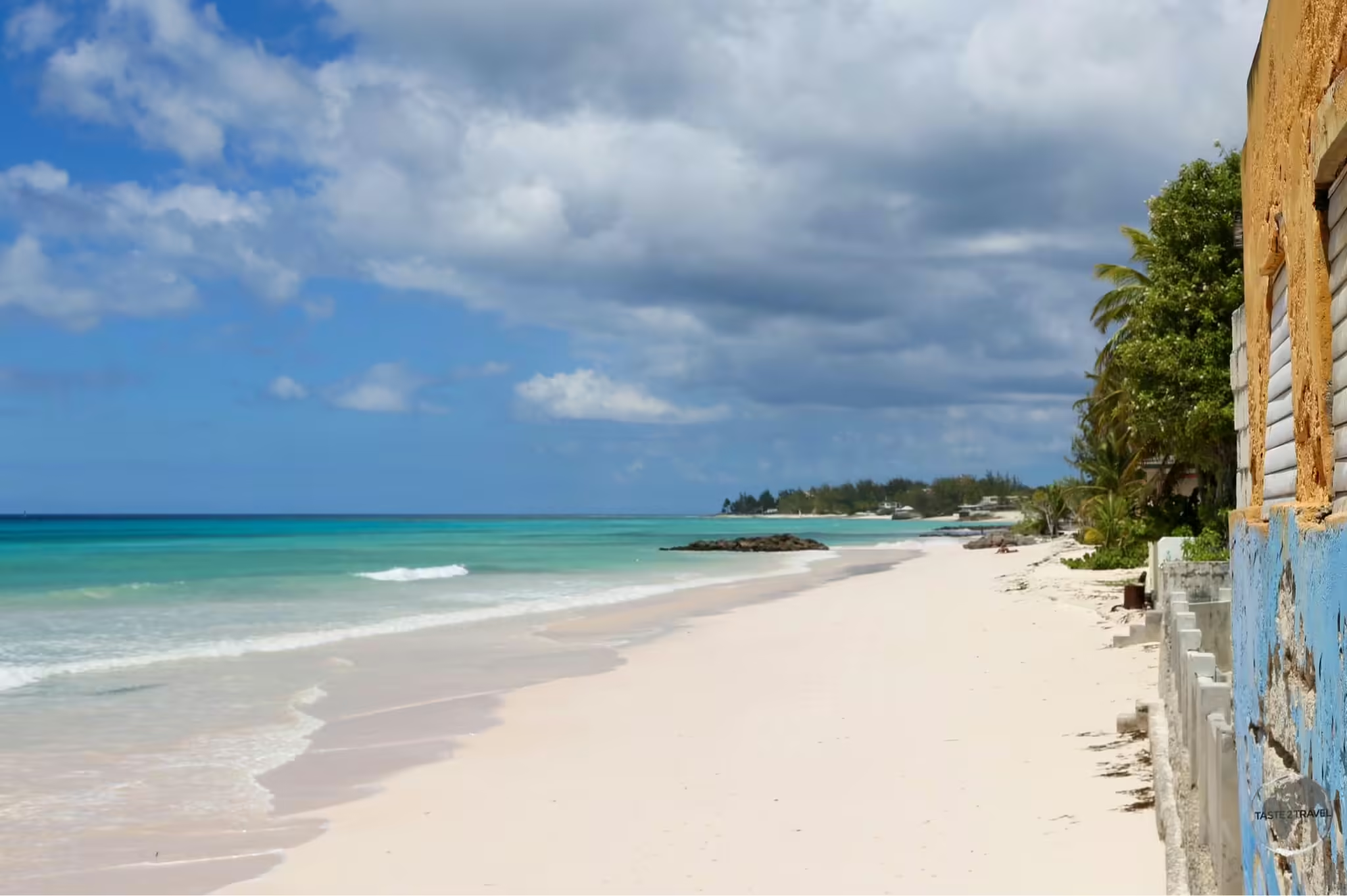
Santa Monica is one of the true wonders of Boa Vista. Boasting more than 11 km of pristine sand, Santa Monica is the longest beach on the island.
Despite receiving many tourists, its huge expanse of sand and never-ending dimensions allows visitors to experience the feeling of isolation in a pristine natural setting.

Santa Monica Beach, Boa Vista Island.
Unfortunately, the developers have already arrived with the first sprawling resort emerging from the surrounding hills.

Boca Beach is tucked away at the southern end of Santa Monica beach.
At the southern end of Santa Monica beach, tiny Boca Beach is home to the only food and beverage option anywhere in this part of Boa Vista.
The tiny shack on the beach is a popular stop for visiting 4WD and quad-bike tours which arrive with guests from the nearby Riu resorts.
Praia De Carquejinha

Praia de Carquejinha, an incredibly beautiful, and almost totally deserted, 8 km long beach on the south coast of Boa Vista.
Located at the bottom of the island, the equally incredible Praia de Carquejinha stretches for 8 km along the south coast.
Truly remote, the only sign of life on this part of the island is the mega-sized Hotel Riu Touareg whose guests have the beach to themselves.
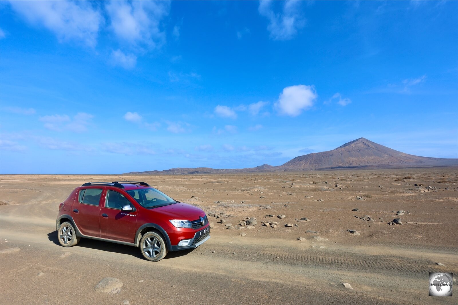
Viana Desert

A view of the Viana desert which lies in the rugged interior of Boa Vista.
Located east of the airport, and the town of Rabil, the Viana desert looks like a set from Lawrence of Arabia. Towering sand dunes, which rise up out of the desert, are framed by a rocky mountain backdrop.
The friendly owner of the nearby Viana Club (see the ‘Eating out‘ section) provides wonderful meals and will help out those silly tourists who manage to get their 4WD bogged in soft sand!
Cape Verde ‘Route 66’

This cobble-stone highway, through the interior of Boa Vista, is considered the “Route 66” of Cape Verde.
Running like a black ribbon for 20 km across the dry interior of Boa Vista, the Cape Verde version of “Route 66” is a fascinating drive.
A cobble-stoned highway, made from local basalt stone, which connects the western town of Rabil with the eastern town of Joao Galego, it’s hard to believe that each stone was laid by hand.
Monte Santo Antonio

The 2nd highest peak on Boa Vista, Monte Santo Antonio rises to an elevation of 379 m (1,243 ft).
As you travel along the only highway along the west coast, it’s hard to miss the impressive Monte Santo Antonio, an ancient volcanic structure which is the 2nd highest peak on Boa Vista, rising up to an elevation of 379 m (1,243 ft). The rocky peak is composed of basalt stone.
Capela de Nossa Senhora de Fátima

Capela de Nossa Senhora de Fátima overlooks the rugged north-west coast of Boa Vista Island.
Located north of Sal Rei, the isolated Capela de Nossa Senhora de Fátima (Chapel of Our Lady of Fatima) is located on a hill, overlooking the rugged north-west coast.
Reached via a rough gravel road, access is for those with a 4WD or quad bike. While the chapel is normally closed, the views over the coast are worth the trip. For those on foot, there is a walking trail along the coast from Sal Rei.
Sal Island

Outdoor art market in Santa Maria, Sal.
The Portuguese first discovered Sal in 1460 but the island wasn’t settled until the salt industry was developed at the end of the 18th century at Pedra de Lume.
Sal (Portuguese for “salt”) is one of the three sandy eastern islands of the Cape Verde archipelago, the other two being nearby Boa Vista, and Maio.
Sal is the main tourist destination in Cape Verde with its airport, Amílcar Cabral International Airport (IATA: SID), serving as the chief international gateway to Cape Verde.
Daily charter flights from Europe make Sal an affordable entry point to this otherwise remote, and expensive to reach destination.
Sal boasts over 350 days of sunshine a year and offers plenty of white sandy beaches in the flat south, while rugged volcanic landscapes dominate the northern end of the island, which is largely unpopulated.
The island is also subject to constant, strong, winds, which create ideal conditions for kite surfing, which is very popular.
Located at the heart of Sal, 2 km north of the airport, Espargos (population: 17,000) is the capital and main commercial centre of the island. It is here where most locals live, travelling south each day to Santa Maria to work in the tourism industry.
The one highway on Sal, national road EN1-SL01, a dual carriageway, connects Espargos with Santa Maria (19 km) in the south of the island. Surrounded on all sides by stunning white sand beaches, Santa Maria is the main tourist hub and home to all of the beach resorts and tourist facilities.
The best way to explore the island is to rent a car which will cost around €50 per day. One day is enough to cover all the sights on Sal – see the ‘Rental Car‘ section below for more details.
Santa Maria

Fishermen in Santa Maria, with the town beach and Hotel Morabeza in the background.
Santa Maria was founded in 1830 as a centre for the production and export of salt. Up to 30,000 tons of salt were shipped from Santa Maria each year. The former ‘Salinas‘ (salt ponds) are located behind the town.
Laying in isolated obscurity for most of its history, the fortunes of Santa Maria changed in 1967 when a Belgium couple, Gaspard Vynckier, a Belgian industrialist and his wife Marguerite Massart (the first female engineer of Belgium), established Cape Verde’s first resort – the Hotel Morabeza.
Located on the beach in the heart of Santa Maria, today, the Hotel Morabeza is just one of a string of resorts which line the beach to the west of town.
The streets of Santa Maria are lined with pastel-coloured buildings, al fresco restaurants, cafes and live-music bars. The busiest restaurants in the evening are located directly on the sandy beach (see the ‘Eating Out‘ section below for more information).

Santa Maria beach on Sal Island.
The one sight in Santa Maria is that which originally put Sal on the tourist map – the dazzling, white-sand beach.

Freshly caught fish are sold each morning on Santa Maria pier.
The expanse of white sand is only interrupted by the town pier which is always a hive of activity with local fishermen selling their daily catch and opportunistic souvenir sellers peddling their wares to the usual throng of tourists.

Fish vendors on Santa Maria pier, Sal Island.
Lining Santa Maria beach are restaurants, bars, surf schools, hotels, villas and everything else required by a busy tourist on holiday!

Distances from Santa Maria, Sal
The main street of Santa Maria is a relaxed pedestrian street – Rua 1 de Junho (1st of June street) – which is lined with bustling cafes, bars, restaurants and lots of souvenir shops which are operated by West African migrants.
Kite Beach

Kite surfing is a major tourist drawcard on the ever-windy islands of Sal and Boa Vista.
Each day, as the heat increases on the dry and arid Sal Island, the coastal winds increase, providing ideal conditions for kite surfers. These daily winds occur for about 8 months of the year, drawing hordes of, mainly European, kite surfers.

Kite Surfing is very popular on the ever-breezy Kite beach.
The premier venue for kite surfing is the aptly named Kite Beach which is located on the exposed east coast of Sal, a few kilometres north of Santa Maria.

Kite surfing in perfect conditions at Kite beach, Sal.
The one facility at Kite Beach is the Mitu & Djo Kite School which is also on Instagram.
Praia Ponta Preta

One of the finer beaches on Sal, Praia Ponta Preta is lined with all-inclusive resorts.
On the opposite side of the island to Kite Beach, the much calmer, leeward coast of Sal is home to Praia Ponta Preta which is lined with numerous all-inclusive resorts.
Murdeira

The flag of Cape Verde flying on the rocky coast at Murdeira, Sal Island.
Located on the west coast, 10 km north of Santa Maria, the fishing village of Murdeira grew up around the Murdeira Village Resort. The rocky coastline of Murdeira is popular with snorkelers.
Salinas de Pedra de Lume

Salinas de Pedra de Lume.
I would rate the stunning Salinas de Pedra de Lume as one of the highlights of my trip to Cape Verde.
Located inside the crater of an extinct volcano, at an elevation of 39 metres above sea level, an underground reservoir fills a small lake with briny water.

A view of the Salinas de Pedra de Lume, a salt mine located inside a volcanic crater.
Until the discovery of this crater lake in 1796 by Manuel António Martins, Sal was uninhabited, due to its arid environment, lack of natural resources and lack of fresh water.

The colourful, briny waters of the Salinas de Pedra de Lume.
With the discovery of a salt lake, the fortunes of the island were transformed overnight. The first settlement was built around the nearby port of Pedra de Lume, African slaves were imported to work on salt production and the name of the island, originally called Llana (“Flat”) was changed to Sal (“Salt”).

Access to the Salinas de Pedra de Lume is through a tunnel which was built in 1804.
In order to aid the extraction of salt from the crater, a tunnel was carved out of the side wall of the crater. This tunnel today serves as the entry point for the Salinas.

The wooden supports of an abandoned cable-car which was used to transport salt from the crater to the nearby port.
Salt production at Pedra de Lume flourished throughout most of the 19th century, but went into decline after 1887, when Brazil, the main export destination, imposed a ban on imported salt.

Salt produced at the Salinas de Pedra de Lume is used by the beauty and culinary industries.
Away from the beach, the Salinas de Pedra de Lume are the most popular tourist attraction on Sal. Arriving in buses, most visitors experience the sensation of floating in the salty waters of the lake and covering themselves in black volcanic mud.

Salinas de Pedra de Lume.
Almost no one ventures beyond the swimming area which is located at the entrance to the salt ponds. If you venture beyond the swimming area, you’ll have the entire crater to yourself.
I spent about an hour walking around the salt pans, where many incredible photos await!
Pedra de Lume

Located in Pedra de Lume, the Capela de Nossa Senhora was built in 1853 for use by the African salt workers.
Located about 5 km east of Espargos, the abandoned port of Pedra de Lume was established around 1800 as the first settlement on Sal. Pedra de Lume was founded by Manuel António Martins, who started the exploitation of the nearby Salinas (salt ponds) in 1796.
Today, most tourists (who arrive on bus tours), speed through the sleepy port, on their way to the nearby Salinas, which is unfortunate!
The charming port is home to a couple of sights and an excellent lunch restaurant – Restaurante Área Docas (see the ‘Eating Out‘ section for more details).
A highlight of Pedra De Lume is the small Capela de Nossa Senhora (Lady Compassion Chapel) which sits in isolation, alongside the access road to the Salinas.
Built in 1853, supposedly by African slaves working at the salt mine, the chapel is normally closed and best photographed after lunch when the sun is in front of the chapel, and the surrounding blue sky at its most brilliant.

The slowly decaying, rusted hulks of former salt barges, in a boat graveyard at Pedra de Lume.
Across the road from the chapel, a small boat graveyard is the final resting place for three former salt barges which, ironically, are now slowly decaying due to the salt air!
Terra Boa
Exploring Terra Boa and the volcanic ash plain, which lies in the remote north of Sal Island. At 406 m elevation, Monte Grande is the highest point on Sal.
From Espargos, an unmarked dirt track snakes its way north to the Farol da Fiur (lighthouse) which is located on the remote and rugged north coast.
The landscape in the northern half of Sal is arid and volcanic and home to nobody. Monte Grande, the island’s highest point at 406 m (1,332 ft) dominates the view.
Half way to the lighthouse, you will reach Terra Boa, a flat volcanic ash plain which is famous for its shimmering mirages – impossible to photograph of course!
Ponta Norte (Farol da Fiúra) Lighthouse

The very remote, Ponta Norte (Farol da Fiúra) lighthouse is located at the northern tip of Sal Island.
The northern tip of Sal is home to the unremarkable Ponta Norte (Farol da Fiúra) lighthouse. A modern, fibreglass, tower painted with black and white bands, the lighthouse stands alongside the stone ruins of the original lighthouse.

An ancient lava delta adjacent to the Ponta Norte (Farol da Fiúra) lighthouse on the north coast of Sal Island.
Ponta Norte (North Point) was formed millions of years ago, following a volcanic eruption from Monte Grande, which resulted in a lava flow entering the sea, creating a lava delta which is today known as Ponta Norte. The lighthouse is built on this lava delta.
Note: Prior to reaching the lighthouse, the smooth volcanic-ash track turns into a nasty, rough volcanic-rock road, with plenty of sharp, tyre-damaging, rocks. Care needs to be taken if you are driving a rental car. This part of the road is only suitable for 4WD.
Accommodation

The vast Hotel Riu Touareg is located on Praia de Carquejinha, on the remote south coast of Boa Vista Island.
With 95% of visitors to Cape Verde arriving on pre-paid holiday packages from Europe, almost all arrivals are shepherded directly from the airport (on a Tui bus) to their isolated, all-inclusive, beach resort.
Most holiday-makers arrive on Tui flights from Europe, which is the cheapest way to access Cape Verde. See the ‘Getting There‘ section below for more details.
The main hotel operator on Cape Verde is the Riu hotel group which offers six sprawling resorts, with 3 located on the stunning beaches of Boa Vista and three located on the island of Sal.
The largest resort on Sal is the mega-sized Hotel Riu Palace Santa Maria while the Hotel Riu Touareg on Boa Vista is located in stunning isolation on the 8 km long Praia de Carquejinha.
When I arrived on Boa Vista from Brussels with Tui, I was the only passenger not booked on a holiday package. While all other passengers boarded a Tui coach, to be taken to their remote Riu beach resort, I took a taxi into the main town – Sal Rei.
Unfortunately, while there was a small line of taxi drivers waiting at the airport, only one driver managed to get a fare that day, despite the fact that 100 arrivals had just exited the airport!
A huge problem with the package tourism industry is that for countries such as Cape Verde, who host vast numbers of holiday makers, most of the money generated never enters the local economy. With 95% of visitors arriving on (European-owned) charter flights and staying in (European-owned) resorts, almost all the revenue generated remains in Europe.
One of the main benefits from the package tourism industry is local employment. The largest employer on the islands of Boa Vista and Sal is the resorts. Each evening in Sal Rei, you can see fleets of mini-buses returning local resort staff back into town, all wearing their Riu uniforms.
Santiago Island

The colourful rooms at the charming Hotel Santa Maria in Praia pay homage to local artists.
While on Santiago, I stayed in the historic heart of the capital Praia, at the Hotel Santa Maria. Located on the charming main pedestrian street, the hotel offers comfortable, spacious rooms for around €42 (CVE4,600) per night.
The hotel pays homage to famous Cape Verdean musicians such as Cesária Évora with rooms decorated by local artists. I booked my room through booking.com.
Boa Vista Island

The Ouril Hotel Agueda on Boa Vista offers comfortable accommodation overlooking the beach in Sal Rei.
On Boa Vista, I stayed at the Ouril Hotel Agueda which is located across from the main beach in downtown Sal Rei (the only town of consequence on Boa Vista).
The Ouril hotel group operates 4 mid-range hotels in Cape Verde; two on Boa Vista and two on Sal.

My spacious, light-filled room at the Ouril Hotel Agueda on Boa Vista.
Rooms, which are full of light, and offer balconies with views over the beach, cost around €70 (CVE7,700) per night which includes a decent breakfast.
The hotel lies in the heart of Sal-Rei, a short stroll from all restaurants, cafes, bars and shops. So much more interesting than staying at an isolated beach resort!
The hotel also features a rooftop terrace bar which is perfect for watching the sunset over the beach.
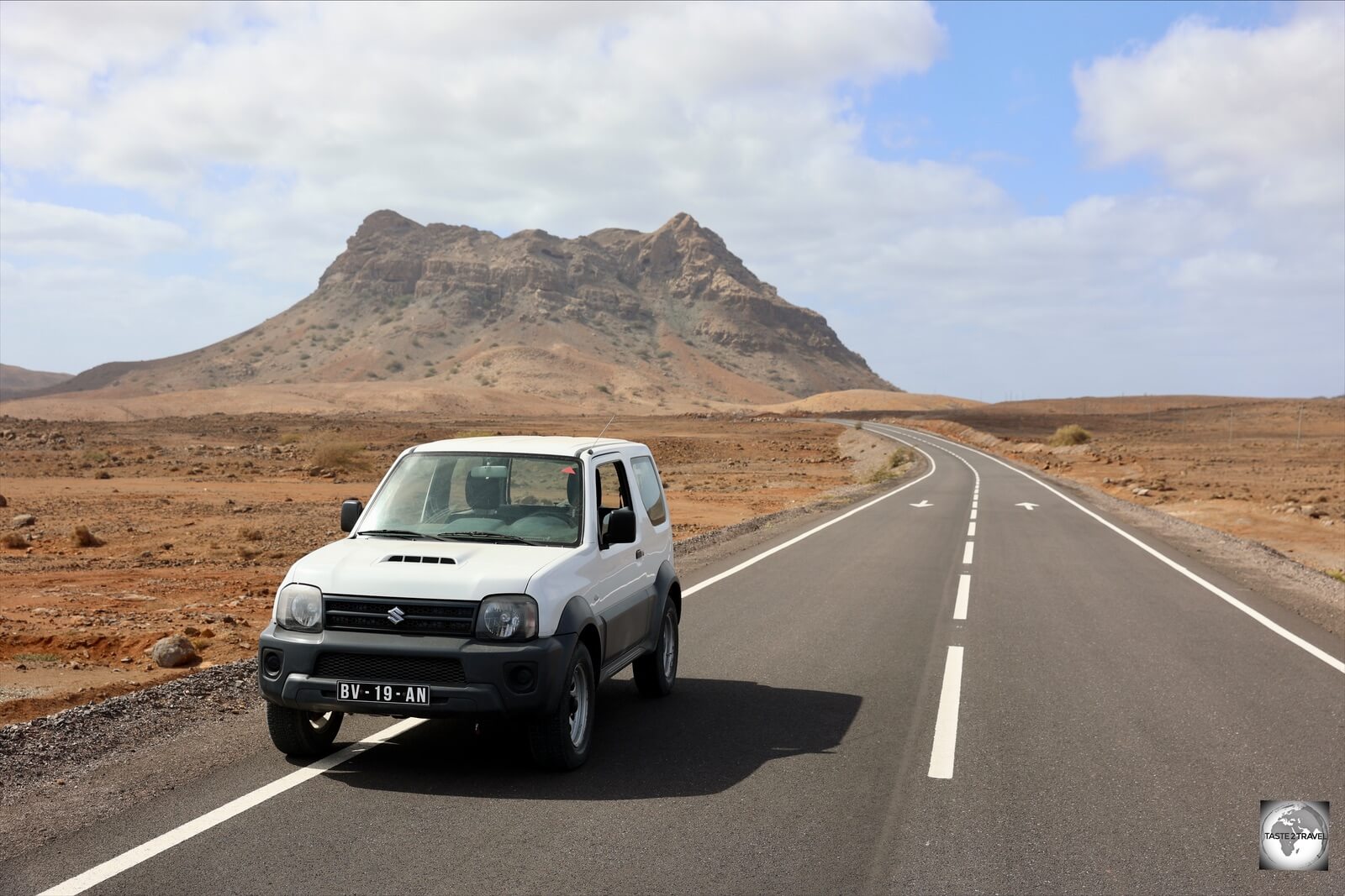
Exploring Boa Vista with my Suzuki ‘Jinny’ 4WD from the Ouril Hotel Agueda.
If you wish to explore Boa Vista, the hotel offers car rental, with a Suzuki ‘Jinny’ 4WD costing €60 (CVE 6,600) per day.
One day is enough to explore the entire island and a 4WD is needed on the rough gravel roads. See the ‘Car Rental‘ section below for more details.
I booked my room through booking.com.
Sal Island

My beautifully designed room at the Hotel Sobrado in Santa Maria, Sal.
Almost all accommodation on Sal is located in the tourist town of Santa Maria, which lies at the southern end of the island, 19 km south of the airport.
Large, beachside resorts are the staple offering in Santa Maria, with a few, smaller, hotel options in the downtown area. I stayed at the very good Hotel Sobrado where rooms start from €100 (CVE11,000) per day which includes a daily buffet breakfast. Despite the high room rate, this is one of the cheaper options on an island which is dominated by all-inclusive resorts.
Featuring beautifully designed rooms, the Hotel Sobrado is 5 minute walk from the main beach, shops, cafes, restaurants and bars.
Room can be booked through booking.com.
Eating Out
Cuisine

Sucupira market in Praia offers an abundance of locally grown produce.
Cape Verde is known for its delicious cuisine which combines West African and Portuguese influences.

Artwork on the wall of the fish market in Sal-Rei, Boa Vista.
Because the archipelago is surrounded by the Atlantic Ocean, fish and seafood is integral to Cape Verdean cooking. Every morning, the many fishing villages on the archipeligo are a hive of activity as fisherman sell their catch, with tuna being especially popular.

Each morning on Sal, fisherman sell their catch on the main pier in Santa Maria.
The rich volcanic soils on islands such as Santiago allow for the cultivation of a diverse range of produce. While I was in Praia, local strawberries were abundant and very affordable. A great place to start your appreciation of local produce is Sucupira market in downtown Praia.

A dry version of Cachupa (left) with omelette and salad, served at the Viana Club on Boa Vista.
The national dish of Cape Verde is the very popular Cachupa – a stew which includes mashed maize, onions, green bananas, manioc, sweet potatoes, squash and yams. Cachupa can also be served dry, which I believe tastes much better than the stew version.
One of the best Cachupas I tasted was a dry version which was served at the Viana Club which is located in the remote sand dunes in the interior of Boa Vista.
Beer

The very tasty local beer, Strela which is Creole for “star”.
The local brew on Cape Verde is the very quaffable Strela which is Creole for “star”. Brewed in Praia, Strela has a cult following in Cape Verde which is very much deserved as it tastes so much better than the European beers on offer at double the price!
There is one craft brewery on Sal, Blimund, which is covered in the Sal section below.
Coffee

Colourful sugar packets from Cafés de Cabo Verde.
The Portuguese introduced ‘Coffea‘ to Cape Verde almost 300 years ago. Coffee has been grown in the rich volcanic soils of Fogo Island for centuries.
Today, Cafés de Cabo Verde market a range of local coffee products, all of which are branded with their colourful ‘Creole’ packaging.
Santiago Island

The main pedestrian street of Praia – the Peatonal – is lined with restaurants, cafes and bars.
Restaurants
The main pedestrian street of Praia – the Peatonal – is lined with restaurants, cafes and bars where you can enjoy live local music while having a traditional dinner of Cachupa and Strela.
If you wish to try the local speciality, the Kaza Katxupa is a great place to sample Cachupa and other Cape Verdean dishes. While indoor tables are offering, the best ambience is offered at the outdoor tables, directly on the pedestrian mall, under the stars, on a warm tropical night.
Just along the Peatonal from Kaza Katxupa, the Restaurante Avis offers the best Caipirinha this side of Brazil – and at just €3 a pop! They are one of the only establishments on the Peatonal which offer live, local creole music in the evenings.
Boa Vista Island
Restaurants/ Cafés

This salad tasted as good as it looks! Freshly grilled tuna salad served at Ca’ Baby restaurant in Sal-Rei.
The main town on Boa Vista, Sal-Rei is home to a wealth of dining options and entertainment venues. Thanks to a resident ex-pat population (mainly Italians), Sal-Rei is blessed with some excellent pizza and pasta restaurants.
The pick of the bunch is Ca’ Baby which is operated by an enthusiastic Italian family who offer fresh homemade pasta, the most amazing wood-fired pizzas and truly decadent desserts – you must try their homemade ice-cream!
I managed to eat my way through a large part of their menu but one of my favourite meals was a colourful salad topped with grilled fresh local tuna. Delicious!

Grilled tuna steaks at Caffè del Porto in Sal-Rei, Boa Vista.
Just around the corner from Ca’ Baby, overlooking the port, the always-dependable Caffè del Porto is open when most other places are closed!
Also owned by a European expat, Caffè del Porto offers pasta, pizza and lots of local seafood, which is hauled ashore each morning at the pier opposite.

The popular Coral cafe in Sal-Rei serves tasty Cape Verdean meals, coffee and freshly baked cakes.
The most popular local restaurant/ café in Sal-Rei is Coral, which is located on the main street. The friendly staff at Coral serve freshly made cakes, coffee, and typical Cape Verdean food for lunch, with meals costing no more than €5.

Grilled chicken for lunch at the Centro de Artes e Cultura in Sal-Rei.
Another wonderful local cafe/ restaurant is located around the corner from Coral at the Centre for Arts and Culture. Open for lunch, meals include the most amazing roast chicken and grilled fish, all for €5 or less.
Bars

Enjoying a Strela beer at the rooftop bar at Cambar d’Sol in Sal-Rei.
The flat-roof buildings which line the beach of Sal-Rei are home to many rooftop bars and restaurants, all of which offer great sunset views. My favourite was Cambar d’Sol which overlooks the beach and is adjacent to the Ouril Hotel Agueda.

A typical Cape Verdean lunch served at Cambar d’Sol in Sal-Rei.
The rooftop terrace at Cambar d’Sol offers prime sunset viewing, cold beers and very decent local cuisine.
For a truly local vibe, and great creole-infused music, the Café Kriola offers Cape Verdean cuisine, plenty of Strela beer and local live music most nights. Located on the main street of Sal-Rei, it’s hard to miss this hub of nocturnal activity.
Sal Island

The incredible ‘Tuna Chef’ served at Restaurante Barracuda in Santa Maria, Sal.
Restaurants/ Cafés
Santa Maria
Being the main tourist town on Cape Verde, Santa Maria has no shortage of dining options, many of which line the main beach or are tucked away in the side streets.

Truly divine! A slightly seared tuna steak at Palm Beach restaurant in Santa Maria.
Two of the most popular places, Restaurante Barracuda and Palm Beach are located alongside each other on the main beach in Santa Maria. Both serve amazing food, offering lots of local fish and seafood.
I ate at both places and especially enjoyed their slightly seared tuna steaks. Of the two tuna offerings, my preference was for the ‘Tuna Chef‘ dish which was served at Restaurante Barracuda and included a fruit sauce which elevated the dish to another level.
The best cafe on the main pedestrian street (Rua 1 de Junho), Giramondo is an emporium of delight, offering a gelateria and an adjacent bistro.
There’s outdoor seating in front, perfect for snacking on a cone of gelato, waffle, crepe or sipping a coffee while taking in the passing people parade.
Pedra de Lume

An excellent lunch of freshly grilled fish at the very good Restaurante Área Docas in Pedra de Lume.
If you’re in the vicinity of Pedra de Lume at lunchtime, I highly recommend taking time out of your sightseeing schedule to enjoy the fine food at Restaurante Área Docas which overlooks the small beach in Pedra de Lume. The food and service are wonderful as are the deserts and coffee!
Bars

Enjoying a ‘Blimund’ craft beer at Palm Beach restaurant in Santa Maria.
While I enjoyed drinking Strela beer in Cape Verde, I was very happy to discover a new craft beer brewery in Santa Maria. The team at Blimund currently offer 4 different beers which can be sampled at their brewery/ pub – Bodeguinha – and at various restaurants around town.
The most popular bar on the pedestrian mall (Rua 1 de Junho) is Buddy Bar which features live music most evenings.
Visa Requirements

Visa policy of Cape Verde – blue countries enjoy ‘visa-free’ entry while yellow countries can obtain a ‘visa-on-arrival’.
Source: Wikipedia.
The visa policy of Cape Verde is wonderfully simple and welcoming to all – except Moroccan passport holders!
Currently, 61 nationalities enjoy visa-free travel to Cape Verde for up to 90 days.
All other nationalities are eligible to receive a Visa-on-Arrival (VOA), provided they arrive at either Boa Vista, Sal, São Vicente or Santiago international airports.
As an Australian passport holder, I received a 30-day ‘VOA’ in 5 minutes, without fuss, which cost me €35. The entire process was conducted by a friendly immigration officer at Boa Vista International airport.
To check your requirements, please refer to the Visa Policy of Cape Verde.
Getting There

A Tui plane on the tarmac at Amílcar Cabral International Airport, also known as Sal International Airport, the main international gateway to Cape Verde.
Air
Frequent, affordable flights from Europe to both Boa Vista and Sal are offered by the British-German Tui group who operate flights from Belgium, Netherlands, UK and Germany.
Tui also operates occasional flights from the Netherlands to Praia International airport and São Vicente International airport.
I flew from Brussels with the Belgium arm of Tui – Tuifly.be – who had a one-way fare available from Brussels to Sal for €99 – which was about the same price which I paid for the 20-minute inter-island flight from Praia to Sal!
Tui offers the best-value option for reaching this remote island nation.

Departure board at Amílcar Cabral International Airport (Sal International Airport).
International Airports
There are four international airports serving Cape Verde with Sal International airport being the main gateway.
- Sal is served by – Amílcar Cabral International Airport (also known as Sal International airport).
- Santiago, and the capital, is served by – Nelson Mandela International Airport (also known as Praia International airport).
- Boa Vista is served by Aristides Pereira International Airport (also known as Boa Vista International airport).
- São Vicente is served by – Cesária Évora International Airport (also known as São Vicente International airport).
Sal
The following airlines operate scheduled services to/from Sal International Airport (IATA: SID):
- Bulgaria Air (seasonal) – flies to/from Sofia
- Cabo Verde Airlines – flies to/from Lisbon
- Corendon Dutch Airlines (seasonal) – flies to/from Amsterdam
- Edelweiss Air (seasonal)- flies to/from Zurich
- Enter Air (seasonal): – flies to/from Katowice, Warsaw–Chopin
- Luxair (seasonal) – flies to/from Luxembourg
- Neos (seasonal) – flies to/from Rome–Fiumicino
- Novair (seasonal) – flies to/from Copenhagen, Helsinki, Stockholm–Arlanda
- Smartlynx Airlines (seasonal) – flies to/from Paris–Charles de Gaulle
- Smartwings (seasonal) – flies to/from Bratislava, Katowice, Prague, Vienna, Warsaw-Chopin
- Sunclass Airlines (seasonal) – flies to/from Copenhagen, Gothenburg, Oslo, Stockholm–Arlanda
- TAP Air Portugal – flies to/from Lisbon
- TAROM (seasonal) – flies to/from Bucharest
- TICV – flies to/from Praia, São Nicolau, São Vicente
- Transavia (seasonal) – flies to/from Paris-Orly
- TUI Airways UK – flies to/from Birmingham, Bristol, London–Gatwick, Manchester
- TUI fly Belgium – flies to/from Brussels
- TUI fly Deutschland – flies to/from Düsseldorf, Frankfurt, Hannover, Munich, Stuttgart
- TUI fly Netherlands – flies to/from Amsterdam
- TUI fly Nordic (seasonal) – flies to/from Copenhagen, Gothenburg, Helsinki, Stockholm–Arlanda
Santiago
The following airlines operate scheduled services to/from Praia International Airport (IATA: RAI):
- Air Senegal – flies to/from Dakar–Diass
- ASKY Airlines – flies to/from Dakar–Diass, Lomé
- Azores Airlines – flies to/from Lisbon, Paris–Charles de Gaulle, Ponta Delgada
- Cabo Verde Airlines – flies to/from Lisbon, Sal, São Vicente
- Royal Air Maroc – flies to/from Casablanca, Bissau
- TAP Air Portugal – flies to/from Lisbon
- TICV – flies to/from Boa Vista, Maio, Sal, São Filipe, São Nicolau, São Vicente
- Transair – flies to/from Dakar–Diass
- TUI fly Netherlands – flies to/from Amsterdam
Boa Vista
The following airlines operate scheduled services to/from Boa Vista International Airport (IATA: BVC):
- Brussels Airlines (seasonal) – flies to/from Brussels
- Luxair (seasonal) – flies to/from Luxembourg
- Neos – flies to/from Bologna, Milan–Malpensa, Rome–Fiumicino, Verona
- Smartwings (seasonal) – flies to/from Prague, Vienna
- Smartwings Slovakia (seasonal) – flies to/from Bratislava
- Sunclass Airlines (seasonal) – flies to/from Stockholm–Arlanda
- TAP Air Portugal – flies to/from Lisbon
- TICV – flies to/from Praia
- Transavia (seasonal) – flies to/from Amsterdam, Paris–Orly
- TUI Airways UK – flies to/from Birmingham, London–Gatwick, Manchester
- TUI fly Belgium – flies to/from Brussels
- TUI fly Deutschland – flies to/from Düsseldorf, Frankfurt, Hannover, Munich, Stuttgart
- TUI fly Netherlands – flies to/from Amsterdam
- TUI fly Nordic (seasonal) – flies to/from Copenhagen, Gothenburg, Helsinki, Stockholm–Arlanda
Airport Transport
Unmetered taxis are available at all airports, with those on Boa Vista and Santiago charging a flat fare of €10 for the short trip to/ from downtown and the airport, while taxis on Sal charge €15 for trips to/ from the airport since the distance from Santa Maria is much longer.
Sea
Prior to the Covid-19 pandemic, occasional cruise ships called at Cape Verde. These are currently suspended!
Getting Around
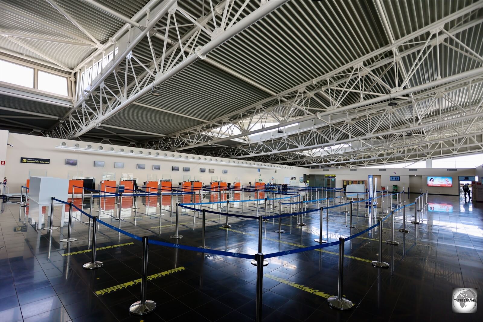
The terminal at Praia’s Nelson Mandela International Airport.
Most inter-island transportation in Cape Verde is done by air, although flights are very limited and expensive. There are more regular flights between the major islands (Santiago, Sal and São Vicente), with less frequent flights to the other islands.
Boat transportation is available, though not widely used nor dependable. On the more populated Santiago Island, public bus transport runs periodically and taxis are common. On less populated islands minibuses (Aluguers) and/or taxis are the only option.
Air
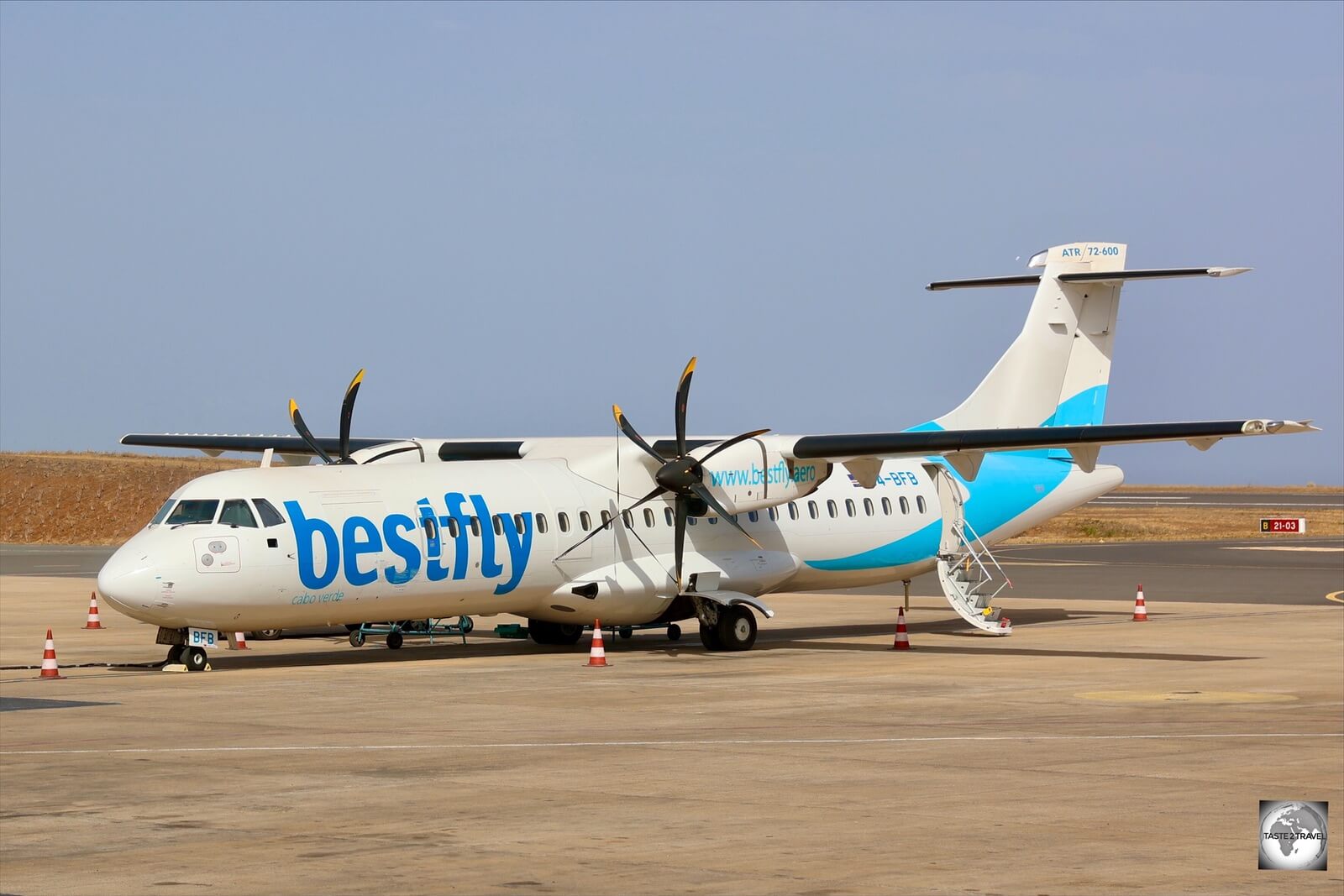
A TICV ATR-72 (one of two in service) at Praia Nelson Mandela International Airport (RAI).
Domestic flights in Cape Verde are operated by Transportes Interilhas de Cabo Verde (TICV), which is 70% owned by BestFly World Wide and 30% owned by the government of Cape Verde.
There are many issues with inter-island flights which you should be aware of when planning any island hopping, including ticket prices, flight schedules and seat availability.

My boarding pass from Boa Vista to Praia with TICV.
Ticket Prices
TICV operate in a monopoly environment and, as can be expected from a monopoly operator, ticket prices are not cheap!
I flew from Boa Vista to Praia and Praia to Sal, with each 20-minute flight costing me almost €100! Ouch!
This is even more upsetting when you consider that Tui offers specials from Europe to Cape Verde for the same price!
Flight Schedules
As for flight frequency, you might expect that on an island nation, where flying is the only available means of travel between most islands, that TICV would be operating a daily shuttle service between all islands.
This is not the case – flight schedules are very limited!
The TICV fleet consists of just 3 ATR-72 prop planes with one in storage and two in active service. Flights are scare – with just two flights per week connecting Boa Vista to Praia.
You can view the weekly flight schedule on the Horários page of the Bestfly website.
While no route map currently exists, flights operate on a ‘wheel and spoke‘ model with all flights departing from the hub airport – Praia – which lies at the centre of the wheel. Flights radiate out from Praia, along the spokes, to individual islands – then return back to Praia.
There are a few flights which connect Praia to Sal then continue onto one other island (either São Vicente or São Nicolau) before returning back to Praia.
Due to the current setup, if you wish to travel from Boa Vista to neighbouring Sal (normally a short boat trip – if ferries were available), you will need to connect through Praia. Connection times in Praia, depending on seat availability, can be days rather than hours!
Seat Availability
With just two 70-seater ATR72’s in service, there are a very limited number of seats available on domestic flights. Once you factor in the scarcity of flights, it’s not surprising that flights sell out weeks in advance.
As I learnt from personal experience on the ground, Cape Verde isn’t a destination for planning any last-minute follies! You should book flights as far in advance as possible!
Inter-Island Ferries

Cape Verde inter-island ferry route map.
Source: cvinterilhas.cv
Inter-island ferries are operated by CV Interilhas with services being unreliable due to many cancellations as a result of bad weather, mechanical issues etc.
Routes / Schedules and Tariffs are posted on the CV Interilhas website and tickets can be purchased online, although only Visa card is accepted. Good luck!
Public Transport

A Toyota Hilux Aluguer on Boa Vista.
On all islands, you will find Aluguers (literally: rental) which are either minibuses or Toyota ‘Hilux’ pickup trucks.
While minibuses connect most towns and cost just a few euros, the Hilux option is popular with tourists who rent them to tour the rugged landscapes of islands such as Boa Vista and Sal.
The only municipal buses on Cape Verde operate in the capital, Praia.
Taxi

Taxis, such as this one on Boa Vista, charge €10 for trips to/ from the airport.
Unmetered taxis are available on most islands, with those on Boa Vista and Santiago charging a flat fare of €10 for the short trip to/ from the airport.
Taxis on Sal charge €15 for trips to/ from the airport since the distance from Santa Maria is much longer.
Rental Car
The best way to maximise your time on the islands is to rent a car. If renting on either Boa Vista or Sal, you should ensure you rent a 4WD as many attractions lie at the end of rugged gravel roads.
A normal, 2WD, car will suffice on Santiago which is covered by paved (or cobble-stone) roads.
Santiago Island

My rental car in the fishing villager of Porto Mosquito on Santiago.
While on Santiago, I rented a car for €50 (CVE5,500) per day through Friendship Tours.
I would certainly recommend this company. They delivered a car to my hotel in the morning and only required a payment of €50 (CVE5,500) cash per day!

License plates on Cape Verde are prefixed with the two-letter island name of the place of registration, with ‘ST’ representing Santiago.
No fuss, no hefty security deposit! Very smooth and easy.
Boa Vista Island

The newly paved highway on the west coast of Boa Vista.
While on Boa Vista, I rented a Suzuki ‘Jinny’ 4WD through my hotel – Ouril Hotel Agueda. If you wish to fully explore Boa Vista, you will need a 4WD.
The daily rental rate was €60 (CVE 6,600) with a €200 (CVE 20,000) security deposit required, which can only be paid in cash.

The interior roads on Boa Vista are made from cobble stones, which stretch to the horizon and beyond.
Sal Island

Exploring rugged Sal Island in my rental car.
On Sal, I rented a car through Caetano Car Rental who are located at the Enacol service station in Santa Maria.
The company has a variety of cars which range in price from €35 – €80 (CVE3,800 – CVE8,800) per day. They also require a cash security deposit of €200 (CVE 20,000).
That’s the end of my travel guide for Cape Verde.
If you have any comments or questions, please do not hesitate to contact me using the comments field below.
Safe Travels!
Darren
Follow me on Instagram:
[instagram-feed feed=1]


 located in North Nicosia old town.")


 on Ledra street.")
 photographing across the UN Green Line.")


 are supported by flying buttresses.")

 in Famagusta.")


 post box in Famagusta serves as a reminder of the British colonial period.")


 above sea level.")


, the headquarters of the Order of Malta.")


.")


.")


