
Tajikistan Travel Guide
Welcome to the taste2travel Tajikistan Travel Guide!
Date Visited: July 2019
Introduction
Tajikistan is described as the The Roof of the World and, with more than half of the country lying above an elevation of 3,000 metres (9,800 ft), it is home to some of the highest mountains on earth. While the country encompasses the smallest amount of land among the five Central Asian states, in terms of elevation, it surpasses them all!

A view, from Tajikistan, of the soaring peaks of the Hindu Kush mountain range in neighbouring Afghanistan.
A big draw for visitors to Tajikistan is the opportunity to travel along the infamous Pamir highway, a gruelling, alpine highway which connects Tajikistan with neighbouring Kyrgyzstan. The road is named after the Pamir mountain range, through which it travels. The Pamir range, which occupies all of eastern Tajikistan, is majestic and awe-inspiring with peaks soaring to over 7,000 metres (23,000 ft).
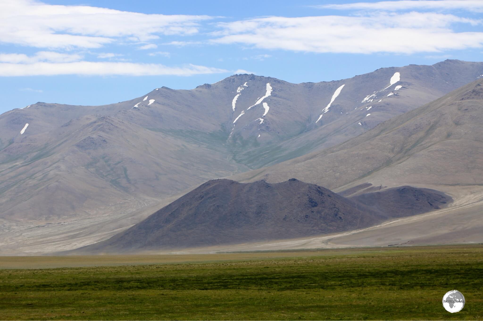
A view from the Pamir highway near the town of Murgab.
Largely unpaved, the Pamir highway stretches for 1,660 km through rugged, spectacular, remote, unforgiving landscapes, connecting the Tajik capital of Dushanbe with the city of Osh in the south of Kyrgyzstan. The Pamirs are remote, a challenging destination for body, mind and soul.
No shortage of spectacular mountain scenery along the Pamir highway.
Tajikistan is the poorest country in Central Asia and is best suited to intrepid travellers who don’t mind some hardship. In many remote towns, especially along the Pamir highway, facilities for tourists are very basic with traditional family ‘home-stays’ (always with smelly, out-house, pit toilets, outdoor showers, very basic meals and mattresses on the floor in shared rooms) being the only accommodation options.
Despite the rigours, a journey through Tajikistan is a rewarding and memorable experience.
Location
Dushanbe, Tajikistan
A land-locked country in Central Asia, Tajikistan is bordered by Kyrgyzstan on the north, China on the east, Afghanistan on the south, and Uzbekistan on the west and northwest.
Looking across the Panj river to neighbouring Afghanistan in the Wakhan valley.
The country includes the Gorno-Badakhshan autonomous region, with its capital at Khorog, which lies across the Panj river from neighbouring Afghanistan.
People

A young Tajik girl, enjoying a day out at Hissar fort near Dushanbe.
The Tajiks
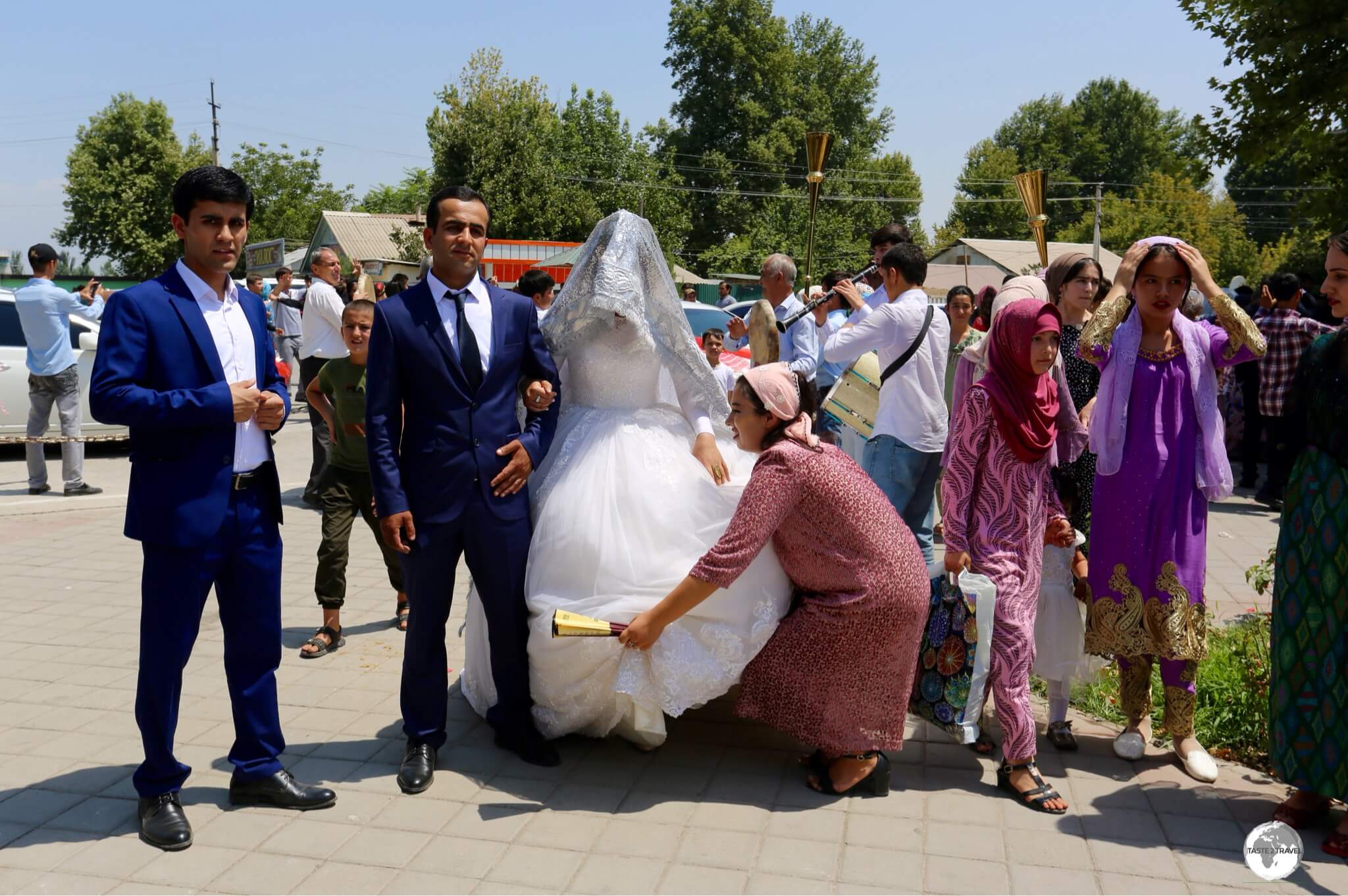
A Tajik wedding party visiting Hissar fort.
With a total population of 9,275,828 – Tajikistan is mostly inhabited by the Tajiks (who comprise four-fifths of the population), an Iranian people, speaking a variety of Persian. The Tajiks have lived in Central Asia for millennia but today are to be found in Tajikistan, Afghanistan and Uzbekistan. Russian is used as an inter-ethnic language with very few people speaking English or any other foreign languages.
The Tajiks are generally reserved, and will not go out of their way to interact with strangers, but are friendly when addressed.
The Pamiris
Making up the other one-fifth of the population are the Pamiris, an Iranian ethnic group who are native to the Gorno-Badakhshan Autonomous Region, which is bisected by the Pamir highway.
The Pamiris are different to the Tajiks in many ways; from their physical features, to their traditional dress, their unique culture and traditions. One notable difference is that Pamiri women traditionally enjoy fewer restrictions than do Tajik women. They are very visible and active in all spheres of society, participating in most activities, equally, alongside men.
The Pamiris of Tajikistan share a unique culture with other Pamiri communities which lie across the borders in neighbouring Afghanistan and (Xinjiang) China.
Flag

The flag of Tajikistan.
The national flag of Tajikistan was adopted in 1992, following independence from the former Soviet Union, and consists of three horizontal stripes in red, white and green. In the middle of the white stripe, there’s an emblem displaying a gold crown with seven stars above.
The ‘red’ of the flag represents the sun, victory and triumph while the ‘white’ represents the moral purity of the people and the snow on the mountain tops (of which there are many in Tajikistan). The ‘green’ symbolises both agriculture and the spiritual essence of Islam, the dominate religion of the country.
The crown represents the Tajik people while the seven stars reference the number “seven” which is important in Tajik culture, being a symbol of perfection and the embodiment of happiness.
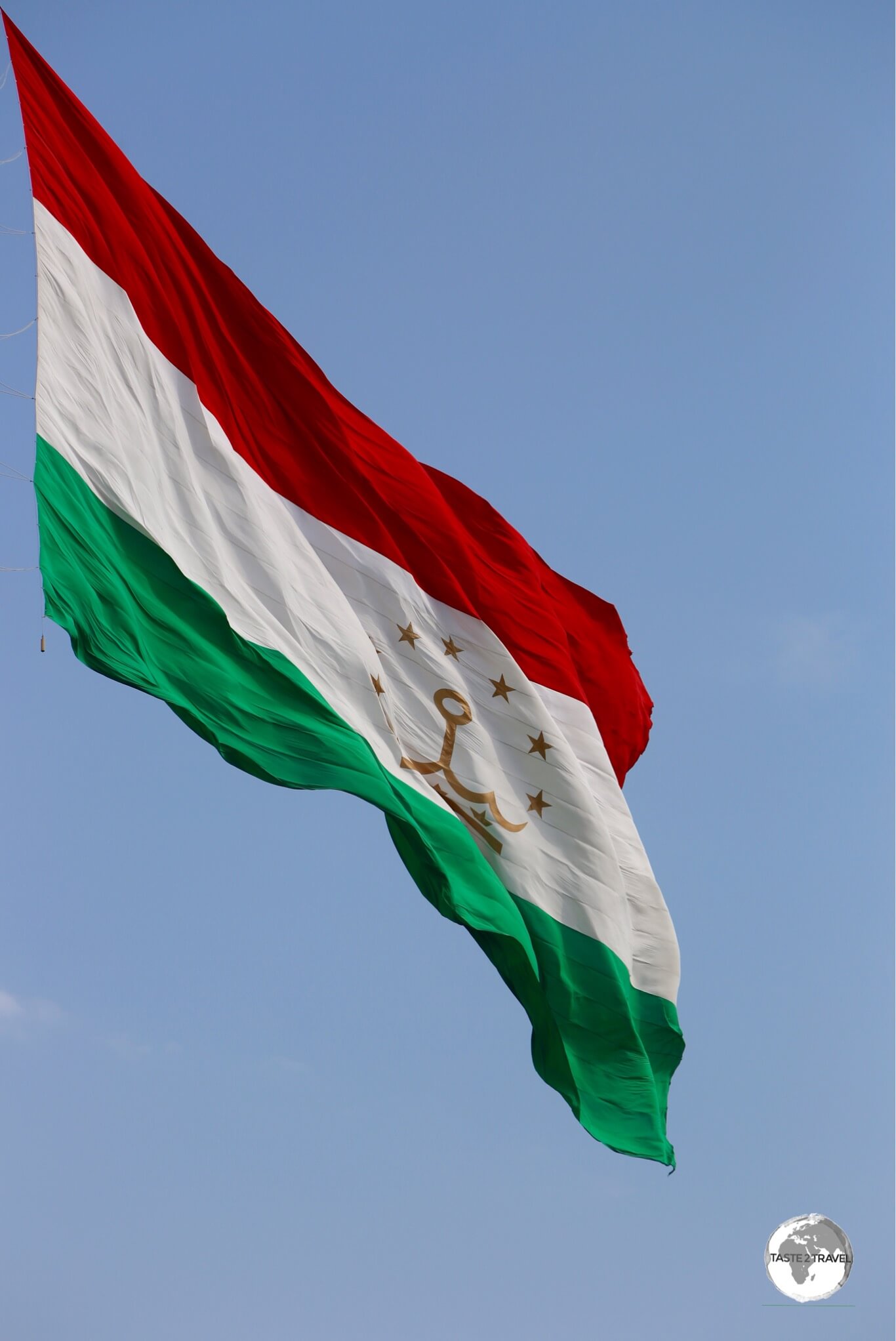
The giant 350-kg flag of Tajikistan, flying in downtown Dushanbe. The flag measures 60 m X 30 m.
The crown and stars are hard to replicate on hand-painted flags, so they are normally omitted, leaving many flags looking like a horizontal version of the Italian flag.
Currency

Brand new 10 somoni notes, which feature Mir Said Ali Hamadoni (1314-1384), a Tajik thinker and poet.
The Tajik somoni (currency code: TJS) is the currency of Tajikistan. At the time of my visit (July 2019), USD$1 was buying 9.43 TJS, which buys much more in Tajikistan than what $1 buys in the United States. To check the current rate against the USD, click here.
Issued by the National Bank of Tajikistan, the currency is named after the father of the Tajik nation, Ismail Samani (also spelled Ismoil Somoni).
Money Matters
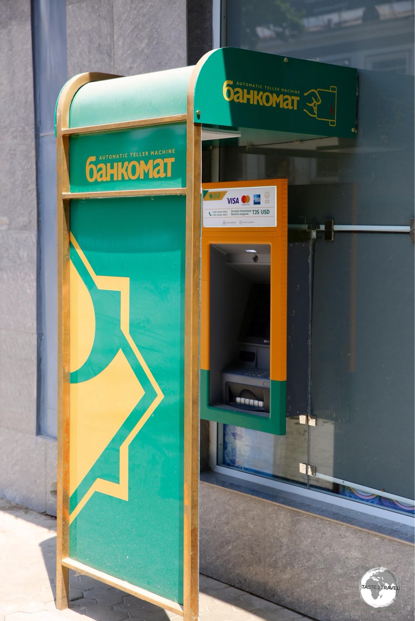
One of the few Kazkom ATM’s, located opposite the TSUM department store, on Rudaki avenue, in Dushanbe.
Tajikistan is purely a cash society, with credit cards almost never accepted. The black economy is alive and thriving, with everyone eager to conceal their earnings from the tax authorities. Even deluxe hotels, or expensive electronic shops in Dushanbe, will insist on cash payment for everything – this often involves a trip to the bank!
However, therein lies the problem!
While Visa cards are accepted by many banks, MasterCard and American Express are only accepted by one bank, the Kazakhstan-based Kazkom (now part of Halyk Bank). The bank maintains a limited number of branches in Dushanbe and Khujand.
Their one ATM in Dushanbe, which accepts Mastercard, can be found on Rudaki avenue, next door to the Segafredo cafe, opposite the Tsum department store.
If you do rely on these cards, and will be entering Tajikistan along the Pamir highway from Kyrgyzstan, your first chance to use an ATM will be in Dushanbe. You’ll need to ensure you have enough cash (USD or Tajik Somoni) to cover all expenses prior to leaving Osh.
Costs
Tajikistan is a destination which can be enjoyed, even on the most stringent of budgets!
Travel costs in Tajikistan can only be described as a bargain. Always, when it came time to settle a bill, I was pleasantly surprised by how cheap everything was. As an example, a meal of fresh salad, a couple of beers, a couple of Shashlik kebabs plus fresh bread would cost me 60 TJS (US$6.00). I never complained!
Sample costs:
- Coca Cola (0.33 litre bottle): 4.33 TJS (US$0.46)
- Water (0.33 litre bottle): 3.00 TJS (US$0.32)
- Cappuccino (at Segafredo cafe in Dushanbe): 13 TJS (US$1.38)
- Bus Ticket within Dushanbe: 1.20 TJS (US$0.13)
- Yandex taxi within downtown Dushanbe: 6 TJS (US$0.64)
- Litre of fuel: 7.80 TJS (US$0.83)
- Meal (inexpensive restaurant): 60 TJS (US$6.35)
- Meal for 2 (mid-range restaurant): 100 TJS (US$10.59)
- Dorm bed in a budget hostel (City Hostel Dushanbe): 170 TJS (US$18)
- Room in a mid-range hotel (Hotel Shumon Dushanbe): 548 TJS (US$58)
- Room in a top-end hotel (Hyatt Regency Dushanbe): 1,600 TJS (US$170)
Internet Connectivity

Terrible! Terrible! Terrible!
Tajikistan has one of the slowest internet services in the world, according to Cable.co.uk, who rank 210 countries and territories in terms of internet download speeds. From their website you can download the complete excel table which places Tajikistan in position #193 of 210, with an average download speed of 1.05 mbps.
Not only is internet very slow, but it’s unavailable in most parts of the country. The only towns along the 1660 km of the Pamir highway where you’ll (possibly) be able to access free Wi-Fi is in the regional capital of Khorog and in Kalai-khumb. In the remote town of Murgab, the Pamir Hotel (the only hotel in town) do not provide Wi-Fi. There’s a T-Cell shop in Murgab where you can invest in a local SIM card with a data package.
Politics

A government building in Panjakent, featuring an (obligatory) image of President Emomali Rahmon.
You can be sure that in any country where the President has created a personality cult around himself, that the politics is rotten! All government buildings in Tajikistan are emblazoned with giant-sized images of President Emomali Rahmon while his image appears elsewhere in many other places.
Following independence from the Soviet Union in 1991, Tajikistan spiralled into a civil war which lasted from 1992 until 1997. During this tumultuous period, Rahmon was elected President (in 1994) and has been in the post ever since – another autocratic ruler in a region which is rife with them!
Tajikistan bills itself as a ‘democracy’, but it’s all a façade. A Tajik told me that, when it comes time to vote, staff at each polling station provide clear instructions on who to vote for! Not surprisingly, the President keeps winning each election! Western observers report that Tajikistan has not held a free or fair election since 1992.
The President has appointed many of his family members to senior government posts. Government controls many aspects of business and society in Tajikistan – a country which is a classic example of a ‘kleptocracy’.
Within this environment, corruption flourishes on all levels. The most visible form of corruption is the huge number of police officers who spend their day not fighting crime but, rather, supplementing their meagre salary by stopping random motorists at impromptu checkpoints and looking for ‘problems’. Everyone knows the drill! If a problem is found, a small payment is made and away you go.
Throughout the countryside, Tajikistan police still maintain the old Soviet-era checkpoints, which always block your way with a boom gate across the road. Once payment has been made, the gate will open. These are less checkpoints and more toll gates.
Laundry Service

The entrance to the only (kilo-wash) laundry I could find in Dushanbe.
The curse of all modern travellers is dirty laundry! At some stage, even a busy nomad needs to take timeout from exploring the world to do laundry.
Unless you use a hostel, or and expensive hotel laundry service, it is a challenge to find a laundromat in Dushanbe.
I found one dry-cleaner, who is located in the basement of the Sadbarg Trade Centre which offers a 24-hour, wash/ dry/ fold service for 15 TJS per kilo. Highly recommended!
Sightseeing

A map of Tajikistan shows my journey, entering from Kyrgyzstan and exiting into Uzbekistan.
The sightseeing section is arranged in the order in which I travelled through Tajikistan, from the east along the Pamir highway to the capital, Dushanbe then exiting in the west into Uzbekistan.
Pamir Highway
A seven-day trip from Osh (Kyrgyzstan) to Dushanbe (Tajikistan).

The view north from the lofty Akbaital Pass 4,655 metres (15,272 ft).
Ever since I journeyed along the Karakorum Highway in 1995, crossing between China and Pakistan at the famous Karakorum Pass – 4,693 metres (15,397 ft) – I’ve wanted to travel the other great highway – the Pamir. I got to realise the dream in July of 2019!
The M41 (the international road designation for the Pamir Highway) is the second-highest international highway in the world, after the nearby Karakorum Highway. The highest pass on the Pamir is Akbaital Pass which is a whisker shy of the height of the Karakorum pass at 4,655 metres (15,272 ft).
Like the nearby Karakorum, the Pamir Highway is a high-altitude adventure, an epic road which winds its way across high desert plateau’s, past stunningly beautiful, alpine lakes, past towering, glacier-covered peaks and over mountain passes which seem to want to swallow you.
There’s no public transport on the Pamir highway. Traffic is very sparse, distances are vast with huge expanses of nothing, in between small settlements. Either you come with your own means of transport, hire a driver with a car (which I did!) or be very patient and wait in different, remote towns to hitch a ride.
Organising a Tour
A popular means of travelling the lonely highway, for those independent travellers without their own transport, is to join a shared 4WD trip from Osh. These can be very economical and include car, plus driver, and all associated expenses for the two.
I organised a seven day trip from Osh to Dushanbe, through Budget Asia Tour (email: budgetasiatour@gmail.com) who operate out of the very humble Osh Guest house in Osh. They seem to enjoy a monopoly on operations along the highway as everyone was travelling with them.
The company organises different random travellers into groups of a maximum of 4 then provides them with a 4WD and driver. Beyond the car and driver, nothing else is organised. It’s a bare-bones trip!
Tour Costs
The cost of the trip is worked out on a per vehicle charge of USD$0.65 per km. The trip I undertook covered a total of 1,660 km which resulted in a cost of USD$1079 for the vehicle.
Added to this amount is a charge of USD$15 per day to cover the cost of food and accommodation for the driver. The total cost for a vehicle with driver over 1,660 km was USD$1184. I shared my car with one other couple so the three of us paid a total of USD$395 for the 7-day trip.
An optional extra allows passengers to pay USD$25 per day to have all their accommodation and meal costs paid by the driver.
Accommodation is provided in basic home-stays (because there is no other option). This is a journey of hardship which is best suited to intrepid travellers! Most towns along the highway offer very basic accommodation, outdoor ‘pit’ toilets, either a single bed or mattress on the floor in shared rooms plus very basic, home-cooked meals.
Day 1: Osh – Tulparkul (Kyrgyzstan)

Located at 3,000 metres (9,842 ft), Tulparkul lake in Southern Kyrgyzstan.
Although day one of the trip was spent in Kyrgyzstan, I’ve included it here for completeness.
On the 1st day of the trip, we departed from Osh and drove south, crossing over two passes – the Taldyk pass, which is the highest pass in Kyrgyzstan at 3,615 m (11,860 ft) and the Chyirchyk pass, which is a minnow at just 2,408 m (7,874 ft).
After descending the passes, we arrived for lunch in the last town in Kyrgyzstan, the remote, alpine settlement of Sary Tash. Although located on an isolated alpine plain, this tiny town is a key junction for the southern region.
Just south of town, a junction allows you to make a left turn for China (and travel within a few hours onto Kashgar via the border town of Irkeshtam). You can also turn right and take a faster road to Tajikistan, and onto Dushanbe, via the border town of Karamyk. Or you can continue due south and take the meandering Pamir highway through the Gorno-Badakhshan autonomous region of Tajikistan. We would take the later (the following morning), but first we had a detour to our first overnight stop.

The snow-covered Lenin Peak (7,134 metres / 23,406 ft) marks the border between Kyrgyzstan and Tajikistan.
For our first overnight stop, we made a left turn and travelled west to the sleepy settlement of Sary Mogul. From here, we headed off road, crossed a river and drove inland for 35 km, along a dusty track, towards the looming summit of Lenin Peak (7,134 metres / 23,406 ft) which sits on the border between Kyrgyzstan and Tajikistan.
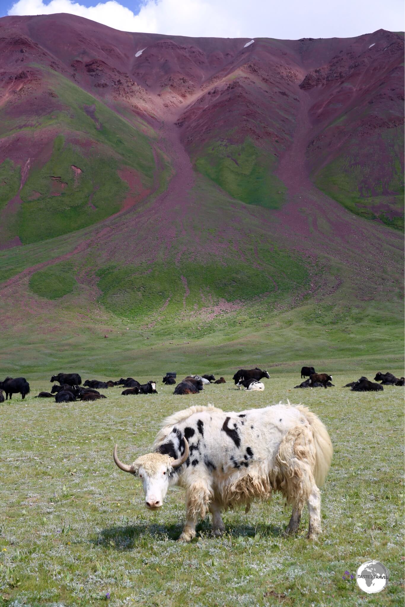
A herd of Yaks grazing on the shores of Tulparkul lake.
Lying in the shadow of Lenin peak is the beautiful Tulparkul lake (3,000 metres / 9,842 ft), which is surrounded by soft, green mountain slopes upon which a cheeky herd of yaks was grazing.

My yurt at the Lenin Peak yurt camp. I like to practice an ‘open door’ policy when staying in yurts.
The shores of the lake are also home to a yurt camp which was our accommodation for the 1st night. The camp is used by travellers on the Pamir highway and the odd mountaineering group who use the camp to prepare for climbs to the summit of Lenin Peak.
Day 2: Tulparkul – Karakul (Tajikistan)

A last view back into Kyrgyzstan from the Kyzylart Pass.
The following morning, after a totally unremarkable breakfast of stale bread, tea and a strange egg concoction, we headed to Tajikistan. First stop was the Kyzylart Pass (4,280 m / 14,042 ft), which forms the border between Kyrgyzstan and Tajikistan. The landscape around the pass is rugged and dry, with the most beautiful ochre-coloured hills and green fields. The pass also marks the start of the Pamir Highway odyssey.

Crossing into Tajikistan from Kyrgyzstan at the Kyzylart Pass.
From the pass, we headed down to the border then, eventually, onto the Pamir plateau toward Karakul Lake, the highest part of the Pamir highway.

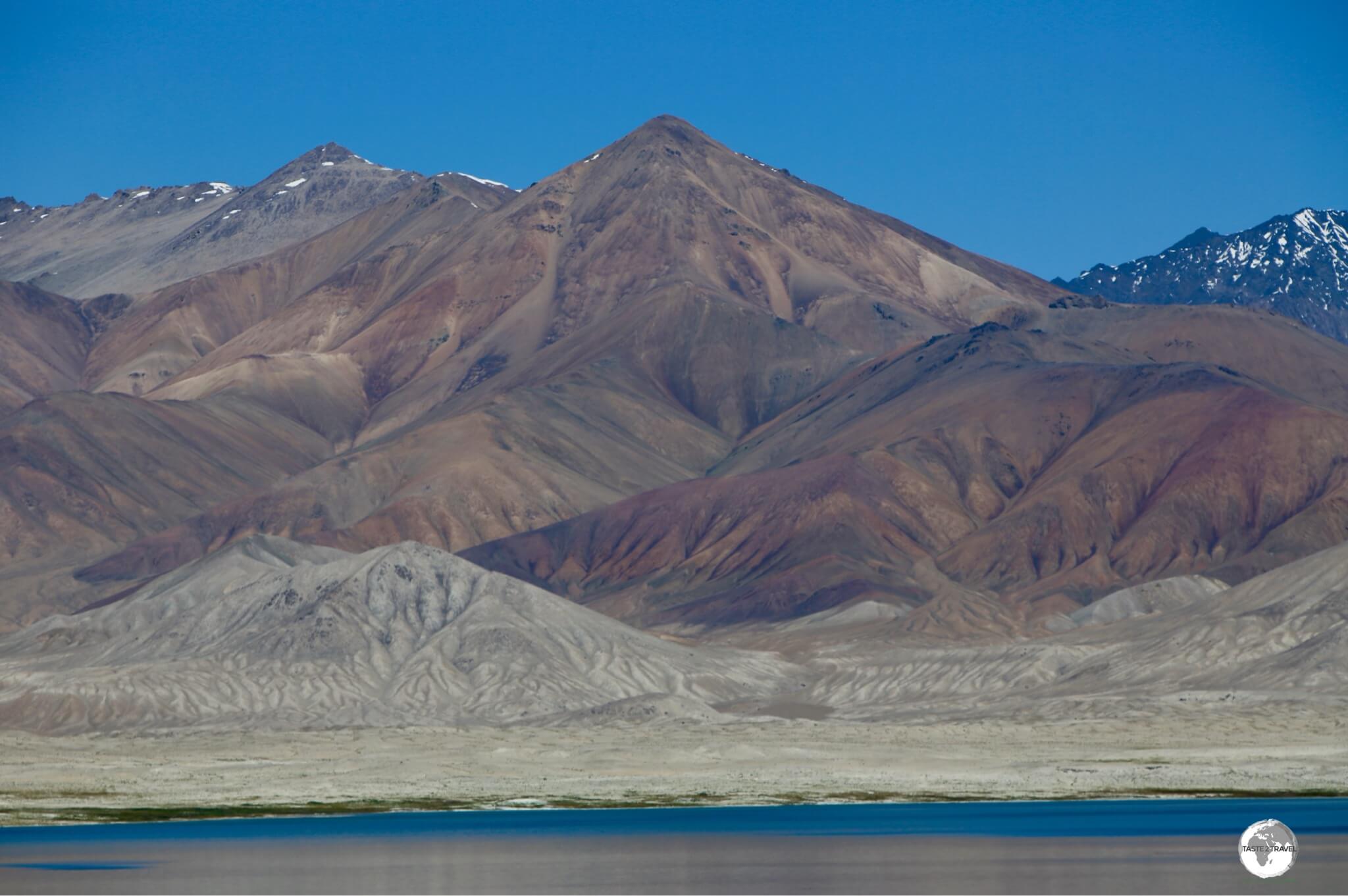
Views from the Pamir highway, north of Karakul lake.
The landscapes on the Pamir Plateau are arid and colourful, with lots of different minerals turning whole mountains into something resembling an artist’s palette.

The Pamir highway travels alongside a continuous barbed-wire fence which was built by the Chinese as a border fortification.
The Pamir highway follows alongside the Chinese/ Tajikistan border, which is demarcated by a barbed-wire fence which runs for the entire 414 km (257 mi) length of the border. The fence was installed in the early 1990’s, following the collapse of the Soviet Union and the onset of civil war in Tajikistan.

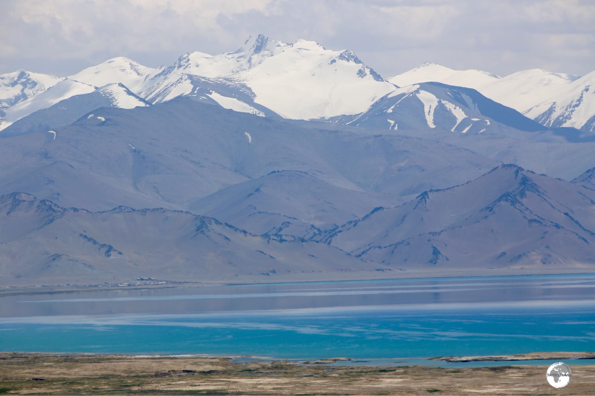
The truly breath-taking Karakul lake is located in the middle of nowhere, at an elevation of 3,960 m (12,990 ft).
Fifty kilometres south of the border, the most spectacular vision came into sight – the shimmering, turquoise-blue, Karakul lake. Located alongside the Pamir highway, the spectacular ‘Karakul’ (means ‘Black lake) lies at the centre of an ancient asteroid impact crater. The lake sits at an elevation of 3,960 m (12,990 ft), reaches a maximum depth of 230 metres and has no outlet. Located near the shore of the lake, the small settlement of Karakul was our second stop for the night, a less-than-deluxe home-stay.
Day 3: Karakul – Murgab
No shortage of stupendous views at Lake Karakul.
The next morning, after another unremarkable breakfast, we continued our journey south to the first large settlement in Tajikistan, the isolated outpost of Murgab. With just 135 km of driving on OK roads, today was the most leisurely, and allowed us plenty of time to spend at Akbaital pass, the highest pass on the Pamir highway at 4,655 metres (15,272 ft).
Murgab
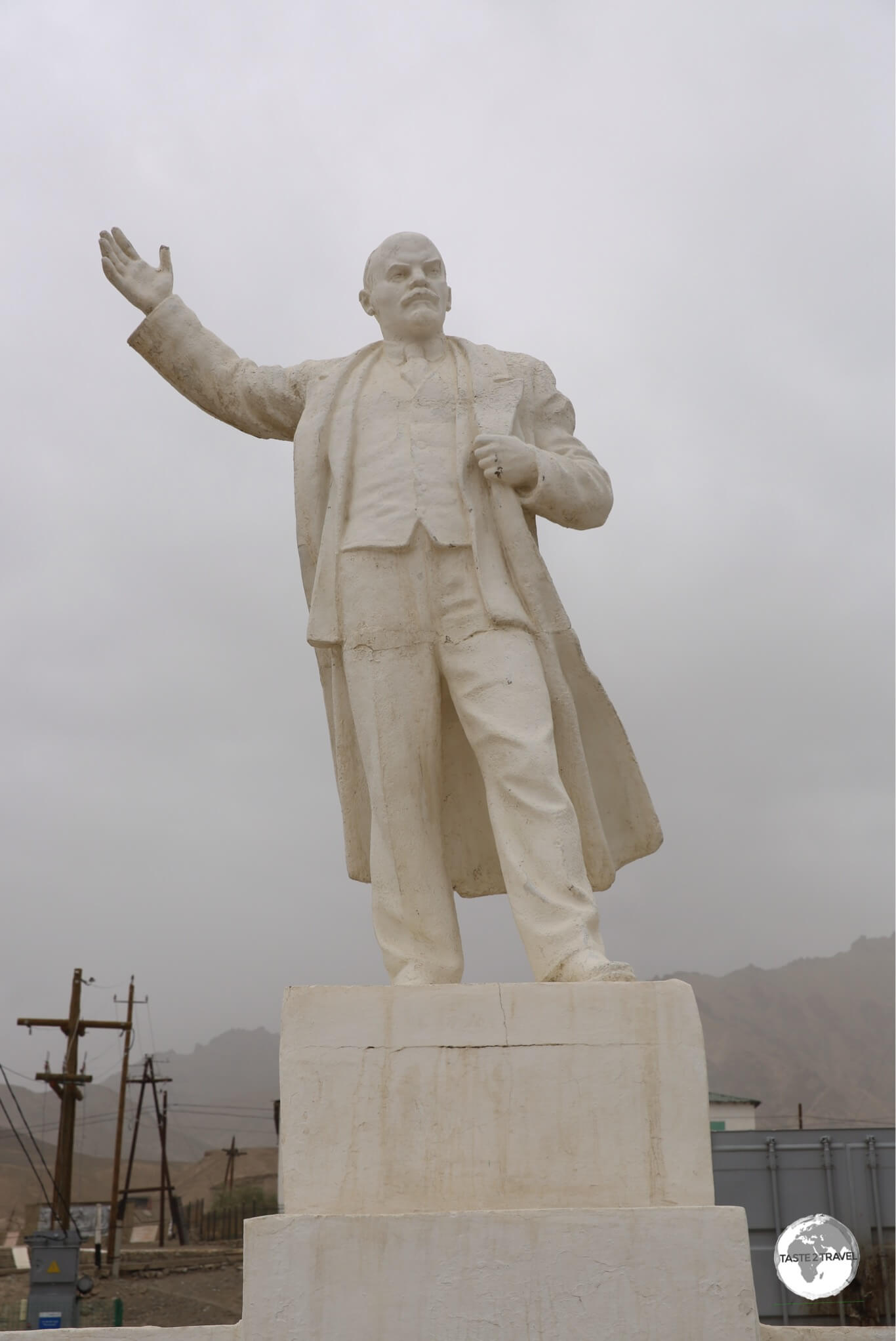
A statue of Lenin graces the main square of Murgab.
Murgab is the capital of the district of the same name and holds the distinction of being the highest town in Tajikistan (and of the former Soviet Union) at 3,650 m/ 11,975 ft above sea level.

The residents of Murgab add a splash of colour to their homes by painting colourful flowers and trees onto the white adobe walls.
The town, which has a real frontier feel to it, consists of adobe-mud structures, shops housed in shipping containers and a couple of concrete, government buildings. It’s home to a population of 4,000 hardy souls.
A road from Murgab branches off the Pamir highway, leading to the nearby Chinese border post at the Kulma Pass (4,362.7 m/ 14,313 ft), which is a short drive from Kashgar.

A road sign in Murgab indicates distances to towns which lie north along the Pamir Highway.
My stay coincided with a spectacular thunderstorm which apparently is a rarity in these parts. It’s interesting to hear thunder when you’re at such a high elevation – it claps just above your head.
Day 4: Murgab – Langer
A view from the Pamir highway near the village of Alichur.
Day four involved a long, gruelling, 10-hour drive of 280 km which would start in Murgab, on the high Pamir plateau, and end in Langer, a village in the Wakhan Valley, overlooking Afghanistan.

Rabat Sasök-Kul is located alongside the Pamir highway, near the village of Alichur.
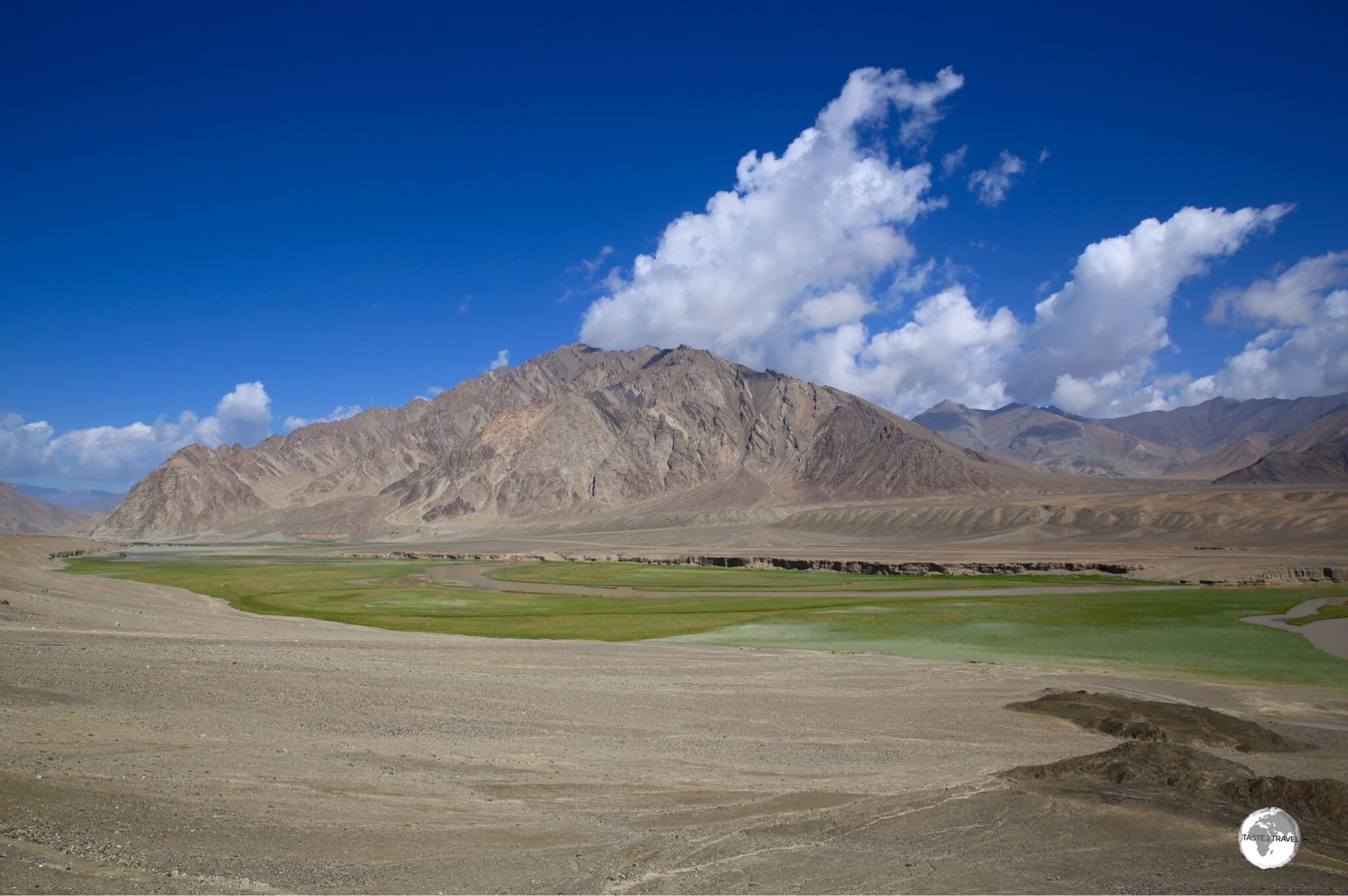
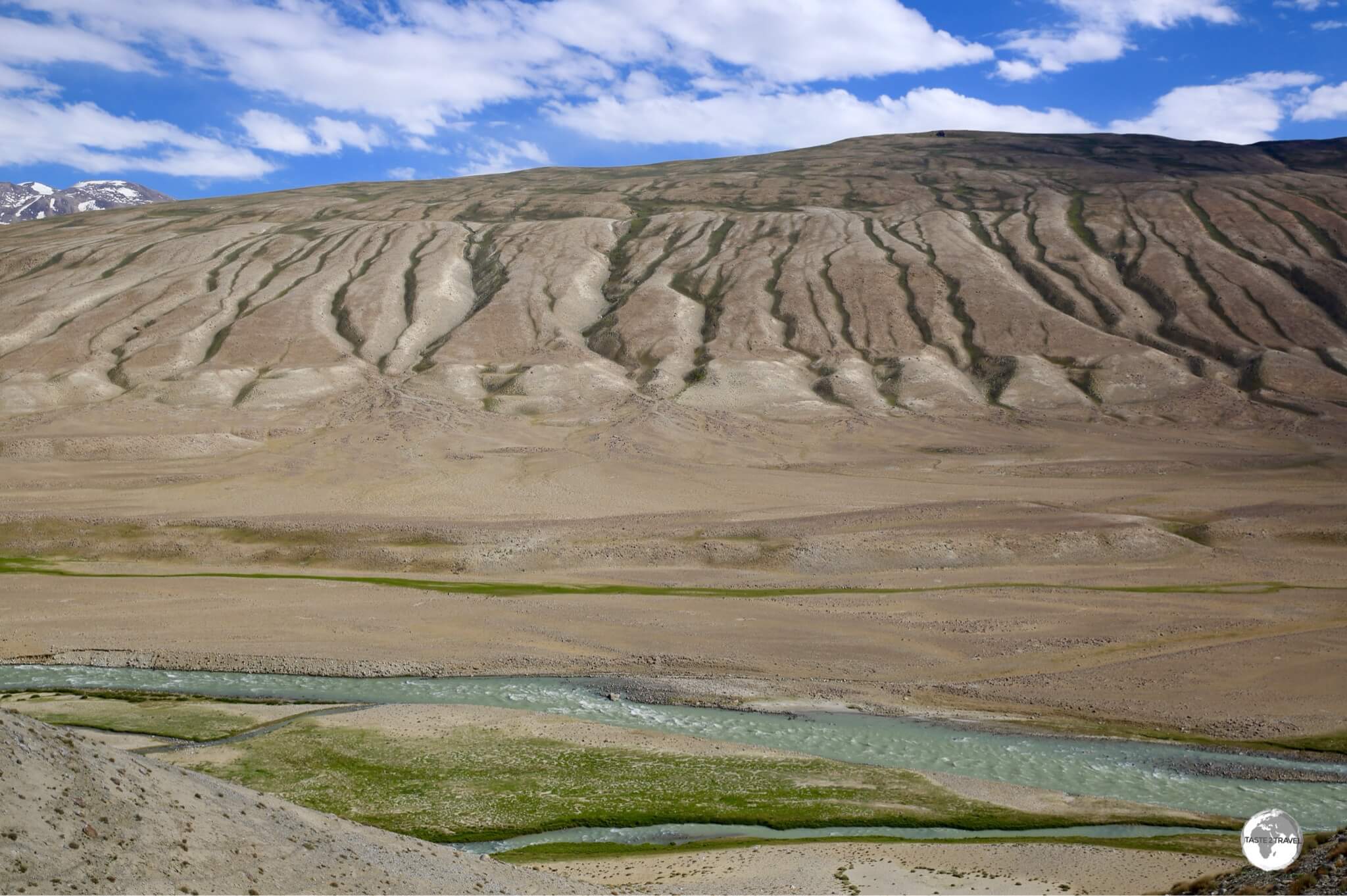
The landscapes along the Pamir highway vary greatly, with turquoise lakes, and their green verges, providing a splash of colour in the otherwise arid environment.

The astonishing fresh-water spring near to the village of Alichur.
One of the more spectacular sights in the morning of day 4, was a large, natural, crystal-clear, fresh-water spring which had ‘greened’ the surrounding countryside. The spring is located beside the highway and contains freshwater fish, which can be cooked for lunch by the family of custodians who live nearby.
Bulunkul Lake

A panoramic photo of Bulunkul lake.
Located in the Alichur Valley, some 20 km north of the Pamir Highway along a dusty, heavily corrugated track, is the incredibly beautiful Bulunkul lake. There are 846 lakes in the Pamir, most of them of tectonic origin.
Although very shallow, reaching a maximum depth of just 6 metres, Lake Bulunkul is one of the more picturesque lakes in Tajikistan, and, in the Soviet days, was thoughtfully stocked with Gibel carp.
During the long winter months, fishing is impossible as the lake freezes over with up to a metre of ice cover. However, in the summer months, the water thaws and the fish are easily caught as they gather to feed along the densely vegetated shoreline of the lake.
The Gibel carp reaches a length of 32 cm and a weight of 1 kg. Locals at a home-stay in the nearby village of Bulunkul fried some of the carp for us to enjoy for lunch, it was the best lunch anywhere in the Pamirs!

Reality or a painting? Different minerals provide a colourful backdrop to the very real Bulunkul lake.
The village of Bulunkul holds the distinction of being one of the coldest inhabited places in the former Soviet Union, with a record minimum temperature of -63 degrees Celsius recorded. Ouch! Despite the harsh conditions, the locals are extremely friendly and welcoming and offer home-stay accommodation for those wanting to stay.

The shallow waters of Bulunkul lake are frozen for much of the year.
Khargush Pass
On the very remote and lonely road south to the Khargush pass (4,344m / 14,251ft).
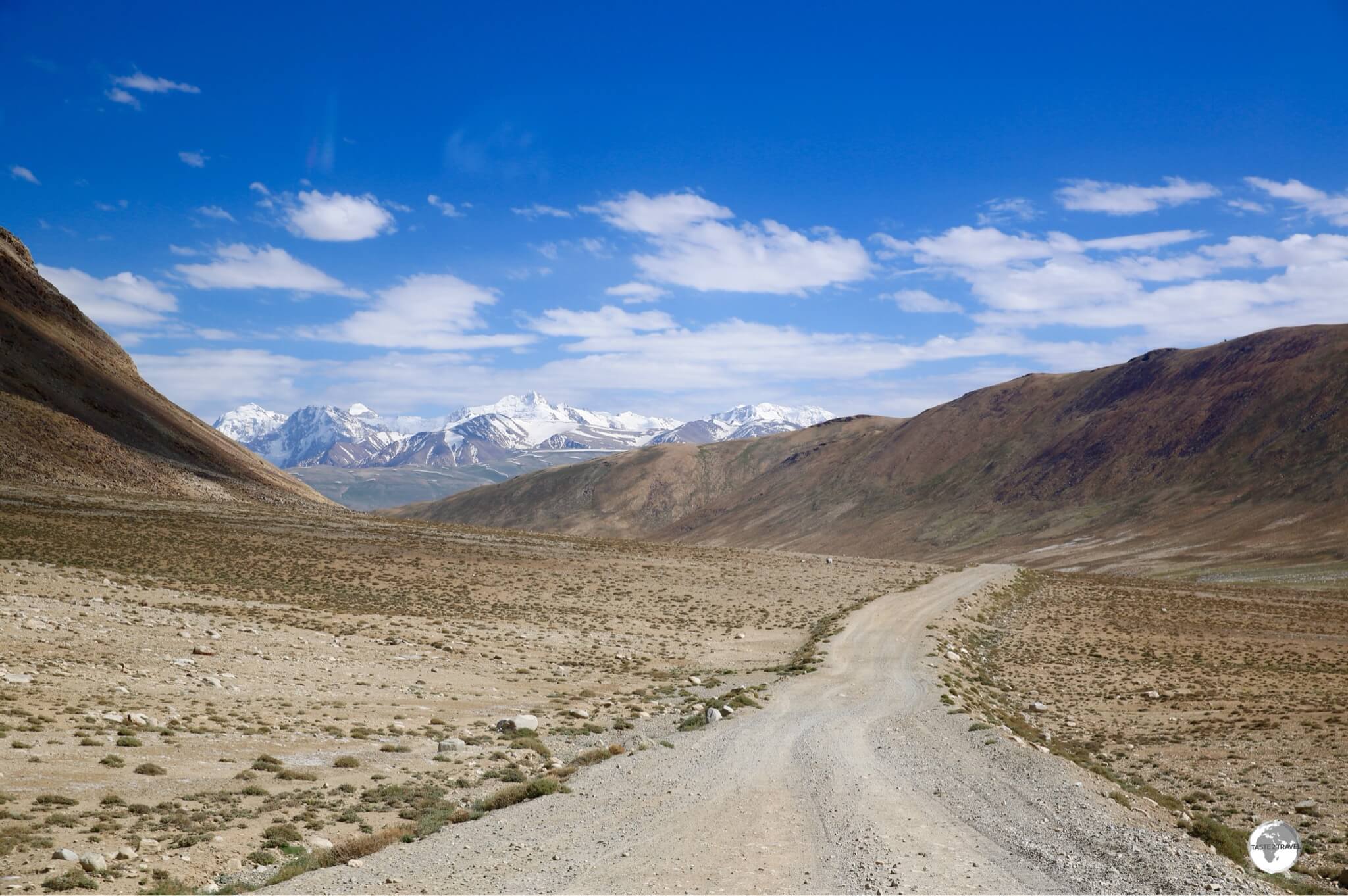
A turnoff, from the Pamir highway near Bulunkul lake, took us onto a rough, corrugated, (4WD-only) road which would lead us, after several hours, to the Khargush pass at 4,344 m / 14,251 ft. Once you cross the pass, you start the decent into the Wakhan valley, with the incredibly vertical Hindu Kush range in neighbouring Afghanistan, spread out before you.
This road is very isolated and sees almost no traffic. We were stopped by one, lone Italian cyclist who was miles from anywhere and had run out of water. We gave him two bottles of water and some food. If you are cycling, there are few streams along this route, no settlements and almost no traffic. The sun is baking hot and the landscape arid and parched (as you will be). We didn’t pass any other vehicles while driving here.
Wahkan Valley
My first views of Afghanistan (other side of the river) and the upper Wakhan valley, at which point the Panj river is just a stream.
After descending the pass, the road winds its way down into the Wakhan valley where it meets the Panj river, a river which forms the border between Tajikistan and Afghanistan.

Spectacular views across the Wakhan valley into Afghanistan, which is dominated by the dramatic Hindu Kush mountain range.
Once we had entered the Wakhan valley, we had an almost-straight run into Langer, our next overnight stop. For the next 70 km, it was slow going as the narrow, gravel road wound its way up into the mountains (with sheer drops into the river far below) and then plunged back down to the river, before climbing again then plunging again.
We eventually arrived in Langer, the first Pamiri town on our trip. Friendly locals greeted us at every turn and, across the river, Afghanistan was glowing in the afternoon sunlight. We had arrived in a very different world! It was wonderful.
Day 5: Langer – Khorog

A sweeping view over the Wahkan valley from the ruins at Yamchun Fort.
Day five of the odyssey had us drive driving along the banks of the Panj river from tiny Langer to the regional capital of Khorog.

The Wahkan valley consists of a string of small, green Pamiri villages which line the banks of the turbulent Panj river.
The road along the river passes through numerous green, Pamiri villages, where the fertile land is intensively cultivated. At Yamchun village, we turned inland and headed up a steep, narrow (one lane, but two-way), gravel road which eventually opened out on a high bluff where we found the ruins of Yamchun Fort.

Yamchun Fort is built on a natural bluff which occupies a commanding position, high above the Wahkan valley.
The ruins of the fort are located at a height of 3,000 m (9,842 ft), and sit 400 m above the valley of the Panj river. The fort offers commanding views over the entire Wakhan corridor and across into Afghanistan. The triangular-shaped fortress was built on a mountainside and is protected on two sides by deep gorges.

The entrance to Bibi Fatima springs, which lie a short drive from Yamchun fort.
A few kilometres up the road from the fort lies Bibi Fatima springs, a stop I had been dreaming about. While most home-stays provide very basic shower facilities, you cannot beat a warm, mineral bath, direct from nature.
The springs themselves are just a simple concrete room built against the rock face where the hot water emerges from a series of pipes. The water is drinkable (at least the locals drink it, and I followed their lead) and after a short soak my skin was soft, glowing and rejuvenated.
Separate bathing rooms are provided for men and woman with entrance (for tourists) costing a mere 10 TJS.
Day 6: Khorog – Kalai Khumb

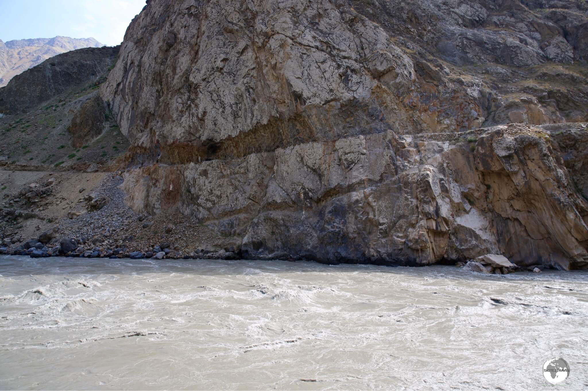
A road on the Afghanistan side of the Panj river which has been carved out of the cliff face.
The sixth day of driving took us 242 km further north along the Pamir highway, from the regional capital of Khorog to the town of Kalai-Khumb (pop: 1,600). The road follows the Panj river, which is further enlarged with several significant inflows.

Afghan road workers carving the road out of a cliff face using a single jackhammer.
In one place, we could observe Afghan road workers using a jackhammer to carve the road out of a cliff face. The road on the Afghan side of the river is very basic, a simple gravel strip carved out of the sheer cliff faces, with no safety railings anywhere in sight.

The Tajikistan-Afghanistan Friendship Bridge spans the Panj river at Darvaz.
The appearance of the Tajikistan-Afghanistan Friendship bridge meant that we were now close to Kalai-Khumb, a town which was used by Soviet troops as a staging post during the Soviet-Afghanistan war, which lasted from 1979-1989.
If you’re travelling from Dushanbe, Kalai-Khumb marks the start of your Pamir highway adventure. This small, relaxing, pleasant town is home to the best hotel anywhere in the Pamir region (refer to the ‘Accommodation‘ section for more).
Day 7: Kalai-Khumb – Dushanbe
After six, long, enduring days, bouncing along rough, gravel roads all the way from Kyrgyzstan, it was a pleasant surprise to arrive back onto a freshly asphalted highway – a real highway at last! Day seven involved the most kilometres travelled, but it was one of the shortest days of driving!
After so many days of following along the Panj river we waved goodbye to Afghanistan and headed inland to the southern city of Kulab, at this point we also said goodbye to the Pamir region. After a leisurely lunch in Kulab, we made the final drive to Dushanbe, along a fast road with various tunnels.
Everyone was happy to have completed the journey. We said our goodbyes, and I checked into my comfortable hotel room – where I took a siesta!
Dushanbe
Dushanbe, the capital of Tajikistan, is located in the historic Hissar Valley. Unlike other capitals in Central Asia, Dushanbe is small and compact and easily covered on foot in a day. The city has a population of 770,000.
There are a small cluster of sights located downtown and the, less-than-remarkable, Hissar fort which is located 30 km from the centre. The city is rather charmless and soulless, not my favourite place in the world. The government has embarked on a series of projects to create museums, parks and the worlds (now 2nd) tallest flagpole.
Flag Pole Park

At 165 metres (541 feet), the Dushanbe flagpole is the 2nd tallest in the world.
It’s hard to miss Dushanbe flagpole, the most dominate feature on the city’s skyline. When it was installed in 2011, the 165 metre (541 feet) flagpole was the tallest in the world. Then in 2014, the Saudi government inaugurated the 171 m Jeddah flagpole.
The flag, which is raised and lowered each day at sunrise and sunset, is 30 m × 60 m (98 ft × 197 ft) and weighs 700 kilograms (1,540 pounds). Due to its weight, the flag only flutters in a stiff breeze, which is normally each afternoon.
National Museum of Tajikistan

The National Museum of Tajikistan, as seen from the flagpole.
Also in flagpole park is the National Museum of Tajikistan which I would nominate as one of the most least engaging national museums anywhere in the world. Opened in 2013, the museum consists of 21 exhibition halls over four floors. The displays, which cover the history, culture, fauna and flora of Tajikistan are very ho-hum!

A display hall at the Tajikistan National Museum, featuring works by local artists.
The museum is open every day from 10:00 to 17:00, except Monday.
Rudaki Park
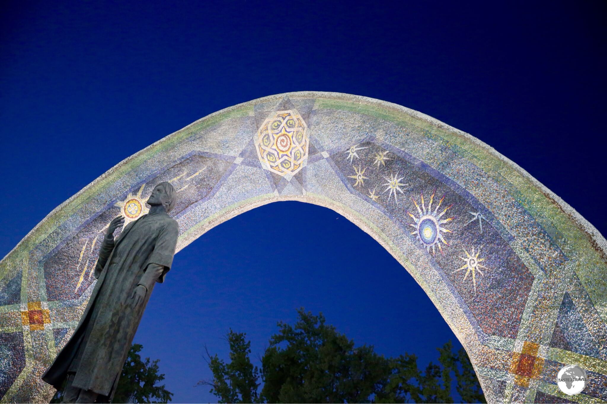
Located in Rudaki park, a statue of Rudaki stands in front of a beautiful mosaic archway which features astronomical bodies.
Across the road from Flag Pole park is Rudaki park, which has an interesting monument to the great poet, at its core. A bronze statue of Rudaki lies beneath a huge mosaic arch which features astronomical bodies and other-worldly designs. It’s especially nice to photograph at dusk.
Ismoili Somoni Statue

The Ismoili Somoni Statue illuminated at sunset.
A short stroll from Rudaki park, is one of Dushanbe’s most iconic monuments, the Ismoili Somoni Statue. This art deco-inspired monument celebrates the 10th-century founder of the Samanid dynasty. It’s also nice to photograph at dusk when the setting sun illuminates the gold casing of the monument.
The Parchan

The Parchan was built to commemorate Tajikistan’s independence.
Located at the other end of the mall from the Ismoili Somoni Statue is the Parchan, a monument which was built to commemorate Tajikistan’s independence.
An interesting thing happened while I was photographing this monument, which I assumed to be constructed from polished white marble. I saw locals tapping on the white panels of the monument and it sounded hollow. Out of curiosity, I too tapped the panels and found that the monument is constructed from ‘faux-marble’ plastic panels. It seemed to be a fitting metaphor for Dushanbe – all is not what it seems!
TSUM Department Store

The very retro TSUM department store.
During the Soviet era, every capital city had a TSUM (or GUM) department store. This was the place where locals, and tourists travelling with In-tourist, would be able to spend their currency on souvenirs, clothes, trinkets and anything else one might desire from behind the iron curtain.
While in every other capital, the old fashioned TSUM have been modernised and turned into glitzy malls, the one in Dushanbe still retains its original look and feel. While the outside of the building is distinctly modern, the dated interior harks back to a bygone era.
Hissar fortress

The main entrance to the Hissar fortress, which lies on the outskirts of Dushanbe.
Hmm! Disappointing! Why is it the Tajik government feels the need to ‘modernise’ their ruined, historical structures? Hissar fortress, which lies 30 km from downtown Dushanbe (a Yandex taxi will cost you 60 somani), was built 2,500 years ago, but you wouldn’t know it.
Like other historical structures around the country, the government has spent time and money to ‘redecorate/ modernise/ vandalise’ this historical sight. Adding to the insult, they have installed a row of modern shops beyond the entrance archway. The Tajiks love it! It’s so modern!
Panjakent

The main food hall at Panjakent bazaar.
Panjakent is an historically significant town, which lies 230 km northwest from Dushanbe but just 60 km southeast of Samarkand, Uzbekistan.
Ancient Panjakent once served as the capital of the Sogdian empire, which occupied pre-Islamic Central Asia. The ruins of the old town are on the outskirts of the modern city.
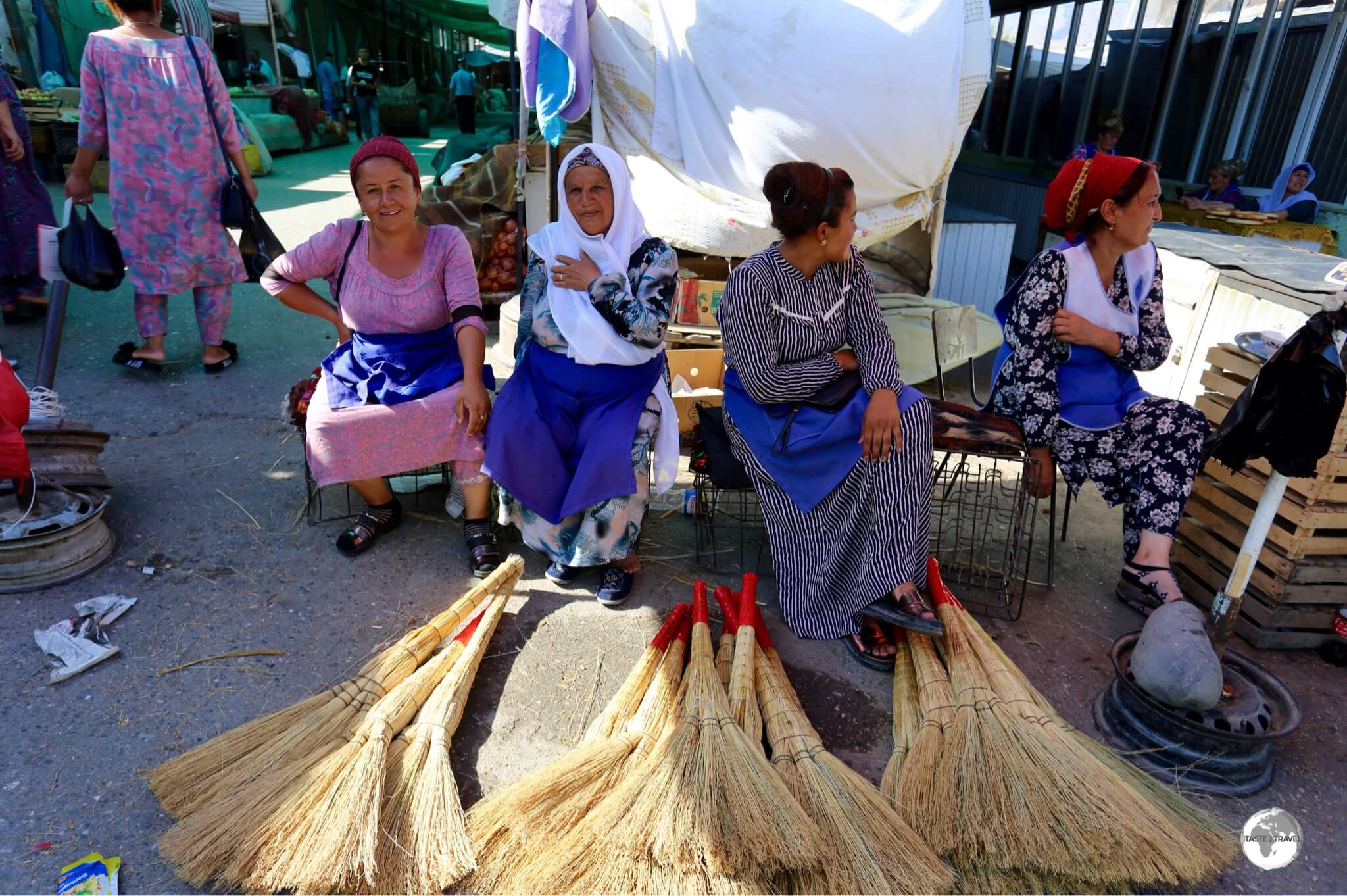
Traders in the market at Panjakent.
The mausoleum of the Tajik national hero, the poet Rudaki, is located a short distance out of town. Rudaki, who is known as the father of Persian poetry, was born in 859 AD but has become more significant in post-Soviet Tajikistan, where symbolic, historical figures have been invoked as cultural touchstones for modern Tajiks.
Sights worth visiting in town include a bustling bazaar and a mosque, which are opposite each other. If you’re arriving in Tajikistan from Uzbekistan, Panjakent will be your first Tajikistan town. It’s a pleasant introduction to Tajikistan.
Accommodation

A ‘Do Not Disturb’ sign in Dushanbe.
Within most towns and cities of Tajikistan, you’ll have no problem finding a range of accommodation options. However, if you’re travelling off the beaten track (i.e. along the Pamir highway or Wahkan valley) you’ll mostly be limited to very basic family home-stays.
No matter how small the settlement in Tajikistan, there’s always somewhere to stay – you only need to ask.
Dushanbe
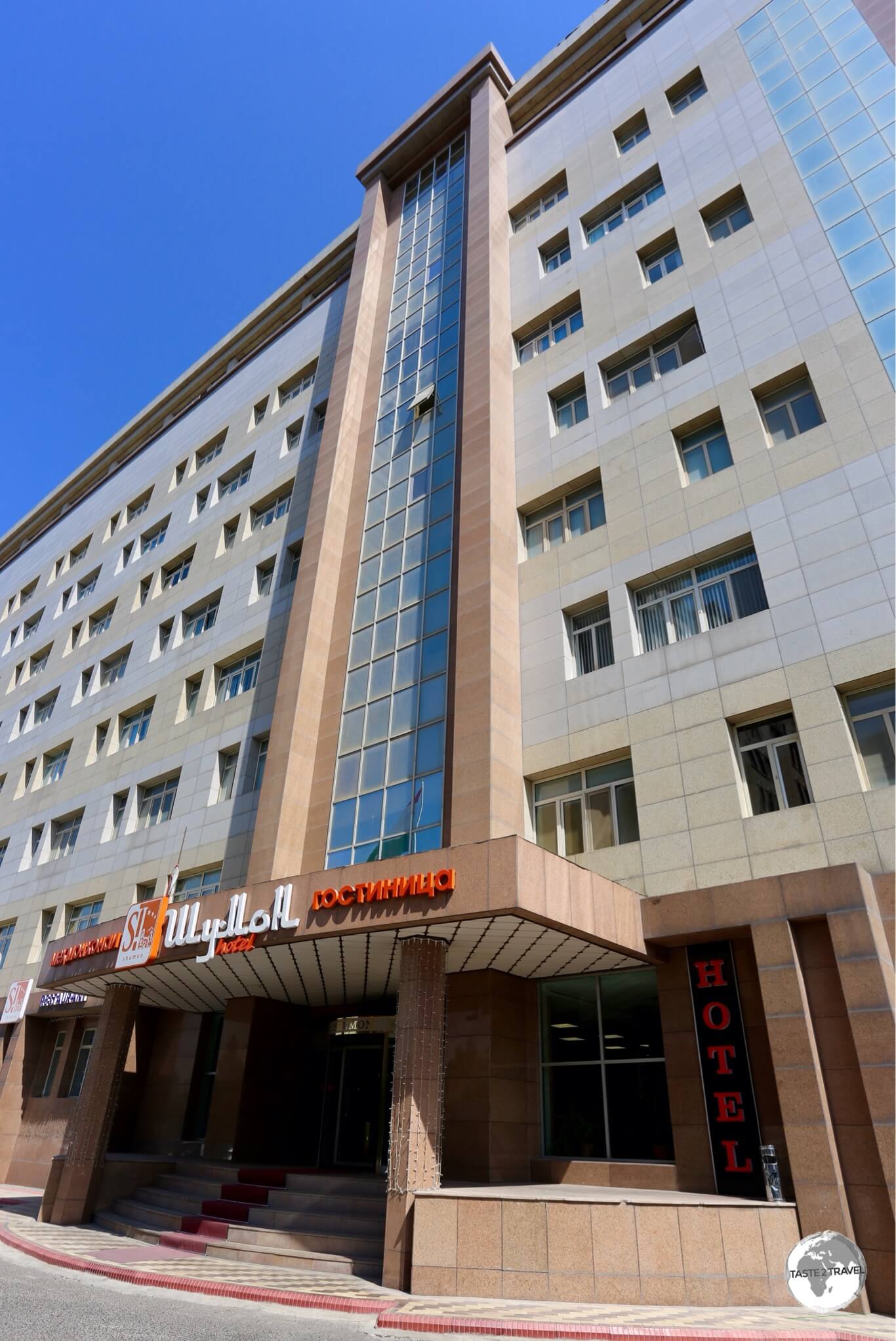
The Shumon hotel in Dushanbe is conveniently located downtown.
While in Dushanbe, I stayed at the wonderful Hotel Shumon where a standard room cost me 548 TJS (US$58) per night. Included in the room rate was an excellent breakfast in the downstairs restaurant “Shumon”, which is owned by a lady from Georgia, and which specialises in amazing Georgian cuisine.
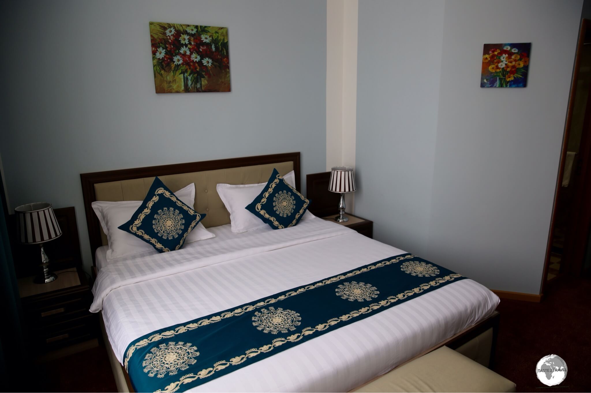
My very comfortable room at the Shumon Hotel in Dushanbe.
From the Hotel Shumon, everything of interest in Dushanbe is within a short walk, as is the best cafe in town – the Cafe Segafredo.
Panjakent

My spacious room at the Hotel Rudaki in Panjakent.
A relative new option in Panjakent is the (very good) Hotel Rudaki, which is named after the local hero, and father of Persian poetry, who is buried in the town.
The hotel is owned by a wonderful family who are very accommodating and welcoming. The rooms are spacious, spotlessly clean and offer views onto the surrounding countryside. The only English speaker is the teenage daughter who does a tremendous job of managing the expectations of the various international guests.
Breakfast, which is included in the very reasonable rate of 150 TJS (USD$16), is very good. Across the road is an excellent cafe which offers amazing Shashlik, salad and beer for dinner. Highly recommended!
Kalai-Khumb

The Karon Palace hotel, a true ‘accommodation oasis’ in a region full of basic home-stays.
Wow! What a surprise!
Situated on the sleepy main street of tiny Kalai-Khumb is the new, and very shiny, Hotel Karon Palace. This is definitely the most luxurious accommodation option anywhere in Eastern Tajikistan and a welcome sight, after a week spent in basic home-stays along the Pamir highway.

My opulent room at the Karon Palace in Kulai Khumb.
While not cheap (you can bargain down to USD$100 per night), the spacious and opulently furnished rooms at the Karon Palace feel more like “5-star Dubai” rather than “small town Tajikistan”.

My living room at the Karon Palace – a million miles from the ruggedness of the Pamir highway.
Outside the doors of the hotel (maybe the only automatic doors in the whole of the Pamir region) is the sleepy village of Kalai-Khumb. Why such a decadent hotel exists in a small, provisional town is a mystery, but after a week of enduring travel along the Pamir highway, I was very happy to soak up some luxury. No credit cards accepted!
Khorog

My cosy room at the Grand Hotel in Khorog.
If you’re travelling from Osh to Dushanbe along the Pamir highway, the regional capital of Khorog is the first major Tajik town you’ll arrive at. A charming, leafy, green town, Khorog is full of friendly Pamiri folk, and offers a good selection of accommodation – and the first opportunity to connect to free Wi-Fi.
While in town, I stayed at the excellent Grand Hotel which offers comfortable, modern rooms, free WiFi and a wonderful breakfast. The hotel is located in the heart of the downtown area and has a handy supermarket on the ground floor. If you pay directly, rooms cost USD$40 per night. No credit cards accepted!
Murgab

The Pamir hotel overlooks the remote town of Murgab.
What to say of the Pamir Hotel? Perched on a hill, overlooking the very remote, regional centre of Murgab, this ageing lady is an old Soviet-era relic which is in need of a complete renovation. If it was located in Dushanbe, or anywhere else where there was a healthy amount of competition, the Pamir hotel would receive few guests.
However, the Pamir hotel is the best hotel for hundreds of miles around! In fact, it is the only hotel for hundreds of miles around! For this reason, it’s always busy and bookings are essential.

The view over Murgab, from my room at the Pamir hotel.
The whole place is a like an over-sized home-stay, except you have your own private room. Shared bathrooms are located at the end of the long hallway, warm showers are offered during certain hours in the evenings, ‘home-stay’ style food is served in the downstairs restaurant – the only restaurant in town. If you’re curious to know what’s for dinner, you can view the menu here.
Rooms cost USD$25 per night, which includes a hearty breakfast!
Karakul

My driver checked us into the ‘deluxe’ digs at Homestay Aigerim on the shores of Lake Karakul.
Located at 4,000 metres (13,150 ft) above sea level, the tiny, wind-blown, settlement of Karakul lies on the spectacularly beautiful Karakul lake, 50 km south of the Kyrgyzstan border. This is the first overnight stop in Tajikistan for those travelling south along the Pamir highway.
The hardly souls who inhabit the tiny village live in remote isolation from the rest of the world, and are normally cut-off from it for half the year, when snow and ice make the Pamir highway impassable during winter.
There’s a few (very basic) home-stay options in Karakul, which is a good thing, as there’s always a constant trickle of vehicles pulling in off the highway.
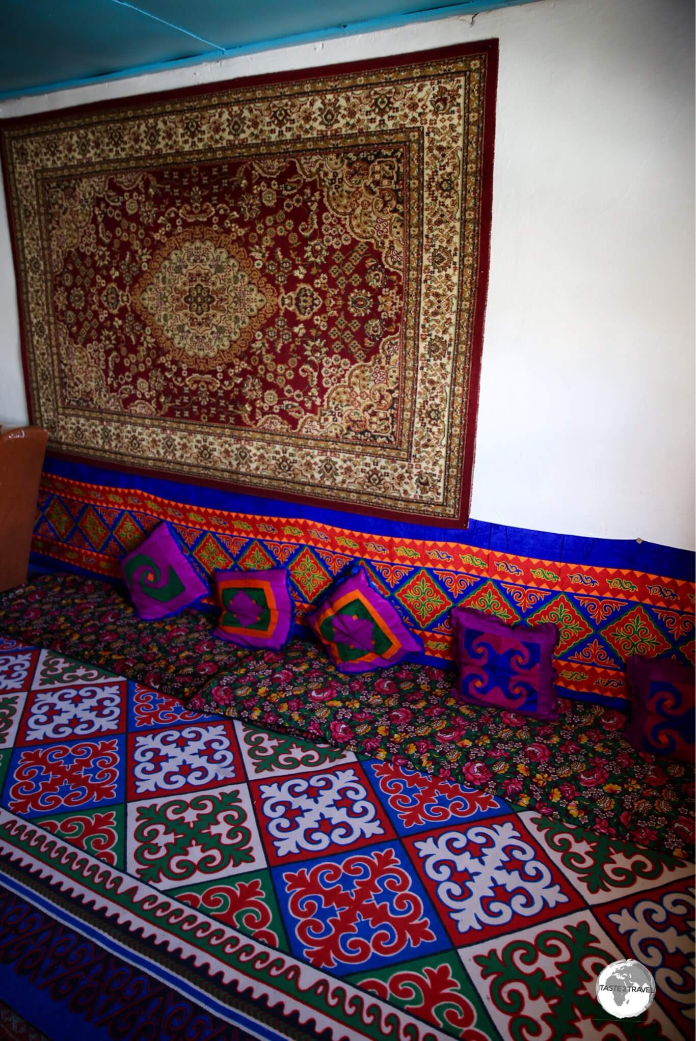
My cosy room at Homestay Aigerim where sleeping was on the floor.
My bedroom, of which I was lucky enough to have to myself, was lined with colourful carpets. Not just the floor, but also the walls!
Throughout Central Asia, carpets are hung on walls as a form of decoration, something that’s especially appreciated during the long, cold winter months when the landscape is a blanket of white snow. In the evening, I constructed a bed using a pile of thin, padded mattresses. Some home-stays offer shared rooms with single beds.

The colourful communal dining area at Homestay Aigerim.
Meals are served around a communal table (you sit on the carpeted floor) and consist of whatever is available in the kitchen.
My first meal at Homestay Aigerim was lunch, which consisted of three fried eggs and stale bread. My last meal was breakfast the following morning, which consisted of – well, three fried eggs and stale bread! All meals in Central Asia are served with pots of tea, either black or green.
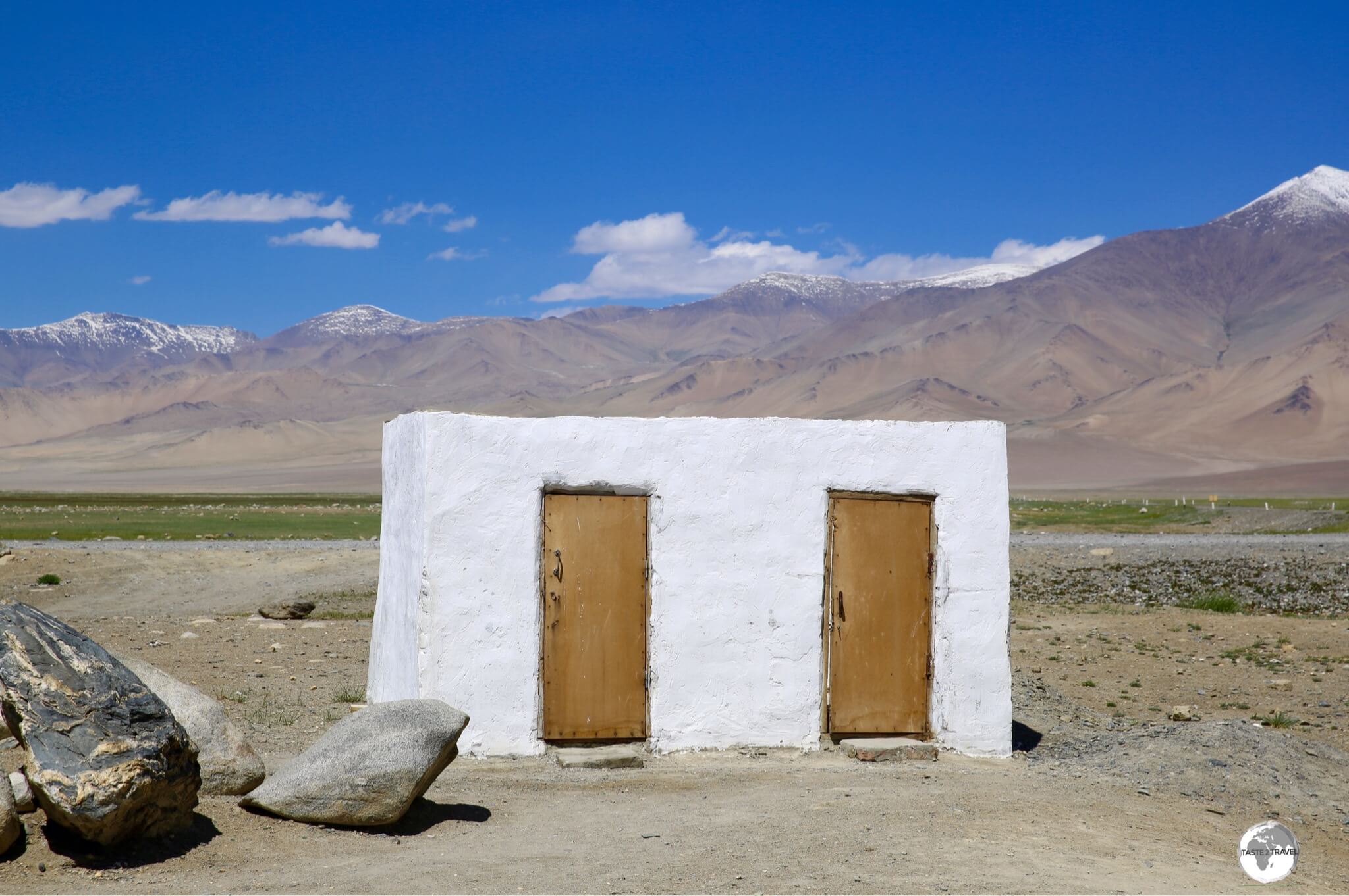
The roofless “pit” toilets at Homestay Aigerim.
As for ‘ablutions’ (I love using that word!), home-stays throughout Central Asia lack any running water! I remember staying at my first home-stay in Kazakhstan and looking for the bathroom – there wasn’t one!
Instead of a bathroom, home-stays normally offer a traditional Banya, a steam bath, which is located outside somewhere. Banya’s need to be pre-booked as they involve lighting a fire (fuelled by animal manure) to heat a large container of water. You take a shower by mixing a bucket of cold, mountain, water with some warm water. It’s all very refreshing and invigorating.
As for the toilets, they’re always smelly outhouses that you try to avoid using. Due to the smell, they’re always located some distance from the house, which is a real problem at 3 am when nature calls and you’re in a village without electricity. If you’ll be staying in home-stays, a torch app on your phone will be your best friend. The best thing about the outhouse at Homestay Aigerim was that there was no roof, which provided lots of ventilation and a great view of the stars at night!
Eating Out

A novel concept for an outdoor drinks shop – drinks are kept cool under the flow of a trickling waterfall.
As with accommodation, there are plenty of dining options in the west of Tajikistan, however, in the sparsely populated east, it’s a different story, with very basic meals provided by home-stays.
Restaurants
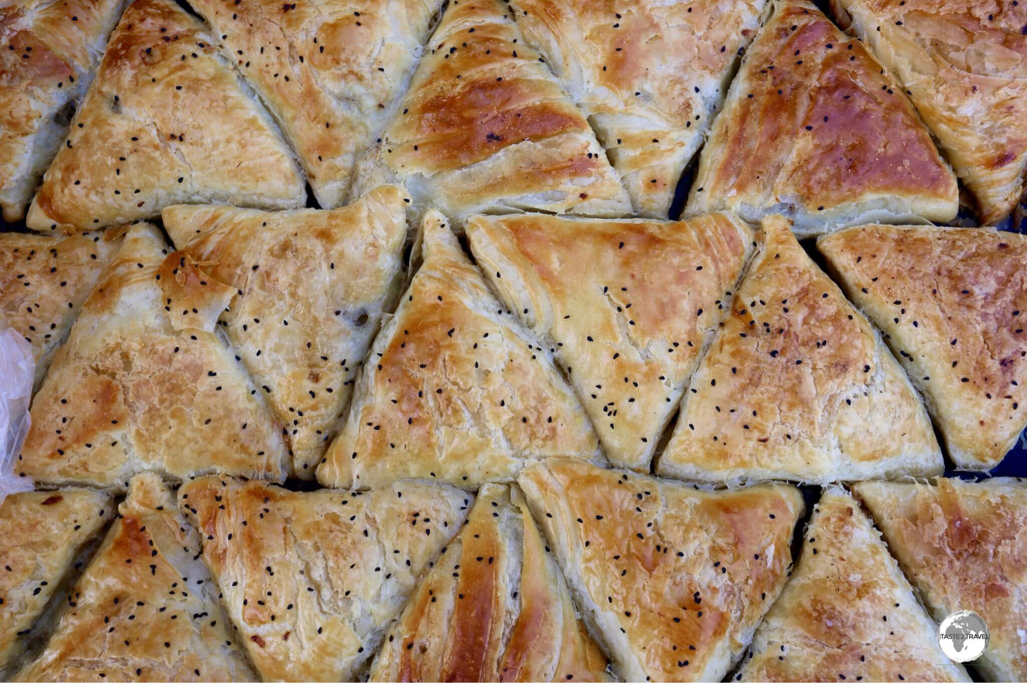
Parcels of tasty goodness – ‘Samsa’ is the most popular snack food in Central Asia and the predecessor of the Indian Samosa.
Dushanbe
Despite being the capital, Dushanbe is hardly a culinary nirvana!
I often ate at the Cafe Karat, which was located opposite my hotel – the Hotel Shumon! The cafe is a modern, clean place where you take a tray, file along, select your meal and pay. Food was always very good and the prices were so cheap. How do they do it?
If you have a hankering for Georgian (the country, not the state) cuisine, you’ll find a wonderful Georgian restaurant on the ground floor of the Hotel Shumon.
Along the main street, Rudaki Ave, are a number of restaurants which serve everything from Italian (Cafe Segafredo) to Indian (simply called ‘Indian Restaurant‘ and located opposite Segafredo) or local cuisine (Rohat Teahouse).
Panjakent
Panjakent offers several restaurants and a tea house. I ate at an excellent restaurant, which is located on the roundabout opposite Hotel Rudaki. No idea of the name and cannot find one, but the Shashlik, salad (served with a fresh soft cheese) and fresh bread were divine.
Kalai-Khumb
Cutting through the centre of Kalai-Khumb is the noisy, raging torrent, which is the Obikhumboi river. Perched above the river (underneath the only bridge in town) is the popular, and worthwhile, Oriyona restaurant which serves all your favourite Central Asian dishes like Shashlik, Plov, Manti etc.
The best place to sit is on the outdoor terrace, directly above the raging white-water of the river below, the thunderous roar from which will block out any dinner conversation.
Khorog
Two words – Delhi Barbar!
If you’ve spent months in Central Asia and wish to escape, even for a moment, from the same monotonous, cuisine which is served throughout all the countries, then Delhi Barbar is for you.
Feel yourself being transported, for a moment, out of the region and into India, where the smell of spice, and all things nice, hangs in the air. I kid you not! When I was looking for this restaurant, it was the smell of spice in the air which led the way. It really is that good!
Not only is the food sensational, but the restaurant is very popular with fellow travellers. A great meeting place on the Pamir highway!
Murgab
The only restaurant in town is on the ground floor of the Pamir Hotel. Menu items include all the typical staples which are served at home-stays throughout Central Asia, including soups, freshly-made Yak-meat dumplings (Manti), and everyone’s favourite – the ubiquitous Lagman.
Cafés

The Rohat tea-house on Rudaki avenue is said to be the largest tea-house in the world.
Rather confusingly in Central Asia, the word ‘cafe’ is used to describe a Cafeteria, rather than an establishment which serves coffee. If you wish to drink coffee, you need to ask for a ‘coffee shop‘. In Tajikistan, I found just a few good cafes. Most Tajiks live on tea.
Dushanbe
The open-air Rohat tea-house, a great place to relax over a cup of tea in Dushanbe.
If you wish to experience a traditional tea-house, you cannot get any more traditional than the Rohat tea-house, which is located on Rudaki avenue in downtown Dushanbe.
This large, airy, outdoor, pavilion was built during the Soviet era and serves tea by the pot along with local cuisine such as Shashlik.
The best coffee in Dushanbe is served at the nearby Cafe Segafredo (also on Rudaki avenue). The friendly, English-speaking staff serve delicious food and the best coffee in town in a clean, modern environment. The free Wi-Fi at the cafe is the fastest I experienced in the whole country!
Khorog
As a self-confessed caffeine addict, I have to confess – it was hard starting each day on the Pamir highway with a cup of black tea (it’s just not the same!)
I had heard on the grapevine that there was a real coffee shop in Khorog, and so, it was with some amount of excitement that I made my way to the Luni Coffee Shop.
The good news, for anyone arriving late in town, is that the cafe is open until 10 pm most evenings. The coffee is amazing and they offer freshly baked cakes. It’s a dream!
Visa Requirements

My visa for Tajikistan, with the additional permit for Gorno-Badakhshan Autonomous Region on the top page.
Almost all nationalities (except for a few neighbouring countries) require a visa to visit Tajikistan, with 121 nationalities currently able to apply for an e-visa (US$50) in advance. To check your requirements, please refer to the Visa Policy of Tajikistan.
If you’ll be visiting the Gorno-Badakhshan Autonomous Region (home to the legendary Pamir Highway), you’ll need to apply for an additional permit which costs US$20. These are checked at police checkpoints as you travel throughout the region.
Tajikistan Embassy in Bishkek
If you’re in Bishkek, or anywhere else with a Tajik embassy, it’s faster to apply directly through the embassy – plus you’ll receive a very nice visa in your passport, rather than a computer printout.
The Tajikistan Embassy in Bishkek is located in the suburbs at 36 Karadarynskaya street. It’s a long drive from the city so it’s best to take a Yandex taxi.
Getting There
Air
International flights to Tajikistan arrive at Dushanbe International Airport (IATA: DYU), which is located 5 km southeast of Dushanbe.
Scheduled Air Services
The following airlines provide scheduled services to/ from Dushanbe:
- Air Astana – flies to/from Almaty
- Avia Traffic Company – flies to/from Bishkek
- flydubai – flies to/from Dubai–International
- Iran Aseman Airlines – flies to/from Mashhad
- Kam Air – flies to/from Kabul
- S7 Airlines – flies to/from Novosibirsk
- SCAT Airlines – flies to/from Nur-Sultan
- Turkish Airlines – flies to/from Istanbul
- Ural Airlines – flies to/from Moscow–Zhukovsky, Saint Petersburg, Ufa, Volgograd, Yekaterinburg
- Utair – flies to/from Moscow–Vnukovo
- Uzbekistan Airways – flies to/from Tashkent
- Varesh Airlines – flies to/from Mashhad, Sari
Airport Transport
Downtown Dushanbe is a 10 minute taxi ride which should cost no more than 15 somani (US$1.50) in a Yandex taxi.
Bus routes #2, #8 and #12 connect the airport with the city centre in 20 minutes.
Land

Approaching the Tajikistan border, south of Sary Tash in Kyrgyzstan.
Tajikistan shares land borders with Kyrgyzstan, China, Afghanistan and Uzbekistan. The fastest and most comfortable way to travel into and out of Tajikistan is with shared taxis which run to and from most borders, although not the remote Pamir Highway border post.
Kyrgyzstan
In the north, Tajikistan shares a 984 km (611 mi) border with Kyrgyzstan. There are currently 5 crossings open, with the most easterly, located south of the Kyrgyz town of Sary-Tash lying on the Pamir Highway.
China
In the west, Tajikistan shares a 414 km (257 mi) border with China, which has a mean-looking, barbed-wire fence running its entire length. There’s just one break in the fence (at the one border crossing), which is located at Kulma Pass (4,362.7 m/ 14,313 ft), a short drive west of the town of Murgab.
Afghanistan

The turnoff to the ‘Tajikistan-Afghanistan Friendship bridge’, south of Kalai-Khumb.
In the south, Tajikistan shares a 1,357 km (843 mi) border with Afghanistan. Most of the border is defined by the raging, white-water rapids of the Panj river – a truly formidable barrier. Due to the impossibly vertical terrain, which is the Hindu Kush mountain range, there are few people living along the Afghan side of the border.
If you wish to enter Afghanistan, you’ll first need to apply for a visa, which you can obtain through the Afghan embassy in Dushanbe or the Afghan consulate in Khorog.
Note: Before leaving Tajikistan, you should ensure you have a double entry visa so you can re-enter the country as onward travel in Afghanistan is not safe.
There are several bridges which connect the two neighbours, although not all crossing points are open. The crossings which are currently open are located at the following places:
- Panji Poyon (the main crossing between Dushanbe and Kunduz)
- Darvaz (on the Pamir Highway south of Kalaikumb, the “Tajikistan-Afghanistan Friendship Bridge”)
- Khorog (on the Pamir Highway)
- Ishkashim (on the Pamir Highway, a popular crossing point for travellers who make brief trips into a ‘safe’ area of the country.)
Uzbekistan
In the west and northwest, Tajikistan shares a 1,312 km (815 mi) border with Uzbekistan. There are 8 crossing points between the two countries which are connected by rail, bus and shared taxi services.
Rail
Tajik Railways do offer a website, however it is currently in test mode.
Russian Railways train # 3293 connects Dushanbe to Moscow on a 4,272 km odyssey. This is the preferred form of transport for the army of Tajik migrant workers who flock to Russia to find better paying jobs.
Getting Around

A French couple were driving this comfortable beast along the Pamir highway. A very nice way of cruising the rough roads of Tajikistan – if you can afford the investment!
Road
Pamir Highway
None of the roads throughout the Gorno-Badakhshan Autonomous Region have been maintained since Soviet times, but the Chinese are about to change all that!
If you venture further south into the Wakhan Valley, the roads are rougher still! Almost all gravel, very narrow in places, often clinging to the sides of sheer drops which plunge into the raging waters of the mighty Panj river.
Video:
I filmed this video from my 4WD, as we drove along the Wakhan valley.
Afghanistan can be seen on the opposite bank of the river.
Currently, whatever asphalt remains is largely pot-holed and threadbare with most of the road reduced to gravel by the ravages of time.
If you’re travelling from east to west, you’ll have rough, gravel roads, most of the way until after Kulaikhum.
Average speeds along the corrugated, pot-holed roads is around 25 km/h.
Video:
Another video from the Wakhan valley, with Afghanistan on the opposite bank.
North and West Tajikistan
Travelling from the west or north, it’s a different story, thanks to the recently completed Dushanbe-Chanak highway which connects Dushanbe to Panjakent and then the Uzbekistan border.
Built by the Chinese, as part of their Belt and Road Initiative (BRI), the new highway is 380 km long, and has slashed driving times from twelve hours to only four. The road includes many tunnels, the longest of which runs under the Shakhristan Pass, with a total length of 5,253 metres – the longest tunnel in the country.
Video:
The following documentary, featuring the Dushanbe-Chanak highway, was filmed by China Global Television Network.
Public Bus
Unlike other regional capitals, Dushanbe is fairly compact and easy to cover on foot. For covering longer distances, buses, trolley-buses and mini buses whizz around town with a ticket costing just 1.20 TJS (US$0.13).
Taxi
Yandex Taxi is an online ride-sharing service which was launched in 2011 and is now present in most of Central Asia, including Dushanbe.
In 2018, Yandex and Uber merged their operations in the region. The Yandex app can be downloaded onto a smartphone and, in terms of functionality, is very similar to Uber.
Rental Car

A much needed car wash in Osh! Before and after photos of my amazing, go-anywhere, Toyota Land Cruiser, perfect for the rough Kyrgyzstan roads.
Car Rental options in Tajikistan are very limited and expensive. It can be more economical to rent a car in neighbouring Kyrgyzstan and drive it across the border.
While in Kyrgyzstan, I rented an excellent Toyota Land Cruiser through Almaz Alzhambaev of Kyrgyzstan Tours and Rent-a-Car Service in Bishkek. The Toyota featured here cost me US$80 per day.
Almaz allows one way rentals and advised that his cars can be driven across borders in Central Asia, once additional (insurance) paperwork had been completed. For this there is a small (USD$40) additional fee.
Contact details for Almaz:
- Email: tourkg@gmail.com
- Tel: +996 777 509 253
- Web: Kyrgyzstan Tours and Rent-a-Car Service
That’s the end of my Tajikistan Travel Guide.
Safe Travels!
Darren
Follow me on Instagram:

Further Reading
Other travel reports from the Central Asia region:
Additional blogs, articles and information on Tajikistan are available on the Indy Guide website.
Tajikistan Travel Guide Tajikistan Travel Guide Tajikistan Travel Guide Tajikistan Travel Guide Tajikistan Travel Guide
Tajikistan Travel Guide Tajikistan Travel Guide Tajikistan Travel Guide Tajikistan Travel Guide Tajikistan Travel Guide
Tajikistan Travel Guide Tajikistan Travel Guide Tajikistan Travel Guide Tajikistan Travel Guide Tajikistan Travel Guide
Tajikistan Travel Guide Tajikistan Travel Guide Tajikistan Travel Guide Tajikistan Travel Guide Tajikistan Travel Guide
Tajikistan Travel Guide Tajikistan Travel Guide Tajikistan Travel Guide Tajikistan Travel Guide Tajikistan Travel Guide
Tajikistan Travel Guide Tajikistan Travel Guide Tajikistan Travel Guide Tajikistan Travel Guide Tajikistan Travel Guide
Author: Darren McLean
Darren McLean is an Australian full-time digital nomad who has spent 36 years on a slow meander around the globe, visiting all seven continents and 239 UN+ countries and territories.
He founded taste2travel to pique one’s curiosity and inspire wanderlust.


