
Marshall Islands Travel Guide
Welcome to the taste2travel Marshall Islands Travel Guide!
Date Visited: January 2017
Introduction
Yokwe! Welcome to the very remote Republic of the Marshall Islands (RMI).
Located across the International date line, five and a half hours flight west of Hawaii. RMI is the first stop on the epic United Airlines Island Hopper (UA154) – a 14 hour, all stops, meander through the central Pacific from Honolulu to Guam. For more on UA154, check out my Central Pacific island hopping blog. The official currency of RMI is the US dollar.

United Airlines Island Hopper (UA154) departing from Kwajelein.
RMI has a total population of 60,000. The capital and main hub, with a population of 27,700, is Majuro. Here you’ll find the international airport, shops, restaurants, hotels and all services. The highest point on Majuro is at a giddy 3 metres – this can be reached by walking to the top of the Majuro Bridge. There is just one road on the atoll so you will not require Google maps.

A wrecked, US, WWII-era plane, off the beach of Enemanit Island.
Image Source: Huffington Post
The real attractions of RMI lie offshore on the myriad islands where you’ll find great diving, snorkeling and fishing.
Location
Majuro Atoll, RMI
Located in the middle of nowhere halfway between Hawaii and Australia and north of Kiribati, RMI is made up of two parallel island chains; the Ratak (sunrise) and the Ralik (sunset). The country consists of 29 atolls and 5 islands – the tops of ancient, submerged volcanoes. RMI is the most easterly part of Micronesia .
The largest piece of real estate in this part of the world is Kwajalein Island. ‘Kwaj’ is a restricted US Army base, built on land the US government has leased from the RMI since pre-independence days. UA154 makes a stop here but non-military personnel are not allowed to disembark. The island is home to the Ronald Reagan Ballistic Missile Defence Test Site.

The highest point on Majuro (3 metres), the Majuro Bridge connects Delap island to Long island.
Image Source: TripAdvisor
History
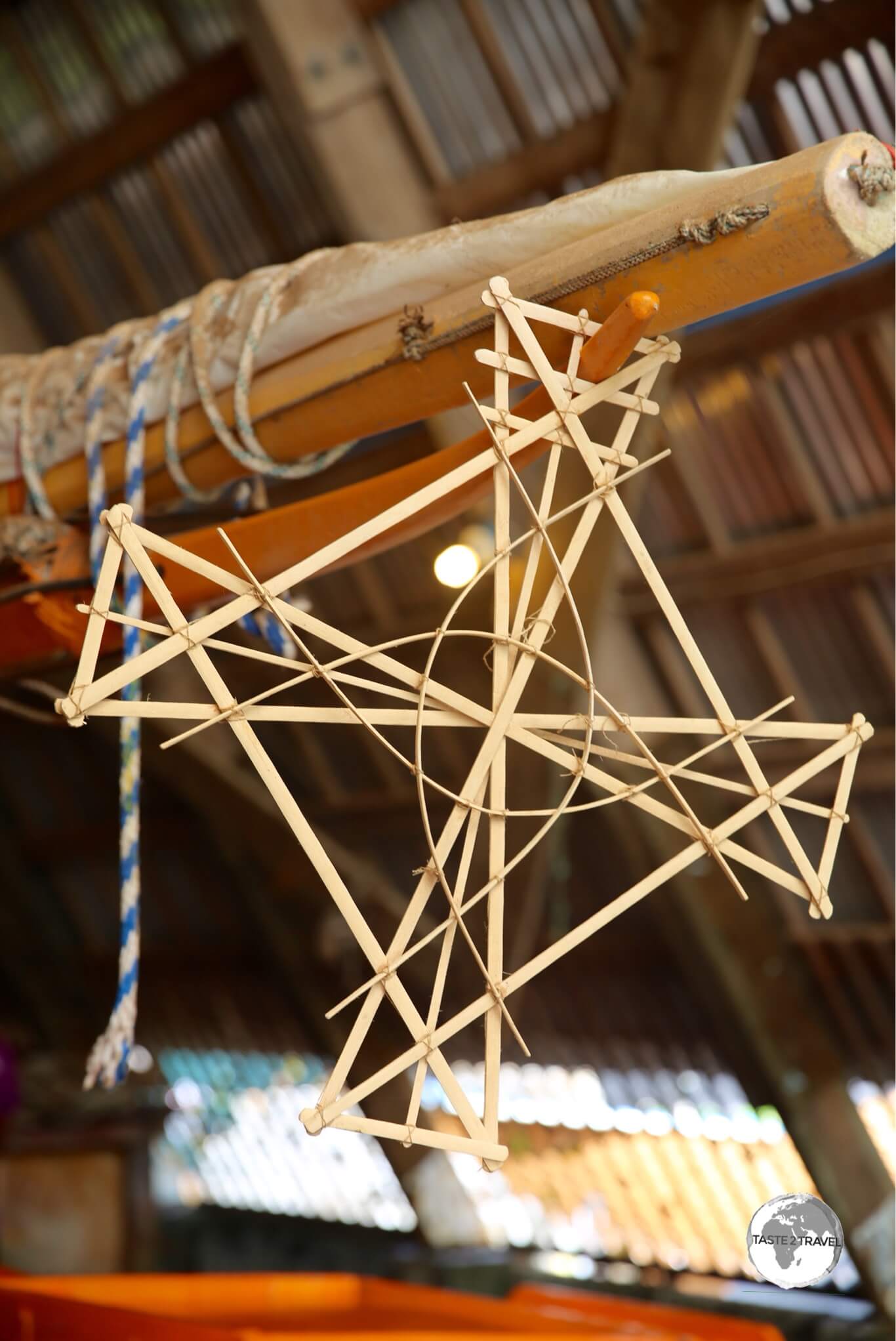
A ‘Stick chart’ in Majuro. These were used in ancient times for navigational purposes.
It is believed the RMI was originally settled around 1,500 B.C. by Micronesian’s, migrating from the west. The first Europeans to make contact with the islands were the Spanish in 1529. They were passing through on a return voyage from their colony in the Philippines to Acapulco, Mexico. The British were the next visitors – mapping the islands in 1788 under the direction of British naval captains Thomas Gilbert and John Marshall, for whom the islands are named (Kiribati to the south used to be known as the Gilbert Islands).
The islands remained largely untouched by Europeans until the Germans arrived in 1878 and set up a coaling station. They declared the islands a German protectorate. The Japanese seized the islands in 1914 and held onto them until WWII at which point they became major battle grounds until US forces prevailed and liberated the islands.

View of Majuro from my Nauru Airlines flight to Kiribati.
In 1947, all former Pacific islands occupied by Japan were grouped together to form the Trust Territory of the Pacific Islands – administered by the United States. The Trust Territory included Palau, Guam, The Northern Mariana islands, Federated States of Micronesia and the Marshall Islands.
In 1978 the Marshallese voted to leave the trust territory, declaring independence in 1979 with Amata Kabua being elected as its first president.
For a more comprehensive overview of the history of RMI, you can refer to Wikipedia.
Bikini Atoll
From atomic bombs….

Atomic bomb test at Bikini atoll.
Image Source: Wikipedia.
Following WWII, US President, Harry S. Truman, issued a directive to US army and navy officials that testing of nuclear weapons would be necessary to determine the effect of atomic bombs on US warships. Due to its remote location, well removed from international flight paths and shipping lanes, Bikini Atoll had the misfortune of being selected as the site for such tests. The only problem were the 167 local residents.
On a quiet Sunday in 1946, the then US governor to the Marshall Islands, visited Bikini and, after the local church service had finished, asked the islanders if they would be willing to vacate the island temporarily. They have never been able to return home.
Once the island had been vacated, the US military relocated 242 warships, 156 aircraft and 25,000 radiation recording devices to Bikini ready for testing. Between 1946 and 1958, 23 nuclear devices were detonated at Bikini, some underwater, some on land and others in the air. The largest detonation was from ‘Castle Bravo‘, which resulted in a staggering 15 megaton yield (a megaton is equivalent to one million tons of TNT). The bomb was 1,000 times more powerful than the bombs dropped on Hiroshima or Nagasaki. In total, the 23 tests yielded a combined 42.2 megatons of explosive power. The tests completely destroyed and contaminated this once pristine tropical paradise, rendering it unfit for habitation.
In the meantime the islanders, who had been transported on a US Navy boat 200-km to Rongerik atoll, were struggling to survive as the island offered no arable land for farming nor a reliable water supply. They were eventually relocated to another atoll, but not before some had died from starvation. Today you can visit the Bikini atoll town hall on Majuro.
…to skimpy swimsuits!

The Bikini gets its name from Bikini atoll.
Image Source: Vogue Magazine
Meanwhile, in 1946, a Parisian engineer by the name of Louis Reard, had just created a skimpy two-piece swimsuit and was looking for a catchy name. In the headlines at the time was news of the nuclear testing at Bikini atoll. The rest is history.
Flag

Marshall Islands Flag
Designed by Emlain Kabua, who served as the first First Lady of the Marshall Islands, the flag of the Marshall Islands consists of a blue field with two diagonal stripes of orange and white radiating from the lower hoist-side corner to the upper fly-side corner and the large white star with four large rays and twenty small rays on the upper hoist-side corner above the stripes.
Like other flags of the Pacific, the blue field represents the Pacific ocean. The rising diagonal band represents the equator, the star above representing this Northern Hemisphere archipelago.
The white and orange portions of the band represent, respectively, the Ratak Chain (“sunrise”) and the Ralik Chain (“sunset”). The star’s 24 points represent the number of electoral districts, while the four elongated points represent the principal cultural centres of Majuro, Jaluit, Wotje and Ebeye.
Currency

The US Dollar.
As with other Pacific nations, which were once part of the United States-administered Trust Territory of the Pacific Islands, the official currency of the Marshall Islands is the US dollar.
Sightseeing
Majuro

Traditional Boat Building workshop in Majuro.
Majuro is a quiet, relaxing place. Apart from one tiny museum, there are no sights to visit, but the experience here is to soak up the ambience of the atoll and plan trips to the nearby islands. I rented a scooter, which allowed me to explore the entire atoll.
It’s a long drive to the last village of Laura (named by US GIs in honour of Lauren Bacall). On the way, you will pass through the equally sleepy village of Rita – (also named by US GIs after Rita Hayworth). You will also pass a Copra processing plant which you can visit (weekdays only).
Adjacent to the Marshall Islands Resort is a traditional boat building workshop. Early Micronesian’s were skilled boat builders and navigators who made long canoe journeys among the atolls. Navigation was made by way of ‘stick charts’. At the workshop, you can observe the art of traditional boat building and have someone explain how to use a stick chart. Who needs Google maps?
If you wish to rent snorkeling gear or arrange diving, there is a dive shop at the Marshall Islands Resort, operated by a Japanese dive master.
Around Majuro

A relaxing Sunday at Enemanit Island, which is located a short boat ride from Majuro.
There are various offshore islands you can visit from Majuro. Arno island can be reached using the ferry from Robert Reimers Hotel (see the ‘Getting Around‘ section below). There is one basic guest house on Arno.
A highlight of my visit to Majuro was a Sunday trip to nearby Enemanit island. The island was once used as an R&R base for US soldiers and it’s said Bob Hope once performed on stage here. The remains of the stage are still visible. Today, Enemanit is a private island owned by Jerry Kramer, a local businessman – originally from the US – who, over the last decades, has built up a collection of successful businesses, which now span the Pacific. Despite his success and the fact that he owns his own tropical island, Jerry is very unpretentious and grounded and is a great personality.
Spending a day with Jerry, his family and friends was a memorable experience. I was treated to a BBQ lunch, lots of beers and great conversation on the beautiful sandy beach. Jerry runs a boat every Sunday morning from the dock of his shipping company (PII) to the island. Friends and visitors are welcome to join him. If you are interested you should inquire at the office of Pacific International Inc (PII) on the northern side of the Majuro bridge.

A pristine beach on Enemanit Island.
A highlight of a visit to Enemanit Island is the opportunity to snorkel above the remains of a wrecked passenger plane, which lies in shallow waters 100 metres off the beach. A few metres in front of the plane is a wrecked helicopter – all great stuff. Ensure you bring your own gear.
Accommodation

The view of Majuro lagoon from my room at the Marshall Island’s Resort.
Marshall Islands Resort
There are few hotels on Majuro – the largest, with 80% of beds on the island – is the Marshall Islands Resort (MIR).
Being the biggest fish in a very small pond, most tourists (including myself) end up staying here.
Formerly an outrigger resort, the hotel has seen better days. The rooms are old and tired, the pool is permanently closed due to problems with the filtering system, service is very lax, staff are less than enthusiastic and not very helpful.
The hotel restaurant is the largest on Majuro and hence is THE place for celebrations/ functions.
Food and service is hit and miss.
Anywhere else this hotel would not be so busy but there are few other choices on tiny Majuro.
Hotel Robert Reimers
One other choice is the much smaller Hotel Robert Reimers.
Thatched cabins cost from US$135, while rooms inside the hotel building cost US$104.
The staff here are much friendlier and more helpful than MRI.
This was my ‘go-to’ place whenever I needed information.
The hotel is conveniently located downtown and includes the best restaurant/ bar on Majuro – Tide Table (see ‘Eating Out‘ below for more).
Reimers also offer excursions to Eneko Island with a return boat trip costing US$30. The hotel also offers basic accommodation on the island in the form of basic cabins which cost US$40 and plusher cabins for $150.
You can book either of these hotels using Booking.com
Eating Out

Weekly farmer’s market in Majuro.
The best bar and restaurant on Majuro is Tide Table, part of the Robert Reimers Hotel complex. With an array of flat screen TV’s on the walls, it has the feel of an American sports bar. The menu could also be best described as Sports Bar cuisine. Open for breakfast, lunch and dinner, the burgers and pizzas are especially good. Happy hour is very popular and a great way to meet local expats.
The offerings at the Marshall Islands Resort restaurant are OK. This is the biggest restaurant on Majuro so you’ll probably end up here at some stage.
There is a weekly farmer’s market held every Saturday morning in downtown Majuro. On offer here, is fresh local produce grown on farms at the northern end of the atoll near the town of Laura.
Visa Requirements

Marshall Islands Passport stamps.
Some nationalities require visas for the Marshall Islands – check your visa requirements prior to arrival.
Getting There

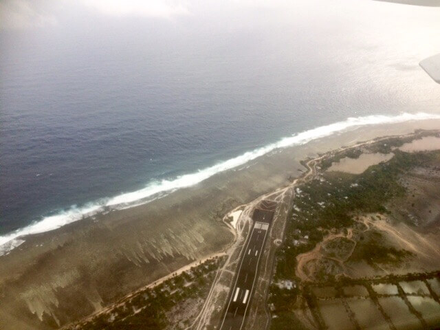
Sleepy Majuro Airport, gateway to the Marshall Islands.
By Air

Arrival at Majuro airport.
All flights to Majuro arrive at Amata Kabua International Airport. For more details on the airport, refer to my Central Pacific island hopping guide.
Departing from Majuro.
The following airlines provide connections to/from Majuro:
- Air Marshall Islands: Domestic services to outer islands.
- Nauru Airlines: International services to Nauru, Tarawa.
- United Airlines: International services to Chuuk, Guam, Honolulu, Kosrae, Kwajalein, Pohnpei.

Departing from Majuro Airport.
Getting Around
Bus
There are no public buses on the island. Hotels operate minibus shuttles to/ from the airport.
Taxi
Shared taxis are the sole form of public transport on Majuro. They run shuttle services along the one main road between the airport and downtown. You never have to wait too long and they’ll go out of their way to drop you off at your front door. Fares are 0.50c for anywhere downtown or $4 for the 20 minute trip to the airport.
Ferry
Ferries to nearby islands, including Arno Island, operate from the dock at Robert Reimer’s. Best to ask the hotel reception staff for the current schedule.
Car

A Marshall Islands license plate.
Hotels and various other companies offer hire cars on Majuro. I hired a scooter at $25 per day from MJCC (Marshall Japan Construction Company) in downtown Majuro.

The best way to explore Majuro is with a rental scooter.
That’s the end of my Marshall Islands Travel Guide.
Safe Travels!
Darren
Follow me on Instagram:

Further Reading
Other travel reports from the Pacific region:
Marshall Islands Travel Guide Marshall Islands Travel Guide Marshall Islands Travel Guide Marshall Islands Travel Guide Marshall Islands Travel Guide Marshall Islands Travel Guide
Author: Darren McLean
Darren McLean is an Australian full-time digital nomad who has spent 36 years on a slow meander around the globe, visiting all seven continents and 239 UN+ countries and territories.
He founded taste2travel to pique one’s curiosity and inspire wanderlust.


Excellent!!!???
Thanks for the complete guide to visiting the Marshall Islands! Now I know a lot more about this place!
Hey Tori,
Thanks for your feedback, I’m pleased you found the report to be useful.
Are you planning to visit the Marshall Islands?
Safe travels!
Darren