Test your knowledge with this quiz from taste2travel!
How well will you score? Your result will be displayed at the bottom of the quiz – will you get to see the legendary Marco Polo?
Good luck!
01. Which was the busiest airport in the world by passenger volume in 2023?
Correct!Wrong!
Since 1998, Hartsfield-Jackson has been the world's busiest airport by passenger traffic.
In 2023, the airport served over 104.6 million passengers, the most of any airport in the world.
02. The iconic 'Rain Vortex' (the world's largest indoor waterfall) is an attraction at which airport?
Correct!Wrong!
Jewel Changi Airport (also known as Jewel or Jewel Changi) is a nature-themed entertainment and retail complex surrounded by and linked to one of the passenger terminals of Changi Airport, Singapore.
Its centrepiece is the world's tallest indoor waterfall, the 40-metre high "Rain Vortex", that is surrounded by a terraced forest setting.
03. Which airport was named 'Best Airport in the World' in 2024 by Skytrax?
Correct!Wrong!
Hamad International Airport has been named the World's Best Airport three times (2021, 2022 and 2024), praised by the Skytrax Awards as the most architecturally significant terminal complex in the world, as well as being the most luxurious.
04. In which country would you be if you had just landed at Socotra International Airport?
Correct!Wrong!
Socotra is an island of Yemen, located in the Indian Ocean.
05. The busiest airport in Paris is named after whom?
Correct!Wrong!
06. The airport of which country has the three-letter code of 'FUN'.
Correct!Wrong!
Funafuti International Airport (FUN) is an airport in Funafuti, in the capital city of the island nation of Tuvalu. It is the sole international airport in Tuvalu. Fiji Airways operates between Suva and Funafuti.
07. Which airport is located in New York City?
Correct!Wrong!
LaGuardia Airport (LGA) is the third-busiest airport in the New York metropolitan area behind Kennedy and Newark airports.
08. How many airlines provide scheduled services to Niue International Airport?
Correct!Wrong!
Air New Zealand is the only airline operating flights to Niue, from Auckland.
09. The world’s longest nonstop flight by distance, as of May 2024, goes between Newark International Airport in New York and which destination?
Correct!Wrong!
Singapore Airlines flight SQ21 travels non-stop for 18:18 hours, covering a distance of 17,162 km (10,644 mi).
10. Serving the Caribbean island of Saba, Juancho E. Yrausquin Airport is widely acknowledged as having the shortest commercial runway in the world. What is its length?
Correct!Wrong!
Not for the feint-hearted, the extremely short runway at Saba airport is flanked on one side by high hills, with cliffs that drop into the sea at both ends of the runway. Due to its exposed coastal location, the airport is constantly buffeted by strong winds.
11. Which airport is widely considered one of the most technically difficult plane landings in the world, with just 50 pilots qualified to land there?
Correct!Wrong!
Bhutan's Paro International Airport is one of the most geographically complicated airports in the world. Located in a valley between 18,000-foot peaks and dense forest trees, only 50 pilots have been specially trained to fly in and out, and flights are only allowed during daytime hours.
12. Which airport has the distinction of being the world's southernmost airport with scheduled public flights?
Correct!Wrong!
Ushuaia International Airport (54°50′36″S / 68°17′40″W) is the world's southernmost commercial airport.
13. Which airport has the distinction of being the world's northernmost airport with scheduled public flights?
Correct!Wrong!
Svalbard Airport (78°14′46″N / 015°27′56″E) is the northernmost commercial airport in the world, located approximately 643 km (400 miles) south of the North Pole.
14. Where would you be landing if you were on final approach to Vágar Airport?
Correct!Wrong!
15. Which airport serves as the hub for Gulf Air?
Correct!Wrong!
16. Which Caribbean island sees planes flying extremely low over Maho Beach, on their final approach to Princess Juliana International Airport.
Correct!Wrong!
17. Which famous architect designed Kuwait International Airport's Terminal 2 (due to open in 2026)?
Correct!Wrong!
18. Constructed at a cost of US$2.3 billion, the white-marble terminal at which airport is built in the shape of a falcon in flight?
Correct!Wrong!
19. Kangerlussuaq International Airport serves as the main gateway to which destination?
Correct!Wrong!
20. Where would you be arriving if you were on final approach to Dzaoudzi–Pamandzi International Airport?
Correct!Wrong!
Dzaoudzi–Pamandzi International Airport is an airport located in Pamandzi, Mayotte, France on the southern tip of the island of Petite-Terre (or Pamanzi), east of Grande-Terre, the main island of Mayotte.
Travel Quiz 78: World Airports Quiz
Sorry! You scored less than 50%. Why not try one of the many other taste2travel trivia quizzes?
You scored almost 75%! Why not try one of the many other taste2travel trivia quizzes?
Very Good - a gold star performance! Please feel free to blitz my many other quizzes on taste2travel!
Excellent result! You're a modern day Marco Polo! Please feel free to blitz my many other quizzes on taste2travel!
Other travel-related quizzes are also available on BuzzFeed.
Travel Quizzes on taste2travel
Welcome to taste2travel!
My name is Darren McLean, I’m the owner of this website and I love travel trivia and I certainly enjoy creating travel quizzes.
As of today (August 2024), there are 76 different quizzes on taste2travel.
This number will continue to grow so don’t forget to check back periodically.
Each quiz on taste2travel contains 20 questions, which means there is a total of 1,520 travel trivia questions waiting to challenge you.
In fact, taste2travel has enough trivia questions to keep a pub trivia night going for many weeks.
You’ll find a range of quizzes covering such topics as:
Airports
Currencies
Flags
Capital Cities
UNESCO World Heritage Sites
World Museums
Map Quizzes
Continent-specific Quizzes
World Islands
Landlocked Countries and much more!
If you have an idea for a topic which I could add to my quiz stable, please do not hesitate to contact me via the Contactpage. I’m always looking for new ideas.
Don’t forget to share these quizzes with your family, friends and community using the social media buttons at the top of the quiz.
Apart from excellent travel quizzes, you’ll also find other outstanding content on taste2travel – such as travel guides, photo galleries and feature articles which provide tips on booking cheap flights and much more.
Other travel-related quizzes are also available on BuzzFeed.
Travel Quizzes on taste2travel
Welcome to taste2travel!
My name is Darren McLean, I’m the owner of this website and I love travel trivia and I certainly enjoy creating travel quizzes.
As of today (August 2024), there are 76 different quizzes on taste2travel.
This number will continue to grow so don’t forget to check back periodically.
Each quiz on taste2travel contains 20 questions, which means there is a total of 1,520 travel trivia questions waiting to challenge you.
In fact, taste2travel has enough trivia questions to keep a pub trivia night going for many weeks.
You’ll find a range of quizzes covering such topics as:
Currencies
Flags
Capital Cities
UNESCO World Heritage Sites
World Museums
Map Quizzes
Continent-specific Quizzes
World Islands
Landlocked Countries and much more!
If you have an idea for a topic which I could add to my quiz stable, please do not hesitate to contact me via the Contactpage. I’m always looking for new ideas.
Don’t forget to share these quizzes with your family, friends and community using the social media buttons at the top of the quiz.
Apart from excellent travel quizzes, you’ll also find other outstanding content on taste2travel – such as travel guides, photo galleries and feature articles which provide tips on booking cheap flights and much more.
All images are copyright! If you wish to purchase any images for commercial use, please contact me via the Contactpage.
About taste2travel!
Hi! My name is Darren McLean, the owner of taste2travel.
I’ve been travelling the world for 36 years and, 239/251 countries and territories (189/193 UN countries), and seven continents later, I’m still on the road.
Taste2travel offers travel information for destinations around the world, specialising in those that are remote and seldom visited. I hope you enjoy my content!
Ever since I was a child, I have been obsessed with the idea of travel. I started planning my first overseas trip at the age of 19 and departed Australia soon after my 20th birthday. Many years later, I’m still on the road.
In 2016, I decided to document and share my journeys and photography with a wider audience and so, taste2travel.com was born.
My aim is to create useful, usable travel guides/ reports on destinations I have visited. My reports are very comprehensive and detailed as I believe more information is better than less. They are best suited to those planning a journey to a particular destination.
Many of the destinations featured on my website are far off the regular beaten tourist trail. Often, these countries are hidden gems which remain undiscovered, mostly because they are remote and difficult to reach. I enjoy exploring and showcasing these ‘off-the-radar’ destinations, which will, hopefully, inspire others to plan their own adventure to a far-flung corner of the planet.
I’m also a fan of travel trivia and if you are too, you’ll find plenty of travel quizzes on the site.
Photography has always been a passion and all the photos appearing in these galleries were taken by me.
If you have any questions or queries, please contact me via the contact page.
This is a São Tomé and Principe Travel Guide from taste2travel.com
Date Visited: April 2024
Introduction
A quiet, ideal paradise, the Central African island nation of São Tomé and Príncipe has been blessed with a relatively peaceful independence, thus avoiding the stigma of tension and a bloodstained past worn by most countries of mainland Africa.
A young girl, relaxing on Principe Island.
As a destination, this former-Portuguese colony is a relaxed, calm, safe and pleasant travel destination and much more affordable than its Central African neighbours.
A view of the east coast of São Tomé Island.
The country consists of two main islands, the larger São Tomé (854 km2 / 330 sq mi), and the much smaller Príncipe (142 km2/ 55 sq mi), as well as several smaller islets.
A panoramic view of Principe Island from the Terreiro Velho Plantation, home to some of the world’s finest cacao beans.
Both islands are heavily eroded volcanoes which are covered in verdant, undisturbed, rainforest, whose green canopy is pierced by ancient volcanic plugs.
The isolated Praia Grande provides one of the most stunning views of Pico Cão Grande.
The volcanic origin of the islands grants them a magnificent look and makes them perfect for exploration.
Downtown São Tomé features many fine examples of Portuguese colonial-era architecture.
São Tomé, which translates in English as “Saint Thomas”, was named by the Portuguese in honor of Saint Thomas, as they discovered the island on his feast day, while Príncipe Island (Prince’s island) was named in honor of Afonso, Prince of Portugal, the favourite son of the then King of Portugal.
The islands were occupied by the Portuguese from their discovery in 1470 until 1975, when independence was granted by Portugal.
Artwork in the museum at Roça Monte Café shows coffee plantation workers collecting beans.
Once uninhabited, over the centuries, the Portuguese imported a workforce of slave labour, from other Portuguese-speaking African colonies, to work on the many plantations on both São Tomé and Príncipe.
After 505 years of Portuguese occupation, which was marked by a building frenzy that resulted in more than 100 sprawling plantations (“Roças” in Portuguese) being built, São Tomé and Príncipe have been left an abundance of charming, colonial-era relics for tourists to explore.
Laundry, laid out to dry on the 1st floor balcony of the abandoned Roça de Água Izé Hospital.
One of the highlights of a trip to São Tomé and Príncipe is being able to visit the many abandoned roças, many of which were closed down after independence in 1975 and remain frozen in time.
The once-productive roças of São Tomé and Príncipe supplied Europe with most of its cacao and much of its coffee.
Street art in Santo Antonio, Principe Island.
Unlike in other countries, the treasure trove of architectural gems, which were left by the Portuguese when they hurriedly departed the islands’ shores in the 1970s, remain largely untouched.
São Tomé and Príncipe is a charming and engaging travel destination offering pristine nature, friendly inhabitants and a fascinating history.
A painting, by a local Principe artist.
Highly recommended!
Location
São Tomé and Príncipe is a small island nation located in the Gulf of Guinea, off the western equatorial coast of Central Africa.
The islands lie 300 km (186 mi) due east of Libreville, the capital of Gabon, and 443 km (275 mi) south-west of Malabo, the capital of Equatorial Guinea (click to view my Travel Guide).
Located close to the true centre of the world (GPS coordinates: 0° 20′ 11.5″ North / 6° 43′ 38.4″ East), São Tomé is located slightly north of the equator, while Principe is located 140 kilometres (87 miles) northeast of São Tomé.
São Tomé (St. Thomas), the capital, and largest city, of São Tomé and Príncipe is located on the Atlantic Ocean.
The islands are surrounded by the Atlantic Ocean. The coastline features sandy beaches, lush rainforests, and volcanic mountain ranges.
Due to its equatorial location, São Tomé and Príncipe has a tropical climate with high humidity.
The islands experience two main seasons: a dry season from June to September and a wet season from October to May.
People
A young boy on São Tomé Island.
Did you know?
São Tomé and Príncipe is the second-smallest and second-least populous African sovereign state after Seychelles.
The islands were uninhabited until their discovery in 1470 by Portuguese explorers João de Santarém and Pedro Escobar.
Relaxing in the main square of Santo Antonio, Principe Island.
Gradually colonised by the Portuguese, and settled throughout the 16th century, they collectively served as a vital commercial and trade centre for the Atlantic slave trade.
Colourful artwork by a São Tomé artist.
The rich volcanic soil and proximity to the equator made São Tomé and Príncipe ideal for sugar cultivation, followed later by cash crops such as coffee and cocoa; the lucrative plantation economy was heavily dependent upon enslaved Africans.
The population consists mainly of Forros (from forro, Portuguese for “free man”), descendants of immigrant Europeans and enslaved Africans who were imported to work on the many plantations.
The Santomean today are largely descendants of former African slaves, which were bought to the islands from other lusophone (Portuguese- speaking) countries throughout Africa, notably Angola, Mozambique and Cape Verde.
Young girls, relaxing on Principe Island.
The largest city, with a population of 72,000, is the capital – São Tomé – which is located on the northeastern coast of São Tomé Island.
Portuguese colonial-era architecture in downtown São Tomé.
Having been a Portuguese colony from 1470 CE until 1975 CE, the people of São Tomé and Príncipe are a blend of African and Portuguese.
No shortage of smiles from the friendly locals on São Tomé and Príncipe.
Culturally, São Tomé and Príncipe is a blend of African and Portuguese heritage.
You’ll find elements of traditional African music, dance, and art mixed with Portuguese language and Catholic religion.
No shortage of warm smiles from the friendly inhabitants of São Tomé and Príncipe.
The official language of São Tomé and Príncipe is Portuguese, due to its colonial history. However, many people also speak Forro, a Portuguese-based creole language that developed on the islands.
Almost no other languages are spoken, however French is spoken by the small community of Gabonese who have settled in the country for economic reasons.
The majority of the population is Roman Catholic, a legacy of Portuguese colonisation. However, there are also small Protestant and indigenous religious communities.
The people of São Tomé and Príncipe often lead a laid-back, island lifestyle.
Fishing is a significant part of the economy and culture, so you’ll see many locals involved in fishing activities.
Crime rates are very low, making São Tomé and Príncipe one of the safest countries in Africa to visit.
The people of São Tomé and Príncipe are known for their warm hospitality and friendliness toward visitors. It’s not uncommon for locals to strike up conversations with tourists and share their love for their islands.
Overall, the people of São Tomé and Príncipe offer a warm welcome to visitors, and their culture reflects a rich tapestry of African and European influences.
Flag
The flag of São Tomé and Príncipe.
The flag of São Tomé and Príncipe consists of a red triangle situated at the hoist, with three horizontal green, yellowand greenbands charged with two five-pointed black stars of Africa at the centre.
The flag of São Tomé and Príncipe, in a park in downtown São Tomé.
The two greenstripes represent the lush vegetation of the islands, as São Tomé and Príncipe are known for their tropical forests and natural beauty.
The yellowstripe symbolises the country’s rich cocoa production, an important part of its economy. It also represents the equator, as the islands are situated just north of the equator.
The two black stars of Africa stand for the two main islands of the country, São Tomé and Príncipe. They also represent African solidarity and independence.
The redtriangle evokes the “struggle for independence”, as well as equality.
Flag street art in downtown Santo Antonio, Principe Island.
The flag was adopted on November 5, 1975, when São Tomé and Príncipe gained independence from Portugal.
The flag was designed by artist and poet Alda Neves da Graça do Espírito Santo, who also wrote the national anthem.
The green, red, yellow, and black colours are known as the ‘pan-African’ colours and are found on the flags of other African nations, symbolising unity with the continent.
Currency
The dobra is the official currency of São Tomé and Príncipe.
The official currency of São Tomé and Príncipe is the dobra, which is named after the Portuguese word for “dollar”, and has the international currency code of STN.
Locally, the currency is abbreviated as ‘DBs‘.
The dobra is divided into 100 units called cêntimos, but due to inflation, cêntimos are not commonly used anymore.
Following record inflation, banknotes of 5, 10, 20, 50, 100, and 200 dobra’s were issued in 2018 with the redenomination of the dobra.
My wad of one hundred, uncirculated, 10-dobra banknotes.
The 5- and 10-dobra notes were printed in polymer, and all the banknotes featured various species of butterfly on the obverse side with local wildlife depicted on the reverse side.
In 2020, the Central Bank of São Tomé and Príncipe issued a new version of the 200-dobra banknote, to replace the previous version caused by the poor quality of the paper used to print the note.
At the time, the 5- and 10-dobra banknotes reverted back to paper, as the polymer versions of the two denominations were unsuitable due to the tropical environment of São Tomé and Príncipe.
The dobra is a restricted currency, with its import and export prohibited.
For those who collect currency, the only way to obtain crisp, clean notes is from a bank branch in Sao Tome. I was able to purchase a wad of 100, uncirculated, 10-dobra banknotes.
Throughout the country, bank notes are almost always old, stained, damp, torn, creased and in very bad condition.
In fact, some locals were keen to swap my new notes as they had rarely seen such clean notes.
Exchange Rates
The current (July 2024) dobra exchange rates are (click the links to view the current exchange rates):
The dobra is the official currency of São Tomé and Príncipe.
Like many other countries in Africa, cash is king in São Tomé and Príncipe!
Since you are unable to use credit cards or ATMs in the country, you should bring enough EUR/ USD cash to cover all your expenses.
Banks/ ATM’s
While banks in São Tomé and Príncipe offer the convenience of ATMs, and those ATMs display the usual promising logos – i.e. Mastercard, Visa, Cirrus and Maestro, ATMsare not connected to the international banking network.
ATMs operate only on the domestic network for domestic bank card holders.
Credit Cards
Apart from the top-end hotels, credit cards are not accepted in São Tomé and Príncipe.
Those establishments which do accept credit cards, such as the Pestana Miramar Hotel in São Tomé, normally only accept Visa card!
Costs
Compared to the high travel costs in neighbouring Central African countries, São Tomé and Príncipe offers much better value and is suitable for all types of travellers from budget to high-end.
Budget travellers should count on spending between EUR €50-100 per day, while a mid-range budget would be around double that.
For high-end travellers, and celebrities escaping the limelight, a one-bedroom villa at the very secluded Sundy Praia Lodge on Principe Island start from just US$1,350 per night. A bargain really!
Note:
Since ATMs and credit cards cannot be used in the country, you must bring all of the cash which you’ll need for your holiday.
Booking, and paying, online for accommodation is one way to reduce the amount of cash you’ll need to carry.
São Tomé and Príncipe were uninhabited prior to colonisation by the Portuguese in the 1490s.
Since then, much of the landscape has remained unchanged or, where former plantations once stood, reclaimed by the rainforests.
The islands are covered by lush rainforests and, with a small population, very little development, and very few tourists, they remain an untouched veritable tropical paradise.
Portuguese colonial-era architecture in downtown São Tomé.
Among the human-made sights on the islands are the many Portuguese-era colonial buildings.
Totally unrenovated, many of these former architectural wonders remain largely unchanged from colonial times.
Essential for every visitor is a tour of one of the islands’ colonial-era plantations – roças – which lie in many different states, from centuries-old buildings slowly being overgrown by rainforest, to lovingly refurbished ones operating as bed-and-breakfasts.
Tour Guides
On both São Tomé and Príncipe islands, I organised a rental car through my guest house.
In both instances, I was offered a driver/ guide which I willing accepted.
Touring the islands can be difficult due to a lack of signage and the poor infrastructure.
Dirt roads in many places are very rough, muddy and almost impassable.
However, with a local driver, who is use to the conditions, travel is made easier.
São Tomé Guide/ Driver
My guide on São Tomé, Elisio Nunes took me to this remote, hidden location which offered a spectacular view of the iconic Pico Cão Grande.
When I rented my 4WD through my guest house in São Tomé, it was delivered by Elisio Nunes who is the young, energetic and enthusiastic owner of Sãoto Tour & Cars.
His company can organise day trips to any part of São Tomé, including boat excursions, and rental cars.
Day trips start at EUR €60, while a rental car costs from EUR €40 per day.
While I intended to do a self-drive of the island, I realised that paying a little extra to have Elisio do the driving and guiding would be beneficial.
As an added bonus, Elisio speaks perfect English which is rare for a Santomean.
At the time of my visit, Elisio was busy organising a local delegation who were about to travel to Macau (a journey of three days) to attend a tourism summit. Elisio was acting as the head of the delegation!
Elisio is a very knowledgeable guide who managed to take me to some hidden places on São Tomé, including one remote beach which offered the best view of the iconic Pico Cão Grande.
Many of the more interesting sights lie at the end of unmarked, muddy, dirt, tracks which wind their way through the dense rainforest.
I can attest that having Elisio as my driver/ guide totally enhanced and enriched my experience of São Tomé.
I would highly recommend engaging the services of Elisio and his company for your trip to São Tomé.
Príncipe Guide/ Driver
My host, and guide, on Principe, Carlos Manuel, enjoying a drink at the Hotel Roça Sundy.
While on Principe, I rented a 4WD through my guest house, Residencial Brigada, which is owned by the very busy, and highly entrepreneurial, Carlos Manuel.
A native of Principe, who lived for many years in Lisbon, Carlos is very active on the local tourism scene and can organise any aspect of a trip to Principe.
He offers airport transfers, comfortable accommodation, car rental, guiding, sightseeing trips by land and sea, plus his talented wife cooks the most amazing meals, using produce from the local market.
All meals are served with freshly squeezed fruit juices.
Exploring Principe with my rental car and my guide/ driver – Rodrigo Lopes.
The cost of his one rental car is EUR €50 per day with an additional fee for a driver/ guide.
Normally Carlos (who speaks English) would offer his services as a driver/ guide.
However, on the day I hired my car, Carlos was busy in the morning so he offered me another guide, Rodrigo Lopes.
After lunch at the guesthouse, Carlos then took over, providing me with an afternoon of sightseeing.
Video:
Exploring Principe in my rental car with my driver/ guide Rodrigo Lopes.
There are many unmarked, muddy, dirt tracks on Principe and many of the best sights are to be found at the end of these tracks.
I was pleased that I had a local driver who knew where he was going. You could easily get lost in the dense rainforests on Principe.
A view of the Atlantic coast in downtown São Tomé.
The capital of São Tomé and Príncipe is also called São Tomé, which in English translates as “Saint Thomas”.
Though a third of the nation’s total population lives here (about 72,000 inhabitants), it feels like a giant village, wonderfully lively and compact.
The Nossa Senhora da Graça Cathedral is located on Praça do Povo (People’s Square) in the city centre.
Most buildings are Portuguese, colonial-era, relics which are in various states of decay which adds a certain amount of rustic charm to the city streets.
Praça da Independencia marks the centre of downtown São Tomé.
The city, which wraps around the waterfront, is easily covered on foot and is very relaxed.
A view of the Atlantic coast in downtown São Tomé.
Crime rates are very low and at no time did I feel threatened or unsafe.
The streets of São Tomé are lined with beautiful, and grand, Portuguese colonial-era buildings.
I was able to walk around with my camera and take photos of almost everything – although the guards outside the Presidential Palace will not allow you to take photos of the palace.
A park in downtown São Tomé.
The locals, who see very few tourists, are very friendly and welcoming.
Nossa Senhora da Graça Cathedral
Dating from the 15th century, the Nossa Senhora da Graça Cathedral (Our Lady of Grace Cathedral) is one of Africa’s oldest churches.
While fairly humble as cathedrals go, the Nossa Senhora da Graça Cathedral (English: Our Lady of Grace Cathedral) is one of Africa’s oldest, and a testimony to persistence, as it has been destroyed and rebuilt numerous times in its 400-year history.
A view of the interior of the Nossa Senhora da Graça Cathedral, also known as the Cathedral of São Tomé.
Construction of the first church was started at the end of the fifteenth century. This original church was situated near the present cathedral.
A larger cathedral was constructed between 1576 and 1578, during the reign of King Sebastian of Portugal.
A view of the altar at the Nossa Senhora da Graça Cathedral in São Tomé.
In 1784, the cathedral was in need of renovation and, in 1814, was rebuilt at the initiative of the local population.
The walls of the cathedral are lined with Azulejo a form of Portuguese painted tin-glazed ceramic tilework.
The last modification was made in 1956, when the church was remodeled in an eclectic revival style, with a neo-Romanesque main façade.
Given the limited opening hours, its best to visit whenever you see the doors open, which is usually for the midday mass.
San Sebastian Fort / National Museum
San Sebastian Fort houses the National Museum.
Built in 1575 by the Portuguese, Fort São Sebastião (San Sebastian Fort) was fully refurbished in 2006 and is now home to the São Tomé National Museum.
Built in 1575 by the Portuguese, Fort São Sebastião (San Sebastian Fort) was fully refurbished in 2006.
The fort is located on the waterfront, in the northeastern part of the city centre, at the southeastern end of Ana Chaves Bay.
The small museum contains religious art and colonial-era artifacts. This is the only history museum in the country.
Statues of the three Portuguese explorers who discovered São Tomé stand in the small praça in front of San Sebastian fort.
Outside of the fort stand three statues of the discoverers of São Tomé – João de Santarém, Pêro Escobar, and João de Paiva.
Shortly after independence, the statues were relocated here from other squares in the city so as not to remind the residents of the colonial past.
São Tomé Island – East Coast
Clothes Washing
Clothes washing is normally done in the rivers on São Tomé
Clothes washing in the countryside in Sao Tome is mostly done in the rivers – along with dishwashing and sometimes bathing.
Clothes washing in the countryside in Sao Tome is mostly done in the rivers.
Once the clothes have been washed, they are laid out on the hot river stones to dry.
Laying out the wet clothes to dry in the sun on the hot river stones.
This is not an unusual practice in Africa, but the pristine, natural, environment of São Tomé is unique in Africa.
Roça de Água Izé
The residential area of Roça de Água Izé, which was once used to house the many thousands of plantation worker’s.
One of the highlights of São Tomé is Roça Água Izé (Água Izé plantation), the first, and the most significant, of the cocoa plantations which were developed on São Tomé by the Portuguese.
A view of the main production facility at Roça Água Izé which today serves as an art gallery, library and community centre.
Around the turn of the 20th century, there were some 150 plantations on São Tomé and Príncipe.
A former workshop at Roça Água Izé, has now been repurposed as a mechanic’s workshop.
Set up by the Portuguese for the production of cocoa and coffee, these estates were self-contained, self-sufficient universes, operating largely outside the colonial administration’s remit.
A community library, and classroom, have been installed inside the abandoned production facility at Roça Água Izé.
Roça Água Izé is where commercial cocoa production first started on São Tomé in the mid 19th-century.
Art work adorns the wall of the former production facility at Roça Água Izé.
When the man responsible for introducing cocoa to the islands, João Maria de Sousa e Almeida, was made First Baron of Água Izé in 1868, he was the first mulatto nobleman in the Portuguese colonies.
The walls of the former production facility at Roça Água Izé have been converted into gallery space where local artists display their works.
Roça Água Izé once housed thousands of workers, many of whom were imported from Angola and Cape Verde.
A view of one of the former stove-houses at Roça Água Izé.
The plantation used to be a large complex with warehouses, a production facility which housed steam-operated machinery, a railway and the best hospital in this part of the world!
A view of the main production facility at Roça Água Izé, which still houses the old steam-driven equipment.
The main production facility, which still houses the old steam-driven equipment, has been converted into a multi-use art gallery, library and community centre.
An artisanal shop has been installed on the old processing equipment at Roça Água Izé.
In 1884, Água Izé had 50km of internal railway lines running through its 80km2 territory and 50 European employees overseeing 2,500 Angolan contract workers.
During its peak production period, cocoa from the plantation was exported to Portugal, from where it was then shipped to all corners of Europe.
In its prime, Roça Água Izé had 50km of internal railway lines running throughout the estate.
With independence in 1975, the world of the roças changed forever as some 200 plantations were nationalised.
While this move was widely supported, a lack of subsequent investment and dip in production saw many of the facilities fall into disrepair.
Today, the plantation has ceased production with many of the buildings now laying in various states of decay, slowly being consumed by the encroaching rainforest.
Most of the abandoned buildings are now occupied by squatters (descendants of the former plantation workers), who eke of an existence by cultivating the remaining cocoa and coffee plants.
Getting there: The roça appears on the roadside on the EN-2 just south of the km-16 marker.
Roça de Água Izé Hospital
My rental car parked outside the abandoned Roça de Água Izé Hospital, once rated as the biggest and best hospital in central Africa.
Built by the Portuguese in 1928, Roça de Água Izé Hospital was once considered to be the biggest and best hospital in central Africa.
A view of the 1st floor staircase at the former Roça de Água Izé Hospital.
Known for its impressive entrance staircase, the most famous building in the Água Izé plantation is now abandoned and in a state of extreme disrepair.
A view of the upper, rear, section of the former Roça de Água Izé Hospital.
The now dark, dank and unlit rooms of this once marvelous facility are occupied by dozens of poor, squatter, families who try to make a living from growing crops on the surrounding land and charging the occasional tourist a small fee to allow access.
One the day we visited, the residents were busy washing their clothes, laying their laundry out to dry one the 1st floor balcony.
A view of the, now roofless, male ward at Roça de Água Izé Hospital.
The former hospital wards, which are located at the rear of the hospital are now roofless and totally abandoned.
A view of the, now roofless, female ward at Roça de Água Izé Hospital.
The whole complex is truly impressive and it’s easy to imagine, in the not-too-distant past, nurses and doctors tending to their patients in the various rooms of this hospital.
A view of the rear of the former Roça de Água Izé Hospital, with the now roofless wards on the left side.
The hospital is located on a hill which overlooks the entire plantation estate.
A view out to sea from the 1st floor of the former Roça de Água Izé Hospital.
No doubt the elevated site was chosen as it receives a direct sea breeze which would have been beneficial to the many patients.
Praia Izé Viewpoint
A panoramic view of Praia Izé from the mirador snack shop.
Just in front of the abandoned hospital, a short garden path leads to a snack shop which affords spectacular views of Praia Izé and beyond.
Boca do Inferno (Mouth of Hell)
The Boca do Inferno (Mouth of Hell), is a small blowhole on the east coast of São Tomé.
Immediately south of the plantation, a side road leads to Boca do Inferno (Mouth of Hell), a small blowhole.
Video:
A view of the Boca do Inferno on a calm day.
When the condition of the sea is right, water is pressed through the natural rock channel and through a hole, which sends a fountain of sea water many meters into the air.
A mask seller at the Boca do Inferno, who managed to sell me this mask for €15.
There are several souvenir stands at the blowhole where locals sell hand carved, colourful masks, other wood carvings and refreshing coconuts.
A view of the east coast, near Boca do Inferno.
Praia das Sete Ondas
A view of Praia das Sete Ondas, a popular surfing beach.
Continuing south along the east coast road, the next stop was the popular surfing beach known as Praia das Sete Ondas (Seven Waves Beach).
A lonely volcanic boulder is a feature of Praia das Sete Ondas.
This grey-sand beach is named after its sets of perfect waves which draws surfers from around the world.
Praia das Sete Ondas is a beautiful, volcanic sand beach.
The beach is located just south of the KM-20 marker on the EN-2.
Praia das Sete Ondas (Seven Waves Beach) is named after its sets of perfect surfing waves.
Obô Natural Park
A painting of Pico Cão Grande by a local artist.
ObôNatural Park, also known by its original name Parque Natural Ôbo, is a natural, national and very important park which is located in the southern part of the island of São Tomé.
There are plenty of gorgeous features that Obo has to offer, however, the most famous is the Pico Cão Grande, a soaring volcanic plug of epic proportions.
In 2012, a section of rainforest on Principe was added to the park, increasing the area of the park to 300 square km (116 square mi).
Pico Cão Grande
The iconic <>i>Pico Cão Grande (“Great Dog Peak”) is a landmark needle-shaped volcanic plug peak in São Tomé.
One of the highlights of the Obo Natural Park is the iconic Pico Cão Grande.
Located in the south of São Tomé Island, about a one-hour drive south of the capital, this iconic volcanic plug was formed around three and a half million years ago by magma solidifying in the vent of an active volcano.
A view of Pico Cão Grande from the main road – highway EN2.
Its summit is 663 m (2,175 ft) above sea level, and it rises about 370 m (1,210 ft) over the surrounding terrain.
Climbing the peak is technically challenging due to slippery moss growing on the volcanic stone and the presence of snakes.
Only a few teams of rock-climbing specialists have managed to summit the peak with one team sustaining snake bites. Ouch!
Praia Grande
The isolated Praia Grande provides one of the most stunning views of Pico Cão Grande.
Located inside ObôNatural Park, the isolated and lonely Praia Grande provides one of the most stunning views of Pico Cão Grande, with a river leading your view directly to the peak which lies in the distance.
While the view of Pico Cão Grande along the road, and from the view point, is very good, the view from Praia Grande is exceptional.
São Tomé Island – Interior
Roça Monte Café
Roça Monte Café (Coffee Mountain Plantation) is a coffee plantation located in the lofty interior of São Tomé Island.
Home to 684 souls, RoçaMonte Café (Coffee Mountain Plantation) is a plantation located in the lofty interior of São Tomé Island, just 6-km inland from the town of Trinidade.
Artwork in the museum at Roça Monte Café.
Situated in mountainous terrain, at an elevation of 670-metres (2,198 ft), the cool and inviting Roça Monte Café is perfectly placed for the cultivation of coffee.
Roça Monte Café was established in 1868, making it one of the oldest plantations on São Tomé.
Established in 1868, this coffee plantation is one of the oldest plantations on São Tomé, and, unlike most plantations, is fully functioning and thriving.
One of the cuter inhabitants of Roça Monte Café.
One of the main attractions of Monte Café is its visitor’s centre, coffee museum and the attached cafe.
A view of the coffee museum at Roça Monte Café.
Visitors can learn about the history of coffee production in São Tomé, where both Arabica and Robusta beans are grown.
Steam-operated equipment at the coffee museum at Roça Monte Café.
The museum has a series of exhibitions that show the coffee production process, from the plantation to the cup.
Following the tour, visitors can relax in the adjacent cafe with a complimentary coffee. Very smooth and delicious!
Coffee heaven – the coffee shop at the Monte Coffee plantation.
While there are plenty of places to purchase coffee in São Tomé, the best place is direct at the source – the Monte Coffee plantation.
Locally produced coffee for sale at the Monte Coffee plantation.
This historic roça has been producing the finest of coffee beans since 1858 and is especially known for its strong arabica beans.
Roça Monte Café – Coffee Mountain plantation!
In the village at Roça Monte Café, Firma Efraim is a coffee shop, guest house and restaurant, offering meals, accommodation and coffee tasting.
Firma Efraim is a coffee shop, guest house and restaurant, offering meals, accommodation and coffee tasting.
Getting there: The entrance to Roça Monte Café is located on the right about 6-km inland from Trindade on the EN-3.
Cascata Sao Nicolau
The beautiful Cascata São Nicolau (Saint Nicholas Waterfall), an easily accessible, 60-metre-high waterfall.
The central highlands have many waterfalls, but Cascata São Nicolau(Saint Nicholas Waterfall) is probably one of the easiest to reach, as it’s right next to the road.
This 60-metre-high waterfall, is hidden by dense vegetation in the middle of a dense forest.
A natural pool at the base of Saint Nicholas Waterfall is an ideal place to cool off.
There is a natural pool at the base of the waterfall, where you can cool off.
Robusta coffee beans growing on the side of the road near Cascata Sao Nicolau.
The falls are located along a winding, bumpy mountain road, just beyond Roça Monte Café.
The road is lined with Robusta coffee plants which were full of fruit at the time of my visit.
São Tomé Island – West Coast
A view of a west coast beach, with many traditional wooden fishing boats, on São Tomé.
As you travel along the north-west coast of São Tomé, just south of Roça Diogo Vaz, which is famous for its chocolate products, a magnificent stone beach comes into view.
A view of the west coast of São Tomé, near to the Santa Catarina tunnel.
Along this beach, and other beaches on the west coast, traditional dug-out fishing boats lie in neat rows.
The west coast of São Tomé is lined with many majestic Ceiba trees.
These wooden, hand-carved fishing boats are made from the long, straight trunk of the Ceiba tree, many of which can be seen, standing like towering sentinels, along the coastline.
Wooden canoes on the west coast of São Tomé.
Santa Caterina Tunnel
A view of the very photogenic Santa Catarina Tunnel.
Driving in Sao Tome is really spectacular and the northwest coast road isn’t any different.
For long sections, the road follows the sparsely populated coast, offering panoramic views of the many stone beaches.
The Santa Catarina Tunnel, the only road tunnel on São Tomé and Príncipe.
Near the end of the road, before the village of Santa Catarina, is the only road tunnel in Sao Tome.
The Santa Catarina Tunnel allows the coastal road to pass through a narrow coastal mountain.
Built by the Portuguese, the 20-metre-long Santa Catarina Tunnel is the only road tunnel on São Tomé and Príncipe.
Principe
A view of the lush, green Principe Island from the Terreiro Velho plantation.
A volcanic island, which was formed 31 million years ago, Principe was uninhabited when discovered by the Portuguese on the 17th of January 1471.
Originally named “Saint Anthony”, the island was later renamed Príncipe (“Prince’s Island”) by King John II of Portugal in honour of his son Afonso, Hereditary Prince of Portugal (1475–1491).
Home to just 7,324 inhabitants, Principe Island is a small, sparsely populated, heavily eroded volcano.
The Chocolate Islands
Cacao plants at the Terreiro Velho plantation on Principe.
As you travel around Principe, you will find cacao trees growing wildly throughout the rainforests on the island, especially at the very wild Terreiro Velho plantation which is home to Claudio Corallo chocolate.
Nicknamed, The Chocolate Islands – in 1913, São Tomé and Príncipe were the world’s largest producer of cocoa.
After achieving independence in 1975, their production saw a significant decline due to their lacking infrastructure.
Today, small boutique chocolate manufacturers, such as Claudio Corallo, are producing world-class, single origin chocolate, using cacao beans from plants which have existed for decades in this remote, pristine environment.
Besides cacao and coffee plants, Terreiro Velho plantation is home to many wild pepper plants.
The old plantation grounds at Terreiro Velho have been taken over by the lush tropical jungle.
Throughout, coffee, cacao and pepper plants can be found growing in areas where the sunlight breaks through the canopy.
Video:
Exploring the Terreiro Velho plantation in my rental car with my driver/ guide Rodrigo Lopes.
The southern part of the island is now a UNESCO Biosphere Reserve, which includes the entire emerged area of the island of Príncipe, and its surrounding islets.
Principe is the closest you will get to an untouched paradise, anywhere in the world.
A view of stunning Praia Banana (Banana Beach), one of the highlights of Principe.
This little-known island provides unspoiled beauty, covered in a canopy of green, broken by spires of primordial rock.
The island offers fantastic beaches, rainforests, snorkeling, fishing, birdwatching and a handful of interesting (if expensive) accommodations.
A typical, Portuguese-built, cobbled road on Principe.
While both islands have their natural rewards, Príncipe offers an abundance of pristine nature and should not be missed!
Of the total number of visitors which venture to São Tomé and Príncipe, only 5% of them make the side trip to Príncipe.
I highly recommend making the trip and spending at least a few days on this charming paradise island.
Getting there:
Príncipe is located 173 kilometres (107 mi) north-east of São Tomé and can be reached on twice daily flights from São Tomé Airport.
Santo Antonio
The Church of Our Lady of the Rosary is the principal church in Santo Antonio, Principe Island.
Located on the north-east coast of Principe, Santo António (Portuguese for Saint Anthony), is the main settlement, and only town, on the island.
Relaxing in the main square of Santo Antonio.
The town was founded by the Portuguese in 1502, and was a centre of sugarcane cultivation.
A tiny house in Santo Antonio, Principe Island.
From 1753 until 1852, it served as the colonial capital of Portuguese São Tomé and Príncipe.
Portuguese colonial-era architecture in Santo Antonio, Principe Island.
Due to its previous role as the capital, tiny Santo Antonio is a treasure trove of Portuguese colonial-era architecture – and some more modern, funky, street art.
Street art in Santo Antonio, Principe Island.
Santo Antonio is home to 2,620 inhabitants, which account for about 35% of the island’s total population.
Portuguese post box on the main square of Santo Antonio, Principe Island.
The town is known for its colonial architecture and for its two churches, the Church of Our Lady of the Conception and Church of Our Lady of the Rosary (Portuguese: Igreja de Nossa Senhora do Rosário).
The interior of the Church of Our Lady of the Rosary, Santo Antonio, Principe Island.
Charming and relaxing, Santo Antonio is often called the “smallest town in the world” and is easily covered on foot.
Portuguese cannons and a memorial to Marcelo da Veiga, a local poet, graces the square, which is named after him, in Santo Antonio, Principe.
Praia das Bananas
A view of Praia das Bananas, one of the best beaches on Principe.
Considered to be the best beach, on an island which offers so many stunning beaches, Praia das Bananas (Banana Beach) is named after its curved stretch of golden sand, which is roughly in the shape of the yellow fruit.
This picture-perfect tropical beach is located on the grounds of Roça Belo Monte, a 15-minute walk from the front gate.
A painting, by a local Principe artist, depicts Praia das Bananas.
It is first seen from above, at a clifftop lookout, before descending to sea level, where you’ll find its golden sands, in the shape of a banana, beneath swaying palms.
The beautiful Praia des Bananas.
Hidden beneath the trees are a small bar and lounge chairs.
There is snorkeling at either end, excellent swimming in between, and kayaks available from resort staff.
At the time of my visit, I had this amazingly beautiful beach to myself.
Photography Note:
The only time to photograph Praia das Bananas is in the morning, when the beach is basking in golden sunlight.
In the afternoon, the sun moves behind the beach which places the golden sand and turquoise water in the shadow (as can be seen in my image above).
Praia Bom Bom
A view of Praia Bom Bom, one of a number of remote and secluded beaches on Principe and home to a deluxe resort.
Deluxe Resorts of Principe
Principe is renowned for its deluxe resort accommodation, which comes at a (high) price!
There are three such resorts on the island, all of which are managed by HBD Principe, a company which is owned by South African billionaire Mark Shuttleworth.
Praia Bom Bom is home to ‘Bom Bom‘, which at the time of my visit was closed for a complete renovation. The resort is due to reopen in September, 2024.
In addition to the Principe properties, HDB also offer Omali Lodge on São Tomé.
A view of Praia Bom Bom, and the small islet which is home to a deluxe resort.
Praia Abade
A view of the very quiet Praia Abade which lies to the east of Santo Antonio.
Located 7-km due east of Santo Antonio, the very quiet Praia Abade is home to a rocky stretch of beach which is completely surrounded by lush, emerald-green, rainforest.
The El Farolito snack shop at Praia Abade.
Snacks and drinks are available from El Farolito (translates as ‘The Lantern’), a small snack shop which lies in the shade of swaying palm trees, directly opposite the beach.
Also at El Farolito, a small souvenir stand offers locally produced crafts at totally reasonable prices.
A view of the fishing village at Praia Abade.
Praia Abade is home to a small population who live in a picturesque fishing village.
Hotel Roça Sundy
The drawing room is a highlight of Eclipse house at the Hotel Roça Sundy on Principe.
One of three superb offerings on Principe by the HDB hospitality group, Hotel Roça Sundy is a luxury hotel, full of character and offering loads of old-world charm.
A view of the beautiful ceiling, which is made from local marapião wood, and the reception area at Hotel Roça Sundy.
The hotel occupies the grounds of the former Roça Sundy, which was established in 1822 and has the distinction of being the first cocoa plantation of the whole archipelago.
A view of the front entrance of Eclipse House at Hotel Roça Sundy.
Located 5 km northwest of the island capital of Santo António, this beautiful, deluxe boutique hotel features 18th and 19th-century buildings which were built by the Portuguese.
Giant sketches of endemic birds feature on the balcony walls at Hotel Roça Sundy.
The buildings, which are interspersed with large courtyards, lush gardens and lawns, have been beautifully restored and feature sweeping staircases and ornate ceilings made from local marapião wood.
Roça Sundy is comprised of two beautifully restored buildings: Eclipse House and Cacao House.
Eclipse House, once the hub of the old plantation, now serves as the main building of Hotel Roça Sundy.
Eclipse House, the former hub of the plantation, features the opulent reception area, a drawing room, restaurant and a beautiful terrace where you can enjoy sunset drinks.
Cost: Hotel Roça Sundy offers 15, well-appointed, rooms which cost from €210 per person, per night (based on 2 people sharing).
Scientific Experiment
A plaque, at Hotel Roça Sundy, commemorates Arthur Stanley Eddington’s scientific experiment.
Roça Sundy was once the sight of an historic scientific experiment when, in 1919, the English scientist, Arthur Stanley Eddington, and his team visited Príncipe to test Einstein’s General Theory of Relativity.
They based themselves at Roça Sundy, and, during a total solar eclipse on the 29th of May 1919, they took photos of a star field around the sun.
They compared these photos to ones taken during the night, in Oxford, England, in February of the same year.
The aim of the expedition to Principe was to measure the gravitational deflection of star-light passing near the Sun.
The value of this deflection had been predicted by Albert Einstein in a 1911 paper.
The expedition allowed the scientists to test Einstein’s theory which was proven to be correct, that star-light is indeed deflected by the light of the sun.
A small museum on the grounds of the hotel features displays which detail this historic event.
Hotel Roça Belo Monte
The restored plantation manor house at Roça Belo Monte, Principe Island.
Located in the north-eastern corner of Príncipe Island, Hotel Roça Belo Monte is a former cacao plantation which was established by the Portuguese in 1922.
The plantation was shuttered at the time of independence but has since been revived in the form of a beautiful boutique hotel.
The crenellated entrance gate at Roça Bela Monte Hotel.
Entrance to the former plantation grounds is through a crenellated gateway.
Beyond this grand entrance, the hotel offers twenty rooms in different buildings, a bar and restaurant with terraces, a swimming pool and panoramic views over the surrounding rainforest.
The plantation grounds also include the iconic Praia Banana.
Scuba Diving
Scuba Diving can be arranged through Dive Tribe who are based at the Pestana São Tomé Hotel.
The ‘Dive Tribe’ scuba diving shop at the Pestana São Tomé Hotel.
A single dive, including all equipment, costs EUR €55, while 4 dives costs €212.
Scuba diving price list, at Dive Tribe in São Tomé.
At the time of my visit, visibility was poor so no diving trips were being organised.
Accommodation
The most inviting pool in the capital – the infinity pool at the Pestana São Tomé Hotel.
The cost of accommodation in São Tomé and Príncipe can range from budget guesthouses to luxury resorts.
Budget guesthouses can cost around $20-$50 per night, while mid-range hotels can cost around $70-$150 per night.
Luxury hotels and resorts can cost upwards of $200 per night.
SãoTomé
Pestana Sao Tome Hotel
The best hotel in the capital, the Pestana São Tomé Hotel.
For those seeking more deluxe digs in the capital, the Pestana Sao Tome Hotel is a good choice.
A view of the garden at the Pestana São Tomé Hotel.
Standard rooms at the Pestana São Tomé Hotel start at USD$220 per night.
The boardwalk, at the Pestana São Tomé Hotel.
The only credit card which is accepted is Visa!
Pestana Miramar São Tomé
The Pestana Miramar São Tomé offers comfortable rooms overlooking the sea from US$120 per night.
A sister property to the Pestana São Tomé Hotel is the nearby Pestana Miramar São Tomé, which is located a short, 5-minute, walk from the former hotel.
Rooms at this older property cost from just US$120 per night.
Hotel Central
The best mid-range option in town is the Hotel Central which, as the name suggests, is located in the heart of the old town.
Comfortable and clean rooms cost from US$50 per night on booking.com
Albergaria Porcelana
During my stay in São Tomé, I resided at the, less-than-ideal, Albergaria Porcelana which was recommended by some friends.
A standard room at this budget establishment costs US$30 per night.
I was flooded out during my stay and a truckload of chicken feed, which was stored in the basement, meant a foul stench hung in the air during my stay.
Very unpleasant. I would avoid this establishment.
Principe
Principe island offers some amazingly deluxe resorts, which are hidden away in secluded corners of this quiet island, and cost a small fortune.
The top 3 hotels on the island are owned by the HBD hospitality group, which is owned by South African billionaire, Mark Butterworth.
Top of the list is the immaculate Sundy Praia Lodge, where a one-bedroom villa costs from US$1,350 per night.
Another HDB offering is the charming, old-world Hotel Roça Sundy which is detailed in the ‘Sightseeing’section above.
Residencial Brigada
A view of my spacious ‘Queen Studio’ room at Residencial Brigada.
During my visit to Principe, I chose to stay at the much more unpretentious, and totally affordable, Residencial Brigada which is tucked away in a side street of Santo Antonio.
The bathroom in my ‘Queen Studio’ room at Residencial Brigada.
The 3-star, Residencial Brigada features accommodation with a garden, free private parking, a terrace and a restaurant.
Owned by the enthusiastic and energetic Carlos Manuel, this cosy guest house offers spotlessly clean and comfortable rooms starting at EUR €57.50 for a single or EUR €70 for two people.
Rates include a delicious breakfast.
Services include airport transfers, free WiFi and delicious, locally-inspired, meals which are prepared by Carlos’ wife – who is an excellent cook.
All meals at Residencial Brigada, including this delicious breakfast, are prepared by Carlos’ wife.
For a more comfortable stay, I recommend spending more to stay in the queen studio.
Also, through Carlos, I rented a 4WD with a local guide/ driver.
The car rental cost EUR €60 per day – plus extra for the driver.
A guide/ driver is essential on an island where many of the sights lie at the end of unmarked, muddy, rough tracks which weave their way through dense jungle.
The Residencial Brigada is a highly recommended option on Principe.
The cuisine of São Tomé and Príncipe reflects both African and Portuguese influences.
Common ingredients include fish, seafood, tropical fruits, and vegetables.
Dishes often feature flavors like coconut, palm oil, and spices.
Being an island nation, fish is a staple of the São Toméan diet, often served with breadfruit and mashed, cooked bananas.
In spite of the abject poverty, São Toméans can always count on some sustenance from the wide array of tropical fruits which grow throughout the island.
The rich volcanic soil allows almost anything to grow in profusion.
SãoTomé
Xicos’s Café
Xico’s Café in São Tomé offers traditional local, and Portuguese, cuisine served in an authentic, old-world cafe/ art gallery.
Located in downtown São Tomé, the very popular Xicos’s Café offers local, and Portuguese, cuisine at reasonable prices in an old-world café environment.
Named after its owner, Xico, the walls of the café are lined with artworks by local artists, all of which is available for purchase.
A view of Xico’s Café in São Tomé.
The café is especially popular with the expat Portuguese community who come to dine on Portuguese cuisine.
My lunchtime ‘meal of the day’ at Xico’s Café – battered tuna, chips and salad.
The open kitchen is located at the front of the café, allowing you to watch your meal being prepared.
I recommend the ‘meal of the day’ which is served at lunchtime and costs 200 DBs. Standard fare at the cafe includes fresh, local fish with chips and salad.
Open every day except Sunday’s.
Lá Bistro
A view of the popular Lá Bistrô in São Tomé.
Around the corner from Xico’s Café, Lá Bistrô serves similar food with fish, chips and salad being the most popular dish.
For caffeine addicts, this is the one place in São Tomé where you can enjoy a barista-made coffee. The coffees are best enjoyed with one of their fresh cakes, which are baked next door in the bakery.
Highly recommended!
Principe
Armazem Restaurante
The Armazém Restaurante in downtown Santo Antonio.
On an island with very limited dining options, Armazém Restaurante do Roça Porto Real (Warehouse Restaurant Roça Porto Real) in downtown Santo Antonio is housed in a former warehouse, with a seating capacity for over 300 people.
With helpful staff who speak Portuguese and French, the restaurant is busiest at lunchtime, with the most popular dishes being grilled meats and typical Portuguese dishes.
Principe Sightseeing Boat Trips
Boat sightseeing trips of Principe can be booked through the Armazem Restaurante in Santo Antonio.
In addition to the wonderful food, the folks at the Armazem Restaurante can help to organise sightseeing boat trips around Principe Island.
Residencial Brigada
While on Principe, I stayed at the Residencial Brigada where the wife of the owner, Carlos, prepared the most amazing meals, using fresh local produce from the nearby market.
Visa Requirements
Visa policy map of São Tomé and Príncipe.
Many nationalities enjoy visa-free access (highlighted in dark green on the map above) to São Tomé and Príncipe for up to 15 days.
This includes most Europeans, Americans, Canadians, Russians, Japanese and South Koreans.
Other nationalities, such as Australians and New Zealanders, must first apply for a visa.
Those who require a visa can try applying through the online STP e-Visa website which I found does not work.
I tried twice to submit an application and at no stage did I receive an email or any confirmation that the application had been received.
I never received an e-Visa via the website.
I instead applied in person at the São Tomé and Príncipe embassy in Lisbon where a visa application takes 1 week to process.
Getting There
Air
My STP Airways flight from São Tomé International Airport to Portugal which used a chartered plane from EuroAtlantic Airways,
São Tomé is served by São Tomé International Airport (IATA: TMS) with regular flights to Europe and other African countries.
The airport is located 5 kilometres (3 mi) north-west of downtown São Tomé.
The very small, inadequate, and outdated terminal, is easily overwhelmed whenever flights of the larger airlines (STP Airways and TAP Air Portugal) arrive and depart.
Lining up, outside São Tomé International Airport at 4 am, waiting to pass through the security check.
In order to enter the airport terminal, all passengers must queue and wait to first undergo a security check in an adjacent annex.
If you are departing on the weekly STP Airways flight to Lisbon (which departs at 07:10), you will need to ensure you are at the airport at around 4 am to join the long line in the car park.
An old TAP Air Portugal advertisement in downtown São Tomé.
The airline uses an older Boeing 777 which is chartered from EuroAtlantic Airways.
Booking
Flights can be booked on the STP Airways website, with a round trip from Lisbon to São Tomé costing about EUR €800.
Airport Transport
Most hotels will provide a shuttle service.
An airport taxi into downtown São Tomé will cost EUR €10.
Getting Around
Taxis are the most popular form of transportation on the islands, with prices ranging from $1-$10 depending on the distance. Car rentals are also available and can cost around $60-$100 per day.
Inter-Island Flights
Flights between Sao Tome and Principe are operated by STP Airways, who use a chartered plane from SEVENAIR.
Carrier
STP Airways operate inter-island flights between São Tomé and Príncipe islands, daily, except Tuesday.
The empty waiting lounge at the very sleepy Principe airport.
The airline uses a chartered, 19-seater, BAe Jetstream 32, plane from SEVENAIR– a Portuguese charter airline.
On both of my flights, there were no more than half a dozen passengers on board.
Inter-islands flights between São Tomé Island and Príncipe are rarely busy.
Schedule
STP Airways provide flights between São Tomé and Principe islands as per the following schedule:
Other travel-related quizzes are also available on BuzzFeed.
Travel Quizzes on taste2travel
Welcome to taste2travel!
My name is Darren McLean, I’m the owner of this website and I love travel trivia and I certainly enjoy creating travel quizzes.
As of today (August 2024), there are 76 different quizzes on taste2travel.
This number will continue to grow so don’t forget to check back periodically.
Each quiz on taste2travel contains 20 questions, which means there is a total of 1,520 travel trivia questions waiting to challenge you.
In fact, taste2travel has enough trivia questions to keep a pub trivia night going for many weeks.
You’ll find a range of quizzes covering such topics as:
Currencies
Flags
Capital Cities
UNESCO World Heritage Sites
World Museums
Map Quizzes
Continent-specific Quizzes
World Islands
Landlocked Countries and much more!
If you have an idea for a topic which I could add to my quiz stable, please do not hesitate to contact me via the Contactpage. I’m always looking for new ideas.
Don’t forget to share these quizzes with your family, friends and community using the social media buttons at the top of the quiz.
Apart from excellent travel quizzes, you’ll also find other outstanding content on taste2travel – such as travel guides, photo galleries and feature articles which provide tips on booking cheap flights and much more.
All images are copyright! If you wish to purchase any images for commercial use, please contact me via the Contactpage.
About taste2travel!
Hi! My name is Darren McLean, the owner of taste2travel.
I’ve been travelling the world for 36 years and, 239/251 countries and territories (189/193 UN countries), and seven continents later, I’m still on the road.
Taste2travel offers travel information for destinations around the world, specialising in those that are remote and seldom visited. I hope you enjoy my content!
Ever since I was a child, I have been obsessed with the idea of travel. I started planning my first overseas trip at the age of 19 and departed Australia soon after my 20th birthday. Many years later, I’m still on the road.
In 2016, I decided to document and share my journeys and photography with a wider audience and so, taste2travel.com was born.
My aim is to create useful, usable travel guides/ reports on destinations I have visited. My reports are very comprehensive and detailed as I believe more information is better than less. They are best suited to those planning a journey to a particular destination.
Many of the destinations featured on my website are far off the regular beaten tourist trail. Often, these countries are hidden gems which remain undiscovered, mostly because they are remote and difficult to reach. I enjoy exploring and showcasing these ‘off-the-radar’ destinations, which will, hopefully, inspire others to plan their own adventure to a far-flung corner of the planet.
I’m also a fan of travel trivia and if you are too, you’ll find plenty of travel quizzes on the site.
Photography has always been a passion and all the photos appearing in these galleries were taken by me.
If you have any questions or queries, please contact me via the contact page.
This is a Pitcairn Islands Travel Guide from taste2travel.com
Date Visited: June 2024
Introduction
Visiting Pitcairn Island has always been a long-held travel dream!
I used to look at its remote location on a world map and dream that one day I would make the long journey there.
The much-photographed longboat shed at Bounty Bay.
It was only recently that I decided to allocate the time and the (considerable) funds to make my dream come true.
Pitcairn is a truly remote destination which is unlike any of the other place which I have visited.
My journey to Pitcairn was also surprisingly emotional – the realisation of a big travel dream, combined with the wonderful, welcoming, warmth and hospitality for which the Pitcairners are famous, a warmth which embraces you immediately upon arrival and holds you close until you leave.
A view of the rugged south coast of Pitcairn Island.
Upon arrival on the island, everyone gathers to welcome you, and upon departure everyone turns out at Bounty Bay to bid you farewell. A truly special and moving experience.
A visit to one of the remotest, populated, islands on earth is a special travel experience, and offers an insight into a unique way of life which is currently lived by the 40+ souls who call Pitcairn Island home.
A miniature model of the HMS Bounty, inside a bottle, at the Pitcairn Museum.
Most of the population are descendants of the HMS Bounty mutineers, a story which has been immortalised in books, and three Hollywood movies:
Mutiny on the Bounty (1935), starring Clark Gable and Charles Laughton.
Mutiny on the Bounty(1962), starring Marlon Brando and Trevor Howard.
The Bounty(1984), starring Mel Gibson and Anthony Hopkins.
A view of the only church on Pitcairn Island – the Seventh-day Adventist church in Adamstown.
The shortest possible trip to Pitcairn Island requires 8 days and will cost approximately:
US $6,556
NZD $10,716
AUD $9,892
EUR €6,110
There are 4 major cost components, all of which are fully described in the ‘Costs‘ section below.
The cost of travelling to Pitcairn Island will only ever increase in price. Recently, the cost of a berth on the supply ship – the MV Silver Supporter – has increased by NZ$500!
A volcanic island, Pitcairn is surrounded by the deep waters of the Pacific Ocean, with waves pounding against high coastal cliffs.
If you wish to travel to Pitcairn, it’s best to do it sooner rather than later!
I have included detailed information below which will allow you to book your own Pitcairn Island adventure.
Highly recommended!
Breadfruit and the Bounty
Originally from Tahiti, Breadfruit can now be found growing around the world.
The story of breadfruit is integral to the story of Pitcairn Island. Without breadfruit, there would be no story!
The story of British involvement with Breadfruit is fascinating and starts with Captain James Cook, who first discovered it on Tahiti (French Polynesia) where he referred to it as ‘bread growing on a tree’.
A display at the Pitcairn Museum – “Breadfruit – that evil fruit”.
Upon his return to England, Captain Cook reported its existence to the King of England, who decided that a starchy staple that grows on a tree would be ideal to feed a growing slave population in the Caribbean.
The King then commissioned Captain William Bligh to sail the HMS Bounty to Tahiti, to collect, then transplant, 150 young breadfruit trees to the Caribbean.
This journey ended abruptly, off the coast of Tonga, when Fletcher Christian and crew staged their Mutiny on the Bounty!
This was the culminating event of what had been an exceptionally long and arduous sea voyage which was captained by Bligh – someone who apparently had a difficult and abrasive personality.
A plaque, which overlooks Bounty Bay, commemorates the Bounty Mutineers and their Tahitian wives, who first settled on Pitcairn Island in 1790.
The mutineers returned to Tahiti, collected their girlfriends/ wives and set sail for anywhere off the radar. They eventually settled on the very remote Pitcairn Island.
Meanwhile, after rowing 6,500 kilometres west, across the Pacific Ocean, in a small row boat, Captain Bligh reached Batavia (Jakarta) where he then hitched a ride back to England.
Determined as ever, Bligh set sail again for Tahiti, collected a new batch of breadfruit trees, then transported them to the Caribbean, where they were planted on various British-controlled islands.
Today, Breadfruit is a staple of the Caribbean diet and forms an integral part of JamaicanBBQ.
One of the original breadfruit trees, which was planted by Bligh, can be seen today in the Kingstown Botanical Garden, in the capital of Saint Vincent and the Grenadines!
The British eventually transported breadfruit around the world, planting it in those tropical areas where it could grow, providing a valuable food source for young colonies and settlements.
The story of the dispersal of breadfruit from its native Tahiti is a global one, and has been included in many of my Travel Guides. I have included links (above) to those reports which contain mentions of the breadfruit story.
Norfolk Island Travel Guide
To fully understand the story of Pitcairn Island, you also need to understand the story of Norfolk Island, presently an Australian territory which is located a mere 6,271 km (3,300 mi) west of Pitcairn Island, on the other side of the Pacific Ocean.
Norfolk Island is actually home to most of the descendants of the HMS Bounty mutiny.
Following the mutiny, the mutineers settled on Pitcairn Island with their Tahitian wives.
With nothing much to do, by the 1850’s, the swelling population had outgrown its tiny (5 square km) island home.
The Pitcairners appealed to Queen Victoria for a larger piece of real estate, somewhere in the Pacific Ocean.
She responded by allocating the recently abandoned, former penal colony, of Norfolk Island, which lies 1,673 km off the east coast of Australia.
The connection between Norfolk Island and Pitcairn Island is symbolised through the many Norfolk Island pine trees which can be found growing on Pitcairn Island.
On the 3rd of May 1856, a British government-supplied ship relocated 194 Pitcairn Islanders (the entire population) to Norfolk Island, who arrived at their new home on the 8th of June 1856.
The Pitcairn Islanders originally lived in the abandoned convict buildings in Kingston before moving to their own 50-acre land grants, where they built homes and farms.
A plaque written in Norfuk, a creole language from Norfolk Island, based on English and Tahitian, installed on the 200th anniversary of the settlement of Pitcairn Island.
The descendants of the Pitcairn Islanders now make up about a half of the island’s population, and a walk through the rows of headstones in the islands’ one cemetery in Kingston show those who were direct descendants of the Bounty mutineers, with numerous gravestones bearing the surnames of Christian, Quintal, McCoy, Adams and Young.
The Norfolk Island Museum includes relics from the Bounty which were carried to the island when Pitcairn was abandoned in 1856.
Sometime later, a small group of Pitcairners decided to return to Pitcairn Island, where they resettled.
Pitcairn Island is a remote island located in the southern Pacific Ocean. It is part of the Pitcairn Islands group, which is a British Overseas Territory.
Hilly Pitcairn Island offers spectacular views in all directions.
The territory consists of Pitcairn Island, Oeno Island, Henderson Island and Ducie Island, with Pitcairn being the only inhabited island.
The island is situated roughly halfway between Peru and New Zealand, and it is one of the most isolated inhabited islands in the world.
Waves, crashing against the south coast of Pitcairn Island.
The capital of Pitcairn Island is Adamstown, which is located roughly 2,170km (1,350 miles) south-east of Tahiti, just over 6,600km (4,100 miles) from Panama, 5,310km (3,300 miles) from Auckland, New Zealand and 7,495 km (4,657 mi) from Sydney, Australia.
The Pitcairn Islands were formed by a centre of upwelling magma called the Pitcairn hotspot.
A former volcano, Pitcairn Island is surrounded by treacherous coastal cliffs such as ‘Down Rope’.
Pitcairn Island is a volcanic remnant primarily formed of tuff, where the north side of the cone has been eroded.
A view of Adamstown, the only settlement on Pitcairn Island.
Adamstown, the main settlement on the island, lies within the volcanic basin.
Water Supply
Water at my homestay was stored in these rainwater tanks which held 70,000 litres of fresh rainwater.
Pitcairn Island has no rivers, springs, reservoirs or any source of fresh water.
The only water supply on the island is collected from the sky. Rainwater is collected in tanks from the rooftops of each home.
Early water tanks on Pitcairn Island were made from wooden palings which made them very leaky.
My homestay featured 4 large tanks which held 70,000 litres of fresh, pure rainwater.
The water was served chilled and also lightly carbonated as Sparkling Pitcairn water. It was just like San Pellegrino!
Chemical-free, it tasted amazing.
People
My hosts, Heather and Kerry Young are both descendants of Bounty Mutineers.
As of April 2021, the total resident population of the Pitcairn Islands was 47.
It is rare for all the residents to be on-island at the same time; it is common for several residents to be off-island for varying lengths of time visiting family or for medical reasons.
A diaspora survey completed by Solomon Leonard Ltd in 2014 for the Pitcairn Island Council and the United Kingdom Government projected that by 2045, if nothing were done, only three people of working age would be left on the island, with the rest being very old.
In addition, the survey revealed that residents who had left the island over the past decades showed little interest in coming back.
Most of the residents of Pitcairn Island are descendants of the mutineers from HMS Bounty and their Tahitian companions.
The small population, and remote location, make Pitcairn Island one of the least populous territories in the world.
Population Decline
An abandoned property on Pitcairn Island.
Pitcairn’s population has significantly decreased since its peak of over 200 in the 1930s, to fewer than fifty permanent residents today.
The island’s community recognise that for the long-term sustainability, re-population is the number one strategic development objective.
The government is committed to attracting migrants, offering free land packages.
Only two children were born on Pitcairn in the 21 years prior to 2012.
However, in this period other children were born to Pitcairn mothers who travelled to New Zealand to receive increased health care safeguards during pregnancy and childbirth.
In 2014, the government’s Pitcairn Islands Economic Report stated that “no one will migrate to Pitcairn Islands for economic reasons as there are limited government jobs, a lack of private sector employment, as well as considerable competition for the tourism dollar.”
The Pitcairners take turns to accommodate those few tourists who occasionally visit the island.
Schooling
There is one school on Pitcairn Island which has been closed for the past two years due to the fact that there are no school-age children living on the island.
Religion
The only church on Pitcairn Island is the Seventh-day Adventist church in Adamstown.
In 1886, the Seventh-day Adventist layman John Tay visited Pitcairn and persuaded most of the islanders to accept his faith.
He returned in 1890 on the missionary schooner Pitcairn with an ordained minister to perform baptisms.
Installed outside the church is this bell from the HMS Dainty, a British Royal Navy destroyer which was decommissioned in 1971.
Since then, the majority of Pitcairn Islanders have been Adventists.
A view of the interior of the Seventh-day Adventist church on Pitcairn Island.
There is just one church on Pitcairn which is the Seventh-day Adventist church in Adamstown.
It’s open for service each Saturday from 11 am to 12 pm and is the main social event on the island each week with locals gathering in the square after the service.
Due to Adventism, the main working day on the island, when most businesses and the one museum is open, is Sunday.
Health
One of the requirements for those wishing to travel to Pitcairn Island is to provide Pitcairn Tourism with a copy of your travel insurance policy which must include medical evacuation coverage.
Pitcairn Island is a long way from the nearest hospital – which is in Papeete, the capital of French Polynesia, 2,320 km to the north-west.
Since there is no airport on Pitcairn, and helicopters cannot reach the island, any medical evacuation involves the slow journey on the supply ship (if it’s not on one of its quarterly trips to New Zealand) to Mangareva.
Once in Mangareva, a special medi-vac flight will need to be organised to fly a patient to Papeete hospital which is a 1,650 km (4-hour) flight.
One medical emergency occurred on the island when a local experienced appendicitis.
At the time, the supply ship was in New Zealand.
The only available option was to use the longboat to travel 540-km in the open ocean to Mangareva.
Unfortunately the patient died before the boat could reach Mangareva.
There is one small clinic on Pitcairn Island and one doctor (currently an Australian) who serves on a yearly contract basis.
Pitcairn Reed Warbler
The Pitcairn reed warbler is the only bird which is endemic to Pitcairn Island.
The Pitcairn reed warbler is the one and only bird which is endemic to Pitcairn Island.
The Pitcairn reed warbler, the only land bird on Pitcairn Island.
Locally known as the “sparrow”, it used to be common throughout the island, where it is the only land bird.
Although listed as ‘endangered’, the Pitcairn reed warbler can be seen throughout the island.
It was formerly classified as a vulnerable species by the IUCN due to its small range, but new research has shown it to be rarer than it was believed.
I found the Pitcairn reed warbler often in banana trees, where it feeds off of any exposed fruit.
Consequently, it was up-listed to endangered status in 2008.
Wildlife
The only wildlife you are likely to see on Pitcairn Island is the odd wild (but very cute) cat!
There is no wildlife on Pitcairn Island, except for a few wild, but very cute, cats who are kept busy keeping the local rat population in check!
Some of these cats have been adopted by the Pitcairners.
Previously, there was a large population of wild goats but these were culled!
Tourism plays a major role on Pitcairn, being the main revenue-maker for the island!
Tourism is the focus for building the economy.
It focuses on small groups coming by charter vessel and staying at “home stays”.
As of 2019, the government has been operating the MV Silver Supporter as the island’s only dedicated passenger/ cargo vessel, providing adventure tourism holidays to Pitcairn on a regular basis.
Tourists stay with local families and experience the island’s culture while contributing to the local economy.
Providing accommodation is a growing source of revenue, and some families have invested in private self-contained units adjacent to their homes for tourists to rent.
My souvenir of Pitcairn – a woven basket which was woven by Daphne Warren, an octogenarian weaver and the last of her kind (glasses case provides scale).
While the journey to one of the remotest places on planet Earth can be long, those wishing to purchase products from Pitcairn Island can do so without leaving home, thanks to the online Pitkern Artisan Gallery.
While orders can be placed online in a matter of minutes, it can take several months to receive your shipment.
All orders are first dispatched from Pitcairn Island to New Zealand on the quarterly supply ship.
Once in New Zealand, shipments enter into the international mail system and will then be forwarded onto customers around the world.
Pitcairn Honey
Pitcairn honey on toast for breakfast at my homestay.
One especially popular item from this remote outpost is Pitcairn Honey – which is often sold out due to high demand.
A jar of Pitcairn honey (as pictured above) currently sells for US$35!
Pitcairn bees, which have existed in blissful isolation for centuries, are known for their good health and purity. They produce a honey of intense, unique, subtle flavour.
Beehives on Pitcairn Island, home to the purest honey in the world!
I was fortunate to be able to enjoy Pitcairn honey on my morning toast while staying with Heather and Kerry Young.
You can purchase Pitcairn honey online through the PIPCO website although all deliveries from the island are dispatched on the quarterly supply ship to New Zealand where they are then posted to customers around the world.
Other honey-related products (e.g. Honey soap) are available for purchase from the Pitkern Artisan Gallery.
General Store
The General Store in Adamstown is the only mini-market on the island.
Located in the Pamai Centre, the General Store is the only mini-market on the island.
Built in 2020, with funds from the European Union, the Pamai Centre is the only commercial centre on the island, housing the General Store, Post Office and Treasury Office.
The General Store sells a limited range of grocery and household items which arrive on the island every 3-months on the supply ship from New Zealand.
The store is closed more than its open! During my visit, it was open only on Sunday morning for about 2 hours!
Flag
The Flag of Pitcairn Island.
The Pitcairn flag features a Blue Ensign with the Pitcairn coat of arms on the fly side.
The design was suggested by the Island Council in December 1980 and approved on 2 April 1984.
It was first flown in May 1984, during a visit by the then-governor Sir Richard Stratton.
The flag of Pitcairn Islands, flying over the main square in Adamstown.
The Pitcairn coat of arms features several symbols relevant to the ancestral history and culture of the Pitcairn Islanders, most of whom are descended from the sailors who mutinied on the HMS Bountyin 1789.
The blue, yellow and green of the shield symbolise the island of Pitcairn rising from the Pacific Ocean, while the anchor and Bible are symbols of the Bounty.
The crest of Pitcairn Islands.
The shield is surrounded by a green and gold wreath, and crested by a helmet bearing a wheelbarrow and a slip of miro, a local tree, which represents the role agriculture played in helping the mutineers survive on the island.
Time Zones
Pitcairn Island’s time zone is GMT-8.
Pitcairn Island is located in the GMT -8 time zone, along with most of the west coast of Canada and the United States.
There is a one-hour time difference between Papeete (GMT -10) and Mangareva (GMT -9).
There is a one-hour time difference between Mangareva (GMT -9) and Pitcairn Island (GMT -8).
WiFi
Despite its remote location, Pitcairn Island enjoys incredibly fast WiFi thanks to Starlink, high speed satellite internet, which is the brain child of Elon Musk and SpaceX.
Television
ABC (Australia) is the only TV channel which is received by the satellite on Pitcairn Island.
There is one satellite on Pitcairn Island which picks up one TV channel – ABC Australia.
However, thanks to super-fast internet from Starlink, most locals watch online streaming services such as Netflix, YouTube etc.
Philately
The stamps of Pitcairn Island make for inexpensive souvenirs.
Stamps from remote islands are always popular with philatelists around the world, and with Pitcairn Island being one of the remotest islands, its stamps are especially popular.
The sale of stamps is an important source of revenue for tiny Pitcairn Island.
The Pitcairn Island post office is located in the one small commercial centre in Adamstown.
If you are ordering stamps online, you will receive your stamps much faster from Tower Mint, who dispatch from the UK, rather than from Pitcairn Island post office, where all items are dispatched on the quarterly supply ship to New Zealand and then posted from there.
I purchased this sheet of Pitcairn stamps for NZ$16! It will one day be framed and displayed on a wall. An ideal souvenir of Pitcairn Island!
On the island, stamps can be purchased at the Pitcairn Islands General Post Office in Adamstown.
The post office is located in the Pamai Centre, alongside the General Store and the Treasury Office.
Like everything else on the island, the post office is closed more than it’s open!
The best time to visit is Sunday morning when the post office is open from 8 am to 10 am.
Introducing Charlene, the friendly and helpful postmaster on Pitcairn Island.
The main benefit of purchasing stamps from the post office is that they will be postmarked with the (rather plain) Pitcairn Islands postmark.
The (somewhat plain) Pitcairn Islands postmark.
It would be nice to see some artwork on the postmark – maybe an image of the HMS Bounty.
A display of stamps for sale at the Pitcairn post office.
The post office displays the latest postage stamps and has all matter or philatelic items available for purchase.
Postcards
The post office sells a range of post cards – excellent gifts for friends and family.
The only place to purchase postcards is at the post office.
I don’t normally send post cards but Pitcairn is no ordinary destination and many requests for postcards were received from family and friends!
Whenever will people have the opportunity to receive a postcard from such a remote corner of the world?
All postal items from Pitcairn Island are sent to New Zealand on the quarterly supply ship from where they enter the international postal system.
Currency
The New Zealand dollar (NZD) is the official currency of Pitcairn Island.
The official currency of Pitcairn Islands is the New Zealand Dollar (NZD).
As a British Overseas Territory, Pitcairn Islands do not have their own currency, so they use the New Zealand Dollar as their official currency.
The New Zealand Dollar is also used in other Pacific Island nations, such as Niue, Tokelau, and the Cook Islands, which are also associated with New Zealand.
The official currency of Pitcairn Island is the New Zealand Dollar (NZD).
While the New Zealand dollar is the official currency, many prices are quoted in United States dollars (USD) which are also widely accepted on the island.
Banking Services
There are no banks on Pitcairn Island, however, cash advances, on credit card, are available at the Treasury Office, which is located in the Pamai Centre, between the post office and the general store.
ATMs
There are no ATMs on Pitcairn Island.
Credit Cards
Credit Cards are only accepted at the Treasury Office for the purpose of cash advances.
Costs
A trip to Pitcairn isn’t cheap. The high cost of travel ensures that the island only receives the most dedicated and determined of visitors.
There are four main cost components involved with a trip to Pitcairn. They are:
A return flight to Papeete, French Polynesia from wherever you are located in the world (e.g.US$1,200 from San Francisco).
A return flight from Papeete to Mangareva (US$886).
A return trip on the MV Silver Supporter supply ship (NZ$6000 – approximately US$3,670).
Four days accommodation on Pitcairn Island (US$800).
Therefore, a one-week trip to Pitcairn Island will cost approximately:
US $6,556
NZD $10,716
AUD $9,892
EUR €6,110
This does not include any accommodation costs in French Polynesia.
Cost item 1
Papeete, the capital of Tahiti, is the international gateway for trips to Pitcairn Island.
Flights to Papeete (pronounced as pah-pay-eh-tay) are limited and, hence, expensive!
The following airlines provide international flights to/ from Papeete:
Air France – flies to/ from Los Angeles, Paris–Charles de Gaulle
Air New Zealand – flies to/ from Auckland
Air Rarotonga – flies to/ from Rarotonga
Air Tahiti Nui – flies to/ from Auckland, Los Angeles, Paris–Charles de Gaulle, Seattle/Tacoma, Tokyo–Narita
Aircalin – flies to/ from Nadi, Nouméa
French Bee – flies to/ from Paris–Orly, San Francisco
Hawaiian Airlines – flies to/ from Honolulu
United Airlines – flies to/ from San Francisco
A typical return airfare from San Francisco, with United Airlines, costs around US$1,200 while a return airfare from Auckland, with Air New Zealand, typically costs around US$1,100.
Cost item 2
My Air Tahiti flight at Mangareva.
The only airline which flies between Papeete and Mangareva (the main island in the Gambier Islands group) is Air Tahiti who fly the 1,640 km trip twice a week – every Tuesday and Saturday.
The MV Silver Supporter times its schedule to coincide with the Tuesday flight. You fly into Mangareva on a Tuesday and fly out again the following Tuesday.
The cost for a return flight to Mangareva is typically US$886.
With such an expensive airfare, to what is a stunningly beautiful and truly remote part of the world, it would be a shame to treat the Gambier Islands as simply a transit point.
At the end of my trip to Pitcairn, I stayed longer in Mangareva, departing on the Saturday flight, which gave me 4 days to explore the Gambier Islands.
Highly recommended!
Mangareva Travel Guide
The lagoon at Mangareva, the main island of the Gambier Islands, one of five archipelagoes in French Polynesia.
Mangareva is the main island of the tiny Gambier Islands group, the remotest archipelago in French Polynesia.
It’s a long way to the Gambier Islands from Papeete, (a flight of 4-hours and a distance of 1,640 km) and it’s not cheap to reach, with a typical return airfare costing US$886.
I decided it was worth spending some time exploring the Gambier Islands before flying back to Papeete.
When would one ever visit this part of the world again?
For a unique, authentic experience far away from anywhere, I would recommend spending some days on the very relaxed and sleepy Mangareva.
The MV Silver Supporter is the dedicated supply and passenger ship for Pitcairn Islands.
The cost of a return passage on the Pitcairn Island supply ship – the MV Silver Supporter – is NZ$6000!
The cost has recently increased from NZ$5,500 which is a decision made in London by the UK government and not a decision made by anyone on Pitcairn Island.
Locals travel on the boat for a flat fee of NZ$500 – even if travelling all the way to Tauranga, New Zealand!
The boat can carry a maximum of 12 passengers in 6 twin-share cabins.
Please refer to the ‘Getting There‘ section below for full details on how to book.
Cost item 4
‘Big flower’ – the stylish and modern home of Heather and Kerry Young, my homestay on Pitcairn Island.
With a complete lack of hotels, accommodation on Pitcairn Island is in the form of homestays, with a typical homestay costing US$200 per night.
The cost includes all meals and return transfers from Bounty Bay on a 4WD quad bike!
A four day stay on the island will be billed at 4 x US$200 = US$800.
Please refer to the ‘Accommodation‘ section below for full details on how to book.
Sightseeing
A map in Adamstown indicates places, sights and walking trails on Pitcairn Island.
Pitcairn Island Virtual Tour
Interesting in viewing some of the sights of Pitcairn Island from the comfort of your armchair?
You can do so through the virtual tour page on the Pitcairn Islands Tourism Website.
Videos:
Following are three videos taken from the back of the quad bike while exploring Pitcairn Island with my informative host, Kerry Young.
Bounty Bay
A view of Bounty Bay from Adamstown.
Named after the HMS Bounty, Bounty Bay is the one harbour which connects Pitcairn Island to the outside world.
Due to the bay’s shallow depth (15 metres), ships must moor offshore.
With no airport on the island, the bay serves a crucial role as a point of entry and exit to the island for people and goods.
Quad bikes, the most common vehicle on Pitcairn Island, parked at Bounty Bay.
The mutineers sailed the Bounty to Pitcairn Island and destroyed it by fire in the bay, thereby committing themselves to their remote island home and ensuring that no passing boat would locate the Bounty and the hiding mutineers.
All travellers to Pitcairn are brought by longboat into Bounty Bay.
Unloading the quarterly supply shipment at Bounty Bay.
Pitcairn currently uses one aluminum longboat, built to the islander’s specifications, and named “Moss”.
The boat is around 13 metres in length and can carry up to 10 tonnes of cargo at any one time.
All goods which arrive on the quarterly supply ship – the MV Silver Supporter, are shipped to shore using the “Moss”.
This single longboat is of vital importance to the island.
A view of the longboat shed at Bounty Bay from Adamstown.
Bounty Bay is connected to Adamstown by a concrete road which winds its way up the ‘Hill of Difficulty‘.
Video:
Travelling up the ‘Hill of Difficulty’, from Bounty Bay, after my arrival on Pitcairn Island.
The quad bike, which is loaded with myself, and my luggage, is driven by Kerry Young, my host.
Adamstown
A road sign in Adamstown, the capital of Pitcairn Island.
Pitcairn Museum
The one museum on Pitcairn Island is open every Sunday morning.
Established in 2005, the Pitcairn Island Museum includes archaeological material from the earliest Polynesian settlers, as well as artefacts from HMS Bounty.
Views of the informative displays at the Pitcairn Museum.
Originally, volcanic Pitcairn Island was used as a stone quarry by Polynesian seafarers who used the volcanic stones to build adzes and other weapons and tools.
The museum provides interesting insights into early Polynesian settlement of the island.
A view of the Pitcairn Museum.
Most of the displays are dedicated to the HMS Bounty and include a cannon which was restored by the Queensland Museum, before being returned to Pitcairn Island.
A display at the Pitcairn Museum.
The museum is open every Sunday morning!
Bounty Anchor
The anchor from the HMS Bounty, on display in the main square of Adamstown.
The anchor from the HMS Bounty is on display in the main square in Adamstown.
Public Hall
The former Public Hall on Pitcairn Island.
The Bounty anchor is installed in front of the former Public Hall which has now been abandoned due to structural issues.
A new hall is currently being constructed across the street.
Bounty Canon
A cannon from the HMS Bounty, on display in Adamstown.
A rust-covered cannon from HMS Bounty is on display on the main street in Adamstown.
This cannon was retrieved from the watery depths of Bounty Bay.
John Adam’s Grave
A view of John Adam’s grave in Adamstown.
Adamstown is named after John Adams, who was the last survivor of the Bounty mutineers who settled on Pitcairn Island in January 1790, the year after the mutiny.
Adamstown is named after John Adams, who was the last surviving Bounty mutineer on Pitcairn Island.
His grave is located in Adamstown, where he is buried alongside his Tahitian wife and daughter.
Adams’ grave on Pitcairn is the only known grave site of a Bounty mutineer.
Pitcairn Cemetery
A gravestone in Pitcairn cemetery.
While John Adams and his wife and daughter are buried in their own private plot, the island has one cemetery in Adamstown, which is the final resting place for anyone who has passed away on the island.
As can be expected, the grave stones reflect the island’s Bounty heritage with most markers bearing the surnames of Christian, Young, Brown etc.
Wooden Longboat
The last wooden longboat built on Pitcairn Island is on display in Adamstown.
Everything not produced on Pitcairn arrives by sea and is shipped ashore using longboats.
In 1819 Captain Henry King donated a boat to the Island and in 1880 Queen Victoria gifted two whaleboats.
The longboats of Pitcairn are reputed to be modelled on this whaleboat pattern. Over time the boats have been modified and enlarged but essentially retain the same look.
The Pitcairners built their own boats, and up until the 1980s, the boats were made of wood.
The last wooden boat was made in 1983 and retired in 1995 when it was replaced with a New Zealand made aluminum boat.
The last wooden longboat is on display in Adamstown opposite the General Store.
Pitcairn Prison
A view of the Pitcairn Prison which was built in 2004 to house six inmates convicted of sex offenses.
In the early 2000’s, tiny Pitcairn Island made worldwide news due to a sex scandal which dated back generations!
A British policewoman, Gail Cox from Kent, was stationed on Pitcairn Island in 1999 for a short-duty secondment, but during her stay she discovered evidence of historic child sex offenses.
Her report led to historic sex charges, one dating back to 1972, against a number of Pitcairn Island men.
On 24 October 2004, the Pitcairn Supreme Court convicted six of the seven accused on 35 of the 55 charges.
Views of the former prison cells at Pitcairn prison.
Those who were convicted represented most of the island’s able-bodied men.
Following the convictions, a prison needed to be built on the island to house the six inmates.
A plaque installed at the Pitcairn cemetery offers and apology for the sexual offenses of the past.
However, the only people who could construct the prison were those who had been convicted.
After they had built the prison complex, the six convicted inmates then served their time!
A view of one of the empty prison cells which have been used to accommodate tourists in the past.
However, the men were needed on a regular basis to perform their usual, crucial, tasks on the island and hence were frequently released.
Today, the prison gate is always open and the empty cells are unlocked.
The very comfortable former cells have served multiple purposes such as tourist accommodation or even a gym.
Saint Paul’s Pool
St. Paul’s Pool, a natural lava rock pool at the westernmost point of Pitcairn Island.
One of the most dramatic and spectacular sights on Pitcairn Island is Saint Paul’s Pool, a natural lava rock pool at the westernmost point of the island.
A wave inundates St. Paul’s Pool, a natural lava swimming pool.
While the turquoise blue waters of the pool look inviting, the pool can be very dangerous during high sea swells, which are very common on the totally exposed Pitcairn Island!
St. Paul’s Pool is not a safe place to swim during large swells.
During such swells, large waves inundate the normally calm waters of the pool, creating strong currents that can wash you out to sea.
Pawala Valley Ridge
A distance indicator at the highest point on the island at the Pawala Valley Ridge.
Pawala Valley Ridge, is the highest point of the Pitcairn Islands, with an elevation of 347 metres (1,138 ft).
A lookout, marked by a distance indicator, provides panoramic views in all directions.
Views over Pitcairn Island and Adamstown from the Pawala Valley Ridge.
Christian’s Cave
A sign points the way to Christian’s cave on Pitcairn Island.
One of the many hikes on Pitcairn Island is to Christian’s cave.
However, hikers should be warned that the final part of the trek is a scramble up a slippery, 45°, slope that is without any sort of track and without much in the way of traction. It’s a slope of slippery gravel and grass!
The steep, slippery slope which you must climb to reach Christian’s cave.
The cave hike is off-limits to visiting cruise ship passengers and it is advised that you only climb the slope with an experienced local hiker such as Kerry Young, who has mapped hiking trails throughout the island.
You should also only attempt this climb if you are wearing proper hiking boots with very good grip.
A view of the north coast of Pitcairn Island from near Christian’s cave.
Accommodation
A view of my beautiful homestay on Pitcairn Island – “Big Flower” – the home of Heather and Kerry Young.
With a total lack of hotels on Pitcairn Islands, all visitors are accommodated in the homes of local families.
My cosy room at ‘Big Flower’, the home of Heather and Kerry Young.
The modern and stylish living room at ‘Big Flower’.
Accommodation options can be viewed on the Where-to-Stay page of the Pitcairn Island Tourist Office website. There are currently 12 homestays listed on the website.
The inviting outdoor area at my homestay.
With no builders on the island, locals are responsible for building their own homes, using materials which are shipped in from New Zealand on the quarterly supply ship.
It took Heather and Kerry two years to build their beautiful home which is perched on a high ledge, above Adamstown.
The view of Pitcairn Island, with Adamstown below, the MV Silver Supporter, and the endless blue of the Pacific Ocean, from my homestay.
Most accommodation packages cost around US$200 per person, per day, which will be billed at US$800 for a 4-day stay.
Heather and Kerry have also built ‘Little Flower’ a self-contained cottage, on an adjacent block of land.
Eating Out
All of my meals on Pitcairn, such as this delicious roast lamb dinner, were prepared by Heather Young, who is an amazing cook.
There is no such thing as ‘Eating Out’ on Pitcairn Island – you always ‘Eat In’.
With a total lack of dining options on Pitcairn Island, home cooked meals for visitors are included in their accommodation package.
The garden at Heather and Kerry’s homestay. The potatoes and onions were drying out in the sun as they had just arrived on the supply ship from New Zealand.
Due to its remote location, and the unreliable nature of supply ships, locals tend to be self-sufficient when it comes to food production, with the fertile volcanic soil on the island put to good use.
Throughout the island, locals grow a wide range of fruit and vegetables.
Delicious apple pies which Heather prepared for dinner one evening.
There are pop-up gardens everywhere, and everyone has their own backyard garden.
In the garden of my homestay, there was a productive vegetable and herb garden, orange, lemon and avocado trees.
As you walk around the island, you pass many fruit trees, where the fruit can be freely picked.
A fresh batch of amazingly delicious cookies which were baked by Heather Young.
Despite being an island surrounded by an abundance of fish and seafood most locals buy imported New Zealand meat at the General store.
One evening, Heather prepared a delicious roast lamb dinner. Divine!
Visa Requirements
One of the world’s rarest passport stamps.
The Pitcairn Island passport stamp is one of the rarest passport stamps in the world.
Pitcairn Island is welcoming to all!
You can visit for up to 14 days without a visa if you plan to arrive and depart on the same ship.
The Pitcairn Island Landing Card must be completed by all arriving passengers.
You must fill in a landing card on arrival.
Passports will be stamped when you come ashore at Bounty Bay.
The immigration officer will stamp both your entry and exit stamp at the same time. You simply date your exit stamp when you depart from the island.
To stay on Pitcairn Island for more than 14 days, you must contact Pitcairn Immigration for entry clearance before making any travel plans.
If you wish to immigrate to Pitcairn, you should contact Pitcairn Immigration using the link above.
A sad fact is, that as rare as the Pitcairn Island passport stamp is, many of the passports which bear this stamp belong to people who have never actually set foot on the island.
Most visitors to Pitcairn arrive via cruise ships, which make a scheduled stop of just a few hours, mooring offshore from the island.
If weather conditions aren’t favourable, the ship’s captain will most likely decide not to land passengers ashore.
Instead, Pitcairn immigration will come on board the cruise ship and stamp passenger’s passports – in return for a payment of US$10.
I read that on one cruise ship, 100 passengers paid to receive Pitcairn passport stamps in their passports – without ever leaving the ship.
Sitting on a ship, offshore from anywhere, could never be considered a visit.
I personally could never have my passport stamped with the stamp of a place which I never actually visited.
Getting There
Pitcairn Island has no airport!
Being a rugged half-crater, rising to some 340 metres (1,100 feet) and girded by precipitous coastal cliffs, there isn’t enough flat land on Pitcairn Island for an airstrip.
The only way to reach Pitcairn Island is by boat!
However, since the island does not have a sea port, all boats must moor offshore with passengers and freight transferred to the island, through Bounty Bay, by long boat.
Although a shallow harbour, with a water depth of 15 metres, Bounty Bay is the only harbour on the island, equipped with a launch ramp accessible only by small longboats.
Access to the rest of the shoreline is restricted by jagged rocks and coastal cliffs.
Air
The nearest airport to Pitcairn Island is Totegegie Airport (IATA: GMR), an airport on Totegegie Island in the Gambier Islands, 540-km to the north-west of Pitcairn.
Totegegie Island is located 9-km across the lagoon from Mangareva.
Sea
MV Silver Supporter
The MV Silver Supporter is a dedicated passenger and cargo supply ship chartered by the Pitcairn Island government.
A dedicated passenger and cargo supply ship chartered by the Pitcairn Island government, the MV Silver Supporter, which was freshly refurbished in 2019, is the principal form of transport which links Pitcairn to the outside world – specifically – Mangareva in the Gambier Islands of French Polynesia.
Every three months, the supply ship travels to Tauranga, New Zealand to collect supplies for Pitcairn Island.
Video:
The slow voyage from Mangareva to Pitcairn Island on the MV Silver Supporter.
Mangareva lies 540 km (335 mi) north-west of Pitcairn Island, a sea voyage of 35 hours.
The MV Silver Supporter is certainly a slow boat to Pitcairn Island, travelling at just 10 knots (about 15km/h)!
Painfully slow!
Cabins
My cabin on the MV Silver Supporter.
The MV Silver Supporter is fully air-conditioned and accommodates up to 12 passengers in 6 spacious twin cabins.
A view of my cabin on the MV Silver Supporter.
In addition to the bedroom, each cabin on this Norwegian-built ship includes ample storage space, a private bathroom and a separate office/lounge area.
A view of my cabin bathroom on the MV Silver Supporter.
Meals
Meals on board the MV Silver Supporter are served 3-times per day in the dining room.
In the communal dining area guests share daily meals with their fellow passengers.
A typical meal served on the MV Silver Supporter.
Meals are served at the following times:
Breakfast is served at 7:30am.
Lunch is served at 11:30am
Dinner is served at 5:30pm
The ship also features a comfortable lounge area where guests can relax and socialise.
WiFi
The ship offers complimentary onboard Wi-Fi which is totally useless.
It’s impossible to get any kind of signal from the satellite receiver.
It would be better if the owner’s installed Starlink – just like everyone else on Pitcairn Island.
Cost
The current cost for a return journey on the MV Silver Supporter from Mangareva to Pitcairn, back to Mangareva, is NZ$6,000 (US$3,700).
This includes accommodation and all meals.
Shipping Schedule
The current shipping schedule for the MV Silver Supporter is posted on the Pitcairn Islands Tourism website.
Trip Duration
Most voyages include a 4-day stay on Pitcairn Island, allowing plenty of time to explore this tiny Pacific Island jewel.
With a 35-hour voyage, each way, from Mangareva, plus 4-days on Pitcairn Island, you will need to allow 8-days for the entire trip to Pitcairn Island.
On the voyage to Pitcairn Island, the ship will normally arrive at Pitcairn around midnight on Wednesday night. Passengers disembark the following morning after breakfast.
Likewise, on the voyage to Mangareva, the ship will normally arrive at around midnight on Monday night. Passengers disembark the following morning after breakfast, then transfer to the airport for the flight to Papeete.
Booking a Berth
My booking confirmation for the MV Silver Supporter which was emailed to me by Pitcairn Islands Tourism.
Full details for booking a berth on the MV Silver Supporter are included on the Pitcairn Islands Tourism website.
Enquiries and bookings should be made through the Contact page of the Pitcairn Islands Tourism website, or by emailing Pitcairn Island Tourism at: tourism@pitcairn.pn
Journey to Pitcairn Island
The municipal ferry which connects Totegegie Airport to Mangareva, from where the MV Silver Supporter departs for Pitcairn Island.
All passengers to Pitcairn Island must first fly to Totegegie Airport (IATA: GMR), which is located on an uninhabited coral atoll, 9-km across the lagoon from Mangareva Island.
The only airline which flies to Mangareva is Air Tahiti, with flights operating every Tuesday and Saturday.
Since the MV Silver Supporter departs on Tuesday, most passengers fly from Papeete, to Mangareva, on the Tuesday flight.
An early morning view of Pitcairn Island from the MV Silver Supporter.
The airport is connected to Mangareva by a municipal ferry which charges CFP 1,000 for the 40-minute crossing.
All passengers must board this ferry as it’s the only means of reaching Mangareva.
Once the ferry docks at Mangareva port, the crew of the MV Silver Supporter, who will be in a small yellow tender boat, will meet and assist passengers.
The crew will load all luggage into the tender while the passengers walk 300-metres down the road to have their passports stamped with an exit stamp from French Polynesia at the local Gendarmerie office.
Note: It should be noted that, this being a French Territory, the Gendarmerie office closes for the standard, French, 2-hour lunch break from 12 noon until 2 pm. If you arrive during this time, you will need to wait for the Gendarme officer to return from lunch.
Normally, Mangareva isn’t an official entry/ exit point for French Polynesia, but, through an MOU (Memorandum of Understanding) between the British and French governments, the French have made an exception for Pitcairn Island passengers, thus allowing the local Gendarmerie to stamp passports.
Once all passports have been stamped, the passengers then return to the port to board the tender for the short transfer to the MV Silver Supporter which will be moored offshore in the lagoon.
The 35-hour journey to Pitcairn then commences.
The Pitcairn Longboat, “Moss”, which will transport us to the island.
The MV Silver Supporter will normally arrive at Pitcairn Island around midnight on Wednesday night.
The transfer from the supply ship to the longboat is by way of a rope ladder.
After breakfast on Thursday, it’s time to disembark.
The Pitcairn longboat – the “Moss”, will pull up alongside the MV Silver Supporter.
Boarding the “Moss” longboat at sea, for the short transfer to Bounty Bay.
Once all luggage has been loaded, its the turn of the passengers to climb down a rope ladder ship and into the longboat.
The journey to shore, and the realisation that you are about to land on one of the remotest, populated, places on earth can be strangely emotional.
Approaching Bounty Bay on the “Moss” longboat.
Upon arrival at Bounty Bay, all visitors report to the immigration officer (Brenda) who has her desk setup alongside the longboat shed.
Here, passports are stamped and arrival cards are collected.
Arrival at Bounty Bay.
Once you have completed formalities and collected your luggage, you’ll board a quad bike with your host for the journey up the ‘Hill of Difficulty” and on to your homestay.
Journey to Mangareva
The “Moss” longboat in the longboat shed, prior to being launched.
The return journey to Mangareva, starts from the dock at Bounty Bay at 4pm on Sunday, when all the island turns out to bid farewell to its visitors.
This is a real social occasion with everyone coming together.
The Pitcairners are known for their warmth and hospitality and the time of departure is an emotional experience for all.
You have become a part of a close-knit community and now it’s time to say goodbye.
The heavy “Moss” longboat is launched from the boat shed by attaching a rope to a tractor which then pulls it down the boat ramp.
The first step in the departure process is launching the heavy “Moss” longboat from the boat shed into Bounty Bay.
This is done by attaching a rope to a tractor and the boat. The tractor then reverses quickly, pulling the Moss out of the boat shed and down the ramp.
The freshly launched “Moss’ longboat in Bounty Bay.
Once in the water, the Moss ties up at the wharf where all passengers and their luggage is loaded.
The Moss then heads out to sea to meet the MV Silver Supporter which is always moored offshore.
It is worth noting that the “Moss” is the only functioning longboat on Pitcairn Island at this time – a potential single point of failure for the island!
Video:
Departing Pitcairn Island on the “Moss” longboat, on our way to board the MV Silver Supporter for the journey back to Mangareva, French Polynesia.
Once all passengers are aboard, the MV Silver Supporter commences its slow crawl back to Mangareva, arriving at around midnight on Monday night.
After breakfast on Tuesday morning, all passengers disembark, arriving at Mangareva port at 8:30 am.
First stop in Mangareva is the local Gendarmerie to get an entry stamp into French Polynesia.
From there, the municipal ferry to the airport (costs CFP 1,000) usually departs from the dock at around 9am.
The flight back to Papeete departs from Mangareva at 12 noon, arriving at 14:50.
Cruise Ships
When I arrived at Pitcairn Island, the majestic Bark Europa was visiting the island.
Several cruise ships call at Pitcairn Island each year.
All cruise ship arrivals are listed on the Cruise Ship Schedule page on the Pitcairn Island Tourist Office website.
Cruise ships typically spend just a few hours on the island with a landing being dependent on the sea conditions and at the discretion of the ship’s captain.
If a landing isn’t possible, the Pitcairn islanders will instead set up an arts and crafts pop-up store on board the ship where purchases can be made.
Ship passengers can also pay to have their passports stamped by Pitcairn Immigration.
Getting Around
Pitcairn Island road signs.
There is one 6.4 km (4 mi) concrete road leading up from Bounty Bay through Adamstown.
A typical country lane on Pitcairn Island.
There are many hiking trails and gravel tracks which provide access to most corners of the island.
There are many towering banyan trees on Pitcairn Island.
Whenever walking or hiking, caution must be front of mind since there are no medical facilities (except for a small clinic) anywhere near Pitcairn Island.
While there are no taxis on Pitcairn, Steve Christian has converted his quad bike into a deluxe ride, complete with a taxi sign.
In the event of a medical emergency, people need to be evacuated to French Polynesia on the slow supply ship then flown to the nearest hospital which is in Papeete – a journey of many days and many thousands of miles.
Exploring Pitcairn Island with my host Kerry Young on his quad bike.
The main modes of transport on Pitcairn Islands are four-wheel drive quad bikes and foot.
That’s the end of my Pitcairn Islands Travel Guide.
If you wish to provide feedback or leave a comment, you can do so using the form below.
Safe Travels!
Darren
Further Reading
Following is a list of other travel guides from the Pacific Ocean region:
Other travel-related quizzes are also available on BuzzFeed.
Travel Quizzes on taste2travel
Welcome to taste2travel!
My name is Darren McLean, I’m the owner of this website and I love travel trivia and I certainly enjoy creating travel quizzes.
As of today (August 2024), there are 76 different quizzes on taste2travel.
This number will continue to grow so don’t forget to check back periodically.
Each quiz on taste2travel contains 20 questions, which means there is a total of 1,520 travel trivia questions waiting to challenge you.
In fact, taste2travel has enough trivia questions to keep a pub trivia night going for many weeks.
You’ll find a range of quizzes covering such topics as:
Currencies
Flags
Capital Cities
UNESCO World Heritage Sites
World Museums
Map Quizzes
Continent-specific Quizzes
World Islands
Landlocked Countries and much more!
If you have an idea for a topic which I could add to my quiz stable, please do not hesitate to contact me via the Contactpage. I’m always looking for new ideas.
Don’t forget to share these quizzes with your family, friends and community using the social media buttons at the top of the quiz.
Apart from excellent travel quizzes, you’ll also find other outstanding content on taste2travel – such as travel guides, photo galleries and feature articles which provide tips on booking cheap flights and much more.
All images are copyright! If you wish to purchase any images for commercial use, please contact me via the Contactpage.
About taste2travel!
Hi! My name is Darren McLean, the owner of taste2travel.
I’ve been travelling the world for 36 years and, 238/251 countries and territories (189/193 UN countries), and seven continents later, I’m still on the road.
Taste2travel offers travel information for destinations around the world, specialising in those that are remote and seldom visited. I hope you enjoy my content!
Ever since I was a child, I have been obsessed with the idea of travel. I started planning my first overseas trip at the age of 19 and departed Australia soon after my 20th birthday. Many years later, I’m still on the road.
In 2016, I decided to document and share my journeys and photography with a wider audience and so, taste2travel.com was born.
My aim is to create useful, usable travel guides/ reports on destinations I have visited. My reports are very comprehensive and detailed as I believe more information is better than less. They are best suited to those planning a journey to a particular destination.
Many of the destinations featured on my website are far off the regular beaten tourist trail. Often, these countries are hidden gems which remain undiscovered, mostly because they are remote and difficult to reach. I enjoy exploring and showcasing these ‘off-the-radar’ destinations, which will, hopefully, inspire others to plan their own adventure to a far-flung corner of the planet.
I’m also a fan of travel trivia and if you are too, you’ll find plenty of travel quizzes on the site.
Photography has always been a passion and all the photos appearing in these galleries were taken by me.
If you have any questions or queries, please contact me via the contact page.


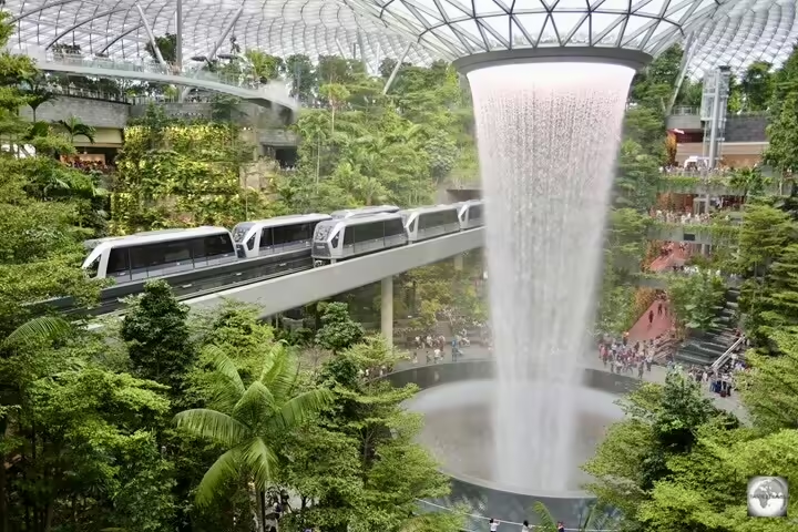


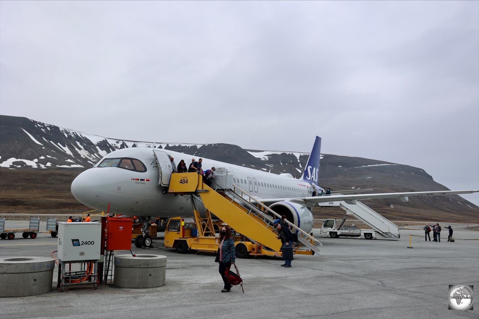


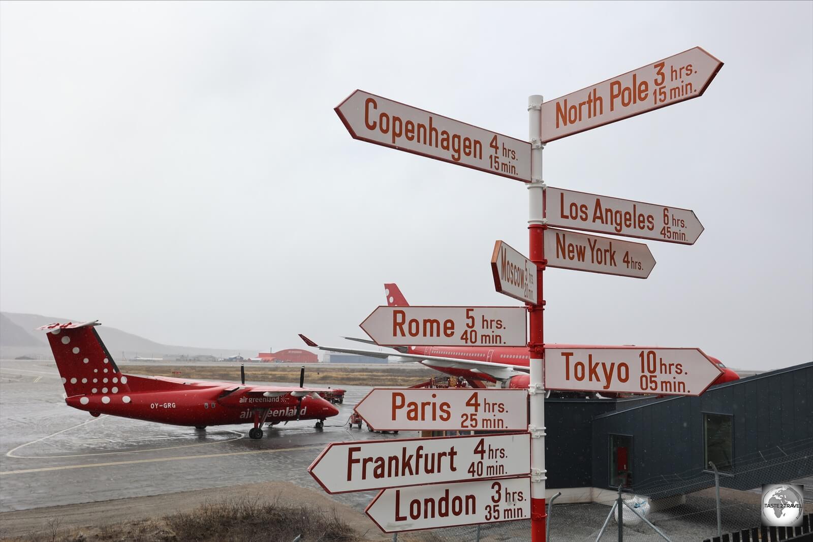


, one of the highlights of Principe.")


 is the principal church in Santo Antonio, Principe Island.")


 is a landmark needle-shaped volcanic plug peak in São Tomé.")


, is a small blowhole on the east coast of São Tomé.")


 is named after its sets of perfect surfing waves.")


, an easily accessible, 60-m high waterfall.")


 is a coffee plantation located in the lofty interior of São Tomé island.")


 was fully refurbished in 2006.")

, the capital, and largest city, of São Tomé and Príncipe is located on the Atlantic Ocean.")
 is one of Africa&#039;s oldest churches.")


 in the city centre, close to the Presidential Palace.")


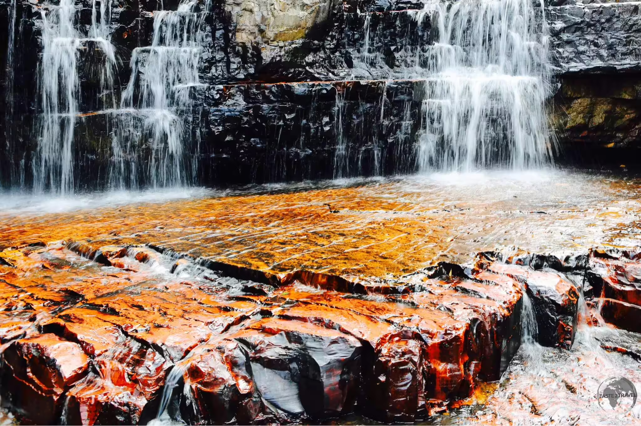


 cat!")


 is the only TV channel which is received by the satellite on Pitcairn Island.")


.")
.")

.")
.")


