
Isle of Man Travel Guide
Welcome to the taste2travel Isle of Man Travel Guide!
Date Visited: April 2018
Introduction
Many people have heard of the Isle of Man (IOM), but how many people, outside of the British Isles or Ireland, could point to it on a map of the world? I know I had to take a look at my atlas – and was surprised by its location!

The Isle of Man is small in area, with good infrastructure and varying landscapes.
Located in the Irish Sea, like a giant’s stepping stone, mid-way between England and Ireland, the Isle of Man, along with Guernsey and Jersey, is one of three self-governing British Crown Dependencies.

The striking flag of the Isle of Man, includes the ‘Legs of Man’, an ancient symbol.
What exactly is a Crown Dependency?
Crown Dependencies do not form part of the United Kingdom and are not classed as British Overseas Territories, they maintain a large degree of autonomy over their own affairs. They issue their own currency, stamps and passports.
In the international realm, the dependencies are considered “territories for which the United Kingdom is responsible“. Each of the Crown Dependencies have their own legislative assemblies, with the power to legislate on many local matters.

The view of the town of Peel.
For travel purposes, all Crown Dependencies lie within the Common Travel Area (CTA), which includes the United Kingdom and Ireland. There are no passport controls when travelling between areas in the CTA and all air and sea connections to IOM originate from within the zone.

The Isle of Man is known for its bucolic scenery.
Known for its rich history, beautiful countryside, sleepy villages and attractive towns, the Isle of Man attracts surprisingly few visitors, with just 266,000 arrivals in 2017, most of whom were from the UK and Ireland. If you make the journey, you will be rewarded. The island offers plenty of accommodation and dining options, delicious, locally brewed, craft beer and plenty of attractions.

A view of the capital Douglas, which is located on a wide bay overlooking the Irish Sea.
The small size of the island allows you to base yourself in one location and explore the remotest of corners – all on easy day trips. I would recommend the capital, Douglas, as a convenient base.
Getting around the island is made even more pleasant thanks to various heritage railways, which are operated by the Isle of Man Rail Company. This is the island that gave the World “Thomas the Tank Engine”.
Did you know?

Thomas the Tank Engine – inspired by the railways of IOM.
Source: Wikipedia
Thomas the Tank Engine was inspired by the Isle of Man Steam Railway and the feature film “Thomas and the Magic Railroad” was filmed on the island.
The creator of Thomas, the Reverend Wilbert (WV) Awdry, was stationed on the Isle of Man in 1945 when the first story was written. The island is within the ‘Diocese of Sodor and Man’. The story of “Thomas and Friends” is set on a fictitious island in the Irish Sea known as ‘Sodor‘.
Location
Douglas, Isle of Man
The Isle of Man is located in the middle of the Irish sea, almost equidistant between Ireland and the United Kingdom, from which there are regular ferry and air services.
At 572 square kilometres (221 square miles), hilly IOM is smaller than Singapore but much larger than Jersey or Guernsey, sustaining a population of 84,000 plus many sheep. The highest point on the island is Mt. Snaefell which lies at 621 metres (2037 ft) and is accessible via the Mt. Snaefell Mountain Railway.

Mt. Snaefell, the highest point on the Isle of Man, rises gently to 621 metres (2037 ft).
Currency

Isle of Man bank notes.
Like Guernsey and Jersey, the Isle of Man issues its own version of the Pound (£) – the Manx Pound which is in parity with the UK Pound Sterling. Notes and coins, denominated in pounds and pence, are issued by the Isle of Man Government Treasury.
UK notes and coins (whether from banks in England, Scotland, or Northern Ireland) are accepted in the Isle of Man, but Manx notes and coins are not accepted in the UK. You should ensure you convert any Manx currency to UK currency prior to leaving the island.
For collectors, IOM coins and banknotes can be purchased online via the Isle of Man Post Office Philatelic Bureau.

Unlike the mainland, the Crown Dependencies still use £1 notes.
Flag

The unique flag of the Isle of Man features the “Triskelion” – the legs of Man.
The flag of the Isle of Man features a Triskelion, an ancient symbol which is comprised of three armoured legs with golden spurs, upon a red background. Known as the ‘Legs of Man’, the triskelion has featured on the island’s coat of arms since the 13th century.

The Isle of Man flag fluttering in the breeze on the promenade in Douglas.
Sightseeing
Douglas

The waterfront in Douglas, capital of the Isle of Man.
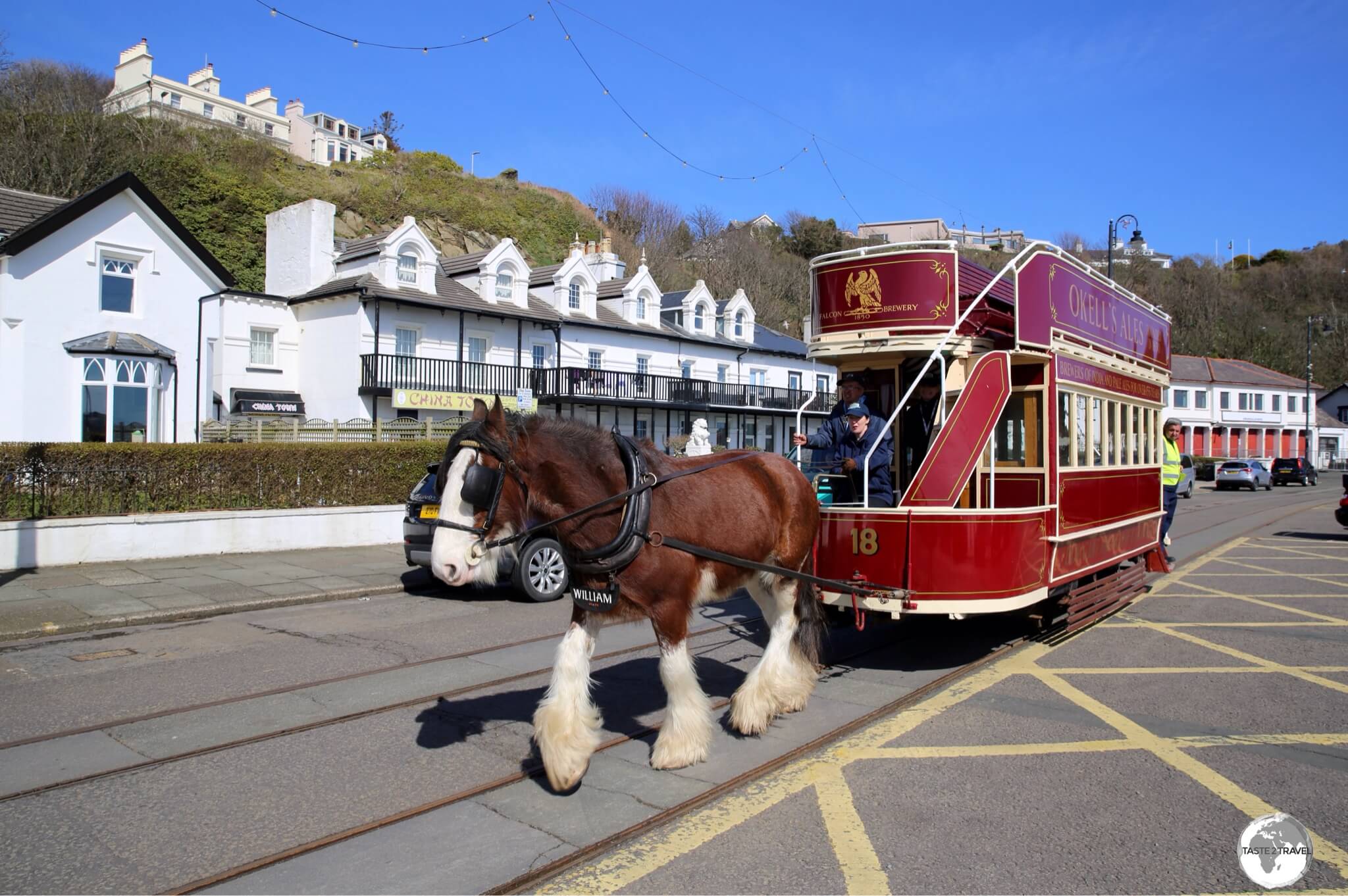
The historic Douglas Bay Horse Tramway is a great way to take in the sights of the Capital’s waterfront.

Made from Manx granite, the Douglas War Memorial is dedicated to those who lost their lives in WWI and WWII.

Built in 1832, the Tower of Refuge sits atop St. Mary’s Isle, a partly submerged reef in Douglas harbour.
Located on St. Mary’s Isle, just offshore from the Sea terminal, is the medieval-looking ‘Tower of Refuge’ which was built in 1832 as a refuge for anyone shipwrecked on the isle. The refuge was constructed two years after a ship, the ‘St. George’, was wrecked upon the rocks. All 40 crewmen were rescued successfully.
Wedged between the Isle of Man Sea Terminal and Douglas Railway station is the Douglas Marina and Quayside precinct, which is home to numerous cafes, bars and restaurants (see the ‘Eating Out’ section for more details). This neighbourhood is relaxed and sleepy during the day but comes alive at night, offering lots of entertainment and dining options.
One of the best museums in the country is the Manx Museum which is located in downtown Douglas. The museum displays cover every aspect of island history (10,000 years of it!) from the Viking era to the modern era.
Beyond Douglas
Once you’ve finished exploring the sights of Douglas, you can venture further afield using one of the three heritage railways which are operated by the Isle of Man Rail Company. All of these services are fantastic and a ‘must do’ while on the island.
From Douglas you can venture north on the Manx Electric Railway (blue line on the map) or you can head south on the Isle of Man Steam Railway (brown line on the map).

The Manx Electric railway ready to depart from the promenade at Douglas.
Manx Electric Railway
From its terminus at Derby Castle (located at the northern end of the promenade), the Manx Electric Railway (MER) connects the capital with the northern towns of Laxey and Ramsey, covering a total distance of 28 km (17.5 mi) in a leisurely 75 minutes. Built between 1893 and 1899, the railway offers spectacular views of the east coast. A return journey from Douglas to Ramsey costs £12.40 for adults.

The Manx Electric Railway offers panoramic views of the coastline north of Douglas.
In the town of Laxey, you can transfer from the MER to another heritage railway – the Snaefell Mountain Railway (light green line on the Map), which will transport you to the highest peak on the Isle of Man (see the ‘Mt. Snaefell‘ section below for more details).

The Snaefell Mountain Railway ready to depart Laxey for the climb to the summit of Mount Snaefell.
Isle of Man Steam Railway
If you wish to explore the southern part of the island, you can do so using the Isle of Man Steam Railway which connects Douglas to Port Erin (where you’ll find a museum dedicated to the railway), via Castletown.
The railway commenced service in 1874 and still operates with its original locomotives and red carriages. The journey time from Douglas to the terminus at Port Erin is one hour with an adult return fare costing £13.40.

The distinctly red carriages of the Isle of Man Steam Railway Company.
Around the Island

A touring map of the Isle of Man displayed outside Ramsey station.
The short distances, excellent infrastructure and light traffic on the island, allow you to easily explore IOM on day trips, using Douglas as a base.
Some sample road distances:
- Douglas to Ramsey – 20 km (12 mi)
- Douglas to Castletown – 14 km (9 mi)
- Douglas to Port Erin – 19 km (11 mi)
- Douglas to Peel – 16 km (10 mi)
- Douglas to Point of Ayre – 36 km (19 mi)

The beautiful Ring-necked Pheasant is a common sight on the Isle of Man.
Isle of Man TT Mountain Course

A map of the TT Race course.
Motorcycling enthusiast’s, the world over, know all about the International Isle of Man TT (Tourist Trophy) race, which is held annually at the end of May. The race has been run since 1907, and is often called one of the most dangerous racing events in the world.
The course runs west from Douglas then north to the town of Ramsey before returning to Douglas over the central mountain range. Each lap is 60.7 km (38 mi) in length, includes more than 200 bends and climbs from sea level to an altitude of 396 m (1,300 ft) at the base of Mount Snaefell. The current lap record is held by Peter Hickman who, in 2018, completed the course in 16:42:778, at an average speed of 217 km/h (135 mph).

Taking a pit stop while driving my rental car around the TT circuit.
The entire circuit is comprised of ordinary public highways which are closed for the racing and practice sessions. This is great news if you have your own rental car. A drive around the circuit is a must while on the island, offering many fine views and access to many different sights.

Plenty of picturesque views to be seen while driving the TT circuit.
St. Michael’s Isle

Derby Fort, St Michael’s Isle.
Well away from the noise of the TT circuit and located a short drive from Castletown, St Michael’s Isle (or Fort Island as it’s more commonly known), is home to two historic, ruined sights; the beautifully situated Derby Fort and St. Michael’s Chapel. The two sights are dramatically placed on the tiny isle, making the trip to this remote corner of IOM worthwhile.
The isle is no longer technically ‘an island’ as it’s joined to the mainland by an extremely narrow, one-lane, unpaved (and heavily pot-holed) causeway which is lined with thick, unforgiving, stone walls. You should not attempt to cross this in anything other than a small, compact car.

St. Michael’s chapel on St Michael’s Isle.
Built in the 12th century, the roofless St Michael’s Chapel consists of four walls and a bell turret. Next to the chapel, the circular Derby Fort was built in 1645 by James, 7th Earl of Derby and Lord of Mann during the civil war in England to defend nearby Derbyhaven Bay, which was then a major port, from invading forces. The current fort replaced an earlier one built in about 1540 by order of Henry VIII of England.
Castletown

The namesake of Castletown, Castle Rushen dominates the downtown area.
With a population of 3,100 – Castletown is the 5th largest town on the Isle of Man. Founded in 1090 AD, Castletown claims to be one of the oldest towns in the British Isles and served as the capital of the IOM for hundreds of years until it was transferred to Douglas in 1869.
The downtown is dominated by the imposing Medieval fortress, Castle Rushen, which was built in 1265 for a Viking king. The castle was once occupied by the Kings and Lords of Mann and is today a museum operated by Manx National Heritage.

The scenic harbour in Castletown.
Castletown is located on a pretty fishing port which experiences large tidal flows. A short walk from the harbour is the Old House of Keys, the former Manx parliament which is now a museum administered by Manx National Heritage. The current ‘House of Keys’ is in Douglas.

The former debating chamber at the Old House of Keys in Castletown.
Calf of Man

The ‘Calf of Man’ is separated from the mainland by Calf Sound and the small rocky islet of ‘Kitterland’.
A short drive along the south coast from Castletown lies the Calf of Man, the southernmost tip of the Isle of Man. The word ‘calf’ derives from the Old Norse word ‘kalfr‘ which means a small island lying near a larger one.
The Calf of Man is an uninhabited island which is separated from the ‘mainland’ by the narrow Calf Sound, a stretch of water notorious for its ferocious tidal race.
The windy Sound Road leads from Port St. Mary through the historic (and very picturesque village) of Cregneash to lands-end where you’ll find a car park and the excellent Sound Cafe (see the ‘Eating Out‘ section below for more details).
From the car park, walking trails offer views of the coastline, the Calf of Man and the small rocky islet of Kitterland which lies midway across the Sound and is home to a number of Grey seal colonies. The area is also and ideal destination for birdwatchers with large numbers of migratory seabirds present.
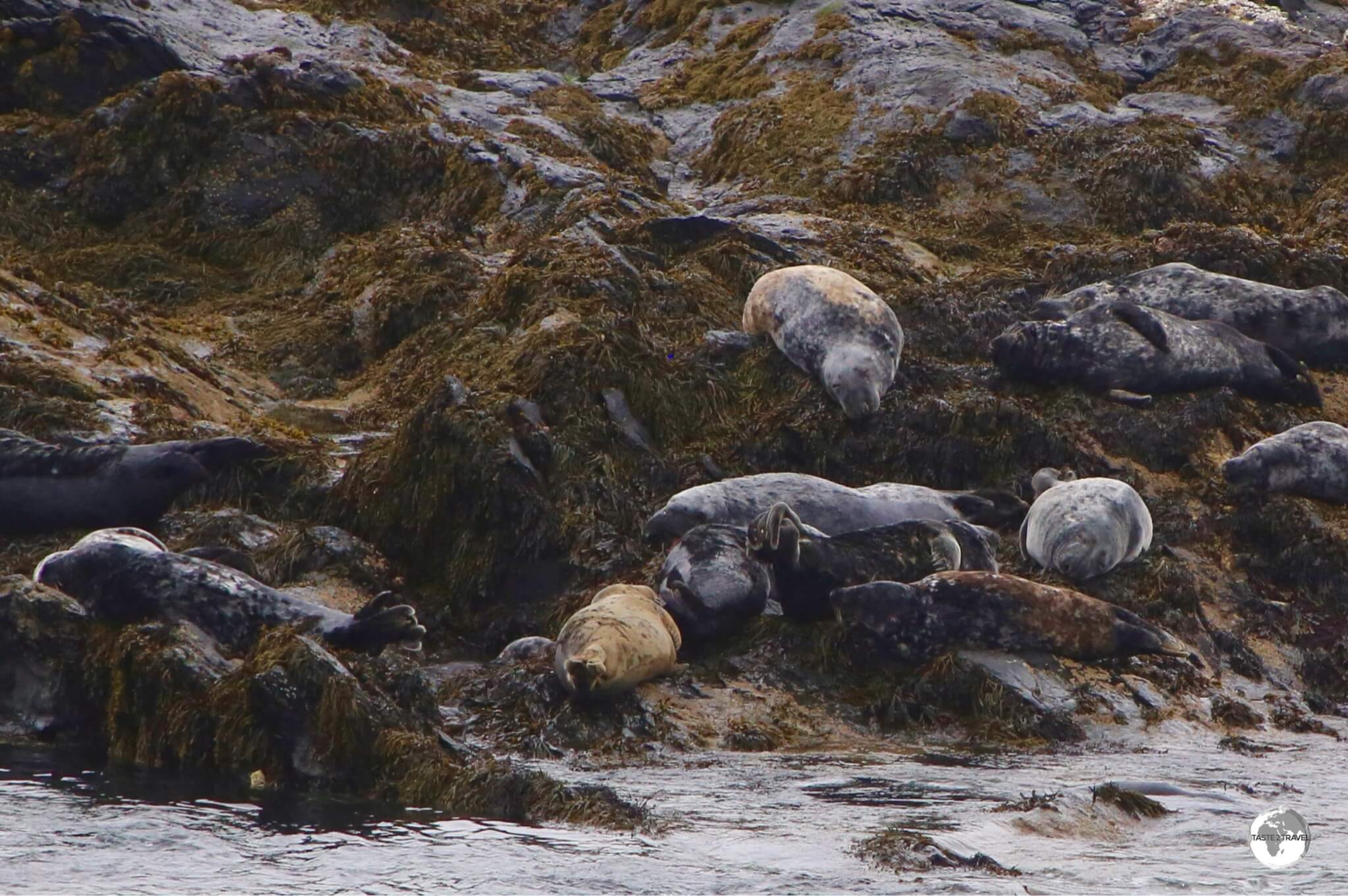
A Grey seal colony on Kitterland – a small rocky islet located between the mainland and the Calf of Man.
Port Erin

Port Erin offers one of the best beaches on the Isle of Man.

A Steam locomotive at the Isle of Man Railway Museum in Port Erin.
The town has been a popular holiday destination since the Victorian era and is the terminus of the Isle of Man Steam Railway. Adjacent to the Port Erin Railway Station is the Isle of Man Railway Museum which charts the history of the Steam Railway from its inception in 1873. The museum features a collection of retired steam locomotives and other rail memorabilia.
Southwest Coast

A typical view along the rugged southwest coast of the Isle of Man.
The drive from Port Erin to Peel via Round Table road then Dalby road travels along the rugged, sparsely populated, southwest coast which is home to lots of wild landscapes of spiky rushes, carpets of moss and wet, peaty soils. Walking trails provide access to the hilly coastline, which offers panoramic views in all directions.
Peel

The sprawling 11th-century Peel castle.
The first fort was built by the Vikings in the 11th century. After the Viking period, the Isle of Man was fought over by the Scottish and English, with the IOM eventually being conquered by the English who then added to the fortifications. During the English reign, St Patrick’s Isle was used both by the Church and the Lords of Mann until the castle was abandoned in the 18th century. Today, the castle is a museum operated by Manx National Heritage.

The ruined Cathedral inside Peel castle.

The view of Peel from Peel castle.
You cannot visit Peel without sampling the best ice-cream on the Isle of Man which is served by the scoop at Davisons ice cream shop which is located on the waterfront. Besides ice-cream, they make a mean milkshake, using only the finest of Manx dairy ice cream.
St. John’s

The Tynwald Hill is the sight of the original parliament on the Isle of Man.
A short drive east of Peel is the hamlet of St. John’s which is home to the historic, man-made bump known as the Tynwald Hill. This four-tired hill, which is thought to be made from soil from all the Island’s 17 ancient parishes, is used once a year to host an open-air meeting of the Island’s parliament.
The location was first used by the Vikings who conducted parliamentary meetings here over a thousand years ago. The hill was constructed in the 13th century, and has been in continuous use making it the oldest continuous parliament in the world.
Far North Coast

The pebbly beach at the Point of Ayre. Scotland lies just beyond the horizon.
The most northerly point on the Isle of Man is the remote and isolated Point of Ayre, which is closer to Scotland than Douglas. Here you’ll find the Ayres Nature Reserve which is one of the best places to observe wildlife on the Isle of Man and the Point of Ayre lighthouse.

An historic Celtic Cross in the grounds of St Andrew’s Church in the northern town of Andreas.
In the town of Andreas, the Church of England church, St. Andrew’s is worth a stop. The current church dates from 1821, however a church has stood at this location since at least the 13th century.

A typical thatched cottage on Cranstal Road, near the northern village of Bride.
Several charming villages can be found in the north of the island with traditional Manx thatched-roof cottages lining the country lanes. The village of Bride is home to some excellent examples with one pictured here.
Ramsey

A tourism poster for the Isle of Man.

The TT Mountain Circuit crosses the Manx hills before descending into Ramsey.
Ramsey is in the sunniest area of the Isle of Man, and one of the driest, receiving relatively low rainfall due to its ‘rain shadow’ location, north-east of the Manx hills.
North of Ramsey, sandy beaches run continuously to the north tip of the island. Downtown, Ramsey beach is popular in the summertime and is punctuated by the 683 metre (2,241 ft) long Queen’s Pier, an iron pier which was built in 1886. Located near the intersection of Queen’s promenade and Queen’s drive, the crumbling Queen’s Pier has been closed to the public since the early 1990’s due to safety concerns and is awaiting restoration. Currently a society, the Friends of Ramsey Queen’s Pier, are raising funds to commence restoration work, you can keep up to date with their efforts here.

The Manx Electric railway ready to depart from Ramsay (Parsonage Road) for Douglas.
The charming old town lies a short stroll from the Manx Electric Railway terminus (Parsonage Road) and can easily be explored on foot in an hour or two. Several restaurants and cafes line the main street, Parliament street, providing good lunchtime dining options or a quick caffeine fix. The best coffee in town is served by the Costa Cafe branch on Parliament street.
Laxey

Towering over the village of Laxey, the Great Laxey wheel is the largest working waterwheel in the world.

Originally used to pump water from a mine, the Great Laxey wheel is built into the hillside above the village of Laxey in the Isle of Man.

Getting close to the fast-moving Lady Isabella.
A view of Laxey village from the top of the wheel.

Laxey Railway station is the terminus for the Snaefell Mountain Railway and a key stop for the Manx Electric Railway.
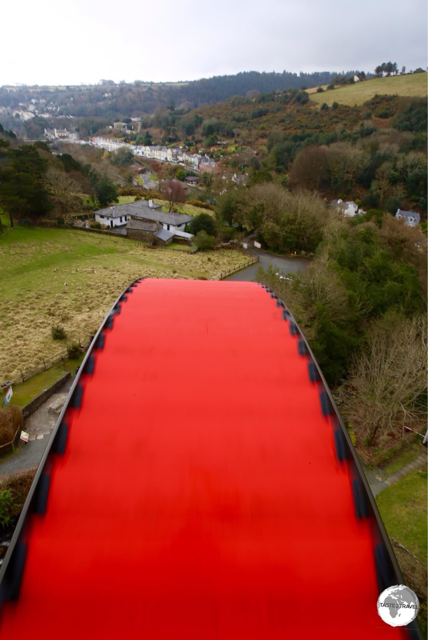
Mount Snaefell

A view of Mt. Snaefell from the main road. Trains can be seen climbing to the summit.
From Laxey you can journey to the summit of the Island’s only mountain, Mount Snaefell 621 m (2,036 feet) from where it is said you can view Six Kingdoms on a clear day – The Isle of Man, England, Ireland, Scotland, Wales and Heaven.
To reach the summit, you have two options:
- Join the Snaefell Mountain Railway from Laxey for the 8 km (5 mi) climb to the summit, a journey time of 30 minutes.
- Walk the 10 km (6 mi) trail from Laxey station to the summit which can be completed in 4.5 hours. Full details on the walk can be found here.

Travelling to the summit of Mt. Snaefell on the Mt. Snaefell railway.
I chose to take the mountain railway which was a smart move as inclement weather moved in over the mountain (a frequent occurrence) during my ascent. What started as a fine, sunny day in Laxey turned into a cold, foggy, snowy day once we started climbing up the mountain and what started as a gently breeze soon became a howling gale.
Video:
Conditions on the summit of Mt. Snaefell were bleak indeed!
The only place where you can see all of the UK
There is an irony to the fact that Isle of Man is not part of the UK, yet it is the only location in the British Isles from which you can see all the UK’s constituent parts – on clear days, England, Wales, Scotland and Northern Ireland are visible from Mount Snaefell, but unfortunately – not on the day I visited.

Bleak conditions on the summit of Mt. Snaefell.
The one saving grace on the summit was the warm and inviting Snaefell Summit Dining cafe where you can literally eat ‘pie in the sky‘.
Accommodation

Historic houses along the promenade in Douglas are home to numerous B&B’s.
Accommodation options can be found all over the Isle of Man, with the majority or properties lining the promenade in downtown Douglas. With most transport options originating in Douglas, the capital makes an ideal base for exploring the island, with all points on the island an easy day trip away.

My ‘King Suite’ at the Inglewood Hotel in Douglas.
While on the Isle of Man, I chose to stay at the wonderful Inglewood Guest House. Located on the waterfront, this dazzling and stylish B&B was recently taken over by an amazingly energetic and enthusiastic South African couple, Yolandi and Ruan, who were busy adding their personal touches to the property at the time of my visit.
Booking.com currently lists 48 properties on the island, hotels.com lists 38 while Airbnb.com list 48 different properties from farm houses to manor houses.
Eating Out

The very pleasant Douglas Marina and Quayside is lined with restaurants, bars and cafes.
Inviting restaurants, cafés and bars can be found in all the main towns on the island, with Douglas being home to the lion’s share of options. The main dining hubs in the capital are the Douglas Marina and Quayside neighbourhood and the Promenade.
Restaurants
Located on the quayside, the Barbary Coast Grill & Bar is a lively and popular venue, with a menu that wouldn’t look out-of-place in an American sports bar. While the steaks and burgers are popular, the house speciality is their Peri Peri chicken. If you wish to sample the range of locally produced craft beers from Okell’s, you’ll find them on tap at the bar.
A short walk west along the quay is the wonderful Little Fish Cafe which offers all of the usual seafood classics in a refined atmosphere. Why not try their ‘Fish and Fizz’, traditional Fish ‘n’ Chips served with a glass of prosecco.
On the promenade there are many restaurants within walking distance of the hotels. One of the standouts is New Manila which, despite its name, offers excellent Thai cuisine.
Cafés

The amazing cake selection at the very remote ‘Sound Cafe’.
One of my favourite cafes on the Isle of Man is the very remote Sound Cafe, which is located at the end of Sound Road, a short drive south of the picturesque village of Cregneash at the southwestern tip of the island. To say this legendary, family run cafe is worth the drive is an understatement. The cafe is adjacent to the Calf Sound visitor car park (plenty of free parking) and offers views of the sound and the nearby Calf of Man.

The ‘Legs of Mann’ featured on a couple of cafe latte’s.
Being a self-declared café snob, I would not normally recommend a coffee chain as a place to enjoy a coffee – but – on the Isle of Man, there are three branches of Costa Coffee, with all three offering good coffee. Located in Douglas, Ramsey and Castletown, the branches at the later two locations offer the best coffee in those towns.
Beer

A pint of Okell’s beer is a fine way to relax after a day of touring the Isle of Man.
The local brewery, Okell’s, was founded in 1850 by Doctor William Okell – so, the beer must be good for you!
While visiting the island, I sampled most of Okell’s range of beers with the firm belief that any beverage created by a doctor must be good for one’s health.

Three of Okell’s regular beers.
Source: Okells.im
The brewery produces five regular beers, including a Bitter, IPA and an MPA (Manx Pale Ale) along with four seasonal brews (Spring Ram, Summer Storm, Autumn Dawn and – in time for Christmas – St. Nick). Islanders are very loyal to their local brew with almost every bar on the island offering you the opportunity to sample these fine brews.
It’s just what the doctor ordered!
Visa Requirements

Souvenir passports stamps can be obtained from the Airport Information desk.
Along with the United Kingdom, Ireland and the Channel Islands, The Isle of Man is part of the Common Travel Area (CTA). There are no passport controls when travelling between areas in the CTA and all air and sea connections to IOM originate from within the zone.
If you’re already inside the CTA, you’re free to visit IOM.
There is no immigration control at the Isle of Man Airport but for those who would like to have a souvenir passport stamp, one can be obtained from the friendly lady at the airport information desk.
Getting There

The view of the Isle of Man from my Aer Lingus flight.
Air
Isle of Man Airport (IATA: IOM), also known as Ronaldsway Airport, is one of two gateways to the Isle of Man, with the other being the Isle of Man Sea Terminal in Douglas.
The airport is located in the southeast corner of the island, near to Castletown, and a short 11 km (6.9 mi) drive southwest of the capital, Douglas.
There’s no immigration control at the airport, with all arrivals originating from airports located within the Common Travel Area. Daily flight departures can be viewed here, while arrivals can be viewed here.
The following airlines provide services to/ from IOM:
- Aer Lingus Regional – flies to/ from Dublin
- British Airways – flies to/ from London–City
- easyJet – flies to/ from Belfast–International, Bristol, Liverpool, London–Gatwick
- Flybe – flies to/ from Birmingham, Liverpool, Manchester
- Loganair – flies to/ from Edinburgh
Airport Transport
Regular public buses connect the airport to Douglas (30 mins/ £2.70), Castletown, Peel, St. John’s and Port Erin. Taxi’s are also available outside the arrivals hall.
Sea
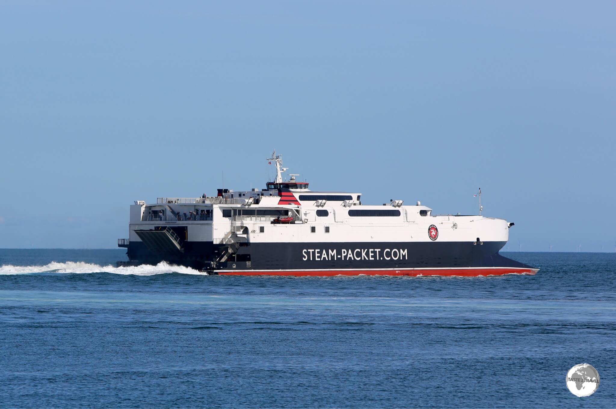
The Isle of Man Steam Packet Company Ferries connect the island to ports in the UK and Ireland.
Located in downtown Douglas, the Isle of Man Sea Terminal is the arrival and departure point for all passenger and car ferries operating to and from the Isle of Man.

IOM Steam Packet Company Route Map
The terminal is operated by, and is the hub for, the Isle of Man Steam Packet Company, which runs year-round sailings to Heysham, and seasonal (summer) sailings to Liverpool, Belfast and Dublin.
The crossing to/ from Heysham operates up to 13 times each week with a sailing time of 3 hours 45 minutes. You can make bookings (foot passenger – from £19.50 each way) and view the current timetable on their website.
Getting Around
Public Bus

Isle of Man Bus Route Map.
Bus services on the island are operated by the government-owned Bus Vannin who provide regular services to every corner of the island.
You can view the current bus route map on their website, which also includes a handy journey planner – Traveline. A variety of ticket options are available, including Go Explore cards, which provide unlimited travel on all bus and rail services for a period of 1, 3, 5 or 7 days.
Train

The Snaefell mountain railway conveys passengers to the loftiest point on the island – Mount Snaefell.
The Isle of Man Rail Company offers four different rail journey’s, all of which provide a fascinating way of exploring the island.

IOM Railways Map.
Source: IOM Railways.
Three heritage rail lines allow visitors to explore a large part of the island:
- The Manx Electric Railway (blue line on the map) connects Douglas with the northern town of Ramsay.
- During its meander along the east coast, the Manx Electric Railway passes through the junction town of Laxey, from where you can switch to the Snaefell Mountain Railway (light green line on the Map) which winds its way up to the island’s highest point, Mount Snaefell, which lies at 620 metres (2,037 feet) above sea level.
- Running south from Douglas, the Steam Railway (red line on the map) passes through Castletown before terminating in Port Erin on the southwest coast.
The 4th service offered by the company is the novel Douglas Bay Horse Tramway (dark green line on the map), which is covered in the Douglas section of this guide.

Details from a Manx Electric Railway carriage.
Rental Car

My rental car on the Isle of Man.
While public transport on the island is frequent and comprehensive, the best way to maximise your time is with a rental car, especially if you plan on exploring every nook and cranny.
Several Car Rental Agents can be found at IOM Airport. I hired a car through Mylchreests who are the local agent for Avis and Budget. Daily rates for a compact car start at £45 with a weekly rate for the same vehicle starting at £166.

All Isle of Man number plates feature the ‘Legs of Mann’.
For those arriving by sea, most companies can arrange advance delivery of vehicles to the Sea Terminal. The IOM Visitors website has a full listing of all agents on the island.
That’s the end of my Isle of Man Travel Guide.
Safe Travels!
Darren
Follow me on Instagram:

Isle of Man Travel Guide Isle of Man Travel Guide Isle of Man Travel Guide Isle of Man Travel Guide Isle of Man Travel Guide Isle of Man Travel Guide Isle of Man Travel Guide Isle of Man Travel Guide Isle of Man Travel Guide Isle of Man Travel Guide Isle of Man Travel Guide Isle of Man Travel Guide Isle of Man Travel Guide Isle of Man Travel Guide
Author: Darren McLean
Darren McLean is an Australian full-time digital nomad who has spent 36 years on a slow meander around the globe, visiting all seven continents and 239 UN+ countries and territories.
He founded taste2travel to pique one’s curiosity and inspire wanderlust.


