
Saba Travel Guide
Welcome to the taste2travel Saba Travel Guide!
Date Visited: May 2015
Introduction
Saba is completely unique, totally unlike anywhere else in the Caribbean. If you ever have the chance to visit this amazing island you should.

White-throated Hummingbird on Saba.
The small population of the island consists of settlers from a variety of countries, including Dutch, English, Scottish, Irish and African.
Like neighbouring Statia, both English and Dutch are spoken on the island and both languages are official, however the everyday language is English. Education is in English.
Along with Bonaire and St. Eustatius (Statia), Saba is part of the Caribbean Netherlands. The island is small with a land area of just 13 square kilometres and a population of 1,991 inhabitants. The capital and largest city is ‘The Bottom’.
Location
Caribbean Netherlands
Saba is located northwest of the Dutch territory of St. Eustatius (Statia) and southwest of Sint Maarten/ Saint Martin (Dutch/ French), St. Barths (French) and Anguilla (British)
The island is essentially a volcano, rising up dramatically out of the Caribbean sea. At 887 metres, the peak of the volcano – Mount Scenery – is the highest point within the Kingdom of the Netherlands. The volcano is classified as ‘potentially active’.

Mount Scenery looms large over the town of Windwardside.
History
Columbus sighted Saba on his 2nd voyage to the Americas in 1493, however he did not land as he was deterred by the rocky, perilous shoreline.
It wasn’t until the 1630’s, that the Dutch Governor of neighbouring Statia sent several Dutch families to colonise the island for the Dutch West India Company.
Due to it’s rugged landscape, the island is a natural fortress, and as such was used as a private sanctuary for the families of smugglers and pirates. In 1664, English pirates, including Thomas Morgan, evicted the Dutch settlers to neighbouring Saint Martin for refusing to swear allegiance to the English crown.
The Dutch returned and in the 17th and 18th century used the island to produce sugar and rum with a small population of slaves. Over the years the island has been controlled by the British, French and the Dutch. The Dutch have now held continuous control since 1816.

The rich volcanic soil and abundant rainfall ensure Saba is covered in lush foliage.
Saba bills itself as the “The Unspoiled Queen” of the Caribbean. Today tourism is the main industry, with about 25,000 visitors each year. Ecotourism is the main draw with hiking and diving the main activities.
Currency

The US Dollar.
The official currency of Saba is the US Dollar. ATMs are located in Windwardside.
Flag

Flag of Saba.
The flag of Saba was adopted in 1985 from a design submitted by an 18-year old student, Edmond Daniel Johnson. The top of the flag is divided into two equal red triangles, while the bottom is divided into two equal blue triangles while the flag centre is a large white diamond with a golden (yellow) five-pointed star in the centre.
The star represents Saba, with the gold colour signifying that Saba is a precious possession and dear to the heart of all Sabans. The gold also symbolises the wealth of natural beauty to be found on Saba. The colours red, white and blue represent the historical and political ties between the Netherlands and the Netherlands Antilles, while the colour white also symbolises peace. Additionally, the colour red symbolises unity, courage and decisiveness, while blue represents the sea, which plays such an important part in the life of all Sabans.
Sightseeing
Windwardside
Windwardside is the second largest town (population: 418) on the island. It gets its name from being on the windward side of the island.
It’s a cute, quiet town where all the buildings are painted with the same uniform colours. There’s no hustle and bustle, no traffic as most people walk and everyone seems to know everyone else. It’s a great base from which to explore the island.

A strict building code on Saba ensures all buildings, such as these cottages in Windwardside, are a uniform white, with green trim and red roofs.
Windwardside is the tourist centre on the island, where you will find a good selection of accommodation, restaurants, cafes, supermarkets etc. Its perched high up on the slopes of Mount Scenery with spectacular views in every direction of the Caribbean sea far below. The summit of Mount Scenery looms large above the town.
One ‘must-see’ site in town is the Harry L. Johnson museum. Housed in a former sea captains cottage (one of the first built on the island), the museum provides an insight into life on the island for the earlier generation of Sabans.
Through photos and informative displays, you’ll get an appreciation for how tough life was on the island. The caretaker of the museum – Jennifer – will happily provide you with a guided tour during which she’ll bring to life the history and stories of Saba. Highly recommended!
If you are in town on a Thursday, you can visit the Eugenius centre to watch elderly Saban ladies make Saba Lace. Lace making was once introduced to the island by a nun from Venezuela.

The town of Windwardside clings to the slopes of Mount Scenery.
Around the Island

A white-throated hummingbird nesting outside my room in Windwardside.

A nesting White-throated Hummingbird in Windwardside.

Hummingbird Eggs – about the size of a large pea.
The Bottom
This is the capital and largest town on the island and depending on which hiking trail you choose you could end up here after one of your hikes. The town is very quiet, with some chickens and goats roaming the streets. It is home to the Saba Medical school, government offices, a few restaurants, shops, etc.
Hiking
There are many fine hiking trails on the island, some of which start in Windwardside. Before you hike you should visit the Trail Shop Saba, which is located in downtown Windwardside at the foot of the Mt. Scenery Trail. The friendly, enthusiastic staff will provide you with maps, information, tips and a whistle.
A scenic hike is the Sandy Cruz trail (150 minutes one way), which links the settlement of Upper Hells’ Gate with The Bottom. The hike takes you through orchards, cloud forest and secondary rain forest, offering spectacular views of the coast and neighbouring islands such as Sint Maarten, Statia, St. Kitts and Nevis.

A view from the ‘Sandy Cruz’ hiking trail.
Saba Beaches
If you are looking for the typical Caribbean island with sandy beaches and palm trees then Saba is not the island for you. There are no beaches on the island, except for a small patch of sand, which has been installed next to the airport.

The only beach on Saba is man-made.
Scuba Diving
Saba is known for it’s unique pinnacle dive sites, created when magma pushed up through the seafloor creating underwater towers of rock which soar up to around 26-m beneath the surface. Due to the unique underwater seascapes, diving on Saba is a unique experience.
There are 4 dive operators on the island. I chose to dive with Sea Saba, who i would recommend. They have an office in downtown Windwardside and provide transport to the port. Dives sites are a short distance from the port.
Currents can be strong but you are rewarded with abundant marine life and spectacular underwater scenery.
Jo Bean Glass Art Studio

Jo Bean giving instruction during her glass-bead making class.
For something different, you could join a half-day glass-bead making workshop, run by the bubbly and infectious Jo Bean. Jo will take you through the bead making process and then set you up with a torch and lots of thin rods of coloured glass so you can create your own works of art. If you don’t have time for the class you can always purchase something from her shop.
Jo is a native of the United States who has been a long-term resident on Saba. Her studio is located a short walk outside of Windwardside on Booby Hill. Highly recommended!
During the workshop I produced a selection of colourful beads which are pictured below. I was even able to make a replica of the famous ‘Statia Blue Bead’ (in the centre of the photo), a bead which is associated with the neighbouring island of Statia (click to read my Statia Travel Guide).
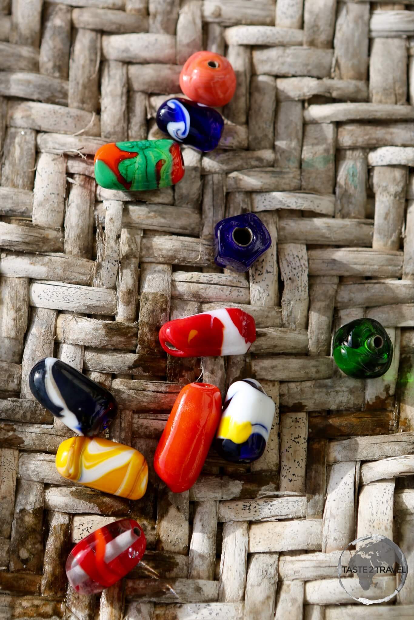
My colourful glass-beads which I produced during my workshop with Jo Bean.
Accommodation
Accommodation on the island is limited, its best to book in advance using an online agent such as booking.com
Most accommodation is in Windwardside. I stayed in the centre of town at Juliana’s Hotel, which I would recommend. A hummingbird was nesting right outside my room.
Eating Out
Many ex-pats have settled on Saba and some of them have opened restaurants and cafes. There is a good range of restaurants in Windwardside, from fine dining to simple BBQ.
Located in the downtown shopping area is my favourite cafe, the Bizzy B Bakery. Their freshly baked bread is amazing as are the pastries, sandwiches and coffee. There is a nice outdoor seating area offering great views of Mount Scenery.
The best BBQ on the island can be found downtown, opposite the Big Rock market at Swinging Doors. You enter this simple restaurant through the swinging saloon doors where you’ll be served the tastiest BBQ on the island. This is the restaurant that locals enthusiastically recommend – everything about this place is awesome.
Visa Requirements
Some nationalities require visas for Saba – check your visa requirements prior to arrival.
Getting There
By Air

This view of Saba airport, shortly after take-off, shows the perilous position of the short runway.
Scary and exciting all at the same time! Saba’s airport is ranked as one of the worlds most dangerous.
Juancho E. Yrausquin Airport has the shortest commercial runway in the world at 400-m long. At the end of the runway are cliffs that plunge into the sea. On one side of the airport is a towering mountain. A most unlikely location for an airport but the only suitable location on this volcanic rock.
Only experienced Winair pilots can land here using special planes, STOL (Short Take-off and Landing). When you land you only break once. When you take off you only start climbing once you have flown off the end of the runway. No room for errors at this airport.
The airport is located at Flat Point, the only flat area on the island. The idea of an airport here was considered by many to be fanciful, including the government. However a determined Captain Remy F. de Haenen (from neighbouring St. Barths) assured the locals he would attempt a landing if they constructed a makeshift runway. And so, in February 1959, after the locals cleared the land by hand and graded it, he landed his small plane. His bravery and determination changed the island forever more.
Only one airline flies to this unique destination:
- Winair – service to Sint Maarten/ Saint Martin
By Sea
A ferry service connects Saba with Sint Maarten/ Saint Martin three times a week. The 45-km journey takes one and a half hours. The service is operated by Saba Transport using the vessel Dawn II.
Getting Around
Saba has one main road, The Road, which consists of 16-km of narrow, windy, twisting, steep paved surface. Owing to the terrain, Dutch and Swiss engineers claimed a road was impossible to build on the island.
One local man, Josephus Lambert Hassellman, believed a road could be built. He took a correspondence course in engineering and, with the help of locals, started building a road across the island. It took 20 years to complete, mostly by hand.
There is no public transport on the island, however a few taxis are available. The drivers are a great source of information on island life, providing free guided tours as you travel and all the latest island gossip.
There are four car rental agencies on the island but hiring a car on such a small island is hard to justify. The island is compact enough and quiet enough that walking is the preferred option.
Around every corner is another amazing view.
Safe Travels!
Darren
Follow me on Instagram:

Further Reading
Other travel reports from the Caribbean region include:
- Anguilla
- Antigua & Barbuda
- Aruba
- Bahamas
- Barbados
- Bonaire
- Bermuda
- Cayman Islands
- Cuba
- Curaçao
- Dominica
- Dominican Republic
- Grenada
- Guadeloupe
- Haiti
- Jamaica
- Martinique
- Montserrat
- Puerto Rico
- Saint Barthélemy (Saint Barts)
- Saint Eustatius (Statia)
- Saint Kitts & Nevis
- Saint Lucia
- Saint Martin/ Sint Maarten
- Saint Vincent & The Grenadines
- Trinidad & Tobago
- Turks & Caicos
- Virgin Islands (British)
- Virgin Islands (U.S.)
Saba Travel Guide Saba Travel Guide Saba Travel Guide Saba Travel Guide Saba Travel Guide Saba Travel Guide
Author: Darren McLean
Darren McLean is an Australian full-time digital nomad who has spent 36 years on a slow meander around the globe, visiting all seven continents and 239 UN+ countries and territories.
He founded taste2travel to pique one’s curiosity and inspire wanderlust.


