Top 10 Caribbean Island Experiences
Welcome to the taste2travel Top 10 Caribbean Experiences feature.
Introduction
It’s not all rum and reggae!
Beyond the tourist brochure images of white-sand beaches, palm trees, Bob Marley and rum punches, the 33 countries and territories of the Caribbean offer a wealth of diverse travel experiences.
During the colonial period the French, Spanish, Dutch, British and even the Danish and Swedish took possession of various islands, which has left its mark today. As a result of this Colonial mélange, the islands of the Caribbean offer a diversity of cultures, traditions and ethnic mixes. The cultural highlight on the Irish-settled island of Montserrat is a week-long St. Patrick’s Day Festival, which celebrates the Irish heritage of the island with a combination of Irish and African influences.
Geographically, the islands of the Caribbean have been formed by either volcanic activity or from the movement of tectonic plates, which has exposed ancient, limestone seabed’s. While the volcanic islands offer lush, rugged, mountainous interiors, cascading waterfalls, meandering rivers and black-sand beaches, the limestone islands offer flatter, arid interiors and blindingly white-sand beaches, it’s these beaches which are featured on the covers of tourist brochures.
The French territory of Guadeloupe consists of two (almost joined) islands, one being volcanic in origin and the other being a raised limestone seabed, offering its visitors the opportunity to explore two very different environments in one destination.
This list highlights just ten favourite travel experiences from Cuba to Trinidad, with links to relevant travel guides for further reading.
Experiences
My personal “Top 10 Caribbean Experiences” (listed in no particular order) are:
#1 – Montserrat
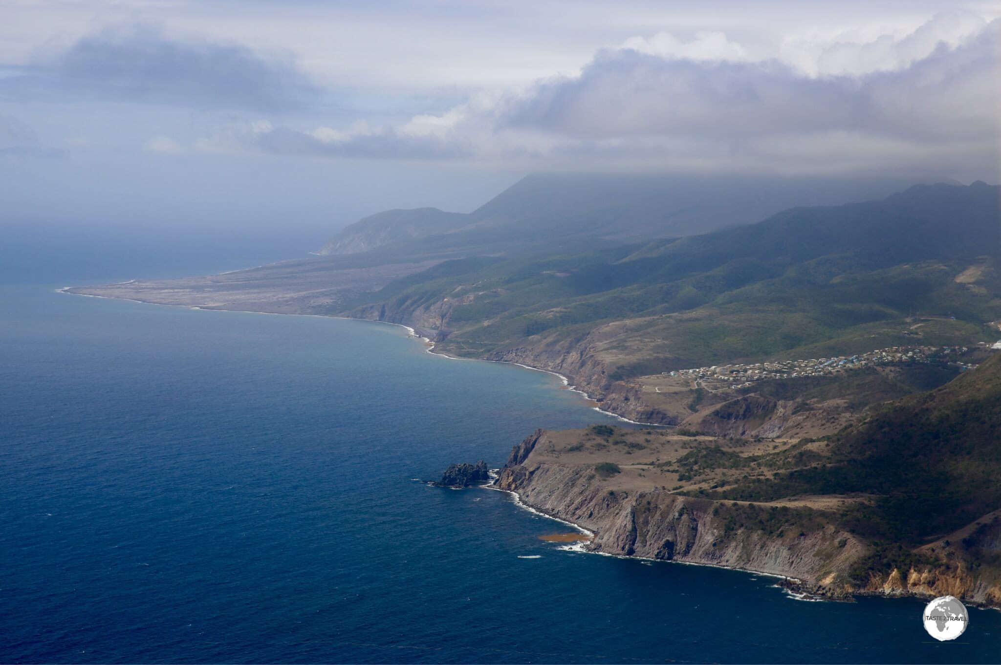
A view of the east coast of Montserrat with recent lava flows visible in the background.
Feel like visiting a modern-day Caribbean Pompeii? The volcanic island of Montserrat offers a very different travel experience from the usual sun, sand and beaches.
Like a phoenix rising from the ashes, tiny Montserrat (a British territory) is slowly dusting itself off after recent volcanic eruptions decimated the southern part of the island, including the capital Plymouth, covering large areas in ash, mud and other volcanic debris. Plymouth remains the capital of Montserrat, making it the only ghost town that serves as the capital of a political territory.

A sweeping view of the lush west coast of Montserrat from the Gingerbread Hill Guest House.
Volcano Tourism
While the Soufrière Hills Volcano is far from dormant, Montserrat is open for tourism and visitors are once again returning to the island that, due to its rich Irish heritage, bills itself as the ‘Emerald Isle of the Caribbean‘.

The buried capital of Plymouth, a modern-day Caribbean Pompeii.
Whilst the island has a few nice (black sand) beaches, the main draw today is ‘volcano tourism‘, with a highlight of any visit being a tour of the fascinating, abandoned capital of Plymouth, which lies entombed under many metres of volcanic debris, inside a restricted exclusion zone.

Pyroclastic flows and lahars inundated Plymouth with metres of ash, mud and rock covering the entire city.
I toured the exclusion zone with the knowledgeable and informative Sun Lea, the owner of Montserrat Island Tours. Tours can remain in the abandoned city for one hour and during that time the guide is required to maintain constant radio contact with monitoring staff at the nearby Montserrat Volcano Observatory (MVO).
Another requirement was that, even while walking about, the motor of our vehicle was always to be left running in case the MVO advised that we need to leave the area ASAP. Something very different form the usual Caribbean experience.

Who needs a white-sand beach? Beautiful Woodlands Bay Beach.
Musical Legacy

A photo of Paul and Linda McCartney on Montserrat.
If you’re a fan of music (who isn’t?) you might be interested in the musical legacy of Montserrat. For a period of ten years from 1979 – 1989, the island was a magnet for many famous musicians who came to record at the legendary AIR Studios Montserrat, which was created by Sir George Martin – the renown English record producer who signed The Beatles and produced every album they made until they disbanded.
Did you know Dire Straits recorded ‘Brothers in Arms‘ on tiny Montserrat? Who else recorded music on Montserrat? It’s an impressive roll-call of famous musicians, including:
- Boy George
- Dire Straits (who recorded ‘Brothers in Arms‘ at the studio)
- Duran Duran
- Elton John (who recorded ‘Too Low for Zero‘ at the studio)
- Eric Clapton
- Genesis
- Jimmy Buffet (who recorded the album ‘Volcano‘ while looking at the then-dormant Soufrière Hills Volcano from the studio)
- Little River Band
- Lou Reed
- Luther Vandross
- Michael Jackson
- Paul McCartney (who recorded the hit single ‘Ebony and Ivory‘ with Stevie Wonder at the studio)
- Sheena Easton
- Stevie Wonder
- The Police (who recorded ‘Ghost in the Machine‘ and ‘Synchronicity‘ at the studio)
- The Rolling Stones
- Ultravox
While it’s possible to visit the island on a quick day trip from neighbouring Antigua, it’s definitely worth spending a few days or more.
For more on this destination, please refer to my Montserrat Travel Guide.
#2 – Cayman Islands

Adult Brown Booby, Cayman Brac
The Cayman islands are all about three things: sun, sea and wealth. A British Crown Colony whose economy is based on tourism and offshore banking, the three, raised limestone islands which comprise the territory are exposed summits of the Cayman Ridge. Separating the islands is the 4.8 km (3 mi) deep Cayman Trench – which is home to the deepest point in the Caribbean sea and many incredible dive sites.
The capital and largest city, George Town, is located on the main island of Grand Cayman, which is the port of call for all cruise ships and the destination of choice for 95% of visitors. Two much smaller (and geographically very different) islands, Little Cayman and Cayman Brac, lie a short flight to the east and should not be overlooked.

On approach to Cayman Brac.
One of the highlights of a visit to Grand Cayman is Stingray City which provides tourists with the opportunity to interact with numerous Atlantic Southern stingrays, who cruise around on a shallow sandbar in the middle of the turquoise-blue waters of the Caribbean sea. This is a definite tourist trap but still a worthwhile experience.

Getting friendly with a local at Stingray city.
The two outer islands are much quieter, with Cayman Brac being a favourite nesting site for sea birds such as the Brown Booby.
The Cayman Trench passes close to the island, providing amazing scuba diving which can be arranged through Reef Divers, who operate out of the Cayman Brac Beach Resort and offer full-service ‘valet‘ diving.
What exactly is ‘valet‘ diving? Prior to entering the water, you sit yourself down on a bench at the back of the dive boat and relax while the crew fit you with all your equipment. Once done, you stand, step forward and plunge into the beautiful, crystal-clear water for which Cayman Brac is famous.

Starfish at Starfish Point.
For more on this destination, please refer to my Cayman Islands Travel Guide.
#3 – Dominica

The view from Scott’s Head of the narrow isthmus that separates the fierce Atlantic and the calm Caribbean.
Known as the “Nature Island,” volcanic Dominica lies at the top of the Windward Islands, south of Guadeloupe and north of Martinique. Although a short boat ride away, Dominica is a world away from its more modern, developed French neighbours.

Kalinago culture is alive and thriving on Dominica.
The island is still home to a sizeable population of indigenous people, the Kalinago, who’ve lived on the island since the 13th century.

Trafalgar falls: Offers the option of hot water (left) or cold water (right) bathing.
Although Dominica is in the Caribbean, it is not considered a resort island and if you’re looking for all-inclusive resorts on sandy beaches this island is not for you. What the island does offer is spectacular, rugged nature. Where else can you swim in a warm-water waterfall which is adjacent to a cold-water waterfall?
For those who like snorkelling, Champagne Reef is not to be missed. Located south of the capital of Roseau, the warm, crystal clear water of the reef is infused with streams of bubbles which emanate from an underwater spring. It’s like snorkelling in a giant bottle of San Pellegrino. Magic!
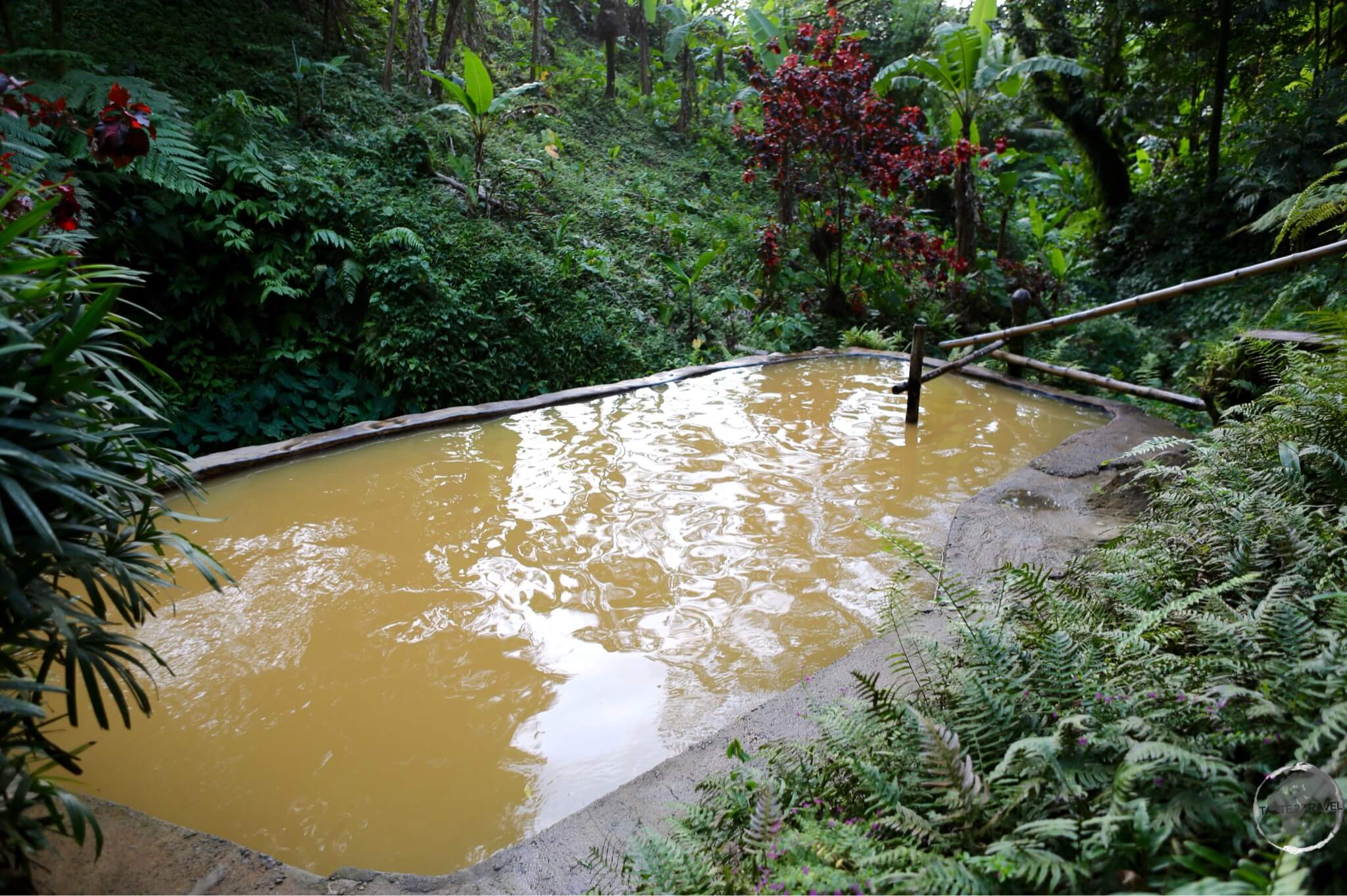
Wotten Waven hot springs
At the end of a long day of hiking, what better way to relax than in one of the many hot sulphur spring baths in the mountainside village of Wotten Waven.
Hurricane Maria
In September of 2017, Dominica was devastated by Hurricane Maria. The island is slowly rebuilding and the government is keen to see tourists return. Lonely Planet recently published an update detailing which islands are ready for tourists post-hurricanes. Most guest houses and hotels are now operational and most sights are open.
For more on this destination, please refer to my Dominica Travel Guide.
#4 – Bonaire
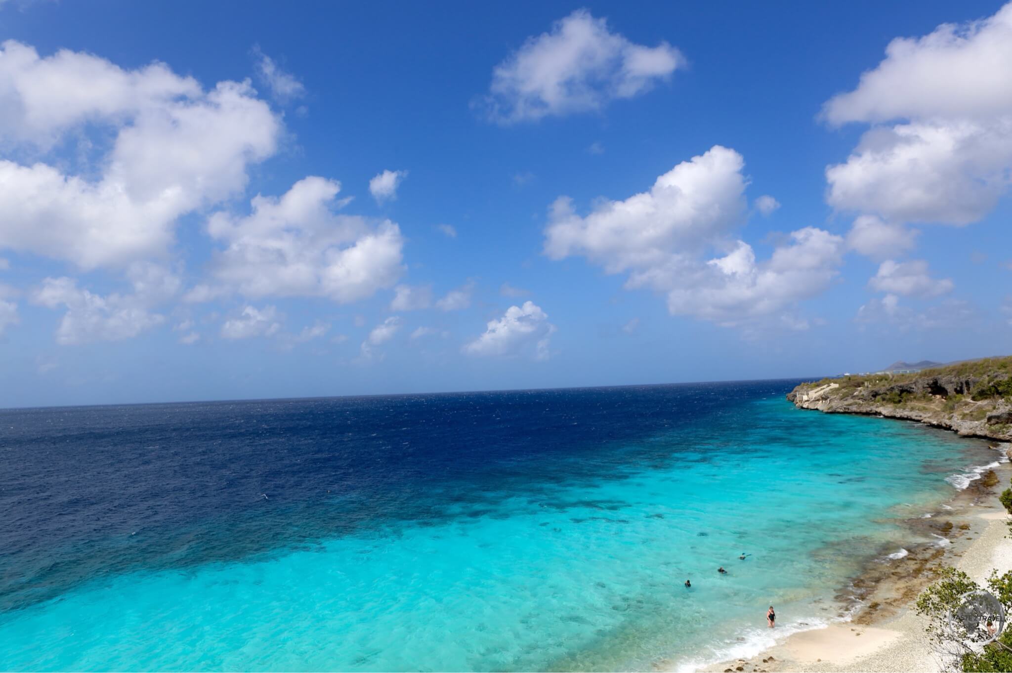
Most of the coastline of Bonaire is rocky with a reef running along the entire shoreline
When your plane pulls up outside the small terminal building of Bonaire’s Flamingo International Airport (which is painted ‘Flamingo pink’) you’ll know you’ve landed somewhere special. Part of the ‘ABC islands’, tiny and quiet Bonaire is a municipality of the Netherlands, located 48-km east of Curaçao and 140-km east of Aruba.
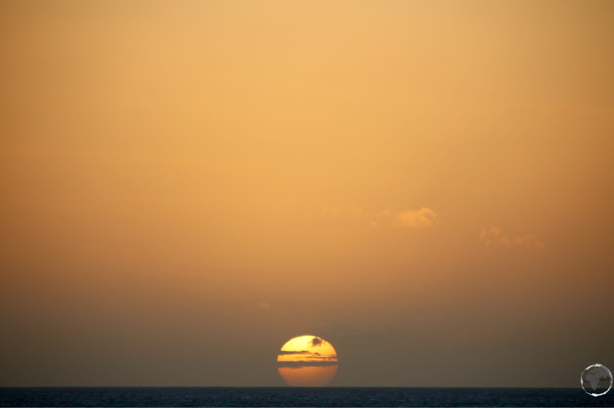
Sunset on Bonaire.
The island bills itself as a ‘Diver’s Paradise’ and with a colourful, onshore reef running the entire length of its protected leeward coast, the island lives up to its name. Due to the onshore reef, there are no sandy beaches on Bonaire with the nearest beach being on neighbouring Curaçao.

Caribbean Flamingo on Bonaire’s lake Gotomeer.
While the island is famous for its reef, the arid interior provides several attractions. Bonaire is famed for its Caribbean Flamingos which are drawn to the brackish salt water of the island’s lagoons. The best place to observe these graceful creatures is at Lake Gotomeer, which contains a healthy supply of brine shrimp, the main diet of Flamingos.
Did you know:
Flamingos are born with grey feathers, which gradually turn pink because of a natural pink dye called canthaxanthin that they obtain from their diet of brine shrimp.

Salt Mine on Bonaire
Looming on the horizon south of the capital, are a series of white hills which are part of the Cargill salt mining operation. Salt mining has always been an important industry on the island. Fort Oranje was built by the Dutch in 1639 to defend the harbour, from which the main export was salt. The capital (Kralendijk) then developed around the fort.
Cactus Vodka!

Cactus vodka from the Cadushy distillery.
There are many cacti on Bonaire and one local company – The Cadushy Distillery – has figured a way to distil the spiny Kadushi Cactus into a less-than-spiny vodka, creating the world’s first cactus vodka.

The Kadushi cactus.
For more on this destination, please refer to my Bonaire Travel Guide.
#5 – Trinidad & Tobago

Male Purple Honeycreeper at Asa Wright nature reserve
Trinidad and Tobago (TT) is a two-island country offering the visitor two completely different destinations in one and, due to the diversity of its fauna, flora and people, one of the more interesting destinations in the Caribbean.

The national bird of Trinidad & Tobago, the Scarlet Ibis, at Caroni Bird Sanctuary.
Trinidad
Nowhere is this diversity more obvious than on the main island of Trinidad, which has not always been a Caribbean island. Located just 11 km from the coast of Venezuela, Trinidad was once joined to the South American mainland and sits on the same continental shelf.

A close up view of a sleeping Tree Boa in the Caroni Bird Sanctuary.
Due to its geological history, the geography, fauna, flora and climate of Trinidad are completely indistinguishable from neighbouring Venezuela. From Howler and Capuchin monkeys to ocelots and tree boa’s, Trinidad is home to a rich variety of ‘mainland’ wildlife which can be found in the jungles of South America but not on any other Caribbean island.

Female white-necked Jacobin hummingbird at Asa Wright Nature Centre.
Trinidad offers some of the best bird watching in the Caribbean, with two highlights being the Caroni Bird Sanctuary, where thousands of Scarlet Ibis roost at sunset and the Asa Wright Nature Centre. Located in the Northern mountains, the centre is one of the top bird-watching spots in the Caribbean with 159 different species having been recorded.

White-necked Jacobin hummingbird at Asa Wright nature centre.
Tobago

Pigeon Point beach, Tobago
A short flight (or ferry ride) from Trinidad, neighbouring Tobago is much quieter and more relaxed than its bustling neighbour. The island is known for its laid-back tempo, it’s many fine beaches, rain-forest, excellent snorkelling and diving and so is a popular tourist destination.

North coast of Tobago
For more on this destination, please refer to my Trinidad & Tobago Travel Guide.
#6 – Saba

Artwork at Saba airport, which is ranked as one of the world’s most dangerous airports.
Along with Bonaire and neighbouring St. Eustatius (Statia), this volcanic island of 1,991 souls is part of the Caribbean Netherlands. At 887 metres (2,910 ft), the summit of Saba – Mount Scenery – is the highest point within the Kingdom of the Netherlands.
Sand-less Saba is completely unique! A rugged volcanic peak which rises steeply out of the Caribbean sea, all the major infrastructure on the island was hand-built by defiant locals after they were advised by Dutch and Swiss engineers that infrastructure couldn’t be built on the impossibly steep slopes of the island.

The main settlement on Saba, Windwardside, with Mount Scenery in the background.
The one road on the island, known as “The Road”, is a 16 km ribbon of hand‐laid stone which bisects the entire island.
After engineers advised a road couldn’t be built, one local resident took a basic engineering course then starting laying out a route across the island. It took 20 years for locals to hand-cut and lay the stone with the road opening in 1958.
At about the same time, Dutch engineers also advised there was no area on Saba level enough to construct a runway.
Again, they would be proved wrong by the defiant locals. In 1959, regional aviator, Remy de Haenen performed an aerial survey of the island and identified “Flat Point” as a suitable area for a runway.
Within weeks, the locals had cleared and graded the area in preparation for a landing. De Haenen made the first landing of an aircraft on the island on February 9, 1959 with nearly the entire population of the island in attendance.

No room for pilot error at perilous Saba airport. “The Road” snakes its way from the airport across the island to Fort Bay.
One of the World’s Most Dangerous Airports
Saba Airport is ranked as one of the most dangerous airports in the world, and boasts the shortest commercial runway at 400-m in length.
Arriving and departing by plane is one of the highlights of a visit to the island – it’s both dramatic and scary. At the end of the runway are cliffs that plunge into the sea and on one side of the airport is a towering mountain, all of which present plenty of challenges for the pilots of Winair – the only airline to fly to Saba.
All flights to this tricky airport are flown by the most experienced of Winair pilots from neighbouring St. Martin and utilise special STOL (Short Take-off / Landing) aircraft.
Upon landing, the pilot jams on the breaks the instant the wheels hit the tarmac. Upon take-off, you only start climbing once you have flown off the end of the runway – a bit like a young bird being pushed out of the nest for the first time – you just have to fly!
If it all sounds too scary, you have the more sedate option of arriving by ferry from St. Martin.

A strict building code on the island ensures all buildings are painted white, with green trim and red roofs.
The main settlement of Saba is the picturesque village of Windwardside, which is located high up on the slopes of Mount Scenery at 400 metres.
The population of Windwardside is an eclectic mix of recently arrived expats (many of whom have introduced a creative flair to the island) and descendants of European migrants.
Less eclectic are the strict building codes which ensures all structures on the island sport the same white, green and red colour scheme.

Hiking trail on Saba.
While the only beach on the island consists of a tiny man-made strip of sand (adjacent to the airport), the real attractions of Saba are the extensive network of hiking trails and the incredible Scuba diving.

The only beach on Saba is man-made.
Saba is known for its unique pinnacle dive sites, created when magma pushed up through the seafloor creating underwater towers of rock which soar up to around 26-m beneath the surface.
Due to the unique underwater seascapes, diving on Saba is a unique experience. I chose to dive with Sea Saba, who I would recommend.
For more on this destination, please refer to my Saba Travel Guide
#7 – Jamaica

Rasta rafting guide
Jamaica is as smooth as its rums and as spicy as its Jerk – a rewarding destination for those willing to pull themselves away from the legendary beaches and venture off the beaten track.
There is much more to Jamaica than Bob Marley, quintessential tropical beaches and sunsets. The third largest island in the Caribbean (after Cuba and Hispaniola), offers an abundance of culture from Reggae music to Rastafarians, a unique cuisine in the form of ‘Jerk’, lush tropical rain forests, misty blue mountains, superb coffee, hidden waterfalls, meandering rivers, famous dark rums and so much more.
Beaches
Of the many beaches on the island, my favourite is Seven Mile beach at Negril. As the name suggests, this is a long stretch of powdery-white sand with a variety of accommodation options strung along the main road.

Seven Mile Beach, Negril.
Blue Mountains
Away from the coast, the rugged, lush-green, verdant interior is home to many spectacular sights, including the famed Blue Mountains.
Located between Kingston to the south and Port Antonio to the north, and deriving their name from the azure haze which hangs over them, the Blue Mountains are the longest mountain range in Jamaica and include some of the highest peaks in the Caribbean. The highest point is Blue Mountain Peak, at 2256-m.

Blue Mountains, home to Jamaica’s famous coffee farms
Today, the mountains are renowned as being the place where the famous Jamaican Blue Mountain Coffee is cultivated.
Coffee plants were first introduced to Jamaica by a former British governor in 1728. Their cultivation started in a field near a parish in Kingston before eventually being extended into the Blue mountains where they flourished.
I travelled through the mountains in my rental car, which allowed me to stop at various cafes along the main road, where I could sample the most amazing, freshly brewed coffee.

Roasting coffee in the Blue Mountains
Waterfalls
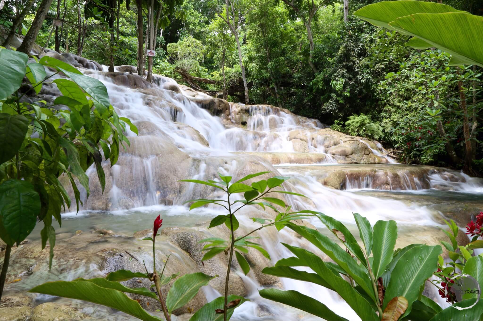
The incredible refreshing – Dunn’s river falls.
Mountainous Jamaica is home to many wonderful waterfalls, all of which provide a refreshing escape from the heat and humidity. One of the more famous is Dunn’s River falls which are located a short drive from the north coast city of Ocho Rios.
The falls are fed by spring water, which is rich with calcium carbonate. This deposits travertine, which is a form of limestone. The falls are described as a ‘living phenomenon’ because the travertine is continuously rebuilt by the sediments in the spring water.
The falls are 55-m high and cascade gently over limestone for 180-m before emptying onto a beautiful sandy beach and into the Caribbean sea. The falls is one of the very few travertine waterfalls in the world that empties directly into the sea.
Rio Grande

Rafting the Rio Grande.
Another highlight of my trip to Jamaica was my raft trip down the Rio Grande. Located on the north coast in the parish of Portland, the Rio Grande was named when the Spanish occupied Jamaica in the 15th and 16th centuries. One of the largest rivers in Jamaica, it is today a popular destination for rafting.
The river is fed by rainwater flowing down from the Blue Mountains. The bamboo rafts, which today carry paying tourists, were originally used to transport produce, especially bananas, from the interior of the island.
The ‘rafting for fun’ craze was started by Hollywood star, Errol Flynn, who made Port Antonio his home and wanted something fun to do when his friends visited. My rafting guide was a 70-year old Rasta dude who was as cool as the flowing river water.
For more on this destination, please refer to my Jamaica Travel Guide.
#8 – Dominican Republic

Vendors on the beach at Boca Chica
Discovered by Columbus on his first voyage to the Americas. Home to the oldest continuously inhabited city in the Americas and today the most popular tourist destination in the Caribbean region, the Dominican Republic is a dream destination.
There is good reason the masses flock to the Dominican Republic (DR). The country is a unique destination, offering an abundance of history, culture, charming colonial cities, white-sand beaches, excellent diving and snorkelling, unspoilt nature, soaring mountain ranges (including the highest peak in the Caribbean) and a friendly and welcoming population.
Add to this a stable political environment, good infrastructure, reliable and modern transportation options, affordable prices and a booming economy. It’s easy to see why the country is the preferred choice for so many visitors. There is something for everyone in the DR – no matter your interest or budget.

A true colonial relic – the Convent of the Dominican Order in Santo Domingo.
Santo Domingo
Santo Domingo, the capital of the Dominican Republic, was founded in 1496 by Bartholomew Columbus (the younger brother of Christopher Columbus), and has the distinction of being the oldest continuously inhabited European city in the Americas.

Interior of the first Cathedral built in the Americas – Catedral Primada de América.
The old town, known as the ‘Zona Colonial‘, has been designated a UNESCO World Heritage site and is a charming place to base yourself, with lots of cool and breezy, renovated colonial relics providing pleasant accommodation options and a respite from the constant heat and humidity.
The narrow streets of the old town are home to many ‘firsts’ in the Americas; the ‘first road’, the ‘first hospital’, the ‘first cathedral’, the ‘first convent’ and so on. If you enjoy immersing yourself in history and culture, Santo Domingo is an engaging destination.

Built by Bartholomew Columbus as his residence – Alcazar de Colon, Santo Domingo.
The dining and entertainment scene in the old town is one of the best in the Caribbean and is constantly evolving, with new restaurants and bars opening on a regular basis. With all this activity, there’s much to keep the visitor occupied and when you need to take a break, beautiful white-sand beaches are a short taxi ride away.
Beaches

Broad-billed Tody in the ‘Indigenous Eyes National Park’, Punta Cana.
Without a doubt, the most popular tourist destination in the Dominican Republic is Punta Cana. Located at the easternmost tip of the Dominican Republic and blessed with 32 kilometres of fine white-sand beaches, Punta Cana is the #1 tourist playground with flights arriving at its busy airport from throughout Europe, North and South America.
All this tourism has had a negative impact on the one key asset, the beach, with almost all beach-side land walled-off by large, private resorts who restrict access to their paying guests. For those staying away from the beach, the only access points are a few crowded and congested public lane-ways.

Natural springs in the ‘Indigenous Eyes National Park’, Punta Cana
One non-beach highlight in Punta Cana is the Indigenous Eyes National Park. This is a private forest reserve operated by the Punta Cana Ecological Foundation.
The reserve features walking trails, which lead you through the forest, past twelve crystal-clear, freshwater lagoons. Five of the lagoons are open to visitors for swimming, a great way to cool off on a hot day.
The lagoons are home to fish and turtles and the trails provide good bird watching opportunities and will eventually lead you onto the beach.

Stormy skies over the beach at Las Terrenas
My preferred beach experience can be found at the much quieter Las Terrenas, which is located on the north-east coast, a 3.5 hour drive north of Punta Cana.

Beach at Las Terrenas.
Las Terrenas is nestled among green hills and started life as a quiet fishing village, however it was only a matter of time before developers would exploit its fine white sand beaches.
Today the beaches are lined with hotels, restaurants and bars but there are far fewer tourists here than Punta Cana and beach access is not restricted.
Mountains

Baiguate Waterfall, Jarabacoa
While the focus of Dominican tourist brochures are the many fine beaches, the mountainous interior of the country also warrants investigation.
A centre for tourism, with lots of accommodation options, is the mountain town of Jarabacoa (525 metres above sea level) which is located a two-hour drive north-west of Santo Domingo, via an excellent highway.
The pleasant countryside around Jarabacoa is full of hiking trails which follow the course of various rivers and provide access to a number of waterfalls. For those hikers with lots of energy and enthusiasm, nearby Pico Duarte (3,087m) is the highest mountain in the Caribbean.
With an average daily temperature of 22 degrees (Celsius), the climate in Jarabacoa is cooler and less humid than the low lands, which allows local farmers to grow lots of amazing produce, including the juiciest and sweetest of strawberries.

Rio Jemenez, Jarabacoa
For more on this destination, please refer to my Dominican Republic Travel Guide.
#9 – Cuba

Cuba is an enchanting destination! A country with a long and complex history and fascinating culture, the largest island in the Caribbean, which is home to the region’s largest population.
Once a favoured hedonistic destination for American celebrities and socialites, Cuba had a reputation as an exotic and permissive playground.
In the early 20th century, Cuba’s ideal tropical beaches attracted the American masses who could purchase cheap package tours from Florida, which included round-trip tickets from Miami, hotel, food and entertainment.
The island also attracted famous celebrities such as Ava Gardner, Frank Sinatra and Ernest Hemingway (who loved Cuba so much he relocated to Havana).

A propaganda painting in Havana’s ‘Museum of the Revolution’, celebrates the overthrow of former President Batista by Fidel Castro.
The party ended in 1959 when a young Fidel Castro, having overthrown the corrupt President, Fulgencio Batista, came to power, installed a communist government and promptly destroyed all symbols of the hedonistic past, including most tourist infrastructure. This effectively ended tourism in Cuba with visitor numbers plummeting from 350,000 visitor’s in 1957 to 4,000 in 1961.

School children in Havana.
Today, the country is once again open to tourism and, in 2016, it attracted a record four million tourists, many of them arriving on cruise ships, carrying US passports.
Cruise ship arrivals increased from 24 in 2012 to 139 in 2015. The Ministry of tourism has forecast more exponential growth in the coming years, all thanks to an increase in visitors from the United States.
Despite the setbacks from the current US administration, the floodgates have been opened and American tourists are once again flocking to this Caribbean jewel.
Havana

The old town in Havana is a treasure trove of Colonial architecture,
Havana is the throbbing heart of Cuba. It’s the capital city, largest city (population: 2.1 million), main aviation and maritime hub and leading commercial centre.
At its heart lies the charming Habana Vieja, the old town and the place of most interest to tourists. Within the walls of the old town, the party never stops, with Salsa music echoing from bars where you can dance 24×7 and where it’s socially acceptable to drink Mojito’s (the national drink) anytime of day.

A Florist in the old town of Havana.
With a history stretching back 500 years, the old town is a treasure trove of Colonial architecture and, after 50 years of neglect, is slowly, and carefully, being renovated. Walking the streets of the enchanting old town, you can feel the history around you – it’s a powerful place.

There are lots of classic beauties to be found on the streets of Havana.
The old town is comprised of numerous grand squares, which can best be described as jewels of colonial architecture.
Lining the squares are cathedrals, old mansions which have been converted into museum’s and galleries, shop’s, restaurant’s, cafe’s, bar’s, and always – music.
The music never stops in the old town, there’s always a band playing somewhere and there are lots of venues where you can dance salsa through the night.
Outside Havana

The colourful old town of Trinidad.
Cuba is a largely urban country, and offers many other resplendent colonial cities such as Cienfuegos, Trinidad, Sancti Spíritus, Ciego De Avila, Camagüey, Holguín and Santiago de Cuba.

Parque José Martí in Cienfuegos.
Of these, my top pick would be Cienfuegos which was founded by French settlers escaping the revolution in neighbouring Haiti. The French established themselves as agricultural barons and used their wealth to construct fantastic mansions in the neoclassical style, which today makes Cienfuegos a pleasure to explore.

A classic American car parked outside Teatro Terry in downtown Cienfuegos.
For more on this destination, please refer to my Cuba Travel Guide.
#10 – Bermuda

Native to Bermuda – the White Tailed Tropic bird is locally known as the Long-tail.
Okay! Bermuda is not part of the Caribbean but it is an island nation in the Atlantic and located a mere 1463 km (909 miles) north-east of the Bahamas – its nearest Caribbean neighbour.
Although, in geographical terms, it’s not part of the Caribbean region, in many other respects, Bermuda has a distinctly Caribbean soul, so I’m including it in my Caribbean ‘Top 10’.

Storm approaching Horseshoe Bay Beach.
Although a British territory, approximately 60% of the population traces its heritage to the West Indies with the Caribbean connection evident in everything from the local music, cuisine and culture to the Caribbean lilt of Bermudian voices.
Despite being located well north of the Tropic of Cancer, Bermuda is kept warmer than usual thanks to the Gulf Stream. It’s all like the Caribbean – just a little to the north!

Bermuda Blues
The beaches on Bermuda can only be described as gorgeous, offering translucent waters, pink-sand and rivalling anything found in the Caribbean. The surrounding reef offers a plethora of diving and snorkelling opportunities and the rich, carefully preserved history is engaging.

Today a UNESCO world Heritage site, St. Georges served as the capital of Bermuda for the first 200 years.
St. Georges town was Bermuda’s first English settlement and served as the capital of Bermuda for its first 200 years. The colourful, mostly pedestrian, town is beautifully renovated and offers a wealth of sights for visitors to explore.

The colourful, calm, traffic-free, streets of St. Georges are a pleasure to explore.
Bermuda Shorts

How to wear Bermuda Shorts
Source: “Tabs” – Authentic Bermuda Shorts
If you’re still struggling to find a reason to visit Bermuda then you simply must go as there is no other place on the planet where you can buy yourself a pair of genuine Bermuda shorts. Winston Churchill once famously quipped “The short-pant is a terrible fashion choice, unless it is from Bermuda.”

Bermuda shorts in every colour of the rainbow at ‘Tabs’ in Hamilton
Local men wear their shorts (always with matching knee-length socks) as a matter of pride. They are perfectly acceptable attire for any occasion, including business meetings and weddings!

Bermuda shorts come in a variety of colours, with red (same colour as the flag) being especially popular.
For more on this destination, please refer to my Bermuda Travel Guide.
That’s the end of my Top 10 Caribbean Island Experiences. I Hope it’s provided some inspiration for your next trip.
Safe travels!
Darren
Follow me on Instagram:
Further Reading
Other travel reports from the Caribbean region include:
Top 10 Caribbean Experiences Top 10 Caribbean Experiences Top 10 Caribbean Experiences Top 10 Caribbean Experiences Top 10 Caribbean Experiences Top 10 Caribbean Experiences Top 10 Caribbean Experiences Top 10 Caribbean Experiences Top 10 Caribbean Experiences Top 10 Caribbean Experiences Top 10 Caribbean Experiences Top 10 Caribbean Experiences Top 10 Caribbean Experiences Top 10 Caribbean Experiences Top 10 Caribbean Experiences Top 10 Caribbean Experiences Top 10 Caribbean Experiences


