Other travel-related quizzes are also available on BuzzFeed.
Travel Quizzes on taste2travel
Welcome to taste2travel!
My name is Darren McLean, I’m the owner of this website and I love travel trivia and I certainly enjoy creating travel quizzes.
As of today (August 2024), there are 76 different quizzes on taste2travel.
This number will continue to grow so don’t forget to check back periodically.
Each quiz on taste2travel contains 20 questions, which means there is a total of 1,520 travel trivia questions waiting to challenge you.
In fact, taste2travel has enough trivia questions to keep a pub trivia night going for many weeks.
You’ll find a range of quizzes covering such topics as:
Currencies
Flags
Capital Cities
UNESCO World Heritage Sites
World Museums
Map Quizzes
Continent-specific Quizzes
World Islands
Landlocked Countries and much more!
If you have an idea for a topic which I could add to my quiz stable, please do not hesitate to contact me via the Contactpage. I’m always looking for new ideas.
Don’t forget to share these quizzes with your family, friends and community using the social media buttons at the top of the quiz.
Apart from excellent travel quizzes, you’ll also find other outstanding content on taste2travel – such as travel guides, photo galleries and feature articles which provide tips on booking cheap flights and much more.
All images are copyright! If you wish to purchase any images for commercial use, please contact me via the Contactpage.
About taste2travel!
Hi! My name is Darren McLean, the owner of taste2travel. I’ve been travelling the world for 33 years and, 212 countries and territories, and – seven continents later, I’m still on the road.
Taste2travel offers travel information for destinations around the world, specialising in those that are remote and seldom visited. I hope you enjoy my content!
Ever since I was a child, I have been obsessed with the idea of travel. I started planning my first overseas trip at the age of 19 and departed Australia soon after my 20th birthday. Many years later, I’m still on the road.
In 2016, I decided to document and share my journeys and photography with a wider audience and so, taste2travel.com was born.
My aim is to create useful, usable travel guides/ reports on destinations I have visited. My reports are very comprehensive and detailed as I believe more information is better than less. They are best suited to those planning a journey to a particular destination.
Many of the destinations featured on my website are far off the regular beaten tourist trail. Often, these countries are hidden gems which remain undiscovered, mostly because they are remote and difficult to reach. I enjoy exploring and showcasing these ‘off-the-radar’ destinations, which will, hopefully, inspire others to plan their own adventure to a far-flung corner of the planet.
I’m also a fan of travel trivia and if you are too, you’ll find plenty of travel quizzes on the site.
Photography has always been a passion and all the photos appearing in these galleries were taken by me.
If you have any questions or queries, please contact me via the contact page.
Svalbard is as close as most mere mortals can get to the North Pole, without embarking on an expedition.
A polar bear warning sign outside of Longyearbyen. “Gjelder hele Svalbard” means that the warning applies to all of Svalbard.
A truly magical and surreal archipelago, whose landscapes include pointy, snow-covered peaks and huge glaciers which calve into the sea, Svalbard is home to more polar bears (~20,000) than people.
Dramatic scenery is a constant in this part of the world.
Outside of the settlements, you (or a guide) are required to carry a loaded rifle as protection against polar bear attack.
A view of the mighty Esmark glacier.
One of the world’s northernmost inhabited areas, the main settlement of Longyearbyen lies at latitude 78˚ North – just 1,316 km (817 mi) south of the North Pole.
A beach cabin provides a sense of scale to the monumental scenery on Svalbard.
Svalbard is one of Europe’s last great wildernesses, and the many highlights of the archipelago are to be found along the shores of the remote and uninhabited fjords – the world’s northernmost fjords!
A trip to the abandoned Soviet mining town of Pyramiden is a highlight of Svalbard.
Svalbard’s main settlement, and entry point, is tiny Longyearbyen (pop: 2,368), which is home to a young, transient population of 53 different nationalities.
A view of the Norwegian town of Longyearbyen, the largest settlement on Svalbard.
Svalbard has a unique immigration policy which allows anyone with a work contract to settle and live on the island, regardless of nationality, without requiring any sort of visa!
This attracts a large number of seasonal Asian workers, especially hard-working Filipinos, many of whom have learnt to speak some Norwegian. See the ‘Visa Requirements‘ section below for more on this.
Typical scenery on the Isfjorden, Svalbard.
Travel costs on Svalbard are very high, with a daily budget likely to be in the region of €400 – 500 if you are staying in a decent hotel and participating in a boat trip on the fjord.
The world’s northernmost Fjord, the Billefjorden, is lined by an uninterrupted range of towering mountain peaks.
Svalbard would be a challenging destination for budget travellers! The main target tourist market is established, well-monied travellers who are prepared to pay €200 for a daytrip on a boat (please refer to the ‘Cost‘ section for more details).
Getting up close to a walrus colony is one of many amazing activities on Svalbard.
One of the highlights of my trip was a 7-hour Walrus safari which was operated by the excellent team from Better Moments. The trip involved 6 hours on a speedboat and one hour on the beach with the walrus colony.
The cost of this trip was an eye-watering NOK2,390 (€231) – but it did include a ham sandwich for lunch!
Despite the cost, it was well worth the money and I would recommend it to anyone visiting Svalbard. It would be a shame to come this far and baulk at doing something unique like the walrus safari because of financial considerations.
The abandoned staff cafeteria in the former Russian coal mining town of Pyramiden, a remote ghost town which is now an intriguing tourist attraction.
Svalbard is also home to two Russian coal mining towns, Barentsburg and the, now-abandoned, Pyramiden, both of which are popular daytrips from Longyearbyen.
Mountain peaks surround the settlement of Longyearbyen.
In this Svalbard Travel Guide, I provide a detailed overview of sights, accommodation and restaurant options along with information on getting to the archipelago and getting around.
Community noticeboard, frozen in time, in the former Soviet mining town of Pyramiden.
Location
Longyearbyen 9170, Svalbard and Jan Mayen
Svalbard, also known as Spitsbergen, is a Norwegian archipelago located between mainland Norway and the North Pole. Longyearbyen lies 2,000 km north of Oslo and 836 km north of Nordkapp (the northern most point in Norway).
Due to its extreme northerly position, Svalbard experiences 2.5 months of complete darkness – the “Polar Night” – from mid-November to late January.
During the summer, the “Midnight Sun” is omnipresent (somewhere above the cloud), lasting from late April to late August.
History
Due to its many pointy peaks, Svalbard was originally named ‘Spitsbergen’ by the Dutch explorer Willem Barentsz.
Svalbard, which translates from Old Norse as “Cold Coast”, was originally discovered by Dutch explorers Willem Barents and Jacob van Heemskerck in June 1596.
They named the archipelago Spitsbergen, meaning “pointed mountains”, due to the many pointed mountain peaks which line the coast.
One of two inhabited settlements on Svalbard, the Russian mining town of Barentsburg is named after the Dutch explorer, Willem Barents.
At the time of their arrival, they reported that so great was the number of whales, that navigating between them was difficult.
With the word out, Dutch and English whalers arrived as early as 1611, followed by French, Hanseatic, Danish, and Norwegian whalers, all of whom started arguing over whaling rights and the division of territory.
Eventually, by the time the arguments had settled, they had slaughtered almost all of the whales!
Remains of a coal mine cable-way in Longyearbyen.
With the decline of whaling by 1800, the islands’ importance centred on the presence of coal. The coal deposits on Svalbard date back millions of years, to a time when the archipelago was located in the tropics and was covered with lush vegetation. The deposits are close to the surface which is attractive for mining companies.
Not until the beginning of the 20th century were the deposits surveyed and mineral rights claimed by American, British, Norwegian, Swedish, Dutch, and Russian companies and individuals.
A simple memorial to John Munroe Longyear among the ruins of the old town of Longyearbyen.
One American to arrive on the island was businessman and mining pioneer John Munroe Longyear, who first visited Svalbard on a cruise in 1901, and became interested in developing a coal mining operation.
In 1906, he established the Arctic Coal Company which developed several mines and the associated infrastructure. He named his settlement Longyear City.
In 1916, the Norwegian company, Store NorskeSpitsbergen Kullkompani, took over the mining operations from Longyear’s Arctic Coal Company, and the settlement was renamed Longyearbyen (“Longyear City” in Norwegian).
Svalbard Treaty
The Svalbard Treaty was signed on 9 February 1920 and entered into force on 14 August 1925. The treaty granted possession of the archipelago to Norway and mineral rights, on an equal basis, to various European and other countries.
The abandoned Russian coal mining town of Pyramiden is today a popular tourist attraction.
Only Russia and Norway continue to extract and export coal from mines on the islands, with one mine each operating in Longyearbyen and Barentsburg.
The main economic activity on Svalbard today is tourism.
People
Svalbard has never been home to a native population, unlike neighbouring Greenland which was originally settled by the native Inuit.
Anyone living on Svalbard has arrived from somewhere else.
With a population of 2,368 – Longyearbyen is a cosmopolitan Arctic village whose residents come from no less than 53 different countries.
Unlike everywhere else in Europe, there is no social security on Svalbard which ensures that anyone who is resident is fully self-sufficient and employed.
Limited medical facilities ensure that anyone requiring medical attention, such as the elderly, cannot live on the archipelago.
Due to these conditions, the population of Longyearbyen is generally young, fit, healthy and fully employed. The average age is a relatively young, 30 years, with the bulk of the population being transient, remaining for a few years on short-term work assignments.
Many of the work contracts cover the short summer tourism season, with workers staying on the archipelago for less than 6 months.
Foundation supports, from one of the original buildings in Longyearbyen, have been tilted by the movement of the underlying permafrost.
There are also two important restrictions which apply to the human population on Svalbard:
No one can be born on Svalbard.
No one can be buried on Svalbard.
Due to the limited medical facilities in Longyearbyen, anyone who is pregnant must relocate to Norway, normally Tromsø, for the final term of their pregnancy.
The underlying permafrost is visible in this gully outside of Longyearbyen,
No one can be buried on Svalbard for two good reasons:
Due to the seasonal movement of the earth caused by the thawing and then re-freezing of the underlying permafrost, no one can be buried on Svalbard, lest their body starts re-emerging from the frozen ground at some stage in the future.
Bodies simply won’t decompose in the frozen ground.
A view of the Russian mining town of Barentsburg, the 2nd largest settlement on Svalbard.
The one other settlement on Svalbard is the Russian mining town of Barentsburg, which is located 40 km (about 1 hour by boat) to the south-west of Longyearbyen. This very quiet town is home to a population of 455 souls from Russia and Ukraine.
Facilities in Barentsburg are limited with residents using Longyearbyen for most services, including the airport.
The currency of Svalbard is the Norwegian krone (currency code: NOK), whose name translates into English as “crown”. The currency is issued in notes of 50, 100, 200, 500 and 1000 krone.
The krone (plural: kroner) is used throughout Svalbard, including in the Russian settlement of Barentsburg.
Credit Cards
If you came to Svalbard without cash, that would not be a problem since every business accepts payment with credit cards. If you prefer to use cash, there is an ATM available in Longyearbyen.
Exchange Rates
Click on the links to view the current exchange rate of 100 NOK against the Euro and US dollar:
The famous polar bear roadside warning sign is featured on a Svalbard stamp.
Postal services on Svalbard, including in the Russian town of Barentsburg, are provided by Norwegian Post, which issues a separate set of Svalbard stamps. The one post office in Longyearbyen is located on the main street.
Located at 78° North, Longyearbyen PO is the world’s northernmost post office.
Svalbard Postmarks
The post office in Longyearbyen also uses unique postmark stamps, featuring a polar bear and reindeer.
The polar bear and reindeer postmarks, which are used at Longyearbyen PO.
When I first saw these postmarks, I commented to the post office staff that these would make ideal souvenir passport stamps, since no immigration stamp exists for Svalbard.
I was told that the post office has been instructed by the government not to stamp passports with these postmarks.
Barentsburg Post Office
The post office in Barentsburg, which is operated by Norwegian Post, is a great place for souvenir shopping.
Located on the main street in Barentsburg, the local post office in this Russian town is operated by Norwegian Post since Svalbard is a territory of Norway.
The post office sells a variety of souvenirs.
Costs
Spectacular day trips on the world’s northernmost fjord are the main activity for most tourists on Svalbard.
Horrendous!
Svalbard is not a destination for anyone on a budget.
For most people, Svalbard will be a one-time travel experience. It’s best to come with enough funds to enjoy the many amazing experiences which await in this unique Arctic playground and not to be too focused on just how much everything is costing you!
Due to the high travel costs, it’s best to bite the budget bullet, do what you wish to do, then leave before your travel budget disappears entirely.
Svalbard would be a miserable travel experience for anyone pinching their pennies!
An example of typical daily costs:
Hotel room at Radisson BLU Polar hotel (includes breakfast): €230
Full day trip to Pyramiden with Henningsen Transport & Guiding (includes lunch): €184
Dinner at Stationen Restaurant (Steak meal with one local beer): €42
Total for one day = €456
Suggested daily budgets:
Budget: Not possible!
Mid-range: NOK 4,000 – 4,648 (€380 – 450)
Top-end: NOK4,648+ (€450+)
The ‘Circle K’ petrol station in Longyearbyen is the world’s northernmost petrol station, where a litre of fuel costs NOK14.70 (€1.42).
Sample costs:
Coca Cola (0.33 litre bottle): NOK35 (€3.38)
Water (0.5 litre bottle): NOK24 (€2.33)
Svalbardi Polar Iceberg Water (750ml bottle): NOK982 (€94.95) ** Possibly the most expensive bottle of water in the world! **
The main street of Longyearbyen is home to a selection of boutiques which sell a range of Arctic merchandise.
While other costs are high on Svalbard, shopping can be a bargain! Svalbard is a duty-free zone so lower tax-free prices apply for everything you buy.
Funky local artwork for sale in Longyearbyen.
You will find bargain prices on outdoor clothing and equipment at Longyearbyen’s sporting goods stores, while the price of alcohol and tobacco are considerably lower than on the Norwegian mainland.
Located on the main pedestrian mall in Longyearbyen, the Coop supermarket is a great place to find bargain souvenirs.
If you are interested in purchasing souvenirs, the local supermarket, Coop, has a great range of items at very reasonable rates. This is also the only supermarket in town!
Items for sale in the gift shop at Pyramiden.
Shopping opportunities exist in Longyearbyen and in the Russian towns of Barentsburg and Pyramiden, where you’ll find at least one or two shops selling souvenirs.
Svalbard Wildlife
Introducing a gallery of Svalbard wildlife!
Unfortunately, the elusive polar bear proved to be too elusive during my stay on Svalbard, and so sadly, was never photographed by me!
Click on images for the full gallery-view.
Arctic Cruises
Cruise ships in Longyearbyen harbour.
Most visitors to Svalbard are cruise ship passengers who overnight in Longyearbyen before and after an Arctic cruise. The cruising season runs from late-April through late-September.
During the 2019 summer season, ~300 cruise ships visited Svalbard, carrying around 20,000 tourists.
Being the only settlement with services in this part of the world, Longyearbyen is a hub for all cruise ship companies. Most passengers arrive in town on special charter flights, which saves the (limited) regularly scheduled flights from being inundated!
A cruise ship is dwarfed by the towering mountains of Svalbard.
The summer cruise season of 2022 was the first time that Svalbard had been open since the summer of 2019, due to the Covid-19 pandemic.
Rather than cancelling cruises in 2020 and 2021, and refunding money back to passengers – which would have resulted in companies becoming bankrupt – the cruise ship companies rescheduled everyone for the 2022 season.
This meant that three years’ worth of passengers were being pushed through the system in one year! This resulted in a huge amount of congestion in tiny Longyearbyen, where, on one day, 8 cruise ships were in port, which overwhelmed the town of 2,400 inhabitants.
With a passenger capacity of 2,500, TUI Cruises’ “MV Mein Schiff” doubled the population of Longyearbyen during its one-day stopover.
On another day, TUI cruises arrived in town, with their mega-ship, ‘MV Mein Schiff 4’ whose passenger capacity matched the population of Longyearbyen, resulting in a doubling of the town’s population.
Having been closed for 3 years, local tour operators, and businesses, were happy to have the cruise ship passengers back in town – even if town was crowded!
A typical 10-day Arctic cruise costs around US$10,000. You can view a selection of cruises on the Swoop Arctic website.
Sightseeing
Tip: For a full list of activities on Svalbard, you should refer to the Things To Do page on the Visit Svalbard website.
You can also make bookings directly from this page.
Longyearbyen
The main town on Svalbard, Longyearbyen (population: 2,368) has the distinction of being the world’s northernmost town, located at 78˚ North – 1,316 km (817 mi) south of the North Pole, and well above the Arctic circle, which is located at 66°30′ North.
While there are two museums and a few other sights in town, Longyearbyen mainly serves as a base for full-day boat trips, exploring the many spectacular sights which are located along the shores of the fjords.
Svalbard Museum
The engaging Svalbard Museum displays artefacts from the history of Svalbard since its settlement along with fauna and flora displays.
A good first stop for any new arrival in town, the Svalbard Museum includes displays on the local fauna and flora of the archipelago, including an impressive (stuffed) polar bear.
Apart from being a natural history museum, Svalbard Museum is a cultural museum and includes displays which tell the story of settlement on the archipelago.
At the time of my visit, there was a special exhibition on permafrost – which affects much in this part of the world.
North Pole Expedition Museum
The North Pole Expedition Museum tells the story of early attempts to reach the North Pole.
Located directly behind the Svalbard Museum, the North Pole Expedition Museum tells the story of man’s early attempts to reach the North Pole, especially using airships and other types of aerial craft.
Displays inside the North Pole Expedition Museum, one of two museums in Longyearbyen.
The museum displays, which cover two floors, includes relics from expedition ships and air ships, old newspapers, maps and more.
Svalbard Church
Svalbard church was receiving a new roof at the time of my visit.
Located in an area of town which was the sight of the original settlement, the very cute Svalbard Kirke (church) is a warm and inviting place whose door is always open.
On the subject of open doors – it is standard practice on Svalbard that all doors to buildings remain unlocked, in case it is necessary for someone to hide from a wandering polar bear.
The altar inside Svalbard church.
The red, wooden church was built in 1958 using plans drawn up by the architect Hans Magnus. The church seats about 140 people and includes a stuffed polar bear (of course!)
Like everything else on Svalbard, the church has the distinction of being the northernmost church in the world and is one of two churches on Svalbard, with the other being a Russian Orthodox chapel in Barentsburg.
Svalbard Global Seed Vault
The Svalbard Global Seed Vault is also known as the Doomsday Vault.
Located outside of Longyearbyen, high on a mountain, overlooking the airport, the Svalbard Global Seed Vault is essentially a huge safety-deposit box for seeds.
Like something from a James Bond film, the entrance of this remote facility is a rectangular wedge of concrete which juts out from the side of a mountain.
The door to the vault is always closed and visitors are not allowed, lest someone introduces any sort of bacteria which would contaminate the valuable seed collection.
Beyond the entrance, a 150-metre-long passage leads to 3 chambers, with just one chamber currently used to house seeds.
Alone in isolation at the top of the world – the Svalbard Global Seed Vault is essentially a huge safety-deposit box for seeds.
The Global Seed Vault, which has been dubbed the “doomsday” vault, stores seeds from around the world – seeds which account for more than 930,000 varieties of food crops.
In 2008, Time Magazine named the Global Seed Vault as one of the ‘best inventions of 2008‘.
Husky Kennels
Common Eider ducks nesting alongside the noisy Husky kennels.
Located a short walk outside of town, the very noisy husky dog kennels are used to house these working dogs which are vitally important for sledding activities during the long, cold winters.
A female Common Eider duck, sitting on her comfortable nest which is made from Eider-down feathers!
All of the noisy racket from the constant barking and howling of the dogs, makes this a fox-free zone, which in turn makes this an ideal nesting site for the Common Eider duck.
A female (foreground) and male pair of Common Eider ducks in Longyearbyen.
The Arctic fox is one of the main predators of the ducks, which are most vulnerable while they are nesting. A large duck, the common eider duck is usually easily recognized by its size, the black belly and the white back of the male.
Previously, the excellent insulating down was collected from the nests of eider ducks for clothing or blankets.
Walrus Safari Daytrip
One of the best-known walrus colonies close to Longyearbyen is on Poolepynten on Prince Karl’s Fordland.
One of the highlights of my trip to Svalbard was being able to get up close to a colony of sunbathing walruses.
The walrus colony at Poolepynten on Prince Karl’s Fordland is located 87 km northwest of Longyearbyen, a 3-hour ride by speedboat.
During the winter months, walruses spend their time on sea ice. During summer, when the sea ice melts, walruses congregate on beaches such as at Poolepynten on Prince Karl’s Fordland, which is 87 km northwest of Longyearbyen.
Found only in the Arctic, there are two species of walrus – the Pacific and Atlantic walrus, with the Atlantic walrus found on Svalbard.
Both males and females grow tusks which they use to haul themselves out of the water and onto the sea ice. Their tusks are also used for keeping breathing holes open in the ice, fighting with other walruses, and for defence against predators.
Walruses use their sensitive whiskers for feeling out mussels and other sea creatures in the dark, Arctic waters.
Due to its great size and tusks, the walrus has only two natural predators: the orca and the polar bear.
Despite having no trees, the beaches of Svalbard, such as Poolepynten, are littered with ancient logs which have been carried to the Archipelago on ocean currents.
The walrus does not, however, comprise a significant component of either of these predators’ diets. Polar bears are more partial to seals!
Our Walrus Safari guide, with his loaded rifle, always on the lookout for polar bears.
I travelled on a Walrus Safari with Better Moments who charge NOK2,390 (€231) for the 7-hour trip. This included a lunch, which was a ham sandwich!
A ‘wet landing’ by dinghy at the very remote Poolepynten beach, with our speed boat in the background.
The safari involved a 6-hour return speedboat trip and one hour on the beach. As there is a risk of polar bear attack, our guide was required to carry a loaded rifle.
The scenery on Prince Karl’s Fordland.
Barentsburg & Esmark Glacier Daytrip
Travel Tip
For anything related to tourism in the Russian towns of Barentsburg and Pyramiden, you should consult with Grumant Arctic Travel Company.
Disclosure: At a time when Russia is waging an illegal invasion of Ukraine, it is incumbent upon me to disclose that the Grumant Arctic Travel company is a division of the Arktikugol (Arctic Coal) mining company, which is owned by the Russian government.
Trips to Barentsburg and Pyramiden from Longyearbyen use Norwegian companies.
A daytrip to Barentsburg always includes a stop at the impressive Esmark glacier which lies on the opposite side of the fjord from the Russian mining town.
Daytrips to Barentsburg include a stop at the Esmark glacier.
I travelled on a daytrip with Polar Charter aboard the MV Polar Girl who charge NOK1,950 (€188) for the 10-hour trip. This included a bowl of soup for lunch and a guided tour of Barentsburg.
The ‘MV Polar Girl’ offers day-trips to Barentsburg and Pyramiden.
Esmark Glacier
Two zodiac boats are dwarfed by the front of the Esmark glacier, which is 15 km wide.
The first of two stops on the daytrip was at the impressive Esmark glacier which calves into Ymerbukta bay, on the northern side of Isfjorden.
Two zodiac boats provide a sense of scale for the huge Esmark glacier, one of hundreds of glaciers on the archipelago.
The last remains of winter fast ice in front of the glacier were slowly melting.
Our boat, breaking through the last of the winter “fast ice”, the preferred habitats for seals, on approach to the huge Esmark glacier.
As we approached the glacier, our boat broke through the last of the fragile winter “fast ice”.
Fast ice is the preferred habitat for seals who escape the threat of polar bears by resting on the ice rather than on land.
Polar bear tracks, on the fast ice, in front of the Esmark glacier.
As a magnet for seals, the fast ice is also the preferred hunting ground for polar bears, whose favourite meal is seal. While we saw polar bear tracks on the ice, the tracks were not fresh and we saw no sign of polar bears.
View from the MS Polar Girl as we cross the Isfjorden en-route to Barentsburg.
Barentsburg
A bust of Lenin looks out over Barentsburg.
Located 60 km west of Longyearbyen, in Grønfjorden (Green Fjord), a small fjord to the west of the larger Isfjorden, the quirky Russian mining town of Barentsburg is home to a population of 455 souls who are both Russians and Ukrainians.
Traditional wooden buildings in Barentsburg.
Barentsburg was first established by a Dutch company in 1920, who named the settlement in honour of the famous Dutch explorer Willem Barentsz.
The one school building in Barentsburg features artwork which adds a splash of colour to this Arctic mining town.
In 1932, Barentsburg was sold to the Soviet state-owned company Arktikugol, and ever since the fall of the Soviet Union the community has been maintained by the Russian state-owned company Trust Arktikugol.
Apart from running the mining operation, the company owns the Grumant Arctic Travel Company.If you wish to stay overnight in Barentsburg, the travel company operates one hotel and one hostel (see the ‘Accommodation‘ section below for more details).
Artwork adorns the side of the abandoned workers’ cafeteria building in Barentsburg.
The currency in use in Barentsburg is the Norwegian krone (NOK) with credit cards accepted by most businesses.
The port authority building in Barentsburg.
During WWII, the Germans destroyed almost all buildings in Barentsburg which makes the current town relatively new.
Sleepy Barentsburg is a living museum of a Soviet-era mining town, complete with many fine Pomor-style wooden buildings.
Barentsburg is a living museum, full of relics from its Soviet past, including many fine Pomor-style wooden houses.
During our visit we had a one-hour guided tour around town, then time to ourselves to explore.
The logo of the Arktikugol company which operates the town of Barentsburg.
The town has its own coal-powered power plant, hospital, hotel, hostel, brewery, two bars, school, kindergarten, cultural and sports-facilities, one supermarket and one Lenin bust.
The former Soviet consulate was built in the classic Stalinist style while the new Russian consulate looms in the background.
Although this is a Russian mining town, Svalbard is a territory of Norway and, as such, the Russian government is represented in Barentsburg through a consulate.
The former consulate, which was built during the Soviet era in the classic Stalinist style, is now a museum while a modern Russian consulate, built directly behind the former consulate, overlooks the whole of the settlement from its hilltop position.
One of four apartment buildings in Barentsburg.
Compared to Longyearbyen, Barentsburg is very quiet and sleepy. There are few cars, few businesses, few shops and a general lack of buzz and activity. It’s all very quiet!
A Soviet-era sign outside a modern apartment building in Barentsburg proclaims “Communism is our goal”.
I saw very few people walking around the few streets which comprise the downtown area. It’s in complete contrast to the more bustling Longyearbyen!
The Russian orthodox chapel in Barentsburg is the world’s northernmost Orthodox chapel.
One sight worth visiting is the wooden Russian Orthodox chapel, the world’s northernmost Orthodox chapel.
The interior of the Russian Orthodox chapel in Barentsburg.
It was erected in honour the victims of an air disaster which occurred in 1996 when a Tupolev plane carrying 141 miners from the Arktikugol company, crashed into a mountain on approach to Longyearbyen airport. It was this event which led to the closure of Pyramiden.
Grumant
Abandoned buildings in the Russian settlement of Grumant.
Located on the southern shore Isfjorden, the Russian mining town of Grumant was first established in 1912 and then abandoned in 1965.
At its peak, it was home to 1,106 coal miners. Due to a lack of port facilities, coal had to be transported to nearby Coles Bay via a rail line. It all proved too difficult and costly and the settlement was eventually abandoned in 1965.
Abandoned buildings at the former Russian mining settlement of Grumant.
Pyramiden & Nordenskiöld Glacier Daytrip
The abandoned Russian mining town of Pyramiden lies 50 km north of Longyearbyen.
A highlight of Svalbard, Pyramiden is an abandoned Soviet coal mining settlement, which is located at the foot of the Billefjorden, near to the massive Nordenskiöld Glacier.
Minerals colour the soil of a mountain slope on the Billefjorden.
Several companies run daily trips from Longyearbyen which include scenic views of the Billefjorden, a trip to the Nordenskiöld Glacier and a guided tour of Pyramiden.
I chose to travel with Henningsen Transport & Guiding (HTG) who offer the 11-hour trip for NOK1,900 (€184), which includes a BBQ lunch, prepared by the excellent and friendly Filipino crew.
The dramatic coastline of the Billefjorden, as seen from the deck of the “MV Billefjorden”.
I was glad I chose HTG as our informative, enthusiastic and knowledgeable guide, Anna Lena Ekeblad,a Swedish expat who has lived in Svalbard since the mid-1990’s (making her one of the longest residents of Longyearbyen), shared her deep knowledge of the Arctic.
Was it any wonder that Willem Barentsz first named Svalbard “Spitsbergen”?
We were served one antidote after another and, without a doubt, the trip with HTG was the best of all the trips I made while in Longyearbyen. Highly recommended, especially if Anna Lena is your guide!
Billefjorden
The shore of the Billefjorden is lined with towering peaks which stand sentinel over the coastline.
Our boat, the “MV Billefjorden” carried us north for 50 km from Longyearbyen to Pyramiden, along the spectacular Billefjorden, the world’s northernmost fjord.
Typical view of the shoreline of the Billefjorden.
Billefjorden is the central fjord of the three branching from the innermost part of the Isfjorden. It is 30 km long and 5–8 km wide and is lined with spectacular cliffs, glaciers and mountain peaks which are breeding grounds for large colonies of Arctic sea birds.
Nordenskiöld Glacier
Approaching the Nordenskiöld Glacier, the first time in the season that a boat could approach the glacier.
One of more than 100 glaciers on Svalbard, the massive Nordenskiöldbreen (Nordenskiöld Glacier) is 25 km (16 mi) long and 11 km (6.8 mi) wide. It calves into Adolfsbukta, a branch of Billefjorden.
Unfortunately, there is nothing in this image to provide scale to the immense size of the Nordenskiöld Glacier.
At certain times of the year, sea ice prevents boats from reaching the face of this huge glacier. We were the first boat trip which was able to reach the glacier – that was in June.
A pair of Bearded seals, resting on sea ice at Nordenskiöld Glacier.
While there were no polar bears present, there were a few bearded seals resting on blocks of sea ice. The seals wait for larger blocks of ice to calve off the glacier then take up residence on them, while always keeping an eye out for their number one predator – the polar bear.
A hole in the ice, roughly in the shape of a heart, makes the Nordenskiöld Glacier the ‘heart of the Arctic’.
One feature of the glacier is a hole in the ice which is shaped roughly like a heart – making this glacier the ‘heart of the Arctic’.
Pyramiden
A bust of Lenin looks out over Pyramiden.
Located across the bay from the massive Nordenskiöld Glacier, the abandoned Russian coal mining town of Pyramiden looms large on the horizon.
The abandoned Russian coal mining town of Pyramiden is today a popular tourist attraction.
As you approach, you can clearly make out the many buildings, crane derricks at the port, mining infrastructure and a strange contraption which ramps its way up the steep mountain slope behind the town.
A covered gallery, which once housed a cable car, carried miners to the mine entrance, located below the mountain summit.
Everything is here, except for the residents!
An old tractor at Pyramiden.
Founded by Sweden in 1910 and sold to the Soviet Union in 1927, Pyramiden is named for the two pyramid-shaped mountains which form the backdrop of the town.
This large shed was used to keep livestock which was used to provide fresh meat, poultry and milk for the town.
During the 1980s the town had a population in excess of 1000 people. A large livestock shed was used as a ‘farm’ to provide fresh meat, poultry, eggs and milk for the town – something unique in this part of the world where all produce is imported.
A bust of Lenin in Pyramiden – the world’s northernmost Lenin monument!
Dwindling coal prices, difficulties with coal extraction from the mountain, and the catastrophic Russian plane crash which claimed the lives of 141 workers all contributed towards the discontinuation of the mining operations.
The first stop on a walking tour of Pyramiden is the memorial stele near the edge of town.
The last ton of coal was extracted in 1998 and is now displayed in a coal wagon which is at the base of the memorial stele.
Soviet emblems on the wall of the cultural hall.
In 1998, the town was then abandoned – frozen in time in this frozen land!
Notices on the community notice board inside the cultural centre at Pyramiden.
Everything remains in place, including notices on the community notice board, in what has become a time capsule of Soviet Arctic life from last century.
Wedding announcement on the community noticeboard in Pyramiden.
Pyramiden is a fascinating tourist attraction and should not be missed!
Soviet-era apartment buildings in Pyramiden.
Prior to the pandemic, I was fortunate enough to visit the abandoned Soviet city of Pripyat in the Chernobyl exclusion zone.
There are many parallels between Pyramiden and Pripyat, including the fact that they were both built as model Soviet towns and now lie abandoned, frozen in time.
A view of the auditorium, a part of the cultural centre in Pyramiden.
Since 2007, there has been a concerted effort to make Pyramiden a tourist attraction, this included a renovation of the town’s one hotel, Hotel Pyramiden, in 2014.
The last ton of coal extracted at Pyramiden is on display at the town entrance.
During the winter months, when sea ice blocks access to the town, there are a staff of 10 caretakers in town.
The swimming hall at Pyramiden features many beautiful design elements.
During the summer tourist season, there are a team of 20 staff who run the hotel, the one shop, the one cafe/ bar and provide tour guiding services.
Our Russian guide, who was required to carry a loaded rifle as protection against polar bears.
Due to the presence of polar bears in the area, guides carry loaded rifles and you must not wander off!
As a model city, Pyramiden was blessed with many facilities which otherwise wouldn’t have existed in a such a remote, tiny town. Everything was built featuring Soviet architecture, which bears witness to a past heyday which has now past.
Pyramiden provides a fascinating window into life in a Soviet-era Arctic town.
The kitchen, at what was once the 24-hour staff cafeteria in Pyramiden.
The main avenue, which is overlooked by a bust of Lenin (of course!), is lined with many impressive buildings, including the staff cafeteria.
The beautiful ‘Polar’ mosaic which is the centrepiece of the staff cafeteria at Pyramiden.
The cafeteria is accessed via a twin staircase, above which is a large, and once beautiful, mosaic of an arctic landscape.
The abandoned staff cafeteria at Pyramiden.
In Pyramiden’s heyday, up to 1000 people used to eat in the cafeteria, which was open 24 hours per day! Today it’s large, empty and silent!
The world’s northernmost swimming pool – the swimming hall in Pyramiden.
Also on the avenue is a swimming hall, featuring lots of fancy wooden panels and an ornate wooden ceiling. All wood on treeless Svalbard has to be imported!
Entrance to the swimming hall in Pyramiden.
The crowning glory of the town was the sports and cultural centre which is located at the top of the avenue.
The entrance to the cultural centre in Pyramiden.
This large building featured an auditorium with rows of comfortable red seats, sports hall, library, music rooms and even a ballet studio. Not bad for a remote Arctic town.
The auditorium in the cultural centre in Pyramiden.
The sport hall inside the cultural centre at Pyramiden.
Music room in the cultural centre at Pyramiden.
A sound-proof music studio in the cultural centre at Pyramiden.
Ballet studio in the cultural centre at Pyramiden.
A bust of Lenin in storage at the cultural centre in Pyramiden.
While the human residents have left, thousands of new residences have moved in!
Seagulls nesting on the window ledges of an abandoned apartment block in the former Russian mining town of Pyramiden.
As is the want of mother nature, Seagulls have established nests on the window ledges of the abandoned apartment buildings.
Seagulls nesting on the window ledges of an abandoned apartment block in the former Russian mining town of Pyramiden.
For the seagulls, these buildings are just another sea cliff with lots of convenient nooks for nests.
Accommodation
One of my rooms at the Radisson Blu hotel, the best accommodation option in Svalbard.
Tip: For a complete listing of all accommodation options on Svalbard, please refer to the “Where To Stay” page on the Visit Svalbard website.
There are currently a total of 6 hotels, 1 apartment complex, 4 guest houses and 1 camping ground available in Longyearbyen. I’ve included details for the main properties below with current (Summer 2022) room rates.
Capacity Constraints
Booking accommodation in Longyearbyen can be tricky, especially during the busy summer cruise ship season.
Hotel beds are limited and, during my stay, the town was completely booked out on more than one occasion, due to an influx of cruise ship passengers.
While many passengers arrive and depart on special charter flights, some choose to extend their stay in the Arctic by checking into hotels in Longyearbyen.
While staying at the 128-room Radisson BLU Polar hotel – the largest hotel in town – a group of 100 cruise ship passengers checked in, waiting to join their ship the following day. This one group filled most of the hotel!
While there are capacity issues, I was told by local tourism operators that there are no plans to add additional rooms by building more hotels and that there is no desire from local authorities to encourage mass tourism to what is a special, and fragile, part of the planet.
The best option is to first check hotel availability prior to booking flights, lest you end up sleeping outside with the polar bears!
Accommodation Costs
As with all other travel costs on the archipelago, accommodation costs on Svalbard are high!
The high costs are completely understandable when you consider market conditions – a remote town, removed from the rest of the world, with limited room capacity and huge (summer time) demand.
Housing in Longyearbyen is limited with most properties owned by companies who use them to house their workers.
Normally, in such a tight market, you could look at alternative accommodation options such as Airbnb. However, you will find nothing listed on that website, due to the fact that there is an apartment shortage in Longyearbyen. Most properties are privately owned by companies who use them to house their staff.
As an example of hotel costs, a ‘standard twin’ room at the Coal Miners’ Cabins, one of the few budget options in Longyearbyen, currently costs NOK1,445 (€138) per night, while an ‘economy twin’ room costs NOK1,245 (€119) per night.
The hotel offers 73, spartanly furnished rooms, with almost all rooms using shared bathrooms / toilets, which are located at the end of the corridor.
It’s hostel facilities at hotel prices!
If you wish to have a private bathroom, you will need to book one of their 3 ‘family’ rooms, which sleeps up to 4 people, and costs NOK4,295 (€413) per night.
Longyearbyen Accommodation
Longyearbyen is the main town on Svalbard, offering the only real selection of services such as shops, accommodation, restaurants, transport etc. All hotels include a buffet breakfast in their rates.
Radisson Blu Polar Hotel Spitsbergen
Another of my rooms at the Radisson BLU hotel, my favourite accommodation in Svalbard.
Offering 128 very comfortable and well-appointed rooms, this is the hotel of choice for cruise ship companies looking to accommodate large groups of passengers. Finding a room can be tricky if there are boats in town!
Apart from their comfortable rooms, the hotel offers a fine dining restaurant and the world’s northernmost pub (refer to the ‘Eating Out‘ section for more details).
Current published room rates are:
Standard Twin/ Double: NOK2,395 (€230)
Junior Suite: NOK2,845 (€274)
Suite: NOK3,595 (€346)
Funken Lodge
Another property by the Hurtigruten group, Funken Lodge offers 88 rooms in what was formerly the accommodation quarters for single employees of the trading company Store Norske.
My ‘Standard Single’ room at The Vault hotel, which cost the princely sum of NOK 2,555 (€246) per night.
Another property by Svalbard Adventures, Svalbard Hotel | The Vault is named after the Global Seed Vault and includes a world map in the lobby, indicating locations from which seed donations have been made to the vault.
The hotel offers 35 rooms in total, with 33 double rooms and 2 single rooms. The cost difference between the two room types is just NOK100 (€10) so, even for a single traveller, it’s worth paying the extra for a larger room with a larger bed.
Unfortunately, I had no choice but to accept a single room as the hotel was fully booked. My room was very pokey, being not much larger than the single bed.
Current published room rates are:
Single: NOK2,550 (€246)
Double: NOK2,650 (€256)
Svalbard Hotell | Lodge
Also, by Svalbard Adventures, Svalbard Hotell | Lodge offers 10 apartments in the heart of town, with each apartment accommodating either 4 or 6 guests.
Current published room rates are:
4-guest Lodge: NOK3,750 (€362)
6-guest Lodge: NOK3,750 (€362)
Mary-Ann’s Polarrigg
A project of love by owner Mary-Ann Dahle, the very eclectic Mary-Ann’s Polarrigg is housed in a former miner’s barracks. This quirky establishment, which has been furnished with relics from former coal mines, includes 17 single, 19 double and four family rooms.
Current published room rates are:
Single: NOK1,195 (€116)
Double: NOK2,295 (€223)
Family Rooms: NOK3,295 (€319)
Basecamp Hotel
If ever you wished to experience the life of a wildlife trapper living in the wilderness, a rustic room at the Basecamp Hotel could be for you.
Modelled on a typical trapper’s hut, complete with modern conveniences and a pub next door, the Basecamp Hotel offers 16 rooms in the heart of Longyearbyen.
Current published room rates are:
Single: NOK1,390 (€135)
Twin: NOK2,090 (€203)
Triple: NOK2,390 (€232)
Suite: NOK2,990 (€290)
Nybyen Guesthouses
Located 2 km inland from Longyearbyen, at the end of the glacial valley, the small settlement of Nybyen (New Town), was originally established to house the coal miners from mine 2A.
The former accommodation cabins are today home to the two cheapest guest houses in town. Both properties offer basic rooms, with shared bathrooms and toilets at the end of the corridor!
Coal Miners’ Cabins
The budget offering by the Hurtigruten group, Coal Miners’ Cabins charges hotel rates for hostel facilities! This is one of the more affordable options in town, although it’s located 2 km outside of town at the end of the glacial valley.
This guesthouse offers 76 rooms, with almost all rooms using shared bathrooms. The only rooms with private bathrooms are a couple of “Family” rooms.
I spent 4 nights in a spartanly furnished “Economy Twin” room, using a (busy) shared bathroom and toilet at the end of the corridor.
Standard Twin (2 persons – shared bathroom): NOK1,645 (€159)
Large Twin with sink (2 persons – shared bathroom): NOK1,745 (€169)
Family Room (4 persons – private bathroom): NOK4,295 (€415)
Gjestehuset 102
Across the road from Coal Miners’ Cabins, this guesthouse was originally built to house miners from coal mine #2A and was formerly known as the “millionaires’ mansion”, being home to the best and most experienced miners.
Gjestehuset 102 has 61 beds (7 singles, 19 doubles and 4 four-person dorms).
Current published room rates are:
Bed in mixed 4-person dormitory (shared bathroom): NOK500 (€48)
Standard Double (2 persons – shared bathroom): NOK1,330 (€129)
Standard Single (1 person – shared bathroom): NOK930 (€90)
Barentsburg Accommodation
Barentsburg Hotel
The Barentsburg Hotel is the one hotel in town. If you do stay overnight, you might be the only guest!
The main game in sleepy Barentsburg, the Barentsburg Hotel offers 46 rooms, including 5 suites and 41 standard twin rooms, with a total of 92 beds.
Current published room rates are:
Single: NOK1550 (€149)
Double: NOK1900 (€183)
Suite: NOK2100 (€202)
Pomor Hostel
The Pomor hostel is the only other accommodation option in Barentsburg.
Located next door to the Barentsburg Hotel, the Pomor Hostel is the cheapest option in town. Offering 30 double and triple rooms (all with shared bathroom), with a total of 72 beds.
Current published room rates are:
Twin: NOK1,000 (€96)
Triple: NOK1,200 (€115)
Breakfast costs an additional NOK200 (€19,20)!
Pyramiden Accommodation
Hotel Pyramiden
The only accommodation option in this fascinating former Russian mining town, Hotel Pyramiden offers 43 rooms, including 38 standard rooms and 5 suites.
It’s important to note that there is no WiFi or mobile phone signal anywhere in Pyramiden. If you wish to drop off the grid, this is the place for you! Best to bring a good book!
Current published room rates are:
Single: NOK2000 (€192)
Double: NOK2500 (€240)
Suite: NOK3000 (€288)
Eating Out
For a small, remote settlement at the top of the world, Longyearbyen offers a superb range of dining options, which are on par with anything you’d find on the mainland.
Being a compact town, everything in Longyearbyen is a 5-minute walk, with this town of 2,500 souls boasting 6 restaurants, 2 cafés and 5 bars.
Tip: For a full list of dining options on Svalbard, you should refer to the Food & Drink page on the Visit Svalbard website.
Dining Costs
Most hotels in town include a buffet breakfast in their nightly rate.
For lunch, the place of choice for most locals and tourists is Fruene café, which is one of two cafes in town, and the only cafe serving food. A typical lunch, with a coffee, costs between NOK150 – NOK200 (€14.75 – €20).
For dinner, a main course of either steak, fish or local reindeer will cost around NOK350 (€35), with a glass of local beer costing up to NOK90 (€8.74) for a pint.
Restaurants
Restaurant Nansen
Located inside the Radisson BLU Hotel, Restaurant Nansen is one of several food and beverage options in town from the Hurtigruten group. This is the place to dine if you are curious to try Arctic ingredients combined with Asian flavours.
For those staying at the Radisson BLU, the daily breakfast buffet, the best in town, is served in the restaurant.
Stationen
Restaurant Stationen offers a selection of international and Norwegian cuisine.
Stationen, whose name is inspired from the many whaling stations which once existed on Svalbard, offers a selection of international and Norwegian cuisine which is served in what used to be the former miner’s cafe – cafè Busen.
Another cosy establishment, restaurant Stationen serves generous, flavoursome meals portions, along with Svalbard brewery beers.
Kroa Restaurant
The cosy and inviting Kroa Restaurant, which is operated by Basecamp Spitsbergen, serves delicious sandwiches, soups, pizza, steaks, fish and more in a very warm and friendly, ‘log cabin-esque’ environment. If you are in need of a warm and cosy gastro-pub, Kroa is the place.
Open for lunch and dinner, sandwiches are priced on the menu at around NOK140 (€13.50) while a hamburger will set you back NOK180 (€17.30). At dinner, a steak or fish meal costs around NOK330 (€32).
Svalbar
The popular Svalbar offers very good hamburgers and pizzas which pair well with the local craft beers.
One of two restaurants owned by Svalbard Adventures, the busy and popularSvalbarserves up a menu of hamburgers and pizza – all of which are wonderfully tasty!
I can personally recommend their Blue Cheese burger which is priced at NOK175 (€17). Pizzas, which are cooked in a brick oven, cost on average NOK159 (€15.28).
Beers from the Svalbard brewery cost either NOK69/ €6.78 (.33L) or NOK89/ €8.74 (.5L).
Polfareren Restaurant
The 2nd offering from Svalbard Adventures is the delectable Polfareren Restaurant at the Svalbard Hotell. If you wish to try local Svalbard reindeer, this is the place to do it, with a reindeer main course priced at NOK375 (€37).
Cafés
Café Fruene
Of the two cafes in Longyearbyen, Café Fruene is the main game! Located on the main street, opposite the Coop supermarket, this large, popular cafe, which is the default lunch venue for locals and tourists, is especially busy whenever cruise ships are in town.
The powerhouse of this bustling operation is a team of efficient Filipinos who keep things moving.
Apart from serving delicious homemade soups, sandwiches, cakes, pastries and coffee, the cafe produces their own (very fine) chocolates – which makes them the world’s northernmost chocolaterie.
Café Huskies
The very inviting Café Huskies features a couple of friendly husky dogs.
Located on the main road, opposite the Radisson BLU hotel, the low-key Café Huskies is a cosy and inviting cafe and gift shop. The stars of the café are two friendly husky dogs who love being petted – when they’re not sleeping on the sofa!
While Café Fruene offers a much larger food selection, Café Huskies offer a few different Poke Bowls, sandwiches, coffee and a few sweet treats, including a delicious rhubarb cheesecake.
Tip: If you enjoy Thai food, the Thai shop, next door to Café Huskies, offers a few Thai takeaway options at lunch!
Bars
Svalbard offers 6 bars in Longyearbyen, 2 in Barentsburg and two breweries – one in Barentsburg and one in Longyearbyen.
Longyearbyen
Bars can be found inside the restaurants listed above – namely, Svalbar, Kroa and Stationen. In addition to those bars, there are the following establishments where you can quench your thirst.
Barentz Gastropub
Barentz Gastropub at the Radisson BLU Polar hotel – the world’s northernmost pub.
Located inside the Radisson BLU hotel, the world’s northernmost pub, Barentz Gastropub, is far from chilly. This warm and inviting space is one of the most popular bars in town, serving tasty food and a good selection of Svalbard Brewery beers.
Reindeer stew with a glass of Svalbard brewery beer at Barentz pub in Longyearbyen.
While the pizzas are very good, I especially recommend the local (Svalbard) reindeer stew which is sprinkled with pomegranate seeds and served with a side of mashed potato. Delicious!
Svalbard Bryggeri (Svalbard Brewery)
Beer taps, featuring the full range of beers, in the tasting room at Svalbard Brewery.
When in Longyearbyen, it’s impossible to miss the local brew, which is served in every bar and restaurant.
Located at the port, the world’s northernmost brewery, Svalbard Bryggeri(Svalbard Brewery), is the creation of a former coal miner, Robert Johansen, who, before he could start brewing, spent 6 years on a legal quest to change a law which had prohibited the production of alcohol on Svalbard since 1928!
The brewing room at the world’s northernmost brewery.
The fact that he succeeded is a testament to his passion for his brewing. This passion is evident in the smooth and distinct flavours of his five different craft beers: an IPA, a stout, a pale ale, a pilsner, and a Weiss-bier.
A glass of Svalbard beer is a great way to relax after a day of exploring.
When you brew beer in the Arctic, you have access to a special ingredient – pure glacier water! Sixteen percent of the water used to brew Svalbard Brewery’s beer comes from the nearby Bogerbreen glacier. It’s an ingredient which makes this beer truly unique!
Today, Svalbard Bryggeri supplies every bar and restaurant in Svalbard, exports to Norway and Europe, and runs Brewery tours for locals and tourists.
A very quaffable Stout beer, with 16% glacier water, from Svalbard brewery.
While in Longyearbyen, I personally sampled all of their beers and couldn’t determine my favourite, so I had to start the process all over again!
Karlsberger Pub
If you enjoy quaffing a fine whisky, the Karlsberger Pub is the place for you. Boasting over a thousand different types of whisky, this is the place to warm your soul on a frigid Arctic evening.
Barentsburg
Red Bear Bar & Brewery
The Red Bear brewery in Barentsburg was the first brewery established on Svalbard.
Up until 2014, a law existed on Svalbard which prohibited the production of any alcohol which was stronger than 2.5 degrees. It was in 2014 that Robert Johansen, of Svalbard Brewery, managed to have the law abolished.
Prior to 2014, the Red Bear Bar & Brewery in Barentsburg, which was opened in 2012 – making it the first of the two breweries on Svalbard – brewed a beer which was slightly less than 2.5 degrees.
The brewery at Red Bear Bar & Brewery in Barentsburg.
Today, thankfully, the brewery produces full strength craft beers, including a Pale Ale, India Pale Ale (IPA), Stout and an Imperial Stout, all of which can be sampled at their restaurant.
The restaurant menu includes main courses of hamburgers, fish and steak at around NOK250 (€25) each.
Icebreaker Bar Krasin
Located inside the Barentsburg hotel, the “Icebreaker Bar Krasin” offers a selection of drinks, including ‘Soviet Arctic cocktails’.
Named after the icebreaker “Krasin”, the Icebreaker Bar Krasin includes an interior design inspired by the saloons of old icebreakers. The specialities here include a range of ‘Soviet Arctic cocktails’ which have their origins in the Russian Arctic region.
Visa Requirements
In terms of immigration – Svalbard is unique – it is a true no-man’s land!
Although Svalbard is part of Norway, the Norwegian Immigration Act does not apply to the archipelago. As such, when you fly to and from mainland Norway, you will be stamped in and out of the Schengen zone. There are no immigration formalities on Svalbard.
Foreigners do not need a visa or work and residence permits from the Norwegian authorities to travel to Svalbard. Due to this, Svalbard is a popular place for workers from Asia, especially Thailand and the Philippines. All that is required to live on Svalbard is a paying job.
However, foreign citizens with a visa requirement for the Schengen Area must have a Schengen visa when travelling to and from Svalbard via mainland Norway. There is no other way to access the archipelago.
For those who require a Schengen visa, it’s important to ensure that you apply for a double-entry Schengen visa so you can return to the Schengen Area (mainland Norway) after your stay in Svalbard.
On my return flight to Oslo airport from Svalbard, most of the returning Filipinos didn’t have Schengen re-entry visas and were detained at immigration where they had to wait for a special transit visa to be issued.
Movement anywhere on Svalbard, including between Longyearbyen (Norwegian) and Barentsburg (Russian) requires no passport since the archipelago is owned by Norway.
Flights to Svalbard Airport are operated from Norway by Scandinavian Airlines and Norwegian Air Shuttle.
Air
The only airport on the archipelago, Svalbard Airport (IATA: LYR) has the distinction of being the northernmost airport in the world with scheduled public flights.
The terminal at Svalbard airport – the northernmost airport in the world with scheduled public flights.
The airport is located 5 km (3.1 mi) northwest of Longyearbyen on the west coast.
Scheduled Flights
The following airlines offer scheduled flights between Svalbard and Norway:
Roundtrip airfares from Oslo to Svalbard during the summer season typically cost around NOK7,000 (€678).
Charter Flights
During the summer cruise ship season, many of the cruise ship companies operate private charter flights to Svalbard, which avoids overwhelming the regularly scheduled flights, with hundreds of cruise ship passengers.
Airport Transport
The Longyearbyen airport shuttle bus operates between all hotels and the airport according to the flight schedule.
Taxis and buses meet each flight with a one-way bus ticket costing NOK 75 (€7.21) or a return ticket costing NOK 120 (€11.54). The bus, whose schedule corresponds to the flight schedule, connects all hotels in Longyearbyen with the airport.
A typical taxi fare is around NOK 180 (€17.30).
Although the airport is just 5 km west of town, walking between town and the airport isn’t allowed, unless you are equipped with polar bear protection – i.e. a rifle!
Getting Around
Road to nowhere! There are just 40 km of roads on Svalbard which are within the town limits of Longyearbyen and Barentsburg.
Road Network
The most popular vehicle on Svalbard is the snow mobile.
There are just 40 km of roads on Svalbard, most of which is in and around Longyearbyen. The only way to travel between Longyearbyen and Barentsburg is by boat. Snow mobiles are the most popular vehicle on Svalbard but are of no use in the drier summer season.
Polar Bear warning signs mark the town limit and should not be passed by anyone on foot unless they are carrying polar bear protection (i.e. a loaded rifle!)
Soviet-era motorbike in Pyramiden.
Public Transport
“Welcome” to Longyearbyen.
Longyearbyen
A daily tour of Longyearbyen is offered by the Svalbard bus company.
There is a modern bus fleet in Longyearbyen, which is operated by Svalbard Bus and Taxi.The buses provide airport shuttle services and transport services for visiting cruise ship passengers.
A view towards Longyearbyen, as seen from the bus tour, from the top of the mountain near coal mine #7.
One of the better value excursions on Svalbard is the daily bus tour (NOK385 / €38) of Longyearbyen which takes you out of town, to the Global Seed Vault and a panoramic viewpoint below the only working coal mine.
Barentsburg
This one antique Russian bus is the sole means of public transport in tiny Barentsburg.
There is one, very cute, antique Russian bus which drives around the two or three streets in downtown Barentsburg.
Taxi
Two taxi companies operate in Longyearbyen – Longyearbyen Taxi and Svalbard Bus and Taxi (Phone: +47 7902 1052).
A typical fare from downtown to the Coal Miners’ Cabins, which are located 2 km out of town, costs NOK 120 (€11.54), while a typical fare to the airport costs NOK 180 (€17.30).
Rental Car
A Svalbard car license plate.
There is one car rental company in Longyearbyen – Arctic Autorent, which can be contacted at:
This is a Baarle Hertog / Baarle Nassau Travel Guide from taste2travel.
Date Visited: February 2021
Introduction
Imagine a scenario whereby you wake up in the morning in your bedroom, which is in Belgium; you walk across the hallway to the bathroom, which is in the Netherlands, to take a shower; you then proceed downstairs to the kitchen, which is Belgium, and prepare breakfast; after which you adjourn to the living room, which is in the Netherlands, to finally relax.
Baarle Nassau (NL) and Baarle Hertog (B) is home to almost half the world’s enclaves.
Sound bizarre?
This is the daily reality faced by some of the residents of Baarle-Hertog / Baarle-Nassau, a small town near the Dutch/ Belgium border which is home to almost half the enclaves on planet Earth.
Souvenir magnets at the Baarle tourist office feature common sights seen in Baarle, from border markers to house numbers.
If, like me, you have an interest in geographical anomalies, a visit to ‘Baarle‘ should be high on your travel bucket list. It really is fascinating!
The former Baarle town hall which was shared between the Dutch and Belgium governments.
Tucked away in a quiet corner of the Netherlands, just across the border from Belgium, lies the unassuming town of Baarle-Nassau/ Baarle Hertog, a typical hamlet which you could easily pass through without noticing anything odd.
The new Belgium Town Hall which sits on the border.
However, there is something peculiar about Baarle, something which draws throngs of camera-toting tourists.
Baarle is a twin town which lies within both the Netherlands (Baarle Nassau) and Belgium (Baarle Hertog).
A line on the road in downtown Baarle indicates the meandering border line.
This quiet border town, which covers an area of just 7.48 square kilometres (2.89 square miles), is the site of possibly the most complicated frontier in the world, a place where a map of the border looks more like a complex mosaic!
The Baarle Cultural Centre, on Pastoor de Katerstraat, is divided between two countries.
Contained within Baarle are no fewer than 22 Belgium enclaves. To confuse matters even further, there are seven Dutch exclaves within Baarle-Hertog (i.e. parcels of Dutch land separated from the Netherlands by Belgium territory).
A map of the enclaves and exclaves of Baarle. Source: Wikipedia
This rather confusing map of Baarle shows the parcels of land which belong to Belgium (dark yellow) and the parcels of Dutch land (light yellow).
The Belgium territories (all prefixed with an ‘H’ for Hertog) are enclaves as they are completely surrounded by the Dutch province of Brabant, while the small parcels of Dutch territories (all prefixed with an ‘N’ for Nassau), completely enclosed by Belgium territory, are exclaves.
As can be observed on the map, there are seven Dutch exclaves contained inside of H1 and H8 (these are numbered N1-7).
Enclaves and Exclaves Explained!
Enclave/ Exclave Diagram.
An enclave is a territory that is entirely surrounded by the territory of one other state. In this case, Baarle-Hertog (Belgium) is enclaved by the Netherlands as it’s surrounded entirely by the Dutch province of Brabant. In the diagram above, ‘C’ is an enclave of ‘A’.
An example of two enclave nations are San Marino and the Vatican City, both of which are completely surrounded by Italy.
An exclave(also known as a counter-enclave) is a portion of a state geographically separated from the main part by surrounding alien territory. In the diagram above, ‘C’ is an exclave of ‘B’.
There are seven Dutch exclaves in Baarle.
Baarle –Theenclave champion!
Home to almost half of the world’s enclaves, Baarle is the ‘Enclave Champion’.
There are 64 enclaves in the world, with Baarle being home to almost half of them. This makes Baarle the Enclave champion!
History
On display at the tourist information centre, a satellite image of Baarle indicates the different enclaves and exclaves.
How was this confusion created?
The history of this bizarre geographical phenomenon goes back to the Middle Ages, when properties were divided up between aristocratic families – well before neat, modern borders were created!
The genesis for today’s enclave’s dates back to 1198 when Duke Hendrik I of Brabant (ancestral lands now in the Netherlands) leased land in Baarle to his neighbour, Godfried II of Schoten, the Lord of Breda (ancestral lands now in Belgium).
At the time, overlords generated income from taxes levied on productive land (i.e. farmed land). The Duke of Brabant kept the income-generating farmland for himself and leased the remaining land to the Lord of Breda. These lands were in and around Baarle and therefore the basis for the enclaves.
Life in Baarle continued without any issue until 1830, the year Belgium gained independence.
A few years later, in 1843, a formal border was determined between Belgium and the Netherlands. Surveyors worked their way, step by step, from the coast of the North Sea to the border of the German states.
At the time, the complex border mosaic in Baarle was placed in the ‘too-hard-basket‘ and left for another time.
As the border was marked out, markers were placed along the way. Marker number 214 was the last marker before Baarle. A gap of 52 km was left, to be determined once the mosaic of borders could be clearly understood, with marker number 215 marking the continuation of the border.
Border marker #214 and 215, commemorates the completion of the border in Baarle.
So difficult was the task of determining the border in Baarle that it wasn’t until 1974 that a map of the border was created and the border between the two countries was finalised. This event is commemorated by a marker in downtown Baarle.
A plaque on the main square, and on the border, commemorates the finalisation of the frontier in Baarle.
Enclave Benefits
This geographical oddity has created some interesting situations throughout history.
During the First World War, although the German Imperial Army occupied Belgium, it could not occupy Baarle-Hertog since it would have to cross Dutch territory, which the Dutch government wouldn’t allow. Thus, Baarle-Hertog became a place where refugees could safely stay.
More recently, during the Covid-19 pandemic, the Belgium government enacted much tougher restrictions than the Netherlands government. While businesses in Belgium endured long periods of lockdown, and remained shut, Dutch businesses could operate freely. For those in Baarle, it simply meant crossing the street to access an open restaurant or bar.
Building Regulation
The owner of this apartment building skirted a Dutch building restriction by installing a second front door on the Belgian side of the border.
While most houses in Baarle lie within one country, a few truly odd properties lie in two countries!
Such properties are indicated by two completely different house numbers, as can be seen on the property featured above which is located on Desirée Geeraertstraat at #7 (Netherlands) and #2 (Belgium).
The determination for deciding in which country a property is located is based on the location of the front door. In some cases, an extra front door has been added, most often on the Belgium side of the border, for good reason!
Located at Chaamseweg 10, this apartment building is known as the ‘Front door swap’ house.
Building permits and regulations are much more relaxed in Belgium than in the Netherlands. Landlords, who own a property located on a border line, find it much easier to renovate or change their property by dealing with the Belgium authorities!
By installing a front door on the Belgium side of their property, they can circumvent the stricter Dutch controls.
An example of this can be seen at Chaamseweg #10, where the landlord installed an extra door on the Belgium side of the border, allowing him to make changes to his property which wouldn’t have been approved by the Dutch authorities.
Financial Loopholes
The Hoogbraak Business Centre was once home to ‘Femisbank’.
Having an international border pass through a single building has also allowed some creative types to take advantage of financial loopholes.
A view of the border passing through the branch of the former Femisbank.
One such case was with Femisbank whose Baarle branch was located inside the Hoogbraak Business Centre, which straddles the border.
Whenever tax authorities from one country would arrive to view a clients’ financial records, those records would already have been moved across the room into the other country, allowing staff to state that the requested tax records weren’t available.
Needless to say, Femisbank lost its license to operate!
Cheaper Fuel
Other benefits of enclave living extend to cheaper fuel. Interestingly, there are no petrol stations in the Dutch parts of Baarle, but many in the Belgium areas.
As of February 2022, 1L of unleaded fuel in Belgium cost €1.70 while in the Netherlands, the same litre cost €2.10.
The many Belgium petrol stations in Baarle do a brisk trade with Dutch cars lined up along the roadside waiting for their turn at the pump.
Fireworks
One of many firework shops in Baarle-Hertog.
Known as Loots in Dutch, the sale and carriage of fireworks is illegal in the Netherlands, except at New Years. Such restrictions don’t apply in Belgium!
Baarle is famous for its fireworks shops, where local Belgium entrepreneurs sell fireworks all year long to Dutch consumers who normally cannot buy them.
Location
5111 Baarle-Nassau, Netherlands
Located in a very busy corner of Europe, Baarle is easily reached from either Belgium or the Netherlands.
Reaching Baarle is easily done from either Belgium or the Netherlands.
I based myself in Antwerp, from which Baarle is an easy (50 km) daytrip.
If using public transport from Antwerp, you can reach Baarle by taking one of the frequent fast trains to Turnhout then bus #460 which leaves from outside Turnhout train station.
Buses run once per hour to Baarle with a journey time of 20 minutes. Payment can be made onboard by tapping your credit card on the ticket reader.
Sightseeing
Throughout Baarle, there are different markers on the ground which are used to indicate the meandering border.
In Baarle, white crosses are used to indicate borderlines on footpaths along with a ‘B’ or ‘NL’.
White crosses are used to indicate borderlines on footpaths, along with a ‘B’ (Belgium) or ‘NL’ (Netherlands).
While white crosses indicate borders on footpaths, round, silver discs indicate borderlines on roadways.
While silver discs are used to indicate borderlines on roadways.
Baarle is a town where a Dutch resident could exit their house, walk across the street and be in Belgium, walk a hundred metres further to find themselves back in the Netherlands and then down to the end of the street to be back in Belgium again.
The tourist office in downtown Baarle flies the flags of Belgium and the Netherlands.
The best place to start your exploration is at the Baarle Tourist Information centre which is located at Singel #1 in the heart of town.
Walking tour map supplied by the Baarle Tourist Information centre.
The tourist office produces a ‘Welcome in Baarle‘ brochure which includes a useful walking tour map. The walk, which is a flat, 5km stroll, covers most of the sights of interest.
Markers on the ground indicate the route of the walking tour in Baarle.
It’s impossible to get lost as silver markers indicate the walking route!
While walking around Baarle, helpful markers on each light pole indicate which country you are in.
As you follow the walking trail, indicators on each light pole advise in which country you are presently located. This can change just by crossing the street.
House numbers in Baarle-Hertog feature Belgium flags.
Another clue as to which country you are in is provided by the house numbers, all of which feature the national colours of their country.
House numbers in Baarle-Nassau feature the Dutch colours.
For those on bicycles, signs indicate the ‘Enclaveroute‘ which takes you beyond town, into the surrounding countryside, where more enclaves await.
The ‘Enclaveroute’ allows you to visit all of the sights of Baarle by bicycle.
One of the highlights of Baarle is the house which is located at Loveren #19. This quaint brick home is the poster-child for Baarle tourism, with the border running up to the front door, dividing the house in two.
Divided between two countries, this house at Loveren #19 is the most photographed site in Baarle.
The house is located inside enclave H7, the smallest enclave in the world!
How big is H7? It’s large enough to contain one and a half houses and part of their backyards!
The divided house at Loveren #19 has two house numbers – Dutch (#19) and Belgium (#2).
Eating Out
A border marker on the main square, outside ‘Den Engel’ brasserie.
There are a cluster of restaurants and cafes on the main square around the tourist office, with the popular Den Engel located on the Dutch side of the border. Bus #460 from Turnhout stops on the square.
That’s the end of my travel guide for Baarle Hertog-Nassau.
I look forward to hearing your feedback regarding this guide.
This is a Northern Cyprus Photo Gallery. To read about this destination, please refer to my Northern Cyprus Travel Guide.
All images are copyright! If you wish to purchase any images for commercial use, please contact me via the Contactpage.
About taste2travel!
Hi! My name is Darren McLean, the owner of taste2travel. I’ve been travelling the world for 33 years and, 209 countries and territories, and – seven continents later, I’m still on the road.
Taste2travel offers travel information for destinations around the world, specialising in those that are remote and seldom visited. I hope you enjoy my content!
Ever since I was a child, I have been obsessed with the idea of travel. I started planning my first overseas trip at the age of 19 and departed Australia soon after my 20th birthday. Many years later, I’m still on the road.
In 2016, I decided to document and share my journeys and photography with a wider audience and so, taste2travel.com was born.
My aim is to create useful, usable travel guides/ reports on destinations I have visited. My reports are very comprehensive and detailed as I believe more information is better than less. They are best suited to those planning a journey to a particular destination.
Many of the destinations featured on my website are far off the regular beaten tourist trail. Often, these countries are hidden gems which remain undiscovered, mostly because they are remote and difficult to reach. I enjoy exploring and showcasing these ‘off-the-radar’ destinations, which will, hopefully, inspire others to plan their own adventure to a far-flung corner of the planet.
I’m also a fan of travel trivia and if you are too, you’ll find plenty of travel quizzes on the site.
Photography has always been a passion and all the photos appearing in these galleries were taken by me.
If you have any questions or queries, please contact me via the contact page.
This is a Northern Cyprus Travel Guide from taste2travel.
Date Visited: November 2021
Introduction
Often overlooked by the hordes of tourists which descend upon the modern, (Greek) Republic ofCyprus, the Turkish Republic of Northern Cyprus (TRNC) is a much quieter backwater, a charming version of a more traditional Cyprus.
While the Republic of Cyprus receives an average of 4,000,000 visitors per year (mostly from Europe), TRNC receives around 1,000,000 visitors per year, with about 900,000 of those coming from Turkey.
A map of Cyprus which shows Northern Cyprus in yellow. Source: Nations Online Project.
Following intercommunal violence in 1974, which saw the Greek Cypriot majority fighting against the Turkish Cypriot minority, Turkey invaded Cyprus, annexing the top third of the island, creating a safe haven for Turkish Cypriots. After almost 50 years, this division remains, and shows no sign of ending anytime soon.
Separating the two sides is the UN Green Line – so named after the original dividing line was drawn on a map using a green pen.
The only country which recognises the TRNC is Turkey. Due to its lack of recognition, Northern Cyprus is heavily dependent on Turkey for economic, political and military support.
A view of Kyrenia port.
Not flush with funds itself, and facing its own financial issues, Turkey has provided minimal investment into Northern Cyprus since its invasion in 1974.
A makeshift barrier on the Greek side of the UN Green Line blocks a street in the old town of Nicosia.
Meanwhile, across the UN Green Line, a much more confident, cosmopolitan and modern, Republic of Cyprus, joined the European Union on the 1st of May 2004.
Garden furniture outside a residential building in North Nicosia softens the effect of the steel wall of the UN Buffer zone.
At the time, the EU wanted a united Cyprus to join the Union. However, despite joining the EU as a de-facto divided island, the whole of Cyprus is considered EU territory, with Turkey as an occupier. EU law is suspended in areas where the Cypriot government (Government of the Republic) does not exercise effective control.
Membership of the EU, and generous EU subsidies, has allowed the Republic of Cyprus to develop at a much faster rate than the TRNC.
Passing through a UN Green Line checkpoint from the Greek to the Turkish side of the island is like passing through a worm-hole, transporting you from a modern, 21st century, 1st world experience to a 20th century, 2nd world experience.
A highlight of North Nicosia, Büyük Han is an Ottoman-era caravanserai which dates from 1572.
Despite the differences TRNC is a charming destination, home to historic towns, medieval castles, vast archaeological sites, beautiful beaches and a capital city with a distinct Ottoman feel.
The use of the weaker Turkish lira as the official currency also makes the TRNC a much cheaper travel destination, compared to the more expensive Greek side of the island, which uses the Euro (€).
Important Note:
If you enter TRNC from Turkey, you will not be able to cross the UN buffer zone into southern Cyprus, nor will you be able to depart from any airport in the south.
This is due to the fact that TRNC is not recognised by the international community and as such, entering Cyprus through TRNC is not recognised as a valid entry point.
If you enter TRNC from Turkey, you will have to exit TRNC back to Turkey.
Location
North Nicosia, Nicosia
Northern Cyprus occupies the top one third of the island of Cyprus, which is located in the Eastern Mediterranean Sea 75 kilometres (47 mi) south of Turkey and 97 kilometres (60.3 mi) west of Syria.
History
Overlooking the north coast of Cyprus, Kantara castle dates from the Byzantine period.
Famous as the mythical birthplace of the goddess Aphrodite, Cyprus was first settled by Mycenaean Greeks in the 2nd millennium BC.
Due to its location at the crossroads of many ancient empires, Cyprus was subsequently occupied by the Assyrians, Egyptians and Persians, from whom the island was seized in 333 BC by Alexander the Great.
Following in the footsteps of Alexander, Cyprus was occupied by the Egyptians, the Roman Empire, the Arab caliphates, and eventually by the Ottomans who ruled the island over three centuries between 1571 and 1878.
A view of the interior of Kumarcilar Han, an Ottoman-era caravanserai (inn), located in North Nicosia old town.
Prior to the Ottoman conquest of 1571, there were no Muslims living permanently on Cyprus. At the time of the Ottoman takeover, about 30,000 Turkish settlers were resettled on Cyprus.
During the years of Ottoman rule, the migration of Turkish (Muslim) settlers to Cyprus, from Anatolia (modern day Turkey), continued, forever changing the ethnic makeup of Cyprus and laying the seeds for the ethnic conflict which would eventually result in the island being divided.
An old ‘GR’ (George Royal) post box in Famagusta serves as a reminder of the British colonial period.
Following the Ottoman period, Cyprus became a British colony. Known as British Cyprus, the island formed part of the British Empire from 1878 to the 16th of August, 1960 at which point the island became independent.
At the time of independence, Cyprus had a total population of 573,566; of whom 442,138 (77.1%) were Greeks, 104,320 (18.2%) Turks, and 27,108 (4.7%) were other nationalities.
A power-sharing arrangement between the Greek and Turkish sides quickly fell apart, resulting in legal impasses and discontent on both sides. Nationalist militants started training, with the military support of Greece and Turkey respectively.
Intercommunal violence erupted on the 21st of December 1963, when two Turkish Cypriots were killed at an incident involving the Greek Cypriot police. Intercommunal violence ensured and, in 1964, Turkey threatened to invade Cyprus in order to protect the Turkish minority.
An abandoned Greek Cypriot home in the Northern Cyprus village of Kantara.
On the 15th of July 1974, the Greek military junta carried out a coup d’état, to unite Cyprus with Greece.
Turkey then launched an invasion, seizing the top third of the island and creating the Turkish Republic of Northern Cyprus (TRNC) as a safe zone for Turkish Cypriots.
Now off limits, a former park on the city walls in North Nicosia is now part of the UN Buffer zone.
As a result of this action, Greek Cypriots who lived in the north of Cyprus, were forced to abandon their homes and relocate south of the dividing line, while Cypriot Turks in the south moved north.
People
At the time of partition in 1974, Turkish Cypriots, who lived all over Cyprus, were forced to relocate north of the UN Green Line into what is now Northern Cyprus. Many chose to leave Cyprus instead!
Likewise, Greek Cypriots, who lived throughout the island, were forced to relocated south of the UN Green Line. It’s estimated that 162,000 Greek Cypriots were forcibly evicted from their homes in the North by the invading force of the Turkish army.
This mass relocation resulted in many properties being abandoned. Today, these properties remain shuttered, and in legal limbo, ghostly reminders of an unresolved conflict.
Today, Northern Cyprus is home to more than 326,000 Turkish Cypriots, with 99% practicing Islam. However, much larger numbers live abroad with the diaspora found in countries such as Turkey (300,000), the United Kingdom (130,000), Australia (30,000) and Canada (6,000).
Flag
The flags of Turkey and Northern Cyprus inside the Saint Peter and Paul Church (Sinan Pasha Mosque) in Famagusta.
The flag of Northern Cyprus is based on the flag of Turkey, with the colours reversed and two additional horizontal red stripes at the top and bottom. Adopted in 1984, the stripes indicate Turkey (top) and Northern Cyprus (bottom).
Hanging from the balcony of a house in North Nicosia, the flag of Turkey always flies alongside the flag of Northern Cyprus.
Everywhere throughout the TRNC, the flag of Turkey flies alongside the flag of Northern Cyprus.
Located on the slopes of the Kyrenia Mountains, a giant flag of Northern Cyprus covers an area of four football fields, and is clearly visible from the Greek side of the island.
Even before you cross into Northern Cyprus, a TRNC flag looms large on the horizon, clearly visible from space and, more importantly for the TRNC government, from the Greek side of the island.
Located on the slopes of Mount Pentadaktylos (Turkish: Beşparmaklar Mountain), the highest point on the Kyrenia mountain range, a flag the size of four football fields can be seen from across the UN Green Line in Nicosia.
Illuminated at night, the flag was first lit up on Greek National Day on the 28th of October, 2003. Today, this massive flag is a permanent reminder of a divided island and considered a provocation by the Greek Cypriots.
Special teams from Turkey regularly bring in red and white dyes to maintain the flag, which appears next to a slogan from Kemal Ataturk, the founding father of modern Turkey: “How happy is he who calls himself a Turk!”
Currency
The official currency of Northern Cyprus is the Turkish Lira.
The currency of Northern Cyprus is the Turkish Lira, although it should be the Euro!
Northern Cyprus is legally part of the EU, but EU law is suspended due to the north being under the control of the Turkish Republic of Northern Cyprus, which the EU does not recognise.
As a consequence, the currency of Turkey, the only state to recognise the TRNC, is the de-facto currency, although the Euro circulates freely.
The Turkish lira (international currency code: TRY, but usually abbreviated as TL) is the currency of Turkey and Northern Cyprus. One Turkish lira is subdivided into one hundred kurus.
All Turkish Lira banknotes feature the smiling face of Kemal Atatürk, the father of modern Turkey.
In recent times, the lira has been weakening, which has resulted in cheaper prices for visitors, but increasing prices for locals.
Did you know? Due to the ever-weakening Turkish Lira, property leases in Northern Cyprus are often denominated in either US$, Euro (€) or Pound Sterling (£).
Of course, locals don’t have access to hard currencies and so must pay their rents in Turkish lira at the current (ever-weakening) exchange rate. Ouch!
Bad news for tenants, great news for landlords who receive ever-increasing rental income.
Shopping
The streets of downtown Kyrenia are lined with bottle shops which offer famous alcohol brands at bargain prices!
Northern Cyprus is a shopper’s paradise, offering a range of international items at bargain prices.
The streets of downtown Kyrenia are lined with branded boutiques and scores of bottle shops which offer famous brands of alcohol at prices far below airport Duty Free shops.
A sign in a Burberry outlet in Kyrenia illustrates the conundrum which is TRNC!
How cheap is alcohol in Northern Cyprus? The following prices were being charged by bottle shops in Kyrenia at the time of my visit (November 2021):
Bottle Shop prices in Kyrenia, Northern Cyprus.
Absolut Vodka 70 cl: 94 TL (US$6.77)
Bombay Sapphire Gin 70 cl: 150 TL (US$10.84)
Tanqueray Gin 70 cl: 180 TL (US$12.97)
Jack Daniels 70 cl: 170 TL (US$12.25)
Jack Daniels 1L: 220 TL (US$15.86)
Jim Bean 1.5L: 180 TL (US$12.97)
Olmeca Tequila Gold 1L: 215 TL (US$15.50)
Costs
A Litre of unleaded fuel in Northern Cyprus cost me 9.14 TL (€0.58)
With most things denominated in (the very weak) Turkish lira, costs in Northern Cyprus are much cheaper than in neighbouring Cyprus where Euro prices are much higher.
While shopping is a bargain; meals, drinks, fuel and almost everything else is much cheaper in TRNC. The two exceptions are hotel and car rental rates which are comparable to Cyprus.
Fuel prices are especially cheap in Northern Cyprus with a litre of unleaded petrol costing 9.14 TL (€0.58), while over the border in Cyprus, the same litre of fuel costs €1.32! No wonder many Greek Cypriots cross the border to refuel their cars.
Sample costs:
Meal (inexpensive Restaurant): 25 TL (€1.60)
Efes Beer (330-ml bottle): 6 TL (€0.38)
Cafe Latte at Mensure’s Coffee & Chocolate in Kyrenia: 23 TL (€1.47)
Chocolate dessert at Mensure’s Coffee & Chocolate in Kyrenia: 40 TL (€2.56)
Coca Cola (330-ml bottle): 7 TL (€0.45)
Water (330-ml bottle): 5 TL (€0.32)
Hotel room at the Sofia Boutique Hotel in Kyrenia: 860 TL (€55.00)
Rental Car (daily rate): 375 TL (€24.00)
Unleaded petrol (1 litre): 9.14 TL (€0.58)
A 70 cl bottle of Absolut Vodka for 94 TL (€6. 00)? Alcohol is especially cheap in Northern Cyprus!
Sightseeing
North Nicosia
Former medieval fortifications which were originally built to defend Nicosia are now used to divide the city.
Nicosia (Turkish: Lefkoşa) is the largest city, capital, and seat of government of Cyprus. It has the distinction of being the southeasternmost of all EU member states’ capitals.
The city has been continuously inhabited for over 4,500 years and has been the capital of Cyprus since the 10th century. Today North Nicosia is the capital of Northern Cyprus, a state recognized only by Turkey, that is considered to be occupied Cypriot territory by the international community.
UN Green Line
A view of the Greek side of the Ledra Palace crossing point in Nicosia.
The Greek Cypriot and Turkish Cypriot communities of Nicosia segregated into the south and north of the city respectively in early 1964, following the fighting of the Cyprus crisis of 1963–64 that broke out in the city.
Frozen in time, an abandoned building inside ‘no-mans-land’ still bears the scars of battle.
This separation became a militarised border (UN Green Line) between the Republic of Cyprus and the Turkish Republic of Northern Cyprus (TRNC) after Turkey invaded the island in 1974, occupying the north of the island, including northern Nicosia.
Ottoman-era homes in North Nicosia overlook the medieval fortifications which now form part of the UN Buffer zone.
At its heart, Nicosia old town is enclosed by a circular defensive wall which was built by the Venetians in the 16th century. With a circumference of 5 km (3 miles), the wall contains eleven pentagonal bastions.
The UN Green Line bisects this circular enclosure, with the Greek half of the old town to the south and the Turkish half to the north. The two main crossing points lie within the walled old town. Despite many attractions, the biggest tourist draw is the UN Green Line.
A map showing a divided Nicosia. Source: BBC.
Despite its many attractions, the biggest tourist draw in Nicosia is the eerie UN Green Line – also known as the UN Buffer zone.
A sign in Nicosia old town warns against entering the UN Buffer zone.
Within Nicosia, the UN Green Line is an almost total exclusion zone and is contained behind high walls, metal gates, barbed wire and concrete-filled oil drums.
A former residential building on the UN Buffer zone in Nicosia is boarded up to prevent unauthorised entry into the zone.
The Green Zone is policed by United Nations troops, amid barbed wire and dilapidated buildings with sand bags still sitting in the windows.
Either side of this dividing line, whole city blocks lay abandoned since 1974, frozen in time, stuck inside ‘no-mans-land’ with former residents and business owners locked out until a solution can be found to reunite the island.
A laneway in North Nicosia is blocked by a section of wall which includes a ladder and two peep holes.
Either side of this dividing line, whole city blocks layed abandoned since 1974, frozen in time, stuck inside ‘no-mans-land’ with former residents and business owners locked out until a solution can be found to reunite the island.
Often, while walking through the maze of laneways in the old town, your way is blocked by a section of the buffer zone.
A residential building in North Nicosia lies directly on the UN Green Line.
After almost 50 years of division, residents on both sides of the buffer zone have become use to living with a hard border passing through their front gardens.
Some have installed garden furniture or sit and play backgammon or chat in streets which have become quiet cul-de-sacs due to access being blocked by the wall.
Residents on the Greek side of the UN Green Line sit and chat in front of a section of wall.
Selimiye Mosque
Selimiye Mosque is a former Christian cathedral converted into a mosque under the Ottomans.
North Nicosia’s most prominent landmark, which can also be seen from the Greek side of the city, the Selimiye Mosque started life in 1209 as a Christian cathedral.
After 78 years of construction, the cathedral was consecrated in 1326 as the Church of Agia Sofia (meaning “Holy Wisdom” in Greek). It was the largest church in the eastern Mediterranean and was used as the coronation church of the kings of Cyprus.
When the Agia Sofia cathedral was converted into a mosque by the Ottomans, minarets were installed in place of the bell towers.
When the Ottomans arrived in 1571, they stripped the building of its Christian contents and added two minarets, between which the Turkish Cypriot and Turkish flags now flutter.
At the time of my visit, the Selimiye Mosque was closed for renovations.
At the time of my visit in November 2021, the mosque was closed for extensive renovations.
Büyük Han
A view of Büyük Han, an Ottoman-era caravanserai which dates from 1572.
Lying at the heart of North Nicosia old town, Büyük Han, is an Ottoman-era caravanserai.
Giftshops occupy the many rooms of Büyük Han, a former caravanserai.
One of the first building projects by the Ottomans, construction of Büyük Han was commenced in 1572 by the first Ottoman governor of Cyprus, Lala Mustafa Pasha. It served as an inn for travellers.
A view of Büyük Han, one of the main sights of North Nicosia.
The building was renovated in the early 1990s and is today a tourist magnet, offering cafes, restaurants and workshops which are housed in the small cells leading off the 1st-floor balcony that originally served as the inn’s sleeping areas.
North Cyprus postcards for sale at a giftshop inside Büyük Han.
Kumarcılar Han
An Ottoman-era Caravansarai in the heart of North Nicosia old town, the Kumarcilar Han is surrounded by cafés and restaurants.
This caravanserai is a smaller version of the neighbouring Büyük Han and was built in the early 18th century. Today its courtyard hosts cafes, and the surrounding cells, where merchant goods were once stored, are today home to local craft shops.
Ottoman Architecture
The streets of North Nicosia old town are lined with Ottoman-style buildings.
One of the noticeable differences between the Greek and Turkish sides of Nicosia are the number of beautifully restored Ottoman-style buildings which line the streets of North Nicosia old town.
Oddly, there are very few Ottoman-style buildings remaining on the Greek side of the city!
Nicosia Market
The covered market in North Nicosia offers everything from plastic combs, souvenirs to produce.
No Turkish city is complete without a covered market and North Nicosia market lives up to all expectations. Located around the corner from the Selimiye mosque, the market is housed inside a huge, sprawling hall and is an Aladdin’s cave of everything imaginable.
From plastic combs to fresh produce, souvenirs and Cyprus (Turkish) delight, the market is a great place to shop!
Kyrenia (Girne)
A very golden statue of Kemal Atatürk, the father of modern Turkey, graces the waterfront in Kyrenia.
The northern port city of Kyrenia (Turkish: Girne) is the main tourist hub of North Cyprus, offering a good selection of accommodation, shopping, sightseeing, dining and entertainment options. This is the place to base yourself with all other cities within daytrip distance.
Kyrenia Castle
Kyrenia castle guards the entrance to Kyrenia harbour.
Built during the Byzantine period, the large looming hulk that is Kyrenia castle guards the narrow entrance to Kyrenia harbour.
A view of Kyrenia harbour from Kyrenia castle.
A large rectangular structure, the castle contains a cistern, dungeon, chapel and two small museums, including the fascinating Shipwreck Museum.
The flags if Turkey and Northern Cyprus flying on top of the ramparts at Kyrenia castle.
A highlight of the castle is a walk (sometimes precarious), along the top of the ramparts, which offers panoramic view of Kyrenia harbour and the old town – the best views in town.
Shipwreck Museum
The Kyrenia Shipwreck Museum contains the remains of the oldest shipwreck recovered from Cypriot waters.
Housed inside one of the castle ramparts, the Kyrenia Shipwreck Museum contains the remains of the oldest shipwreck recovered from Cypriot waters.
Built of Aleppo pine, this Greek merchant ship sank off the Kyrenia coast around 300 BC, and was discovered by a local diver in 1967.
The recovered wooden hull of the Greek merchant ship which sunk in 300 BC.
Its cargo consisted of amphorae (ancient vessel form used as a storage jar), almonds, grain, wine and millstones from the Greek islands of Samos, Rhodes and Kos. In an upstairs room is the remains of the wooden hull.
Bellapais Abbey
Bellapais Abbey is a highlight of Kyrenia.
Founded in the early 13thC by the Augustinian friars who had been evicted from the city of Jerusalem, after it fell to Saladin, Bellapais Abbey was established under Aimery Lusignan who ruled Cyprus from 1194-1205.
The abbey consists of a church and a cloister, with most of the monastic buildings surrounding the cloister. The name “Bellapais” derives from the French name “Abbaye de la paix” which means “Abbey of Peace”.
Located on a hill, 6 km south-west of Kyrenia town, Bellapais is home to the only functioning church in Northern Cyprus – the church of Ayia Asprophorusa, “Our Lady of the White Garments”.
A view of the interior of Ayia Asprophorusa church at Bellapais Abbey.
While all other churches in Northern Cyprus were converted into mosques during the Ottoman period, the small church of Ayia Asprophorusa was deemed to be of such importance that it was spared!
The church was once said to have been endowed with a piece of the True Cross from Jerusalem, a gift from a crusading Knight. This relic was stolen by invading Genoese in the 14th century.
Ayia Asprophorusa church at Bellapais Abbey was converted into an orthodox church.
Built in the 13th century building, the church is the oldest surviving building of the abbey. It has three aisles and inside the church there are chandeliers and impressive arches with pillars that support the roof.
The altar of Ayia Asprophorusa church, the only functioning church in Northern Cyprus, where 99% of the population are Muslim.
After the Ottomans conquered Cyprus, they handed Bellapais monastery to the Orthodox Church. The Orthodox Church only made small changes, mainly to the interior of the church. They added features like the wooden altar and icons.
A view of the cloister at Bellapais Abbey.
The beautiful, 18-arch, cloister and the refectory surrounding the courtyard area were completed between 1324 and 1359 AD. There are several stairs from the cloisters which provide access to the roof from where you have sweeping views of the north coast and Kyrenia.
A Byzantine column in the Chapter House at Bellapais Abbey.
Located on the eastern side of the cloister, the Chapter House functioned as the abbey’s administrative section. The column in the centre of the Chapter house may have come from a Byzantine church.
Saint Hilarion Castle
Saint Hilarion castle offers panoramic view of Kyrenia and the north coast of Cyprus.
Saint Hilarion Castle lies on the Kyrenia mountain range, directly overlooking the port city. This strategic location provided the castle with command of the pass road from Kyrenia to Nicosia.
It is the best-preserved ruin of the three former strongholds in the Kyrenia mountains, the other two being Kantara and Buffavento.
Constructed in the 11th century by the Byzantines, Saint Hilarion Castle was part of a defensive system, together with the castles of Buffavento and Kantara, to guard the island against Arab pirate attacks.
A view of Kyrenia from Saint Hilarion Castle.
Used as a summer residence by the ruling Lusignans, the castle was divided into three sections, with the lower and middle sections serving economic purposes, while the upper section housed the royal family.
Today, the Turkish army maintains a military base (one of many in Northern Cyprus) nearby along with firing ranges and other practice areas. Photography along the approach road to the castle is forbidden (guards maintain watch over passing motorists) but, once at the castle, you have a clear view of their installations and photography isn’t a problem.
Kantara Castle
Kantara Castle occupies a lofty position high in the Kyrenia mountain range.
Another of the defensive installations, Kantara Castle is located at an elevation of 550–600 metres (1,800–1,970 ft) above sea level, in the Kyrenia mountain range, 66 km east of Kyrenia.
Kantara Castle is located at an elevation of 550–600 metres (1,800–1,970 ft) above sea level.
While the exact date of its construction remains unknown, although most probably during the Byzantine period, the castle became derelict in 1525 and was dismantled in 1560.
Perched on a high peak in the Kyrenia mountains, Kantara castle offers sweeping views of the north coast of Cyprus.
The castle is surrounded by ridges of barren granite and sandstone bedrock which were used as the main building materials for the castle’s construction.
A view of the Kyrenia mountain range, looking east towards the panhandle of Cyprus.
The lack of local water sources necessitated the collection of rainwater through the use flat roofs which were connected to the cisterns through a drainage system.
Famagusta
City Walls
A view of the western side of the immense city walls which surround Famagusta. A pathway now lies in the former moat.
Nowhere else in Cyprus is the heavy burden of history so apparent than in the port city of Famagusta (Turkish: Gazimağusa).
With its old town completely surrounded by huge walls which were built by the Venetians during the 15th- and 16th-century, Famagusta draws a steady stream of tourists who make day trips across the UN Buffer zone from nearby Larnaca and Ayia Napa.
During the Middle Ages, Famagusta was the island’s most important port city and a gateway to trade with the eastern Mediterranean ports, from where Silk Road merchants carried their goods to Western Europe.
A gateway in the city walls of Famagusta.
Dating from 274 BC, Famagusta is nicknamed “the city of 365 churches” owing to a legend that at its peak, Famagusta boasted one church for each day of the year.
When the Ottomans took control of the city after a long battle with the ruling Venetians, all Christians were expelled from the city and were replaced by settlers from Anatolia.
In the following years, the many churches were either destroyed or converted to mosques.
Today, Famagusta’s star has fallen with many buildings in the old town closed or abandoned. While it makes for a great day trip, Famagusta old town offers few accommodation and dining options and is very quiet in the evenings, once all the day trippers have left. Famagusta is located 61 kilometres (38 miles) south-east of Kyrenia.
Lala Mustafa Pasha Mosque (St. Nicholas Cathedral)
Consecrated in 1328, St. Nicholas cathedral was converted into the Lala Mustafa Pasha Mosque after the Ottoman Empire captured Famagusta in 1571.
The Lala Mustafa Pasha Mosque, originally known as the Saint Nicholas Cathedral is the largest medieval building in Famagusta.
Built between 1298 and 1400, it was consecrated as a Catholic cathedral in 1328. The cathedral was converted into a mosque after the Ottoman Empire captured Famagusta in 1571 and it remains a mosque to this day.
A view of the mihrab inside Lala Mustafa Pasha Mosque, formerly St. Nicholas cathedral, Famagusta.
At the time of its conversion to a mosque, nearly all statuary, stained-glass and other artworks were removed or plastered over, as well as most tombs and the altar. A minaret was added to one of the former bell towers.
A large mihrab (facing Mecca) has been installed on the southern wall of the former church, which completely changes the orientation of the building.
A view of the vaulted ceiling inside Lala Mustafa Pasha Mosque.
The Gothic structure, including the impressive vaulted ceiling, was preserved, although the interior is now very minimal with all pews removed and replaced by carpet.
Sinan Pasha Mosque (Saint Peter and Paul Church)
Due to its height, the walls of the Sinan Pasha Mosque (Saint Peter and Paul Church) are supported by flying buttresses.
Originally consecrated in 1359 as the Saint Peter and Paul church, this massive structure was financed with funds donated by a successful merchant. Because of its height, the church walls had to be supported by impressive flying buttresses.
A worshipper inside the Sinan Pasha Mosque, formerly the Saint Peter and Paul church.
The building became disused during the Venetian period, as it escaped the attention of the Ottoman bombardment of the city in 1571. After their conquest, the Ottomans added a minaret to the south west corner (since destroyed) and renamed the edifice Sinan Pasha Mosque, after “Sinan the Great” who served five times as Grand Vizier in the Ottoman empire.
Worshippers inside the Sinan Pasha Mosque in Famagusta.
During the British era of the island, the mosque was used as a potato and grain store and so is also locally referred to as the “Bugday Cami” (wheat mosque).
Like the nearby Lala Mustafa Pasha Mosque, the interior of the former church has had all religious artwork removed and is now very minimal with just a mihrab installed on the southern wall underneath the flags of Turkey and Northern Cyprus.
St. George’s of the Greeks Church
The ruins of St. George’s of the Greeks church in Famagusta.
Consecrated in 1360, and today a magnificent ruin, the Church of St. George of the Greeks is believed to have been the seat of Famagusta’s Orthodox bishopric during medieval times.
A view of the former interior of St. George’s of the Greeks church in Famagusta.
Although structural unsound, with a roof that was too heavy for the supporting columns, the church stood for little over one hundred years and was destroyed during the Ottoman siege of Famagusta in 1571.
Accommodation
The pool and breakfast area at the Sofia Boutique Hotel in Kyrenia.
The best range of accommodation options in Northern Cyprus are to be found in the tourist hub of Kyrenia.
While hotel options exist in North Nicosia and Famagusta, the picturesque port city of Kyrenia is the place for shopping, dining and entertainment, with everything open late into the evening.
I stayed at the wonderful Sofia Boutique Hotel (room rate 860 TL/ €55.00) which is located at 7 Atilla Street in the heart of Kyrenia old town, a 3-minute walk from the old port and castle.
My room at the Sofia Boutique hotel in Kyrenia.
Each of the nine rooms at the Sofia Boutique hotel are nicely decorated, featuring cosy interiors which are welcoming and homey.
While situated in the heart of Kyrenia old town, a short walk from the dining and entertainment hub around the port, the hotel is an oasis of calm and serenity.
Breakfast at the Sofia Boutique hotel in Kyrenia.
Breakfast, which is made to order, is served each morning poolside.
A high level of service was provided by the small team of staff who had emigrated to Northern Cyprus from CIS countries such as Russia, Turkmenistan and Kazakhstan. It seems Northern Cyprus is an employment destination of choice for those nationalities who would have difficulty gaining an EU work visa.
I enjoyed my stay at the Sofia Boutique hotel and look forward to visiting again! The hotel is a real gem and one I would highly recommend!
Eating Out
The interior of a colourful café in the old town of North Nicosia.
While Cyprus may be a divided island, when it comes to cuisine, the island is very much united!
The same, delicious, food which is served on the Greek side of the island is also to be found on the Turkish side, with a standard meal consisting of grilled meat, fresh salad, grilled halloumi and fresh, warm, flat-bread.
Where the cuisine of the TRNC differs slightly from the Greek side is the presence of Turkish restaurant chains.
Restaurants
A view of the TRNC checkpoint on Ledra Street, North Nicosia, from the Simit Dünyası restaurant.
North Nicosia
One popular Turkish restaurant chain – Simit Dünyası– serves delicious food from its North Nicosia branch, which is located directly opposite the TRNC (Ledra Street) checkpoint.
A grilled halloumi sandwich for lunch at Simit Dünyası in North Nicosia, with the TRNC checkpoint in the background.
As soon as you exit the Turkish side of the crossing, your first stop should be this restaurant/ café. The first thing you’ll notice is the price difference, compared to the, more expensive, Greek side.
Offering a front row view of the Turkish side of the Ledra Street checkpoint, it’s not often you can sit and enjoy lunch while watching the comings and goings of a border crossing. Photography of the checkpoint isn’t a problem!
Most visitors to Northern Cyprus are day-trippers who walk across the Ledra Street crossing to spend a day shopping and eating in the old town of North Nicosia.
The streets of the old town are lined with cafés and restaurants, all serving tasty food at very reasonable prices.
A bridge-builder in a divided city and a unique dining experience!
The ‘Home for Co-operation’ restaurant and café offers a unique dining location inside the UN Buffer zone in Nicosia.
For a truly unique dining experience, it’s hard to beat the Home for Co-operation restaurant and café, which is located inside the UN Buffer zone, opposite the abandoned Ledra Palace hotel in downtown Nicosia.
Where else in the world do you have the opportunity to dine inside ‘no-mans-land’?
Open Monday to Friday from 9:00 to 21:00, the Home for Co-operation acts as a meeting place for people from both sides of the buffer zone. Signs on either side of the buffer zone provide directions to the cafe which is an institution in the divided capital.
To access this uniquely placed café, you simply need to present your passport at either the Greek or Turkish checkpoints which lie just 100-metres from the café.
In addition to serving freshly roasted coffee and tasty meals, the Home for Co-operation also features exhibitions and provides meeting spaces for people from either side of the buffer zone to work on collaborative projects.
A beacon of hope in a divided city!
Cafés
North Nicosia
Café No.3 is located a short walk from the Ledra Street crossing in North Nicosia.
The streets of North Nicosia old town are lined with traditional Ottoman-style houses which are home to both retro and modern cafés and restaurants. One popular cafe is Café No.3 which is located a short walk from the Ledra Street checkpoint.
Located in the heart of North Nicosia old town, the Kumarcilar Han is the setting for many cafes and restaurants.
Located in the heart of North Nicosia old town, the beautifully restored Kumarcilar Han (Gambler’s Inn), an Ottoman-era Caravansarai, is the setting for many cafes and restaurants.
Famagusta
Located within the walled old town of Famagusta, Petek Pastanesi is famous all over Cyprus for its divine pastries and sweets, including a tempting selection of Cyprus (Turkish) delight. This is an ideal place for lunch or coffee and cake in between visiting the many ruined churches of Famagusta.
Kyrenia
A selection of very affordable hand-made chocolates at Mensure’s Coffee & Chocolate café in Kyrenia.
For those who appreciate hand-made chocolates and good coffee, the ground floor of the Sofia Boutique hotel in Kyrenia is occupied by the delectable Mensure’s Coffee & Chocolate café.
With a warm and inviting interior, soft, calm music (Sade is especially popular!) and relaxed ambiance, this emporium of sweetness is a great place to unwind.
The menu features both sweet and savoury options but is especially strong on chocolatey desserts. The perfect accompaniment to a coffee, hand-made Belgium chocolates, which cost about €0.20 each, are offered in a variety of flavours.
Bars
A great place for sunset drinks, the rooftop bar at the White Pearl Hotel in Kyrenia offers a panoramic view of the old port and castle.
Kyrenia
There are many bars in Northern Cyprus, with most serving inexpensive Turkish beer and cheap, international-brand spirits.
A large concentration of bars can be found around the old port in Kyrenia. A favourite place for sunset viewing was the rooftop bar at the White Pearl hotel, which overlooks the port.
The view of Kyrenia port and castle from the rooftop bar at the White Pearl Hotel in Kyrenia old town.
The brainchild of Birol Bebek, a local professional photographer, this groovy, chilled space, serves cold Turkish beers and fabulous cocktails to the sound of mellow jazz classics.
A great place to watch the sunset and the flurry of activity in the restaurants below.
Visa Requirements
A view of the main crossing point (from the Greek Cypriot side) on Ledra Street, Nicosia.
Almost everyone is entitled to a 30-day tourist visa which is issued without fuss at either Ercan International airport or any of the land crossings. If you can provide proof of booked, long-term, accommodation, you can apply for a 90-day tourist visa.
At the time of my visit, extra requirements were in place due to the ongoing Covid-19 pandemic, with a vaccination certificate and a negative ART (Antigen Rapid test) required.
No passport stamps are issued by TRNC immigration and no visa documents are provided. Instead, entry and exit records are recorded by TRNC immigration on a computer database.
Crossing the UN Green Line in Nicosia is a very straight-forward affair, requiring just your passport. Greek officials are very casual with formalities because they don’t recognise TRNC. As far as they are concerned, you are simply crossing to an occupied part of Cyprus.
Tourists in Nicosia (Greek side) photographing across the UN Green Line.
On the TRNC side, they are a little more serious but they love welcoming the steady stream of tourists which visit. Most visitors to the TRNC are day-trippers who walk across the UN Green Line and spend a day shopping and eating in North Nicosia (much cheaper than the Greek side). Most visitors do not stray beyond the walls of North Nicosia old town which is unfortunate!
Getting There
Air
Flights into Northern Cyprus arrive at Ercan International Airport (IATA: ECN), which is located 13 kilometres (8 miles) east of North Nicosia, 40 kilometres west of Famagusta and 44 kilometres south of Kyrenia.
All flights into and out of Northern Cyprus operate to/ from Turkey.
The following (Turkey-based) airlines operate scheduled services to/from Northern Cyprus:
Once the grandest hotel in Nicosia, the abandoned Ledra Palace hotel is frozen in a time-warp, stuck in the middle of no-mans-land in the middle of the UN buffer zone.
There are a total of nine land border crossings between Northern Cyprus and Cyprus, with two being located in downtown Nicosia (Ledra Street and the nearby Ledra Palace Hotel).
Sea
Frequent ferry services between mainland Turkey and Northern Cyprus are operated by Akgunler Denizcilik. With three different vessels (2 slow RO-RO ships and one fast passenger catamaran), the company connects the Turkish port cities of Mersin and Taşucu with Kyrenia and Famagusta.
For reservations and schedules, please refer to the Akgunler Denizcilik website.
Getting Around
A TRNC car license plate.
The best way to maximise your time in Northern Cyprus is with a rental car. The crumbling infrastructure in the north is inferior to the south, where a lack of proper highways makes for much slower journey times.
While car license plates on the Greek side of the island feature three letters and three numbers and a CY designation on the blue EU field, cars from TRNC feature two letters, three numbers and a blue field which contains the seal of the Motor Vehicles Registrar.
Public Transport
Kyrenia Gate in North Nicosia is the main terminus for buses to Kyrenia and other towns.
The backbone of public transport in Northern Cyprus are the many minibuses, which operate on fixed routes from North Nicosia, stopping anywhere along the way to pickup and drop-off passengers.
Buses depart from Kyrenia Gate which is the old northern gateway into Nicosia old town. Prices are inexpensive at approximately 1 TL for trips within the capital and 2.50 TL – 5 TL for inter-city trips. Buses run frequently but to no fixed timetable.
Taxi
There are numerous taxi companies operating in Northern Cyprus with tariffs being very reasonable at 10-20 TL (within town) to 40-70 TL (between towns)
Taxis are often best booked by phone. You can view a list of taxi companies here.
Rental Car
My rental car parked in the village of Kantara.
It should be noted that most rental cars in Cyprus cannot be driven across the UN buffer zone. This is due to insurance coverage being invalid on the other side of the buffer zone.
If you wish to rent a car which can be driven from south to north you should contact one of the larger, international operators such as Hertz or Europcar. I did see Cyprus-registered rental cars from these companies while in Northern Cyprus.
Rental cars from Northern Cyprus cannot be taken across the UN Buffer zone! If you have your own vehicle, you are allowed to take it across the border.
While in the north, I saw many private cars from the south, full of Greek Cypriots visiting the sites of the north or checking on their abandoned properties.
I rented a car through my hotel in Kyrenia, which cost me £20 per day. Car rental rates in Northern Cyprus are normally quoted in Pound sterling.
The license plate of my rental car. All rental car license plates in TRNC are coloured red and prefixed with a ‘Z’.
Speed Cameras
As with everything else in Northern Cyprus, a lack of investment in infrastructure makes for much slower journey times compared to the southern side of the island where EU subsidies have been used to build a modern, fast, highway network.
Most towns in the north are connected by old-style highways which are two-lane main roads with lots of junctions and round-a-bouts. At every single junction you will find an (annoying) speed camera. They are everywhere and often requiring you to slow from 100 km/h to 50, 60 or 70km/h! Cameras occur every few kilometres!
One especially annoying camera is located on a downhill stretch of highway near Kyrenia, requiring you to slow down to 50km/h on a dual carriageway highway. Argh!
That’s the end of my travel guide for Northern Cyprus.
If you wish to provide feedback on this, or any other content on taste2travel, please leave a comment.
This is a Sovereign Military Order of Malta Photo Gallery.
All images are copyright! If you wish to purchase any images for commercial use, please contact me via the Contactpage.
About taste2travel!
Hi! My name is Darren McLean, the owner of taste2travel. I’ve been travelling the world for 33 years and, 209 countries and territories, and – seven continents later, I’m still on the road.
Taste2travel offers travel information for destinations around the world, specialising in those that are remote and seldom visited. I hope you enjoy my content!
Ever since I was a child, I have been obsessed with the idea of travel. I started planning my first overseas trip at the age of 19 and departed Australia soon after my 20th birthday. Many years later, I’m still on the road.
In 2016, I decided to document and share my journeys and photography with a wider audience and so, taste2travel.com was born.
My aim is to create useful, usable travel guides/ reports on destinations I have visited. My reports are very comprehensive and detailed as I believe more information is better than less. They are best suited to those planning a journey to a particular destination.
Many of the destinations featured on my website are far off the regular beaten tourist trail. Often, these countries are hidden gems which remain undiscovered, mostly because they are remote and difficult to reach. I enjoy exploring and showcasing these ‘off-the-radar’ destinations, which will, hopefully, inspire others to plan their own adventure to a far-flung corner of the planet.
I’m also a fan of travel trivia and if you are too, you’ll find plenty of travel quizzes on the site.
Photography has always been a passion and all the photos appearing in these galleries were taken by me.
If you have any questions or queries, please contact me via the contact page.
This is the taste2travel guide to the Sovereign Military Order of Malta.
Date Visited: December 2021
Introduction
I love geographical oddities, so when I learnt about a sovereign state which issues its own passports, stamps, currency, license plates, has a government, a permanent mission to the UN but no territory – I was fascinated.
Most tourists rarely hear about SMOM – the Sovereign Order of Malta, a lay Catholic religious order which has existed for 930 years.
Also known as the Order of Malta or Knights of Malta, the order was traditionally of a military, chivalric and noble nature. Despite its name, the Knights haven’t had any military function since leaving Malta in 1798 and today are known for their relief corps – the Maltesers – who provide humanitarian assistance around the globe.
The Rome headquarters of the SMOM, the Magistral Palace on Via dei Condotti,
The SMOM are headquartered at the Magistral Palace (Palazzo Malta), which is located in the heart of Rome on Via dei Condotti, a short stroll from the Spanish Steps.
The Palace serves as the residence of the Grand Master of the Order (position currently vacant) and also as the seat of government.
The Palace grounds have been granted extraterritorial status by the Italian government – just like Embassies around the world.
A view of the courtyard of the Magistral Palace from the main entrance on Via dei Condotti.
While the Palace isn’t open to visitors, you can step onto the grounds of this sovereign state by entering the horse carriageway which is the main entrance, A security gate ensures you cannot enter the Palace itself.
You can also enter the Palace complex by visiting the post office (see ‘Philately‘ below) which is located in the administration wing at the rear of the Palace.
A view of the Magistral Villa from the Villa garden.
Located on the Aventine Hill, overlooking the river Tiber, the city of Rome and the Vatican is the Magistral Villa, the 2nd property which serves as the Embassy of the SMOM to Italy and as the seat of the Roman branch of the Order of Malta.
Like the Magistral Palace, the Magistral Villa has been granted extraterritorial status by the Italian government.
The view of the dome of St. Peter’s Basilica through the famous ‘Keyhole of Malta’.
If there is anything the SMOM is known for – it’s the famous ‘Keyhole of Malta‘ (Il Buco Della Serratura), a small keyhole in a gate which offers a spectacular, telescopic view of the dome of St. Peter’s through a long tunnel of cypress hedge.
On any given day, a constant stream of tourist’s queue in the square outside the Villa to peek through the keyhole, trying to compose a perfect shot of the dome.
While tourists are aware of the keyhole, they have little idea about the Magistral Villa or the SMOM.
Santa Maria del Priorato church is a Neoclassical masterpiece by famed architect – Giovanni Battista Piranesi.
The Magistral Villa, which is surrounded by high security walls, isn’t open to the public but can be accessed by joining a private tour which is conducted every Friday morning (see ‘Sightseeing‘ below for details on booking tours).
I highly recommend the tour – it’s the best way to get that famous photo as you have the opportunity to stand in the middle of the hedge and compose the perfect shot.
What is covered on a tour of the Villa is the garden and the famous church – Santa Maria del Priorato (St. Mary of the Priory), a fine example of Neoclassical architecture by famed Venetian architect Giovanni Battista Piranesi. An explosion of stucco relief, Piranesi chose the church as his final resting place.
The view over the Forum of Augustus from the balcony of the Casa dei Cavalieri di Rodi.
A third, lesser-known property – the Casa dei Cavalieri di Rodi (House of the Knights of Rhodes), rises up out of the ancient rubble which is the Forum of Augustus, a short stroll from the Coliseum.
This property is also closed to the public but can be accessed by joining a private tour, which are conducted every Saturday morning (see ‘Sightseeing‘ below for details on booking tours).
The SMOM Visitor’s centre produces informative brochures in a variety of languages.
For those who like collecting passport stamps, you’ll be disappointed to learn that the SMOM doesn’t issue any stamps – not even souvenir stamps. Possibly this will change in the future!
If you would like to learn more about the global humanitarian work conducted by the Order of Malta, you can refer to their annual Activity Report which is published in several languages:
Casa dei Cavalieri di Rodi (House of the Knights of Rhodes): Piazza del Grillo, 1(Metro Station: Blue line – Colosseo)
History
A geographical map at the Casa dei Cavalieri di Rodi shows the ancient possessions of the Order of Malta.
The Order of Malta was founded in 1048 by Amalfian merchants in Jerusalem as a monastic order that ran a hospital to tend to Christian pilgrims in the Holy Land. The flag of Amalfi, which features an 8-pointed cross on a blue field was adopted by the Knights of St. John, who substituted the blue for red.
The flag of the Order of Malta was adopted from the flag of Amalfi. Source: Wikipedia.
At the height of its power, the order was also tasked by Rome with the additional military function of defending Christians from the local Muslim population.
The Knights of St. John were just one of a number of Christian military orders founded during this period — including the fabled but now defunct Knights Templar. The Knights, also known as the Hospitallers both cared for the sick and defended Jerusalem until 1187, when the Sultan of Egypt conquered the holy city.
The Knights went into exile in 1291, relocating to Limassol, Cyprus. The impressive Kolossi Castle, which was originally built in 1210 by the Knights, served as a base for the Order.
The Order then bought the island of Rhodes in 1309 and relocated there. While on Rhodes, it is claimed the Knights harassed Muslim merchants in the Eastern Mediterranean. This harassment ended in 1523, when they were forced from Rhodes by the Ottoman sultan Süleyman the Magnificent.
England’s King Charles V, offer the island of Malta to the Knights in exchange for an annual falcon – now known as the Maltese falcon!
The Knights of St. John ruled Malta until they were dislodged by Napoleon’s army in 1798. The order settled in Rome in the mid-19th century, where it remains to this day.
Flags & Emblems
Flags
The state flag of the Sovereign Military Order of Malta, inside the church of Santa Maria del Priorato.
The constitution of the Order of Malta states: “The flag of the Order bears either the white Latin cross on a red field or the white eight-pointed cross (cross of Malta) on a red field.“
The flag of the Order’s Works, featuring a white Maltese cross, inside the Casa dei Cavalieri di Rodi.
The two flags of the Order of Malta are:
State Flag: The State flag, which looks very similar to the Danish flag, consists of a white Latin cross on a red field. The state flag is derived from the design worn by the Knights Hospitaller during the Crusades.
Flag of the Order’s Works: The Flag of the Order’s Works consists of a white Maltese cross on a red field.
The two flags of the Order of Malta, above the main entrance to the Magistral Palace on Via dei Condotti.
Both flags are flown above the entrance to the Magistral Palace, where a third (middle) flagpole is reserved for the flag of the Grand Master, which is flown when he is in residence. Although not visible from the street, a large Maltese cross flag flies above the Palace. This can clearly be seen from the top of the Spanish steps.
Similarly, a large Maltese cross flag flies above the Magistral Villa (not visible from the street) and also from the balcony of the Casa dei Cavalieri di Rodi.
Coat-of-Arms
The coat of arms of the Sovereign Military Order of Malta. Source: Wikipedia
The coat-of-arms of the Order displays a white Latin cross on a red oval field, surrounded by a rosary, which is all superimposed on a white eight-pointed cross and displayed under a princely cloak surmounted by a crown.
An Order of Malta post box inside the Magistral Villa.
The Knights Hospitaller established an early form of postal service in Malta in the early 1530s. Today, the Order’s modern postal administration, known as the Poste Magistrali, issues several sets of stamps each year, which are denominated in euro.
Order of Malta stamps which I purchased from the Post Office at the Magistral Palace.
Stamps can be purchased at the post office at the Magistral Post Office, which is located on the 2nd floor of the administration wing of the Magistral Palace at Via delle Carrozze, 79.
Opening Hours: The post office is open:
Monday, Tuesday and Thursday from 08:30 to 13:30
Wednesday and Friday from 08:30 to 13:30 and 14:00 to 16:00
Order of Malta postcards which can be purchased from the post office at the Magistral Palace.
Stamp Validity
It should be noted that the stamps of the Order of Malta are not valid for postage to all countries. The SMOM has bi-lateral postal agreements with 50 different countries (not including the US, UK or Australia) to which postage can be sent bearing SMOM stamps.
Mail stamped with Sovereign Order of Malta stamps can be sent to the countries listed here, provided it is posted at the Magistral Post Office. Additionally red ‘Poste Magistrali‘ post boxes can be found on the ground floor of the administration building at Via delle Carrozze, 79 or on the grounds of the Magistral Villa.
Currency
Bronze and silver scudo coins, issued by the Sovereign Military Order of Malta. Source: https://www.orderofmalta.int/coins/
The official currency of the SMOM is the scudo, an historic currency which dates back to a time when the Order ruled over Malta – from 1530 until 1798.
Coins, which are minted in gold, silver and bronze, cannot be used for transactions and serve only as collector’s items. The scudo is subdivided into 12 tarì, and the tari subsequently subdivided into 20 grani (singular grano).
The following coins are currently available for purchase:
Gold and silver scudo coins, issued by the Sovereign Military Order of Malta. Source: https://www.orderofmalta.int/coins/
A complete set of uncirculated scudo coins can be purchased for €80 from the Magistral Post Office, which is located on the 2nd floor of the administration wing of the Magistral Palace at Via delle Carrozze, 79.
The de-facto currency of the SMOM is the euro (€).
SMOM License Plates
A Sovereign Military Order of Malta vehicle license plate. Source: http://www.plateshack.com/y2k/SMOM/smomy2k.html
The SMOM issues its own car license plates, although these are very scare.
I saw one car bearing such a plate which was parked inside the (locked) courtyard of the Magistral Palace. I wasn’t able to properly photograph the plate so I’ve sourced an image from the internet.
Government
The Magistral Palace serves as the seat of government of the Sovereign Military Order of Malta.
With the position of Grand Master currently vacant, the Order of Malta is presently headed by a Lieutenant of the Grand Master, which is Fra’ Marco Luzzago. The Grand Master usually resides inside the Magistral Palace which is the seat of the SMOM government.
The body of government is the Superior Council which consists of a group of 11 elected individuals (all men). Heading the council is the Grand Master along with the holders of the four High Offices (Grand Commander, Grand Chancellor, Grand Hospitaller and Receiver of the Common Treasure) and six members.
Sightseeing
There are three SMOM properties in downtown Rome, all of which are easily accessed via public transport.
Tours
Of the three properties, the Magistral Villa and the Casa dei Cavalieri di Rodi are open to the public. Both properties are open one day per week for private tours, with the Villa open on Friday mornings (except July and August) and the Casa open on Saturday mornings.
Due to it serving as the residence of the Grand Master and being the seat of government for the Order, the Magistral Palace is not open to the public.
Private tours of the SMOM properties can be organised by emailing the SMOM Visitor’s centre at visitorscentre@orderofmalta.int
The Magistral Palace (Palazzo Malta) serves as the headquarters and seat of government for the Sovereign Military Order of Malta.
With the highest concentration of luxury brands, Via dei Condotti is Rome’s most elegant shopping street – provided money is no object! Located at number 68, just two blocks in front of the Spanish Steps, the Magistral Palace lies in the heart of this ritzy shopping precinct.
While Via dei Condotti is a busy shopping street, almost everyone passes by the palace without ever noticing it, totally unaware of its importance or of its extraterritorial nature, and fully focussed on window shopping in the glitzy boutiques. The Order generates handsome revenue by renting out the ground floor retail premises to the likes of Jimmy Choo, Hermes and Mont Blanc.
The palace was left to the Order of Malta in 1629 by its representative in Rome, Fra’ Antonio Bosio. Since 1834, the palace has served as the residence of the Grand Master and seat of the Sovereign Order of Malta’s government.
The palace serves as the headquarters of the Order of Malta. From here, the Order’s diplomatic, religious, humanitarian and administrative undertakings are overseen. The palace grounds have been granted extraterritorial rights by the Italian Republic.
The Magistral Palace is closed to the public, but you are able to stand inside the main entrance which once served as a horse carriageway.
Plaque at the entrance to the Magistral Palace (Palazzo Malta).
For those who count ‘countries visited’, you can claim to have stood on the territory of the SMOM by standing inside the main entrance. From the entrance, two large gates block public access to the palace courtyard.
A Maltese cross adorns the rear wall of the courtyard at the Magistral Palace.
The rear wall of the courtyard features a Maltese cross which is mounted above a fountain. At the time of my visit in December of 2021, a small Christmas tree had been installed in front of the fountain. The tiny courtyard is normally used as a car park by visiting diplomats.
A marble plaque on the outside of the Magistral Palace, on the corner of Via dei Condotti and Via Boca di Leone.
SMOM Visitor’s Centre
The Magistral Palace is bounded by three streets; Via dei Condotti (front), Via Bocca di Leone (side) and Via delle Carrozze (rear). Previously, an SMOM Visitor’s Centre operated from the small premises at Via Bocca di Leone, 73.
The former SMOM Visitor’s centre, which is now closed.
At the start of the pandemic, the Order made the decision to close the shop, in an attempt to raise more revenue, by offering the premises for rental income. However, as of my visit in December 2021, the premises had yet to be rented with the space in front of the door being used for parking.
The current Visitors Centre is now located on the 2nd floor of the administration building, around the corner at Via delle Carrozze, 79.
The entrance to the Magistral Post Office at Via delle Carrozze, 79.
SMOM Post Office
For those wishing to purchase postage stamps, coins and postcards, you can do so from the Magistral Post Office, which is located on the 2nd floor of the administration wing at Via delle Carrozze, 79.
Although the palace isn’t open to visitors, the administration section of the palace is. Once inside the doors, you are on the territory of the Sovereign Military Order of Malta.
The entrance to the administration section of the Magistral Palace.
Inside, on the ground floor, a bright red ‘Poste Magistrali‘ post box can be used for postage, provided the destination country recognises the stamps of the SMOM (refer to the Philately section above).
The post office (a desk in the hallway) is located on the 2nd floor! The Visitor’s Centre is also located here.
The Magistral Villa serves as both the embassy of the SMOM to Italy and as the seat of the Roman branch to the Order.
The Magistral Villa, which is also known as the Villa del Priorato di Malta and Villa Malta has been in the possession of the Order of Malta since the 14th century and, together with the Magistral Palace, is one of its two institutional seats. Like the palace, the villa has also been granted extraterritorial status by Italy.
The Grand Master receives heads of state and representatives of governments at the Villa, as well as the ambassadors accredited to the Order.
Tours: Private tours of the Magistral Villa are conducted each Friday morning (except during July and August) and can be arranged by emailing the SMOM Visitor’s Centre at: visitorscentre@orderofmalta.int
While the garden and church are open to visitors, the villa cannot be visited.
Plaques at the entrance to the Magistral Villa on Aventine Hill.
Originally built in 939 as a Benedictian monastery, the property was transferred to the Knights Templar in the 12th century. In 1312 the Order of Templars was suspended and the monastery was given to the Knights of Rhodes, at a time when the Order was headquartered on Rhodes.
In 1522, when the Order moved from Rhodes to Malta, the name of the order was changed to the Sovereign Order of Malta (Sovrano Ordine di Malta). The Roman seat of the Order, which was called the Gran Priorato di Roma dei Cavalieri di Malta, was also located at the property.
In 1765, under the direction of the Grand Prior Giovan Battista Rezzonico, nephew of pope Clement XIII, and with the Venetian architect Giovanni Battista Piranesi, the entire property was radically transformed.
Santa Maria del Priorato
Located on the grounds of the Magistral Villa, the Santa Maria del Priorato church was designed by famed Venetian architect Giovanni Battista Piranesi.
The church of Santa Maria del Priorato is one of the oldest churches in Rome, having first been established in the 10th century when the property was a monastery.
A view of Santa Maria del Priorato church at the Magistral Villa.
As part of the reconstruction project overseen by Giovanni Battista Piranesi, a former medieval church was modified and renamed as Santa Maria del Priorato (St. Mary of the Priory). The Virgin Mary is venerated by the Order of Malta as its patroness.
Detail of an entrance at the Villa Magistral, featuring the Virgin Mary, who is venerated by the Order of Malta as its patroness.
The church is used today as a place of worship by the Order and includes a Magistral Throne, which is used by the Grand Master. Whenever the Order is without a Grand Master, the throne is turned to face the back of the canopy. A key event for the church is the feast of St. John the Baptist, patron saint of the Order, which is celebrated on the 24th of June.
The magistral throne of the Grand Master of the Sovereign Military Order of Malta inside Santa Maria del Priorato church.
The church is unique in that it is the only example of the architectural work of Piranesi – it is the only building he ever built. It is also considered to be the earliest example in Rome of Neoclassical architecture. At the time is was completed, Piranesi’s stucco craze faced some criticism – it was just a little too ‘neo‘ for some.
Funeral Monument of Giovanni Battista Piranesi inside Santa Maria del Priorato at the Magistral Villa.
So enamoured was Piranesi with his masterpiece, he wanted always to remain in the church. Today, his ashes are interred underneath a statue of himself, wearing a Roman toga, which was sculptured by Giuseppe Angelini (1735-1811).
The tombstone from the funeral monument of Giovanni Battista Piranesi.
The interior of the church is striking for its whiteness, with all statues, and the many stucco reliefs, in the same shade of white. The centre-piece is the high altar which is also in stucco and was created by Tommaso Righi, an apprentice of Piranesi.
The elaborately ornate high altar is the work of Tommaso Righi (1727-1802).
The original design of the altar, as described by Piranesi himself was “a sarcophagus as the base and table of the altar, an elaborate superstructure with a medallion (on which a Madonna and Child would be carved), and a depiction of the Apotheosis of St. Basil (the namesake of the order’s original church at the Casa dei Cavalieri di Rodi)”.
Stucco relief surrounds an Order of Malta Grand Master, inside Santa Maria del Priorato church.
Keyhole of Malta
The view of St. Peters Basilica through the Cypress-hedge tunnel, taken from the garden.
Most visitors to the Magistral Villa never enter the Villa, but instead join a queue in the square outside to wait their turn to view the dome of St. Peter’s through the famous Keyhole of Malta (Il Buco Della Serratura).
The majestic dome of St. Peter’s, designed by Michelangelo and completed in the 16th century is visible all across Rome, but, what’s possibly the best view, is completely invisible at first sight – until you look through the tiny (1 cm-wide) keyhole.
Incredibly, a wonderful telescoped view of St. Peter’s opens up before you, symmetrically framed by the Cypress hedges of the Villa garden. The unique vista is the brainchild of Piranesi.
Tourists outside the Magistral Villa, waiting to view the dome of Saint Peter’s Basilica through the Keyhole of Malta.
Guarding access to the Villa from the Piazza dei Cavalieri di Malta is a majestic entrance screen which was also designed by Piranesi. The famous keyhole is installed in the arch-headed central gate.
A view of the famous ‘Keyhole of Malta’ at the Magistral Villa.
Trying to photograph a distant dome, through a tunnel hedge, through a 1 cm wide keyhole, isn’t an easy task, especially when you have a long line of people waiting behind you wishing to do the same thing. I took several photos through the keyhole which were all bad.
The photo I have included above was taken inside the grounds of the Villa, which meant I had to briefly block someone’s view. If you want to get the perfect shot, it’s best to book a private tour.
A view of the front end of the Cypress-hedge tunnel.
What is unique about this view is that you can view three ‘lands’ simultaneously; with the SMOM in the foreground, Italy in the mid-ground and Vatican City in the background.
Magistral Villa Garden
The view of St. Peter’s from the garden of the Magistral Villa.
As part of the great makeover project, led by Piranesi, the Villa garden was also completely remodelled. Exotic plants, including different varieties of palm trees were planted.
A garden fountain at the Magistral Villa.
From the garden, you can also enjoy an unobstructed view of the dome of St. Peter’s without peering through a tiny keyhole. Worth taking a private tour!
The gardens at the Magistral Villa were designed by Piranesi.
The centre-piece of the garden is a towering 500-year-old Lebanese cedar tree. The garden features fountains and a well which dates back to the time of the monastery.
The centre-piece of the Magistral Villa garden is this towering 500-year-old Lebanese cedar tree.
A highlight of the garden is the small, 17th-century coffee-house whose walls are lined with the coats-of-arms of the Professed Knights of the Order of Malta from 1800 to today.
A view of the garden coffee house which is located in the villa gardens.
The Villa serves as the main function centre for the Order, with garden functions being popular, especially during the Covid pandemic. For such functions, the coffee-room provides the perfect catering venue.
The walls of the garden coffee house display the coats-of-arms of the Professed Knights of the Order of Malta from 1800 to today.
The coffee-house lies alongside the cypress hedge tunnel, which you need to pass through (briefly blocking someone’s view), in order to enter.
Magistral Villa
A view of the Magistral Villa which serves as the Embassy of the SMOM to Italy.
As part of the reconstruction project conducted by Piranesi in the 17th century, the Magistral Villa, a former monastery, was transformed. Today, the Villa serves as the Embassy of the SMOM to Italy and is the seat of the Roman branch of the Order. Public access is prohibited.
The Magistral Villa serves as the SMOM Embassy to Italy.
Casa dei Cavalieri di Rodi (House of the Knights of Rhodes)
Casa dei Cavalieri di Rodi was built by the Knights Hospitaller at the end of the 13th century.
While most reports on the Order of Malta mention the Magistral Villa and the Magistral Palace, there is a 3rd, lesser-known property, which is often overlooked – the Casa dei Cavalieri di Rodi (House of the Knights of Rhodes).
The haphazard external appearance of the House of the Knights of Rhodes is the result of a stratification of monuments on the area that housed the Forum of Augustus in the imperial age.
The Forum of Augustus at dusk.
Located at the Forum of Augustus, across the road from the wedding cake monument which is the Victor Emmanuel II National Monument (Altare della Patria), you could be mistaken for thinking the Casa is a ruin. However, a fluttering Maltese Cross flag on the balcony of the upper floor indicates that this building is indeed functional and occupied.
The entrance to the Casa dei Cavalieri di Rodi on Piazza del Grillo.
In the 9th century, monks began the construction of a church and a monastery dedicated to St. Basil on the area of the Forum of Augustus.
Plaques at the entrance to the Casa dei Cavalieri di Rodi.
As was the practice at the time, parts of old wall structures were utilised in the construction process. In 1230, the complex was then incorporated into a property of the Knights of St. John.
Loggia – Terrace
The view over the Forum of Augustus from the balcony of the Casa dei Cavalieri di Rodi.
In 1466, renovations were commissioned by Cardinal Marco Barbo, a Roman prior of the Order, which included the construction of the upper floor terrace (loggia) which offers panoramic views of the Forum of Augustus.
When in 1566 the Knights of St. John moved its headquarters to the Magistral Villa on Aventine hill, Pope Pius V entrusted the building to the Institute of the Dominican Sisters.
The Dominican Sisters occupied the property until 1930, at which time the convent was demolished to make way for the Via dei Fori, a wide avenue which runs in a straight line from the Piazza Venezia to the Colosseum.
During the 1940s and 1950s, the City of Rome made renovations to the Casa dei Cavalieri di Rodi, which made it possible to recover the entire house, which was then granted back to the Sovereign Military Order of Malta in 1946.
The front entrance to the Casa dei Cavalieri di Malta.
Palatine Chapel of Saint John the Baptist
A view of the “Palatine Chapel of Saint John the Baptist of the Knights of Rhodes” inside the Casa dei Cavalieri di Rodi.
On the ground floor of the Casa is the Palatine Chapel, dedicated to St. John the Baptist, patron of the Order of the Knights. A niche on the rear wall includes an altar with a statue of St John.
A statue of St. John the Baptist on the altar of the Palatine Chapel.
Despite its appearance, the chapel is a modern edition to the property, built in 1946 into one of the rooms of the Casa dei Cavalieri di Rodi.
Hall of Honour
A view of the Hall of Honour.
Upstairs, on the 1st floor of the Casa dei Cavalieri di Rodi, is the Hall of Honour. Characterised by its lofty ceiling, the flags of the eight “languages” of the Order hang from the two side walls.
The islands of Rhodes and Malta, former headquarters of the Order, are displayed in the Hall of Honour.
Two large paintings, which date from the 20th century, show the island of Rhodes and Malta; while a 2nd painting shows the possessions of the ancient Order. From the Hall of Honour, a doorway leads into the Hall of the Loggetta.
Hall of the Loggetta
A Magistral Throne, used by the Grand Master of the Order, inside the Hall of the Loggetta.
The Hall of the Loggetta features sculptures and paintings from different periods. It is used as a function room by the Order.
Photos of two former Grand Masters of the Order lie on a table beneath a painting of Christ.
Tours
Private tours of the Casa dei Cavalieri di Rodi are conducted each Saturday morning.
There’s no immigration control between Italy and the two extra-territorial properties controlled by the Sovereign Military Order of Malta. For those who like collecting passport stamps, you’re out of luck! Passport stamps are not issued by the SMOM.
SMOM Passports
The rarest passports in the world belong to the Sovereign Military Order of Malta. Source: Wikipedia
The world’s rarest passport, with only 500 in circulation, belongs to the Sovereign Military Order of Malta, the one country in the world without land!
Diplomatic Passports
There are just three people who carry an Order of Malta diplomatic passport:
The Grand Master
The Grand Commander
The Grand Chancellor
Service Passports
Service passports of the Sovereign Military Order of Malta are issued only to people who are in charge of a special mission within the Sovereign Military Order of Malta. The validity of the passport is strictly linked to the duration of the assignment.
That concludes my report for the Sovereign Military Order of Malta.
Other travel-related quizzes are also available on BuzzFeed.
Travel Quizzes on taste2travel
Welcome to taste2travel!
My name is Darren McLean, I’m the owner of this website and I love travel trivia and I certainly enjoy creating travel quizzes.
As of today (August 2024), there are 76 different quizzes on taste2travel.
This number will continue to grow so don’t forget to check back periodically.
Each quiz on taste2travel contains 20 questions, which means there is a total of 1,520 travel trivia questions waiting to challenge you.
In fact, taste2travel has enough trivia questions to keep a pub trivia night going for many weeks.
You’ll find a range of quizzes covering such topics as:
Currencies
Flags
Capital Cities
UNESCO World Heritage Sites
World Museums
Map Quizzes
Continent-specific Quizzes
World Islands
Landlocked Countries and much more!
If you have an idea for a topic which I could add to my quiz stable, please do not hesitate to contact me via the Contactpage. I’m always looking for new ideas.
Don’t forget to share these quizzes with your family, friends and community using the social media buttons at the top of the quiz.
Apart from excellent travel quizzes, you’ll also find other outstanding content on taste2travel – such as travel guides, photo galleries and feature articles which provide tips on booking cheap flights and much more.
This is an Åland Islands Photo Gallery. To read about this destination, please refer to my Åland Islands Travel Guide.
All images are copyright! If you wish to purchase any images for commercial use, please contact me via the Contact page.
About taste2travel!
Hi! My name is Darren McLean, the owner of taste2travel. I’ve been travelling the world for 33 years and, 209 countries and territories, and – seven continents later, I’m still on the road.
Taste2travel offers travel information for destinations around the world, specialising in those that are remote and seldom visited. I hope you enjoy my content!
Ever since I was a child, I have been obsessed with the idea of travel. I started planning my first overseas trip at the age of 19 and departed Australia soon after my 20th birthday. Many years later, I’m still on the road.
In 2016, I decided to document and share my journeys and photography with a wider audience and so, taste2travel.com was born.
My aim is to create useful, usable travel guides/ reports on destinations I have visited. My reports are very comprehensive and detailed as I believe more information is better than less. They are best suited to those planning a journey to a particular destination.
Many of the destinations featured on my website are far off the regular beaten tourist trail. Often, these countries are hidden gems which remain undiscovered, mostly because they are remote and difficult to reach. I enjoy exploring and showcasing these ‘off-the-radar’ destinations, which will, hopefully, inspire others to plan their own adventure to a far-flung corner of the planet.
I’m also a fan of travel trivia and if you are too, you’ll find plenty of travel quizzes on the site.
Photography has always been a passion and all the photos appearing in these galleries were taken by me.
If you have any questions or queries, please contact me via the contact page.


 and male pair of Common Eider ducks in Longyearbyen.")


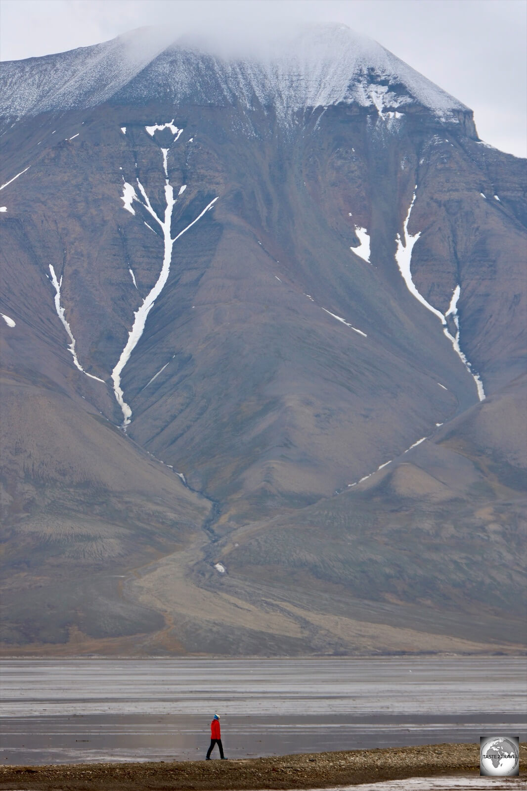

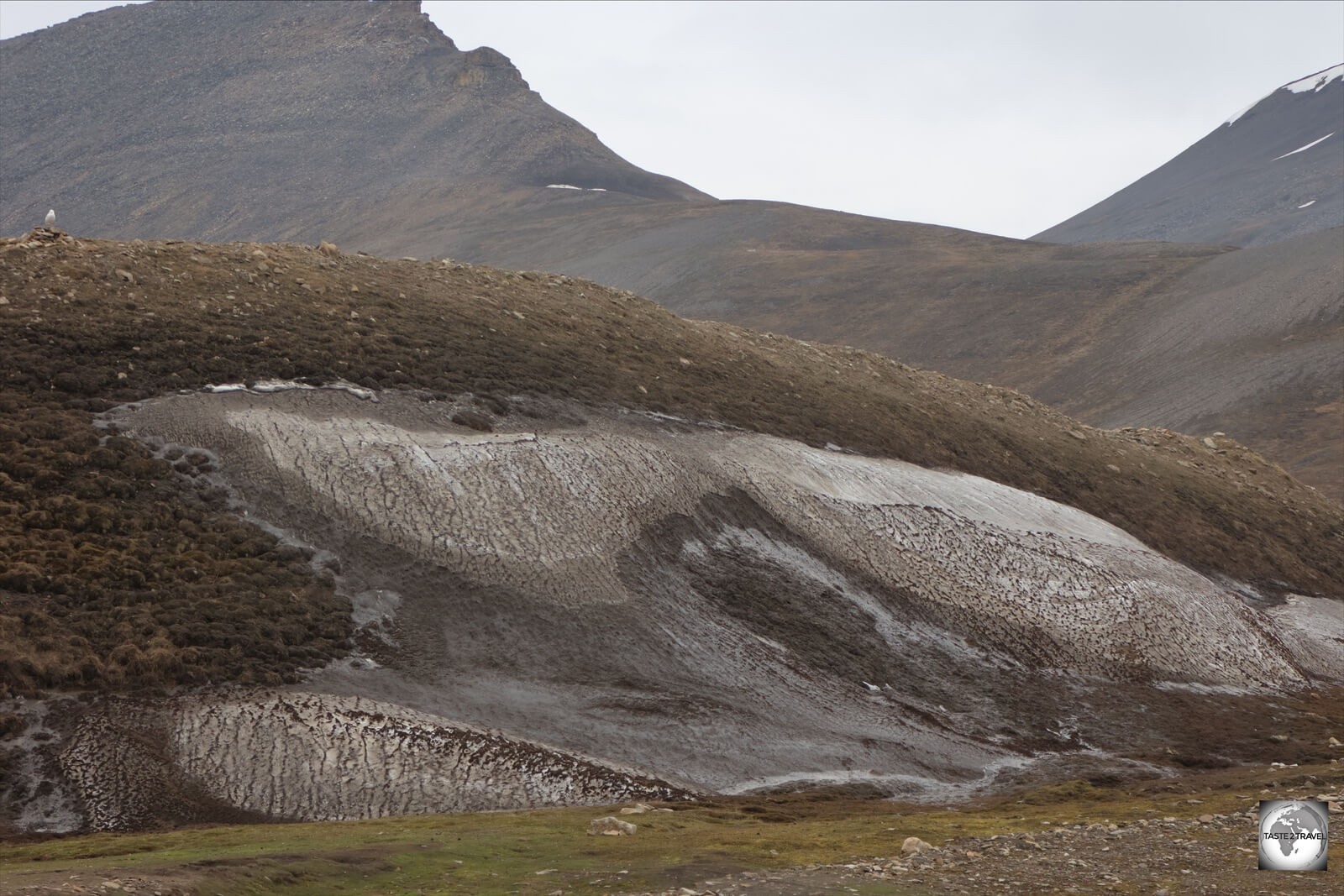


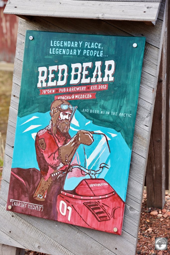


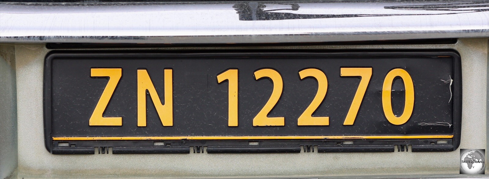


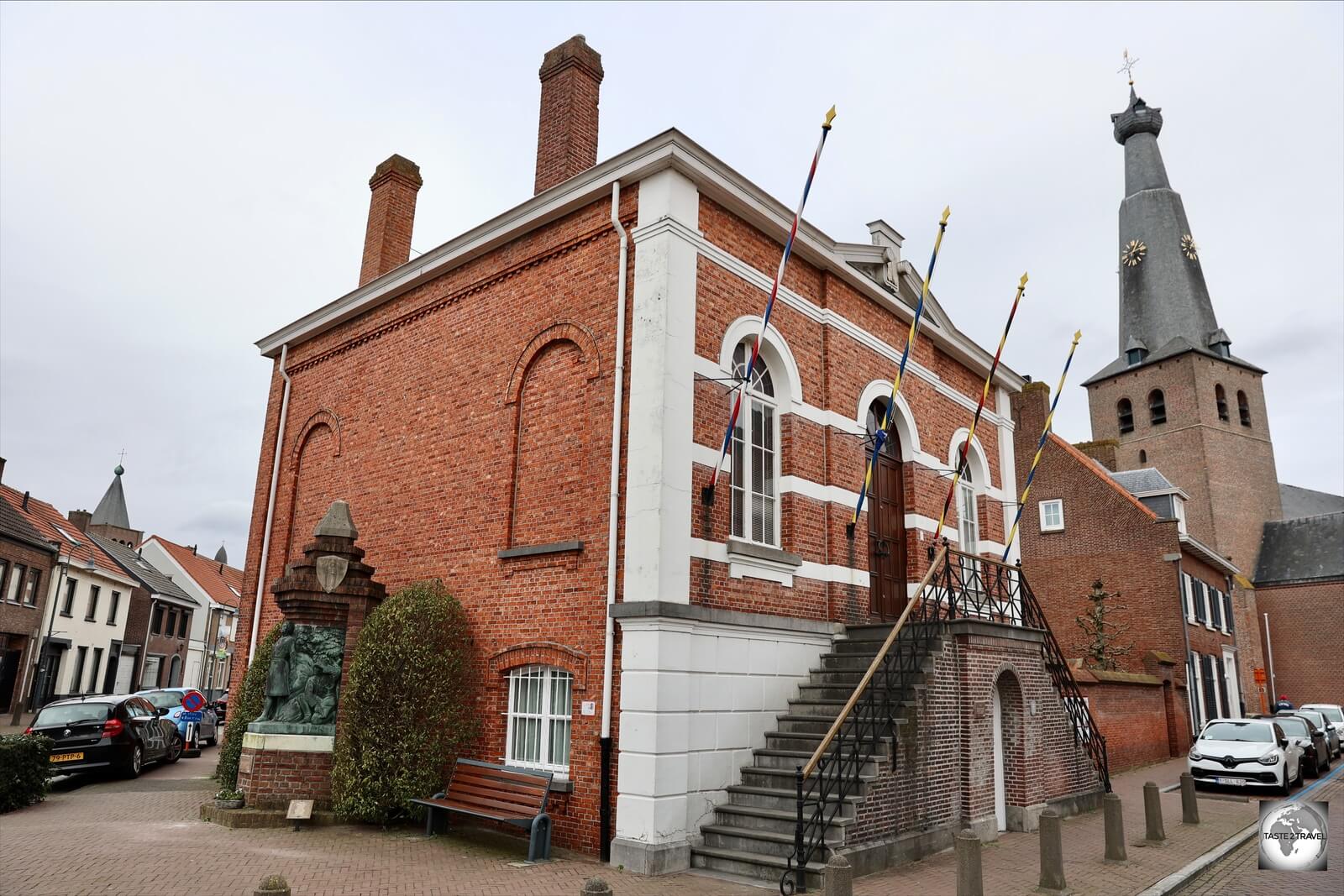


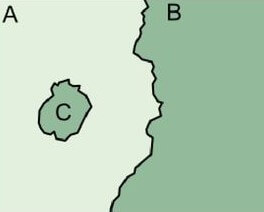


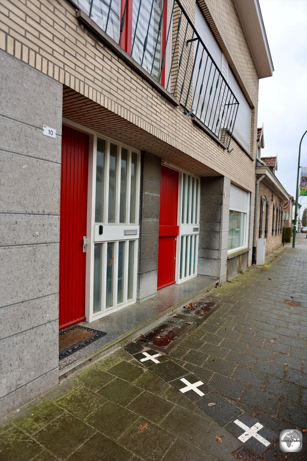


 located in North Nicosia old town.")


 on Ledra street.")
 photographing across the UN Green Line.")


 are supported by flying buttresses.")

 in Famagusta.")


 post box in Famagusta serves as a reminder of the British colonial period.")


 above sea level.")


, the headquarters of the Order of Malta.")


.")


.")


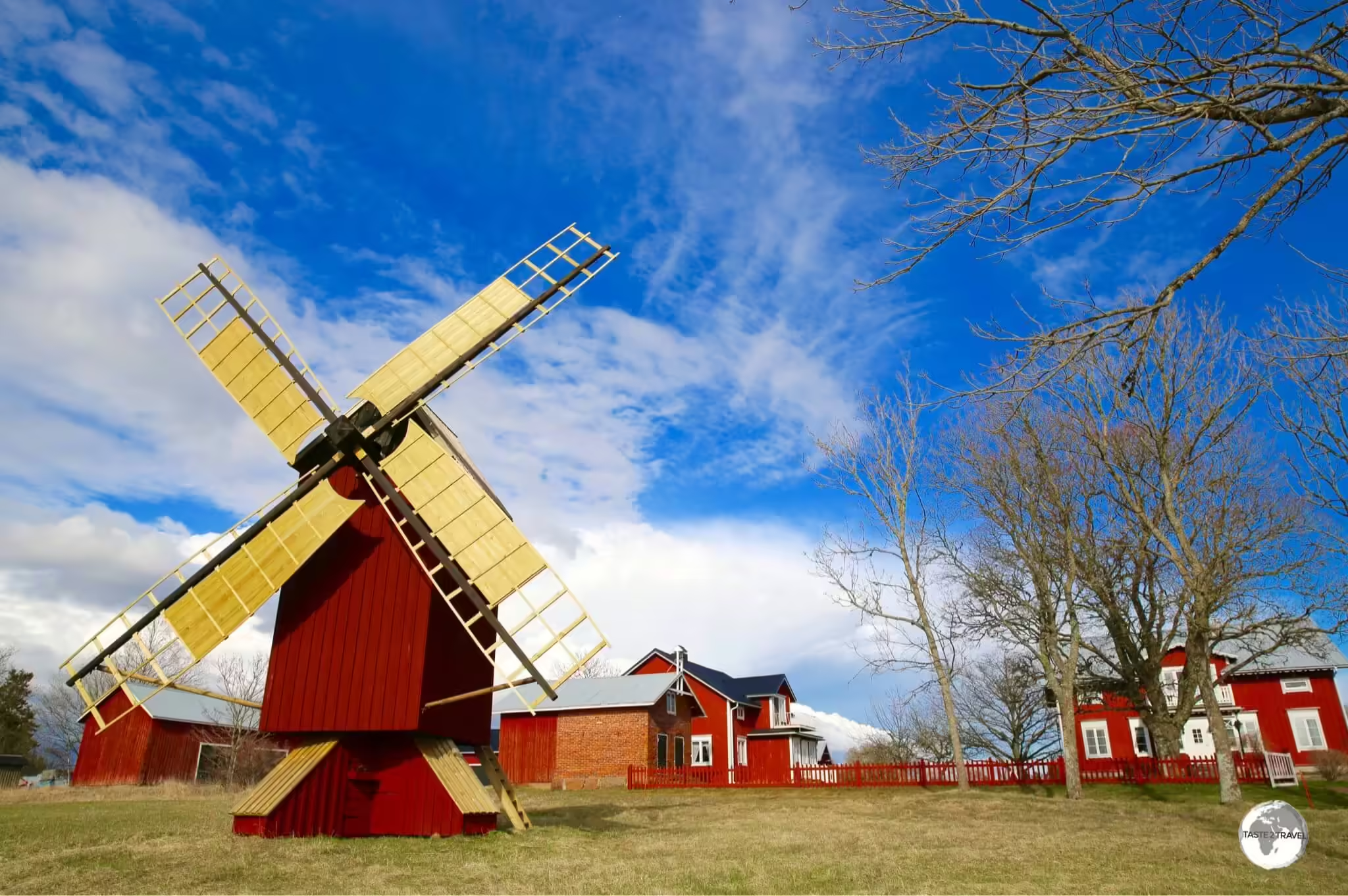


