All images are copyright! If you wish to purchase any images for commercial use, please contact me via the Contactpage.
About taste2travel!
Hi! My name is Darren McLean, the owner of taste2travel.
I’ve been travelling the world for 36 years and, 239/251 countries and territories (189/193 UN countries), and seven continents later, I’m still on the road.
Taste2travel offers travel information for destinations around the world, specialising in those that are remote and seldom visited. I hope you enjoy my content!
Ever since I was a child, I have been obsessed with the idea of travel. I started planning my first overseas trip at the age of 19 and departed Australia soon after my 20th birthday. Many years later, I’m still on the road.
In 2016, I decided to document and share my journeys and photography with a wider audience and so, taste2travel.com was born.
My aim is to create useful, usable travel guides/ reports on destinations I have visited. My reports are very comprehensive and detailed as I believe more information is better than less. They are best suited to those planning a journey to a particular destination.
Many of the destinations featured on my website are far off the regular beaten tourist trail. Often, these countries are hidden gems which remain undiscovered, mostly because they are remote and difficult to reach. I enjoy exploring and showcasing these ‘off-the-radar’ destinations, which will, hopefully, inspire others to plan their own adventure to a far-flung corner of the planet.
I’m also a fan of travel trivia and if you are too, you’ll find plenty of travel quizzes on the site.
Photography has always been a passion and all the photos appearing in these galleries were taken by me.
If you have any questions or queries, please contact me via the contact page.
This is a São Tomé and Principe Travel Guide from taste2travel.com
Date Visited: April 2024
Introduction
A quiet, ideal paradise, the Central African island nation of São Tomé and Príncipe has been blessed with a relatively peaceful independence, thus avoiding the stigma of tension and a bloodstained past worn by most countries of mainland Africa.
A young girl, relaxing on Principe Island.
As a destination, this former-Portuguese colony is a relaxed, calm, safe and pleasant travel destination and much more affordable than its Central African neighbours.
A view of the east coast of São Tomé Island.
The country consists of two main islands, the larger São Tomé (854 km2 / 330 sq mi), and the much smaller Príncipe (142 km2/ 55 sq mi), as well as several smaller islets.
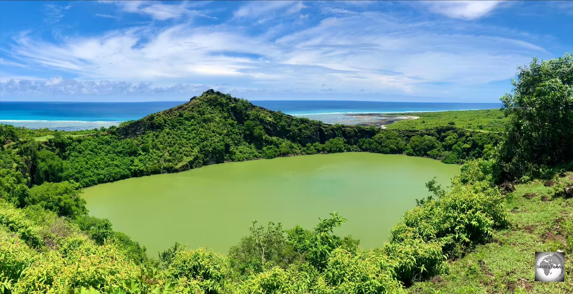
A panoramic view of Principe Island from the Terreiro Velho Plantation, home to some of the world’s finest cacao beans.
Both islands are heavily eroded volcanoes which are covered in verdant, undisturbed, rainforest, whose green canopy is pierced by ancient volcanic plugs.
The isolated Praia Grande provides one of the most stunning views of Pico Cão Grande.
The volcanic origin of the islands grants them a magnificent look and makes them perfect for exploration.
Downtown São Tomé features many fine examples of Portuguese colonial-era architecture.
São Tomé, which translates in English as “Saint Thomas”, was named by the Portuguese in honor of Saint Thomas, as they discovered the island on his feast day, while Príncipe Island (Prince’s island) was named in honor of Afonso, Prince of Portugal, the favourite son of the then King of Portugal.
The islands were occupied by the Portuguese from their discovery in 1470 until 1975, when independence was granted by Portugal.
Artwork in the museum at Roça Monte Café shows coffee plantation workers collecting beans.
Once uninhabited, over the centuries, the Portuguese imported a workforce of slave labour, from other Portuguese-speaking African colonies, to work on the many plantations on both São Tomé and Príncipe.
After 505 years of Portuguese occupation, which was marked by a building frenzy that resulted in more than 100 sprawling plantations (“Roças” in Portuguese) being built, São Tomé and Príncipe have been left an abundance of charming, colonial-era relics for tourists to explore.
Laundry, laid out to dry on the 1st floor balcony of the abandoned Roça de Água Izé Hospital.
One of the highlights of a trip to São Tomé and Príncipe is being able to visit the many abandoned roças, many of which were closed down after independence in 1975 and remain frozen in time.
The once-productive roças of São Tomé and Príncipe supplied Europe with most of its cacao and much of its coffee.
Street art in Santo Antonio, Principe Island.
Unlike in other countries, the treasure trove of architectural gems, which were left by the Portuguese when they hurriedly departed the islands’ shores in the 1970s, remain largely untouched.
São Tomé and Príncipe is a charming and engaging travel destination offering pristine nature, friendly inhabitants and a fascinating history.
A painting, by a local Principe artist.
Highly recommended!
Location
São Tomé and Príncipe is a small island nation located in the Gulf of Guinea, off the western equatorial coast of Central Africa.
The islands lie 300 km (186 mi) due east of Libreville, the capital of Gabon, and 443 km (275 mi) south-west of Malabo, the capital of Equatorial Guinea (click to view my Travel Guide).
Located close to the true centre of the world (GPS coordinates: 0° 20′ 11.5″ North / 6° 43′ 38.4″ East), São Tomé is located slightly north of the equator, while Principe is located 140 kilometres (87 miles) northeast of São Tomé.
São Tomé (St. Thomas), the capital, and largest city, of São Tomé and Príncipe is located on the Atlantic Ocean.
The islands are surrounded by the Atlantic Ocean. The coastline features sandy beaches, lush rainforests, and volcanic mountain ranges.
Due to its equatorial location, São Tomé and Príncipe has a tropical climate with high humidity.
The islands experience two main seasons: a dry season from June to September and a wet season from October to May.
People
A young boy on São Tomé Island.
Did you know?
São Tomé and Príncipe is the second-smallest and second-least populous African sovereign state after Seychelles.
The islands were uninhabited until their discovery in 1470 by Portuguese explorers João de Santarém and Pedro Escobar.
Relaxing in the main square of Santo Antonio, Principe Island.
Gradually colonised by the Portuguese, and settled throughout the 16th century, they collectively served as a vital commercial and trade centre for the Atlantic slave trade.
Colourful artwork by a São Tomé artist.
The rich volcanic soil and proximity to the equator made São Tomé and Príncipe ideal for sugar cultivation, followed later by cash crops such as coffee and cocoa; the lucrative plantation economy was heavily dependent upon enslaved Africans.
The population consists mainly of Forros (from forro, Portuguese for “free man”), descendants of immigrant Europeans and enslaved Africans who were imported to work on the many plantations.
The Santomean today are largely descendants of former African slaves, which were bought to the islands from other lusophone (Portuguese- speaking) countries throughout Africa, notably Angola, Mozambique and Cape Verde.
Young girls, relaxing on Principe Island.
The largest city, with a population of 72,000, is the capital – São Tomé – which is located on the northeastern coast of São Tomé Island.
Portuguese colonial-era architecture in downtown São Tomé.
Having been a Portuguese colony from 1470 CE until 1975 CE, the people of São Tomé and Príncipe are a blend of African and Portuguese.
No shortage of smiles from the friendly locals on São Tomé and Príncipe.
Culturally, São Tomé and Príncipe is a blend of African and Portuguese heritage.
You’ll find elements of traditional African music, dance, and art mixed with Portuguese language and Catholic religion.
No shortage of warm smiles from the friendly inhabitants of São Tomé and Príncipe.
The official language of São Tomé and Príncipe is Portuguese, due to its colonial history. However, many people also speak Forro, a Portuguese-based creole language that developed on the islands.
Almost no other languages are spoken, however French is spoken by the small community of Gabonese who have settled in the country for economic reasons.
The majority of the population is Roman Catholic, a legacy of Portuguese colonisation. However, there are also small Protestant and indigenous religious communities.
The people of São Tomé and Príncipe often lead a laid-back, island lifestyle.
Fishing is a significant part of the economy and culture, so you’ll see many locals involved in fishing activities.
Crime rates are very low, making São Tomé and Príncipe one of the safest countries in Africa to visit.
The people of São Tomé and Príncipe are known for their warm hospitality and friendliness toward visitors. It’s not uncommon for locals to strike up conversations with tourists and share their love for their islands.
Overall, the people of São Tomé and Príncipe offer a warm welcome to visitors, and their culture reflects a rich tapestry of African and European influences.
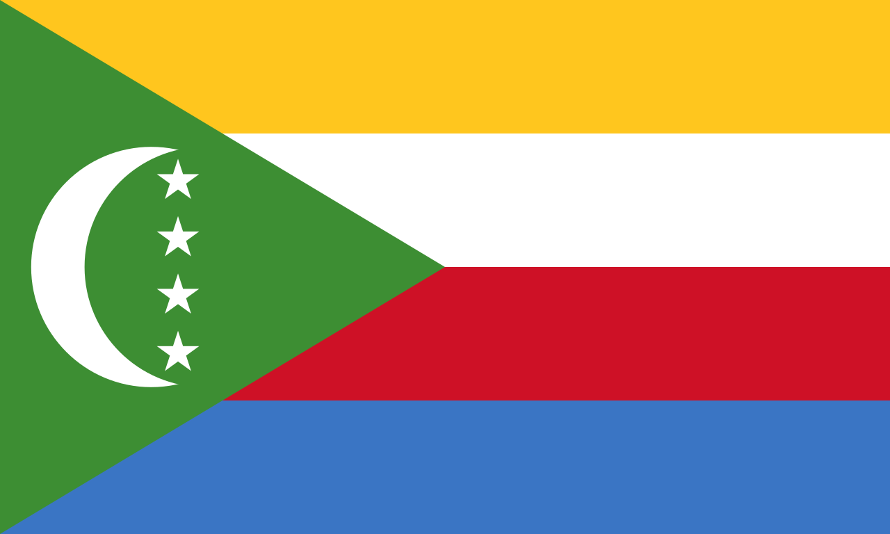
Flag
The flag of São Tomé and Príncipe.
The flag of São Tomé and Príncipe consists of a red triangle situated at the hoist, with three horizontal green, yellowand greenbands charged with two five-pointed black stars of Africa at the centre.
The flag of São Tomé and Príncipe, in a park in downtown São Tomé.
The two greenstripes represent the lush vegetation of the islands, as São Tomé and Príncipe are known for their tropical forests and natural beauty.
The yellowstripe symbolises the country’s rich cocoa production, an important part of its economy. It also represents the equator, as the islands are situated just north of the equator.
The two black stars of Africa stand for the two main islands of the country, São Tomé and Príncipe. They also represent African solidarity and independence.
The redtriangle evokes the “struggle for independence”, as well as equality.
Flag street art in downtown Santo Antonio, Principe Island.
The flag was adopted on November 5, 1975, when São Tomé and Príncipe gained independence from Portugal.
The flag was designed by artist and poet Alda Neves da Graça do Espírito Santo, who also wrote the national anthem.
The green, red, yellow, and black colours are known as the ‘pan-African’ colours and are found on the flags of other African nations, symbolising unity with the continent.
Currency
The dobra is the official currency of São Tomé and Príncipe.
The official currency of São Tomé and Príncipe is the dobra, which is named after the Portuguese word for “dollar”, and has the international currency code of STN.
Locally, the currency is abbreviated as ‘DBs‘.
The dobra is divided into 100 units called cêntimos, but due to inflation, cêntimos are not commonly used anymore.
Following record inflation, banknotes of 5, 10, 20, 50, 100, and 200 dobra’s were issued in 2018 with the redenomination of the dobra.
My wad of one hundred, uncirculated, 10-dobra banknotes.
The 5- and 10-dobra notes were printed in polymer, and all the banknotes featured various species of butterfly on the obverse side with local wildlife depicted on the reverse side.
In 2020, the Central Bank of São Tomé and Príncipe issued a new version of the 200-dobra banknote, to replace the previous version caused by the poor quality of the paper used to print the note.
At the time, the 5- and 10-dobra banknotes reverted back to paper, as the polymer versions of the two denominations were unsuitable due to the tropical environment of São Tomé and Príncipe.
The dobra is a restricted currency, with its import and export prohibited.
For those who collect currency, the only way to obtain crisp, clean notes is from a bank branch in Sao Tome. I was able to purchase a wad of 100, uncirculated, 10-dobra banknotes.
Throughout the country, bank notes are almost always old, stained, damp, torn, creased and in very bad condition.
In fact, some locals were keen to swap my new notes as they had rarely seen such clean notes.
Exchange Rates
The current (July 2024) dobra exchange rates are (click the links to view the current exchange rates):
The dobra is the official currency of São Tomé and Príncipe.
Like many other countries in Africa, cash is king in São Tomé and Príncipe!
Since you are unable to use credit cards or ATMs in the country, you should bring enough EUR/ USD cash to cover all your expenses.
Banks/ ATM’s
While banks in São Tomé and Príncipe offer the convenience of ATMs, and those ATMs display the usual promising logos – i.e. Mastercard, Visa, Cirrus and Maestro, ATMsare not connected to the international banking network.
ATMs operate only on the domestic network for domestic bank card holders.
Credit Cards
Apart from the top-end hotels, credit cards are not accepted in São Tomé and Príncipe.
Those establishments which do accept credit cards, such as the Pestana Miramar Hotel in São Tomé, normally only accept Visa card!
Costs
Compared to the high travel costs in neighbouring Central African countries, São Tomé and Príncipe offers much better value and is suitable for all types of travellers from budget to high-end.
Budget travellers should count on spending between EUR €50-100 per day, while a mid-range budget would be around double that.
For high-end travellers, and celebrities escaping the limelight, a one-bedroom villa at the very secluded Sundy Praia Lodge on Principe Island start from just US$1,350 per night. A bargain really!
Note:
Since ATMs and credit cards cannot be used in the country, you must bring all of the cash which you’ll need for your holiday.
Booking, and paying, online for accommodation is one way to reduce the amount of cash you’ll need to carry.
São Tomé and Príncipe were uninhabited prior to colonisation by the Portuguese in the 1490s.
Since then, much of the landscape has remained unchanged or, where former plantations once stood, reclaimed by the rainforests.
The islands are covered by lush rainforests and, with a small population, very little development, and very few tourists, they remain an untouched veritable tropical paradise.
Portuguese colonial-era architecture in downtown São Tomé.
Among the human-made sights on the islands are the many Portuguese-era colonial buildings.
Totally unrenovated, many of these former architectural wonders remain largely unchanged from colonial times.
Essential for every visitor is a tour of one of the islands’ colonial-era plantations – roças – which lie in many different states, from centuries-old buildings slowly being overgrown by rainforest, to lovingly refurbished ones operating as bed-and-breakfasts.
Tour Guides
On both São Tomé and Príncipe islands, I organised a rental car through my guest house.
In both instances, I was offered a driver/ guide which I willing accepted.
Touring the islands can be difficult due to a lack of signage and the poor infrastructure.
Dirt roads in many places are very rough, muddy and almost impassable.
However, with a local driver, who is use to the conditions, travel is made easier.
São Tomé Guide/ Driver
My guide on São Tomé, Elisio Nunes took me to this remote, hidden location which offered a spectacular view of the iconic Pico Cão Grande.
When I rented my 4WD through my guest house in São Tomé, it was delivered by Elisio Nunes who is the young, energetic and enthusiastic owner of Sãoto Tour & Cars.
His company can organise day trips to any part of São Tomé, including boat excursions, and rental cars.
Day trips start at EUR €60, while a rental car costs from EUR €40 per day.
While I intended to do a self-drive of the island, I realised that paying a little extra to have Elisio do the driving and guiding would be beneficial.
As an added bonus, Elisio speaks perfect English which is rare for a Santomean.
At the time of my visit, Elisio was busy organising a local delegation who were about to travel to Macau (a journey of three days) to attend a tourism summit. Elisio was acting as the head of the delegation!
Elisio is a very knowledgeable guide who managed to take me to some hidden places on São Tomé, including one remote beach which offered the best view of the iconic Pico Cão Grande.
Many of the more interesting sights lie at the end of unmarked, muddy, dirt, tracks which wind their way through the dense rainforest.
I can attest that having Elisio as my driver/ guide totally enhanced and enriched my experience of São Tomé.
I would highly recommend engaging the services of Elisio and his company for your trip to São Tomé.
Príncipe Guide/ Driver
My host, and guide, on Principe, Carlos Manuel, enjoying a drink at the Hotel Roça Sundy.
While on Principe, I rented a 4WD through my guest house, Residencial Brigada, which is owned by the very busy, and highly entrepreneurial, Carlos Manuel.
A native of Principe, who lived for many years in Lisbon, Carlos is very active on the local tourism scene and can organise any aspect of a trip to Principe.
He offers airport transfers, comfortable accommodation, car rental, guiding, sightseeing trips by land and sea, plus his talented wife cooks the most amazing meals, using produce from the local market.
All meals are served with freshly squeezed fruit juices.
Exploring Principe with my rental car and my guide/ driver – Rodrigo Lopes.
The cost of his one rental car is EUR €50 per day with an additional fee for a driver/ guide.
Normally Carlos (who speaks English) would offer his services as a driver/ guide.
However, on the day I hired my car, Carlos was busy in the morning so he offered me another guide, Rodrigo Lopes.
After lunch at the guesthouse, Carlos then took over, providing me with an afternoon of sightseeing.
Video:
Exploring Principe in my rental car with my driver/ guide Rodrigo Lopes.
There are many unmarked, muddy, dirt tracks on Principe and many of the best sights are to be found at the end of these tracks.
I was pleased that I had a local driver who knew where he was going. You could easily get lost in the dense rainforests on Principe.
A view of the Atlantic coast in downtown São Tomé.
The capital of São Tomé and Príncipe is also called São Tomé, which in English translates as “Saint Thomas”.
Though a third of the nation’s total population lives here (about 72,000 inhabitants), it feels like a giant village, wonderfully lively and compact.
The Nossa Senhora da Graça Cathedral is located on Praça do Povo (People’s Square) in the city centre.
Most buildings are Portuguese, colonial-era, relics which are in various states of decay which adds a certain amount of rustic charm to the city streets.
Praça da Independencia marks the centre of downtown São Tomé.
The city, which wraps around the waterfront, is easily covered on foot and is very relaxed.
A view of the Atlantic coast in downtown São Tomé.
Crime rates are very low and at no time did I feel threatened or unsafe.
The streets of São Tomé are lined with beautiful, and grand, Portuguese colonial-era buildings.
I was able to walk around with my camera and take photos of almost everything – although the guards outside the Presidential Palace will not allow you to take photos of the palace.
A park in downtown São Tomé.
The locals, who see very few tourists, are very friendly and welcoming.
Nossa Senhora da Graça Cathedral
Dating from the 15th century, the Nossa Senhora da Graça Cathedral (Our Lady of Grace Cathedral) is one of Africa’s oldest churches.
While fairly humble as cathedrals go, the Nossa Senhora da Graça Cathedral (English: Our Lady of Grace Cathedral) is one of Africa’s oldest, and a testimony to persistence, as it has been destroyed and rebuilt numerous times in its 400-year history.
A view of the interior of the Nossa Senhora da Graça Cathedral, also known as the Cathedral of São Tomé.
Construction of the first church was started at the end of the fifteenth century. This original church was situated near the present cathedral.
A larger cathedral was constructed between 1576 and 1578, during the reign of King Sebastian of Portugal.
A view of the altar at the Nossa Senhora da Graça Cathedral in São Tomé.
In 1784, the cathedral was in need of renovation and, in 1814, was rebuilt at the initiative of the local population.
The walls of the cathedral are lined with Azulejo a form of Portuguese painted tin-glazed ceramic tilework.
The last modification was made in 1956, when the church was remodeled in an eclectic revival style, with a neo-Romanesque main façade.
Given the limited opening hours, its best to visit whenever you see the doors open, which is usually for the midday mass.
San Sebastian Fort / National Museum
San Sebastian Fort houses the National Museum.
Built in 1575 by the Portuguese, Fort São Sebastião (San Sebastian Fort) was fully refurbished in 2006 and is now home to the São Tomé National Museum.
Built in 1575 by the Portuguese, Fort São Sebastião (San Sebastian Fort) was fully refurbished in 2006.
The fort is located on the waterfront, in the northeastern part of the city centre, at the southeastern end of Ana Chaves Bay.
The small museum contains religious art and colonial-era artifacts. This is the only history museum in the country.
Statues of the three Portuguese explorers who discovered São Tomé stand in the small praça in front of San Sebastian fort.
Outside of the fort stand three statues of the discoverers of São Tomé – João de Santarém, Pêro Escobar, and João de Paiva.
Shortly after independence, the statues were relocated here from other squares in the city so as not to remind the residents of the colonial past.
São Tomé Island – East Coast
Clothes Washing
Clothes washing is normally done in the rivers on São Tomé
Clothes washing in the countryside in Sao Tome is mostly done in the rivers – along with dishwashing and sometimes bathing.
Clothes washing in the countryside in Sao Tome is mostly done in the rivers.
Once the clothes have been washed, they are laid out on the hot river stones to dry.
Laying out the wet clothes to dry in the sun on the hot river stones.
This is not an unusual practice in Africa, but the pristine, natural, environment of São Tomé is unique in Africa.
Roça de Água Izé
The residential area of Roça de Água Izé, which was once used to house the many thousands of plantation worker’s.
One of the highlights of São Tomé is Roça Água Izé (Água Izé plantation), the first, and the most significant, of the cocoa plantations which were developed on São Tomé by the Portuguese.
A view of the main production facility at Roça Água Izé which today serves as an art gallery, library and community centre.
Around the turn of the 20th century, there were some 150 plantations on São Tomé and Príncipe.
A former workshop at Roça Água Izé, has now been repurposed as a mechanic’s workshop.
Set up by the Portuguese for the production of cocoa and coffee, these estates were self-contained, self-sufficient universes, operating largely outside the colonial administration’s remit.
A community library, and classroom, have been installed inside the abandoned production facility at Roça Água Izé.
Roça Água Izé is where commercial cocoa production first started on São Tomé in the mid 19th-century.
Art work adorns the wall of the former production facility at Roça Água Izé.
When the man responsible for introducing cocoa to the islands, João Maria de Sousa e Almeida, was made First Baron of Água Izé in 1868, he was the first mulatto nobleman in the Portuguese colonies.
The walls of the former production facility at Roça Água Izé have been converted into gallery space where local artists display their works.
Roça Água Izé once housed thousands of workers, many of whom were imported from Angola and Cape Verde.
A view of one of the former stove-houses at Roça Água Izé.
The plantation used to be a large complex with warehouses, a production facility which housed steam-operated machinery, a railway and the best hospital in this part of the world!
A view of the main production facility at Roça Água Izé, which still houses the old steam-driven equipment.
The main production facility, which still houses the old steam-driven equipment, has been converted into a multi-use art gallery, library and community centre.
An artisanal shop has been installed on the old processing equipment at Roça Água Izé.
In 1884, Água Izé had 50km of internal railway lines running through its 80km2 territory and 50 European employees overseeing 2,500 Angolan contract workers.
During its peak production period, cocoa from the plantation was exported to Portugal, from where it was then shipped to all corners of Europe.
In its prime, Roça Água Izé had 50km of internal railway lines running throughout the estate.
With independence in 1975, the world of the roças changed forever as some 200 plantations were nationalised.
While this move was widely supported, a lack of subsequent investment and dip in production saw many of the facilities fall into disrepair.
Today, the plantation has ceased production with many of the buildings now laying in various states of decay, slowly being consumed by the encroaching rainforest.
Most of the abandoned buildings are now occupied by squatters (descendants of the former plantation workers), who eke of an existence by cultivating the remaining cocoa and coffee plants.
Getting there: The roça appears on the roadside on the EN-2 just south of the km-16 marker.
Roça de Água Izé Hospital
My rental car parked outside the abandoned Roça de Água Izé Hospital, once rated as the biggest and best hospital in central Africa.
Built by the Portuguese in 1928, Roça de Água Izé Hospital was once considered to be the biggest and best hospital in central Africa.
A view of the 1st floor staircase at the former Roça de Água Izé Hospital.
Known for its impressive entrance staircase, the most famous building in the Água Izé plantation is now abandoned and in a state of extreme disrepair.
A view of the upper, rear, section of the former Roça de Água Izé Hospital.
The now dark, dank and unlit rooms of this once marvelous facility are occupied by dozens of poor, squatter, families who try to make a living from growing crops on the surrounding land and charging the occasional tourist a small fee to allow access.
One the day we visited, the residents were busy washing their clothes, laying their laundry out to dry one the 1st floor balcony.
A view of the, now roofless, male ward at Roça de Água Izé Hospital.
The former hospital wards, which are located at the rear of the hospital are now roofless and totally abandoned.
A view of the, now roofless, female ward at Roça de Água Izé Hospital.
The whole complex is truly impressive and it’s easy to imagine, in the not-too-distant past, nurses and doctors tending to their patients in the various rooms of this hospital.
A view of the rear of the former Roça de Água Izé Hospital, with the now roofless wards on the left side.
The hospital is located on a hill which overlooks the entire plantation estate.
A view out to sea from the 1st floor of the former Roça de Água Izé Hospital.
No doubt the elevated site was chosen as it receives a direct sea breeze which would have been beneficial to the many patients.
Praia Izé Viewpoint
A panoramic view of Praia Izé from the mirador snack shop.
Just in front of the abandoned hospital, a short garden path leads to a snack shop which affords spectacular views of Praia Izé and beyond.
Boca do Inferno (Mouth of Hell)
The Boca do Inferno (Mouth of Hell), is a small blowhole on the east coast of São Tomé.
Immediately south of the plantation, a side road leads to Boca do Inferno (Mouth of Hell), a small blowhole.
Video:
A view of the Boca do Inferno on a calm day.
When the condition of the sea is right, water is pressed through the natural rock channel and through a hole, which sends a fountain of sea water many meters into the air.
A mask seller at the Boca do Inferno, who managed to sell me this mask for €15.
There are several souvenir stands at the blowhole where locals sell hand carved, colourful masks, other wood carvings and refreshing coconuts.
A view of the east coast, near Boca do Inferno.
Praia das Sete Ondas
A view of Praia das Sete Ondas, a popular surfing beach.
Continuing south along the east coast road, the next stop was the popular surfing beach known as Praia das Sete Ondas (Seven Waves Beach).
A lonely volcanic boulder is a feature of Praia das Sete Ondas.
This grey-sand beach is named after its sets of perfect waves which draws surfers from around the world.
Praia das Sete Ondas is a beautiful, volcanic sand beach.
The beach is located just south of the KM-20 marker on the EN-2.
Praia das Sete Ondas (Seven Waves Beach) is named after its sets of perfect surfing waves.
Obô Natural Park
A painting of Pico Cão Grande by a local artist.
ObôNatural Park, also known by its original name Parque Natural Ôbo, is a natural, national and very important park which is located in the southern part of the island of São Tomé.
There are plenty of gorgeous features that Obo has to offer, however, the most famous is the Pico Cão Grande, a soaring volcanic plug of epic proportions.
In 2012, a section of rainforest on Principe was added to the park, increasing the area of the park to 300 square km (116 square mi).
Pico Cão Grande
The iconic <>i>Pico Cão Grande (“Great Dog Peak”) is a landmark needle-shaped volcanic plug peak in São Tomé.
One of the highlights of the Obo Natural Park is the iconic Pico Cão Grande.
Located in the south of São Tomé Island, about a one-hour drive south of the capital, this iconic volcanic plug was formed around three and a half million years ago by magma solidifying in the vent of an active volcano.
A view of Pico Cão Grande from the main road – highway EN2.
Its summit is 663 m (2,175 ft) above sea level, and it rises about 370 m (1,210 ft) over the surrounding terrain.
Climbing the peak is technically challenging due to slippery moss growing on the volcanic stone and the presence of snakes.
Only a few teams of rock-climbing specialists have managed to summit the peak with one team sustaining snake bites. Ouch!
Praia Grande
The isolated Praia Grande provides one of the most stunning views of Pico Cão Grande.
Located inside ObôNatural Park, the isolated and lonely Praia Grande provides one of the most stunning views of Pico Cão Grande, with a river leading your view directly to the peak which lies in the distance.
While the view of Pico Cão Grande along the road, and from the view point, is very good, the view from Praia Grande is exceptional.
São Tomé Island – Interior
Roça Monte Café
Roça Monte Café (Coffee Mountain Plantation) is a coffee plantation located in the lofty interior of São Tomé Island.
Home to 684 souls, RoçaMonte Café (Coffee Mountain Plantation) is a plantation located in the lofty interior of São Tomé Island, just 6-km inland from the town of Trinidade.
Artwork in the museum at Roça Monte Café.
Situated in mountainous terrain, at an elevation of 670-metres (2,198 ft), the cool and inviting Roça Monte Café is perfectly placed for the cultivation of coffee.
Roça Monte Café was established in 1868, making it one of the oldest plantations on São Tomé.
Established in 1868, this coffee plantation is one of the oldest plantations on São Tomé, and, unlike most plantations, is fully functioning and thriving.
One of the cuter inhabitants of Roça Monte Café.
One of the main attractions of Monte Café is its visitor’s centre, coffee museum and the attached cafe.
A view of the coffee museum at Roça Monte Café.
Visitors can learn about the history of coffee production in São Tomé, where both Arabica and Robusta beans are grown.
Steam-operated equipment at the coffee museum at Roça Monte Café.
The museum has a series of exhibitions that show the coffee production process, from the plantation to the cup.
Following the tour, visitors can relax in the adjacent cafe with a complimentary coffee. Very smooth and delicious!
Coffee heaven – the coffee shop at the Monte Coffee plantation.
While there are plenty of places to purchase coffee in São Tomé, the best place is direct at the source – the Monte Coffee plantation.
Locally produced coffee for sale at the Monte Coffee plantation.
This historic roça has been producing the finest of coffee beans since 1858 and is especially known for its strong arabica beans.
Roça Monte Café – Coffee Mountain plantation!
In the village at Roça Monte Café, Firma Efraim is a coffee shop, guest house and restaurant, offering meals, accommodation and coffee tasting.
Firma Efraim is a coffee shop, guest house and restaurant, offering meals, accommodation and coffee tasting.
Getting there: The entrance to Roça Monte Café is located on the right about 6-km inland from Trindade on the EN-3.
Cascata Sao Nicolau
The beautiful Cascata São Nicolau (Saint Nicholas Waterfall), an easily accessible, 60-metre-high waterfall.
The central highlands have many waterfalls, but Cascata São Nicolau(Saint Nicholas Waterfall) is probably one of the easiest to reach, as it’s right next to the road.
This 60-metre-high waterfall, is hidden by dense vegetation in the middle of a dense forest.
A natural pool at the base of Saint Nicholas Waterfall is an ideal place to cool off.
There is a natural pool at the base of the waterfall, where you can cool off.
Robusta coffee beans growing on the side of the road near Cascata Sao Nicolau.
The falls are located along a winding, bumpy mountain road, just beyond Roça Monte Café.
The road is lined with Robusta coffee plants which were full of fruit at the time of my visit.
São Tomé Island – West Coast
A view of a west coast beach, with many traditional wooden fishing boats, on São Tomé.
As you travel along the north-west coast of São Tomé, just south of Roça Diogo Vaz, which is famous for its chocolate products, a magnificent stone beach comes into view.
A view of the west coast of São Tomé, near to the Santa Catarina tunnel.
Along this beach, and other beaches on the west coast, traditional dug-out fishing boats lie in neat rows.
The west coast of São Tomé is lined with many majestic Ceiba trees.
These wooden, hand-carved fishing boats are made from the long, straight trunk of the Ceiba tree, many of which can be seen, standing like towering sentinels, along the coastline.
Wooden canoes on the west coast of São Tomé.
Santa Caterina Tunnel
A view of the very photogenic Santa Catarina Tunnel.
Driving in Sao Tome is really spectacular and the northwest coast road isn’t any different.
For long sections, the road follows the sparsely populated coast, offering panoramic views of the many stone beaches.
The Santa Catarina Tunnel, the only road tunnel on São Tomé and Príncipe.
Near the end of the road, before the village of Santa Catarina, is the only road tunnel in Sao Tome.
The Santa Catarina Tunnel allows the coastal road to pass through a narrow coastal mountain.
Built by the Portuguese, the 20-metre-long Santa Catarina Tunnel is the only road tunnel on São Tomé and Príncipe.
Principe
A view of the lush, green Principe Island from the Terreiro Velho plantation.
A volcanic island, which was formed 31 million years ago, Principe was uninhabited when discovered by the Portuguese on the 17th of January 1471.
Originally named “Saint Anthony”, the island was later renamed Príncipe (“Prince’s Island”) by King John II of Portugal in honour of his son Afonso, Hereditary Prince of Portugal (1475–1491).
Home to just 7,324 inhabitants, Principe Island is a small, sparsely populated, heavily eroded volcano.
The Chocolate Islands
Cacao plants at the Terreiro Velho plantation on Principe.
As you travel around Principe, you will find cacao trees growing wildly throughout the rainforests on the island, especially at the very wild Terreiro Velho plantation which is home to Claudio Corallo chocolate.
Nicknamed, The Chocolate Islands – in 1913, São Tomé and Príncipe were the world’s largest producer of cocoa.
After achieving independence in 1975, their production saw a significant decline due to their lacking infrastructure.
Today, small boutique chocolate manufacturers, such as Claudio Corallo, are producing world-class, single origin chocolate, using cacao beans from plants which have existed for decades in this remote, pristine environment.
Besides cacao and coffee plants, Terreiro Velho plantation is home to many wild pepper plants.
The old plantation grounds at Terreiro Velho have been taken over by the lush tropical jungle.
Throughout, coffee, cacao and pepper plants can be found growing in areas where the sunlight breaks through the canopy.
Video:
Exploring the Terreiro Velho plantation in my rental car with my driver/ guide Rodrigo Lopes.
The southern part of the island is now a UNESCO Biosphere Reserve, which includes the entire emerged area of the island of Príncipe, and its surrounding islets.
Principe is the closest you will get to an untouched paradise, anywhere in the world.
A view of stunning Praia Banana (Banana Beach), one of the highlights of Principe.
This little-known island provides unspoiled beauty, covered in a canopy of green, broken by spires of primordial rock.
The island offers fantastic beaches, rainforests, snorkeling, fishing, birdwatching and a handful of interesting (if expensive) accommodations.
A typical, Portuguese-built, cobbled road on Principe.
While both islands have their natural rewards, Príncipe offers an abundance of pristine nature and should not be missed!
Of the total number of visitors which venture to São Tomé and Príncipe, only 5% of them make the side trip to Príncipe.
I highly recommend making the trip and spending at least a few days on this charming paradise island.
Getting there:
Príncipe is located 173 kilometres (107 mi) north-east of São Tomé and can be reached on twice daily flights from São Tomé Airport.
Santo Antonio
The Church of Our Lady of the Rosary is the principal church in Santo Antonio, Principe Island.
Located on the north-east coast of Principe, Santo António (Portuguese for Saint Anthony), is the main settlement, and only town, on the island.
Relaxing in the main square of Santo Antonio.
The town was founded by the Portuguese in 1502, and was a centre of sugarcane cultivation.
A tiny house in Santo Antonio, Principe Island.
From 1753 until 1852, it served as the colonial capital of Portuguese São Tomé and Príncipe.
Portuguese colonial-era architecture in Santo Antonio, Principe Island.
Due to its previous role as the capital, tiny Santo Antonio is a treasure trove of Portuguese colonial-era architecture – and some more modern, funky, street art.
Street art in Santo Antonio, Principe Island.
Santo Antonio is home to 2,620 inhabitants, which account for about 35% of the island’s total population.
Portuguese post box on the main square of Santo Antonio, Principe Island.
The town is known for its colonial architecture and for its two churches, the Church of Our Lady of the Conception and Church of Our Lady of the Rosary (Portuguese: Igreja de Nossa Senhora do Rosário).
The interior of the Church of Our Lady of the Rosary, Santo Antonio, Principe Island.
Charming and relaxing, Santo Antonio is often called the “smallest town in the world” and is easily covered on foot.
Portuguese cannons and a memorial to Marcelo da Veiga, a local poet, graces the square, which is named after him, in Santo Antonio, Principe.
Praia das Bananas
A view of Praia das Bananas, one of the best beaches on Principe.
Considered to be the best beach, on an island which offers so many stunning beaches, Praia das Bananas (Banana Beach) is named after its curved stretch of golden sand, which is roughly in the shape of the yellow fruit.
This picture-perfect tropical beach is located on the grounds of Roça Belo Monte, a 15-minute walk from the front gate.
A painting, by a local Principe artist, depicts Praia das Bananas.
It is first seen from above, at a clifftop lookout, before descending to sea level, where you’ll find its golden sands, in the shape of a banana, beneath swaying palms.
The beautiful Praia des Bananas.
Hidden beneath the trees are a small bar and lounge chairs.
There is snorkeling at either end, excellent swimming in between, and kayaks available from resort staff.
At the time of my visit, I had this amazingly beautiful beach to myself.
Photography Note:
The only time to photograph Praia das Bananas is in the morning, when the beach is basking in golden sunlight.
In the afternoon, the sun moves behind the beach which places the golden sand and turquoise water in the shadow (as can be seen in my image above).
Praia Bom Bom
A view of Praia Bom Bom, one of a number of remote and secluded beaches on Principe and home to a deluxe resort.
Deluxe Resorts of Principe
Principe is renowned for its deluxe resort accommodation, which comes at a (high) price!
There are three such resorts on the island, all of which are managed by HBD Principe, a company which is owned by South African billionaire Mark Shuttleworth.
Praia Bom Bom is home to ‘Bom Bom‘, which at the time of my visit was closed for a complete renovation. The resort is due to reopen in September, 2024.
In addition to the Principe properties, HDB also offer Omali Lodge on São Tomé.
A view of Praia Bom Bom, and the small islet which is home to a deluxe resort.
Praia Abade
A view of the very quiet Praia Abade which lies to the east of Santo Antonio.
Located 7-km due east of Santo Antonio, the very quiet Praia Abade is home to a rocky stretch of beach which is completely surrounded by lush, emerald-green, rainforest.
The El Farolito snack shop at Praia Abade.
Snacks and drinks are available from El Farolito (translates as ‘The Lantern’), a small snack shop which lies in the shade of swaying palm trees, directly opposite the beach.
Also at El Farolito, a small souvenir stand offers locally produced crafts at totally reasonable prices.
A view of the fishing village at Praia Abade.
Praia Abade is home to a small population who live in a picturesque fishing village.
Hotel Roça Sundy
The drawing room is a highlight of Eclipse house at the Hotel Roça Sundy on Principe.
One of three superb offerings on Principe by the HDB hospitality group, Hotel Roça Sundy is a luxury hotel, full of character and offering loads of old-world charm.
A view of the beautiful ceiling, which is made from local marapião wood, and the reception area at Hotel Roça Sundy.
The hotel occupies the grounds of the former Roça Sundy, which was established in 1822 and has the distinction of being the first cocoa plantation of the whole archipelago.
A view of the front entrance of Eclipse House at Hotel Roça Sundy.
Located 5 km northwest of the island capital of Santo António, this beautiful, deluxe boutique hotel features 18th and 19th-century buildings which were built by the Portuguese.
Giant sketches of endemic birds feature on the balcony walls at Hotel Roça Sundy.
The buildings, which are interspersed with large courtyards, lush gardens and lawns, have been beautifully restored and feature sweeping staircases and ornate ceilings made from local marapião wood.
Roça Sundy is comprised of two beautifully restored buildings: Eclipse House and Cacao House.
Eclipse House, once the hub of the old plantation, now serves as the main building of Hotel Roça Sundy.
Eclipse House, the former hub of the plantation, features the opulent reception area, a drawing room, restaurant and a beautiful terrace where you can enjoy sunset drinks.
Cost: Hotel Roça Sundy offers 15, well-appointed, rooms which cost from €210 per person, per night (based on 2 people sharing).
Scientific Experiment
A plaque, at Hotel Roça Sundy, commemorates Arthur Stanley Eddington’s scientific experiment.
Roça Sundy was once the sight of an historic scientific experiment when, in 1919, the English scientist, Arthur Stanley Eddington, and his team visited Príncipe to test Einstein’s General Theory of Relativity.
They based themselves at Roça Sundy, and, during a total solar eclipse on the 29th of May 1919, they took photos of a star field around the sun.
They compared these photos to ones taken during the night, in Oxford, England, in February of the same year.
The aim of the expedition to Principe was to measure the gravitational deflection of star-light passing near the Sun.
The value of this deflection had been predicted by Albert Einstein in a 1911 paper.
The expedition allowed the scientists to test Einstein’s theory which was proven to be correct, that star-light is indeed deflected by the light of the sun.
A small museum on the grounds of the hotel features displays which detail this historic event.
Hotel Roça Belo Monte
The restored plantation manor house at Roça Belo Monte, Principe Island.
Located in the north-eastern corner of Príncipe Island, Hotel Roça Belo Monte is a former cacao plantation which was established by the Portuguese in 1922.
The plantation was shuttered at the time of independence but has since been revived in the form of a beautiful boutique hotel.
The crenellated entrance gate at Roça Bela Monte Hotel.
Entrance to the former plantation grounds is through a crenellated gateway.
Beyond this grand entrance, the hotel offers twenty rooms in different buildings, a bar and restaurant with terraces, a swimming pool and panoramic views over the surrounding rainforest.
The plantation grounds also include the iconic Praia Banana.
Scuba Diving
Scuba Diving can be arranged through Dive Tribe who are based at the Pestana São Tomé Hotel.
The ‘Dive Tribe’ scuba diving shop at the Pestana São Tomé Hotel.
A single dive, including all equipment, costs EUR €55, while 4 dives costs €212.
Scuba diving price list, at Dive Tribe in São Tomé.
At the time of my visit, visibility was poor so no diving trips were being organised.
Accommodation
The most inviting pool in the capital – the infinity pool at the Pestana São Tomé Hotel.
The cost of accommodation in São Tomé and Príncipe can range from budget guesthouses to luxury resorts.
Budget guesthouses can cost around $20-$50 per night, while mid-range hotels can cost around $70-$150 per night.
Luxury hotels and resorts can cost upwards of $200 per night.
SãoTomé
Pestana Sao Tome Hotel
The best hotel in the capital, the Pestana São Tomé Hotel.
For those seeking more deluxe digs in the capital, the Pestana Sao Tome Hotel is a good choice.
A view of the garden at the Pestana São Tomé Hotel.
Standard rooms at the Pestana São Tomé Hotel start at USD$220 per night.
The boardwalk, at the Pestana São Tomé Hotel.
The only credit card which is accepted is Visa!
Pestana Miramar São Tomé
The Pestana Miramar São Tomé offers comfortable rooms overlooking the sea from US$120 per night.
A sister property to the Pestana São Tomé Hotel is the nearby Pestana Miramar São Tomé, which is located a short, 5-minute, walk from the former hotel.
Rooms at this older property cost from just US$120 per night.
Hotel Central
The best mid-range option in town is the Hotel Central which, as the name suggests, is located in the heart of the old town.
Comfortable and clean rooms cost from US$50 per night on booking.com
Albergaria Porcelana
During my stay in São Tomé, I resided at the, less-than-ideal, Albergaria Porcelana which was recommended by some friends.
A standard room at this budget establishment costs US$30 per night.
I was flooded out during my stay and a truckload of chicken feed, which was stored in the basement, meant a foul stench hung in the air during my stay.
Very unpleasant. I would avoid this establishment.
Principe
Principe island offers some amazingly deluxe resorts, which are hidden away in secluded corners of this quiet island, and cost a small fortune.
The top 3 hotels on the island are owned by the HBD hospitality group, which is owned by South African billionaire, Mark Butterworth.
Top of the list is the immaculate Sundy Praia Lodge, where a one-bedroom villa costs from US$1,350 per night.
Another HDB offering is the charming, old-world Hotel Roça Sundy which is detailed in the ‘Sightseeing’section above.
Residencial Brigada
A view of my spacious ‘Queen Studio’ room at Residencial Brigada.
During my visit to Principe, I chose to stay at the much more unpretentious, and totally affordable, Residencial Brigada which is tucked away in a side street of Santo Antonio.
The bathroom in my ‘Queen Studio’ room at Residencial Brigada.
The 3-star, Residencial Brigada features accommodation with a garden, free private parking, a terrace and a restaurant.
Owned by the enthusiastic and energetic Carlos Manuel, this cosy guest house offers spotlessly clean and comfortable rooms starting at EUR €57.50 for a single or EUR €70 for two people.
Rates include a delicious breakfast.
Services include airport transfers, free WiFi and delicious, locally-inspired, meals which are prepared by Carlos’ wife – who is an excellent cook.
All meals at Residencial Brigada, including this delicious breakfast, are prepared by Carlos’ wife.
For a more comfortable stay, I recommend spending more to stay in the queen studio.
Also, through Carlos, I rented a 4WD with a local guide/ driver.
The car rental cost EUR €60 per day – plus extra for the driver.
A guide/ driver is essential on an island where many of the sights lie at the end of unmarked, muddy, rough tracks which weave their way through dense jungle.
The Residencial Brigada is a highly recommended option on Principe.
The cuisine of São Tomé and Príncipe reflects both African and Portuguese influences.
Common ingredients include fish, seafood, tropical fruits, and vegetables.
Dishes often feature flavors like coconut, palm oil, and spices.
Being an island nation, fish is a staple of the São Toméan diet, often served with breadfruit and mashed, cooked bananas.
In spite of the abject poverty, São Toméans can always count on some sustenance from the wide array of tropical fruits which grow throughout the island.
The rich volcanic soil allows almost anything to grow in profusion.
SãoTomé
Xicos’s Café
Xico’s Café in São Tomé offers traditional local, and Portuguese, cuisine served in an authentic, old-world cafe/ art gallery.
Located in downtown São Tomé, the very popular Xicos’s Café offers local, and Portuguese, cuisine at reasonable prices in an old-world café environment.
Named after its owner, Xico, the walls of the café are lined with artworks by local artists, all of which is available for purchase.
A view of Xico’s Café in São Tomé.
The café is especially popular with the expat Portuguese community who come to dine on Portuguese cuisine.
My lunchtime ‘meal of the day’ at Xico’s Café – battered tuna, chips and salad.
The open kitchen is located at the front of the café, allowing you to watch your meal being prepared.
I recommend the ‘meal of the day’ which is served at lunchtime and costs 200 DBs. Standard fare at the cafe includes fresh, local fish with chips and salad.
Open every day except Sunday’s.
Lá Bistro
A view of the popular Lá Bistrô in São Tomé.
Around the corner from Xico’s Café, Lá Bistrô serves similar food with fish, chips and salad being the most popular dish.
For caffeine addicts, this is the one place in São Tomé where you can enjoy a barista-made coffee. The coffees are best enjoyed with one of their fresh cakes, which are baked next door in the bakery.
Highly recommended!
Principe
Armazem Restaurante
The Armazém Restaurante in downtown Santo Antonio.
On an island with very limited dining options, Armazém Restaurante do Roça Porto Real (Warehouse Restaurant Roça Porto Real) in downtown Santo Antonio is housed in a former warehouse, with a seating capacity for over 300 people.
With helpful staff who speak Portuguese and French, the restaurant is busiest at lunchtime, with the most popular dishes being grilled meats and typical Portuguese dishes.
Principe Sightseeing Boat Trips
Boat sightseeing trips of Principe can be booked through the Armazem Restaurante in Santo Antonio.
In addition to the wonderful food, the folks at the Armazem Restaurante can help to organise sightseeing boat trips around Principe Island.
Residencial Brigada
While on Principe, I stayed at the Residencial Brigada where the wife of the owner, Carlos, prepared the most amazing meals, using fresh local produce from the nearby market.
Visa Requirements
Visa policy map of São Tomé and Príncipe.
Many nationalities enjoy visa-free access (highlighted in dark green on the map above) to São Tomé and Príncipe for up to 15 days.
This includes most Europeans, Americans, Canadians, Russians, Japanese and South Koreans.
Other nationalities, such as Australians and New Zealanders, must first apply for a visa.
Those who require a visa can try applying through the online STP e-Visa website which I found does not work.
I tried twice to submit an application and at no stage did I receive an email or any confirmation that the application had been received.
I never received an e-Visa via the website.
I instead applied in person at the São Tomé and Príncipe embassy in Lisbon where a visa application takes 1 week to process.
Getting There
Air
My STP Airways flight from São Tomé International Airport to Portugal which used a chartered plane from EuroAtlantic Airways,
São Tomé is served by São Tomé International Airport (IATA: TMS) with regular flights to Europe and other African countries.
The airport is located 5 kilometres (3 mi) north-west of downtown São Tomé.
The very small, inadequate, and outdated terminal, is easily overwhelmed whenever flights of the larger airlines (STP Airways and TAP Air Portugal) arrive and depart.
Lining up, outside São Tomé International Airport at 4 am, waiting to pass through the security check.
In order to enter the airport terminal, all passengers must queue and wait to first undergo a security check in an adjacent annex.
If you are departing on the weekly STP Airways flight to Lisbon (which departs at 07:10), you will need to ensure you are at the airport at around 4 am to join the long line in the car park.
An old TAP Air Portugal advertisement in downtown São Tomé.
The airline uses an older Boeing 777 which is chartered from EuroAtlantic Airways.
Booking
Flights can be booked on the STP Airways website, with a round trip from Lisbon to São Tomé costing about EUR €800.
Airport Transport
Most hotels will provide a shuttle service.
An airport taxi into downtown São Tomé will cost EUR €10.
Getting Around
Taxis are the most popular form of transportation on the islands, with prices ranging from $1-$10 depending on the distance. Car rentals are also available and can cost around $60-$100 per day.
Inter-Island Flights
Flights between Sao Tome and Principe are operated by STP Airways, who use a chartered plane from SEVENAIR.
Carrier
STP Airways operate inter-island flights between São Tomé and Príncipe islands, daily, except Tuesday.
The empty waiting lounge at the very sleepy Principe airport.
The airline uses a chartered, 19-seater, BAe Jetstream 32, plane from SEVENAIR– a Portuguese charter airline.
On both of my flights, there were no more than half a dozen passengers on board.
Inter-islands flights between São Tomé Island and Príncipe are rarely busy.
Schedule
STP Airways provide flights between São Tomé and Principe islands as per the following schedule:
All images are copyright! If you wish to purchase any images for commercial use, please contact me via the Contactpage.
About taste2travel!
Hi! My name is Darren McLean, the owner of taste2travel.
I’ve been travelling the world for 36 years and, 238/251 countries and territories (189/193 UN countries), and seven continents later, I’m still on the road.
Taste2travel offers travel information for destinations around the world, specialising in those that are remote and seldom visited. I hope you enjoy my content!
Ever since I was a child, I have been obsessed with the idea of travel. I started planning my first overseas trip at the age of 19 and departed Australia soon after my 20th birthday. Many years later, I’m still on the road.
In 2016, I decided to document and share my journeys and photography with a wider audience and so, taste2travel.com was born.
My aim is to create useful, usable travel guides/ reports on destinations I have visited. My reports are very comprehensive and detailed as I believe more information is better than less. They are best suited to those planning a journey to a particular destination.
Many of the destinations featured on my website are far off the regular beaten tourist trail. Often, these countries are hidden gems which remain undiscovered, mostly because they are remote and difficult to reach. I enjoy exploring and showcasing these ‘off-the-radar’ destinations, which will, hopefully, inspire others to plan their own adventure to a far-flung corner of the planet.
I’m also a fan of travel trivia and if you are too, you’ll find plenty of travel quizzes on the site.
Photography has always been a passion and all the photos appearing in these galleries were taken by me.
If you have any questions or queries, please contact me via the contact page.
This is a South SudanTravel Guide from taste2travel.com
Date Visited: April 2024
Introduction
Welcome to South Sudan, the world’s newest country, a land of vast plains, vibrant cultures, fascinating tribes and untamed wilderness.
A Mundari cattle herder, covered in cow-dung ash.
Nestled in the heart of East Africa, South Sudan is a country rich in diversity and history, offering travellers a unique and immersive experience like no other.
Sunset north of Juba.
South Sudan boasts a tapestry of completely undeveloped, and untouched, landscapes, from the lush greenery of its swamps and savannas to the rugged peaks of its mountain ranges.
A young Mundari girl.
The concept of tourism is new to South Sudan and at this early stage there are many bureaucratic hurdles to visiting the country. All of these are outlined in the following sections of this guide.
Currently, the only sensible way to visit South Sudan is to engage the services of a local tour company.
Home to the Lotuko tribe since the 14th century, the very remote Ilieu village is nestled among giant granite boulders.
I traveled to South Sudan with Kinyeti Wild Tours who I would recommend (full details are included in the ‘Tour Company‘ section below).
As for the South Sudanese, I found them to be a kind, warm and welcoming people. They have much to be proud of and are eager to share their rich cultural heritage with curious travellers.
No shortage of warm smiles in South Sudan.
Corruption permeates every aspect of life in South Sudan and it would seem the main economic activity is government officials extracting bribes from the beleaguered population.
A Mundari cattle herder, surrounded by his cows.
In this South Sudan Travel Guide, I provide insights, recommendations, and practical tips to make the most of your visit.
While the country is open to tourists, it is, currently, best suited to intrepid, adventurous travellers.
Birds, feeding off of bugs on a Ankole-Watusi cow.
Location
Juba, South Sudan
South Sudan is located in East-Central Africa, bordered by six countries, making it a landlocked nation.
To the north, Sudan, from which South Sudan gained independence in 2011 after decades of civil war, shares a 1,900-kilometre (1,200 miles) border with South Sudan.
To the east, Ethiopia shares a 1,300-kilometre (810 miles) border with South Sudan.
To the southeast, Kenya shares a border of 232-kilometres (144 miles), while to the south, Uganda, shares a border of 435-kilometres (270 miles) with South Sudan.
The Ugandan border crossing in the town of Nimule, is the busiest, and most significant land border crossing to South Sudan.
Meanwhile, to the west, the Central African Republic shares a 682-kilometre (424 mile) border with South Sudan. The boundary between the two countries is relatively porous and has experienced some instability due to conflicts in the region.
Lastly, in the southwest, the Democratic Republic of the Congo shares a 714-kilometre (444 miles) border with South Sudan. This border is marked by the flow of the Nile River.
Views of the countryside in south-eastern South Sudan.
South Sudan’s landscape is characterised by vast plains, swamps, and savannas, as well as mountainous regions in the southeast and the far west.
The White Nile, one of the two main tributaries of the Nile River, flows through the country from south to north, providing water resources and supporting agriculture and wildlife habitats.
The south-east of South Sudan is characterised by large granite boulders rising up over green plains.
Additionally, South Sudan is home to significant wetland areas, including the Sudd, one of the largest freshwater wetlands in the world.
People
A Mundari cattle herder, one of 60 distinct ethnic groups in South Sudan.
The people of South Sudan are as diverse and vibrant as the landscapes of their country.
Comprising over 60 distinct ethnic groups, each with its own language, traditions, and customs, the population of South Sudan is a mosaic of cultures, beliefs, and identities.
Young Mundari girls.
Hospitality is deeply ingrained in South Sudanese culture, and I can attest that I was always made to feel welcome.
Family and community play central roles in South Sudanese society, with strong kinship ties forming the backbone of social life.
Elders are highly respected, and traditional values are upheld with pride, even in the face of modernisation.
Lotuko children, playing a game, in Ilieu village, south-eastern South Sudan.
Despite the challenges posed by decades of conflict and hardship, resilience runs deep in the spirit of the South Sudanese people.
In recent years, efforts to foster reconciliation and unity have gained momentum, as South Sudanese from all walks of life work towards healing the wounds of the past and forging a path towards peace and prosperity.
The incredibly photogenic Mundari adolescents tend to the cattle camps, sweeping them clean and collecting cow manure for the fires.
Amidst the challenges, the people of South Sudan remain hopeful, resilient, and proud of their rich cultural heritage.
Flag
The flag of South Sudan, bearing a tilted star.
The flag of South Sudan is a symbol of the nation’s identity and aspirations.
Adopted on July 9, 2011, when South Sudan gained independence from Sudan, the flag embodies the hopes and dreams of its people for a future of peace, unity, and prosperity.
The flag was designed by Samuel Ajak, who was an artist and brigadier general for the Sudan People’s Liberation Army under revolutionary leader John Garang.
The flag was never formally defined in detail, which has led to many misunderstandings regarding its official colours or the rotation of the yellow star.
The flag of South Sudan bears similarities with the flags of Sudan and Kenya. It shares the black, white, red, and green of the Sudanese flag, in addition to having a chevron along the hoist.
One difference between the flags of Sudan and South Sudan is that there is a yellow star inside the blue chevron, representing the unity of South Sudan.
The horizontal black, white, red, and green bands of the flag share the same design as the Kenyan flag, and the Pan-African symbolism thereof.
According to the government of South Sudan, the colours of the flag represent the following:
Black: Represents the people of South Sudan.
Red: Represents the blood that was shed for the independence of the country.
Green: Represents the country’s agricultural, natural wealth, land, as well as progress.
White: Represents peace.
Blue: Represents the waters of the Nile River, which flows through the country.
Yellow: Represents unity (of the states), hope, and determination for all people.
Flag in Dispute
The flag of South Sudan, bearing an upright star.
The Flag of South Sudan is still disputed about whether the yellow star is tilted to the right slightly or whether it is upright.
Both of these designs are commonly used.
Currency
The currency of South Sudan is the South Sudanese Pound (SSP).
The official currency of South Sudan is the South Sudanese Pound, which has the international currency code of SSP.
The currency came into being on the 9th of July 2011, at the time of independence.
The currency, which is issued by the Bank of South Sudan (BoSS), consists of just three bank notes – 100, 500 and 1,000 SSP.
The obverse side of the South Sudanese Pound banknotes features the image of John Garang, the founding father of South Sudan.
The obverse side of each banknote features the image of John Garang, a former Sudanese politician and revolutionary leader, who is credited with being the founding father of South Sudan.
John Garang died under mysterious circumstances in 2005 when the Ugandan presidential (Mi-172) helicopter he was flying in crashed.
The reverse side of the South Sudanese Pound features wildlife and the River Nile.
The reverse side of the South Sudanese Pound features Ostriches on the 1,000 SSP note and a lion on the 100 SSP note.
The 200 SSP note features a panorama of the Nile River, which flows through South Sudan.
Exchange Rate
My wad of 100 x 100 SSP bank notes.
Currently (May 2024), US$1 = 2,500 SSP which means the wad of 100 x 100 SSP pictured above is worth just US$4.
The currency of South Sudan is the South Sudanese Pound (SSP).
Exchange rates quoted on the internet are false since these are the official rates which no one in South Sudan uses.
Costs
One of the world’s poorest countries is one of the most expensive to visit!
Return airfare from Dubai to Juba with Ethiopian Airlines: US$1,000
I travelled to South Sudan with Kinyeti Wild Tours.
With a lack of infrastructure and little public transport, plus many bureaucratic hurdles, it’s best to engage the services of a local tour company when organising a trip to the world’s newest country.
I normally travel strictly as a solo, independent traveller – without the aid of a tour guide or tour company.
However, I would highly recommend you engage a local tour guide / company for your trip to South Sudan.
I will outline the reasons for this advice below.
There are many bureaucratic requirements for a visit to South Sudan, requirements which can only be completed by a local tour company.
The very organised, competent, and enthusiastic, Isaac Lotwal, the owner of Kinyeti Wild Tours.
I travelled to South Sudan with Kinyeti Wild Tours who I would recommend.
The company was founded by Isaac Lotwal and is one of the very few tour operators in South Sudan – a country where the concept of tourism is still unfamiliar and tourists are (sometimes) viewed with suspicion.
Tour Costs
Tours to one of the world’s poorest countries are surprisingly expensive.
I paid US$2,150 for a 4-day tour which included visits to two tribes, accommodation, food, transport, guiding, photography permit, foreigners’ registration process and airport transfers.
During our visit to the Mundari tribe, I was told the tribe charges US$200 per visitor and are happiest when a group arrives since a large number of visitors is much more lucrative.
Payment Options
Credit cards are not accepted in South Sudan, nor are online payment methods such as PayPal.
There are two options for paying for tours – either a good old fashion bank transfer or you simply carry the cash with you and hand it to your guide on arrival (in a discreet setting of course!).
Bureaucracy
A visit to South Sudan requires a Letter of Invitation (which can only be issued by a locally-registered company), a Photography Permit (which must be obtained from the government, by a local company, before you arrive in the country), and a separate Foreigners’ Registration process once you have arrived in Juba.
All of these requirements will be completed by the local tour company.
Letter of Invitation
My Letter of Invitation (LOI) for South Sudan, which was issued by Kinyeti Wild Tours.
During the e-visa application process, visitors to South Sudan are required to upload a Letter of Invitation from a local South Sudan tour company.
Such a letter (pictured above) was issued to me by Kinyeti Wild Tours.
Photography Permit
Anyone carrying photography equipment (drones are strictly banned) will need to obtain a Photography Permit in advance of their arrival.
The cost for this permit is a whopping US$550 which is nothing more than a blatant tourist tax.
The only way to obtain this prior to your arrival is through a local tour company.
When I arrived at Juba airport, I was met by Isaac who had a folder full of paperwork for my visit. This also included the Photography Permit.
Isaac led me to a customs office where he handed over the permit and I handed over my Canon DSLR (EOS R6). A customs officer (who obviously had no idea what he was looking at), performed a cursory check of my camera and the permit before letting me go.
At no stage in South Sudan was my photography permit requested.
However, it was checked once again when I departed from Juba airport.
Note:
If you are travelling only with a smartphone camera, you do not need to apply for a Photography Permit.
Such permits are for large format DSLR cameras.
Foreigner Registration Process
Upon arrival in South Sudan, all visitors are required to undergo a separate ‘Foreigner Registration Process’, which is stamped into your passport.
Upon arrival in the country, all foreigners in South Sudan are required to register at the Central Immigration office in Juba.
Isaac took care of this process while I relaxed at my hotel after my long flight.
The sticker from this process will take up half a page in your passport.
Conclusion
There is much in the way of paperwork to be completed by visitors to South Sudan. For this reason, it is imperative you travel through a local tour company.
There is also the issue of a lack of public transport and terrible infrastructure.
You will need a private car with driver and guide in order to explore beyond Juba!
Sightseeing
Juba
A sunken boat, in the middle of the White Nile River in Juba.
Juba is an unremarkable, gritty, chaotic, less-than-charming capital of dusty, (mostly unsealed) streets, lined with simple corrugated iron structures.
There are very few solid buildings in South Sudan, except for a small area in downtown Juba which is home to a collection of hotels, government ministries, the Presidential Palace, NGO’s and a few banks.
One iconic site in Juba is that of a sunken boat which lies just off the shore of the White Nile, near one of Juba’s most popular expat bars – the AFEX River Camp.
A large copper Rhinoceros monument at the AFEX River Camp in Juba.
The story of this boat is that it had been damaged while unloading goods. The motor failed and the boat drifted downstream until it eventually became stuck in its current location.
Tribal Visits
During my stay in South Sudan, I visited two tribes – the Lutoko tribe and the Mundari tribe.
Lutoko Tribe
Ilieu Village Views
A view of the village of Ilieu. The Lutoko tribe have inhabited the slopes of this escarpment since the 14th century CE.
Located in Eastern Equatoria State, a 5-hour drive from Juba, along bumpy, heavily pot-holed, red-earth roads, the village of Ilieu is home to the Lotuko tribe, who have lived on the slopes of a steep escarpment since at least the 14th century.
Views of the surrounding plains from Ilieu village.
Over the centuries, the tribe have moved large boulders into place to create laneways and stone fences. Inside these fences, small family compounds are kept neat and clean.
The entire village is kept spotlessly clean, unlike other urban environments throughout South Sudan.
The roof thatching is especially interesting since it’s made from bundles of tightly knotted grass which are then tied together in layers.
There are two water sources, neither of which are conveniently located in the village. Instead, villagers must hike downhill (20 minutes) or uphill to fill water containers which they then haul back to the village.
Due to the remote location of Ilieu village, a 5-hour drive from Juba, I camped overnight in the village school yard.
Ilieu village is located on the slopes of an escarpment in the remote south-east region of South Sudan.
A view of Ilieu village, home of the Lotuko tribe.
Views of the surrounding countryside from Ilieu village.
A young girl, on her way to collect water from a source high up on the granite boulder which overlooks the village.
Laneways constructed from granite boulders and fences made from tree branches.
Walking through Ilieu village involves lots of clambering over giant granite stones.
Laneways and fences in Ilieu village, constructed of granite stones and wooden tree branches.
Over the centuries, the tribe have moved large boulders into place to create laneways and stone fences.
Constructing laneways in Ilieu village is very labour-intensive.
A village kitchen, with a fire below and food storage above.
Grinding Grain
A young Lotuko girl, grinding grain.
Grinding grain is an important activity which has taken place for many centuries in the village.
Evidence of former grain grinding sites can be seen throughout the village.
Remnants from centuries of grinding activity.
A grinding stone in a village compound.
A large grinding stone and views of Ilieu village.
Portraits of the Lotuko
Portraits of the Lotuko tribe at Ilieu village.
One of many tribal groups in South Sudan, the Lotuko, are a Nilotic (of the Nile valley) ethnic group whose traditional home is the Eastern Equatoria state of South Sudan.
Their region is characterised by ranges and mountain spurs such as Mount Kinyeti, the highest mountain in South Sudan with an altitude of 3,186 metres (10,453 ft) above sea level.
Isaac named his tour company after this mountain, which he has climbed. Isaac is a native of a village which lies in the shadow of Mount Kinyeti.
Portraits of the Lotuko tribe at Ilieu village.
Portraits of the Lotuko tribe at Ilieu village.
Portraits of the Lotuko tribe at Ilieu village.
Portraits of the Lotuko tribe at Ilieu village.
Portraits of the Lotuko tribe at Ilieu village.
Portraits of the Lotuko tribe at Ilieu village.
Portraits of the Lotuko tribe at Ilieu village.
Mundari Tribe
A sunset view of a Mundari cattle camp.
The Mundari are a small ethnic group of roughly 100,000 (very tall) people, who are renowned cattle-herders and agriculturalists.
A Mundari girl using her arms to imitate the curvy cow horns.
They are one of the ethnic groups indigenous to the Nile valley (Nilotic). Their main homeland is located north of Juba, the capital of South Sudan.
Mundari boys at the Mundari cattle camp.
Nomadic cattle-herders, they move their cattle camps to areas which offer the greenest pastures where their cattle can feed.
Birds, feeding off of bugs on a Ankole-Watusi cow.
Cattle are the Mundari’s primary source of wealth; the cows serve as a form of currency (these days, an attractive bride can “cost” as much as 100 cows) and, as such, have become a symbol of status and power.
A young Mundari girl, working in the cattle camp.
Marriages are arranged by the prospective groom offering cattle to the bride’s family and husbands may take as many wives as they can support.
Ankole-Watusi Cows
Ankole-Watusi cows at a Mundari cattle camp.
The Mundari tend large herds of Ankole-Watusi cows, which are renowned for their impressively large and curly horns.
The cows are known as “the cattle of kings” because they were preferred by African kings.
A Mundari adolescent, who loved being photographed.
A herd of Ankole-Watusi cows is still kept at the former Royal Palace in Nyanza, Rwanda (click to view these cows in my Rwanda Travel Guide).
The Mundari have an all-encompassing relationship with their cows, they sleeping alongside them, massage them with cow-dung ash and build fires to keep them warm and to keep the bugs away.
Their cows are treasured family members!
A happy Mundari cattleman, surrounded by his beloved cows.
The Mundari tend to consume fish caught from the nearby Nile River. They do no eat their cows, but consume the milk which is produced by them.
Ankole-Watusi cows have the most incredibly curvy horns.
A young boy posing with an Ankole-Watusi cow.
Who’s the odd one out here?
Because of their preference by African rulers, Ankole-Watusi cows are known as “the cattle of kings”.
The Mundari sculpt the horns of their cows to make them curvier.
The Mundari live lives which are closely intertwined with their beloved cows.
Ankole-Watusi cows at a Mundari cattle camp.
Young Mundari girls, imitating the curved horns of their cows.
The Mundari build fires to keep their cows warm and the mosquitos away.
Tension in the camp!
Each evening, when the cows return to camp, they return to the exact same spot where they are tied to a small peg in the ground.
Ankole-Watusi cows at a Mundari cattle camp.
Cow-Dung Ash
The Mundari cover their skin in cow-dung ash to protect against mosquito bites.
The Mundari collect and burn the copious amounts of cow dung which is produced each day in the cattle camp.
The ash produced from the dung is smeared on their bodies to protect against mosquito bites.
The Mundari also massage the ash into the hides of their cows to provide them with protection against mosquitos.
The Mundari cover their skin in cow-dung ash to protect against mosquito bites.
A Mundari baby, covered in cow-dung ash to protect against mosquito bites, sleeping on the ground.
A Mundari baby, covered in cow-dung ash to protect against mosquito bites, sleeping on the ground.
A Mundari man, rubbing cow dung ash into the hide of one of his cows.
A Mundari man, rubbing cow dung ash into the hide of one of his cows.
A Mundari man, rubbing cow dung ash into the hide of one of his cows.
Gathering the ash from the fire.
Cattle Camp Maintenance
A Mundari boy, sweeping the camp grounds.
Mundari cattle camps are kept clean by the Mundari children and adolescents who collect cow dung for the fires and who sweep the areas around the cattle camp.
A Mundari boy, sweeping the camp grounds.
Collecting cow dung in a Mundari cattle camp is a never-ending job.
A Mundari girl, sweeping the camp grounds.
A Mundari girl, sweeping the camp grounds.
A Mundari girl, sweeping the camp grounds.
A Mundari girl, gathering cow dung which will be burnt on one of the many camp fires.
A Mundari boy, gathering fresh cow dung which will be burnt on one of the many camp fires.
The collecting of cow dung keeps most of the Mundari children busy.
Collecting cow dung.
A young Mundari boy, with hair which has been treated with cow dung ash and washed with cow urine, collecting cow dung.
A young Mundari girl, collecting cow dung for the fire.
Mundari Beauty Treatment
Mundari men of South Sudan rub cow-dung ash into their hair and then bathe their hair in cow urine.
A unique Mundari beauty treatment involves massaging cow-dung ash into the hair of Mundari men.
The hair is then washed with cow urine. The uric acid gives the hair a copper-colour tint which the Mundari regard as beautiful.
A container of cow urine, ready to be used as a hair rinse treatment.
A Mundari beauty salon.
Massaging cow-dung ash into the hair of a Mundari man.
Portraits of the Mundari
Two Mundari cattle herders on a motorbike.
A Mundari man in a sudden gust of wind.
A Mundari cattle herder, sitting among his herd.
A young Mundari girl.
A young Mundari girl.
A young Mundari boy.
A young Mundari boy.
A young Mundari boy.
A young Mundari boy.
A young Mundari girl.
Young Mundari girls.
Accommodation
Clocks at the Royal Palace Hotel in Juba.
Juba
During my stay in South Sudan, I stayed at the very good Royal Palace Hotel in Juba which offers three different room types, with a Standard Room costing US$120 per night (including a buffet breakfast).
My comfortable and spacious ‘Standard room’ at the Royal Palace Hotel in Juba.
The Royal Palace Hotel is located a short walk from the Nile River, in a neighbourhood of dusty, dirt streets and a mish-mash of buildings and businesses. This is downtown Juba!
The bathroom in my room at the Royal Palace Hotel in Juba.
Located in a secure compound, behind high security walls, the calm and relaxing ambience of the Royal Palace Hotel is a welcome respite from the dusty and chaotic streets of Juba.
The Royal Palace Hotel claims that their swimming pool is the largest in South Sudan.
The hotel boasts the largest swimming pool in South Sudan which strangely is the same depth throughout at almost 6 feet (183 cm).
The cafe at the hotel serves some of the best Barista-made coffee in South Sudan.
Camping
Our campsite, during our visit to the remote Lotuko tribe at Ilieu village.
I have to admit – I’m not a fan of camping!
Despite being a boy scout in my childhood, who did lots of camping, I have definitely become accustomed to comfortable hotel rooms.
Due to the remote location of Ilieu village (home to the Lotuko tribe), which is a 5-hour drive, along atrocious dirt roads from Juba, we had no option but to camp the night at the village.
Setting up our campsite, which was in the school yard of Ilieu village.
Isaac has invested heavily in good camping equipment which he has sourced from South Africa.
The tents, bedding, food and everything else was very comfortable.
If you plan to spend time visiting the different tribes of South Sudan, you should be prepared for some nights of sleeping under the stars.
There are very few facilities outside of the capital, Juba.
In the morning, after our night of camping, Isaac and our driver where packing away one of the tents.
When they moved the tent (which they had slept in), a startled, large, black, scorpion came out of its burrow and started running around with its tale fluttering in the air. He was quickly stomped on!
Eating Out
The cuisine of South Sudan reflects the country’s rich cultural diversity and its agricultural heritage.
It primarily consists of grains, vegetables, fruits, and meat, with significant regional variations influenced by the availability of local ingredients and traditional practices.
Especially popular is fish from the Nile River which flows through the country.
Restaurants
Hotel Torit
My lunch stop at the Hotel Torit, which is the main hotel in Torit, the capital of Eastern Equatoria.
While in Torit (the regional capital of Eastern Equatoria State), I stopped for lunch at the Hotel Torit, a tired and run-down hotel which happens to be the best in town.
A view from the restaurant at the Hotel Torit.
The rather forlorn, Hotel Torit, is a government-owned, tired, dirty, run-down establishment, where rooms cost US$60 per night.
A view of the restaurant at the Hotel Torit.
I was the only guest in the hotel restaurant which offers one set meal at lunchtime.
Chicken and rice for lunch at the Hotel Torit.
I was served chicken and rice which gave me a bad case of diarrhea. Not recommended!
Bars
“South” – the very quaffable beer of South Sudan.
“South”, the beer of South Sudan, is widely available at hotel bars throughout the country.
Visa Requirements
Visa policy map of South Sudan, with those nationalities which require an e-Visa highlighted in yellow. Source: Wikipedia.
Almost all nationalities (yellow on the above map) require an e-Visa to visit South Sudan.
Create an account using the option on the homepage.
Fill out the account with all the required information.
Choose the type of visa you want to apply for.
Fill out the application form.
Attach the required documents to support your visa application.
Required Documents List (all in JPG format):
A passport photo with the dimensions 2×2 inch (5x5cm)
The copy of your passport photo page.
A copy of your Letter of Invitation (LOI).
A negative Covid-19 test. (Is this still 2020? I uploaded my Covid-19 vaccination certificate which was accepted).
A copy of your Yellow Fever Vaccination Certificate. (This is also checked upon arrival at Juba Airport).
Pay the e-Visa application fee of USD$120 using a credit card. Note: The payment failed the first time for me. I simply tried again and it was accepted.
Within 72 hours, your approved e-Visa should appear on your account where it must be downloaded and printed.
Note:
You will not receive any email notification regarding the status of your e-Visa application.
Instead, you must login to your account and check the status of your application on the e-Visa website.
Once your e-Visa has been approved (within 72 hours), it will be posted on the official website from where you should download it and print it.
A printed version of the e-Visa must be presented upon arrival at Juba International Airport.
Getting There
My boarding pass, from Addis Ababa to Juba with Ethiopian Airlines.
Air
All international flights arrive at Juba International Airport (IATA: JUB) which is located a short drive from downtown Juba.
The following airlines provide scheduled flights to/ from Juba International Airport:
African Express Airways – flies to/ from Nairobi–Jomo Kenyatta
Kenya Airways – flies to/ from Nairobi–Jomo Kenyatta
RwandAir – flies to/ from Entebbe, Kigali
Sky Travel and Aviation – flies to/ from Gulu
Turkish Airlines – flies to/ from Istanbul
Uganda Airlines – flies to/ from Entebbe
Addis Ababa Skylight In-terminal Hotel
My very comfortable room at the Addis Ababa Skylight In-Terminal Hotel.
On my trip to South Sudan, I flew with Ethiopian Airlines, via Addis AbabaInternational Airport.
Ethiopian Airlines are one of the largest airlines in Africa, providing daily connections to 63 African cities from their hub at Addis Ababa International Airport.
As one of the main aviation hubs in Africa, many travellers spend time transiting through Addis AbabaInternational Airport.
Located in a quiet, remote, corner of Addis Ababa airport, the Skylight In-Terminal Hotel can be found by following the green signs inside the terminal.
If you have a prolonged layover at the airport, I highly recommend checking into the excellent Skylight In-Terminal Hotel.
The hotel is located in a quiet corner of the airport, away from all the usual airport noise such as boarding announcements.
You can find the hotel by following the green “Skylight In-Terminal Hotel” signs on the airside of the terminal.
The reception desk at the Skylight In-Terminal Hotel.
Eventually, you’ll reach a reception desk where friendly and efficient staff will assist you with a room.
Current rates (May 2024) at the Skylight In-Terminal Hotel.
Rooms can be booked in different time bands from 1-3 hours; 4-6 hours; 7-12 hours; 13-24 hours or 24 hours.
I booked a Standard room for 7-12 hours at a cost of US$100. Totally worth it!
Payment can be made with credit card!
The beautiful bathroom in my room at the Skylight In-Terminal Hotel.
The hotel offers 97 tranquil havens in five different categories.
At no stage do you exit immigration or customs.
You do not need any entry documents for Ethiopia to stay in a room on the ‘airside‘ of this hotel.
If you are staying in Ethiopia, the hotel also offers 1,024 comfortably modern rooms and suites on the ‘landside‘ of the terminal.
The restaurant at the Skylight In-Terminal Hotel serves meals around the clock.
The restaurant at the Skylight In-Terminal Hotel never closes, with hungry transit passengers arriving 24 hours a day.
Breakfast is especially good and flight departure boards ensure you won’t miss your flight.
Road
Uganda
Currently, the main land border crossing into South Sudan is in the town of Nimule, Uganda.
A heavily pot-holed road connects Juba to Nimule with a total driving distance of 193 km (120 mi), with a driving time of 4.5 hours.
Possibly, this road was built during the British colonial period and has not been maintained, in any way, since.
As this is the only (terribly) paved route into the country from the south, this busy road serves as the main route for all goods entering land-locked South Sudan from Mombasa port.
The road is very busy with Kenyan and Ugandan trucks delivering all manner of goods into South Sudan.
Adding to the chaos, totally unnecessary police checkpoints add considerable delays to the journey. These checkpoints are nothing more than a place for corrupt officials to collect bribes from passing motorists, especially the many truck drivers.
One checkpoint, on the southern outskirts of Juba, sees trucks queued for 5-10 km in each direction, waiting to pass through the checkpoint (once they have paid the required bribe!).
Kenya
The South Sudan border town of Nadapal, lies across the border from Kenya’s Turkana Province.
The 375 km (233 mi) gravel road between Nadapal and Juba is due to be upgraded to an international standard bitumen road. This project was approved in 2008 and has yet to start.
A bitumen highway will allow trucks to travel more directly from Mombasa port to Juba, rather than through Uganda as is the current route.
Currently, the bad roads make this a 2-day, epic, journey.
Getting Around
A very good stretch of red-earth road in Eastern Equatoria state.
Public Transport
There is little in the way of public transport in South Sudan.
If you plan to visit different tribes, they tend to inhabit the remote back-corners of the country and are only accessible with a private car, driver and a guide.
All images are copyright! If you wish to purchase any images for commercial use, please contact me via the Contactpage.
About taste2travel!
Hi! My name is Darren McLean, the owner of taste2travel.
I’ve been travelling the world for 36 years and, 238 countries and territories, and seven continents later, I’m still on the road.
Taste2travel offers travel information for destinations around the world, specialising in those that are remote and seldom visited. I hope you enjoy my content!
Ever since I was a child, I have been obsessed with the idea of travel. I started planning my first overseas trip at the age of 19 and departed Australia soon after my 20th birthday. Many years later, I’m still on the road.
In 2016, I decided to document and share my journeys and photography with a wider audience and so, taste2travel.com was born.
My aim is to create useful, usable travel guides/ reports on destinations I have visited. My reports are very comprehensive and detailed as I believe more information is better than less. They are best suited to those planning a journey to a particular destination.
Many of the destinations featured on my website are far off the regular beaten tourist trail. Often, these countries are hidden gems which remain undiscovered, mostly because they are remote and difficult to reach. I enjoy exploring and showcasing these ‘off-the-radar’ destinations, which will, hopefully, inspire others to plan their own adventure to a far-flung corner of the planet.
I’m also a fan of travel trivia and if you are too, you’ll find plenty of travel quizzes on the site.
Photography has always been a passion and all the photos appearing in these galleries were taken by me.
If you have any questions or queries, please contact me via the contact page.
This is a Western Sahara Travel Guide from taste2travel.com
Date Visited: March 2024
Introduction
Welcome to the enchanting land of Western Sahara, a place where endless desert landscapes meet the sparkling waters of the Atlantic Ocean.
The White Dune is a highlight of Dakhla.
A visit to Western Sahara has been a long-held travel dream, and it didn’t disappoint.
There is something mesmerising about empty, endless desert landscapes. They truly do free the mind!
Street art in Laayoune, the largest city in Western Sahara.
Nestled between Morocco and Mauritania, Western Sahara offers a blend of rugged beauty, rich cultural heritage, and a fascinating history.
From the vast dunes of the Sahara Desert to the vibrant coastal towns, Western Sahara beckons adventurers with its charm and mystique.
Boasting an almost deserted (pun intended) coastline of 1,110 km (690 km), Western Sahara offers no shortage of beaches, most of which you’ll have to yourself!
Porto Rico Beach, one of many isolated beaches which line the long coast of Western Sahara.
The coastal city of Dakhla is the main tourist hub, offering a wealth of accommodation options and daily flights from Europe and Morocco.
The ever-windy Dakhla Lagoon is a world renown kite-surfing spot, attracting thousands of kite-surfers who stay at the many kite-camps.
Venturing further into the Sahara, there are many beautiful and intriguing attractions which lie within an easy day-trip from Dakhla.
Distances in Western Sahara are vast.
In this Western Sahara travel guide, I’ll delve into the wonders of this lesser-known region, uncovering its hidden treasures and offering insights to make your journey unforgettable.
Whether you seek thrilling desert adventures, cultural immersion, or simply a peaceful escape, Western Sahara promises a journey like no other.
Camels! A common sight throughout Western Sahara!
Disputed Territory
While this is a disputed land, about 20% of the territory is controlled by the Sahrawi Arab Democratic Republic (SADR); the remaining 80% is occupied and administered by Morocco.
A wall (the ‘berm‘) separates the two territories and that wall cannot be crossed!
There are no separate border formalities or any other additional formalities in place.
You do not need to show your passport to enter Western Sahara from Morocco, and there are no ‘Western Sahara’ passport stamps. You are simply stamped into and out of ‘Morocco’ depending on your port of entry/ exit.
It’s all Morocco and looks and feels like any other part of Morocco.
Overland to Mauritania
Camel traders at the Camel market in Nouakchott, the capital of Mauritania.
Currently, the route across the Sahara Desert, linking Morocco and Mauritania, via Western Sahara, is the only trans-Saharan route which is (legally) open to travellers.
Anyone wishing to travel overland between Europe and sub-Sahara Africa, must pass through Western Sahara.
I travelled overland from Agadir (Morocco) to Nouakchott (Mauritania) via public transport, a journey of approximately 2,000 km (1,242 mi).
For those overlanders reading this guide, I have included information on continuing the journey to Mauritania.
You will find details on the border crossing and the Mauritanian Visa-on-arrival (VOA) in the ‘Visa Requirements‘ section below.
Details on the daily bus which connects Dakhla with Nouadhibou and Nouakchott are included in the ‘Getting There‘ section below.
Location
Dakhla 73000
Western Sahara is a region located in North Africa, bordered by the Atlantic Ocean to the west, Morocco to the north, Algeria to the northeast, and Mauritania to the east and south.
It is situated in the Maghreb region of North Africa, known for its diverse landscapes ranging from expansive deserts to rugged mountains and coastal plains.
Video: Cruising through Western Sahara by bus!
The region spans an area of about 266,000 square kilometres (103,000 square miles), making it roughly the size of the United Kingdom.
The landscape of Western Sahara is dominated by the vast Sahara Desert, which covers the majority of the territory.
This desert terrain is characterised by endless dunes, rocky plateaus, and arid plains.
In the east, the landscape transitions into the mountainous region of the Saharan Atlas, with peaks reaching over 2,000 metres (6,500 feet) in elevation.
A view of the coast of Western Sahara at Porto Rico beach, south of Dakhla.
To the west, Western Sahara boasts a stunning coastline along the Atlantic Ocean, featuring beautiful beaches and fishing villages.
This coastal area is an important economic and cultural hub, with cities like Laayoune and Dakhla serving as major centres of activity.
Overall, Western Sahara’s geographical location presents a unique blend of desert beauty, coastal charm, and rugged mountain landscapes, offering visitors a diverse range of experiences and attractions to explore.
People
Street art in Laayoune, Western Sahara.
The people of Western Sahara are diverse, with a rich cultural tapestry woven from various ethnic groups.
The Sahrawi people are the indigenous inhabitants of this region, known for their resilience and nomadic heritage.
Traditionally, they are nomadic herders who have roamed the vast expanse of the desert for generations, relying on their deep knowledge of the land and its resources for survival.
The Sahrawi culture is deeply rooted in traditions that emphasise community, hospitality, and solidarity.
Extended families form the core of Sahrawi society, with strong bonds that extend beyond blood relations.
Respect for elders and a strong sense of communal responsibility are integral to their way of life.
Due to the turbulent history of Western Sahara, many Sahrawis have experienced displacement and resettlement.
A significant portion of the population now resides in refugee camps in neighboring Algeria, where they have maintained their cultural identity and traditions despite the challenges.
In urban areas like Laayoune, the largest city in Western Sahara, you’ll find a mix of Sahrawis, Moroccans, and other ethnic groups.
Despite the challenges they have faced, the people of Western Sahara continue to preserve their cultural heritage and maintain a strong sense of identity.
Flags
Western Sahara Flag
The flag of Western Sahara is never flown in areas controlled by the Moroccan government.
You will never see the flag of Western Sahara being flown in the Moroccan-controlled areas of this disputed land. Instead, the Moroccan flag is flown everywhere!
The flag of Western Sahara is a symbol of the Sahrawi people’s struggle for independence and self-determination.
The flag is a tri-colour of three equal horizontal stripes (black, white, and green from top to bottom) overlaid by a red triangle issuing from the hoist side. These are the Pan-Arab colors.
The design of the flag is based on that of the Palestinian flag, which in turn was derived from the colours used in the Arab Revolt.
There is a red star and crescent in the middle stripe. The star and crescent are considered symbols of Islam, and can be seen on flags of other neighbouring Islamic countries such as Algeria and Mauritania
Each element of the flag holds significant meaning:
Black: The top black stripe represents the dark days of struggle and hardship endured by the Sahrawi people, particularly during their fight for independence.
White: The middle white stripe symbolises peace and hope for a peaceful resolution to the conflict and a better future for the Sahrawi people.
Green: The bottom green stripe represents the abundant natural resources of Western Sahara, including its rich land and vegetation.
Red: The red triangle on the hoist side stands for the blood shed by Sahrawis in their struggle for independence. It also symbolises their commitment to sacrifice for their land and freedom.
This flag was adopted by the Sahrawi Arab Democratic Republic (SADR), the self-proclaimed government of the Western Sahara, in 1976.
It is a powerful emblem of the Sahrawi people’s aspirations for independence and sovereignty over their homeland.
The flag is often displayed proudly in Sahrawi refugee camps, as well as in areas of Western Sahara under the control of the Polisario Front, the liberation movement fighting for Sahrawi self-determination.
Moroccan Flag
The flag of Morocco.
The Moroccan flag is the only flag which is be displayed in the Moroccan-controlled part of Western Sahara.
The current flag has served as the national flag of Morocco since 17 November 1915.
It has a red field with a green pentagram (a 5-pointed star) in the centre.
The greenstar represents the five pillars of Islam, and the redrepresents the blood of the ancestors and unity.
Currency
The Moroccan Dirham is the official currency used in the Moroccan-controlled area of Western Sahara.
The official currency of the Moroccan-controlled area of Western Sahara is the Moroccan Dirham, which has the international currency code of MAD.
This is due to the fact that Morocco, which claims sovereignty over Western Sahara, uses the Moroccan Dirham as its official currency throughout its territories, including Western Sahara.
All Moroccan Dirham banknotes feature Mohammed VI, the current ruler of Morocco.
In areas under the control of the Sahrawi Arab Democratic Republic (SADR), the self-proclaimed government of Western Sahara, the Algerian Dinar (DZD) is also sometimes used alongside the Moroccan Dirham.
However, the Moroccan Dirham is the more widely accepted and official currency in most transactions within the region.
Uncirculated Moroccan Dirham banknotes.
All currency in Morocco is issued by the country’s central bank – the Bank Al-Maghrib.
The current series of banknotes were issued in 2013 and feature a portrait of King Mohammed VI and the royal crown.
Each of the notes show a Moroccan door to the left of the King, demonstrating the richness of the country’s architectural heritage, and symbolising the openness of the country.
Exchange Rate
The Moroccan Dirham is the official currency of Morocco.
The current (April 2024) exchange rates for the Moroccan Dirham (MAD) are:
Unlike most countries in Africa, credit cards are widely accepted in Morocco.
ATMs
Also, unlike most countries in Africa, ATMs are widely available in Morocco and accept all credit cards.
Costs
Travel costs throughout the region are wonderfully reasonable.
Unlike so many parts of sub-Sahara Africa, Morocco and Western Sahara are ideal for those travelling on a budget.
Sightseeing
Laayoune
Colourful shopfronts in downtown Laayoune.
Laayoune, also spelled El Aaiún, is the largest city in Western Sahara. It serves as the capital of the region and is situated on the Atlantic coast.
A city of very few tourist sights, Laayoune means “water sources” in Arabic, in reference to the natural oasis providing the town with its water supply.
This relaxed, charming, laid-back city is an important administrative, economic, and cultural centre within Western Sahara.
One of many town squares in Laayoune.
The city has experienced significant growth over the years, with a population (220,000) that has expanded due to migration and urbanisation.
Laayoune serves as a hub for transportation within the region, with an airport and road connections linking it to other parts of Western Sahara and Morocco.
Flights from Laayoune airport connect the city to other Moroccan cities plus the Canary Islands, which lie a short distance offshore.
St. Francis of Assisi Catholic Church
Located in Laayoune, the St. Francis of Assisi Catholic Church was built in 1954, during the Spanish colonial presence in Spanish Sahara.
A last vestige of the colony that was Spanish Sahara, the St. Francis of Assisi Catholic Church is hidden away in a back street of Laayoune.
The church was built in 1954, during the Spanish colonial presence in Spanish Sahara.
Today, the St. Francis of Assisi church opens twice a week for mass which is attended by the small Spanish expat population of Laayoune.
While the population of Laayoune is almost 100% Muslim, the church serves the small Spanish expat community that is still present, as well as serving active personnel of the UN mission in the country.
Closed most of the time, the church is only open during mass which is held twice a week at 8 pm on Saturday and 12:00 pm on Sunday.
The Grand Mosque of Laayoune
The Grand Mosque of Laayoune features a square Almohad-style minaret – a common feature on mosques throughout the Maghreb.
Like most mosques in Morocco, the Grand Mosque of Laayoune, the city’s principal mosque, features a square Almohad-style minaret.
A detailed view of the square Almohad-style minaret at the Grand Mosque of Laayoune.
The Almohad’s ruled over Morocco, Algeria and Al-Andalus (Spain) during the 12th-13th century.
The square Almohad-style minaret can be found from Seville (Spain), throughout Morocco and Algeria.
Dakhla
Despite being a desert city, Dakhla is home to many green spaces.
Although, in terms of population, the 2nd city of Western Sahara (pop: 107,000), Dakhla is the #1 tourist hub in the region, with direct flights from Europe and Morocco delivering large numbers of tourists, especially kite-boarding enthusiasts, for which the region is famous.
No shortage of camels in the Sahara Desert.
Located 1,696 km (1,052 mi) south of the Moroccan capital of Rabat, Dakhla is closer to Nouakchott, the capital of Mauritania, which is 822 km (510 mi) to the south.
Dakhla, also known as Ad Dakhla or Villa Cisneros, is a city located at the end of a long, narrow peninsula, the Río de Oro Peninsula, surrounded on three sides by the Atlantic Ocean.
While the city has limited appeal, its most famous for its kite-boarding camps which are located north of town, on the shores of the (always windy) Dakhla Lagoon.
Desert Tours
Views of the azure waters of the Atlantic Ocean from the top of the White Dune.
Beyond Dakhla, the Sahara Desert holds many stunning attractions which should not be missed.
I ventured into the desert with a local driver/ guide by the name of Sidi, who is the neighbour of the owner of the Dar Rio Oro guest house in Dakhla.
I shared a 4WD with three French friends with each of us paying €60 for the full day trip.
This was a highlight of Dakhla! Highly Recommended!
Video:
Cruising south through Western Sahara – from Laayoune to Dakhla by bus!
The White Dune
A view of a small lagoon which is surrounded by the sands of the White Dune.
Reachable only by 4WD, along a sandy piste cutting across the Sahara Desert, the White Dune rises up from the surrounding brown sand desert, like a shiny beacon.
Views of the Atlantic Ocean from the top of the White Dune.
The white-sand dune, which is surrounded by the ocean at high tide, stands in stark contrast against the blue waters of the Atlantic Ocean and the brown sand of the surrounding desert.
Views of the lagoon and the Atlantic Ocean from the top of the White Dune, a highlight of Dakhla.
Porto Rico Beach
A panoramic view of Porto Rico Beach, with its abandoned Spanish-era lighthouse.
About sixty kilometres south of Dakhla, on the road to Mauritania, Porto Rico Beach is a beautiful Sahara Desert beach of white sand and crystal-clear water.
An abandoned Spanish-era lighthouse overlooks Porto Rico Beach.
Overlooked by an abandoned, Spanish-era lighthouse, this long, pristine beach is located a few kilometres north of the Tropic of Cancer.
The cliffs which line Porto Rico Beach are made of chalk deposits.
The geology-geek in me was excited to see that the cliffs which line the beach at Porto Rico Beach are made of chalk deposits.
Chalk is a fine-textured, earthy type of limestone distinguished by its light colour, softness, and high porosity. It is composed mostly of tiny fragments of the calcite shells or skeletons of plankton.
Almost in the tropics – a view of the stunningly isolated Porto Rico Beach.
Imlili Oasis
The ‘Sebkha of Imlili’ are permanent, isolated, pools of hypersaline water which were formed during the Holocene epoch (11,700 years ago).
Located in a remote corner of the Sahara Desert, about 100 km south of Dakhla, totally off-piste, and accessible only with a local guide in a 4WD, the Sebkhaof Imlili (‘Sebkha‘ translates as a salt-water depression) are permanent pools of hypersaline water which were formed during the Holocene epoch (11,700 years ago).
One giant ‘fish spa’ – the salt water pools at Imlili are inhabited by voracious, carnivorous fish who love eating dead skin.
What makes these pools truly unique are the many small, carnivorous fish which inhabit them – totally cutoff from any other water source.
These fish are of one single species – Coptodon guineensis.
Trapped in these isolated pools for thousands of years, the fish at Imlili are considered to be relics of the past.
It is believed that the fish have existed in these isolated pools ever since they were trapped there during the Holocene epoch, after the Green Sahara period.
These aquatic animals are considered to be relics of the past.
The only way to reach the very remote Imlili oasis is with a knowledgeable local guide in a 4WD vehicle.
One of the more unusual characteristics of Coptodon guineensis is that they are carnivorous.
For tourists wishing to experience a natural ‘fish spa‘, you can dip your feet into the pools and let the fish nibble on dead skin, calluses or anything else.
Note:
It’s important to note that if you have any open wounds, you should not expose them to the voracious fish, who will only make the wound bigger.
It’s also important to be aware that water conditions are not conducive to care due to the fact that it is stagnant.
‘Me and Mini-Me’ – a mother and baby camel with very similar markings – near Imlili.
Accommodation
Laayoune
My comfortable and spacious room at the Sahara Line Hotel in Laayoune.
While in Laayoune, I stayed at the very good Sahara Line Hotel which is located in the city centre, a short walk from all the sights.
From the friendly, welcoming staff, to my spacious and comfortable room and the very good breakfast (served during Ramadan), this hotel serves as an ideal base for anyone visiting Laayoune.
My room at the Sahara Line Hotel included a sunny sitting room.
If this pleasant hotel wasn’t enough, as a final act of kindness, the manager drove me in her car to the bus station, without charge.
Highly recommended!
Dakhla
Part of my sprawling room at the Dar Rio Oro guest house in Dakhla.
While in Dakhla, I stayed at the charmingly traditional Dar Rio Oro guest house which is a family-owned guest house which overlooks the sea in downtown Dakhla.
Built in a traditional Moroccan-style, over a period of 2 years, by the French owners, Dar Rio Oro features two spacious rooms on each floor with a common dining/ sitting room on the 5th floor.
A rooftop terrace on the 6th floor offers more rooms and a terrace with panoramic views.
For those with mobility issues, there is no elevator in the building – just stairs.
During my stay, Madame Fatima (the wife) was taking care of the property while her husband was away in France.
The sitting room in my room at the Dar Rio Oro guest house in Dakhla.
Fatima is very attentive and a font of information, although her English is limited.
Her children and pets (a cat and dog) were normally in the communal living room, giving the whole place the feeling of a family home rather than a hotel.
A highlight of my stay was a day trip with Sidi (the neighbour) who took me in his 4WD into the desert to see some of the spectacular sights which surround Dakhla.
I shared his spacious 4WD with three French travellers with each of us paying €60 for a full day of sightseeing. This tour is highly recommended!
The view, from one of my balconies, at the Dar Rio Oro guest house in Dakhla.
As for the rooms, the interior concrete walls are at least 20-cm thick which ensures the rooms are wonderfully silent, although the thick walls can interfere with WiFi signal.
My room contained a large bedroom with 3 beds, a kitchen, a living room, a large bathroom and two balconies.
A dinner of camel couscous and vegetables, served one evening at the Dar Rio Oro guest house in Dakhla.
Breakfast is served each morning in the communal dining room, which offers a balcony with a view over the adjacent fort and the sea.
One evening, Fatima prepared a traditional camel couscous with chickpeas and vegetables. Delicious!
Besides camel couscous, Fatima also offers free transfers to/ from the airport or bus station.
The popular ‘Gardenia’ is rated as the best restaurant in Laayoune on TripAdvisor.
One excellent restaurant in Laayoune is Restaurant Gardenia which is rated as the #1 restaurant in Laayoune by TripAdvisor.
A clean, modern restaurant which is staffed by professional, attentive wait staff, Gardenia offers a range of cuisines from Moroccan, Italian, International and even Japanese.
While I chose to eat steak, I was also tempted by the delicious-looking sushi.
Highly recommended!
McDonald’s
Laayoune boasts the last McDonald’s in Africa – before crossing the Sahara Desert into sub-Sahara Africa.
I have never before featured McDonald’s in any of my travel guides and I cannot claim to be a fan.
However, the newly opened branch of McDonald’s in Laayoune deserves a special mention as being the last McDonald’s in Africa before you cross the Sahara Desert into sub-Sahara Africa.
There are no McDonald’s restaurants in sub-Sahara Africa, with the next McDonald’s being in South Africa.
That’s a long way between Big Macs!
Dakhla
My Octopus Restaurant
An exquisite fish dish, served at My Octopus restaurant in Dakhla.
While there are many restaurants to choose from in Dakhla, there is really only one establishment which has elevated the local dining and culinary scene – My Octopus.
Located on the waterfront, on Ave. Mohamed V, this popular restaurant serves amazingly fresh local fish and seafood which is all very beautifully presented.
A delicious desert, served at My Octopus restaurant in Dakhla.
… the best desserts in the desert!
Also worth trying are their desserts. These are the best desserts in the desert!
Visa Requirements
Morocco/ Western Sahara
My Moroccan passport stamps.
Since Western Sahara is considered, by the Moroccans, to be a part of Morocco, the Visa Policy of Morocco applies.
The Visa Policy Map of Morocco – countries in dark green enjoy visa-free access for 90 days. Source: Wikipedia
Many nationalities enjoy, 90-day, visa-free access to Morocco, as indicated on the above map.
Entering Western Sahara
It’s important to note that there are no formal borders between Morocco and Western Sahara as the Moroccans consider all of this territory to be Moroccan.
When travelling by land from Morocco into Western Sahara, there are no borders, no extra passport stamps, no checks whatsoever.
I travelled on a night bus from Agadir to Laayoune. I fell asleep somewhere in Morocco and woke up the next day in Western Sahara. A very relaxed and pleasant journey.
If your first entry into Morocco is through a port in Western Sahara, such as Laayoune or Dakhla airport or over the Mauritanian/ Moroccan land border, you will receive a Moroccan entry stamp.
Mauritania
My Mauritanian Visa-on-arrival (VOA) which was issued at the Morocco/ Mauritanian land border.
For those travelling overland into Mauritania, almost everyone (grey counties on the map below) requires a visa.
These are issued, without fuss, on land borders or at Nouakchott International Airport.
Visa policy map of Mauritania. Source: Wikipedia
My Mauritanian Visa-on-Arrival (VOA) was issued in 20-minutes at the land border between Western Sahara (Morocco) and Mauritania.
Valid for a stay of 30-days, a single-entry visa costs €55 which must be paid in euro cash (only banknotes accepted).
Tip:
As is typical of sub-Sahara African countries, the bureaucratic process for entering the country can be vexing.
Getting my VOA was a 7-step process with different people in six different (unmarked) offices, in two different buildings, tasked with doing something.
When I arrived at the border, the driver of my minibus was smart enough to hand me over to a ‘fixer’ who quickly sped me through a process which could potentially take much time.
The fixer knew all the steps to follow and knew all the staff and enjoyed a priority service.
At one stage, I met a lone Italian traveller who had been stuck at the border for some time, and was clearly flustered, since he was trying to pay for his visa with a mix of euro banknotes and coins. However, only banknotes are accepted.
Since I had plenty of euro banknotes, I exchanged his coins for a €20 note, which allowed him to then receive his visa.
In the end, I paid my fixer €5 for what was a fast-track service.
I highly recommended paying a small fee for a fixer to provide you with a fast-track service!
Getting There
Supratours provide regular, daily, connections between northern Morocco, Western Sahara and the Mauritanian border.
Air
There are two international airports serving Western Sahara:
One interesting back door into the region is offered by Binter Canarias, the airline of the Canary Islands.
From their base on the Canary Islands, Binter offer interesting connections to Western Sahara, Senegal, Cape Verde (click to read my travel guide), Mauritania, the Azores, Madeira, Spain, Portugal and beyond.
Meanwhile, Royal Air Maroc are one of the largest airlines in Africa, offering connections to many cities in Europe and sub-Sahara Africa from their base in Casablanca.
Laayoune Airport
The following airlines fly to/ from Laayoune International Airport:
A promotion by Supratours, for their daily bus connection from Morocco to Mauritania.
Morocco
Laayoune bus station (‘Gare Routiere’ in French).
Buses
Both CTM and Supratours offer comfortable and reliable daily bus connections between Western Sahara and northern Morocco.
For those who prefer overland travel, regular daily buses connect various cities in northern Morocco with all cities in Western Sahara.
The two main bus companies which provide daily services from Casablanca, Rabat, Marrakech and Agadir, south to Laayoune, Dakhla and onwards to the Mauritanian border are CTM and Supratours.
All bus journeys I made in Western Sahara were almost empty.
Both companies operate a fleet of large, comfortable, modern buses, with most services in Western Sahara being almost empty.
Schedule
Bus departures from Laayoune bus station.
From Marrakech
From Marrakech to Laayoune, CTM operate 7 buses per day with a journey time of 16 hours and a cost of 387 MAD.
Of these 7 buses, 2 continue down the coast on the epic voyage to Dakhla(24 hours/ 545 MAD).
From Agadir
From Agadir to Laayoune, CTM operate 11 buses per day with a journey time of 12 hours and a cost of 266 MAD.
Of these 11 buses, 4 continue down the coast to Dakhla(21 hours/ 455 MAD).
From Guerguerat (Moroccan/ Mauritanian border)
From Guerguerat to Dakhla, CTM/ Supratours operate 1 bus per day which leaves the border at 4 pm, arriving 5 hours later in Dakhla (190 MAD).
One of the joys of travelling by bus in Morocco are the many refreshment stops at tea houses.
In the case of the lonely trip to the Mauritanian frontier, the two companies consolidate the few passengers onto one bus in Dakhla.
I purchased a ticket from Supratours but rode on a CTM bus to the border.
My Supratours bus ticket from Laayoune to Dakhla, which cost 230 MAD.
There were maybe six people on the bus, and most alighted in small towns before the border.
Onwards to Mauritania
My bus ticket from Dakhla to Nouadhibou.
Buses
One daily bus, which is jointly operated by Supratours and CTM, connects Dakhla with the Moroccan/ Mauritanian land border which is located at Guerguerat, a small frontier post which lies 367 km (5 hours) south of Dakhla.
Bus tickets for Mauritania can be purchased from this office of Supratours in Dakhla.
Tickets for the bus should be purchased at least a day in advance from the Supratours office which is located on Ave. Mohamed V in downtown Dakhla.
The bus departs from the front of the Supratours office each morning at 8 am.
It will also make a stop at the CTM office and Dakhla bus station before departing Dakhla for the 5-hour journey to the border.
The cost of a ticket to Nouadhibou is payable in two parts – 190 MAD for the trip to the border, then 100 MAD for the minibus ride from the border to Nouadhibou.
You can also purchase a combo-ticket from Dakhla to Nouakchott.
The Moroccan border post at Guerguerat.
Once at the border, you exit Morocco through a clean, well-organised, efficient border facility and exit into a litter-strewn wasteland.
This is the narrow corridor of no-man’s land which belongs to Western Sahara but is totally unoccupied.
Tip:
The only facilities at this frontier are on the Moroccan side of the border, where you’ll find a service station, a small guest house, restaurant and shop.
There are no facilities in no-man’s land or on the Mauritanian border.
The minibus from El Moussavir Plus company, waiting at the exit of the Moroccan border post.
After you proceed (by yourself) through the Moroccan border post, you’ll find the Mauritanian minibus, which is operated by El MoussavirPlus transport company, waiting for you outside the border exit gate.
It departs from the Moroccan border at 3 pm each day.
If you have purchased a combined ticket, the driver will already have your name and will collect your ticket.
If you do not have an onward ticket, you can negotiate a price with the driver.
I was the only passenger in the minibus.
The journey from the Mauritanian border to Nouadhibou is about 45 minutes.
Upon arrival in Nouadhibou, you will be dropped at the office of El Moussavir Plus which is on the outskirts of town.
From here, if you are staying in town, you will need to negotiate a ride in a shared taxi to your hotel.
Taxis in Mauritania are the most beat-up, old, dilapidated, Mercedes Benz motor cars. How they manage to continue to function defies the laws of physics.
Onward to Nouakchott
El MoussavirPlus operate daily minibuses to Nouakchott, which depart at 7 am each morning from their office, which is located on the outskirts of Nouadhibou.
The bus arrives in Nouakchott at around 1 pm.
It’s best to reserve your place on the bus at least one day before travel. Each bus has just 13 seats and my bus was fully booked.
Shared Taxis
Mauritanian license plate.
Regular shared taxis connect Dakhla with Nouadhibou.
These are operated by Mauritanian drivers – just look for the Mauritanian license plated cars near the central market in Dakhla.
While I was waiting for the bus at the Supratours office in Dakhla, local Moroccan share-taxi drivers were stopping by to see if anyone was interested in riding in a shared taxi to the border, rather than taking the bus.
There seems to be plenty of transport options from Dakhla to the border early in the morning.
Getting Around
Road Distances
Road distance from Agadir to Laayoune.
Highways throughout Morocco are, generally, in excellent condition, including the long, lonely stretch which winds its way along the empty coast of Western Sahara.
Table: Road distances between towns in Western Sahara.
Agadir
Laayoune
Dakhla
Nouadhibou
Agadir
641 km (398 mi)
1,171 km (728 mi)
1,522 km (945 mi)
Laayoune
641 km (398 mi)
530 km (330 mi)
881 km (547 mi)
Dakhla
1,171 km (728 mi)
530 km (330 mi)
351 km (217 mi)
Nouadhibou
1,522 km (945 mi)
881 km (547 mi)
351 km (217 mi)
Once you cross the border into Mauritania, you have officially entered West Africa where the infrastructure is typical of West African countries – i.e. fairly bad with poorly maintained, pot-holed, bumpy roads most of the way south to Nouakchott.
Road distance from Agadir to Dakhla.
While the Moroccan government understands the benefit of well-maintained infrastructure, the Mauritanian government does not!
Road distance from Agadir to Nouadhibou.
Buses
As mentioned in the previous section, both CTM and Supratours provide frequent, comfortable, bus connections between all the towns throughout Western Sahara and onward to northern Morocco.
Taxi
The most popular form of public transport within towns in Western Sahara are shared taxis which can be hailed from anywhere.
A seat in a shared taxi costs between 5-10 MAD.
Rental Car
Plenty of rental car companies can be found in Laayoune and Dakhla.
The average price of a small car rental in Morocco is US$25 per day.
That’s the end of my travel guide for Western Sahara.
If you wish to leave any comments or contact me, you can do so using the form below.
Safe Travels!
Darren
Further Reading
Following is a list of my travel content from the region:
All images are copyright! If you wish to purchase any images for commercial use, please contact me via the Contactpage.
About taste2travel!
Hi! My name is Darren McLean, the owner of taste2travel.
I’ve been travelling the world for 36 years and, 236 countries and territories, and seven continents later, I’m still on the road.
Taste2travel offers travel information for destinations around the world, specialising in those that are remote and seldom visited. I hope you enjoy my content!
Ever since I was a child, I have been obsessed with the idea of travel. I started planning my first overseas trip at the age of 19 and departed Australia soon after my 20th birthday. Many years later, I’m still on the road.
In 2016, I decided to document and share my journeys and photography with a wider audience and so, taste2travel.com was born.
My aim is to create useful, usable travel guides/ reports on destinations I have visited. My reports are very comprehensive and detailed as I believe more information is better than less. They are best suited to those planning a journey to a particular destination.
Many of the destinations featured on my website are far off the regular beaten tourist trail. Often, these countries are hidden gems which remain undiscovered, mostly because they are remote and difficult to reach. I enjoy exploring and showcasing these ‘off-the-radar’ destinations, which will, hopefully, inspire others to plan their own adventure to a far-flung corner of the planet.
I’m also a fan of travel trivia and if you are too, you’ll find plenty of travel quizzes on the site.
Photography has always been a passion and all the photos appearing in these galleries were taken by me.
If you have any questions or queries, please contact me via the contact page.
This is an Equatorial Guinea Travel Guide from taste2travel.com
Date Visited: March 2024
Introduction
Nestled along the coastline of Central Africa, Equatorial Guinea awaits the adventurous traveller with its lush rainforests, vibrant culture, and captivating history.
Malabo National Park, a manicured garden in the capital city, features eight zones for visitors to discover.
Despite being one of Africa’s smallest countries, this hidden gem boasts an array of experiences waiting to be discovered.
While gaining a tourist visa was once difficult, a change in government policy, and the introduction of an eVisa process has made it easier than ever to visit this once isolated tropical jewel.
I fully explain the new eVisa process in the Visa Requirements section below.
Located on Bioko Island, Malabo is the capital of Equatorial Guinea.
This guide covers my stay in Malabo, the capital of Equatorial Guinea.
To travel outside the capital, visitors are required to apply for a Travel Authorisation which is issued by the Ministry of Tourism and takes 3-4 business days to process.
Local tour companies will arrange this permit for paying clients.
Finca Sampaka produces very fine chocolate, a short drive from downtown Malabo.
In a bid to diversify its economy away from declining oil revenues, Equatorial Guinea has now opened its doors to tourism.
Now is the opportune time to visit, before the hordes arrive!
Location
Malabo, Equatorial Guinea
Equatorial Guinea is situated on the west coast of Central Africa, bordered by Cameroon to the north and Gabon to the east and south.
Its unique location places it just north of the equator, giving the country its name.
A view of the port in Malabo, the capital of Equatorial Guinea.
The country consists of a mainland region known as Rio Muni, along with several small offshore islands.
The largest of these islands is Bioko, also known as Fernando Po, located about 40 kilometres (25 miles) off the coast of Cameroon. Bioko is home to the capital city, Malabo.
One unique geographical feature is that the Equator passes through the country, specifically through the island of Corisco, making Equatorial Guinea one of the few countries in the world to be bisected by this imaginary line.
Overall, Equatorial Guinea’s location provides it with a diverse range of ecosystems, from coastal mangroves to dense rainforests, making it a fascinating destination for those interested in exploring varied landscapes and biodiversity.
People
Artwork at the Equatorial Guinea Cultural Centre in Malabo.
The population of this small but culturally rich nation is a mix of different ethnic groups, each contributing to the country’s unique identity.
The country is home to several ethnic groups, with the Fang being the largest. The Fang people primarily inhabit the mainland region of Rio Muni.
Other major ethnic groups include the Bubi on Bioko Island, the Ndowe, the Bujeba, and the Annobonese on the island of Annobón.
Each group has its own traditions, languages, and cultural practices, enriching the country’s cultural landscape.
The official languages of Equatorial Guinea are Spanish, French, and Portuguese due to its colonial history.
However, there are also several indigenous languages spoken across the country. Fang, Bubi, and Igbo are among the most widely spoken native languages.
A view of the interior of Saint Elizabeth’s Cathedral, the main cathedral in Malabo.
Religion in Equatorial Guinea reflects its historical influences.
The majority of the population identifies as Christian, with Roman Catholicism being the predominant denomination.
However, there are also followers of indigenous beliefs and Islam, particularly among some of the ethnic groups.
The Equatoguinean Cultural Centre in Malabo promotes local arts and culture.
Despite its small size, Equatorial Guinea’s population is a testament to the richness and diversity of African cultures.
The people, with their strong sense of identity and community, contribute to the country’s colorful mosaic of traditions and customs.
Worth checking out is the Equatoguinean Cultural Centre, which is housed in a beautiful, yellow, colonial building on the main street in Malabo.
The centre promotes local arts and culture and is always full of students who take advantage of the free WiFi, which is available in the central atrium.
Flag
The flag of Equatorial Guinea.
The flag of Equatorial Guinea was adopted on October 12, 1968, upon gaining independence from Spain.
It consists of three horizontal bands of green, white, and red, with a bluetriangle on the hoist side of the flag.
The green band symbolises the country’s natural resources, particularly its lush forests and vegetation. Green is also often associated with agriculture and the country’s hope for a prosperous future.
The white band represents peace and unity. It signifies the country’s aspirations for harmony among its diverse population and its commitment to peaceful coexistence.
Thered band symbolises the sacrifices made for independence and the bloodshed of the country’s martyrs. Red is a common color in many African flags, often representing the struggles for freedom.
The blue triangle on the hoist side of the flag represents the sea, as Equatorial Guinea is a coastal nation. Blue is also a color associated with the ocean and maritime activities.
A tiny, barely visible, Equatorial Guinea flag, flying upon the tallest flagpole in Malabo at Plaza of Equatorial Guinea.
In the centre of the flag is the national coat of arms of Equatorial Guinea.
The coat of arms features a silk cotton tree (Ceiba pentandra), which is a symbol of national prosperity.
Above the tree, there are six yellow six-pointed stars, representing the country’s mainland and five islands.
Below the tree, there is a banner bearing the national motto “Unidad, Paz, Justicia” (Unity, Peace, Justice).
Currency
The currency of Equatorial Guinea is the Central African CFA franc, which is the official currency of six central African nations.
The currency of Equatorial Guinea is the Central African CFA franc, which has the international currency code of XAF.
This currency is used by six countries in the Central African region, including Equatorial Guinea, Cameroon, Chad, Central African Republic, Congo-Brazzaville, and Gabon.
The CFA franc is pegged to the Euro, with a fixed exchange rate, providing stability in international transactions.
Currently, €1 = 655.96 CFA francs.
This peg has meant that travel costs in all countries in the CFA zone are much higher than costs on the non-CFA countries.
Almost a full set of (uncirculated) CFA franc banknotes – with the 2,000 missing!
Within Equatorial Guinea, the currency is issued and regulated by the Bank of Central African States (BEAC), which is the central bank for the Central African Economic and Monetary Community (CEMAC).
The bank is headquartered in Yaoundé, Cameroon, with the headquarters building featured on the front of all banknotes.
The CFA franc is denoted by the symbol “FCFA” or “XAF” and is available in both coins and banknotes.
Coins are available in denominations of 1, 2, 5, 10, 25, 50, 100, and 500 francs, while banknotes are issued in denominations of 500, 1,000, 2,000, 5,000, and 10,000 francs.
Banking Services
The currency of Equatorial Guinea is the Central African CFA franc, abbreviated as XAF.
Credit Cards
Like almost all other African countries, cash is king in Equatorial Guinea with credit cards rarely accepted.
It is advisable to have some local currency on hand for all transactions, as well as U.S. dollars or Euros for larger purchases or in case of emergencies.
ATMs
ATMs are available in major cities like Malabo and Bata, where you can withdraw cash using international debit or credit cards.
Like many other African countries, Visa card is widely accepted in ATMs while Mastercard is accepted by just a few banks – such as Eco bank and Société Générale.
Costs
Menu prices, displayed at a café in the Malabo National Park.
Travel costs in Equatorial Guinea are typical of central African countries and of the CFA zone – i.e. higher than in other African countries.
This is not a budget-friendly destination for budget travellers.
The beer of choice in this former Spanish colony is San Miguel, which is brewed in Malaga, Spain.
Daytrip tour of Bioko Island with Rumbo Malabo: €285
WiFi
Despite being one of the wealthier countries in Africa, Equatorial Guinea has one of the slowest WiFi speeds in Africa.
The most frustrating thing you can do in Equatorial Guinea is to waste your time trying to use the incredibly slow internet.
WiFi speed test in Malabo which shows a typical download speed in Equatorial Guinea.
While the rest of the world measures WiFi speed in Mbps (megabits per second), in Equatorial Guinea, speed is still measured in kbps (kilobits per second).
Nowhere in the country did I experience anything faster than 512 kbps – i.e. the speed offered by an old-fashioned dial-up modem.
I performed internet speed tests in a number of locations, including at my hotel, and normally received download speeds of less than half a megabit per second (as indicated in the above screenshot).
An article on the Africa Report website states that downloading a 5GB movie took 734 minutes in the Republic of Congo, 788 minutes in Sao Tome, 850 minutes in Ethiopia, 965 minutes in Niger and 1,342 minutes in Equatorial Guinea.
There are various reasons for the slow internet speeds throughout Africa, including a lack of investment in infrastructure and also a desire by autocratic regimes (i.e. dictators) to hobble something which they consider to be a major threat to their hold on power.
Sightseeing
The Plaza of Equatorial Guinea is located on the Paseo Maritimo in Malabo.
Travel Authorisation
A special consideration for anyone wishing to venture beyond the capital of Malabo is the Travel Authorisation.
At police checkpoints around Bioko Island, you, or your tour company, will need to show this authorisation which is issued by the Department of Tourism and has a processing time of 3-4 days.
If you are travelling with a tour company, such as Rumbo Malabo, they can organise the authorisation in advance.
Malabo
The capital city of Equatorial Guinea, Malabo (pop: 297,000), is located on the northern coast of Bioko Island.
It’s a mix of Spanish colonial architecture and modern buildings.
While the government has built showpiece boulevards (especially connecting the new airport to downtown Malabo) which are lined with modern, glitzy office towers and ministry buildings, just behind this façade lies sprawling urban slums where many locals live in poverty.
St. Elizabeth’s Cathedral
St. Elizabeth’s Cathedral is a Roman Catholic cathedral located in the city of Malabo.
This beautiful Roman Catholic cathedral in Malabo is one of the city’s most iconic landmarks and a first stop on most sightseeing tours of the city.
Named after St. Elizabeth of Hungary, the cathedral is built in a neo-Gothic style that emphasises its façade, flanked by two 40-metre-high (130 ft) towers, and a nave with two aisles.
A view of the interior of St. Elizabeth’s Cathedral in Malabo.
Its construction began in 1897 with donations from parishioners, commercial companies and the Spanish government, for it was one of its colonies.
Designed by the architect, Luis Segarra Llairadó, the cathedral was inaugurated in 1916. The cathedral was seriously damaged by fire on January 16, 2020 while restoration work was underway. It has since been fully restored.
The copper doors at St. Elizabeth’s Cathedral in Malabo.
For those interesting in photographing the beautiful interior, the cathedral is normally closed during the day, but opens for mass which is conducted each day at 12 noon.
A view of the beautiful interior of St. Elizabeth’s Cathedral in Malabo.
This is the only time for photographing the interior and its best to arrive around 11:45 am, before mass commences.
Plaza of Independence
A view of the cathedral from Plaza of Independence, Malabo.
Opposite the cathedral, the Plaza of Independence (Plaza de la Independencia) contains traces of the long period of Spanish colonialism.
At the centre of the plaza stands a fountain, made of Carrara marble, with a Ceiba tree (a national symbol) at its centre.
A view of one of the ten tiled benches in the Plaza of Independence in Malabo.
Surrounding the fountain is a series of ten tiled benches and tiled pergolas. These have been recently renovated using not Spanish – but Italian – handmade tiles.
Malabo National Park
A view of Malabo National Park, which is a large manicured garden built by the Chinese.
Built by the China Road and Bridge Corporation, Malabo National Park is not a national park but a manicured garden, which features 8 different zones.
This new park is next door to the airport, and covers an area of 870,000 sq metres. The park offers restaurants, a sports area, activities for children, a lake with jet-skis and boats and an art gallery.
A statue of Teodoro Obiang Nguema Mbasogo, the president of Equatorial Guinea, at Malabo National Park.
As can be expected from a Chinese project, homage, in the form of a statue, is paid to the autocratic leader of Equatorial Guinea – Teodoro Obiang Nguema Mbasogo. The statue is installed just inside the main entrance gate.
The president is a former military officer who has served as the second president of Equatorial Guinea since 3 August 1979.
As of 2024, he is the second-longest consecutively serving current non-royal national leader in the world.
A very empty Malabo National Park provides an ideal retreat from bustling Malabo.
On the day of my visit, I was the only visitor in the park.
If you would rather not walk in the steamy tropical heat, you have the option to rent a bike and cycle around the park. There’s even a lake where you can rent a rowboat.
The sculpture plaza at Malabo National Park.
Of the eight zones – the Ethnic Customs Zone features a plaza lined with totem sculptures which depict local customs and beliefs.
Malabo National Park offers eight zones to explore plus a couple of cafes.
While the park is beautiful and pleasant to walk around, it’s somewhat soulless and surreal and reminded me of empty ‘showpiece’ parks in Turkmenistan!
Paseo Maritimo
A view along the Paseo Maritimo in Malabo.
Speaking of empty and soulless, the Paseo Maritimo is a wide paved Malecón which follows along the shore of the bay in Malabo.
Whenever I visited, I was the only one there!
There are a couple of empty cafés which serve meals and drinks.
Plaza of Equatorial Guinea
“I heart Guinea Equatorial” at the Plaza of Equatorial Guinea.
Installed at the centre of the Paseo Maritimo, the Plaza of Equatorial Guinea features the tallest flagpole in Malabo (with the smallest of flags fluttering somewhere at the top).
The (again empty) plaza features an “I heart Malabo” and “I heart Guinea Equatorial” signs.
Finca Sampaka
The driveway to Finca Sampaka is lined with towering palm trees.
Located on the southern outskirts of Malabo, Finca Sampaka is a cacao and coffee producing estate which dates from 1906.
Finca Sampaka was established on the outskirts of Malabo in 1906.
The name Sampaka is derived from the name of the original settler to the area, Samuel Parker, who emigrated from Liberia. The district in which the farm is located is called the Sampaka district.
Finca Sampaka export cacao and coffee beans around the world.
The farm, which has an area of about 1,000 hectares, is known for producing high quality cocoa and coffee.
The shop at Finca Sampaka, where you can purchase chocolate, coffee and even pepper, all of which is produced on the estate.
In the 1990s, the farm was incorporated into the CAMASA company who today produce high quality chocolate bars, coffee and even a local version of Nutella.
Cacao beans, in the processing laboratory at Finca Sampaka.
In the interest of research for this travel guide, I purchased a selection of chocolate products to sample. They were truly delicious!
Nothing beats the amazing aroma of freshly blended chocolate – seen here at Finca Sampaka.
Guided tours of the estate are available and should be booked through the Contact page of the company website.
The CAMASA company produce high quality chocolate bars, coffee and even a local version of Nutella.
One of their most versatile products is their Crema de Cacao which is a local version of Nutella and, as per the label, can be enjoyed on bread, with deserts and even with fruits. Nice!
Coffee beans for sale at Finca Sampaka.
While chocolate is the mainstay of the farm, they also have a coffee tree plantation which produces very flavourful beans, which can be purchased at the farm shop.
Accommodation
Malabo
Ibis Malabo
Suffering issues with dampness, the Ibis Malabo Hotel has been under renovation for more than one year, with the external cladding slowly being replaced.
Thanks to the many visiting oil and gas executives, Malabo is blessed with a good selection of hotels – most of which cater to visiting business travellers with hefty travel budgets!
My spacious and comfortable room at the Ibis Malabo Hotel.
During my time in Malabo, I stayed at the very nice Ibis Malabo Hotel.
Room rates start at €110 for a standard room without breakfast. Since there are no restaurants or cafes nearby, it’s best to add breakfast which is an additional €10.
The hotel, which suffers from issues relating to dampness, has been under renovation for more than a year, with its exterior cladding being replaced.
My spacious and comfortable room at the Ibis Malabo Hotel.
Like many hotels in Malabo, the Ibis is located in the middle of nowhere, surrounded by a few government ministry buildings and lots of green parkland.
To travel anywhere, you will need transport or you’ll need to flag a shared taxi from the road. A trip into the downtown area costs CFA 1,000,
All rooms feature the standard Ibis pod-bathroom.
Due to its isolated location, most guests tend to eat dinner in the hotel restaurant.
During my stay the hotel was empty so the restaurant most nights was empty.
The pool at the Ibis Malabo, which was never used.
The hotel features a pool and a large green garden but this too was always empty.
Eating Out
Malabo
Cafe Malabo
Located in the heart of Malabo, the comfortable and inviting Café Malabo serves good coffee and excellent food.
The standout restaurant in the downtown area is the comfortable and inviting Café Malabowhich is the preferred venue for locals, ex-pats and any tourists which have ventured to this remote corner of the world.
Café Malabo serves as a cafe, restaurant, winery and a concert space for local performers.
Cafe Malabo is open for breakfast, lunch and dinner and serves a variety of international (with an emphasis on Spanish) and local dishes.
Another excellent Café con leche at Café Malabo.
Apart from its excellent cafe offerings, Café Malabo serves as a restaurant, winery and a concert space for local performers.
Visa Requirements
My immigration entry and exit stamps for Equatorial Guinea.
In the past, obtaining a visa to visit Equatorial Guinea was notoriously difficult.
However, this has now changed thanks to a change in policy by the Government of Equatorial Guinea who has implemented a policy of economic diversification as a result of falling oil revenues, the main source of income for the Equatorial Guinean economy.
Within the framework of this diversification of the economy, the tourism sector plays an important role.
To help boost tourist arrivals, a new eVisa website has been created which now allows visitors to apply online for a visa, which is usually granted, without fuss, in five business days.
Never has there been an easier time to visit Equatorial Guinea!
The Visa Policy map of Equatorial Guinea. Source: Wikipedia.
Applications for an eVisa for Equatorial Guinea, must be made at the eVisa website which was developed by VFS global, a Swiss company. As can be expected from anything created by the Swiss, the website functions very efficiently.
the application process is very straight-forward and will require you to upload the following:
A scan of the photo page of your passport.
A return flight ticket (all eVisa holders must arrive at Malabo International Airport). Note: your visa will be made valid for the dates of your flights only.
A confirmed hotel reservation covering all the nights of your stay in the country.
Finally, you must pay, online, the processing fee of US$75 which is non-refundable.
A copy of my eVisa payment receipt.
Once submitted, you will receive a receipt via email (as shown above).
After a processing time of 5-days you should receive your eVisa via email. This should be printed and presented upon arrival at Malabo International Airport.
When you arrive at Malabo airport, you will be simply stamped into and out of the country.
You will not receive a full-page visa in your passport.
Getting There
Departure board at Malabo International Airport.
Air
Malabo Airport
All international flights arrive at Malabo International Airport, or Saint Isabel Airport, (IATA: SSG) which is located on the island of Bioko. The airport is located 9 kilometres (5.6 mi) to the east of Malabo.
All eVisa holders must arrive at Malabo International Airport.
If you are arriving from a neighbouring African country, you can’t help but be impressed by the new modern, shiny terminal building with its 6 air-bridges which was built by a Chinese company, ABC Construcciones WEI.
Although there is plenty of retail space allocated inside the terminal, there are currently no shops and no cafes at the airport. You should bring any food and drinks you might need prior to your flight.
All images are copyright! If you wish to purchase any images for commercial use, please contact me via the Contactpage.
About taste2travel!
Hi! My name is Darren McLean, the owner of taste2travel.
I’ve been travelling the world for 36 years and, 233 countries and territories, and seven continents later, I’m still on the road.
Taste2travel offers travel information for destinations around the world, specialising in those that are remote and seldom visited. I hope you enjoy my content!
Ever since I was a child, I have been obsessed with the idea of travel. I started planning my first overseas trip at the age of 19 and departed Australia soon after my 20th birthday. Many years later, I’m still on the road.
In 2016, I decided to document and share my journeys and photography with a wider audience and so, taste2travel.com was born.
My aim is to create useful, usable travel guides/ reports on destinations I have visited. My reports are very comprehensive and detailed as I believe more information is better than less. They are best suited to those planning a journey to a particular destination.
Many of the destinations featured on my website are far off the regular beaten tourist trail. Often, these countries are hidden gems which remain undiscovered, mostly because they are remote and difficult to reach. I enjoy exploring and showcasing these ‘off-the-radar’ destinations, which will, hopefully, inspire others to plan their own adventure to a far-flung corner of the planet.
I’m also a fan of travel trivia and if you are too, you’ll find plenty of travel quizzes on the site.
Photography has always been a passion and all the photos appearing in these galleries were taken by me.
If you have any questions or queries, please contact me via the contact page.
This is a Comoros Travel Guide from taste2travel.com
Date Visited: February 2024
Introduction
Tucked away in the azure waters of the Indian Ocean, off the coast of east Africa, the Comoros Islands beckon travellers with their untouched beauty and captivating allure.
An octopus collector on Grand Comore, hunting for octopus at low tide.
Largely undeveloped and totally off the tourist radar, this unknown and hidden archipelago is a tapestry of volcanic landscapes, vibrant culture, and warm hospitality, waiting to be discovered.
The Comoros Islands, consisting of Grande Comore, Mohéli, Anjouan, and Mayotte, each offer a unique charm waiting to be explored.
The French administered Mayotte separately from the remainder of the Comoros beginning in 1975, when the three northernmost and predominantly Muslim islands of the Comoros declared independence, and the Muslim and Christian inhabitants of Mayotte chose to remain with France.
Mayotte Travel Guide
Mayotte, which is the most easterly of the four islands of the Comoran archipelago, is an overseas department of France, which is still claimed by the government of Comoros.
Having an outpost of the European Union located in close proximity to one of the poorest countries on the planet ensures that Mayotte is beset by a plethora of social issues which are the result of numerous Comoran refugees who travel illegally to the island by boat.
The main island. Grande Comore, is home to the capital, Moroni, and the only international airport in the country.
The island is dominated by the towering Mount Karthala (2,361 metre / 7,746 feet), an active volcano which occasionally erupts, covering the island in jet-black lava boulders.
A view of Maloudja Beach on Grand Comore.
In between the black lava flows lie stunning, white sand beaches, which are lapped by the azure waters of the Indian Ocean.
Comoros is a true paradise which still remains largely undeveloped. While the neighbouring island nations of Seychelles and Mauritius have fine-tuned their tourism offering, tourism remains undeveloped on Comoros. There are just five hotels listed on Booking.com on the main island of Grande Comore.
Comoros is home to many large Baobab trees.
Beyond the natural beauty of the islands lies the heart of the Comoros – its people.
Comoros is a safe and welcoming destination.
The warm smiles of locals welcome you as you delve into the rich tapestry of Comorian culture, which has been influenced from centuries of trade with Africa, Arabia and Asia.
Despite the entire island being covered in black volcanic lava, there are plenty of white sand beaches on Grand Comore.
The Comoros Islands offer an authentic Indian Ocean travel experience that is as captivating as it is unforgettable.
It’s a destination which is ideal for intrepid travellers who seek to get off the well-worn tourist circuit, and of course for the country-counters who are determined to visit all 193 UN countries.
Location
Moroni, Comoros
The Comoros Islands are located about 320 km (200 mi) off the eastern coast of Africa, in close proximity to Tanzania, Mozambique and Madagascar.
An archipelago nation, the Comoros consist of four main islands.
Grande Comore
Mohéli
Anjouan
Mayotte (an overseas department of France, geographically part of the Comoros but politically distinct)
A view of Grande Comore Island, which is covered in black lava.
The islands are of volcanic origin, with Mount Karthala on Grande Comore being an active volcano and one of the tallest peaks in the Indian Ocean.
People
The people of the Comoros, known as Comorians (population: 820,000) are a diverse and culturally rich population with a unique ethnic blend of African, Arab, and Malagasy, which reflects the islands’ history of trade and settlement.
The official languages of the Comoros are Comorian, French, and Arabic. Comorian is widely spoken among the population, with different dialects spoken on each of the main islands.
Islam is the dominant religion in the Comoros, with the majority of Comorians adhering to Sunni Islam. The practice of Islam plays a central role in daily life, culture, and traditions.
Flag
The flag of the Comoros.
The flag of Comoros was officially adopted on January 7, 2002, following a national referendum. The current design was chosen to better reflect the unity, history, and aspirations of the Comorian nation.
A souvenir Comoran flag.
The flag design consists of a white crescent with four white five-pointed stars inside of a green triangle.
The flag has four stripes, representing the four main islands of the nation: yellowfor Mohéli, white for Mayotte (a French department claimed by the Comoros), red for Anjouan and bluefor Grande Comore.
The four stars on the flag also symbolise the four islands. The star and crescent, as well as the colour green on the flag, symbolise the main religion of the country – Islam.
Currency
The Comorian franc is the official currency of the Comoros.
The official currency of Comoros is the Comorian franc (FC), which has the currency code of KMF.
The Comorian franc is issued and regulated by the Central Bank of the Comoros, which is the country’s central monetary authority.
It is used for all financial transactions within the country, including daily purchases, business transactions, and banking operations.
Credit cards are rarely accepted on the Comoros.
A view of the obverse side of Comoran franc banknotes, which feature Arabic script.
Banknotes, which are printed by the Bank of France, are issued in denominations of 500 FC, 1,000 FC, 2,000 FC, 5,000 FC, 10,000 FC.
Coins are issued in denominations of 25 FC, 50 FC, 100 FC, 250 FC.
Credit Cards
In the few places on Comoros where credit cards are accepted, only Visa card is accepted.
Like so many countries in Africa, credit cards are rarely accepted on the Comoros. Cash is king!
This lack of credit card acceptance is due to the fact that 95% of Africans do not have a bank account and hence, do not own any plastic bank cards. All transactions are conducted in cash!
The only businesses which accept credit cards are a couple of the better hotels which deal with foreign tourists.
Throughout Comoros, whenever credit cards are accepted, only Visa card is accepted.
If you are using Mastercard, American Express or any other card, you will find your card is not accepted.
A very frustrating experience!
BFC bank in Moroni provides the one ATM in the Comoros which accepts Mastercard and American Express.
The one lifeline, for non-Visa card holders, is the single ATM which is installed at the Moroni branch of Banque Fédérale des Commerce (BFC), which is the main commercial bank on the Comoros Islands.
Because they are the main business bank for the country, they feel it is appropriate that they accept all major credit cards.
The only ATMs on Grand Comore are located in downtown Moroni.
There are no ATMs at the airport. It is essential to arrive on the Comoros with either EUR or USD cash!
Costs
Travel costs on Comoros are the highest of any country in eastern Africa!
Sample costs:
Cappuccino? – I found nowhere on Comoros which offered barista-made coffee.
Can of Coke/ Sprite: €1.50
Small bottled water: €0.50
Imported Beer: €7.50
Meal at a mid-range restaurant: €10
Meal at the Golden Tulip Hotel: €15
Hotel room at the Golden Tulip Hotel: €130
Daytrip tour with Adore Comore tour company: €80 per person (minimum of 2 people)
Tour Companies
My guide, from Adore Comore, at Lac Salé.
While on Grand Comore, I toured the island with an excellent guide from the Adore Comore tour company.
The company offers a range of daytrips which are priced from €80 per person (minimum 2 pax).
As a single pax, I had to pay €160 for a day trip which makes for an expensive outing.
During our day trip, our car suffered a punctured tire which was not surprising considering the terrible condition of the roads.
Sightseeing
Grand Comore, also known as Ngazidja, is the largest and most populous island in the Comoros archipelago. It offers a diverse range of sights and attractions for visitors to explore.
The island is dominated by Mount Karthala, an active shield volcano and the highest point in the Comoros. It stands at approximately 2,361 metres (7,746 feet) above sea level.
Moroni
A view of Moroni harbour and the historic Friday Mosque.
Moroni, the capital of the Comoros, lies in the shadow of Mount Karthala, on the west coast of Grand Comore.
The iconic view of Moroni is of the (heavily polluted) harbour and the Friday Mosque (Mosquée de Vendredi), which was constructed in 1427, without a minaret. It wasn’t until 1921 that a minaret was finally added.
As the main commercial centre on the Comoros, chaotic Moroni is home to a bustling market.
Lac Salé (Salt Lake)
A view of Lac Salé, where the water colour fluctuates between blue, brown and green.
A highlight of Grand Comore is Lac Salé, or Salt Lake, a unique geological formation located on the north coast of Grand Comore.
The lake’s high salinity creates striking contrasts of colors, with the water colour fluctuating (throughout the day) between blue, brown and green.
The colour of the lake water contrasts strongly with the turquoise waters of the adjacent Indian Ocean.
Dos du Dragon
“Dos du Dragon,” or the dragon’s back, looks like a mythical creature, resting by the sea.
Located a short drive beyond the Salt Lake, Dos du Dragon, or the “dragon’s back” is a rocky protrusion jutting out into the Indian Ocean.
Mitsamiouli Beach
A view of beautiful Mitsamiouli Beach.
Located on the northwest coast of Grande Comore, beautiful MitsamiouliBeach is home to a pretty stretch of white-sand, surrounded by black volcanic lava and backed by a line of palm trees.
A Comoran family, enjoying a day out at Mitsamiouli Beach.
The government of Qatar, through the Qatar National Hotels Company, is currently building a new beachside resort in Mitsamiouli.
For this reason, the road between the airport and Mitsamiouli has been completely resurfaced and is currently the best road anywhere in the Comoros.
Sada Beach
A view of Sada Beach at low tide.
Sada Beach is home to a small community of expat holiday houses.
Most of the large homes that line the coast are boarded up since most of the residents are only in-country for a few weeks at a time.
Giant Baobab Tree
The giant Baobab tree.
Located near the airport, a huge, hollow, Baobab tree makes for an interesting stop while driving along the west coast.
My guide, from Adore Comoros, providing a sense of scale for this giant Baobab tree.
A large opening at the base of the tree allows access into a lofty, hollow, chamber which provides an interesting perspective on the world.
A view inside the hollow of the giant Baobab tree.
Accommodation
There is a very limited number of accommodation options on the Comoros, with bookimg.com listing just 5 properties on Grande Comore.
Golden Tulip Hotel
The Golden Tulip Hotel offers the best accommodation on the Comoros.
The only international chain hotel on the Comoros is the Golden Tulip Hotel which offers the best accommodation in the country.
The hotel is located on the west coast of Grande Comore, 10 km south of the airport and 10 km north of the capital, Moroni.
A public taxi from the airport to the hotel costs 5,000 KMF (€10) while the hotel charges 15,000 KMF (€30) for an airport shuttle.
Apart from its comfortable rooms, the hotel offers a very good restaurant which attracts both guests and visiting locals who come for all sorts of functions and events.
The hotel offers the best restaurant on the island and the only conference/ meeting room facilities, which ensures a steady stream of corporate guests.
My spacious and comfortable room at the Golden Tulip Hotel, Comoros.
A standard room on booking.com costs around US$130 with payment options at the hotel limited to cash or Visa credit card.
The hotel does not accept Mastercard or American Express.
One way to stay at the hotel, and pay with any credit card, is to book a room through expedia.com and select the option to ‘Pay in Advance‘. This will allow you to pay with any credit card via Expedia.
The hotel offers spacious and comfortable, albeit slightly dated, rooms which overlook the palm-tree studded garden and unbeatable views of the Indian Ocean.
A view of the garden, and the Indian Ocean, from my room at the Golden Tulip Hotel.
The hotel also features its own private beach and a family of giant tortoises which act as lawn mowers, gradually grazing their way around the hotel lawn.
The lawn at the Golden Tulip Hotel is kept in good order thanks to a family of grazing tortoises.
Reverse Money Exchange:
Comoran francs cannot be exchanged outside of the country and it can be difficult to change excess francs back into hard currency at the end of your trip.
I was able to exchange excess francs, for both EUR and USD, at the reception desk at the Golden Tulip Hotel.
A great service for departing guests.
Hôtel La Grillade
A view of the Hôtel La Grillade, which is located a short drive north of Moroni.
Also located on the west coast, 1 km north of Moroni, the mid-range Hôtel La Grillade offers very average rooms for about €80 per night.
I would rate the hotel as 1-2 stars and not worth the money that is being charged.
Payment is either cash or Visa card only!
The hotel has a decent restaurant which offers reasonable food.
A public taxi from the airport to the hotel costs 5,000 KMF (€10) while the hotel charges 10,000 KMF (€20) for an airport shuttle.
Eating Out
Every day at low tide, hordes of locals search for octopus in tidal rock pools.
The cuisine of Comoros reflects influences from Africa, Arabia, Madagascar and beyond. As can be expected on an island nation, seafood dominates the diet with fish, octopus and lobster especially popular.
Golden Tulip Hotel
Breakfast, with a view of the Indian Ocean, at the Golden Tulip Hotel.
The outdoor, ocean-front, restaurant at the Golden Tulip Hotel is one of the most popular restaurants on Grande Comore.
The best breakfast, anywhere on Grande Comore, is served on the balcony of the restaurant, with a front-row seat overlooking the azure waters of the Indian Ocean.
A delicious, seared-tuna, salad, served at the Golden Tulip Hotel.
Specialties include lobster and a very tasty seared-tuna salad which is made from freshly caught tuna.
Hotel La Grillade
The restaurant menu at the Hotel La Grillade features locally caught lobster, which is very affordable at €12.
While the rooms at Hotel La Grillade are very average, the food served in the restaurant by the friendly staff is anything but average!
Their lobster meal, which costs just €12, is an absolute bargain.
I also recommend their fillet steak, which is served with a creamy pepper sauce! Delicious!
Highly recommended!
Sada Beach Restaurant
My lunch stop at Sada Beach during a trip to the north of Grande Comore.
During a trip to the north coast of Grande Comore with Adore Comoros, I had lunch at a rustic beachfront restaurant at Sada Beach.
My tasty, and spicy, freshly caught, tuna curry lunch at Sada Beach.
Owned by a Comoran couple, the husband used to work as a chef in a nearby resort, until the resort closed.
I was treated to a beautiful tuna curry with salad, rice, plantains and more. Very nice!
Visa Requirements
My Comoros Visa-on-Arrival (VOA) which was issued without fuss at Moroni International Airport.
The Visa Policy of Comoros is wonderfully simple.
All nationalities require a visa which can be purchased on arrival at Moroni International Airport.
Visas cost €30, or US$50, for stays of up to 45 days.
Free of charge visas are issued to transit visitors with a stay for a maximum of 24 hours
All visitors must hold a passport valid for 6 months and return or onward tickets.
My visa was issued, without fuss, by friendly immigration officers in about 10-minutes.
Getting There
Ethiopian Airlines flies daily from Addis Ababa (Ethiopia) to Moroni, via Dar es Salaam (Tanzania).
Air
All visitors arrive at Moroni International Airport, aka Prince Said Ibrahim International Airport (IATA: HAH), the only international gateway to the Comoros.
The airport is located on the west coast of Grande Comore, 20 km (12 mi) north of Moroni.
The following airlines provide service to/ from Moroni:
Air Austral – flies to/from Saint-Denis de la Réunion
Air Madagascar – flies to/from Antananarivo, Majunga


, one of the highlights of Principe.")


 is the principal church in Santo Antonio, Principe Island.")


 is a landmark needle-shaped volcanic plug peak in São Tomé.")


, is a small blowhole on the east coast of São Tomé.")


 is named after its sets of perfect surfing waves.")


, an easily accessible, 60-m high waterfall.")


 is a coffee plantation located in the lofty interior of São Tomé island.")


 was fully refurbished in 2006.")

, the capital, and largest city, of São Tomé and Príncipe is located on the Atlantic Ocean.")
 is one of Africa&#039;s oldest churches.")


 in the city centre, close to the Presidential Palace.")


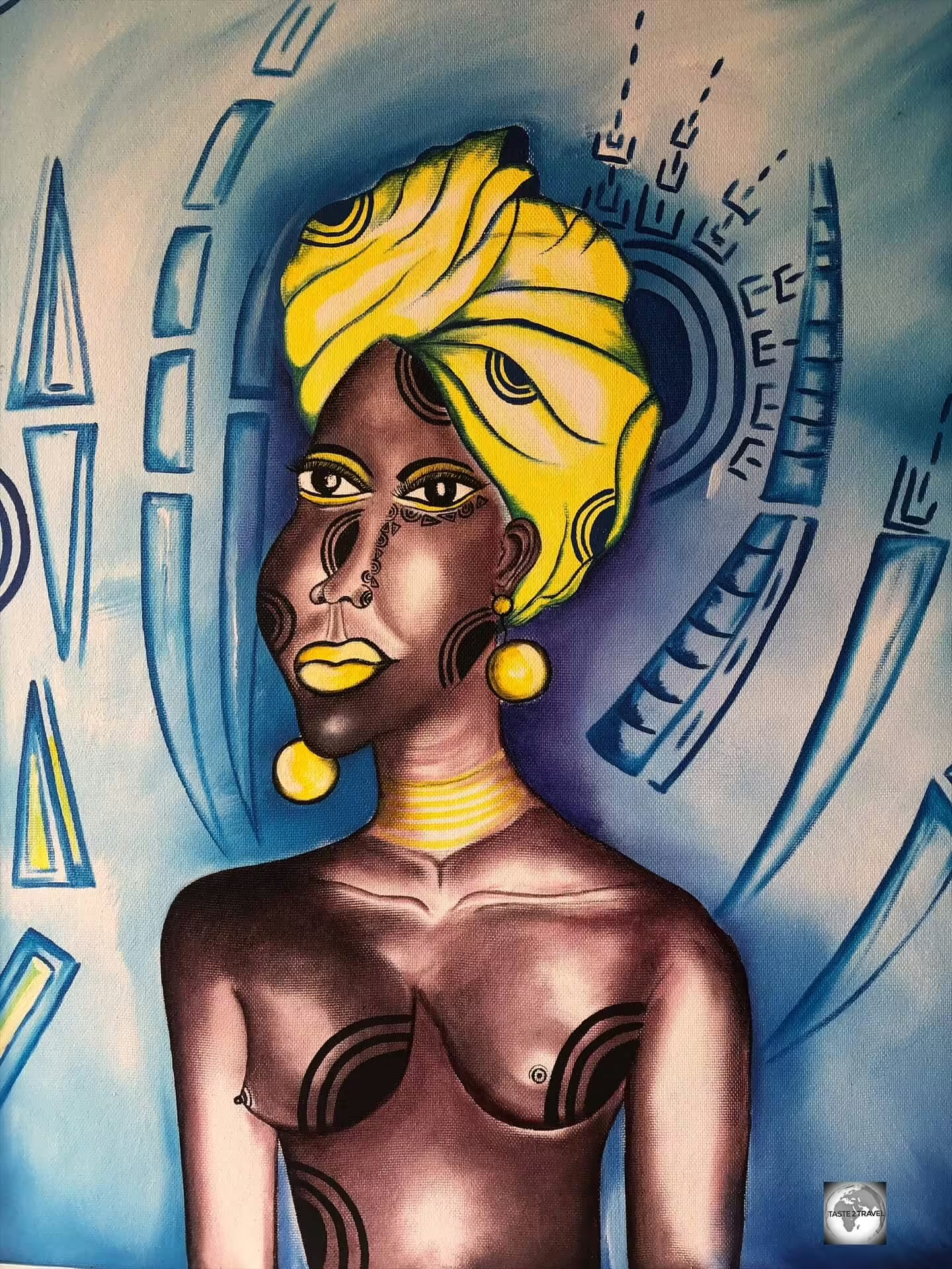


.")
.")

.")
.")


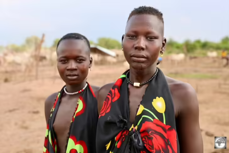


.")


. ")


 CFA franc banknotes - with the 2,000 missing!")


.")


 which was issued without fuss at Moroni International Airport.")