To read about this destination, please refer to my Iran Travel Guide.
All images are copyright! If you wish to purchase any images for commercial use, please contact me via the Contactpage.
About taste2travel!
Hi! My name is Darren McLean, the owner of taste2travel.
I’ve been travelling the world for 36 years and, 230 countries and territories, and seven continents later, I’m still on the road.
Taste2travel offers travel information for destinations around the world, specialising in those that are remote and seldom visited. I hope you enjoy my content!
Ever since I was a child, I have been obsessed with the idea of travel. I started planning my first overseas trip at the age of 19 and departed Australia soon after my 20th birthday. Many years later, I’m still on the road.
In 2016, I decided to document and share my journeys and photography with a wider audience and so, taste2travel.com was born.
My aim is to create useful, usable travel guides/ reports on destinations I have visited. My reports are very comprehensive and detailed as I believe more information is better than less. They are best suited to those planning a journey to a particular destination.
Many of the destinations featured on my website are far off the regular beaten tourist trail. Often, these countries are hidden gems which remain undiscovered, mostly because they are remote and difficult to reach. I enjoy exploring and showcasing these ‘off-the-radar’ destinations, which will, hopefully, inspire others to plan their own adventure to a far-flung corner of the planet.
I’m also a fan of travel trivia and if you are too, you’ll find plenty of travel quizzes on the site.
Photography has always been a passion and all the photos appearing in these galleries were taken by me.
If you have any questions or queries, please contact me via the contact page.
This is an Iran Travel Guide from taste2travel.com
Date Visited: May 2023
Introduction
Welcome to my Iran Travel Guide!
I recently travelled to Iran for 3-weeks, traversing what is known as the ‘Classic Route‘, travelling from Shiraz, north to Tehran, stropping at Yazd, Esfahan (Isfahan), Kashan and Tehran.
A view of the spectacular dome at the Sheikh Lotfollah Mosque in Esfahan, one of many outstanding sights in Iran.
During my time in the country, I travelled with an amazing freelance Iranian guide, Esmaeil Shahsavar (aka Essi), who made my trip so much more memorable than if I had travelled by myself!
Travelling in Iran with the amazing Essi!
Essi is a proud Iranian who is passionate about Iran’s history, culture and society. Through him, I was introduced to many remarkable people and places, which allowed me to gain insights into Iran that wouldn’t be available to me as a regular tourist.
I highly recommend engaging the services of a local guide who is passionate and knowledgeable. I have included contact details for Essi in the ‘Tour Guide‘ section below.
Detail of the sublime tilework at the Shah Mosque in Esfahan.
Did you know? Iran is home to 27 UNESCO World Heritage Sites, making it one of the top 10 countries in terms of UNESCO sites.
In so many ways, Iran has been a cradle of civilisation for humanity. Iran is known for its ancient civilisations, stunning architecture and its influence on the greater region and beyond.
An aerial view, taken from my Flydubai flight, of the spectacularly pink Maharloo Lake.
During my 3-weeks in Iran, I took 1,500 photos. In most other countries, I would take 200-300 photos in the same period of time.
Iran is one of the most surprising, authentic travel destinations anywhere on planet Earth.
Iran is unlike most countries – a fascinating travel destination which offers an overwhelming amount of sightseeing, including no less than 27 UNESCO World Heritage Sites.
Columns, from the ruined Apadana Palace at Persepolis.
As for the people, the hospitality of Iranians is legendary and I was always made to feel very welcome.
There is a vast difference between everyday Iranians and the Iranian government, whose, normally provocative, actions make the daily news cycle for all the wrong reasons.
Iranians are generally an intelligent, educated, open-minded lot who are keen to engage with the outside world.
Iran rial banknotes, featuring the image of Ayatollah Khomeini, the first supreme leader of Iran.
Despite the internet being blocked by the government, most Iranians access the internet using VPN’s. Despite efforts by the government, Iranians tend to be fully informed!
Due to international sanctions, there are many restrictions imposed on Iran.
Credit cards cannot be used inside Iran, which also means that cash cannot be withdrawn from ATMs. I cover all of these monetary restrictions, and solutions, in the ‘Currency‘ section below.
Additionally, applying for a tourist visa isn’t so straight-forward and is best done using an Iranian-registered travel company. The visa application process is fully explained in the ‘Visa Requirement‘ section below.
If you have thought about visiting Iran, I would urge you to go.
I had an amazing time in the country and look forward to returning one day to continue my road-trip through this fascinating, ancient, and modern, land.
Location
Iran is located in the heart of western Asia, at a crossroads with the Middle East. Iran’s strategic location has made it an historically important crossroads for trade and cultural exchange between the East and the West.
Iran shares land borders to the north with Turkmenistan, Armenia, Azerbaijan, and the exclave of Nakhchivan (an autonomous region of
Azerbaijan).
To the northeast, Iran is bordered by Afghanistan, while to the east, it shares a long border with Pakistan. To the west, it borders Iraq.
To the southwest, Iran has a long coastline along the Persian Gulf and the Gulf of Oman. On the other side of the Persian Gulf, the same body of water is referred to as the Arabian Gulf – much to the annoyance of Iranians.
In terms of topography, Iran is very diverse, with vast mountain ranges, deserts, plateaus, and fertile valleys.
The Zagros Mountains run along its western border, while the Alborz Mountains are located in the north. Central Iran is dominated by the Iranian Plateau, which includes the Dasht-e Kavir (Great Salt Desert) and the Dasht-e Lut (Lut Desert).
The country also features several fertile plains and valleys, including the Caspian Sea (the world’s largest landlocked body of water) to the north.
People
The people of Iran, known as Iranians, are a diverse and culturally rich population with a long history dating back thousands of years.
Iran is a multi-ethnic country, and Iranians are comprised of various ethnic groups. The majority are Persian, making up about 61% of the population.
Other significant ethnic groups include Azeris, Kurds, Arabs, Lurs, Baloch, and Turkmen, among others. This ethnic diversity contributes to the cultural richness of the nation.
The official language of Iran is Persian (Farsi), and it serves as the lingua franca across the country. However, many Iranians are bilingual or multilingual, with minority ethnic groups often speaking their own languages or dialects.
Why Two Door Knockers?
A traditional wooden door, featuring two door knockers.
Formerly, in more conservative times, traditional wooden doors in Iran featured two knockers.
The knocker on the left was used by female visitors, while the one on the right was used by male visitors.
Always, the door knocker on the left is to be used by female visitors, while the one on the right is to be used by male visitors, with each producing a different sound.
This allowed householders to know the gender of the visitor before they opened the door.
This was important since it wasn’t acceptable for a male to open a door to a female visitor and vice-versa.
The predominant religion in Iran is Shia Islam. The country is home to some of the most important Shia religious sites, and religious practices play a significant role in the daily lives of many Iranians. However, there are also religious minorities in Iran, including Sunni Muslims, Christians, Jews and Zoroastrians.
Iranians have a rich cultural heritage that includes contributions to literature, poetry, art, music, and philosophy. Persian poetry, with luminaries like Rumi and Hafez, holds a special place in world literature.
Persian carpets, such as this one in Kashan, are in integral part of Iranian culture.
Traditional Persian music, characterised by instruments like the tar and setar, is renowned for its beauty and complexity.
Iranians are known for their warm hospitality. Guests are highly esteemed in Iranian culture, and it is common for hosts to go to great lengths to make visitors feel welcome.
Iran has a strong emphasis on education, and literacy rates are relatively high. Both men and women have access to education, and women’s participation in higher education has been steadily increasing over the years.
A birthday girl, posing for the camera at Maharloo Lake.
The dress code in Iran varies, but modesty is a key consideration. Traditional clothing such as the chador, hijab, and manteau are common for women, while men typically wear long-sleeved shirts and trousers.
However, younger Iranian women are challenging the established norms, with many choosing not to wear hijab. This is a direct challenge to the conservative Islamic leaders who run the country and continues to cause friction and problems.
Flag
The flag of Iran, as souvenir fridge magnets.
The flag of Iran, also known as the Iranian Tricolor consists of three horizontal stripes of equal width, arranged from top to bottom in the following colors:
1. Green Stripe: The top stripe is green, which holds significant historical and cultural symbolism. Green has long been associated with Islam, representing growth, hope, and happiness. It is also a colour that reflects the natural landscapes of Iran, including its lush gardens and forests.
2. White Stripe: The middle stripe is white, which symbolises peace and purity. White is often seen as a color of harmony and tranquility, reflecting the desire for a peaceful coexistence among Iran’s people and with the rest of the world.
3. Red Stripe: The bottom stripe is red, a color that represents valour, bravery, and the bloodshed of those who sacrificed for Iran’s independence and freedom. It also symbolises the country’s long history of struggle against invaders and oppressors.
The flag of Iran, flying at Pasargadae.
In the centre of the white stripe, near the hoist side, there is a stylised emblem known as the “Allah-o-Akbar” emblem. This emblem features a stylised calligraphic design of the phrase “Allah-o-Akbar,” which means “God is the Greatest” in Arabic script.
The calligraphy is done in a way that it forms a stylised version of the word “Allah” (God) within the emblem.
Currency
The Iranian rial, aka toman, is the official currency of Iran.
The currency situation in Iran is especially confusing for the first-time visitor.
While the official currency is the Iranian rial (international currency code: IRR), all prices are expressed in toman. The toman is an ancient currency which has existed since 1798.
In 1932, the rial was introduced, with one toman being equal to 10 rial. Although, today, the rial is the official currency, all prices are expressed in toman.
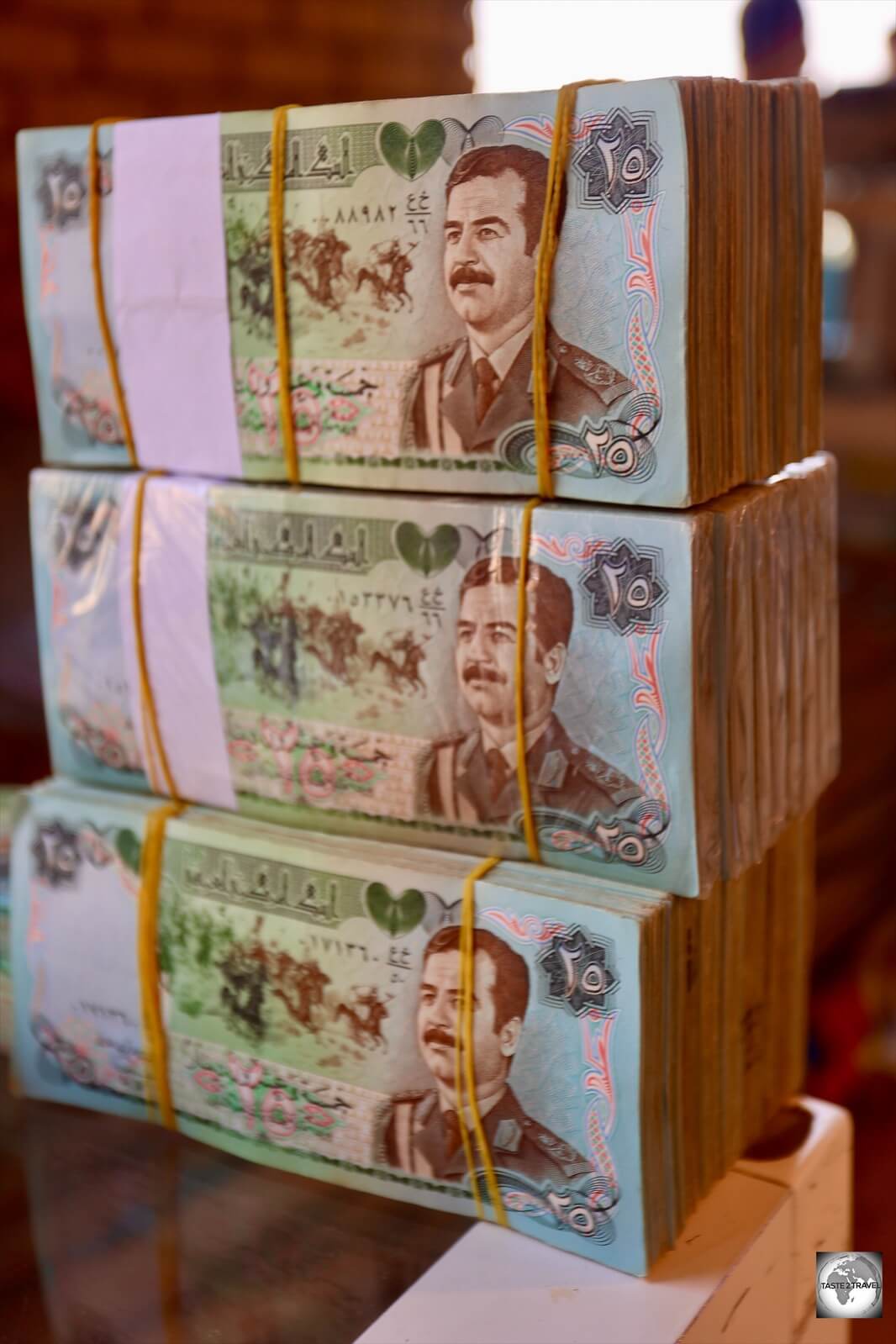
My uncirculated wad of one hundred, 10,000 Iranian rial, banknotes which I purchased from a money changer.
Iranians transact in toman, not rial, although they use rial banknotes.
What makes things confusing is that all bank notes are issued in rial, but they are used as toman. To further complicate matters, three extra zeros are omitted from the rial when converting to toman.
This means, if you purchase something which is worth 2,000,000 rial – you will pay 200,000 toman which is expressed simply as ‘200’. Very confusing for visitors.
Currently, four different versions of the 1,000,000 Iranian rial bank note are in circulation, although each is expressed as ‘100’ toman.
If that’s not confusing enough, different series of Iranian rial banknotes are in circulation at the same time. For example, there are currently four different versions of the 1,000,000 rial bank note in circulation (ss shown above).
As can be seen in the image above, the latest versions of the bank notes (right side) have the last 4 zeros of the rial amount shaded out so that the value is expressed as toman. Additionally, the toman amount of ‘100’ is clearly displayed on the notes.
As an example of an everyday transaction, if you pay for a coffee in a café, you’ll be charged 150 toman which is 1,500,000 rials.
Exchange Rate
Bank notes in Iran feature the image of Ayatollah Khomeini, the first supreme leader of Iran from 1979 until his death in 1989.
The exchange rate of the Iranian rial has experienced significant fluctuations due to economic factors and sanctions.
While there are many ATMs in Iran, they only accept Iranian bank cards.
Due to sanctions, Iran is not part of the international bank system and as such, international credit cards cannot be used in Iran.
This also means that foreigners are unable to withdraw cash from ATMs in Iran. You will need to arrive in the country with enough USD cash (or Euro) for your entire stay.
Iranian banks do issue domestic cards to their customers, which allow Iranians to pay for purchases electronically and withdraw cash from ATM’s.
Iranians are big on electronic payments, preferring to pay for almost everything using a card, rather than carrying loads of cash.
Credit cards also cannot be used to pay for hotels in Iran and, due to sanctions, the regular online booking sites (booking.com etc.) do not list Iranian hotels.
One Iranian online accommodation provider, 1st Quest, allows you to pre-book, and pre-pay, for accommodation using your international credit card. Transactions on this site are conducted outside of Iran.
You should book all accommodation prior to arriving in Iran. Please refer to the ‘Accommodation‘ section below for more on 1st Quest.
Prepaid Tourist Card
The Mah Card is an Iranian prepaid debit card for tourists.
One card option available for visitor’s is Mah Card, an Iranian debit card which can be pre-loaded with funds which saves you from carrying around piles of cash.
Due to the processing time involved in issuing the card (up to 7 days), it’s essential that you apply for this in advance of your trip.
Upon arrival in Iran, the card will be waiting for you at your nominated accommodation.
Accessing Your Home Bank
It should be noted that due to sanctions, your bank at home might be inaccessible in Iran. When I tried to login to my bank in Australia, I received a message to say that the service was unavailable in Iran due to sanctions regulations.
Costs
Travel costs in Iran are totally reasonable! As a destination, Iran offers excellent value for money.
One of the biggest bargains in Iran is petrol, which currently costs US$0.06 per litre! Some of the cheapest fuel in the world!
It goes without saying – Iran is not your usual travel destination!
Due to sanctions, and the ongoing (difficult) political environment, there are many considerations which must be made when planning a trip to Iran.
If you apply for a visa independently, there is a good chance your application will be denied.
You need to apply for a visa through an Iranian-registered travel company. For a full description of the Visa Application process, please refer to the ‘Visa Requirements‘ section below.
Because of sanctions, most international travel insurance policies do not provide coverage in Iran – you will need to purchase an Iranian travel insurance policy.
Also – credit cards cannot be used anywhere inside Iran. You cannot withdraw cash from ATMs anywhere in Iran.
However, you can apply, in advance, for an Iran Tourist Card which is an Iranian debit card which you can pre-load online and will allow you to make electronic payments throughout Iran.
All of these services are offered by the amazingly helpful folks at Tap Persia.
Tap Persia is a one-stop shop for all your Iran travel needs!
If you are planning a trip to Iran, you would be wise to first contact Tap Persia.
From their website, you can organise everything online. Their most important service is the Visa Application service.
Their service is friendly and efficient! They are the gateway to Iran for so many travellers!
1st Quest
Also because of sanctions, hotels in Iran cannot be booked using the regular online booking websites.
You can pre-book hotels online, and pay with your credit card, using 1st Quest which is Iran’s version of booking.com.
Iranian Tour Guide
“Essi is your man in Iran!”
Normally, I travel independently!
However, prior to arriving in Iran, I was introduced to a Shiraz-based tour guide, Esmaeil Shahsavar (aka Essi), through some friends who had travelled previously with him and highly recommended the experience!
Essi is a qualified tour guide who speaks perfect English. He is a proud Iranian who loves his country, its culture, history and its people!
He works both as a freelance tour guide and for established tour companies and has an expansive knowledge of the entire country. Wherever we went, he knew of hidden sights which he loved to share with me.
Video:
Video of Persepolis taken by Essi!
Essi is also a keen videographer and was always making videos of our adventures. He shares many of his videos on his Instagram account.
I contacted Essi and organised to use his services in Shiraz and onto Yazd. Beyond Yazd, I planned to travel independently to Tehran.
However, it became clear on the first day that Essi is more than just a tour guide. He has a genuine love for Iran, and is eager to share its history, culture, sights, cuisine and so much more with visitors.
Even as we drove between sights, in his clean and comfortable white Peugeot, he would play the most beautiful Iranian music and provide translation of the lyrics!
In the end, I realised my travel experience in Iran would be greatly enhanced by having Essi as my full-time guide. I agreed to travel with Essi for the 21-days I was in Iran!
During this time, I travelled what is known as the ‘Classic Route‘, starting in Shiraz, then moving on to Yazd, Esfahan, Kashan then Tehran.
In each city, I scheduled a 4-night stay which allowed time to explore the sights in and outside of each city.
At every step of the trip, Essi would surprise me by revealing dazzling sights in the most remote and unlikely locations. With him, I visited places I could never have reached with regular public transport.
In every city, Essi knew people, and introduced me to his many friends which further enhanced my travel experience.
Travelling in Iran with Essi was a no-brainer – it was a win/win situation.
The 21-days I spent travelling the Classic Route with Essi was the ultimate Iran Road Trip.
If you are planning a trip to Iran and would like to travel with a freelance guide, who will enthusiastically share his knowledge and passion for his amazing country, then Essi is your man in Iran!
Sightseeing in Iran offers a captivating journey through a land rich in history, culture, and natural beauty. Iran boasts a wide range of attractions, from ancient historical sites to stunning landscapes.
The sightseeing section follows the direction of my travel, starting in Shiraz and ending in Tehran.
Shiraz
Shiraz is known as the city of poets, literature, and gardens. One of the principal cities in Iran, Shiraz is an historic and culturally rich city located in the southern part of the country.
The city has a long and illustrious history dating back over 4,000 years. It was the capital of the Persian Empire during the Zand Dynasty in the 18th century and played a significant role in Persian culture and politics.
Colourful cushions for sale at Vakil Bazaar, Shiraz.
Shiraz is often referred to as the “City of Poets,” the “City of Gardens,” and the “City of Love” due to its association with Persian literature, lush gardens, and romantic ambiance.
Shiraz is renowned for its deep connection to Persian poetry and literature. It is the birthplace of some of Iran’s most celebrated poets, including Hafez and Saadi.
The city is known for its stunning Islamic architecture. Some of the most impressive landmarks include the Nasir al-Mulk Mosque (also known as the “Pink Mosque”) with its colorful stained-glass windows, and the Shah Cheragh Shrine, known for its dazzling mirror work and intricate tile designs.
Shiraz offers a unique blend of history, culture, and natural beauty that makes it a captivating destination for anyone interested in exploring Iran’s rich heritage. It is a city where poetry comes to life, and visitors can immerse themselves in the timeless beauty of Persian culture.
Shiraz offers many days of sightseeing both inside the city and outside, where the spectacularly pink Maharloo Lake is a truly surreal sight.
The city is the best base from which to make daytrips to the UNESCO World Heritage sites of Persepolis, Naqsh-e Rostam and Pasargadae.
Some of the sights of Shiraz include:
Nasir al-Mulk Mosque
Built during the Qajar dynasty, construction of the Nasir al-Mulk Mosque began in 1876 by the order of Mirza Hassan Ali Nasir-ol-Mulk, one of the lords of Shiraz.
Built during the Qajar dynasty, construction of the Nasir al-Mulk Mosque began in 1876 by the order of Mirza Hassan Ali Nasir-ol-Mulk, one of the lords and aristocrats of Shiraz and was completed in 1888.
The pink colour which covers the walls of the Pink Mosque was created by craftsmen who used an expensive glaze, which included gold.
The mosque is known for its many coloured glass Orsi windows and its fully tiled walls which feature a distinct pink colour.
One of the magnificent Muqarnas, a form of decorative vaulting, which is popular in Iranian-Islamic architecture, at the Nasir al-Mulk Mosque.
Craftsmen used a very expensive glaze that contained gold to colour the tiles with pink. It is said that 20 kilograms of gold was used for this process. It is for this reason that the mosque is nicknamed the “Pink Mosque”.
Truly resplendent mosque decoration, at the Nasir al-Mulk Mosque in Shiraz.
One of the standout architectural features at the Pink Mosque are the Muqarnas, a form of decorative vaulting, which is popular in Iranian-Islamic architecture.
A view of a Muqarna, surrounded by a sea of pretty pink tiles, at the Nasir al-Mulk Mosque in Shiraz.
In muqarnas, the surface of a vault or dome is subdivided into niche-like cells that have no load-bearing function.
Also known as stalactite vaulting or honeycomb vaulting, the example at the Pink Mosque is truly stunning.
A smaller, but equally dazzling Muqarna, at the Nasir al-Mulk Mosque in Shiraz.
Nasir al-Mulk Mosque is famous for its seven Orsi windows, which are made of a mixture of wood and colourful glass.
A view of the richly decorated interior of the Nasir al-Mulk Mosque.
Although stained glass is mostly popular in churches nowadays, the earliest discovered was in Syria from the 7th century CE.
A spectacular rainbow of stained glass makes the “Pink Mosque” one of the most beautiful in Iran.
There is evidence of techniques and recipes for obtaining stained glass by the Persian chemist Jabir ibn Hayyan who published his techniques as early as the 8th century CE.
The best time to photograph the windows at the Nasir al-Mulk Mosque is in the early morning.
Photography Tips:
The best time to photograph the Orsi windows at the Nasir al-Mulk Mosque is in the early morning – before 8am.
The best season for photography is in winter, when the sun is low in the sky. This low angle of sunlight fills the mosque with lots of colourful light. I visited during the summer when the sun is higher in the sky and the colourful light shadows are shorter.
Orsi differs from stained glass used in many churches and Ottoman mosques which serve as illuminated images rather than a source of light.
Orsi windows at the Nasir al-Mulk Mosque in Shiraz.
Orsi windows are characterised for using pieces of colour glass, which are cut into different geometric shapes. Such shapes were used due to the prohibition of images and icons in Islamic art.
Orsi windows are characterised for using geometric shapes in their designs due to the prohibition of images and icons in Islamic art.
The main purpose of Orsi is creating colourful light on the interior of the building.
Nasir al-Mulk Mosque has seven wooden doors with colourful Orsi connecting the interior mosque to the courtyard.
A view of the courtyard at the Nasir al-Mulk Mosque in Shiraz.
Shahcheragh Shrine
A view of the Shahcheragh Shrine, the holiest shrine in the city of Shiraz, during the magical ‘golden hour’.
The Shahcheragh Shrine is the holiest shrine in the city of Shiraz and the 3rd holiest shrine in Iran.
The shrine houses the tomb of Ahmed bin Musa, the son of Musa al-Kadhim, who is known as Shah Cheragh (King of the Light) in local traditions.
A view of one of the minarets at the golden porch at the Shahcheragh Shrine in Shiraz.
The first structure over the grave of Ahmed bin Musa was built in the 13th century CE.
Worshippers praying at the Tomb of Sayyid Ahmad, inside the Shahcheragh Shrine.
Like other Shia holy shrines, the interior of the shrine is decorated with a profusion of individually laid mirrors.
A view of the mirror-covered central dome, inside the Shahcheragh Shrine in Shiraz.
The mausoleum of Sayyid Ahmad is topped by a large dome which is covered in individually laid mirrors.
Visiting Tips:
Large cameras are not allowed inside the shrine – only smartphone cameras are permitted.
All tourists must be fully escorted by a friendly mosque guardian.
Ali Ibn Hamzeh Shrine
The Ali Ibn Hamzeh Shrine was constructed in the 10th century CE to honour a noble descendant of the prophet of Islam.
Welcome to the most tourist-friendly Islamic sight in Shiraz!
Built in Shiraz in the 10th century to honour a noble descendant of the prophet of Islam, the Ali Ibn Hamzeh Shrine is now a popular praying retreat for Muslims.
A view of the shrine of Ali Ibn Hamzeh Shrine.
Its peaceful ambiance, soothing architecture, and welcoming attitude of its caretakers toward any kind of visitors have made this shrine an attractive destination in Shiraz.
I was made to feel welcome in the visitor’s centre, where I was offered cups of tea and biscuits.
The shrine was constructed in the 10th centuryCE, to honour Ali Ibn Hamzeh, who was a descendant of the prophet of Islam and is a sacred figure for Shiites.
The shrine of Ali Ibn Hamzeh Shrine is installed below a dazzling mirror-covered central dome.
Ali Ibn Hamzeh was prosecuted by the caliph and fled to Shiraz in 805, but after staying hidden for some time, he was finally found and killed.
Every inch of the interior of the Ali Ibn Hamzeh Shrine is covered with tiny, hand-laid mirrors.
In around 950, the local ruler of Shiraz built a shrine which was later developed further.
Like other Shia Holy Shrines, the interior of this shrine offers a dazzling profusion of mirror work with each thumbnail-sized fragment being installed individually.
A truly stunning sight in a country which is full of breathtakingly beautiful wonders.
Qavam House
Located in the heart of Shiraz, Qavam House is a traditional and historical house and garden.
Located in the heart of the Iranian city of Shiraz, Qavam House – also known as Narenjestan garden, is a traditional and historical house and garden.
Built between 1879 and 1886, the building preserves the elegance and refinement enjoyed by upper-class Persian families during the 19th century.
A view of Qavam House from the garden.
Qavam House was built during the Qajar period in the late 19th century. At that time, the Qavam family was among the political figures of Shiraz, and Qavam House served as the residential place of the Qavam family and the office for their administration.
Since the garden has an abundance of sour orange trees, people call it Narenjestan. Interestingly, the Spanish world for ‘orange’ is naranja.
A wall mosaic, in the garden at Qavam House, which depicts three Qajari eunuchs.
The garden at Qavam House features date palms, and a large number of sour orange trees.
Persian gardens generally have a rectangular form consisting of four quarters abundant in trees and flowers, streams and pathways, ponds and fountains.
A symbol of wealth – the stunning mirrored porch at Qavam House was built during an age when only the wealthy could afford to buy mirrors.
A highlight of the house is the spectacular mirrored porch.
The ceiling of the mirrored porch at Qavam House, Shiraz.
In the 19th century, mirrors were an expensive item to purchase, with most mirrors imported from Russia. The use of mirrors was a way for a family to indicate its wealth.
Mirror Mirror on the Wall! A mirrored room, inside Qavam House, Shiraz.
Two smaller porches feature very fine plaster stucco work.
A porch at Qavam House features a profusion of plaster stucco work.
Qavam House has elaborate architecture embellished with various Persian arts such as paintings, stucco, wood carving, stone carving, tile work, and mirror work.
An artist at Qavam House, painting a miniature on a piece of stone.
In the basement of the house are some truly talented artists. One artist paints miniature images on bird feathers using a tiny brush made from cat’s fur.
This scene has been painted onto a feather, by an artist at Qavam House, using a tiny brush made from cat’s fur.
Eram Garden
Eram Garden is a UNESCO World Heritage Site and one of the most famous Persian gardens in Shiraz.
Relaxing and expansive, Eram Garden is yet another UNESCO World Heritage Site and one of the most famous Persian gardens in Shiraz.
A view of the pavilion at Eram Garden.
It features meticulously landscaped gardens, fountains, and historic buildings, making it a peaceful oasis within the city.
Arg of Karim Khan
Located in the centre of Shiraz, the Karim Khan Citadel was built as part of a complex during the Zand dynasty.
The Arg of Karim Khan or Karim Khan Citadel, is a citadel located in downtown Shiraz, Iran. It was built as part of a complex during the Zand dynasty (1751 to 1794).
It is named after Karim Khan Zand, and served as his living quarters. It is rectangular in shape and resembles a medieval fortress.
The dynasty, which ruled most of ancient Iran, began as a Safavid restoration but soon became an independent effort to restore peace and prosperity.
It rebuilt and rerouted trade through Iran, issued coins in the name of the Hidden Imam, and built a mosque in Shiraz, but never sought clerical endorsement of power.
Buildings inside the Karim Khan Citadel feature Orsi windows.
Karim Khan Zand holds an enduring reputation as the most humane Iranian ruler of the Islamic era. His descendants were overthrown by the Qajars.
In the past, the citadel was sometimes used as a prison. Today, it is a museum operated by Iran’s Cultural Heritage Organization. A public park surrounds it.
Vakil Bazaar
A carpet seller in Vakil Bazaar, Shiraz.
In between all the sightseeing, the charming and historic Vakil Bazaar offers excellent shopping, especially for Persian rugs and Iranian handicrafts.
A view of one of the many covered laneways inside Vakil Bazaar, Shiraz.
A typical Iranian bazaar, centered around an ancient “caravanserai” which was an accommodation place built for merchants travelling by camels in the past.
A carpet shop at Vakil Bazaar, Shiraz.
The bazaar features a number of leafy squares with fountains in the centre, surrounded by two-storey guest houses which are now occupied by various artisanal shops.
Shopping at Vakil Bazaar, Shiraz.
A great place for shopping when in Shiraz.
Vakil Mosque
Vakil Mosque was built between 1751 and 1773, during the Zand period.
The Vakil Mosque is a mosque in downtown Shiraz, situated to the west of the Vakil Bazaar next to its entrance.
This mosque was built between 1751 and 1773, during the Zand period; however, it was restored in the 19th century during the Qajar period.
View of the interior of the Vakil Mosque.
Vakil means regent, which was the title used by Karim Khan, the founder of Zand Dynasty. Shiraz was the seat of Karim Khan’s government and he endowed many buildings, including this mosque.
Maharloo Lake
An aerial view, taken from my Flydubai flight, of the spectacularly pink Maharloo Lake.
Located 27 kilometres southeast of Shiraz, the very pink, Maharloo Lake, is a stunning natural attraction.
If arriving into Shiraz by air, there is a good chance you’ll fly over the lake on final approach to Shiraz International Airport. Worth sitting on a window for what is a truly dazzling sight.
The aerial views included here were taken in the morning from my flight from Dubai to Shiraz.
This unique and picturesque lake is known for its striking pink hue, which results from a combination of factors, making it a popular destination for tourists and nature enthusiasts.
A birthday girl, participating in a photography shoot at the very surreal Maharloo Lake.
The intensely striking pink colour is the result of the high salinity and the presence of microorganisms, particularly algae and bacteria. These microorganisms thrive in the salty waters and produce a red pigment, giving the lake its characteristic pink and reddish tones.
The very pink, Maharloo Lake, seen from my window seat on my Flydubai flight, on approach to Shiraz International Airport.
The intensity of the pink colour can vary depending on the time of day, weather conditions, and the season. At the time of my visit, the lake was at its most ‘pink’.
Sunset view of the very pink Maharloo Lake.
Maharloo Lake is a saltwater lake, and its water has a high salinity content. The salt concentration in the lake is the primary reason behind the absence of aquatic life in its waters. The lake’s salt flats and crystalline formations along the shoreline add to its unique natural beauty.
The lake is set against a backdrop of arid desert landscapes and distant mountains, creating a stunning contrast with its vibrant pink waters.
A surreal and spectacular sight – the very pink Maharloo Lake.
The reflection of the surrounding mountains and the changing colors of the lake’s surface make it a popular spot for photographers and nature enthusiasts. Best photography is in the late afternoon.
A highlight of Shiraz, Maharloo Lake is a magical place where the interplay of salt, microorganisms, and changing environmental conditions creates a remarkable and visually stunning sight.
Getting There:
Located on the outskirts Shiraz, in a remote, desert setting, you will need private transport to access the lake.
I recommend travelling with Essi (Instagram: Safarbon), a native of Shiraz, and someone who knows the best photo vantage points on the lake.
Persepolis
Founded by Darius I in 518 BCE, Persepolis is a UNESCO World Heritage site and the most popular tourist attraction in Iran.
Situated on the plains of Marvdasht, 60 km (37 miles) northeast of Shiraz, Persepolis is one of Iran’s most iconic and important archaeological sites.
Relief carving at Persepolis.
Not surprisingly, Persepolis is a UNESCO World Heritage site and is also the most popular tourist attraction in Iran.
Greek for “City of the Persians”, Persepolis was the ceremonial capital of the Achaemenid Empire (550–330 BCE), which was once one of the world’s most powerful empires.
Many of the carved reliefs at Persepolis were carved from dark-grey marble.
The city was founded by Darius the Great in the late 6th century BCE and served as the centre for royal gatherings and celebrations. The city is known for its impressive ruins, including massive stone gateways, palaces, and intricately carved reliefs, many of which are carved from dark-grey marble.
Persepolis is renowned for its grand and imposing architecture. The site features a vast complex of palaces, halls, and other structures, primarily constructed of gray limestone.
Views of the ruins at Persepolis.
The buildings showcase intricate carvings, colossal columns, and exquisite detailing. It featured five “palaces”, or halls, of varying size, and grand entrances.
The entrance to the Apadana Palace features reliefs which pay homage to the King.
What makes Persepolis truly striking is that the entire city, which was constructed over a period of 200 years, was built atop a 27 metre (89 ft) high, man-made, walled plinth – the ultimate landscaping project!
Access to the top of the plinth, and the site itself, is via the monumental Grand Staircase, a wide, 111-step, stone staircase. The stairs were carved from massive blocks of stone, but each step was shallow so that Persians in long elegant robes could ascend the steps gracefully.
Due to its perched setting, Persepolis looms large over the surrounding plains.
Ruins of the Gate of All Nations at Persepolis, with two heavily damaged Lamassu’s at the front of the gate.
At the top of the Grand Staircase, the entrance to Persepolis is marked by two monumental gateways known as the Gate of All Nations.
Two heavily damaged Lamassu’s still stand guard at the front of the gate. These mythical creatures. which depicted a winged creature with the bearded head of a human and the body of a bull or a lion were normally installed at city entrances as a form of protection.
These gateways served as impressive entrances to the complex and displayed the empire’s multicultural character with depictions of various nations and ethnicities bringing tribute to the Persian king.
Carved reliefs line the main entrance to the Apadana Palace.
The Apadana Palace is one of the most prominent structures at Persepolis. It was used for audiences and royal receptions. The grand staircase leading to the Apadana is flanked by rows of beautifully carved stone columns.
A bas-relief from the Apadana Palace at Persepolis, depicting delegations bringing offerings to the king.
Persepolis is adorned with numerous reliefs and inscriptions that depict scenes of Persian kings, royal processions, and tribute-bearing delegates. The inscriptions are often written in Old Persian, Elamite, and Babylonian cuneiform scripts.
Views of the ruins at Persepolis.
As the name suggests, the Hundred-Column Hall is a vast hall supported by a forest of columns. While not actually containing 100 columns, it is an awe-inspiring structure with rows of columns that once held up the roof.
A column, covered in relief carvings, at Persepolis.
The function of Persepolis remains unclear. It was not one of the largest cities in Persia, let alone the rest of the empire, but appears to have been a grand ceremonial complex that was only occupied seasonally.
A bas-relief at Persepolis, representing a symbol in Zoroastrianism for ‘Nowruz’ – the Persian New Year!
Until recently, most archaeologists held that it was primarily used for celebrating Nowruz, the Persian New Year, held at the spring equinox, which is still an important annual festivity in modern Iran.
A perfectly preserved Huma bird column capital. This mystical bird is said to have spent its entire life flying and never came into contact with the earth’s surface.
Persepolis was once said to be the richest city under the sun.
A bas-relief from the Apadana Palace at Persepolis, depicting a delegation offering sheep to the king.
Unfortunately, the party was cut short by the arrival of Alexander the Great (who is not referred to as ‘Great’ by Iranians).
Arriving in 330 BCE, Alexander was on a mission to exact revenge against the Persians for their invasion of Greece…for the destruction of Athens, the burning of Greek temples, and all the other crimes the Persians had committed against the Greeks.
After a 4-month occupation, and looting, of Persepolis, and after one drunken party, Alexander, at the urging of the beautiful and seductive Thais, set fire to the Apadana Palace.
A bas-relief from the Apadana Palace at Persepolis, depicting delegations bringing offerings to the king.
All of this placed the Persian King, Darius III, in an untenable position. He was murdered by one of his satraps (a provincial governor in ancient Persia) only weeks later.
Getting There:
My guide, Essi, trying to keep cool on a 45-degree day at Persepolis in front of the ruins of the Apadana palace.
Located about a one-hour drive from Shiraz, the ancient city of Persepolis is a popular day trip from the city.
It’s best to travel with a knowledgeable guide who has their own transport.
I recommend travelling with Essi (Instagram: Safarbon) who is an excellent guide, a native of Shiraz, and someone who has an intimate knowledge of this part of Iran and of Persepolis.
Naqsh-e Rostam
Naqsh-e Rostam is an ancient archaeological tomb site and a UNESCO World Heritage Site.
Located just 12 kilometres (7.5 mi) northwest of Persepolis, Naqsh-e Rostam is an ancient archaeological tomb site and a UNESCO World Heritage Site.
The site is renowned for its rock-cut tombs, reliefs, and historical significance, particularly its association with the Achaemenid Empire, whose rulers built nearby Persepolis.
Naqsh-e Rostam is famous for its impressive rock-cut tombs, hewn into the cliffs of a mountain. These tombs were created for Achaemenid kings and nobility and served as their final resting places.
A view of the tombs at Naqsh-e Rostam.
The four tombs are believed to be those of:
Darius I – aka “Darius the Great” – (c. 522-486 BC)
Xerxes I – son of Darius the Great (c. 486-465 BC)
Artaxerxes I – 3rd son of Xerxes I (c. 465-424 BC)
Darius II (c. 423-404 BC)
The order of the tombs follows (left to right): Darius II, Artaxerxes I, Darius I and Xerxes I.
A view of three of the tombs at Naqsh-e Rostam – from left to right: Darius II, Artaxerxes I and Darius I.
The tombs are characterised by their distinctive cross-shaped chambers, which are carved directly into the rock face.
Although closed to the public, each tomb chamber features a central chamber with smaller chambers branching off, where the remains of the deceased were likely placed.
While some of the tomb entrances feature elaborate reliefs, the panel next to the tomb of Xerxes I is blank – an ancient ‘work in progress’.
Above the tomb entrances, there are elaborate reliefs depicting scenes of royal and military triumphs, including the famous “Investiture of Ardashir I” relief, which shows the founder of the Sassanian Empire receiving the ring of kingship from the Zoroastrian deity Ahura Mazda.
Other reliefs include depictions of Achaemenid kings in audience with divine figures and their own court officials.
The reliefs at Naqsh-e Rostam provide valuable insights into the ancient Persian religion of Zoroastrianism, which pre-dates the arrival of Islam in the region. The symbolism and imagery in the reliefs are related to Zoroastrian beliefs and practices, emphasising the divine right of kings and the role of religion in the Achaemenid Empire.
During my visit, the tomb of Xerxes I was covered by scaffolding. To give a sense of scale, the height of the scaffolding was 65 metres (213 ft).
An ancient enigma – the purpose of the ‘Cube of Zoroaster’, a 5th-century B.C Achaemenid square tower remains a mystery.
Standing in front of the tombs is the mysterious Cube of Zoroaster, a 5th-century B.C Achaemenid square tower. A true enigma, the purpose of the tower is unknown.
Getting There:
My guide, Essi, buying delicious stone fruit from a roadside vendor (who is apparently a star on social media) near Naqsh-e Rostam.
Naqsh-e Rostam is located a short drive from Persepolis and can be visited on the same day trip.
Due to a complete lack of public transport, it’s best to travel with a guide who has transport.
I again recommend travelling with Essi (Instagram: Safarbon) when visiting Naqsh-e Rostam.
Pasargadae
A UNESCO World Heritage Site – the Tomb of Cyrus the Great at Pasargadae.
Also, a day trip from Shiraz and yet another UNESCO World Heritage Site – Pasargadae is an ancient archaeological site which is located 135 km (a 2-hour drive), northeast of Shiraz.
Although there isn’t much to see today, the site holds immense historical significance as the first capital of the Achaemenid Empire (550–330 BCE) and is known for its historical, architectural, and cultural importance.
Pasargadae is considered to be the foundation of the Achaemenid Empire. It was founded by Cyrus the Great, one of the most celebrated figures in ancient Persian history, in the 6th century BCE.
It served as the capital of the Achaemenid Empire from the time of its founding until the capital was later moved to Persepolis by Darius the Great.
The most renowned and iconic feature of Pasargadae, and the one remaining site, is the Tomb of Cyrus the Great, which is often referred to as Cyrus’s Mausoleum.
This simple but impressive structure is a rectangular stone tomb built on a stepped platform. It is believed to be the final resting place of Cyrus, who is known for his benevolent rule and the Cylinder of Cyrus, one of the earliest declarations of human rights.
The reign of Cyrus the Great marked the beginning of a new era in ancient Persia – an era characterised by religious tolerance and the promotion of human rights.
Cyrus the Great – the founder of Human Rights!
“Cyrus the Great” truly was great!
In 539 BCE, the armies of Cyrus the Great, the first king of ancient Persia, conquered the city of Babylon (in modern Iraq).
But it was his next actions that marked a major advance for Man. He freed the slaves, declared that all people had the right to choose their own religion, and established racial equality.
These and other decrees were recorded on a baked-clay cylinder in the Akkadian language with cuneiform script. Known today as the “Cyrus Cylinder”, this ancient record has now been recognised as the world’s first charter ofhuman rights.
It is translated into all six official languages of the United Nations and its provisions parallel the first four Articles of the Universal Declaration of Human Rights.
Cyrus was greatly loved by Persians and had the full respect of Alexander the Great who ordered his invading army not to touch Cyrus’s tomb. It is for this reason that the tomb is the one structure which remains intact today.
Getting There:
I travelled to Pasargadae on a day trip from Shiraz with my trusty guide – Essi (Instagram: Safarbon).
For lunch, we ate a traditional meal at a local family home, a short walk from Cyrus’s tomb. The family were friends of Essi – another advantage to travelling with a local guide.
Abarkuh
The ancient Abarkuh ice house in Yazd Province is one of the four remaining ice houses in Iran.
Ice Storage House
Rising up from the side of the road in the ancient desert town of Abarkuh is a strange, cone-shaped, mud-brick structure.
No! It’s not a strange ancient temple, or some other-worldly object, but an ingenious, ice storage house.
Popular in ancient Persia, such ice houses were built with a default structure consisting of four main parts – the shallow freezing pool, shadow-casting walls, ice storage and, of course, the conical dome.
When it was originally built, the Abarkuh ice house was completely enclosed and insulated. The hole in the ceiling dates from modern times.
Ice was produced, during the cold winter months, by pouring water into the shallow freezing pools. Overnight, ice would form. The next day, more water was added. The process was repeated each day until a thick layer of ice had formed.
Ice was produced during the cold winter months, then stored for use during the hot summer months.
This ice was then cut into slabs and stored inside the ice storage house where it would remain until it was needed during the hot summer months. Truly genius!
It is believed that such ice houses have existed in Iran since 400 BCE.
Perhaps even more peculiar than its shape are the ingredients used to make it – sand, clay, adobe, lime, egg whites, ashes and goat hair! From those ingredients, the Persians were able to make an ancient mortar called sarooj. Sarooj is water resistant and, acts as an affective insulator – ideal for storing ice.
Yadz
The iconic Amir Chakhmaq Complex dominates the centre of historic Yazd.
This desert city is known for its well-preserved historic architecture, including the Jameh Mosque, Amir Chakhmaq Complex, and traditional windcatchers.
Charming and engaging, Yazd is an historic and culturally rich city located in the middle of the desert in central Iran. The capital of the province of the same name, Yazd is known for its unique desert architecture, ancient history, Zoroastrian heritage, and distinct cultural traditions.
One of the most striking features of Yazd is its traditional desert architecture.
Yazd is known as the “The City of Windcatchers.”
The city’s old town is a labyrinth of narrow, winding alleys and mud-brick buildings with distinctive badgirs (wind towers) that serve as natural air conditioning, directing cool winds into the homes during the hot summer months.
This architectural style has earned Yazd the nickname “The City of Windcatchers.”
The city of Yazd is an important centre for the Zoroastrian religion. After the Muslim conquest of Persia (633 CE), many Zoroastrians migrated to Yazd from neighbouring provinces.
By paying a levy, Yazd was allowed to remain Zoroastrian even after the Muslim conquest. Today however, most inhabitants of Yazd are Shia Muslims, although many important Zoroastrian sights remain.
Amir Chakhmaq Complex
Reflections of the Amir Chakhmaq Complex in Yazd.
The Amir Chakhmaq Complex, with its beautiful façade and large square, is a prominent gathering place.
Reflections shots at the Amir Chakhmaq Complex – a prominent structure in Yazd, Iran, noted for its symmetrical sunken alcoves.
The Amir Chakhmaq Complex is an iconic structure in the heart of Yazd.
The complex, which overlooks the main square of Yazd, is home to a mosque, bathhouse, a water well and various shops.
Built in the 15th century, the complex is one of outstanding aesthetics and beauty. A fitting centre piece for this desert city.
Jameh Mosque of Yazd
Dating from the 14th-century, the Jameh Mosque is the principal mosque of Yazd.
The Jameh Mosque of Yazd is the grand, congregational mosque of Yazd city, within the Yazd Province of Iran.
This magnificent mosque is an architectural masterpiece. It features stunning tilework, intricate geometric designs, and an exquisite portal. The mosque is one of the highest in Iran and offers panoramic views of the city from its minarets.
This 14th-century mosque was constructed on the site of a former Zoroastrian fire temple.
The Jameh Mosque in Yazd is crowned by a pair of 52-metre-high minarets, the highest in Iran.
The standout feature of the Jameh Mosque are the twin, 52-metre-high minarets, which can be seen from anywhere in the city. They are the highest minarets in Iran.
Zoroastrian Fire Temple
The sacred Zoroastrian Fire Temple in Yazd houses a fire which has been burning continuously for more than 1,500 years.
Yazd is home to one of the world’s oldest monotheistic religions, Zoroastrianism, which originated in ancient Persia.
Zoroastrianism is an ancient Persian religion that may have originated as early as 4,000 years ago. Arguably the world’s first monotheistic faith, it’s one of the oldest religions still in existence.
The city has a significant Zoroastrian community, and important sights such as the Zoroastrian Fire Temple.
The holy fire, at the Zoroastrian fire temple in Yazd, has been burning for more than 1,500 years.
The temple houses a sacred fire (also known as Behram Fire), which has been burning continuously for more than 1,500 years, making it the longest burning flame in Iran.
The holy fire of the fire temple is in a large bronze furnace, and a person named Hirbod is responsible to keep it.
The sacred fire is installed in the temple behind an amber tinted glass enclosure. Only Zoroastrians are allowed to go to the sanctum area of the fire. Non-Zoroastrians can only view it from outside the glass chamber.
No one is allowed to breathe on the sacred fire!
Attendants, who tend to the fire to ensure it never dies, must wear white surgical gowns and masks.
The main entrance of the Zoroastrian Fire Temple features the ‘Faravahar’, a symbol from ancient Persia which represents the god of Zoroastrianism.
Adorning the main entrance of the temple is the Faravahar. a symbol from ancient Persia which features a winged sun disk with a seated male figure in the centre. It is thought to represent Ahura Mazda, the god of Zoroastrianism
Tower of Silence
The Tower of Silence, in Yazd, is a former Zoroastrian ‘sky burial’ sight.
Located on a hill on the outskirts of Yazd, the Tower of Silence, is a former Zoroastrian ‘sky burial’ sight which dates from 1672.
Zoroastrians believe that earth, fire and water are all holy elements, and thus do not pollute them by burying, burning or giving their dead to the water.
The stairway to the Tower of Silence, which is located on the outskirts of Yazd.
Instead, for many centuries, they placed their dead bodies, in rows, on the stone floor inside the tower of silence, letting vultures to consume the corpses.
In the middle of the tower exists a pit known as Ostudan where the remaining bones were placed after they are stripped of meat. The bones were then covered in lime powder which decomposed the bones.
Inside the Tower of Silence, bodies of the deceased were laid out on this pavement, where they were devoured by vultures.
The practice was banned in Iran in 1966-1967, due to hygiene reasons.
Dowlat Abad Garden
Dating from 1747 CE, and a UNESCO World Heritage Site, the Dowlat Abad Garden is a historical garden located in Yazd, Iran.
Dowlat Abad Garden is a historical garden in Yazd, Iran. The garden was created in 1747 by Mohammad Taghi Khan Bafqi who was the ruler of Yazd at the time.
Stained-glass windows, inside the pavilion at the Dowlat Abad Garden in Yazd.
He began the construction by ordering a 65-kilometre long Qanat (underground canal which transports water from distant mountains) with 5 root branches to be made to transfer water from Mehriz to the site.
The centerpiece of the Dowlat Abad Garden is the pavilion and its 33.8 metre tall windcatcher!
The centerpiece of the garden is a 33.8 metre tall windcatcher, the tallest adobe-made windcatcher in the world.
The pavilion at the Dowlat Abad Garden in Yazd features the most dazzling stained-glass windows.
It’s also known for its beautiful coloured-glass windows.
The 5-metre-high windows are constructed by cutting individual pieces of glass and inserted them between supporting wooden strips which act as frames for each piece of glass.
The pavilion features four large panels of stained-glass windows.
The garden was listed as a UNESCO World Heritage Site in 2011.
Traditional Bazaars
A strikingly beautiful domed-ceiling illuminates one corner of Yazd bazaar.
For centuries, this desert oasis city was an important trading stop on the Silk Route. Around this trading activity grew a large sprawling bazaar which covers much of the old town.
Yazd has vibrant bazaars where you can shop for handicrafts, textiles, spices, and sweets. The bazaars are not only places for commerce but also for social interaction and cultural experiences.
A great place to wander and lose yourself!
Pahlevani and Zurkhaneh
Listed by UNESCO on the “Intangible Cultural Heritage List”, Zurkhaneh is an ancient form of sport.
One of the highlights of the city of Yazd was being able to attend a Pahlevani and Zurkhaneh performance.
Listed by UNESCO on the “Intangible Cultural Heritage List”, Zurkhanehis an ancient form of sport whose original purpose was to train Persian men as warriors and instill them with a sense of national pride in anticipation for the coming battles.
A combination of “gym workout meets performance art”, proceedings are led by the “morshed” who beats a drum and chants religious verses and poems.
Videos:
Videos of Pahlevani and Zurkhaneh performance in Yazd, Iran.
The Zurkhaneh venue in Yazd is housed inside an ancient water reservoir which is a short walk from the Amir Chakhmaq Complex.
Regular training sessions last about 90 mins and consist mainly of ritual gymnastic movements and strength building exercises.
The performance starts with a 10-minute workout using heavy wooden clubs, known as a ‘meel’. The largest of these clubs each weigh 20-kilograms.
The Zurkhaneh venue in Yazd is housed inside an ancient water reservoir.
With links to Sufism, participants also practice whirling, which is done in sync with the drumming.
The energy in the room was truly electric. The chanting, drumming and actions of the participants formed a powerful energy mix.
The oldest participant was in his late 70’s while the youngest was a cute little boy who could certainly whirl.
Meybod
Meybod is an historic city located in the middle of the desert, 50 kilometres north of Yazd. Meybod is one of Iran’s oldest cities, with a history dating back thousands of years.
The arid climate and desert environment have influenced the city’s architecture, lifestyle, and traditions.
Pigeon Towers
Meybod is famous for its unique pigeon towers.
Meybod is famous for its unique pigeon towers, which were used to house pigeons and collect their droppings for use as fertiliser. These towers feature decorative designs and are a testament to the historical importance of agriculture in the region.
One such tower features 8,000 alcoves which could accommodate up to 8,000 nesting pigeon couples.
Pigeon towers were used to house pigeons and collect their droppings for use as fertiliser.
While pigeons are often seen as pests by modern day city dwellers, in ancient times pigeons were prized for one thing – their poop!
Apparently, pigeon poop is a much stronger fertiliser than regular manure.
This Pigeon tower features 8,000 alcoves which could accommodate up to 8,000 nesting pigeon couples.
The poop collected from this tower was used to fertilise gardens throughout town.
Narin Castle
The entrance to the ancient Narin Castle, one of Meybod’s most famous landmarks.
Narin Castle is one of Meybod’s most famous landmarks. It is an ancient mud-brick fortification that dates back to the Sassanian era (3rd to 7th centuries CE).
Dating from the Sassanian era (3rd to 7th centuries CE), Narin Castle is one of Meybod’s most famous landmarks.
The castle served both defensive and residential purposes and offers panoramic views of the town and surrounding desert.
Caravanserai
The Shah Abbasi Caravanserai in Meybod.
An important trading crossroads on the ancient Silk Route, Meybod has several caravanserais (roadside inns) that were once vital for travellers and merchants on the Silk Road.
A view of the domed entrance at the Shah Abbasi Caravanserai in Meybod.
The Safavid-era Shah Abbasi Caravanserai is particularly noteworthy.
Zilou Carpets
A reversible Zilou carpet, on the loom in Meybod.
The city of Meybod is registered by UNESCO as the city of handicrafts, and is home to the very special Zilou carpet.
Weaving a Zilou carpet at the Shah Abbasi Caravanserai in Meybod.
Originating in Mehbod, cotton, flat-weave, Zilou carpets are uniquely reversible. they can be displayed from either side.
Zilou carpets are uniquely reversible.
Carpet weavers demonstrate their skill at studios inside the Shah Abbasi Caravanserai, where souvenir carpets can be purchased.
Zilou carpets for sale in Meybod.
Inexpensive carpets can be purchased from the weavers at the Shah Abbasi Caravanserai.
Naeen
Located 113 km (70 mi) northwest of Meybod, the desert town of Naeen (also spelt Naein, Nain or Na’in) is situated in Esfahan province.
Naeen is one of the oldest continuously inhabited cities in Iran, with a history dating back over 2,000 years. It has played a significant role in the cultural and architectural development of the region.
Naein has several historical caravanserais, which served as vital rest stops for travellers and merchants along the Silk Road.
Saffron Cottage Restaurant
Heaven for a travelling gourmet – the divine Saffron Cottage Restaurant in Naeen, the home of saffron-infused cuisine.
During our lunch stop in Naeen, Essi took me to a dear friend’s restaurant – Saffron Cottage – where we enjoyed a saffron-infused feast.
Located in the old part of town, inside a cool subterranean basement, away from the blistering desert heat, the restaurant is the brainchild of its enthusiastic owner, Davood, whose family owns a nearby Saffron farm.
Essi, Davood and his daughter, at the Saffron cottage Restaurant in Naeen.
Essi and Davood have been good friends for many years and it was nice to witness their reunion after a long separation due to the pandemic.
Our saffron-infused lunch at the Saffron Cottage Restaurant in in Naeen.
Saffron from the family farm can be purchased in the restaurant but can also be tasted, with almost every delicious, homemade, meal containing saffron.
Another highlight at the Saffron Cottage Restaurant is the camels’ milk saffron ice-cream. Divine!
Two of the highlights for me were the saffron-infused lemonade, so refreshing on a hot day, and the saffron ice-cream which is made from camels’ milk.
A memorable meal in a unique setting and all thanks to my amazing guide – Essi!
The Cover Photo: A view of the truly magnificent Shah Mosque, a highlight of Esfahan.
Often referred to as “Half of the World”, due to its immense architectural, artistic, and historical wealth, magnificent Esfahan, also spelt – Isfahan, is a highlight of Iran.
Esfahan is celebrated for its exceptional Safavid-era (17th century) architecture. The city’s buildings showcase exquisite tilework, Persian gardens, intricate mosaics, and stunning Persian and Islamic architectural elements.
Home to 2,220,000 souls, Esfahan is one of Iran’s oldest cities, with a history dating back over 2,500 years. It has been a prominent centre for culture, trade, and politics throughout its long history.
The city flourished between the 9th and 18th centuries. Under the Safavid dynasty, Esfahan became the capital of Persia, for the second time in its history, under Shah Abbas the Great.
It was Shah Abbas who was responsible for building many of the impressive sights which awe visitors today.
Naqsh-e Jahan Square
Sunset view of the Naqsh-e Jahan Square, the main square of Esfahan, a UNESCO World Heritage Site and once the largest square in the world.
Lying at the heart of Esfahan is the truly impressive Naqsh-e Jahan Square (translates as “Exemplar of the World“), a UNESCO World Heritage Site.
Also known as Iman Square, it was once the largest square in the world.
Today, it’s ranked as the 2nd largest square in the world – after Beijing’s Tiananmen Square – although Naqsh-e Jahan Square is much more lively, less formal and more inviting than the austere Tiananmen Square.
A view, from the balcony of the Ali Qapu Palace, of the southern half of Naqsh-e Jahan Square, the main square of Esfahan.
A magnet for tourists and locals, Iman Squareis home to a sprawling bazaar and four truly spectacular sights which adorn each side of the square – the overwhelmingly large Naqsh-e Jahan Square, the stunningly beautiful Sheikh Lotfollah Mosque, the Ali Qapu Palace and the very ornate Qeysarie Gate.
A view, from the balcony of the Ali Qapu Palace, of the northern half of Naqsh-e Jahan Square, the main square of Esfahan.
The best sunset views of the square are from the terrace of the Qeysarie Café which is located on the northern side of the square. Please refer to the ‘Eating Out‘ section for more details.
Shah Mosque (Imam Mosque)
A view of the main courtyard of the Shah Mosque, where almost half a million handmade tiles were used!
Located on the southern side of Naqsh-e Jahan Square, Shah Mosque is a masterpiece of Islamic architecture, featuring stunning tilework, calligraphy, and architectural details.
The entrance portal at the Shah Mosque features a beautiful Muqarna.
In 1598, When Shah Abbas decided to move his capital to Esfahan, he commenced the largest building project ever seen in ancient Persia.
The crown jewel in this monumental project was the Shah Mosque, which would replace the older Jameh Mosque in conducting the Friday prayers.
Tilework, and calligraphy, at the Shah Mosque in Esfahan.
Construction of the Shah Mosque began in 1611 under Shah Abbas, and was completed around 1630 during the rule of Shah Safi, Abbas’s successor, who ruled from 1629 to 1642.
Every inch of surface space at the Shah Mosque is covered with the most exquisite tilework.
The walls of the courtyard contain the most exquisite sunken porches, framed by painted tiles of deep blue and yellow.
During my visit, the main dome of the mosque was under renovation.
A view of the mosque with its twin turquoise minarets and the main dome, which was under renovation during my visit.
The “four-Iwan” format, which can be seen at the Shah Mosque, was a signature architectural style for mosques built during the Safavid-era. It consisted of a central courtyard with the towering gateways of the four Iwan’s on each side of the courtyard.
The seven colours used in the tilework at the Shah Mosque include – dark Persian blue, light Turkish blue, white, black, yellow, green and ‘biscuit’ (light golden yellow).
The splendour of the mosque is mainly due to the beauty of its seven-colour mosaic tiles and calligraphic inscriptions. The colours used for the tilework include dark Persian blue, light Turkish blue, white, black, yellow, green and biscuit (light golden yellow).
Every surface of the Shah Mosque is covered with hand-glazed tiles which feature just seven different colours.
While the tiles are predominantly blue, the walkways feature tiles of cooler, yellowy-green shades.
A view from one Iwan, across to the main mosque at the Shah Mosque complex.
As with the nearby Sheikh Lotfollah Mosque, the architect employed an L-shaped vestibule to account for the difference between the direction of qibla (Mecca), and the gateway of the mosque on the main square.
This view of the Shah Mosque shows the main entrance (left) on the Naqsh-e Jahan Square, with the mosque offset 45-degrees to face Mecca.
This simple architectural trick subtlety changes the orientation of visitors by 45-degrees.
A view of one of the lofty, tiled, domes, inside the main prayer hall at the Shah Mosque in Esfahan.
Like the other monuments on the square, the Shah Mosque is listed as a UNESCO World Heritage Site.
The Shah Mosque is a huge structure, reportedly constructed using 18 million bricks and 475,000 tiles.
The Shah Mosque is a huge structure, said to contain 18 million bricks and 475,000 tiles.
A view of the leafy courtyard of one of the two madrasas at the Shah Mosque.
Apart from the main mosque, the Shah Mosque complex includes two madrasa’s(religious schools) which face onto leafy courtyards.
Sheikh Lotfollah Mosque
A highlight of Esfahan, the magnificent Sheikh Lotfollah Mosque is known for its impressively tiled interior.
Situated on the eastern side of Naqsh-e Jahan Square, SheikhLotfollah Mosque is known for its delicate and intricate tilework, especially its dome.
The Sheikh Lotfollah Mosque is considered a masterpiece of Iranian architecture.
Yet another UNESCO World Heritage Site, the SheikhLotfollah Mosque is considered a masterpiece of Iranian architecture.
The tiled dome of the Sheikh Lotfollah Mosque, during the magical golden hour.
Of the four monuments that dominated the perimeter of the Naqsh-e Jahan Square, this one was the first to be built.
Construction of the mosque started in 1603 and was finished in 1619.
It was built by the chief architect Mohammadreza Isfahani, during the reign of Shah Abbas I of Persia.
The Sheikh Lotfollah Mosque was built by shah Abbas as a private mosque for the royal court.
The purpose of this mosque was for it to be private to the royal court – unlike the Shah Mosque, which was meant for the public. For this reason, the mosque does not have any minarets and is smaller.
A wonder of the ancient world, the Sheikh Lotfollah Mosque is a dazzling sight.
It was not until centuries later, when the doors were opened to the public, that ordinary people could admire the effort that Shah Abbas had put into making this a sacred place for the ladies of his harem, and the exquisite tile-work, which is far superior to that covering the Shah Mosque.
Details of the Interior design of Sheikh Lotfollah Mosque.
The creation of the calligraphy and tiles, which exceed, in both beauty and quality, anything previously created in the Islamic world, was overseen by Master calligrapher Ali Reza Abbasi.
The tilework on the interior side of the dome seems to lead the eye upwards toward its centre.
The tilework on the interior side of the dome seems to lead the eye upwards toward its centre, as the rings of ornamental bands filled with arabesque patterns become smaller and smaller.
Interior detail of Sheikh Lotfollah Mosque, a UNESCO World Heritage Site.
The monument’s architect was Mohammad-Reza Isfahani, who solved the problem of the difference between the direction of qibla (Mecca), and the gateway of the building on the square, by devising an L-shaped connecting vestibule between the entrance and the enclosure. This simple architectural trick changes the orientation of visitors by 45 degrees.
Because it was built as a private mosque for the royal court, the Sheikh Lotfollah Mosque lacks a minaret.
The design of the tiles on the interior side of the dome seems to lead the eye upwards toward its centre, as the rings of ornamental bands, filled with arabesque patterns, become smaller and smaller.
A view of the turquoise cable molding – 32 lozenges which support each arch of the mosque.
One of the design highlights for me was the incredible turquoise cable molding of each supporting archway. Thirty-two lozenges diminish in size as they approach the centre of each arch.
A truly outstanding beauty of Islamic architecture.
Ali Qapu Palace
Located on the western side of Naqsh-e Jahan Square, Ali Qapu Palace is a UNESCO World Heritage Site.
Located on the western side of Naqsh-e Jahan Square, Ali Qapu Palace is known for its ornate architecture and beautiful music hall.
A view of the ornate balcony at the Ali Qapu Palace in Esfahan.
A former imperial palace, it once served as the official residence of Persian Emperors of the Safavid dynasty.
The Ali Qapu Palace once served as the official residence of Persian Emperors of the Safavid dynasty.
UNESCO inscribed the Palace and the Square as a World Heritage Site due to its cultural and historical importance.
A view of the balcony at the Ali Qapu Palace, Esfahan.
The palace is forty-eight metres high and there are six floors, each accessible by a difficult spiral staircase.
Sweeping views of the square are offered from the 5th floor balcony.
Qeysarie Gate
The stunning view of the Naqsh-e Jahan Square in Esfahan, from the private loft room at the top of Qeysariye Gate.
Qeysarie gate, which was built in the 17th century during the Safavid era, is an historical gate at the main entrance of the Bazaar of Isfahan and Qeysarie Bazaar in Isfahan, Iran.
The gate is located on the northern side of the square – the only cardinal point on the square which doesn’t feature a magnificent monument.
The gate originally had three floors, but the third floor was later destroyed. Today, a private loft room occupies the 3rd floor of the gate.
The best sunset views over Naqsh-e Jahan Square (the main square of Esfahan) are from the terrace of the Qeysariye Café.
The friendly staff at the Qeysariye Café can provide access to this private room which is accessed from the roof of the café.
For the best sunset views in town, you cannot beat the terrace of the Qeysariye Café which overlooks Naqsh-e Jahan Square.
This is where all the photographers congregate in the late afternoon, waiting to capture the magic which unfolds as the sun sets behind the square.
The evening view of the bustling Naqsh-e Jahan Square in Esfahan, from the terrace of the Qeysariye Café.
While the café also boasts a museum, the real highlight is hidden away up on the roof!
If you ask the friendly staff nicely, they’ll possibly provide access to a private room which is located in the loft of the Qeysariye Gate. This is the main gate on the north side of Naqsh-e Jahan Square.
The panoramic view from this private room is one of the best in Esfahan and you’ll most likely have it all to yourself!
Traditional Handicrafts
Esfahan is known for its traditional handicrafts, including the most exquisite copperware.
Esfahan is known for its traditional handicrafts, including exquisite Persian carpets, intricate miniature paintings, and fine silverware and copperware.
A carpet seller at one of the many carpet shops which line Naqsh-e Jahan Square, Esfahan.
The galleries which line the sides of Naqsh-e Jahan Square are home to a warren of shops selling artisanal wares, rugs and traditional handicrafts.
Wooden boxes, decorated with miniature Persian paintings, a popular souvenir item in Esfahan.
Jameh Mosque of Esfahan
A UNESCO World Heritage Site, the ancient Jameh Mosque, one of the first mosques built in Iran, features a central courtyard surrounded by four Iwans.
Historic Esfahan is brimming with UNESCO World Heritage Sites.
A view of one of the, opulently designed, Muqarnas, at the Jameh Mosque in Esfahan.
One such site, which is hidden away in the back laneways of Esfahan Bazaar, is the incredibly beautiful and very old Jameh Mosque, which dates from around 771 CE.
A view of three of the four Iwans which line the central courtyard at the Jameh Mosque in Esfahan.
The mosque is the result of continual construction, reconstruction, additions and renovations on the site from around 771 CE to the end of the 20th century.
A view from the east Iwan, across to the west Iwan, at the Jameh Mosque.
As with many mosques in Iran, it is believed that the Jameh Mosque is built on top of a former Zoroastrian fire temple.
A view of two of the four Iwans which line the central courtyard at the Jameh Mosque in Esfahan.
One of the first mosques to be built in ancient Persia, Jameh Mosque is one of the largest and most important monuments of Iranian-Islamic architecture in Iran and certainly a significant sight of interest.
A view from the north Iwan, across to the south Iwan, at the Jameh Mosque.
Detail of the Muqarna, which adorns the ceiling of the southern Iwan at the Jameh mosque in Esfahan.
The southern Iwan of the courtyard (leading to the mihrab) was distinguished from the other Iwans by being larger and by being embellished with large tiers of muqarnas.
The oldest part of the mosque complex is the ancient hypostyle hall which dates from the 8th century CE.
The hypostyle hall at the Jameh Mosque, is supported by many square, brick pillars.
The hypostyle hall is comprised of many rows of square, baked brick pillars. The reason for the square pillars was that it was easy to lay carpets on the floor of the prayer hall, whereas laying carpets around rounded pillars is much more difficult.
Detail of a Mihrab inside the hypostyle hall at the Jameh Mosque.
The pillars of the hypostyle hall support a vaulted ceiling which is festooned with many different styles of domes, all built using baked bricks.
A view of the domed ceiling of the hypostyle hall at the Jameh Mosque, all of which was constructed from baked bricks.
Throughout its history, most rulers of ancient Persia continued to expand and improve the Jameh Mosque.
The one notable exception was Shah Abbas I who was more preoccupied with his new constructions around the Naqsh-e Jahan Square, especially the Shah Mosque.
A view of one of the many smaller domes in the ancient hypostyle prayer hall.
The mosque today is an amalgamation of different styles and periods coalesced into one building, the details of which cannot always be easily dated. It’ a real mish-mash of architectural styles and influences.
One of the domes, inside the hypostyle hall at the Jameh Mosque.
Not easy to find, unless you are being guided by Essi of course, the Jameh Mosque is now thoroughly enmeshed with the surrounding structures of the bazaar and the old city.
Chehel Sotoun Palace
Yet another UNESCO World Heritage Site, Chehel Sotoun was built during the Safavid dynasty, during the reign of Shah Abbas II in the 17th century.
A UNESCO World Heritage Site, Chehel Sotoun is an historic palace located a short walk from Naqsh-e Jahan.
The name “Chehel Sotoun” translates to “Forty Columns” in Persian, referring to the twenty slender wooden columns that are reflected in the pool in front of the palace, creating the illusion of forty columns.
A view of the entrance pavilion at Chehel Sotoun Palace, which is supported by twenty wooden columns.
Chehel Sotoun was built during the Safavid dynasty, specifically during the reign of Shah Abbas II in the 17th century. The architectural style reflects the grandeur and opulence of the Safavid era, characterised by the use of intricate tilework, frescoes, and symmetrical designs.
A view of the ceiling of the main hall of the Chehel Sotoun Palace in Esfahan.
The palace is set within a large garden, and in front of the main building, there is a reflecting pool. The reflection of the palace and the surrounding trees in the pool is what gives the palace its name.
Colourful frescoes line the walls of the main hall at the Chehel Sotoun Palace in Esfahan.
The main hall of the palace is adorned with impressive frescoes and murals depicting historical and mythological scenes. These paintings showcase court ceremonies, battles, and scenes from Persian literature.
The main hall of the palace is adorned with impressive frescoes and murals depicting historical and mythological scenes.
The palace served as a venue for official receptions and state functions during the Safavid era. It was a place where the Shah would entertain foreign dignitaries and ambassadors.
The historical significance of Chehel Sotoun is tied to its role in the political and cultural life of the Safavid court.
Armenian Quarter
Vank Cathedral lies at the heart of the Armenian district of New Julfa in Esfahan.
Esfahan has a vibrant Armenian community, and the Armenian Quarter is known for its historical churches, including Vank Cathedral with its stunning frescoes and artifacts.
A view of the spectacular interior of Vank Cathedral.
Vank Cathedral, or the Holy Saviour Cathedral, is an Armenian Cathedral which lies at the heart of the Armenian district of New Julfa.
The walls of Vank cathedral are covered with frescoes.
The cathedral was established in 1606, built by the hundreds of thousands of Armenians who were forcibly resettled by Shah Abbas I in his new capital as part of his scorched-earth policy in Armenia during the Ottoman War of 1603-1618.
A view of the interior of Vank Cathedral, which was built by the Armenian community of Esfahan.
As part of Abbas’s forced resettlement of peoples from within his empire, as many as 300,000 Armenians (primarily from Jugha) were resettled in Esfahan during Abbas’ reign.
The walls of Vank Cathedral are painted with frescoes, some of which depict tortures inflicted upon Armenian martyrs by the Ottoman Empire.
In Esfahan, he ordered the establishment of a new quarter for these resettled Armenians from Old Julfa, and thus the Armenian Quarter of Isfahan was named New Julfa (today one of the largest Armenian quarters in the world).
A view of Vank Cathedral, the centre of the Armenian community in Esfahan.
The church also features an Armenian museum and memorial to the Armenian genocide.
Views of Vank Cathedral, Esfahan.
Outside, the streets of New Julfa are lined with Armenian cafes, restaurants and shops.
An Armenian Café in the New Julfa district of Esfahan.
Historic Bridges
The Allahverdi Khan Bridge, popularly known as Si-o-se-pol (bridge of thirty-three arches), which spans the, normally dry, Zayanderud river in Esfahan.
Esfahan is renowned for its historical bridges, including the Si-o-Se-Pol and the Khaju Bridge.
The Allahverdi Khan Bridge, popularly known as Si-o-se-pol (bridge of thirty-three arches) is the largest of the eleven historical bridges on the Zayanderud, the largest river of the Iranian Plateau.
The bridge was built in the early 17th century to serve as both a bridge and a dam. It is a popular recreational gathering place, and is one of the most famous examples of Iran’s Safavid architecture.
The Khaju Bridge in Esfahan is a popular gathering spot for locals at sunset.
These bridges serve as both functional crossings over the Zayandeh Rud River which is normally dry.
Esfahan Music Museum
The guide from the Esfahan Music Museum (left), and my regular guide, Essi, holding a very long Iranian horn instrument,
Located in the new part of town, the Esfahan Music Museum is a privately-run museum showcasing over 300 traditional Iranian musical instruments in a sleek gallery.
A collection of traditional Setars at the Esfahan Music Museum.
The museum is operated by enthusiastic and talented music students who provide fully guided tours with lots of demonstrati0ns on the different instruments.
A fascinating insight into the rich musical culture of Iran.
A display of traditional percussion instruments at the Esfahan Music Museum.
Located in Hasht Behesht Garden, entrance costs US$6, which includes a private concert at the conclusion of the guided tour.
Natanz
The entrance to the historic Jameh Mosque, a highlight of sleepy Natanz.
Located in the desert, 135 km north of Esfahan, the sleepy, oasis town of Natanz (pop: 14,000) is a garden town with a history dating back 2,500 years.
Jameh Mosque
The entrance of the Jameh Mosque of Natanz.
A highlight of Natanz is the ancient Jameh Mosque which dates from the 11th century (CE).
The Jameh Mosque of Natanz dates from the 11th century (CE).
It features a 37-metre-high minaret and the tomb of the 8th century mystic, Sheikh Nour al-Din Abdolsamad Isfahani Natanzi.
The main courtyard of the Jameh Mosque is lined with 4 ‘Iwans’ (alcoves).
The dome of the mosque, which is currently being renovated, was built in the 11th century, while other sections were constructed in the 14th century.
Detail of the entrance of the Jameh Mosque in Natanz.
Natanz Fire Temple
Located in Natanz, this Zoroastrian Fire Temple dates from the Sasanian era (224–651 CE).
Behind the mosque are the remains of an ancient Zoroastrian Fire Temple which dates from the Sasanian era (224–651 CE).
Very little remains of the structure.
A view of the ancient Zoroastrian Fire Temple in Natanz.
Natanz Nuclear Facility
In modern times, Natanz has gained international attention due to the Natanz Nuclear Facility, the largest such facility in the country, which is known for Iran’s nuclear enrichment activities.
The facility includes an underground uranium enrichment plant and has been a subject of international scrutiny and negotiations.
The facility lies on the side of the highway, north of Natanz, on the road to Kashan.
Strictly – no photos allowed as you pass the facility!
Abyaneh
Located in the desert, halfway between Esfahan and Kashan, the village of Abyaneh is famous for its ochre red mud-brick houses.
Located in the mountains, between Esfahan and Kashan, the remote desert village of Abyaneh (population: 300) is famous for its ochre red mud-brick houses.
Little changed over the centuries, Abyaneh is often referred to as an “ancient living museum”.
This ancient village, which has largely preserved its culture, language, architecture, costume and traditional rituals over the centuries, remains largely unaffected by the modern world.
Colourful, handmade shoes for sale in historic village of Abyaneh.
Abyaneh is often referred to as an “ancient living museum” due to its history, which dates back over 2,000 years.
Sharing lunch, with my guide Essi, at the Domiloon Restaurant in Abyaneh.
The village has been continuously inhabited, making it one of Iran’s oldest settlements.
The ochre-red colour of the village is due to a high iron oxide level in the surrounding soil.
Abyaneh’s distinctive red mud-brick houses, known as “kharanegh,” are designed with thick walls to withstand harsh weather conditions, including heavy snowfall in winter and scorching heat in summer.
Souvenirs for sale in Abyaneh village.
The reddish hue of the buildings comes from the local clay and is a defining characteristic of the village.
Reflections in Abyaneh village.
The villagers in Abyaneh often wear traditional clothing, which includes colourful and ornate dresses for women and white garments for men.
Abyaneh village is considered to be one of the oldest, and most authentic villages, in Iran.
Abyaneh is known for its local handicrafts, including intricate traditional embroidery and textiles, which can be found in the village’s shops and market stalls.
Traditional housing in Abyaneh village.
Kashan
Located 2,5 hours (209 km) north of Esfahan, and 250 km south of Tehran, the city of Kashan has a history dating back over 7,000 years, making it one of Iran’s, and the world’s, oldest continually inhabited cities.
For millennia, Kashan has served as an important centre for trade, culture, and craftsmanship along the Silk Road.
Trade bought great wealth to the city and some of this wealth was channeled into grandiose mansions in the ultimate game of “keeping up with the Joneses“.
The spectacular Agha Bozorg Mosque lies in the heart of historic Kashan.
Today, Kashan is known for its truly opulent historic houses known as “Kashan traditional houses” that showcase exquisite stucco work, elegant courtyards, and beautiful windcatchers (badgirs) designed to provide natural cooling.
No expense was spared when it came to building the finest of mansions for the city’s ruling class.
Tabatabai House
A view of the central courtyard at Tabatabai House.
One such mansion is Tabatabai House, which was built for the wealthy Tabatabai family.
Truly stunning, Tabatabai House is one of the most prominent historic houses of Kashan and Iran.
The house was built around 1880, during the reign of the Qajar dynasty. It is one of the most prominent historic houses of Kashan and Iran.
‘Orsi’ windows, inside Tabatabai House in Kashan.
Tabatabai House was designed by famed Persian architect Ali Maryam, who later designed nearby Borujerdi House.
An open domed-room at Tabatabai House.
A renowned architect, Ali Maryam, was responsible for designing many of the fine buildings which, today, draw the tourist hordes to Kashan.
A view of one of the many domed ceiling rooms at Tabatabai House.
Tabatabai House covers nearly 5,000 square metres and includes 40 rooms, four courtyards, four basements, three windcatchers, gardens and ponds.
A portico ceiling at Tabatabai House is lined with star-shaped mirrors.
The house is decorated with stone reliefs, stucco, and stained glass. A truly dazzling sight!
Stained glass windows and plasterwork inside one of the rooms at Tabatabai House.
Abbassian House
An exterior view of Abbasian House and its central courtyard.
Located a short walk from Tabatabai House, Abbassian House is another fine example of a grand Kashan mansion.
Built for a wealthy glass merchant, Abbassian House is one of the finest of Kashan’s historical mansions.
Haj Mohammad Ibrahim, a well-known glass merchant, commissioned this house in 1836.
One of the courtyards at Abbasian House.
The architectural style of Abbasian House is like other traditional houses in Kashan, with buildings arranged around a central courtyard.
A view of one of the many exquisitely designed dome-ceiling rooms at Abbasian House.
Common to houses built in Kashan, Abbasian House is placed below ground level. Therefore, visitors descend into the property when entering.
Iranian plaster work at Abbasian House is considered to be some of the finest in Iran.
This simple design trick allowed buildings to be closer to the subterranean aqueduct and it insulated the building during summer and winter.
One of the many domed rooms at Abbasian House.
Construction took 20 years, with hundreds of craftsmen creating what has been nominated as the most beautiful Iranian-Islamic residential building in Iran.
A view from one of the highly decorated Iwan’s (alcove) at Abbasian House.
The sprawling property is comprised of five, multi-level, courtyards and multi-story buildings which have been decorated with plaster reliefs, mirror work, and stained-glass.
A view from within an upper-floor room at Abbasian House, Kashan.
The structure of Abbasian House consists of several floors, courtyards, and buildings. The whole complex is finely decorated with Orsi windows, mirrors and plaster reliefs.
Abbassian House consists of several courtyards and multistorey buildings, and is decorated with plaster reliefs, mirror-work, and stained glass.
There are traces of original Iranian-Islamic architecture in every corner of the house.
A view of one of the courtyards at Abbasian House.
You can see it in the original designs, plaster patterns, and various decorations of this house.
The stunning design detail of the ceiling of the main Iwan at Abbasian House.
Its beauty is stunningly eye-catching. That’s why it is considered to be one of the most beautiful Iranian-Islamic residential buildings ever to be built.
A view of one of the Iwans at Abbasian House.
Borujerdi House
Interior of the main dome of the Borujerdi House in Kashan.
Also in the same neighbourhood, Borujerdi House was constructed in 1857, by everyone’s favourite architect Ali Maryam, for Seyyed Mehdi Borujerdi, a wealthy merchant.
Borujerdi House was built in the name of love – for the bride of Borujerdi, a wealthy merchant.
The mansion, which was built in the name of love, is decorated with stucco, glass work, and mirror work, and features frescoes by prominent painter Kamal-ol-Molk.
Interior of the Borujerdi House.
Seyyed fell in love with a girl from the affluent Tabatabai family, who lived nearby in the fanciest mansion in town. To impress her family, Seyyed built this mansion for his would-be bride.
Borujerdi House was built by architect Ali Maryam over a period of 18 years.
With no expense spared, construction took 18 years and employed 150 craftsmen. Love knows no bounds!
The bride came from the affluent Tabatabai family, for whom the architect had built the nearby Tabatabai House several years earlier.
To ensure success for his project, and ultimately the approval of the bride’s father, Borujerdi commissioned the architect, Ali Maryam, to build his magnificent mansion. Conveniently, Ali Maryam had also built the Tabatabai family mansion several years earlier.
Detail of interior decorations, including stucco work, at the Borujerdi House in Kashan.
In the end, the bride was happy, Mr Tabatabai gave approval for the wedding and the couple lived happily ever after in their fancy love pad.
Sultan Amir Ahmad Bathhouse
The Sarbineh (dressing hall) at the Sultan Amir Ahmad Bathhouse in Kashan features a large octagonal hall and has an octagonal pool in the middle, separated by 8 pillars from the outer section.
The exquisitely designed Sultan Amir Ahmad Bathhouse, also known as the Qasemi Bathhouse, is an ancient Persian hammam located in the heart of historic Kashan.
Constructed in the 16th century, the opulent Sultan Amir Ahmad Bathhouse features exquisite design details.
Constructed in the 16th century, during the Safavid era, the bathhouse sustained damage in 1778 as a result of an earthquake and was renovated during the Qajar era.
The interior of the Sultan Amir Ahmad Bathhouse is decorated with turquoise and gold tilework, plasterwork, brickwork, as well as artistic paintings.
The bathhouse is named after Imamzadeh Sultan Amir Ahmad, whose mausoleum is nearby.
A view of the conical mosque roof at the Mausoleum of Sultan Amir Ahmad in Kashan.
The bathhouse is known for its beautiful turquoise and gold tile work.
A view of the Sarbineh (dressing hall) at the Sultan Amir Ahmad Bathhouse in Kashan.
The roof of the bathhouse is made of multiple domes that contain convex glasses to provide sufficient lighting to the bathhouse while concealing it from the outside.
A view of the interior decorations and tilework at the Sultan Amir Ahmad Bathhouse in Kashan.
Agha Bozorg Mosque
Built in the 18th century, a unique feature of the Agha Bozorg Mosque in Kashan is its sunken courtyard.
Agha Bozorg Mosque is an historical mosque, located in the heart of Kashan old town.
Thanks to the work of Ali Maryam, design elements from the Agha Bozorg Mosque can be seen elsewhere in Kashan.
This 18th-century complex is a fine example of Islamic architecture, with a mosque, a madrasah (religious school), and a beautiful sunken courtyard adorned with intricate tilework and calligraphy.
Ali Maryam, who designed many of the most beautiful mansions in Kashan, started his career as an architect at the Agha Bozorg Mosque.
The layout of the mosque is unique in that it sits above a subterranean, tree-lined, courtyard. This sunken space, which is cooler in the intense summer heat, is home to a Madrasah.
The Agha Bozorg Mosque has been described as “the finest Islamic complex in Kashan”.
The mosque has been described as “the finest Islamic complex in Kashan and one of the best of the mid-19th century”.
A sunset view of the Agha Bozorg Mosque in Kashan.
It was here where Ali Maryam, who designed many of the most beautiful mansions in Kashan, started his career as an architect.
The Agha Bozorg Mosque in Kashan features exquisite Iranian-Islamic architecture.
Kashan Bazaar
A highlight of Kashan bazaar is the spectacular Aminoddole Plaza, home to a stunning light well.
Kashan’s historic bazaar is a sprawling, vibrant, marketplace where you can shop for textiles, spices, carpets, ceramics, and local handicrafts.
A view of the very large Kashan bazaar.
A truly ancient bazaar which dates from the Seljuk era (10th -11th century CE), the covered laneways of Kashan bazaar sprawl for several kilometres throughout downtown Kashan.
Aminoddole Plaza, a masterpiece of Iranian design by architect Ali Maryam.
A highlight of Kashan bazaar is Aminoddole Plaza, a former caravanserai and one of several plazas in the grand Bazaar of Kashan, Iran.
The plaza was designed primarily for commerce, but in recent times has been used for important religious ceremonies. It used to be an important trading place on the Silk Road.
This outstanding example of Iranian design is hidden away inside the sprawling Kashan bazaar.
Aminoddole Plaza was designed by the famed Persian architect – Ali Maryam (of course!) whose many magnificent designs transformed Kashan.
Aminoddole Plaza is truly breathtaking in its intricate design.
Fin Garden
Located on the outskirts of Kashan, this UNESCO World Heritage-listed Persian garden is one of Kashan’s most famous attractions. It features lush gardens, reflecting pools, and historic pavilions, making it a tranquil oasis in the desert landscape.
Rosewater Production
An antique rosewater distillery in the old town of Kashan.
Kashan is famous for its rosewater, which is extracted from the fragrant rose petals grown in the surrounding region. The rosewater is used in culinary and cosmetic products and is an important part of local culture.
Shops throughout town distill and sell huge quantities of fragrant rosewater.
A modern rosewater distillery in the old town of Kashan.
Each morning at breakfast, the hotel staff served me a large glass of ice-cold rosewater. It was a refreshing start to the day, with the desert heat already topping 40-degrees.
Tehran
Government propaganda, which does not correspond with the sentiments of ordinary Iranians, adorns a building in Tehran!
Finally, to Tehran, the capital city, and largest city, of Iran.
The last stop on my 3-week meandering odyssey with my guide Essi. We had covered so much since leaving Shiraz and I had taken about 1,500 photos. Truly extraordinary!
Bustling Tehran (the traffic is intense) is located in the north-central part of the country and serves as the political, economic, cultural, and transportation hub of Iran.
Home to 8.6 million souls, Tehran is a sprawling metropolis with a rich history, a diverse population, and a wide range of attractions and activities.
Compared to other cities in Iran, Tehran is young – at just over 200 years old. Despite its youth, Tehran grew significantly in the 19th and 20th centuries, particularly during the Qajar and Pahlavi dynasties.
It became Iran’s capital in the late 18th century and has played a central role in the country’s political and cultural development.
Tehran is home to numerous museums and cultural institutions, including the National Museum of Iran and the Golestan Palace Complex.
Golestan Palace
A UNESCO World Heritage Site, Golestan Palace was built in the 16th century as part of the royal palace complex for the Qajar dynasty.
Golestan Palace is the one site in the capital which is listed by UNESCO as a World Heritage Site.
The palace was built in the 16th century, renovated in the 18th century and finally rebuilt in 1865. It is the former official royal Qajar complex in Tehran.
Golestan Palace consists of gardens, royal buildings, and collections of Iranian crafts and European presents from the 18th and 19th centuries.
One of the oldest historic monuments in Tehran, Golestan Palace belongs to a group of royal buildings that were once enclosed within the mud-thatched walls of Tehran’s arg (“citadel”).
Golestan Palace is covered with beautiful tilework.
Golestan Palace consists of gardens, royal buildings, and collections of Iranian crafts and European presents from the 18th and 19th centuries.
This historic palace complex in the heart of Tehran features beautifully decorated halls, gardens, and museums, offering visitors a glimpse into Iran’s royal history.
A view of the spectacular Marble Throne terrace, which was built between 1747-1751.
One of the highlights of Golestan Palace is the spectacular Marble Throne terrace, which was built between 1747-1751, by the order of Fath Ali Shah of the Qajar dynasty.
The terrace is adorned by paintings, marble-carvings, tile-work, stucco, mirrors, enamel, woodcarvings, and lattice windows. The Marble Throne terrace embodies the finest of Iranian architecture.
A highlight of Golestan Palace, the Marble Throne is made from yellow marble from Yazd Province.
The centre piece of the terrace is the famous Marble Throne, which is made from yellow marble from Yazd Province. The throne consists of sixty-five pieces of marble, and was designed by Mirza Baba Naqash Bashi (“head painter”) of the Qajar court.
The court and palace of Golestan became the official residence of the Qajar dynasty.
Coronations of the Qajar kings and formal court ceremonies were held on this terrace. The last coronation to be held at the Marble Throne was the coronation of Reza Shah of the Pahlavi dynasty, in 1925.
National Museum of Iran
The gold and silver foundation tablets of the Apadana Palace in Persepolis, a highlight of the National Museum of Iran.
Located a short walk from Golestan Palace, the National Museum of Iran is one of the oldest and most significant museums in the country.
It houses a vast and diverse collection of artifacts, spanning several millennia of Iran’s rich history and cultural heritage.
A human-headed winged bull (Lamassu) from Persepolis, at the National Museum of Iran.
A highlight of the museum are two foundation tablets, one in gold and the other in silver, from the Apadana Palace in Persepolis.
Found in stone boxes in 1933, they contain a trilingual inscription by Darius I (r. 522-486 BCE) in Old Persian, Elamite and Akkadian, which describes his Empire in broad geographical terms.
The museum is situated in two separate buildings: the Museum of Ancient Iran and the Museum of the Islamic Era.
Azadi Tower
Azadi Tower, also known as the Freedom Tower, is one of Tehran’s iconic landmarks.
The Azadi Tower, also known as the Freedom Tower, is one of Tehran’s iconic landmarks. It was built to commemorate the 2,500th anniversary of the Persian Empire and offers panoramic views of the city from its observation deck.
Azadi Tower showcases a fusion of white marble and stone, symbolising purity and strength.
It is one of the landmarks of Tehran, marking the west entrance to the city, and is part of the Azadi Cultural Complex, which also includes an underground museum.
The tower is about 45 metres (148 ft) tall and is completely clad in cut marble.
Azadi Tower was built to mark the 2,500-year celebration of the Persian Empire.
It was commissioned by Mohammad Reza Pahlavi, the last Shah of Iran, to mark the 2,500-year celebration of the Persian Empire and completed in 1971.
It also serves as the country’s “kilometre zero”
Accommodation
Due to sanctions, accommodation in Iran cannot be booked online using the usual booking services such as booking.com, hotels.com, Expedia etc.
One Iranian company – 1st Quest – fills this void by allowing you to book hotels, online, in advance, using a credit card.
This is an invaluable service since you need to specify on your Iranian visa application, your exact itinerary, including hotel names for each day you will be in Iran. For more on the visa application, please refer to the ‘Visa Requirement‘ section below.
Prepaying accommodation also removes a major expense which will save your precious USD cash reserves while in the country.
Shiraz
My basic room, at the Taha Traditional Hostel in Shiraz.
Yazd Friendly Hotel provides accommodation in a traditional hotel in the heart of Yazd Old Town. From the hotel, all the sights of Yazd are a short stroll away!
The courtyard at the Yazd Friendly Hotel.
My simply furnished, spacious, double room cost just €16 per night which included a delicious traditional breakfast, served in the courtyard directly outside my room.
Of all my hotels in Iran, the Yazd Friendly Hotel provided the best value.
My typical Iranian breakfast, which was served each morning at the Yazd Friendly Hotel.
A budget hotel, Yazd Friendly Hotel provides a total of 10 ensuite rooms which are clean and spacious.
All rooms open onto the tranquil, leafy, central courtyard which is where a scrumptious breakfast is served each morning.
Esfahan
My favourite hotel in Iran – Keryas Traditional Hotel in Esfahan.
The friendly reception staff at Keryas Traditional Hotel in Esfahan.
Of all my hotels in Iran – Keryas Traditional Hotel was my favourite!
My very comfortable, double room, at Keryas Traditional Hotel in Esfahan.
My beautiful, spacious double room cost €43 per night which included an amazing buffet breakfast in the courtyard directly outside my room.
A view of my spacious room at Keryas Traditional Hotel in Esfahan.
The hotel is centrally located next to Naqsh-e Jahan Square and directly behind the iconic turquoise dome of the Shah Mosque.
The courtyard at Keryas Traditional Hotel.
From the excellent service, which is provided by the enthusiastic staff, to the deluxe, spacious rooms which line the central courtyard, to the amazing buffet breakfast is served each morning in the courtyard – life at the Keryas Traditional Hotel is very relaxed and easy!
After breakfast, where I recommend the small pancakes with locally made jam and sour cream, you only need to step outside to find yourself in the heart of historic Esfahan.
Kashan
The courtyard of Falahati House, my very comfortable, and historic, hotel in Kashan.
Housed in a recently renovated Kashan historic house, the staff, rooms and ambience ticked all the boxes.
My comfortable double room cost €44 per night which included a very good breakfast in the, refreshingly cool, subterranean restaurant.
However, it’s all about location, location, location!
Unfortunately, Falahati House is in the wrong location, being situated about 2 km south of the main tourist area and well away from any shops or cafes. There is nothing in the immediate area which would appeal to visitors!
For this reason, I would recommend booking something closer to the historic houses’ neighbourhood, where there are many fine hotels, cafes and restaurants.
Tehran
My hotel in Tehran, the Ferdowsi International Grand Hotel is considered to be one of the finest hotels in Iran.
Although this is considered to be one of the top hotels in Iran, it would be rated as an average hotel in other parts of the world. The rooms, and facilities, are old and dated and the hotel is in need of a complete renovation.
However, it’s in an unbeatable location, being just a short stroll from the main sights of Golestan Palace and the Iran National Museum.
My comfortable double room cost €77 per night which included a buffet breakfast.
Strangely, there is a complete lack of restaurants and cafes anywhere near the hotel. What you will find in the surrounding neighbourhood are many shops selling automotive spare parts, hardware, toilets and bathroom accessories.
Eating Out
Spices for sale, at a shop in the Vakil Bazaar of Shiraz.
Like the cuisines of neighbouring countries, the cuisine of Iran reflects the influences of various civilisations that have occupied or traded with the region over centuries.
As with other countries in the region, grilled meat, particularly kebabs, is a significant part of Iranian cuisine. Popular varieties include koobideh (minced meat kebabs), barg (grilled lamb or beef fillets), and joojeh (grilled chicken).
Most meals are served with fresh, tasty salads and freshly baked flatbreads – which are normally served straight from the tandoor (‘Tanur‘ in Iran) oven.
Spices form an integral part of Iran cuisine, especially saffron, for which Iran is famous.
Saffron
One of the highlights at the Saffron Cottage Restaurant is the saffron-infused lemonade.
Saffron is a highly prized spice in Iranian cuisine, used for its distinct flavour and colour.
A great place to sample saffron-infused cuisine is the Saffron Cottage restaurant in Naeen where the owner, Davood prepares the most delectable dishes using saffron from his family’s farm.
Davood is a good friend of Essi, so if you are travelling with Essi, you will no doubt end up at the Saffron Cottage for lunch.
Rosewater
Damask roses for sale at a Rosewater shop in Kashan.
Rosewater holds cultural and culinary significance in Iranian cuisine. It is an essential ingredient in various Persian dishes, both sweet and savory. Rosewater adds a distinctive floral aroma and flavour to dishes, enhancing their overall taste.
In Turkey, Rosewater it is most commonly used to flavour Turkish Delight!
The main centre of Rosewater production is the town of Qamsar, which is located 30 km south of Kashan. Rosewater is produced in more than 1500 traditional distilleries in Qamsar, with much of it being sold in shops in Kashan.
Qamsar’s rosewater is made from a special rose called “damask rose”. It has a very distinctive flavour and is used heavily in Iranian cuisine and sweets. It is also used as a perfume among Muslims.
Rosewater from Qamsar has a special spiritual status too—it is used, each year, to wash the Kaaba shrine in Mecca, one of the most sacred sites in Islam.
Carrots Galore!
Popular in Iran, “Ab Havij Bastani” is an ice cream float using carrot juice.
Carrots appear in the most unlikely foods in Iran.
While the rest of the world has carrot cake, Iranians prefer to serve their carrots in an ice-cream float!
Yes – Ab Havij Bastani is an ice cream float using carrot juice and is very popular in Iran. It is quite tasty and oddly refreshing on a 40-degree day.
The most popular jam in Iran is carrot jam. It was served at every hotel I stayed at and was often the only choice of jam.
Faloodeh
Faloodeh, seen here in Shiraz, is a sorbet ice cream which is mixed with vermicelli rice noodles and rose water.
Also worth a special mention is Faloodeh,an ancient Persian sorbet ice cream which is made of such unusual ingredients as vermicelli rice noodles, rose water, lime juice, and different syrups.
Restaurants
Shiraz
Kateh Mas Restaurant
Delicious Iranian food, featuring Persian rice with crispy Tahdig, served at the excellent Kateh Mas Restaurant in Shiraz.
Hidden away, underneath one of the main streets of downtown Shiraz, the Kateh Mas Restaurant serves excellent Iranian cuisine with the most amazing ‘doogh‘ (a salty yoghurt drink which is known as ‘Ayran‘ in Turkey).
Live folk music is provided at meal times which adds to the atmosphere.
During my several visits, I was the only foreigner in attendance, with all other tables full of Iranian families who were enjoying the food and music.
All meals are served with Persian rice with crispy Tahdig, which is undoubtedly the most delicious and popular dish in Persian cuisine. Think of fluffy rice which is then flipped upside down to reveal a crispy golden crust at the top.
Truly delicious!
Cave Restaurant @ Bakuya Restaurant Complex
The Cave Restaurant is perched inside the hillside Bakuya Restaurant Complex, offering panoramic views of Shiraz and traditional Iranian cuisine.
Traditional Iranian cuisine, with my guide Essi, at the Cave Restaurant in Shiraz.
Yadz
Fazeli Café
The rooftop terrace of the Fazeli Café offers good Iranian cuisine and unbeatable views of Yazd old town.
Located in the heart of Yazd old town, on the rooftop of the Fazeli Hotel, the Fazeli Caféserves typical Iranian cuisine and deliciously refreshing drinks with an unbeatable view of Yazd old town.
This is the best place in town for sunset drinks – although without alcohol of course!
Esfahan
Mirza Soleiman Khan Rahnejat Mansion
The very popular ‘Mirza Soleiman Khan Rahnejat Mansion’ Restaurant, in Esfahan old town, serves very tasty Iranian cuisine.
Located in a laneway, a short walk from the main square, the very popular Mirza Soleiman Khan Rahnejat Mansion Restaurant serves the most delicious Iranian food in a cool, leafy garden.
The restaurant, which was fully renovated in 2017, is housed in a European-style mansion which was built during the Qajar era.
Kashan
Abbasi Teahouse and Restaurant
Essi, setting up the Australian flag at the Abbasi Teahouse and Restaurant in Kashan.
Occupying the basement of Abbasi house, this family-run restaurant is justly popular with visitors.
Traditional seating is arranged around a fountain and the menu features equally traditional dishes, such as kebabs and roasted vegetables and stews.
The restaurant has a collection of all world flags and will ensure visitors dine with their national flag.
Cafés
While tea is the drink of choice among Iranians – always served with a stick of crystallised sugar – coffee is becoming more popular among the youth of Iran.
Due to sanctions, Iran has been spared from the onslaught of international coffee shop chains. Instead, the Iranians have created their own coffee shops, which are so much better than any of the international chains.
While travelling in Iran, I was able to find excellent coffee in most towns.
Shiraz
Youlep Café
Located in the heart of Shiraz old town, the very popular Joulep Café serves excellent coffee and food.
Located on a square in Shiraz old town, next to the Vakil Mosque, the Joulep Café serves very good coffee, delicious cakes and food.
Cheesecake and coffee at the Joulep Café in Shiraz.
The café, and the square, are a great place to relax during sunset, after a busy day of sightseeing in historic Shiraz.
Yadz
Papasi Café
Located in the heart of Yazd old town, the Papasi Café serves excellent coffee and food in a beautifully styled environment.
While there are many places for coffee in Yazd, there is only one Papasi Café.
Being spoilt, with amazing coffee and a very personalised chocolate cake, at the truly divine Papasi Café in Yazd.
Located in the heart of the old town, a short walk from the Jameh Mosque, this café offers excellent coffee, cakes, and food, all served by the friendliest of staff in a beautifully styled environment.
Highly recommended!
Esfahan
Big and cosmopolitan Esfahan is brimming with excellent cafés. Caffeine addicts are spoilt for choice with excellent cafes located in most neighbourhoods.
Radio Café
Located in the heart of Esfahan, Radio Café serves excellent coffee and international food.
The centrally located Radio Café was one of many favourite cafés in Esfahan.
Centrally located a short walk from the main sights, such as Naqsh-e Jahan Square and Chehel Sotoon Palace, this modern café offers excellent coffee, very good international food and a wonderful ambience.
Some reviewers on TripAdvisor claim that this café serves the best coffee in Esfahan, I’m a very fussy coffee drinker and I concur!
Naqsh-e Jahan Square Cafés
One of many cafes, which are hidden away inside the shopping galleries which line Naqsh-e Jahan Square in Esfahan.
Tucked away, inside the shopping galleries which line Naqsh-e Jahan Square, there are a couple of funky, cavernous cafes which offer a respite from souvenir shopping.
Kashan
Dopaza Café
My favourite café in Kashan was the hip and funky Dopaza Café.
Both Essi and I agreed that our favourite café in Kashan was the hip and funky Dopaza Café. We would start each day by first having a coffee, or two, at this convivial café.
With almost all reviews on TripAdvisor rating the café as ‘excellent’, you know you are in good hands.
Avgoon Café
A view of the stunning interior of the Avgoon Café, which is located in the refreshingly cool basement of the Ameriha Hotel in Kashan.
Located around the corner from the Dopaza Café, the opulent Avgoon Café is located in the basement of the Saraye Ameriha (Ameriha Hotel) in Kashan.
A truly inviting space – the Avgoon Café at the Ameriha Hotel in Kashan.
Hotels in Kashan often locate their restaurants and cafes underground, where it is so much cooler.
The courtyard of the Ameriha Hotel, which was originally built as a private residence.
This sprawling mansion was originally built as a family residence during the Zand dynasty (1751-94 CE) for Agha Ameri, the governor of Kashan. The property has now been restored and transformed into a beautiful boutique hotel.
The Avgoon Café in Kashan, offers great coffee, served in a historical, opulently designed space.
Being the largest traditional house in Kashan, it has several interior and exterior yards, each consisting of pools and many rooms. It also has the highest wind catcher in Kashan.
Bars
Forget it! Alcohol is strictly banned in the Islamic Republic of Iran!
Prior to departing from Dubai International Airport on my Flydubai flight to Shiraz, the captain announced that no alcohol was allowed to be carried on the flight to Iran!
Upon arrival at Shiraz airport, all bags were x-rayed to ensure compliance!
Visa Requirements
My e-visa, which was issued by the Iranian consulate in Dubai.
Introduction
The Visa Policy of Iran has been relaxed in recent years and now allows most nationalities to apply for an “e-Visa”. I use quotes here because the Iranian e-Visa isn’t really an e-Visa!
As is typical of Iran, this “e-Visa” hasn’t simplified the visa process but has just added an additional layer to the original process.
The Iranian e-Visa is an electronic visa in name only!
Once you apply for the e-Visa, if successful, you will receive a ‘Visa Authorisation‘ letter via email from your sponsoring company.
You then must present yourself, along with the Visa Authorisation letter, at a (pre-designated) Iranian embassy/ consulate where you must then join the line to apply for a traditional visa.
No Passport Stamps
Being mindful of the fact that some countries, notably the United States, refuse admission to those who have travelled to Iran, the government of Iran does not stamp passports.
They also only provide a visa in the form of an electronic document – no visa is placed in your passport.
At the end of your visit, there will be no proof in your passport that you visited Iran.
However, if you cross a land border from a neighbouring country, you will have a passport stamp from the neighbouring country.
Visa Sponsorship
Twice before, many years ago, I had lodged my own applications for an Iranian visa at two different embassies. Both times, after many days of waiting, my applications were denied with no explanation given.
Today, if you apply independently for a visa, there is a good chance it will be denied.
The ensure a successful outcome, you need to apply for a visa through an Iranian-registered travel company.
I applied online though Tap Persia and received my Visa Authorisation letter in about 3 days.
Pay TAP Persia’s service fee of €28 (this is not the visa fee – just the service fee charged by Tap Persia).
Receive the Visa Authorisation Letter in 3-5 business days.
Collect (and pay) for your visa at your pre-selected embassy/airport.
A remarkable and efficient service, and the only way to ensure success when applying for an Iranian visa!
Visa Application Requirements
In order to apply for an Iranian visa through Tap Persia, you will need to submit the following:
A copy of the photo page of your passport.
A day-by-day Travel Planner which states where you’ll be each day and the name of your accommodation each evening. You can pre-book accommodation, online, using the services of 1st Quest.
A copy of a valid travel insurance policy which provides coverage in Iran. Due to sanctions, Iran is generally excluded from international travel insurance policies. You can purchase an inexpensive policy for Iran through Tap Persia.
You will need to pre-select the visa collection location, which will be either an embassy/ consulate or at an airport on arrival. Your Visa Authorisation letter will state where the visa can be issued. Since I applied from Dubai, I nominated the Iranian consulate in Dubai, where the application process took several hours. I received my actual visa the following day via email. Your visa will be issued only for the number of days specified on your application.My 22-day visa cost me 450 AED (US$122).
As I mentioned before – this is hardly a typical e-Visa process, but rather a traditional visa application process which has been dressed up as an e-Visa!
At the end of the day, you still need to go and join the long lines at the embassy/ consulate in order to receive your visa!
Getting There
My Flydubai boarding pass, flying from Dubai to Shiraz – a short hop across the Persian Gulf.
Air
Despite US-imposed sanctions, the aviation market in this country of 88-million people is thriving with numerous airlines and many international gateways to choose from.
Daily flights depart for most Iranian airports from both the major hubs of Dubai International Airport (aka The World’s Hub) and Istanbul International Airport.
An aerial view, taken from my Flydubai flight, of the spectacularly pink Maharloo Lake.
From Dubai, the excellent, flydubai, offer daily services to many cities in Iran. I flew from Dubai to Shiraz with flydubai, a short hop of 75-minutes, which offered spectacular views of the incredible Maharloo Lake on final approach to Shiraz.
A spectacular welcome to Iran – the very pink, Maharloo Lake, lies to the south of Shiraz.
At the end of my trip. I flew from Tehran to Istanbul with Turkish Airlines.
Due to sanctions, Iranian-based carriers are unable to purchase new, western made, aircraft to update their aging fleets.
Ageing fleets, coupled with poor safety regulations, has resulted in a series of aviation disasters and incidents in Iran. Because of this, in the last 25 years there have been 17 plane crashes, and 1500 deaths. From 2000 to 2006, 11 Iranian plane crashes claimed about 700 lives.
Airlines
There are currently 16 Iranian commercial airlines in operation, with Mahan Air being the largest carrier. Mahan Air currently operates flights to domestic destinations and international destinations, serving 44 destinations in 10 countries.
The oldest airline is the government-owned Iran Air (website is normally down) which has been in operation since 1944. As of 2023, it operates scheduled services to 72 international destinations.
A 2nd, smaller, government-owned carrier is Meraj Airlines which offers international connections to neighbouring countries such as Turkey, Iraq, Lebanon and Syria.
International Airports
Iran boasts no less than nine international airports that serve as major gateways for international travel and facilitate connections with cities around the world.
Following is a summary of Iran’s international airports, with a link to Wikipedia pages which list the connections for each airport.
Tehran Imam Khomeini International Airport (IATA: IKA): Located approximately 30 kilometres southwest of Tehran, Imam Khomeini International Airport is Iran’s primary international gateway and one of the busiest airports in the country.
Tehran Mehrabad International Airport (THR): Mehrabad Airport, situated within Tehran city limits, primarily handles domestic flights. It serves as a secondary airport for the capital city.
Shiraz International Airport (SYZ): Located in the southern city of Shiraz, this airport serves as a key international gateway to Iran’s historical and cultural attractions. It offers international flights to destinations in Asia and the Middle East.
Esfahan International Airport (IFN): Esfahan International Airport, located in central Iran, provides international connections to nearby countries and serves as a convenient entry point for travelers exploring the historic city of Isfahan.
Mashhad International Airport (MHD): Mashhad, in northeastern Iran, is a major pilgrimage destination for Shia Muslims. Mashhad International Airport offers international flights to accommodate pilgrims and tourists visiting the city’s religious sites.
Tabriz International Airport(TBZ): Tabriz International Airport is situated in the northwest of Iran, near the border with Turkey. It handles international flights to destinations in Turkey and the Middle East.
Kish International Airport (KIH): Located on Kish Island in the Persian Gulf, this airport serves as a major gateway for tourists and travellers visiting the island’s resorts and attractions. It offers international connections, primarily to neighboring countries, notably Dubai. The airport offers a 14-day visa-free entry to foreign citizens who enter from a foreign country, and remain on Kish Island.
Bandar Abbas International Airport (BND): Bandar Abbas International Airport, situated in the southern coastal city of Bandar Abbas, provides international flights, particularly to destinations in the Persian Gulf region.
Ahvaz International Airport (AWZ): Ahvaz International Airport is located in the southwestern province of Khuzestan. It offers international flights to regional destinations.
Following are detailed descriptions of the three main international airports in Iran:
Iran Air – flies to/from Ahvaz, Bandar Abbas, Bandar Lengeh, Doha, Dubai–International, Isfahan, Kish, Kuwait City, Lamerd, Mashhad, Qeshm, Tehran–Mehrabad
Affordable taxis are available from all airports in Iran.
If you have arranged to travel with a guide (Essi is your man in Iran!), your guide will be waiting for you at the airport.
Land
Iran shares land borders with seven countries, acting as a link between the Middle East, Central Asia, and South Asia.
Iran’s western border is primarily with Iraq. This border stretches for approximately 1,458 kilometres (905 miles). It runs through mountainous regions, plateaus, and plains in both countries.
Iran shares a border with Turkey in the northwest, spanning approximately 499 kilometres (310 miles). The border traverses mountainous terrain and is a significant gateway for trade and transportation.
Iran’s short border with Armenia lies in the northwest and stretches for around 35 kilometres (22 miles) through mountainous terrain.
In the north, Iran shares a border with Azerbaijan, which includes both land and water borders (on the Caspian Sea). The land border extends for approximately 765 kilometres (475 miles) and runs through mountainous terrain.
Iran’s northeastern border is with Turkmenistan and spans about 992 kilometres (616 miles). This border runs through desert and semi-arid regions and serves as a significant crossing point for trade and commerce into what is the most closed country in the region.
Iran’s eastern border is with Afghanistan and is approximately 936 kilometres (582 miles) long. The border traverses mountainous terrain and arid regions. It is an important transit route for goods and people, including lots of Afghan refugees escaping from Taliban rule.
In the southeast, Iran shares a border with Pakistan that extends for about 959 kilometres (596 miles). The border crosses arid and mountainous areas and is a significant route for trade and travel between the two countries.
Sea
Persian Gulf
International ferries connect Iran to nearby countries around the Persian Gulf. For a complete schedule, and to make a booking, you should consult the Iran Ferry Booking page on the Tap Persia website.
Caspian Sea
To the north, Iran has a coastline along the Caspian Sea, which is shared with several countries, including Russia, Kazakhstan, Turkmenistan, and Azerbaijan.
The Caspian Sea is the world’s largest inland body of water, and Iran’s coastline spans approximately 740 kilometres (460 miles).
Getting Around
While Iran offers the usual range of public transport options, I travelled entirely with my guide Essi, in his trusty Peugeot.
We drove from Shiraz to Tehran, following the ‘Classic Route‘, making overnight stops at Yazd, Esfahan, Kashan and finally Tehran.
I highly recommend travelling with a nonweldable, local guide.
That’s the end of my Iran Travel Guide. If you wish to leave any feedback or comments, you can do so using the form below or through my Contact page.
Safe Travels!
Darren
Further Reading
Other taste2travel travel guides from the region include:
All images are copyright! If you wish to purchase any images for commercial use, please contact me via the Contactpage.
About taste2travel!
Hi! My name is Darren McLean, the owner of taste2travel.
I’ve been travelling the world for 36 years and, 229 countries and territories, and seven continents later, I’m still on the road.
Taste2travel offers travel information for destinations around the world, specialising in those that are remote and seldom visited. I hope you enjoy my content!
Ever since I was a child, I have been obsessed with the idea of travel. I started planning my first overseas trip at the age of 19 and departed Australia soon after my 20th birthday. Many years later, I’m still on the road.
In 2016, I decided to document and share my journeys and photography with a wider audience and so, taste2travel.com was born.
My aim is to create useful, usable travel guides/ reports on destinations I have visited. My reports are very comprehensive and detailed as I believe more information is better than less. They are best suited to those planning a journey to a particular destination.
Many of the destinations featured on my website are far off the regular beaten tourist trail. Often, these countries are hidden gems which remain undiscovered, mostly because they are remote and difficult to reach. I enjoy exploring and showcasing these ‘off-the-radar’ destinations, which will, hopefully, inspire others to plan their own adventure to a far-flung corner of the planet.
I’m also a fan of travel trivia and if you are too, you’ll find plenty of travel quizzes on the site.
Photography has always been a passion and all the photos appearing in these galleries were taken by me.
If you have any questions or queries, please contact me via the contact page.
This is an Afghanistan Travel Guide from taste2travel.com
Date Visited: August 2023
Introduction
Welcome to Afghanistan, a land where history, culture, and breathtaking landscapes converge to create an unforgettable travel experience.
While I had always dreamed of visiting this Asian jewel, and for many years had travelled along its borders, including in China, Pakistan, and Tajikistan, I was content to view Afghanistan from the safety of a neighbouring country.
The stunning Blue Mosque, in Mazar-i-Sharif, is made of blue hues of highly detailed mosaic tiles, inspired by Persian design.
For most of my lifetime, the news headlines emanating from Afghanistan were very negative and menacing, and still remain so today. Afghanistan has an image problem that not even the most adept PR company could hope to change.
For this reason, I had relegated a visit to Afghanistan to the ‘too-hard-basket‘.
However, after visiting almost all the countries and territories of the world, including many former conflict zones, I decided to bite the bullet (no pun intended) and plan a visit!
Road trips in mountainous Afghanistan offer incredible views.
Since August of 2021, when the Taliban swept to power, and hugely embarrassed the US Military, who beat a hasty retreat, leaving behind an arsenal of the world’s most impressive weapons, the situation on the ground has changed significantly.
At that time, the former Islamic Republic of Afghanistan become the Islamic Emirate of Afghanistan, with the much-maligned Taliban forming a government.
The stunning Blue Mosque is a highlight of Mazar-i-Sharif.
One of the main priorities for the Taliban has been to restore a sense of safety and security to the country which had become a lawless land.
While almost everyone I spoke to does not accept the rule of the Taliban, who have an unfortunate habit of issuing draconian decrees, absolutely everyone agreed that they feel much safer and more secure due to the hardline the Taliban take against any criminal behavior.
As part of their security measures, all tourists to Afghanistan will only be issued with a tourism visa through the sponsorship of an Afghan-registered tour company.
The imposing walls of Herat Citadel.
Once inside the country, tourists, who must be accompanied by a guide, must report to the Department of Culture in each province they visit (there are 34 provinces in Afghanistan), where they will be issued with a ‘Travel Authorisation‘ for that province.
This authorisation will be requested whenever you visit a tourist sight, and at the numerous roadside checkpoints. Without this authorisation, you will have difficulties to move around the country.
An onerous, time-consuming task, this is done in the name of security! More information on this process is included in the ‘Visa Requirements‘ section below.
Recent Turmoil
A captured Soviet helicopter at the Jihad Museum in Herat.
While Afghanistan has a rich, complex history spanning thousands of years, Afghanistan’s recent history, since 1979, when the Soviet Union invaded to prop up a sympathetic government, has been dark and often violent.
The Jihad Museum in Herat, which details the period surrounding the Soviet invasion and occupation of Afghanistan, includes captured Soviet weapons such as helicopters and fighter jets.
The Soviet army’s 1989 withdrawal was followed by a civil war and domination by warlords.
That in turn gave rise to the Taliban, which seized power shortly before it was toppled by a U.S. invasion in retaliation for the Sept. 11, 2001, terrorist attacks.
A hand-woven Afghan carpet, commemorating “Operation Enduring Freedom”, on sale in a souvenir shop in Herat.
The 2001 terrorist attack on the World Trade Centre in New York City led to the commencement of ‘Operation Enduring Freedom’, the United States’ global War on Terror, which was fought in several countries, but primarily Afghanistan.
A view of the ceiling of the Gawhar Shad Mausoleum in Herat.
This operation began in October 2001 with the invasion of Afghanistan to dismantle the Taliban regime and eliminate al-Qaeda’s presence in the country. It involved a coalition of U.S. forces and international partners, including NATO.
Operation Enduring Freedom continued for many years, and its scope expanded to include counterinsurgency efforts against the Taliban, training and equipping Afghan security forces, and counterterrorism operations.
A view of the Great Mosque of Herat.
Eventually, the United States and NATO forces completed a very messy and hurried withdrawal from Afghanistan on August 31, 2021.
Since then, the Taliban have been in power, with the world waiting and watching to see what happens next in Afghanistan.
Conclusion
Afghanistan may not be a typical travel destination, but it offers intrepid travellers a chance to discover a land where history, culture, and natural beauty intertwine with the resilience of its people.
Colourful rolls of hand-woven cloth for sale at Herat bazaar.
While travel here requires careful planning and awareness of the evolving security situation, the rewards are immense for those who embark on a journey to this unique destination.
If you do travel here, you should be prepared to see Taliban carrying their fully loaded AK-47s everywhere.
Whether meeting with the Taliban in a government office, to dining alongside them in a restaurant, guns are everywhere. They are always armed and ready to defend themselves against an attack!
Likewise, checkpoints throughout the country are numerous and often feature heavily armed Taliban and armoured, ex-US military, Humvees.
The empty niche, which was once occupied by the Eastern Buddha at Bamyan.
I look forward to returning again one day to Afghanistan as I feel I have simply scratched the surface of what is a complex, and immensely rewarding, travel destination.
Safety & Security
Afghanistan is a country with a troubled past, a country which has, and still does, face significant security challenges.
Most governments around the world advise against all travel to Afghanistan and regular travel insurance policies do not provide coverage for Afghanistan.
For many decades, the news headlines coming from Afghanistan have been very negative.
Most people would never consider travelling to Afghanistan and, while most Afghans agree that the security situation has improved under the Taliban, most outsiders wouldn’t consider travelling to a country which is controlled by the Taliban.
I spent 11 days in Afghanistan and, at no point, did I feel unsafe or in danger. While most Afghans do not recognise the rule of the Taliban, almost everyone I spoke to agreed that the security situation under the Taliban is the best it has been in decades.
This is due to the fact that the highly armed Taliban are highly visible on the streets, with checkpoints everywhere. Thanks to the US Military, who beat a hasty retreat from Afghanistan, the Taliban have use of the latest US weapons and lots of fully armed Humvees. All of this impressive hardware is on full display at the many checkpoints.
The message from the Taliban is clear – do not step out of line! The days of rogue operators kidnapping foreigners has past, as kidnappers know they will be shot if caught.
Security has been achieved at the barrel of the gun – which is invariably an AK-47!
In each province, as a foreigner, I had to meet with the Taliban and obtain a Travel Authorisation (please refer to the Visa Requirements section below for more on this process) in order to visit the province.
In each meeting, I was greeted with respect and kindness. I was welcomed to Afghanistan and asked if I felt safe.
Security and safety are a big priority of the Taliban. I was told that the supreme leader has issued a decree to all Taliban that foreigners must be treated kindly and with respect. I can concur that most of the Taliban are following this directive.
Afghanistan is still very much in a state of flux and, while the Taliban would like to see more tourists visiting, the damage to the image of Afghanistan is so great that most potential tourists will not be planning a visit anytime soon.
The Taliban seem keen to be accepted by the world at large. However, it seems the only legitimate path forward for the Taliban is that they become a political party and then contest free and fair elections.
I would recommend Afghanistan to those intrepid travellers who have experience visiting other conflict zones.
While in the country, you will see lots of heavily armed Taliban (including sitting in their offices nursing their AK-47s), lots of armed vehicles and you will need ample patience as you negotiate the many, many checkpoints, body searches etc.
Location
Afghanistan is a landlocked country located in South Asia, Central Asia, and Western Asia. Its geographical location places it at a crossroads of several important regions and countries. Here’s a description of Afghanistan’s location:
Afghanistan is often considered a part of Central Asia, as it shares borders with several Central Asian countries, including Turkmenistan, Uzbekistan, and Tajikistan to the north. These mountainous and often rugged borders define Afghanistan’s northern boundary.
To the south, Afghanistan shares a border with Pakistan, which is classed as South Asia. The border between Afghanistan and Pakistan is a long and historically significant one, with multiple crossing points.
An incredible handwoven carpet in a restaurant in Mazar-i-Sharif features a map, and flags, of the world.
To the west, Afghanistan shares a border with Iran, which is classed as West Asia. Afghanistan was once part of the Persian empire and shares significant cultural and historical ties with Iran. The border with Iran extends through the western part of Afghanistan.
To the east, Afghanistan shares a relatively short border with China, which is part of East Asia. This border is located in the northeastern part of Afghanistan, in the Wakhan Corridor.
Afghanistan is characterised by its rugged and mountainous terrain, with the Hindu Kush mountain range running through the central part of the country.
This mountainous geography has historically contributed to Afghanistan’s isolation and played a role in shaping its culture and history.
On the road to Bamyan, Afghanistan.
One significant geographical feature of Afghanistan is that it is a landlocked country, meaning it has no coastline. Despite its lack of access to the sea, Afghanistan’s location at the crossroads of various regions has made it strategically important throughout history.
Afghanistan’s geographical location has both advantages and challenges. Its position has made it a historical trade and cultural crossroads, but it has also been a region of geopolitical significance, which has contributed to its complex history and political dynamics.
People
Two Pashtun men, exploring the ancient city walls in the town of Balkh,
The people of Afghanistan are a diverse and ethnically rich population with a long history and a unique cultural heritage.
Like many of the inhabitants in Mazar-i-Sharif, my guide (right) and driver were from the Turkmen ethnic group.
Afghanistan is known for its ethnic diversity, with several major ethnic groups, including:
Pashtuns: Pashtuns are the largest ethnic group in Afghanistan, and they have a significant presence in both urban and rural areas. They speak Pashto and have a strong cultural influence in the country. The members of the Taliban are predominantly Pashtuns.
Tajiks: Tajiks are another major ethnic group in Afghanistan, primarily living in the northeastern and western parts of the country. They speak Dari (a variety of Persian) and have a rich cultural history.
Hazaras: Hazaras are a predominantly Shia Muslim ethnic group with a distinct Central Asian appearance. They primarily inhabit the central highlands of Afghanistan.
Uzbeks, Turkmen, and Baloch: These ethnic groups have smaller but significant populations in Afghanistan, often concentrated in specific regions.
While photographing older woman is not allowed in Afghanistan, younger girls are happy to be photographed.
The official languages of Afghanistan are Pashto and Dari (Persian). However, due to the country’s ethnic diversity, many other languages and dialects are spoken across the nation.
Young boys in Herat.
The vast majority of Afghans are Muslims, with Sunni Islam being the predominant branch. There is also a significant minority of Shia Muslims, primarily belonging to the Hazara ethnic group.
A young boy in Bamyan.
Afghan society traditionally places a strong emphasis on family and community values. Extended families often live together, and there is a strong sense of hospitality towards guests.
My guide in Kabul and Bamyan, Jamshyd, is a member of the Tajik ethnic group.
Female Travellers
While Afghanistan is a complicated travel destination, female travellers have to contend with an added layer of complexity which comes from not only being in an Islamic country, but being in a country where the (repressive) Taliban set the rules.
While as a solo male traveller, it’s difficult for me to relate to the female experience, I can offer some observations from what I experienced.
Observation 1:
Hijab must be worn by all females at all times!
When I was leaving Bamyan, we had to make the obligatory stop at the checkpoint on the outskirts of town. All checkpoints are manned by Taliban soldiers.
At the checkpoint, a religious policeman was advising a family, who were arriving in their car, that the nearby lake, Band-e Amir, was currently off limits to females.
This was due to a decree which had been issued by the supreme leader of the Taliban, banning female visitors to the lake, after some girls were found at the lake a couple of days earlier, without hijab!
Observation 2:
While at Bamyan, I was surprised to meet an Australian-Afghani family who were on holiday from Melbourne. They were excited to meet a fellow Australian in Afghanistan.
I offered for us to have a photo together in front of the giant Buddhas. The family thought this was a good idea but were then reminded of the Taliban rules – which prohibit females from interacting with males who are not family members.
In the end, they declined my offer, but allowed their younger daughter to have a photo with me!
Observation 3:
While entering the Blue Mosque in Mazar-i-Sharif, the Taliban security guards asked my guide if I was travelling with any female companions.
The reason for this question was that the Taliban have a schedule for female visitors, and on the day, I was visiting, female visitors were not allowed inside the mosque compound.
For female visitors, I would highly recommend either travelling on an organised group tour or with a male companion.
Flag
The flag of Afghanistan.
Official Flag of Afghanistan
The official flag of Afghanistan consists of three vertical stripes arranged from left to right: black, red, and green.
Black Stripe: The black stripe represents the dark past of Afghanistan. It symbolises the difficult and challenging periods in Afghanistan’s history.
Red Stripe: The red stripe represents the bloodshed and sacrifices made by Afghan people in their struggle for independence and freedom.
Green Stripe: The green stripe signifies hope for a bright future and prosperity for the nation. It represents the lush green landscape of Afghanistan and the hope for a peaceful and stable future.
In the centre of the red stripe, an emblem features a mosque with a pulpit and flags on either side, below which are Eastern Arabic numerals for the solar year 1298 (1919 in the Gregorian calendar, which marks Afghanistan’s independence from British influence).
Above the mosque is a pulpit with the Shahada (the Islamic declaration of faith) inscribed on it, below which are sheaves of wheat on either side.
This emblem represents Afghanistan’s Islamic heritage and its aspirations for a prosperous future.
Taliban Flag
The flag of the Taliban at the Blue Mosque in Mazer-i-Sharif.
The flag which is currently flown throughout Afghanistan is the white and black flag of the Taliban.
The flag of the Taliban, alongside the flag of my hotel in Herat.
The flag features a white background with the Shahada (the Islamic declaration of faith) written in black.
Currency
The Afghan Afghani is the official currency of Afghanistan.
The official currency of Afghanistan is the Afghan Afghani, which is often abbreviated as “Afs“. The international currency code for Afghani is ‘AFN‘.
The currency of Afghanistan is issued by Da Afghanistan Bank – the Central bank of Afghanistan.
For those who are keen numismatists, the bank offers an informative PDF-format document which describes the evolution of currency in Afghanistan – covering all series of currency from ancient to modern times.
Featuring the Shrine of Ali at Mazar-i-Sharif, the 1,000 Afghani banknote is the highest denomination note.
Banknotes are issued in denominations of Afs 10, 20, 50, 100, 500, and 1,000.
The Afghani is nominally subdivided into 100 puls, although there are no pul coins in circulation these days.
Costs
Menu prices, at the very fine, Bukhara Restaurant, in Kabul.
While travel costs in Afghanistan are totally reasonable, all visitors must join a tour in order to secure a visa and most tour companies are currently charging around US$300 per day, which is all inclusive.
Due to the current travel restrictions under the Taliban government, it’s impossible for foreigners to travel independently to Afghanistan.
All trips must be organised through an Afghan-registered tour company.
Any trips organised by a foreign tour company will still need to use a local Afghan tour company.
However, the foreign companies will be adding their ‘middleman’ fee into the final cost of the tour.
Visiting Bamyan, with my informative guide, Jamshyd Aryan (left), the CEO of Afghan Safari Tours and Travels, and our driver, Omar.
In order to receive a visa for Afghanistan, applicants must provide a letter of invitation which must be issued by an Afghan-registered company.
This company must also provide a copy of their trading license which is issued by the Ministry of Culture in Kabul. A copy of the trading license will be requested by the Afghan embassy when you lodge your visa application.
All aspects of the visa application process are detailed in the ‘Visa Requirements‘ section below.
Exploring one of the niches of the (former) giant Buddhas at Bamyan with my guide, Jamshyd Aryan, and our driver, Omar.
Upon arrival in Afghanistan, you will be met by the tour company and fully escorted – as per the security requirements of the Taliban government.
In every province you enter, you, and your tour company, will have meetings with the (Taliban) Ministry of Culture where you will be issued with a written travel authorisation for that province.
Without this travel authorisation, you are not free to travel anywhere.
The spectacular Blue Mosque in Mazar-i-Sharif is a highlight of Afghanistan.
Kabul
While Kabul served as a base for my trips to Herat, Bamyan and Mazar-i-Sharif, I spent little time in the city.
It seemed I always arrived late into the capital and then departed early the next morning for the next location.
I will cover Kabul on my next trip to Afghanistan.
Mazar-i-Sharif
The beautiful, Shrine of Hazrat Ali, also known as the Blue Mosque, is the highlight of Mazar-i-Sharif.
Nestled in the northern plains of Afghanistan lies the historic city of Mazar-i-Sharif. According to tradition, the city of Mazar-i-Sharif owes its existence to a dream.
At the beginning of the 12th century, a local mullah had a dream in which Hazrat Ali ibn Abi Talib appeared to reveal that he had been secretly buried near the city of Balkh.
‘Mazar-i-Sharif‘, which is named after the Shrine of Hazrat Ali, translates as “the shrine of the magnificent“.
Known as Afghanistan’s Serene City of Spirituality, the famous poet and Sufi mystic, Jalal al-Din Rumi (known simply as ‘Rumi’) was born in the area. Rumi was famous for his poems, and other works, which widely influenced mystical thought, and literature, throughout the Muslim world.
The beautiful entrance to the Shrine of Hazrat Ali in Mazar.
Mazar is famous in Afghanistan for its fine cuisine and for producing the tastiest melons in the country. On my return flight to Kabul, many of my fellow passengers boarded the flight carrying a melon under their arm. It was a sweet-smelling flight!
While Mazar lies just 400 km northwest of Kabul, the journey, on a rough road, takes 9 hours, while flights from Kabul take just 50 mins. Most people chose to fly!
The Blue Mosque (Shrine of Hazrat Ali)
The present-day Blue Mosque dates from the 15th century (CE).
The Shrine of Hazrat Ali, also known as the Blue Mosque, is a mosque located in the heart of Mazar-i-Sharif.
It is one of the reputed burial places of Ali ibn Abi Talib, cousin and son-in law of Prophet Muhammad.
While Shia Muslims believe that the same Imam Ali is buried in a holy shrine in Najaf, Iraq (my Iraq Travel Guide features the shrine in Najaf), Sunni Muslims believe that shortly after the murder of Ali and the burial of his body at Najaf, some of Ali’s followers were worried that his body would be desecrated by his enemies.
To avoid this, they decided to relocate his body by placing his remains on a white female camel.
A view of the western gate at the Blue Mosque.
Ali’s followers traveled with the camel for several weeks, until the camel ultimately fell to the ground exhausted.
The body was then reburied where the camel fell, in present day Mazar. The body was said to be rediscovered there in the 12th century (CE).
The blue Mosque was constructed in a way to make it appear to be floating.
The Shrine was first built in the 12th century (CE), but then destroyed by Genghis Khan in the 13th century (CE), and later rebuilt in the 15th century (CE).
A view of the western gate and the Blue Mosque.
When visiting the Shrine, visitors are required to present their local Travel Authorisation to the mosque guardian who occupies an office at the rear of the mosque.
The Blue Mosque was inspired by classic Persian design elements.
Once you have been registered, you are free to visit the mosque compound, however, due to Taliban restrictions, non-Muslims are not allowed inside the mosque.
Balkh
A view of the countryside around Balkh, from atop the ancient city walls.
A popular daytrip from Mazar is to the nearby ancient city of Balkh, which is located 20 km (12 mi) northwest of Mazar-e Sharif, and 74 km (46 mi) south of the Uzbekistan border.
Afghan boys playing cricket in Balkh. The Afghans love cricket!
Balkh is an ancient city, with a 2500-year long history, situated on the plain between the Hindu Kush Mountains and the river Amu Darya (historically known as the Oxus) in the north of Afghanistan.
The ancient, earthen, city walls still surround the modern town of Balkh.
Balkh was once one of the wealthiest and largest cities of Greater Khorasan.
The city was known to Persians as Zariaspa and to the Ancient Greeks as Bactra, giving its name to Bactria.
A settlement existed at the site as early as 500 BC, and the town was captured by Alexander the Great about 330 BC. Thereafter it was the capital of the Greek satrapy of Bactria.
It was in Balkh that Alexander the Great met his wife, Roxana, a Bactrian princess.
It is said that Alexander married Roxana after invading Persia and after his defeat of Darius, ruler of the Achaemenid Empire. Reportedly, Roxana was a young teenager at the time of her marriage to Alexander.
Young boys, at the tomb of the famous scholar Mullah Mohammad Jon in Balkh.
The great wanderer, Marco Polo, once described Balkh as a “noble and great city”.
Today, Balkh is, for the most part, a mass of ruins, with much of its former past buried under metres of mud and dust. A huge excavation project which has yet to be commenced.
The former Citadel, the Bala Hisar, is completely covered by centuries of mud and dust.
The modern town of Balkh, which offers a handful of sights, is home to a population of 140,000 souls.
Video: Travelling from Balkh to Mazar-i-Sharif.
Ancient City Walls
A view from on top of the ancient city walls of Balkh.
Today, the traces of Balkh’s earthen walls can still be seen over a length of some 10 kilometres, to the north of which lies a secondary fortified area, the Bala Hisar.
Lookout points on top of the ancient city walls offer panoramic views of the surrounding, rural, countryside.
Bala Hisar
A curious, lone, tomb is installed on the former earthen wall of the Bala Hisar.
The Bala Hisar (former citadel) of Balkh is a fortified area within the larger walled enclosure of Balkh situated to the north of the modern city.
The guardian of the lone tomb at the Bala Hisar.
Abandoned today, the area marks the original location of the city of Balkh before its expansions in the Greek, Kushan, and Islamic periods.
The circular enclosure wall with half-round ramparts that stands today dates to the reoccupation of the site during the Timurid period in the 14th century (CE).
Mosque of Nine Cupolas
The ‘Mosque of Nine Cupolas’ is a UNESCO World Heritage Site.
Located in the ancient town of Balkh, the Haji Piyada Mosque (“Mosque of Nine Cupolas”) is a Samanid-style building which dates from the 9th century (CE).
The mosque is thought to be the earliest Islamic building in the country.
Carbon dating conducted in early 2017, together with historical sources, suggest it could have been built as early as the year 794, on the site of a former Zoroastrian temple.
The ‘Mosque of Nine Cupolas’ is believed to have been built on the site of a former Zoroastrian temple.
The interior is divided into nine bays, each originally covered by a dome – the nine cupolas.
The columns and the arches that divide the bays are decorated in deeply carved stucco, depicting a wide variety of designs, stylistically comparable to Abbasid decoration in Mesopotamia.
The ‘Mosque of the Nine Cupolas’ features deeply carved stucco design.
Pilgrims visit the tomb of saint, Haji Piyada, who was also buried there.
As part of conservation efforts, in 2011, a large temporary metal roof was constructed in order to protect the site from rain, wind and other natural disasters.
In order to visit the mosque, which is locked behind a security fence, your guide will need to seek permission from the Taliban guards who can be found in an office at the front of the property.
They will want to see a copy of your travel authorisation from Mazar and will want to keep a photocopy of the document. Since we didn’t have a copy, we had to drive the Taliban guard into town to get a copy then drive him back to the mosque – a 10 km roundtrip.
Khwaja Abu Nasr Parsa (Green Mosque)
The Green Mosque in Balkh, where Abu Nasr Parsa is buried.
Located in the centre of a leafy, green park in downtown Balkh, the Green Mosque is the burial place of Khwaja Abu Nasr Parsa (died 1461), a 15th-century Sufi mystic.
The shrine was built around 1598 and has an octagonal plan of two stories with axial Iwans and corner rooms.
A view of the entrance to the Green Mosque in Balkh.
Khwaja Abu Nasr Parsa was a spiritual leader of the Naqshbandi order and a theological lecturer in Herat.
A view of the very dilapidated Khwaja Abu Nasr Parsa (Green Mosque) in Balkh.
Today, the mosque has suffered heavily from neglect and damage by warring factions during the Soviet and Afghan civil wars.
The minaret has either collapsed due to the age of the building or could have been the act of aggression during wartime by the communists. Much of the tile work has disappeared and everything is in dire need of repair.
Visiting inside the mosque is not allowed.
Tomb of Rabia Balkhi
The tomb of Rabia Balkhi, a celebrated, 10th century, female poet.
Located in the same park, in front of the Green Mosque, is the sunken Tomb of Rabia Balkhi.
Rabia Balkhi was a 10th-century writer, who composed poetry in Persian and Arabic. She is the first known female poet to write in Persian.
Sadly, Rabia was a victim of an honour killing by her brother Hareth, after she fell in love with one of her brother’s slaves. She apparently wrote her last poems in her own blood.
After her death, all her poems were destroyed by her brother. Her tomb has become a spiritual place for Sufis.
Herat
A view of the front entrance of the Great Mosque of Herat.
Welcome to Herat, a city that embodies the essence of Afghanistan’s rich cultural heritage. Known as the “Pearl of Khorasan” and celebrated for its stunning architecture, vibrant bazaars and its imposing citadel.
Worshippers at the Great Mosque of Herat.
UNESCO is presently considering the nomination of Herat as a World Heritage Site.
Great Mosque of Herat
The white marble courtyard of the Great Mosque of Herat, with a view of three of the four Iwans.
Known also as the Herat Central Blue Mosque, or the Friday Mosque, or the Jami Masjid of Herat, this mosque lies at the heart of the city, surrounded on all sides by a sprawling, bustling and fascinating bazaar.
A view of one of the Iwans at the Great Mosque of Herat.
The Great Mosque of Herat was the city’s first congregational mosque. It was built on a site where religious temples had been located for many centuries.
Like most ancient mosques in the region, the Great Mosque of Herat was built over a former Zoroastrian temple.
The first known building was a Zoroastrian temple, which was converted into a mosque in the 7th century.
Detail of tilework at the Great Mosque of Herat.
Afterward, it was enlarged by the Turkic Ghaznavids. The mosque was built by the Ghurids, under the rule of Sultan Ghiyath al-Din Muhammad Ghori, who laid its foundation in 1200 CE.
A stone memorial marker is installed outside the entrance of the Great Mosque of Herat.
The Ghurids built the entire mosque using brick. The layout is a typical 4-iwan plan with an interior courtyard and a water basin.
A view of the Great Mosque of Herat.
Later, it was extended several times as Herat changed rulers down the centuries from the Kartids, Timurids, Mughals and then the Uzbeks, all of whom supported the mosque.
A view of the main Iwan at the Great Mosque of Herat.
The fundamental structure of the mosque from the Ghurid period has been preserved, but parts have been added and modified. The mosque was given its present appearance during the 20th century.
A view of the back entrance of the Great Mosque of Herat.
Access to the mosque is granted by Taliban security guards after they have reviewed your travel authorisation, which is issued by the Department of Culture in Herat.
Herat Citadel
An iconic sight in Herat, the imposing Citadel of Herat, also known as the Citadel of Alexander.
The Citadel of Herat, also known as the Citadel of Alexander, is located in the centre of Herat in Afghanistan.
The impressive Citadel was constructed by Alexander the Great, who arrived in Herat in 330 BC.
It dates back to 330 BC, when Alexander the Great and his army arrived to what is now Afghanistan after the Battle of Gaugamela.
Damaged by decades of war, the citadel was completely renovated from 2006 to 2011.
Many empires have used it as a headquarters in the last 2,000 years, and it was destroyed and rebuilt many times over the centuries.
The oldest building in Herat, the citadel is believed to stand on the foundations of a fort built by Alexander the Great.
The citadel is built on an artificial mound and stretches 250m east to west. Its 18 towers rise over 30m above street level, with walls 2m thick.
The present structure was largely built by Shah Rukh in 1415, after Timur trashed what little Genghis Khan had left standing.
Fragments of tiles, which once featured a poem, can be seen on the northwest wall, the so-called ‘Timurid Tower’.
The exterior of the citadel was once covered with tiles which featured Kufic script, with a poem proclaiming the castle’s grandeur. Today, fragments of these tiles can be seen on the northwest wall, the so-called ‘Timurid Tower’.
Exploring Herat Citadel.
Khwaja Abdullah Ansari Shrine
A view of the shrine of Khwaja Abdullah Ansari.
Located in Herat, Khwaja Abdullah Ansari Shrine is the funerary compound of the Sufi saint Khwaja Abdullah Ansari.
The shrine of Khwaja Abdullah Ansari.
The shrine was erected in 1425, under the patronage of Shah Rukh, the ruler of the Timurid dynasty.
A detailed view of one of the Iwans at the Shrine of Khwaja Abdullah Ansari complex.
He commissioned the site as a memorial mausoleum for patron-saint Khwaja Abdullah Ansari who was a Sufi mystic and patron saint of Herat.
The shrine of Khwaja Abdullah Ansari is surrounded by the tombs of other Islamic elites.
Surrounding the mausoleum are the tombs of many local Islamic elites, who wished to be buried alongside the revered Sufi saint.
Tombs at the Shrine of Khwaja Abdullah Ansari are installed everywhere, including inside the Iwans.
Musallah Minarets of Herat
Four of the five, 55-metre-high, 15th century, Musallah Minarets of Herat.
The Musalla complex, also known as the Musalla of Gawhar Shah, is a former Islamic religious complex located in the suburbs of Herat.
The complex contains examples of Timurid architecture, much of which lies in ruin.
Shah Rukh, the ruler of the Timurid Empire, made Herat the capital of his empire in 1405, moving it from Samarkand.
Construction on the complex began in 1417 under Queen Gawharshad, the wife of Timurid ruler Shah Rukh.
Towering above the surrounding neighbourhood are 5 impressive, 55-metre-high minarets which date from the 15th Century (CE).
During the Panjdeh incident of 1885, Russian soldiers attacked Afghan soldiers southeast of Merv. Most of the buildings in the complex were leveled by the British and Emir Abdur Rahman Khan in order to prevent the Russians from using the buildings as cover.
Only the Gawhar Shad Mausoleum and nine of the original twenty minarets were allowed to remain.
A view of the Gawhar Shad Mausoleum in Herat.
The complex is also home to the Gawhar Shad Mausoleum and the Mausoleum of Ali-Shir Nava’i which was rebuilt in 1955.
Gawhar Shad Mausoleum
A view of the dilapidated dome of the Gawhar Shad Mausoleum.
The Gawhar Shad Mausoleum, also known as the Tomb of Baysunghur, is an Islamic burial structure located in the Musalla complex.
The smallest tombstone belongs to the infant Prince Baysunghur.
Built in the 15th century, the structure served as a royal tomb for members of the Timurid dynasty and was originally built as a mausoleum for the young Prince Baysunghur, a son of the Timurid ruler Shah Rukh.
A view of the ceiling of the Gawhar Shad Mausoleum in Herat.
The mausoleum forms a cruciform shape, with a dome covering the centre. This dome is the most impressive feature of the structure, in that it is actually three domes superimposed over one another: a low inner dome, a bulbous outer cupola and a structural dome between them.
A view of the front entrance of the Gawhar Shad Mausoleum.
Mausoleum of Ali-Shir Nava’i
The rebuilt Mausoleum of Ali-Shir Nava’i in Herat.
Located next to the Gawhar Shad Mausoleum is the Mausoleum of Ali-Shir Nava’i, who was one of the most influential Timurid nobles of Herat.
Alisher Nava’i was born in 1441, in Herat, to a family of well-read Turkic chancery scribes.
During Alisher’s lifetime, Herat was ruled by the Timurid Empire and became one of the leading cultural and intellectual centres in the Muslim world.
Interior view of the Mausoleum of Ali-Shir Nava’i in Herat.
Alisher belonged to the Chaghatai mir class of the Timurid elite. He was a protagonist of the Chaghatai Turki language and a great patron of the arts.
Because of his distinguished Chaghatai language poetry, Nava’i is considered by many throughout the Turkic-speaking world, to be the founder of early Turkic literature.
Many places and institutions in Central Asia are named after him.
Herat Jihad Museum
The Jihad Museum in Herat details Afghanistan’s struggle against the Soviet invasion in the 70’s and 80’s.
Located on the outskirts of Herat, the Jihad Museum was built in 2010 as a place for Afghans to understand past conflicts and their history.
The museum seeks to inform visitors of the mujahideen’s resistance and to educate Afghans.
It is a memorial to the mujahideen who fought the Soviets in the 70s and 80s as well as to the Afghans who lost their lives fighting.
The museum is designed as a blue, green and white rotunda. The outside of the building is inscribed with some of the names of victims of the war, both men and women.
A captured Soviet tank and a fighter jet, on display at the Jihad Museum.
Located in a park on a hilltop, the Jihad Museum is surrounded by a garden with flowers and fountains and captured Soviet military equipment, including tanks, a fighter jet and helicopters.
Inside, the museum exhibits a large collection of Russian rifles, grenades and plastic land mines on display.
The ‘Portrait Hall of Fame’ displays portraits of over 60 Afghan commanders who fought the Soviets.
The Portrait Hall of Fame displays portraits of over 60 Afghan commanders who fought the Soviets.
A highlight of the Jihad Museum is a 360° diorama which depicts Afghan villagers rising up against Soviet soldiers.
The highlight is the amazing 360°diorama which depicts Afghan villagers rising up against Soviet soldiers. The stages of battles end in a mujahideen victory and the eventual Soviet withdrawal from Afghanistan.
A gallery of Afghan commanders.
The museum provides a fascinating insight into a dark period of Afghanistan’s history.
Herat Bazaar
Colourful, hand-woven, rolls of textiles at a shop inside Herat bazaar.
Herat is home to one of the oldest and largest bazaars in Asia.
Faux-gold bangles for sale at Herat bazaar.
Sprawling around the Great Mosque of Herat, this bustling market is a treasure trove of traditional Afghan crafts, spices, exquisite carpets, hand-woven textiles and so much more.
A spice seller at Herat bazaar.
Herat Bazaar is a great place to buy souvenirs and gifts that reflect Afghan culture and heritage. Many shops sell Afghan antique items at very reasonable prices.
Traditional children’s clothing for sale at Herat bazaar.
Herat Bazaar is renowned for its rich cultural heritage, vibrant atmosphere, and the diverse range of goods and products it offers to both locals and visitors.
“Afghanistan” souvenir fridge magnets on sale at Herat bazaar.
The bazaar has a long history dating back to ancient times. It has been a prominent trading hub along the Silk Road, connecting Asia, the Middle East, and Europe.
Souvenirs of Afghanistan at Herat bazaar.
While there is plenty of shopping to be done at the bazaar, a visit is more of a cultural experience and a great opportunity to interact with local Heratis who are renowned for their warm hospitality.
Bamyan
A place of incredible natural beauty, Bamyan is known for its giant Buddha statues which were, unfortunately, destroyed by the Taliban in 2001.
Tucked away amidst the rugged central highlands of Afghanistan lies the enchanting Bamiyan Valley, a place where history, culture, and natural beauty converge.
A view of the Bamyan Valley, from the Eastern Buddha.
Bamyan Province is situated in the central part of Afghanistan, approximately 230 kilometres (143 mi) west of the capital, Kabul. It is surrounded by the Hindu Kush mountain range.
A view of the sandstone cliff at Bamyan, and the niche of the larger Western Buddha.
Known for its (now destroyed) giant Buddha statues, stunning landscapes, and warm hospitality, Bamiyan beckons intrepid travelers to explore its hidden treasures.
The Buddhas of Bamiyan
A young Afghan hipster, in front of the Eastern Buddha niche.
The once colossal Buddha statues were carved into the sandstone cliffs of the Bamiyan Valley, over 1,500 years ago. At the time, these statues were among the largest standing Buddhas in the world.
Carbon dating of the structural components of the Buddhas has determined that the smaller 38 m (125 ft) “Eastern Buddha” was built around 570 CE, and the larger 55 m (180 ft) “Western Buddha” was built around 618 CE.
The intricate details and features of the Buddhas showcased the craftsmanship and artistic abilities of the ancient Bamiyan people.
One of many niches carved into the cliff, which feature dome ceilings and carved walls.
Also lining the cliff are numerous other niches which once contained smaller statues. Some of the niches feature intricately carved walls and domed ceilings.
The empty niche, which was once occupied by the Western Buddha at Bamyan.
On orders from Taliban founder Mullah Omar, the statues were destroyed in March 2001, after the Taliban government declared that they were un-Islamic and idolatrous. International and local opinion strongly condemned the destruction of the Buddha
Fragments, from the destroyed Western Buddha, have been covered, pending future restoration.
Today, visitors can view the empty niches and large fragments of the destroyed buddhas which are housed in protective shelters.
Since the destruction of the Buddhas of Bamyan, there have been international efforts to document and reconstruct these iconic statues in some form. However, the process has been fraught with challenges due to the political and security situation in Afghanistan.
A precipitous staircase, carved into the sides of the cliff, allows visitors to climb up and over the smaller Eastern Buddha.
A precipitous staircase allows visitors to climb up and over the smaller Eastern Buddha. The views of the Bamiyan countryside, from the top of the Buddha, are spectacular.
A view of the Bamyan Valley, from the top of the Eastern Buddha.
The steep climb to the top of the Eastern Buddha provides an unforgettable, panoramic view of the very green Bamyan Valley.
The empty niche, which was once occupied by the Eastern Buddha at Bamyan.
The Buddhas of Bamyan were once iconic symbols of Afghanistan’s cultural and religious diversity. Their destruction remains a somber reminder of the impact of ideological extremism on cultural heritage and the need to preserve such treasures for future generations.
Shahr-e Gholghola (The City of Screams)
A view of Shahr-e Gholghola, also known as the “City of Screams”.
Located on the opposite side of the valley to the Buddhas, Shahr-e Gholghola is a UNESCO World Heritage Site which is more famously known as the “City of Screams“.
A view of Bamyan from the City of Screams.
Once the centre of Bamyan, this ancient mudbrick settlement was besieged by Mongol invaders during Genghis Khan’s invasion in the 13th century.
A view of Bamyan, from the City of Screams.
During the fighting, Mutukan, the favourite grandson of Genghis Khan, was killed by an arrow fired from the besieged walls of the city.
This, naturally, upset Genghis, who then ordered the entire population to be massacred, which gave the city its famous moniker – “City of Screams”.
An old watch tower overlooks Bamyan Valley at the City of Screams.
Journey to Bamyan
The main highway from Kabul to Bamyan, winds its way through the central highlands of Afghanistan.
The road journey from Kabul to Bamyan is a picturesque and adventurous drive through the heart of the country, offering stunning views of rugged mountains, deep valleys, and historical sites along the way.
On the road to Bamyan from Kabul on the northern route.
There are two possible routes between Kabul and Bamyan, both are incredibly scenic, passing through the central highlands and the Hindu Kush:
The southern route, which involves a journey of 3 hours 38 minutes (180.6 km), via the Kabul-Behsud Highway.
The northern route, which involves a journey of 4 hours 25 minutes (232 km), via the A77.
The northern route passes through a narrow gorge in the Hindu Kush.
Not too long ago, the road journey from Kabul to Bamyan would have been considered too risky due to the risk of kidnapping and improvised explosive device (IED) attacks.
Today, with the former insurgents now in government, all is calm!
Mineral rich, fresh mountain water, has stained the rocks in this roadside gorge.
Accommodation
All of the following accommodation options were pre-booked, by a tour company, as part of my tour package to Afghanistan.
Kabul
My spacious, windowless, room at the Kabul City Walk Hotel.
While in Kabul, I stayed at the centrally located Kabul City Walk Hotel. While some rooms feature windows, I was always assigned a windowless room.
As is typical in Afghanistan, this hotel has awarded itself 4-stars, but, in the real world, it would be a 2-star hotel!
Like most buildings in Afghanistan, the entrance to the hotel is fortified, with guests entering off the street, through an attack-proof annex where all bags are searched by hand – including turning on your camera to prove that it’s a camera. Also included for good measure is a body pat-down, before you proceed through a metal detector.
Breakfast at the Kabul City Walk Hotel.
A decent buffet breakfast is offered each morning in the restaurant on the 9th floor. For those who are staying in windowless rooms, the restaurant offers panoramic views of Kabul.
The staff at the Kabul City Walk Hotel were friendly and professional, and the service was good. The hotel served as my base during my visit to Afghanistan.
Mazar-i-Sharif
The old and dated, Sameer Waleed Guest House in Mazar-i-Sharif.
While my tour package included hotel accommodation, I somehow ended up in this old and faded, downbeat guest house. There are many other better options in Mazar.
Tip: When booking a tour, you should ask which hotels you will be accommodated in so that you can pre-check and avoid any disappointment.
My old and dated room at the Sameer Waleed Guest House in Mazar-i-Sharif.
The guest house, which is primarily used by visiting local families, features old and dated rooms with very uncomfortable beds.
Breakfast was served each morning in my room and consisted of a piece of bread, a packet of jam and two teas bags.
Best to stay elsewhere!
Herat
In Herat, I stayed at the Nazary Hotel, which like the Kabul City Walk Hotel, displays 4-stars, but would be rated as a 2-star hotel in the real world.
Comfortable and spacious rooms offer views of downtown Herat while a buffet breakfast is served on the top floor.
Like other hotels in Afghanistan, security is tight, with guests first entering the hotel through a secure annex, where all luggage is thoroughly searched and a body pat-down is done. From the annex, you then proceed to reception.
Bamyan
In Bamyan, I stayed at the Bamyan Royal Hotel, which is one of the better hotels in town, with each room offering a balcony with a view to the Bamyan Buddhas.
Like most hotels in Afghanistan, the Bamyan Royal Hotel offers dated, but decent, rooms, with a complimentary breakfast served in the ground floor restaurant.
Unlike other hotels in the country, security here is more relaxed, with security guards on the main gate performing a cursory check of any vehicles entering the property.
Eating Out
Enjoying a typical Afghan lunch with my guide, Jamshyd (left) and my driver, Jaleel, at the Jumairah restaurant in Kabul.
Cuisine
Afghan cuisine is a rich and diverse culinary tradition that reflects the country’s history, geography, location and cultural influences.
It has been shaped by a blend of Persian, Indian, Central Asian, and Middle Eastern flavors, resulting in a unique and flavourful array of dishes.
Enjoying a plate of Kabuli Pulao in Kabul.
Afghan cuisine often features rice dishes, with the most famous being Kabuli Pulao. This dish consists of aromatic long-grain rice cooked with lamb or beef, carrots, and raisins, garnished with nuts.
Afghan bread, known as naan, is a staple in the Afghan diet. It’s typically baked in a tandoor oven and can be round or oblong in shape. One of the best breads in Afghanistan is Naan Mazari.
Naan Mazari
Freshly baked Naan Mazari.
Naan Mazari is a special type of bread from North Afghanistan, specifically Mazar-i-Sharif.
To those who have travelled in Central Asia, or Western China, this style of bread will be very familiar.
Naan Mazari is baked in a clay, tandoor, oven.
Naan Mazari is first shaped by the baker with a unique pattern imprinted into the top of the bread.
Naan Mazari baking inside a tandoor oven.
The bread is then baked inside a clay tandoor oven until it’s golden brown.
A kebab meal, at the Bilal restaurant in Mazar-i-Sharif, is served with freshly baked Naan Mazari.
Many restaurants in Mazar-i-Sharif, including the very good Bilal restaurant, have their own in-house bakeries and will always serve their meals with freshly baked Naan Mazari.
As for meat, lamb and chicken are the most commonly consumed meats, with goat and beef also being popular choices.
Meat is invariably cooked in the form of kebabs and always served with bread and a side salad of tomato and cucumber. Kebabs are often marinated in yogurt and spices before grilling.
An amazing cup of Doogh, served at a restaurant in Mazar-i-Sharif.
Doogh is a popular, traditional, yogurt-based drink, sometimes flavored with mint and served cold. This is also known as Ayran in Turkey and throughout Central Asia. A very tasty complement to any meal!
Mantu
One of my favourite dishes in Afghanistan – Mantu.
Steamed dumplings are a popular staple throughout Central Asia, including in Kazakhstan, Uzbekistan, Tajikistan, Turkmenistan and Kyrgyzstan(click to read my travel guides for those countries), where they are known as Manty.
However, in my humble opinion, the best steamed dumplings are served in Afghanistan, where they are known as Mantu.
Mantu is a thin dough that is filled with beef, or lamb, mixed in onions and spices.
What sets Afghan Mantu apart is the orange topping sauce, which is made from chaka (thick creamy strained yogurt), mixed with lentils.
This sauce is missing in the other countries and certainly complements the Mantu perfectly!
Being a huge country, with a diverse population, and located at a crossroads in Asia, Afghan cuisine varies from region to region due to local influences.
Overall, Afghan cuisine offers a wide range of flavours and dishes, making it a fascinating and delicious aspect of Afghan culture.
Restaurants /Cafés
Kabul
Excellent Afghan cuisine is served at the Bukhara Restaurant in downtown Kabul.
There are many fine restaurants in Kabul, including the excellent Bukhara restaurant, The Cafeteria and the Jumairah restaurant. All of these restaurants are located in close proximity to each other.
Mazar-i-Sharif
Sharing dinner with Munir and Hamid, my guide (left) and driver, at Bilal Restaurant in Mazar.
Mazar-i-Sharif is the food capital of Afghanistan, with Afghans flocking here to sample the many delectable offerings from amazing Sheer Yakh (Afghan Kulfi ice cream), to the delicious, always freshly baked, Naan Mazari bread – both of which are featured below.
A specialty of the Bilal restaurant is a plate of succulent grilled lamb, served with salad.
There are many fine restaurants in Mazar, however, repeat visits were made to the excellent, and always busy, Bilal restaurant where I enjoyed delicious meals with my guide, Munir and driver, Hamid.
The restaurant is very popular with local Taliban officials who always dine alongside their, fully loaded, AK-47s. No photos allowed!
Sharing mutton kebabs for lunch, with my guide, Munir, in Mazar-i-Sharif.
Mazar-i-Sharif is known for its exquisite melons. Melons are sold everywhere, piled high on the side of the street. When I flew back to Kabul, many passengers carried melons with them on the flight.
Sheer Yakh
A master maker of Sheer Yakh – Afghan Kulfi ice cream – in Balkh.
Both Mazar-i-Sharif and Balkh are famous for Sheer Yakh – an Afghan kulfi ice cream.
There are many roadside ice cream cafes in both towns, where you can watch the masters of Sheer Yakh perform their magic.
Sheer Yakh, meaning frozen milk or cold milk in Dari, is a traditional Afghan dessert that uses the same ingredients as the Indian kulfi ice cream, but is prepared differently.
My driver, Hamid, about to enjoy a monumental plate of Sheer Yakh in Balkh.
The ice cream ingredients such as milk, sugar, and flavorings are all added to a metal container, which is then placed inside another metal container filled with ice and salt.
The person who makes the ice cream continuously rotates the vessel holding the ingredients manually within the stationary ice-filled container and occasionally stirs the creamy mixture until it becomes frozen.
Video: A master ice cream maker in Balkh, preparing Sheer Yakh!
Typical flavorings include cardamom, rose water, and salep (wild orchid powder).
A plate of divine, Sheer Yakh, made from fresh mangoes, served in an ice cream shop in Mazar-i-Sharif.
A favorite summertime street food item, Sheer Yakh is usually served in small bowls and topped with chopped pistachios, almonds, and thick cream.
Video: My driver, Hamid, pouring a thickened cream mix over a monumental construction of Sheer Yakh in Balkh!
Herat
While I ate more standard Afghan cuisine in Herat, the standout offering for me was the excellent coffee served at Afghan Coffee which is hidden away inside a small shopping mall, opposite Farhang park in downtown Herat.
This was the best coffee I found in Afghanistan, which is a staunch tea-drinking nation.
Headless Mannequins: In the same shopping mall, the heads of all mannequins, in the different clothing shops, have been removed on the orders of the Taliban who considered a mannequin with a head to be an idol!
Bamyan
The Shamama Restaurant in Bamyan served the most succulent chicken for dinner.
Located in downtown Bamyan, the Shamama Restaurant offers typical Afghan cuisine in a family-friendly environment. They have even installed a children’s indoor playground in one of their many rooms.
The name of the restaurant is derived from Shamama – The Queen Mother Buddha of Bamiyan!
I especially recommend their grilled chicken, which is coated in spiced yoghurt! Truly divine!
Visa Requirements
Visa Policy
The Visa Policy Map of Afghanistan is full of grey, with every nationality requiring a visa in advance. Source: Wikipedia.
Citizens of all countries require a visa to visit Afghanistan. The only exemptions are travellers born in Afghanistan, born to Afghan parents or with parents born in Afghanistan.
Following the 2021 takeover of the country by the Taliban, diplomatic missions of Afghanistan set up by the former government, the Islamic Republic of Afghanistan, were instructed by the Taliban to continue their work, and the Taliban government is accepting visas issued by these missions for entry into Afghanistan.
Some missions have stopped issuing visas, while others have continued to issue them.
Tourist Visas
My visa for Afghanistan was issued at the Afghanistan Embassy in Abu Dhabi, and was valid for 30 days.
I obtained my tourist visa, without fuss, at the Embassy of Afghanistan in Abu Dhabi (click to view map location), which still flies the official, tri-colour, Afghan national flag.
Also in the UAE, visas can be obtained from the Consulate General of Afghanistan in Dubai (click to view map location), which also flies the tri-colour flag. The Dubai consulate is located a short, 300-metre walk from the ‘Max‘ metro station.
Currently, tourist visas are issued to those travellers who have a Letter of Invitation (LOI) from an Afghanistan-registered tour company.
In addition to the letter of invitation, you might be asked to provide a copy of the official trading license of the tour company. This is issued by the Afghanistan Department of Culture, to registered tour operators in Afghanistan.
Visas are generally issued on the same day, are valid for a stay of 30 days, and cost around US$150.
Foreigner Registration
Issued at Kabul International Airport, the Foreigner Registration card must be carried at all times.
Upon arrival at Kabul International Airport, all foreigners are required to register at a registration desk inside the immigration hall.
In order to register, you’ll need to complete an A4-size form, which is almost like a 2nd visa application form, and you’ll need to provide 2 passport photos.
Important: You should ensure you have 2 passport photos with you as there is no facility at the airport for taking photos.
A similar registration process is also required upon arrival at Mazar-i-Sharif airport – even for domestic arrivals.
Tourist Travel Authorisation Process
My ‘Travel Authorisation’ letter which was issued by the Department of Culture in Kabul.
One important consideration for visitors to Afghanistan is the current (Taliban imposed) requirement that all tourists apply for a ‘travel authorisation‘ in each province they visit.
Before you start any sightseeing in a new province, you must first visit the provincial office of the Department of Culture and secure a written travel authorisation, which allows you to travel around the province and visit the different sights. This process will be handled by your guide.
Without this travel authorisation, you will be refused entry to sights!
This travel authorisation must be carried everywhere you go and will always be requested at road checkpoints, tourist sights and many other places.
My travel authorisation for Mazar-i-Sharif was handwritten on the same document as my Kabul authorisation.
This process is time consuming and involves meetings with Taliban government officials. I was always treated with respect and made to feel welcome.
It’s important to note that government offices are closed for the weekend (Thursday afternoon and all-day Friday), so you should avoid arriving in a new province during the weekend.
I arrived in Mazar-i-Sharif on a Friday afternoon, when the local registration office was closed. I had to remain in my hotel until I could register on Saturday morning.
My travel authorisation document which was issued in Herat.
When I arrived in Herat, it was 4 pm which is the closing time of the Department of Culture. My guide, who was friends with the staff in the office, had arranged for them to remain open until I had been processed.
The staff kept the office open, and were waiting for us when we arrived at 4:30 pm. I was processed speedily and was then free to explore the many sights of Herat.
During my registration process with the Department of Culture in Kabul, I met with the Deputy Minister of Tourism, who certainly was the friendly face of the Taliban!
He warmly welcomed me to Afghanistan, and offered a complementary visa extension, should I require more time in the country.
The minister, who encouraged me to stay as long as I wished, was very welcoming and said that he hoped to see more tourists visiting Afghanistan in the future.
Getting There
“I Love Afghanistan” sign at Kabul International Airport.
Air
Currently, no international airlines are flying to Afghanistan.
Airport shuttle bus at Kabul International Airport.
Flights to the country are operated by two Afghan airlines – the government owned (and totally unreliable) Ariana Afghan Airlines (referred to locally as simply AAA), and the much more reliable, privately owned, Kam Air.
The current (September 2023) Kam Air route map.
Of the two Afghan airlines, I would recommend Kam Air, which is the largest private Afghan airline. A typical return airfare from Dubai to Kabul with Kam Air costs around US$700.
I flew with Kam Air, return, from Dubai to Kabul and also from Kabul to Mazar-i-Sharif.
My boarding pass for my Kam Air flight from Dubai to Kabul.
Founded in 2003, Kam Air has twelve aircraft, operating scheduled domestic passenger services throughout Afghanistan and international services to destinations in Central Asia, South Asia, and the Middle East.
When flying to, from and within Afghanistan, Kam Air is the preferred airline.
Kam Air planes are configured with all economy seats, while AAA offers some business class seats on a few of its planes.
Both airlines are flying very old planes.
On one flight with AAA, I found myself in row 2 of an all-economy configuration, flying on a very old Airbus A310. One of the first Airbus’ to be produced, this particular aircraft was manufactured in the early 1980’s.
During the safety demonstration we were advised that cassette players were not to be used during the flight! Welcome to Afghanistan!
Kam Air flies daily to Kabul from Terminal 1 at Dubai International Airport.
The following airlines operate scheduled services to/from Kabul International Airport:
Kam Air– flies to/ from: Abu Dhabi, Ankara, Bamyan, Chaghcharan, Delhi, Dubai–International, Dushanbe, Herat, Islamabad, Jeddah, Kandahar, Khost, Kunduz, Kuwait City, Lashkargah, Maymana, Mazar-i-Sharif, Medina, Najaf, Sharjah, Tarinkot, Tashkent
The privately owned Kam Air is the more reliable of the two Afghan airlines.
Airport Arrival Procedure
Due to the unique security situation in Afghanistan, arriving at an Afghan airport is a different experience, compared to most other countries.
At all airports, no member of the public, including tour company staff, are allowed anywhere near the terminal. All members of the public must wait in the airport car park, which is always located near the front gate of the airport.
At Kabul airport, the car park is located about 300 metres from the International terminal. When you first exit the terminal, you will not find anyone waiting for you. You must instead walk to the car park at the front of the airport.
Airport Departure Procedure
Departing from an Afghan airport is also different to anywhere else in the world. Due to security concerns, the many security screenings are first performed away from the airport terminal.
As an example:
To gain access to Kabul International Airport, all vehicles are required to line up outside the airport gate. Passengers then walk through the first security checkpoint where you are subject to a body pat-down and a manual search of all bags (including turning cameras on to prove that they are cameras).
At this checkpoint you line up for a long time since one security staff is manually checking all passenger bags!
After exiting the 1st checkpoint, you then walk 200 metres to the 2nd checkpoint – another body pat-down with all bags x-rayed.
After this, you then walk another 200 metres to the entrance of the terminal where you join another long line for yet another body pat-down and all bags x-rayed for a 2nd time.
About 30 minutes after arriving at the airport, you finally get to enter the terminal to check-in!
Once you have checked in, you then proceed to the regular airport security screening – the 4th security check!
Airport Transport
All arriving tourists will be met in the car park of each airport by their guide and driver.
If you require a taxi, you’ll find plenty of them waiting in the airport car parks.
Land
Trucks in Afghanistan are highly decorated and always very colourful.
Located at an Asian crossroads, Afghanistan shares land borders with six countries:
Pakistan: Afghanistan’s eastern border is approximately 2,430 kilometres (1,510 miles) long, making it the longest border of Afghanistan. This border stretches from the northern region of Pakistan, near the Wakhan Corridor, to the southern border with Pakistan’s Balochistan province.
Iran: Afghanistan shares a western border with Iran, which is approximately 936 kilometres (582 miles) long. This border extends from the northeastern part of Iran to Afghanistan’s western provinces.
Turkmenistan: The northern border of Afghanistan with Turkmenistan is roughly 804 kilometres (500 miles) long. It runs through the northern provinces of Afghanistan.
Uzbekistan: Afghanistan’s border with Uzbekistan is around 144 kilometres (90 miles) long, situated in the northern part of the country.
Tajikistan: Afghanistan’s northeastern border with Tajikistan is approximately 1,206 kilometres (749 miles) long. This border passes through the rugged terrain of the Hindu Kush mountains.
China: Afghanistan’s easternmost border is shared with China’s Xinjiang region. The border with China is about 76 kilometres (47 miles) long and is located in the narrow Wakhan Corridor.
Afghanistan’s neighbours have a tendency to shut their land borders in times of trouble. Prior to travelling to a land border, you should first confirm whether or not it’s possible to cross the border.
Getting Around
Boarding my Kam Air flight to Mazar-i-Sharif.
Air
Boarding my Ariana Afghan Airlines flight to Herat.
Due to the appalling state of the roads in Afghanistan, flying is the preferred choice of travel for many Afghans.
My boarding pass with Ariana Afghan Airlines, for my flight from Kabul to Herat.
The road journey between Kabul and Mazar-i-Sharif is 427 km but takes 9 hours, versus a 50-minute flight!
I flew on two (return) domestic flights which were included in my tour package – Kabul to Mazar-i-Sharif and Kabul to Herat. All domestic flights operate to/ from Kabul Airport.
Mazar-e-Sharif International Airport, officially called Mawlana Jalaluddin Mohammad Balkhi International Airport.
I flew to Mazar with Kam Air who were reasonably punctual.
Herat International Airport, also known as Khwaja Abdullah Ansari International Airport.
However, my flights to Herat were operated by AAA (Ariana Afghan Airlines) who delayed my return flight by 7 hours, without any advance notification being given.
My Kam Air boarding pass, for my flight from Mazar-i-Sharif to Kabul.
A typical return airfare on Kam Air from Kabul to Mazar costs around US$130, while a return flight from Kabul to Herat costs around US$160.
Public Transport
Travelling from Bamyan to Kabul.
There are plenty of long distance shared-taxis and buses operating in Afghanistan.
However, for security reasons, visitors will be assigned a private vehicle with a guide and driver.
Taxi
I toured the sights of Balkh in a taxi, accompanied by my guide and a driver.
Taxis, which are all painted yellow and white, are plentiful in all the major urban centres.
Prices should be negotiated in advance.
That’s the end of my Afghanistan Travel Guide.
If you wish to provide feedback, you can do so using the ‘comments’ form below.
All images are copyright! If you wish to purchase any images for commercial use, please contact me via the Contactpage.
About taste2travel!
Hi! My name is Darren McLean, the owner of taste2travel.
I’ve been travelling the world for 36 years and, 225 countries and territories, and seven continents later, I’m still on the road.
Taste2travel offers travel information for destinations around the world, specialising in those that are remote and seldom visited. I hope you enjoy my content!
Ever since I was a child, I have been obsessed with the idea of travel. I started planning my first overseas trip at the age of 19 and departed Australia soon after my 20th birthday. Many years later, I’m still on the road.
In 2016, I decided to document and share my journeys and photography with a wider audience and so, taste2travel.com was born.
My aim is to create useful, usable travel guides/ reports on destinations I have visited. My reports are very comprehensive and detailed as I believe more information is better than less. They are best suited to those planning a journey to a particular destination.
Many of the destinations featured on my website are far off the regular beaten tourist trail. Often, these countries are hidden gems which remain undiscovered, mostly because they are remote and difficult to reach. I enjoy exploring and showcasing these ‘off-the-radar’ destinations, which will, hopefully, inspire others to plan their own adventure to a far-flung corner of the planet.
I’m also a fan of travel trivia and if you are too, you’ll find plenty of travel quizzes on the site.
Photography has always been a passion and all the photos appearing in these galleries were taken by me.
If you have any questions or queries, please contact me via the contact page.
This is a Turkmenistan Travel Guide from taste2travel.
Date Visited: May 2023
Introduction
One of the most closed and reclusive countries in the world, the enigma of Central-Asia, Turkmenistan is a fascinating and little-understood travel destination.
Standing on the edge at the very remote Yangykala Canyon.
Nestled in the heart of Central Asia, Turkmenistan is a hidden gem waiting to be discovered by intrepid travellers. This is no mainstream destination, with all aspiring visitor’s needing to secure a visa through a lengthy visa process.
A view of the central dome at the spectacular Turkmenbashi Ruhy Mosque in Ashgabat.
Currently, the only way to secure a visa is by joining a tour with a Turkmenistan-registered tour company.
I travelled to Turkmenistan with Oguz Travel who I would definitely recommend. For more on Oguz Travel, please refer to the Tour Companies section below.
The Mausoleum of Ahmad Sanjar at Merv, a UNESCO World Heritage Site.
Turkmenistan is by far the most mysterious and unexplored of Central Asia’s ‘stans. A country rich in oil and gas, the government has no need for tourist dollars.
Turkmenistan became famous for the truly bizarre dictatorship of Saparmyrat Niyazov, who ruled as ‘Turkmenbashi’ (‘leader of the Turkmen’) until his death in 2006.
Learning the secrets of Turkmen carpets, from an expert guide, at the Turkmen Carpet Museum in Ashgabat.
During his presidency, Niyazov cultivated a cult of personality which would have even made the leaders of North Korea blush.
He installed grandiose monuments, and golden statues of himself, including one large, golden statue in Ashgabat which rotated to always face the sun.
Turkmen women, shopping for cloth at the Tolkuchka Bazaar in Ashgabat.
Niyazov turned Turkmenistan into a sort of totalitarian theme park, although since his death things have been tempered down.
Lying at a crossroads on the ancient Silk Road, Turkmenistan has a rich and complex history and is home to several UNESCO World Heritage sites.
An ancient seabed, the spectacular Yangykala Canyon is a highlight of Turkmenistan.
Mostly desert, Turkmenistan is sparsely populated but is home to many remote and spectacular sights such as the Yangykala Canyon and the Darvaza Gas Crater – known as the ‘Gates of Hell‘.
In the mountain village of Nokhur, grave markers include the horns of mountain goats, which are said to ward off evil spirits.
Despite its challenges, Turkmenistan remains a fascinating and unique country, with a rich cultural heritage and stunning natural beauty.
Location
Ashgabat, Turkmenistan
Situated at the heart of Central Asia, Turkmenistan is bordered by Iran to the south, Afghanistan to the southeast, Uzbekistan to the northeast, and Kazakhstan to the northwest.
It is also bounded by the Caspian Sea to the west, which provides access to international waters.
A map, on the office wall at Oguz Travel in Ashgabat, shows the location of Turkmenistan.
The country has a strategic location along the ancient Silk Road trade route, which has historically made it an important crossroads of cultures and civilizations.
The landscape of Turkmenistan is characterised by vast expanses of deserts and semi-deserts, punctuated by mountain ranges in the south and southeast regions.
The Karakum Desert, which covers much of the country, is one of the largest sand deserts in the world.
People
Two Turkmen boys, relaxing at the UNESCO World Heritage Site of Merv.
The people of Turkmenistan are diverse and have a rich cultural heritage that has been shaped by various influences over the centuries.
As of 2023, the country has a population of 6.3 million people, the majority of whom are ethnic Turkmen.
Demographically, the population is comprised of:
Turkmen 72%
Russian 12%
Uzbek 9%
Other 7%
Azeri 1%
The Turkmen people are known for their hospitality and traditional way of life. Many still practice the ancient nomadic lifestyle of their ancestors, living in yurts and moving from place to place with their herds of livestock.
Most Turkmen women wear traditional dress on a daily basis.
The culture of Turkmenistan is heavily influenced by Islam, which is the dominant religion in the country, with 93% of the population being Muslim.
Like other former-Soviet republics, where religion was banned for most of the 20th century, the version of Islam practiced in Turkmenistan is much less strict than the version of Islam found throughout the Middle East.
Despite the challenges faced by the country, the people of Turkmenistan remain proud of their identity and continue to work towards a better future for themselves and their country.
I found the Turkmen to be warm, friendly, welcoming, courteous and very curious about the foreigner in their midst. Most Turkmen have limited opportunities to meet a foreigner!
Turkmenistan’s President DJ
The Turkmen love to have fun and they also love their music – especially electronic dance music.
I found it strange that hotel pools, rather than offering a calm, relaxed environment, instead featured loud, mounted speakers, which boomed with the sound of electronic dance music.
Maybe this craze was started by the former President who was a keen DJ – as can be seen in the following video which shows him DJing at a New Year’s Eve party in 2020.
Flag
The five traditional carpet designs along the hoist side make the flag of Turkmenistan the most complex national flag design in the world.
The flag of Turkmenistan features a greenfield with a vertical stripe of five different carpet designs to the left of the flag.
The greenbackground represents Islam, which is the dominant religion in the country, and also represents the natural environment of the country, particularly its lush oases.
A giant Turkmenistan flag, flying over the city of Mary.
The five different carpet medallions represent the five main tribes of the Turkmen people, which are:
Teke
Yomut
Saryk
Choudur
Arsary
The designs are also meant to symbolise the country’s rich cultural heritage and history, as well as its status as a centre of traditional carpet weaving.
To the right of the carpets, there is a white crescent moon and five stars, which are also symbolic of the Islamic faith.
The crescent moon represents progress, while the five stars symbolize the five main pillars of Islam: faith, prayer, fasting, pilgrimage, and charity.
Currency
The manat is the official currency of Turkmenistan.
The Turkmenistanmanat is the official currency of Turkmenistan. If you have travelled to Azerbaijan, you will be familiar with this unit of currency as they use the Azerbaijan manat.
The original manat was introduced on 1 November 1993, replacing the rouble, which was the currency of the former Soviet Union.
The manat is subdivided into 100 tenge with both coins and banknotes in circulation. Banknotes are issued in denominations of 1, 5, 10, 20, 50, 100, and 500 manats.
The very colourful Turkmenistan manat banknotes.
The international currency code for the manat is TMT, although the currency is not exchangeable outside of Turkmenistan. It is important that you spend all of your currency before leaving the country.
There are many good souvenir and duty-free shops at Ashgabat International Airport, where you can make lastminute purchases to rid yourself of excess manat.
The manat is the official currency of Turkmenistan.
Due to the isolated nature of the country, there are few working international banking services in the country. It is best to take all the money, in the form of USD cash, you expect to spend with you into the country.
Since January 2015, the official exchange rate has been set at US$1 = 3.5 manats.
Black Market
As with most closed economies, a currency black market exists in Turkmenistan with many shopkeepers in Ashgabat keen to exchange USD or EUR, for manats, at very favourable rates.
During my stay, the official exchange rate was US$1 = 3.5 manats, while the unofficial rate was US$1 = 20 manats!
I exchanged money with one shopkeeper in Ashgabat who had pre-prepared bundles of 2,000 manat notes (worth USD$100). I handed him US$100, and he handed me one bundle of 2,000 manats.
During my 8 days in Turkmenistan, I exchanged a total of US$150, at the unofficial rate, to cover incidental costs. This was more than sufficient!
ATMs
ATMs do not exist in Turkmenistan!
Credit Cards
Credit cards cannot be used in Turkmenistan, which is strictly a cash society!
Costs
Since all visitors are required to join a fully escorted, fully inclusive tour, travel costs are as per the tour.
A one-week tour will typically cost between USD$500-700.
In addition to the cost of my tour, I had to pay for my roundtrip flight to Turkmenistan plus my visa and incidental expenses.
I flew from Dubai to Ashgabat with FlyDubai, who typically charge USD$730 for a return flight.
The cost of my tourist visa was US$99, which was payable in USD cash at Ashgabat International Airport.
In addition, I changed USD$150 on the black market to receive 3,000 manat. This was more than sufficient to cover incidental costs during my 8 days in Turkmenistan.
Tour Companies
Currently, the only way to secure a visa for Turkmenistan, either a tourist or transit visa, is to apply through a Turkmenistan-registered tour company.
I toured Turkmenistan, as a solo passenger, with Oguz Travel who I would highly recommend.
The modern office of Oguz Travel in Ashgabat.
All visitors to Turkmenistan need to join a fully escorted tour with a local tour company.
For a full description of the Visa process, please refer to the Visa Requirements section below.
A view of the office of Oguz Travel in Ashgabat.
Currently, Oguz Travel charge between Us$500 – $700 (per person) for a one-week tour of Turkmenistan. This cost excludes airfares and the visa fee.
The friendly staff at Oguz Travel in Ashgabat.
My tour included driver / guide, transport, meals, accommodation and a domestic flight. Everything was organised by the professional and friendly staff at Oguz Travel.
Sharing a traditional Turkmen lunch with Kemal, the Inbound Specialist at Oguz Travel, and his wife Aya, inside a Yurt, at a restaurant in Ashgabat.
I was fully escorted from the moment I arrived until I departed.
I recommend Oguz Travel for any trip to Turkmenistan.
Oguz Travel offered a reliable, professional service and ensured my trip to Turkmenistan was truly memorable!
A view of the white-marble apartment buildings which line the perfectly manicured avenues of Ashgabat, the capital of Turkmenistan.
Home to 730,000 souls, Ashgabat is the gleaming, spotlessly clean, perfectly manicured capital city of Turkmenistan.
The city is situated on the southern edge of the Karakum Desert, and its name translates to “City of Love” in the Turkmen language.
Video: Driving in Ashgabat, Turkmenistan.
From the moment you arrive at the huge white-marble Ashgabat International Airport, which is built in the shape of a falcon in flight, you can’t help but notice how perfectly clean and perfectly well maintained everything is.
Ashgabat is a showpiece capital city. Everything is built to razzle and dazzle.
While driving around the capital, you will see uniformed cleaners mopping and scrubbing the granite gutters and footpaths.
Home to only white cars, Ashgabat is a perfectly manicured, spotlessly clean capital city.
There is not a single piece of litter to be seen anywhere – the capital is kept spotlessly clean. I spoke to Turkmen, who had travelled abroad, and they commented on how surprised they were to find litter on the ground in other countries.
The streets of the capital are lined with thousands of cone-shaped pine trees, all of which are pruned by hand.
Turkmenistan’s mascot for the 2017 “Asian Indoor and Martial Arts Games” was an Alabay dog called “Wepaly”.
Beyond the line of pine trees, pristine, white-marble buildings line the perfectly maintained avenues and boulevards.
On the move in Ashgabat, the capital of Turkmenistan.
Ashgabat is known for its unique architecture, which features a mix of traditional Turkmen design and modern, futuristic styles.
Giant mosaic artwork adorns many apartment buildings in Ashgabat.
Many of the buildings in the city are made from white marble, giving it a distinctive look.
It’s interesting to note that while white-marble is used on buildings, and monuments, throughout the country, it’s all imported! Turkmenistan does not possess any sources of marble.
Quirky Ashgabat
There are many quirky, but seriously strict rules, which govern life in Ashgabat.
As you cruise around the streets of Ashgabat, you can’t help but notice that everyone seems to be driving a very clean, late model, white car.
Drivers in Ashgabat can drive any colour car they wish – provided it’s white!
This is a government regulation which was introduced by the previous president, Gurbanguly Berdymukhammedov, who believed that the colour white was ‘lucky’. It is for this reason that all buildings are clad in white marble!
A few exceptions have been made that allow some people to drive silver cars!
As for the cleanliness of all vehicles, if a driver is found to be driving a dusty or dirty car in Ashgabat, he can be stopped by one of the many roadside policemen (they are stationed on every street corner in Ashgabat) and the driver will be issued a fine!
After one long day-trip into the countryside, my driver/ guide dropped me at my hotel in Ashgabat at 10 pm. While I was ready for bed, he mentioned that he first needed to go and get his car washed before he went home to sleep.
When I enquired as to why it was so urgent to get his car washed so late at night, he explained that if he is stopped by a policeman he could be fined because of his dirty car.
All cars in Ashgabat are kept spotlessly clean!
Another rule, which is hugely inconvenient for any Turkmen visiting the capital from the countryside, is that only cars bearing a license plate issued in Ashgabat (AG) or the surrounding Ahal (AH) region are allowed to enter the capital.
Drivers, who are driving cars with license plates issued in other regions, must park their cars on the outskirts of the capital, in specially built mega-sized garages, and either take a taxi, public transport or meet a family member who is driving a car (white of course!) with a local license plate.
One of the most popular forms of inter-city public transport in Turkmenistan are shared taxis. Almost all taxis bear regional license plates which means they are unable to drive into the city to drop their passengers. Instead, they must park on the outskirts of Ashgabat, where everyone must then transfer to other vehicles to complete their journey.
If regional drivers do attempt to drive into the capital, they will be stopped and fined by one of the many policemen!
Car license plates in Turkmenistan are suffixed with a two-letter region code, such as this one, which is from the Balkan (BN) region.
Car license plates in Turkmenistan are suffixed with a two-letter region code as follows:
AG – Ashgabat
AH – Ahal
BN – Balkan
DZ – Daşoguz
LB – Lebap
MR – Mary
The upside for those living in other regions is that they can drive any colour car they wish and they don’t have to wash their cars if they become dirty. Life for those who live in the regions is a little more relaxed.
Sights of Ashgabat
Turkmen Carpet Museum
A highlight of the Turkmen Carpet Museum is the Guinness Book of Records-listed “largest carpet in the world” (left wall) which is 301 square metres in area and weighs 1.2 tons.
The Turkmen Carpet Museum in Ashgabat is a renowned institution dedicated to the art and history of Turkmen carpets. It is a veritable house of treasures!
A highlight of Ashgabat was my guided tour of the Turkmen Carpet Museum.
The museum houses an impressive collection of Turkmen carpets and rugs, including the largest handwoven carpet in the world, which is 301 square metres in area and weighs 1.2 tons.
Displays at the Turkmen Carpet Museum in Ashgabat.
Turkmenistan is famous for its handwoven carpets, which are often considered some of the finest in the world. These carpets are known for their vibrant colors, intricate geometric patterns, and rich cultural symbolism.
Each of the five different tribes in Turkmenistan had their own unique carpet design. It’s these five unique designs which now feature on the national flag.
More than just a display of pretty carpets, the museum provides visitors with historical context about the art of carpet-making in Turkmenistan.
You can learn about the significance of carpets in Turkmen culture, their role in daily life, and the traditional techniques used in their creation.
The museum has multiple exhibition halls displaying various types and styles of Turkmen carpets.
Each hall focuses on specific regions, historical periods, or weaving techniques, allowing you to explore the diversity of Turkmen carpet art.
3D carpets, which feature raised medallions, at the Turkmen Carpet Museum in Ashgabat.
They even have 3D carpets – although you don’t need to wear special glasses to view them!
A fascinating, double-sided carpet, at the Turkmen Carpet Museum.
One of my favourites were the double-sided carpets. Truly unique!
All visitors are led through the museum by an expert guide who describes the various wonders which are displayed.
My guide at the Turkmen Carpet Museum, explained the finest of the details which are hidden inside each carpet.
There is also a museum shop which sells carpets and other trinkets. These carpets make for unique and culturally rich mementos of your visit.
Traditional Turkmen caps, known as telpek, for sale at the Turkmen Carpet Museum giftshop.
Located in the building next door to the museum is the Ministry of Carpets. If you wish to export a carpet which is greater than one square metre in size, you will need to apply for an export permit from the ministry.
One day, I’ll return to Ashgabat to go carpet shopping!
Turkmenbashi Ruhy Mosque
The largest mosque in Central Asia, Turkmenbashi Ruhy Mosque is considered the main mosque of Turkmenistan.
The Turkmenbashi Ruhy Mosque, also known as the Gypjak Mosque, is considered the main mosque of Turkmenistan. It is the largest mosque in Central Asia.
A view of the Turkmenbashi Ruhy Mosque in Ashgabat.
This grand mosque, which was built by the French construction company Bouygues (who also built the fabulously opulent Yyldyz Hotel) is located 7 km (4.3 mi) west of Ashgabat, in the town of Gypjak, which was the home town of President Saparmyrat Nyýazow.
A view of the large, star-shaped, handwoven Turkmen carpet, which lies beneath the central dome, at the Turkmenbashi Ruhy Mosque.
Every inch of this mosque is absolutely breathtaking, with only the finest of materials used for its construction.
The outside is completely made of white-marble, with a massive gold-covered dome, which is 50 metres in diameter, and gold-accented minarets which soar to 91 metres.
A view of the breathtakingly beautiful Turkmenbashi Ruhy Mosque in Ashgabat.
The height of the minarets corresponds to “1991”, the year Turkmenistan became independent.
A view of the dome of the Turkmenbashi Ruhy Mosque.
Inside, lush, handwoven, Turkmen carpets cover the floor, while golden chandeliers illuminate the defining feature of the mosque: the central dome, which is intricately tiled with gold and blue mosaic tiles.
A view of the mausoleum of former president, Saparmyrat Nyýazow.
The mosque opened on 22 October 2004, and was built by Nyýazow, along with a mausoleum in preparation for his death.
A view of the dome, inside the mausoleum of former president, Saparmyrat Nyýazow.
Nyýazow died two years later, and was buried in the mausoleum on 24 December 2006, along with other family members.
Detail view of the main entrance door of the Turkmenbashi Ruhy Mosque.
The mosque has been at the centre of controversy as scriptures from both the Quran and the Ruhnama (The Book of the Soul), Nyýazow’s ‘pseudo-spiritual guide to life’ are inscribed into the walls.
A view of the Turkmenbashi Ruhy Mosque which features four minarets.
Also controversially, the gold lettering on the minarets reads: “The Ruhnama is a holy book, the Koran is Allah’s book.”
A view of the mihrab at the Turkmenbashi Ruhy Mosque.
It has outraged many Muslims that the Ruhnama is placed as the Quran’s equal.
A door at the Turkmenbashi Ruhy Mosque.
Despite its capacity to accommodate 10,000 worshippers’, the mosque is often empty as the Ruhnama inscriptions are considered blasphemous by devout Muslims.
A view of the Turkmenbashi Ruhy Mosque in Ashgabat.
Another possible reason the mosque is normally empty is that nobody really liked Turkmenbashi, Turkmenistan’s first president-dictator, who built the mosque in his mother’s honour and is now buried alongside her in the mausoleum.
The Turkmenbashi Ruhy Mosque – spectacular and opulent construction, but one which has caused much controversy.
Monument Arch of Neutrality
The Monument Arch of Neutrality in Ashgabat.
The 75 metre (246 ft) tall, Monument Arch of Neutrality, was built to commemorate Turkmenistan’s status of permanent neutrality, which was recognised by the United Nations in 1995. Neutrality was a key foreign policy principle of Turkmenistan.
The arch was built in 1998, at a cost of US$12 million, on the orders of then president, Saparmyrat Nyýazow, to commemorate the country’s official position of neutrality.
A golden statue of former president, Niyazov, rotates to follow the sun.
As was fitting with his cult of personality, he also ordered that the monument be topped by a 12-metre (39 ft) tall gold-plated statue of himself, which always rotated to face the sun.
While the arch features an elevator which ascends to an observatory, this was not working at the time of my visit.
Turkmenistan Independence Monument
The Turkmenistan Independence Monument commemorates the country’s independence in 1991.
The Turkmenistan Independence Monument was constructed to commemorate Turkmenistan’s declaration of independence from the Soviet Union, which occurred on October 27, 1991.
At its core, the monument features a tall central column, made of white marble (of course!). This column is adorned with intricate Turkmen motifs and decorative elements.
Ruhnama Monument
The truly bizarre Ruhnama Monument in Ashgabat.
Located down the hill from the Turkmenistan Independence Monument is the truly bizarre Ruhnama Monument.
The former president of Turkmenistan, Saparmurat Niyazov, wasn’t simply happy enough with his cult of personality, he also wanted to guide the nation by authoring a spiritual guide.
The Ruhnama, which translates as “The Book of the Soul”, was a spiritual guide provided to the Turkmen people by the president.
The book was introduced to Turkmen culture in a gradual but eventually pervasive way. Niyazov first placed copies in the nation’s schools and libraries but eventually went as far as to make an exam on its teachings an element of the driving test.
It was mandatory to read Ruhnama in schools, universities and governmental organisations. New governmental employees were tested on the book at job interviews.
After the death of Niyazov in December 2006, the books popularity remained high, however in recent years, its popularity has waned.
Alem Entertainment Centre
A view of the Alem Entertainment Centre, whose main attraction is the world’s largest indoor Ferris wheel.
In 2012, Turkmenistan gained another entry in the Guinness Book of World Records, with the “largest Ferris wheel in an enclosed architectural design“.
Located in Ashgabat, the world’s largest indoor Ferris wheel is 47 metres high and has a diameter of 57 metres.
The main attraction at the Alem Centre, the Ferris wheel is 47 metres high and has a diameter of 57 metres. A large glass and white-steel casing houses the Ferris wheel, which has 24 six-seat cabins.
The Alem Entertainment Centre, also features a bowling alley, cinema screens, a restaurant, and a planetarium.
Tolkuchka-Basar
Turkmen women shopping for textiles at the Tolkuchka Bazaar in Ashgabat.
Tolkuchka-Basar, also known as Tolkuchka Bazaar, is one of the largest and most famous open-air markets in Central Asia.
Souvenirs for sale at the carpet market at Tolkuchka Bazaar.
Located on the outskirts of Ashgabat, this bustling bazaar is known for its wide variety of goods, including traditional crafts, textiles, electronics, carpets and much more.
As a sign of marital status, married Turkmen women typically wear a head scarf, while single girls do not!
Turkmen clothing is known for its vibrant and colourful designs.
Colourful decorations on sale at the at the Tolkuchka Bazaar in Ashgabat.
he use of bright colors, intricate patterns, and embroidery is a significant characteristic of their traditional attire.
A shopkeeper at the Tolkuchka Bazaar in Ashgabat.
During my visit to the bazaar with Kemal, I visited the textile market where I could observe local women purchasing lengths of cloth for making traditional Turkmen clothing.
Shopping for cloth at the at the Tolkuchka Bazaar in Ashgabat.
While western-style clothing is popular among the youth of Turkmenistan and those living in urban areas, traditional clothing is still largely worn, especially by women.
Many Turkmen women prefer to make their own traditional clothing.
Traditional attire remains an important symbol of Turkmen identity and cultural heritage.
A view of a small selection of the Turkmen carpets, available for purchase, at the carpet bazaar in Ashgabat.
We also visited the carpet bazaar where I was offered the most amazing Turkmen carpets at the craziest of prices!
This kind lady offered to sell me this small Turkmen carpet for just US$10.
The low prices offered had me salivating and I was keen to buy, however, any carpet larger than one square metre requires an export permit from the Ministry of Carpet! Yes – there is a ministry for carpets!
My guide, Kemal, provides a sense of scale to the bargain of the century. I was offered this handwoven Turkmen carpet for just US$50!! Incredible!
The prices for handwoven Turkmen carpets at the Tolkuchka Bazaar were a steal! The prices were shockingly cheap, especially for something that would have taken so long to make!
A “Lenin” carpet for sale at the at the Tolkuchka Bazaar.
However, as a full-time traveller, without a place to currently call home, it made no sense for me to buy. I did promise Kemal that I will return one day, when I am ready to buy a horde of bargain Turkmen carpets.
An amazing felt carpet for sale at the Tolkuchka Bazaar. I love felt carpets!
Despite the fact that I am a full-time traveller, without a base, I do have a small carpet collection which is comprised of pieces I have purchased during my travels.
One day, I will have a home where I can display my collection. Then I’ll return to Ashgabat to add some Turkmen carpets to my collection.
Alabay Monument
The Alabay dog is the national dog of Turkmenistan.
Unveiled in 2020 by the then President, Gurbanguly Berdymukhamedov, this 6m (19ft) golden statue of the Alabay dog, the national dog of Turkmenistan, adorns a roundabout in downtown Ashgabat.
The Alabay is a home-bred Turkmen variety of the Central Asian shepherd dog and is listed under the country’s national heritage.
Akhal-Tekes Horse Stable
The Akhal-Teke, a breed of horse which originated in the Karakum Desert, is integral to Turkmen culture.
The horse, and specifically, the Akhal-Tekes breed of horse, is an integral part of Turkmen culture.
Horses in Turkmenistan are treated like royalty, living in plush stable complexes, where they are groomed, bathed, fed the finest of food and generally pampered.
A young stable-hand, with one of the prize horses from the stable.
Among all equine breeds known today in the world, the Akhal-Teke, which originated in the Karakum Desert, is universally considered one of the most ancient ones.
On the outskirts of Ashgabat, large stable complexes house these magnificent beasts. Visitors are able to visit to see these horses up close.
The stable-hand, taking a horse for a gallop.
Although I am not a horse person, I could appreciate that these horses truly are special. They are the most beautiful of horses!
Kow Ata Underground Lake
Kow Ata is an underground lake, which is located inside a large cave, 90 km west of Ashgabat.
Located 90 km west of Ashgabat, Kow Ata is an underground lake, which is located inside a large cave, near the village of Bäherden, at the foot of the Kopet Dag mountain.
The cave was reportedly discovered in the 19th century by railway workers during construction of the Ashgabat to Turkmenbashi railway.
Located 55-metres below the surface, Kow Ata underground lake is reached via a series of stairways.
The lake is located 55-metres (180 ft) below the entrance of the cave, and is reached by a series of stairways. No sunlight reaches inside the cave and lighting on the stairway is poor. I had to use the torch on my phone to light the way.
The length of the lake, which lies in darkness, is reported to be between 75 metres (246 ft) and 80 metres (260 ft). The average depth is about 10 metres (33 ft), with a maximum depth of 15 metres (49 ft).
It’s a popular swimming place for locals escaping from the scorching summer heat outside.
A view of the long stairway, which descends 55-metres through the cave, to Kow Ata underground lake.
Entrance to the cave costs 50 manat!
Several restaurants in the car park provide food and drinks.
Nokhur
Located in the mountains of southern Turkmenistan, Nokhur village is known for its unique culture, traditional way of life, and stunning natural surroundings.
Nokhur is a village in the Akhal velayat of Turkmenistan, located at the western end of the Kopet dag ridge, in the mountains, at an altitude of 1,000-1,100 metres above sea level.
A highlight of Nokhur village is its cemetery full of goat-horn grave markers.
The area is known for its unique culture, traditional way of life, and stunning natural surroundings. The village is nestled in the Kopet Dag mountains, providing it with a breathtaking backdrop of rugged landscapes.
A view of the cemetery at Nokhur, a highlight of the village.
The village is inhabited by the Nokhuris people who are different from other Turkmens. They have their own language and distinct cultural practices.
A truck, fully laden with hay, in Nokhur village, Turkmenistan.
It is said that the residents of Nokhuris are descendants of soldiers who first arrived in the region, as part of the army of Alexander the Great, and who decided to stay and settle in the scenic valley, rather than to continue moving and fighting, as the army made its way south towards Persia.
While in Nokhur village, I had lunch with my driver, underneath the waterfall, at the excellent Soygi Dagy restaurant.
At the entrance to the village, the excellent Soygi Dagy restaurant, serves very tasty Turkmen cuisine at the base of a crashing waterfall. A fantastic location for a restaurant as the waterfall acts as a natural air-conditioner on hot days.
Nokhur Cemetery
Graves at Nokhur cemetery include the horns of mountain goats, which are believed to keep evil spirits away.
The cemetery of Nokhur is the main sight in this mountain village. Its graves, marked by the horns of mountain goats, point to burial rites steeped in animism, sprinkled with Zoroastrianism.
Gravestones at Nokhur cemetery.
The goat horns are there to fight off evil spirits, while the gravestones are marked with grooved steps, to help the deceased ascend to heaven.
A wooden grave marker at Nokhur cemetery, clearly showing the goat horns and the grooved steps.
The reverence of mountain goats clearly predates Islamic traditions, and though today the Nokhuris are devout Muslims, this part of their ancient belief system has continued to survive.
Although the residents of Nokhur are now Muslim, they still incorporate pre-Islamic animist and Zoroastrian believes in their culture.
Nokhur Plane Tree
Tea vendors, selling tea, under the shade of the giant Plane tree in Nokhur village.
Located in the centre of Nokhur village is a huge, centuries-old, plane tree. A hollow in the trunk can accommodate several people at once.
A tea seller, selling his herbal teas, under the shade of the giant plane tree in Nokhur village.
Visitors can purchase herbal teas, which are sold by a couple of vendors who make tea from drying locally collected wildflowers and herbs.
The herbal teas sold at Nokhur village are made from locally dried herbs and wildflowers.
Balkanabat
A view of the “Monument to the Desert Explorers” in Balkanabat.
Balkanabat is the capital city of the Balkan Province in Turkmenistan. A sleepy town, Balkanabat is located in the western part of Turkmenistan, 150 km inland from the coast of the Caspian Sea and the port city of Turkmenbashi.
This regional hub is situated in the heart of the Karakum Desert and serves as a gateway to various natural resources and energy reserves in the region.
The city’s economy is closely tied to the oil and gas industry, as the region around Balkanabat is rich in hydrocarbon resources.
Oil and gas exploration, production, and refining are significant economic activities in and around the city.
The Monument to the Desert Explorers
The “Monument to the Desert Explorers” is dedicated to the pioneers of the oil industry in Turkmenistan.
The only real sight in Balkanabat is this monument which is located on the western edge of town.
The Monument to the Desert Explorers is sculpted from concrete, but made to look like sandstone.
It commemorates the Turkmen and Russian explorers who discovered oil in the region, which ultimately led to the birth of Balkanabat.
The sculpture depicts several explorers huddling around a camel, who is carrying barrels of oil, taking shelter from an apparent sandstorm as they make their way across the desert.
Yangykala Canyon
A highlight of Turkmenistan, the stunningly beautiful Yangykala Canyon.
A truly stunning sight, the Yangykala Canyon is a stunning natural geological formation located about 2 hours inland from either Balkanabat or Turkmenbashi, via some terribly potholed roads, which eventually turn to gravel.
Vibrant, colourful, rock formations at Yangykala Canyon are the result of iron minerals in the soil.
Often referred to as the “Grand Canyon of Turkmenistan” due to its unique and striking landscapes, Yangykala was once underwater, the floor of an ancient ocean, the gigantic Tethys Sea, that existed millions of years ago.
Once the Tethys Sea had dried, it left behind a rocky landscape that was slowly eroded by wind and rain, cutting out cliffs and canyons whose colourful walls are now on full display – an artwork by Mother Nature!
Fossilised seashells can be found everywhere at Yangykala Canyon.
Evidence of the former seabed can be found everywhere at Yangykala Canyon, in the form of fossilised seashells.
Remnants of the Tethys Sea remain today as the Mediterranean, Black, Caspian, and Aral seas.
My driver Rejep, enjoying the panoramic view at Yangykala Canyon.
One of the most captivating features of the Yangykala Canyon is the array of vibrant colors that adorn the rock formations, a result of high iron mineral content.
Views of Yangykala Canyon.
The layers of sedimentary rock display shades of red, orange, yellow, and white, creating a mesmerising, and at times surreal, visual spectacle.
There are several viewpoints along the rim of the canyon that offer breathtaking panoramic views of the surrounding landscapes. These can be access with a high-clearance 4WD.
Visitors can stand at these vantage points and marvel at the expanse of the canyon, the intricate patterns of the rock layers, and the play of light and shadows.
Views of the stunningly beautiful Yangykala Canyon.
The canyon is located in a relatively remote and arid region, which adds to its mystique. Its isolation has helped preserve its pristine landscapes and minimise human impact.
Well off the beaten track, the only way to reach the canyon is with a private vehicle.
The spectacularly colourful Yangykala Canyon, a highlight of Turkmenistan.
There are absolutely no facilities anyone near the canyon, so you need to come prepared with all the water and food you might need. On the day I visited, temperatures in the canyon were in the mid-40’s Celsius!
Turkmenbashi
White-marble hotels, line the Caspian Sea in the Avaza National Tourist Zone at Turkmenbashi.
Turkmenbashi, formerly known as Krasnovodsk, is a port city and one of the major urban centres in Turkmenistan.
The city’s name was changed from Krasnovodsk to Turkmenbashi in honor of Turkmenbashi (Saparmurat Niyazov), the first President of Turkmenistan, in 1993. The name “Turkmenbashi” translates to “Leader of the Turkmen.”
It holds significant economic and strategic importance due to its access to the Caspian Sea and its role in trade and transportation.
Turkmenbashi is located on the northeastern coast of the Caspian Sea, in the Balkan Province of Turkmenistan. It serves as the administrative centre of the Balkan Province.
One of the most crucial aspects of Turkmenbashi is its port, which is the largest port on the Caspian Sea.
The city’s economy is closely tied to maritime activities, shipping, and trade. A regular passenger ferry connects Turkmenbashi to Baku, the capital of Azerbaijan.
The port plays a pivotal role in the export and import of goods, particularly energy resources like oil and gas.
Similar to other parts of Turkmenistan, Turkmenbashi has a significant presence in the oil and gas sector. The region is rich in hydrocarbon resources, and the city is involved in oil and gas exploration, production, and transportation.
Avaza National Tourist Zone
A view of the swimming pools at the Hazar Hotel, the most popular hotel in the Avaza National Tourist Zone.
Close to Turkmenbashi is the Avaza National Tourist Zone, a beach resort area along the Caspian Sea which was inspired by the developments of Dubai, but which lacks the crowds or the buzz of the glitzy Emirate.
Avaza was developed to attract tourists and features modern hotels, entertainment facilities, and recreational opportunities. However, the tourists have yet to arrive! Avaza is probably the least known resort in the world!
At the time of my visit, there were a handful of Turkmen holiday-makers enjoying the facilities, but it was very quiet – dead really!
This tourist zone is a peculiar place!
A view of the white-marble hotels which line the shore of the Caspian Sea, inside the Avaza National Tourist Zone.
Lining the beach are a number of white-marble (of course!) high rise hotels, each one built, and operated, by a different government department.
Beyond the hotels, expansive, manicured, perfectly clean, parks and pine forests allow holiday makers to walk and exercise in a pollution-free environment.
When Avaza was created, the president of Turkmenistan deemed that the zone should be kept car-free zone, so that those on holiday are not subject to pollution, traffic or noise.
As a result, all vehicles are to be parked in a giant parking station at the entrance to the zone, requiring passengers to transfer to a special fleet of taxis, who operate shuttle services to the different hotels.
During my visit to Avaza, I spent time relaxing with my driver/ guide – Rejep – by the large swimming pool at the Hazar Hotel, which is owned by the Central Bank of Turkmenistan.
Apparently, the Hazar Hotel has the best swimming pool of all the hotels. The pool is popular with visiting locals, and features the obligatory boom-box speakers, booming out loud electronic music.
Mary
Located in the southeast of Turkmenistan, 366 km east of Ashgabat via a rough, deteriorated, Soviet-era highway, the city of Mary (pop: 210,000) is the capital of the province of the same name.
It is located near the border with Afghanistan and has historically been an important trade and cultural centre due to its strategic location along the Silk Road.
Mary is the launching pad for visits to the nearby UNESCO World Heritage Site of Merv, which lies 33 km outside the city.
Merv
A highlight of Merv, the 12th-century Mausoleum of Ahmad Sanjar, is considered one of the finest examples of Seljuk architecture.
Merv is a UNESCO World Heritage Site located 33 km from the city of Mary. It is one of the most important archaeological sites in the region, and is considered one of the greatest cities of the Islamic world.
A view of the ornate ceiling of the Mausoleum of Ahmad Sanjar at Merv, Turkmenistan.
At its peak, Merv was a major centre of trade and culture, and was an important stop along the Silk Road.
Merv was inhabited from the 3rd millennium BCE to the 18th century CE, and was ruled by a series of empires, including the Achaemenids, the Parthians, the Sassanids, the Arabs, the Seljuks, and the Mongols.
Camels grazing around an ancient structure at historic Merv.
The city was known for its impressive architecture, including its mosques, palaces, and fortifications, many of which have been partially or fully restored.
Merv is a fascinating destination for those interested in history and archaeology, offering a glimpse into the rich cultural heritage of Central Asia.
Mausoleum of Ahmad Sanjar
The Mausoleum of Ahmad Sanjar at Merv.
One of the highlights of Merv is the impressive Mausoleum of Ahmad Sanjar, a 12th-century mausoleum that is considered one of the finest examples of Seljuk architecture.
The fabulous dome of the Mausoleum of Ahmad Sanjar was heavily damaged during the Mongol sacking of Merv in 1221 CE.
Built in 1157 CE, the mausoleum commemorates Ahmad Sanjar, a Seljuk ruler of Khorasan. Throughout his reign, Sanjar fought off several invasions and uprisings, until finally being defeated by the Oghuz.
Seljuk architecture at its best – the interior of the Mausoleum of Ahmad Sanjar at Merv.
During the Mongol sack of Merv in 1221 CE, the mausoleum was burnt, only after the Mongols had dug up the grave of Ahmad Sanjar, looking for precious objects.
A view of the tomb, and the mausoleum, of Ahmad Sanjar at Merv.
The fire caused significant damage to the mausoleum, destroying much of the building’s exterior brickwork and causing the outer dome to collapse.
Merv remained severely depopulated in the period following the Mongol invasion and the tomb deteriorated further due to centuries of neglect.
Great Kyz Kala
One of the most iconic structures at Merv, the Great Kyz Kala is a monumental mudbrick, fortified residence.
The Great Kyz Kala is a monumental mudbrick, fortified-building, one of a number of similar structures known as köshks, within the UNESCO World Heritage Site of Merv.
This iconic structure is thought to have been built somewhere between the 6th and 8th century CE, in the late Sassanian or early Islamic period, and to have continued in use until the Mongol sack of Merv in 1221 CE.
A view of the Great Kyz Kala at Merv, Turkmenistan.
Located just outside the city walls, it seems likely to have functioned as a fortified residence
Darvaza
Possibly the #1 tourist attraction in Turkmenistan – the Darvaza Gas Crater.
Darvaza, also known as the Door to Hell, is a natural gas field located in the Karakum Desert of Turkmenistan. It is famous for its large, burning crater, which has been burning continuously since 1971.
The crater is very popular with tourists, who flock to see its eerie glow in the darkness of night.
The Darvaza gas crater was created when Soviet geologists were drilling for gas in 1971 and the ground collapsed, creating a large hole.
The gas that was released from the hole was thought to be harmful to local residents, so the decision was made to set the gas on fire to prevent it from spreading.
A view into the Gates to Hell – the Darvaza Gas Crater lies in a remote corner of the Karakum desert.
The hope was that the fire would burn out within a few weeks, but it has been burning continuously ever since.
Today, the Darvaza crater is a popular tourist attraction.
Taking photos around the rim of the Darvaza Gas Crater is like trying to photograph inside an oven.
The crater is about 60 metres wide and 20 metres deep, and the flames can reach up to 10-15 metres high.
While the area around the crater is remote and can be difficult to access, many tour operators offer guided trips to Darvaza for those interested in seeing the fiery spectacle up close.
The gas inside the Darvaza Gas Crater was ignited when it was first discovered in the early 1970’s and has been burning ever since.
Getting up close to take photos is like standing close to a large flame grill! Thermal winds, which are whipped up by the flames, can easily singe the hairs on your head!
On the day of my visit, the temperate in the desert was around 45 degrees Celsius, while the temperate at the rim of the crater was around 70 degrees Celsius. My camera almost melted!
Accommodation at Darvaza
An onsite Yurt village provides accommodation options for those who wish to overnight at the Darvaza Gas Crater.
For those who wish to stay overnight, an onsite yurt village provides accommodation options.
A view inside one of the accommodation Yurts at Darvaza.
Restaurant at Darvaza
A view of the restaurant complex at the Darvaza Gas Crater.
The nearest dining options in this part of the desert are hundreds of miles away in Ashgabat. One onsite restaurant provides basic meals for those staying overnight.
The restaurant at the Darvaza Gas Crater provides a place to seek shade from the intense desert heat.
Accommodation
My accommodation in Ashgabat – the recently opened, very opulent, 5-star, Yyldyz Hotel.
Accommodation options catering for all budgets can be found in each of the major cities, including Ashgabat, Turkmenbashi and Mary.
Accommodation will be arranged by your tour company as per your requirements.
During my time in Turkmenistan, I experienced two different types of accommodation, which were at complete opposite ends of the accommodation spectrum.
What looks like an artist’s concept drawing for a development project is actually the view from my room at the Yyldyz Hotel, Ashgabat.
I stayed for all but one of my nights at the recently opened, 5-star, Yyldyz Hotel in Ashgabat, which is regarded as the best hotel in Turkmenistan and is beyond luxurious!
I also got to experience a family homestay when my driver/ guide invited me to stay with him and his family in their 5-bedroom apartment in the western city of Balkanabat.
While a family home cannot be compared to the opulent offerings of a 5-star hotel, my homestay experience was one I will forever treasure! Something truly special!
Ashgabat
A room fit for a king! Or even a solo traveller! My palatial room at the Yyldyz Hotel, Ashgabat.
The Yyldyz Hotel is a 5-star luxury hotel located on a hill on the outskirts of Ashgabat. It was built by the French construction company Bouygues Bâtiment International.
The tear-shaped design of the Yyldyz Hotel reminded me of the Burg Al-Arab Hotel in Dubai.
The imposing, teardrop-shaped tower, which reminded me of the Burj Al Arab Hotel in Dubai, is more than 100 metres tall, and contains 155 spacious and opulent rooms/ suites, which are fit for royalty.
The lofty and plush, marbled-lined lobby, at the Yyldyz Hotel in Ashgabat.
From the moment you step into the lofty, marble-clad lobby, you know you have arrived somewhere special. The English-speaking reception staff are professional and provide a good level of service.
Video: Approaching the Yyldyz Hotel in Ashgabat, Turkmenistan.
My room/ suite was incredibly spacious, much larger than your average apartment.
A view of one half of my bathroom at the Yyldyz Hotel in Ashgabat, Turkmenistan.
As I entered, a hallway led first to a huge bathroom, which featured a large shower, bathtub, and underfloor heating.
Enough room for a single traveller! The other half of my bathroom at the Yyldyz Hotel.
The bathroom was almost as large as some hotel rooms I’ve stayed in.
My suite at the Yyldyz Hotel was furnished with a sofa and decorated with paintings of Turkmen horses.
The hallway then led to a sitting room where there was an office desk and chair, coffee machine, refrigerator etc.
Beyond the sitting room, the incredibly large bedroom featured ceiling to floor windows along the entire front wall, which provided the most stunning views of Ashgabat. Even the king-sized bed seemed to be too small for this huge space.
Plenty of room to relax, in my bedroom at the Yyldyz Hotel in Ashgabat.
All of the walls of my room were adorned with original artworks featuring Turkmen horses.
Each morning, a generous buffet breakfast was served in the hotel restaurant.
The very large indoor pool at the Yyldyz Hotel in Ashgabat.
Facilities at the hotel include an indoor and outdoor pool (both are huge and very popular with visiting locals), a gym, a sauna/ spa, a banqueting hall, a panoramic restaurant, nightclub and pub.
The outdoor pool at the Yyldyz Hotel in Ashgabat is very popular with visiting locals.
The Yyldyz Hotel was a special experience and, since I travelled to Turkmenistan with Oguz Tours, they were able to offer this deluxe experience at a special promotional rate.
Balkanabat
My driver/ guide, Rejep, and his family, inside their apartment in the city of Balkanabat.
During my first few days in Turkmenistan, I travelled with an amazing driver/ guide by the name of Rejep.
Rejep, with his son, who was celebrating his 1st birthday during my visit.
One evening, we arrived in his hometown of Balkanabat, which is located in the west of Turkmenistan, 153 km inland from the Caspian Sea port city of Turkmenbashi.
Dinner is served! A view of the living room at Rejep’s apartment. I ate and slept on the floor in this room.
Rejep had invited me to experience a traditional homestay, by staying with his extended family who live in a 5-bedroom apartment which dates from the Soviet era.
Rejep and I shared a traditional Turkmen meal which was prepared by his very talented wife. Truly delicious!
Away from all the glitzy, showpiece, marble-clad buildings of Ashgabat, and a million miles from the opulence of the Yyldyz Hotel, most Turkmen live in old Soviet apartment blocks which remain totally unrenovated.
A traditional Turkmen dinner of Plov, salad and vegetables which was prepared by Rejep’s wife.
These apartments are purely utilitarian – solid, but cold, constructions, which are not noted for any form of luxury or comfort. They are the mainstay of private residential housing in Turkmenistan.
Satellite dishes galore! A view of the Soviet-era apartment building in Balkanabat, where my driver/ guide Rejep lives with his extended family.
What was interesting to note were all the satellite dishes which clung to the outside walls of all apartment buildings in Turkmenistan.
The Turkmen prefer to tune into Turkish TV channels, which offer game shows, reality shows and other programs, which are much more entertaining than the stale offerings of Turkmenistan state television.
My bed for the night, on the floor of the living room at Rejep’s apartment.
During my stay at his home, Rejep’s son was celebrating his 1st birthday. He was certainly curious about the stranger in his house.
Rejep’s wife prepared the most delicious meals, including Plov, which was full of flavour.
Rejep and I shared a traditional breakfast on the floor of his living room.
What’s notable about Turkmen homes is that they are sparsely furnished. Everything, from sleeping, eating and preparing meals, is done on the floor.
Eating Out
The cuisine of Turkmenistan, reflects its nomadic heritage, as well as influences from neighbouring countries like Iran, Afghanistan, and Russia.
The cuisine is characterised by its use of simple, locally available ingredients, and a focus on hearty and flavourful dishes.
Meat holds a central place in Turkmen cuisine, especially mutton, beef, and occasionally camel meat. Lamb is particularly popular and is often used in various dishes, including stews, kebabs, and pilafs.
Pilaf (Plov) is a staple dish in Turkmen cuisine. It typically consists of rice cooked with meat (usually lamb or beef), vegetables, and aromatic spices. The dish is often garnished with fried onions, raisins, and sometimes saffron, giving it a rich and flavourful profile.
Grilled skewered meats, known as kebabs, are widely enjoyed in Turkmenistan. These can include various types of meat, such as lamb, beef, and chicken, often marinated with spices and herbs before grilling.
Bread, known as “çörek” in Turkmen, is a staple food. The traditional bread is round and flat, often baked in tandoor ovens. It is usually served with various dishes and used to scoop up food.
Dairy products like yogurt, Ayran (a yogurt-based drink), and various types of cheeses play a role in Turkmen cuisine. These items are not only consumed as they are but are also used as ingredients in different dishes.
For those who love to eat melons, Turkmenistan is melon-central and the Turkmen are fanatical about their melons.
On our drive to his family home, my driver, Rejep, stopped at several roadside melon stalls to purchase a variety of melons. At each stall, he spent time to feel and smell each melon, being careful to select only the best!
By the time we had reached his home, he had purchased seven different melons – all of which tasted amazing!
Restaurants /Cafés
While in Turkmenistan, all meals were arranged by my tour company, Oguz Travel.
Although tea is an essential part of Turkmen culture, coffee is becoming more popular, with cafés offering caffeine addicts a choice of espresso, cappuccino, café latte etc.
Ashgabat
Welcome to coffee heaven! Bazetti Coffee in Ashgabat!
The best coffee in Ashgabat is served at Bazetti Coffee which is hidden away on the ground floor of a non-descript, white-marble, building in a suburb of Ashgabat.
An amazing cappuccino at Bazetti Coffee in Ashgabat.
There are no signs to be seen anywhere! You just have to know where to go! I always went with my guide, Kemal, who knew the way and who is also a fellow caffeine addict.
Bazetti Coffee in Ashgabat, offers a menu of international café favourites.
Bazetti roast their own coffee and sell to cafes throughout Turkmenistan. This is a haven for coffee lovers.
The delicious Russian Cheesecakes at Bazetti Coffee.
Also worth trying are their freshly baked, Russian Cheesecakes! Truly divine!
Mary
The modern and funky, Aladdin Café, in the city of Mary. Highly recommended!
The funkiest restaurant/ café in the city of Mary is the Aladdin Café, which features a menu of Turkmen and International favourites, all of which are served in a very groovily-designed environment.
Highly recommended!
Bars
Bars can be found in all the major hotels.
The Yyldyz Hotel offers a bar on its top floor and alcohol is also served poolside.
Visa Requirements
Visa Policy
It’s all grey! Nationals from the grey countries require a visa to visit Turkmenistan – that’s everyone! Source: Wikipedia.
The only exceptions to this rule are people from certain parts of neighbouring Kazakhstan or Uzbekistan, who are allowed to enter without a visa for a limited period of time.
Tourist Visa
My visa for Turkmenistan which was issued on arrival at Ashgabat International Airport.
In order to obtain a tourist visa for Turkmenistan, all foreign nationals must first obtain a Letter of Invitation (LOI) which is a visa authorisation that is issued by Turkmenistan immigration.
Only a Turkmenistan-registered tour company can apply for an LOI on behalf of a client. As part of the LOI process, visitors are required to book a tour with the sponsoring tour company.
My Letter of Invitation (LOI), which serves as a visa authorisation letter for Turkmenistan.
The Letter of Invitation must be approved by the Ministry of Foreign Affairs in Ashgabat – a process which usually takes up to 3 weeks.
You cannot travel to Turkmenistan without an approved LOI.
Important: The LOI also includes dates of validity, including an expiry date, by which date you must have exited the country.
In order to remain flexible, its best if the tour company specifies tour dates which are in excess of your actual tour dates.
I travelled to Turkmenistan for 8 days. However, the tour company specified dates which were for one month which then meant that the LOI was valid for one month which allowed flexibility.
If there are issues with the dates on your LOI, the only option is to resubmit a new application, thereby starting the 3-week approval process all over again.
It’s always better to specify a much longer date range when applying for the LOI!
Once issued, holders of an LOI can then obtain a visa-on-arrival (VOA) at Ashgabat International Airport.
The visa application process can be complex and time-consuming, and visitors are advised to apply well in advance of their planned travel dates.
Important:
It’s important that you make no firm travel plans, including the booking of flights and tours, until your LOI is approved.
Approval is not guaranteed!
Once the LOI is issued, you are able to book flights and tours.
Upon arrival at Ashgabat International Airport, visitors must present their LOI at immigration who will issue a visa in their passport.
I paid US$99 for my visa, which had to be paid in USD cash.
Getting There
Air
Built at a cost of US$2.3 billion, the white-marble terminal at Ashgabat International Airport is built in the shape of a falcon in flight.
Most international flights into Turkmenistan arrive at Ashgabat International Airport (IATA: ASB), which is one of two airports currently receiving international flights, with the other being the much quieter Turkmenbashi International Airport.
Ashgabat International Airport
Ashgabat International Airport, whose gleaming, white marble (of course!) terminal is built in the shape of a falcon, was reopened in September 2016 with a new state-of-the-art terminal and upgraded infrastructure facilities.
Formerly known as Saparmurat Turkmenbasy International Airport, it is located approximately 10km north-east of Turkmenistan’s capital city, Ashgabat.
My boarding pass, for my flight from Dubai to Ashgabat.
Built at a cost of US$2.3 billion, the airport has a capacity to serve 14 million passengers per year at a rate of 1,600 passengers per hour. It is the largest airport terminal in Central Asia.
With just 2.5 million passengers in 2019, the airport certainly doesn’t suffer from capacity issues.
The newly redesigned airport also includes two 3,800-metre-long runways, which are capable of handling Airbus A380’s. Currently, no such aircraft fly to Ashgabat.
The airport serves as a hub for the local airline, Turkmenistan Airlines which operates services from Ashgabat, across Asia and into Europe.
Currently, just five airlines operate flights to Ashgabat International Airport, with one of those being the local carrier.
The strikingly beautiful departure hall at Ashgabat International Airport.
Turkmenistan Airlines – flies to/ from Almaty, Beijing–Capital, Daşoguz, Delhi, Dubai–International, Frankfurt, Istanbul, Kazan, Kerki, London–Stansted, Mary, Moscow–Domodedovo, Türkmenabat, Türkmenbaşy
Airport Transport
Tourists arriving in Turkmenistan will be fully escorted by their tour company. Four local bus routes operate between Ashgabat International Airport and downtown Ashgabat.
Land
Turkmenistan shares land borders with five neighboring countries: Iran to the south, Afghanistan to the southeast, Uzbekistan to the north and northeast, Kazakhstan to the northwest, and the Caspian Sea to the west.
Here’s a brief description of the land border crossings into Turkmenistan:
Iran-Turkmenistan Border Crossings: There are two main border crossings between Iran and Turkmenistan – Sarakhs (Iran) and Serakhs (Turkmenistan) in the south, and Bajgiran (Iran) and Gaudan (Turkmenistan) in the west. The Sarakhs border crossing is the busiest and most frequently used for crossing between the two countries. Both borders are open for traffic 24/7.
Afghanistan-Turkmenistan Border Crossings: There are two border crossings between Afghanistan and Turkmenistan – Imamnazar (Turkmenistan) and Akina (Afghanistan) in the southeast. Imamnazar is the most commonly used border crossing, and it is open for traffic 24/7.
Uzbekistan-Turkmenistan Border Crossings: There are three main border crossings between Uzbekistan and Turkmenistan – Farap (Turkmenistan) and Alat (Uzbekistan) in the north, Shavat (Turkmenistan) and Kungrad (Uzbekistan) in the northeast, and Khojeyli (Turkmenistan) and Nukus (Uzbekistan) in the northwest. Farap is the busiest border crossing between the two countries, and it is open for traffic 24/7.
Kazakhstan-Turkmenistan Border Crossings: There are two border crossings between Kazakhstan and Turkmenistan – Ozbekistan (Kazakhstan) and Dashoguz (Turkmenistan) in the northwest, and Bolashak (Kazakhstan) and Serhetyaka (Turkmenistan) in the west. Ozbekistan/Dashoguz border crossing is the most commonly used crossing, and it is open for traffic 24/7.
In general, travelers crossing the border into Turkmenistan are required to present a valid passport, visa (if required), and customs declaration form. It is recommended to check the latest border regulations and restrictions before travelling.
Sea
International ferries ply the waters of the Caspian Sea between Azerbaijan (Baku) and Turkmenistan (Turkmenbashi).
While all forms of public transport exist in Turkmenistan, including buses, shared long distance taxis, city taxis, trains and planes, all visitors will normally be escorted by their tour company.
Car
My driver/ guide Rejep, with his trusty Toyota, at the Yangykala Canyon.
During my first few days in Turkmenistan, I travelled in the western part of the country with an excellent driver/ guide – Rejep Shiriyev.
On the road with Rejep, travelling west towards Balkanabat.
Rejep is an excellent driver and speaks very good English. He had an excellent knowledge of all the sites we visited.
I particularly enjoyed my homestay experience, being invited to stay with Rejep and his wonderful family in the city of Balkanabat.
When making a booking, you can request the services of Rejep through your tour company.
Despite its name, and the building of the Avaza Tourist Zone, the airport at Turkmenbashi International Airport currently only offers domestic flights.
Like everything else in Turkmenistan, my flight was organised by my tour company who had to pull some strings to find me a seat on the flight.
Apparently, domestic flights in Turkmenistan are sold out months in advance. Difficult to make lastminute bookings.
Shared Taxis
Shared taxis crisscross Turkmenistan, travelling on epic journeys through the vast, empty desert.
All taxis arrive on the outskirts of Ashgabat where they terminate at large taxi stations.
That’s the end of my Turkmenistan Travel Guide.
If you wish to provide feedback or leave a comment, please do so using the form below.
Safe Travels!
Darren
Further Reading
Other travel guides from the Central Asia region include:
All images are copyright! If you wish to purchase any images for commercial use, please contact me via the Contactpage.
About taste2travel!
Hi! My name is Darren McLean, the owner of taste2travel. I’ve been travelling the world for 35 years and, 215 countries and territories, and – seven continents later, I’m still on the road.
Taste2travel offers travel information for destinations around the world, specialising in those that are remote and seldom visited. I hope you enjoy my content!
Ever since I was a child, I have been obsessed with the idea of travel. I started planning my first overseas trip at the age of 19 and departed Australia soon after my 20th birthday. Many years later, I’m still on the road.
In 2016, I decided to document and share my journeys and photography with a wider audience and so, taste2travel.com was born.
My aim is to create useful, usable travel guides/ reports on destinations I have visited. My reports are very comprehensive and detailed as I believe more information is better than less. They are best suited to those planning a journey to a particular destination.
Many of the destinations featured on my website are far off the regular beaten tourist trail. Often, these countries are hidden gems which remain undiscovered, mostly because they are remote and difficult to reach. I enjoy exploring and showcasing these ‘off-the-radar’ destinations, which will, hopefully, inspire others to plan their own adventure to a far-flung corner of the planet.
I’m also a fan of travel trivia and if you are too, you’ll find plenty of travel quizzes on the site.
Photography has always been a passion and all the photos appearing in these galleries were taken by me.
If you have any questions or queries, please contact me via the contact page.
The magical and mythical Kingdom of Bhutan is no ordinary destination. Known by the Bhutanese as Druk Yul, meaning “Land of the Thunder Dragon“, Bhutan is a modern-day Shangri-La.
A view of Thimphu valley from the hiking trail to Druk Wangditse Lhakhang.
The Last Shangri-La?
When English author James Hilton wrote Lost Horizon in 1933, he portrayed a fictional kingdom, Shangri-La, as a mystical, harmonious valley, gently guided from a lamasery, enclosed in the western end of the Kunlun Mountains.
Overlooking Thimphu, the 51.5 metres (169 ft) high Buddha Dordenma statue is one of the largest Buddha statues in the world.
Shangri-La has become synonymous with any earthly paradise, particularly a mythical Himalayan utopia – an enduringly happy land, isolated from the world, a description which wholly fits the Kingdom of Bhutan.
Handwoven fabrics at the Gagyel Lhundrup Weaving Centre in Thimphu.
Tourism Policy
Long closed to the outside world, the Kingdom of Bhutan only started to open its borders in the 1970’s, with the first tourists arriving in 1974.
Bhutan is known as “Druk Yul”, meaning “Land of the Thunder Dragon”.
Though open to foreigners, the Bhutanese government is acutely aware of the environmental impact tourists can have on Bhutan’s unique and virtually unspoiled landscape and culture.
Built as a memorial, the 108 Druk Wangyal Chortens at Dochula Pass are a spectacular sight.
Accordingly, the government has restricted the level of tourist activity under a policy known as “high value, low impact”.
Buddhist artwork, in a gift shop in Paro.
As part of this policy, tourists can only travel to Bhutan on a fully-escorted tour, which is organised through a local Bhutanese tour company. It is through the tour company that flights and visas will be arranged.
Houses in Bhutan are wonderfully decorative and often feature ejaculating phalluses.
Independent travel is possible for citizens of the South Asian Association for Regional Cooperation (SAARC) countries – India, Maldives and Bangladesh, although they are required to apply for a permit in advance.
The Sangchhen Dorji Lhuendrup Nunnery in Punakha features a Nepalese-style Chorten (Stupa).
As part of their high value, low impact policy, the government restricts tourist numbers by charging a mandatory Sustainable Development Fee, a tourist tax, charged at a, post-pandemic, rate of US$200 per person/ per night.
Temple embroidery for sale in the gift shop at the National Institute for Zorig Chusum.
On a typical 7D/6N itinerary, this equates to a tax of US$1,200 per person!
Punakha Dzong (fortress) is a highlight of Bhutan.
In addition to paying this tax, visitors are required to pay for a tour, airfare and a visa. My one week, all inclusive, trip cost around US$3,600 which included return flights from Singapore.
Prayer flags flutter on Punakha suspension bridge – the longest such bridge in Bhutan.
I travelled with the Dana Bhutan travel company, which I would highly recommend! More details regarding tour costs and Dana Bhutan are included in the ‘Tour Companies‘ section below.
Charming Bhutan
A monk playing football at Khuruthang Lhakhang.
Bhutan is a charming mix of the old and modern! While almost everyone wears traditional dress, which has remained unchanged since the 17th century, their outfits contain a large pocket which is handy for carrying their smartphones.
The entrance to the temple at Punakha Dzong.
Despite their isolation, the Bhutanese are modern, educated and fully informed about the outside world, with many having studied abroad on government grants. Despite a ban on television and internet only being lifted in 1999, the Bhutanese today are online and tech savvy.
The Bhutanese are always polite, courteous and very welcoming to visitors, going out of their way to provide the best of service.
The beautiful Nepalese-style Stupa at Khuruthang Lhakhang.
This Himalayan Kingdom offers a pristine environment complete with stunning landscapes of snow-capped peaks, picturesque valleys, majestic, medieval-era fortresses and monasteries, all of which are connected by a network of winding, mountain roads and lots of hiking trails.
Rice paddies in the Punakha Valley.
Despite the costs, Bhutan is a once-in-a-lifetime travel destination, a fascinating Himalayan Kingdom which should be experienced by anyone in search of Shangri-La.
Highly recommended!
Prayer wheel in Punakha Valley.
Location
Thimphu, Bhutan
Bhutan is a country of south-central Asia, located on the eastern ridges of the Himalayas.
This remote kingdom is located in a geographically strategic position, sandwiched between the Assam-Bengal Plain of India to the south and the Plateau of Tibet of southwestern China to the north.
Due to the towering Himalayas forming an impenetrable barrier along the Bhutan-China border, there are no road connections with China and the border remains closed. There have been territorial disputes in the past which have all been initiated by China! China currently has territorial disputes with both Bhutan and India.
Located on the Bhutan – Tibet border, Jomolhari, as seen from Paro Valley, is Bhutan’s second highest mountain with an elevation of 7,326 m / 24,035 ft.
There are limited road connections with India, which is the major trading partner for Bhutan. Bhutan enjoys a close relationship with India.
The main urbans centres are Thimphu (pop: 114,000) and Paro (pop: 11,400), both of which are located in narrow valleys in the Lesser Himalayan region.
Physically, Bhutan may be divided into three regions from north to south: the Great Himalayas, the Lesser Himalayas, and the Duars Plain.
People
A group of school children from a special needs school at the National Museum of Bhutan.
With a total population of 780,000 (2021), Bhutan is home to three major ethnic groups: the Bhutia, the Nepalese, and the Sharchop.
The Bhutia are the largest ethnic group and make up about half of the population. They are the descendants of Tibetan immigrants who came southward into Bhutan beginning about the 9th century. The Bhutia are dominant in northern, central, and western Bhutan.
They speak a variety of Tibeto-Burman languages, and the most common of these, Dzongkha, is Bhutan’s official language; the written language is identical with Tibetan. The Bhutia dominate Bhutan’s political life.
Young girl in the Paro Valley.
The Nepalese, who constitute about 1/3 of Bhutan’s population, are recent arrivals. The growing number of Nepalese prompted the government to ban further immigration from Nepal beginning in 1959 and to prohibit Nepalese settlement in central Bhutan.
The minority Sharchop, occupy eastern Bhutan and are related to the hill tribes from the neighbouring Indian states of Assam and Arunachal Pradesh.
Traditional Dress
One of the most surprising sights in Bhutan is that almost everyone wears traditional dress. While the Bhutanese always look smart and formal, foreigners are always down-dressed by comparison, wearing their casual travelling attire.
Men
Two school boys in Paro wearing their traditional dress school uniforms.
The men wear the very smart and formal looking gho, which was introduced in the 17th century to give the Bhutanese a more distinctive identity.
The gho is a knee-length robe tied at the waist by a cloth belt known as the kera. This is complimented by knee-length, black socks and formal black, leather shoes.
Always impeccably dressed, my guide Jamyang (right) with two fellow guides at the Buddha Dordenma temple.
Under the gho, men wear a tego, a white jacket with long, folded-back cuffs. On festive occasions, the gho is worn with a kabney – a scarf, which is draped over the shoulder
Women
Two women at the Babesa restaurant in Thimphu, wearing traditional dress.
Bhutanese women can normally be seen wearing the traditional kira, an ankle-length dress consisting of a rectangular piece of woven fabric.
A worshiper at the Dordenma Buddha temple complex.
It is wrapped and folded around the body and is pinned at both shoulders, usually with silver brooches and bound at the waist with a long belt.
Two women at the Buddha Dordenma temple wearing traditional dress.
The kira is usually worn with a wonju, a long-sleeved blouse.
Imported from India, these rolls of fabric are used for making Bhutanese traditional clothing.
The material for all traditional clothing is imported from India and can be purchased, by the metre, in shops in Paro and Thimphu.
Gross National Happiness Index
A diagram illustrating the nine domains of the GNH Index, which are further supported by 33 indicators. Image Source: https://www.researchgate.net/
Uniquely Bhutanese, the Gross National Happiness Index is a measure of well-being which should serve as an inspiration for other countries!
The Gross National Happiness Index (GNH) is a holistic approach to measure the happiness and wellbeing of the Bhutanese population.
The index, which consists of nine domains and thirty-three indicators was developed by the Bhutanese government who consider the traditional GDP indicator (used by every other country) to be fundamentally flawed.
As per the Bhutanese government, narrow framings of development founded on GDP growth have led to multiple ecological, social and political-economic crises across the world that threaten the survival of humans and socio-ecologies.
Under the GDP system, a country’s success has been based upon its economic success which is usually derived from over-consumption, deep inequality and resource depletion. This has led to a call for ‘de-growth’.
The GNH provides a working, and successful, example of an alternative living measure that challenges GDP metrics. The index places happiness at the centre of human development – not economic gain!
In addition to analysing the happiness and wellbeing of the people, it also guides government development policy.
Having spent a week travelling and meeting the Bhutanese, I can attest that they seem to be genuinely happy.
A Country Without Killing
There are no slaughter houses in Bhutan – life, and nature, are fully protected under the laws of Bhutan!
As a society which was founded on Buddhist beliefs, the killing of anything is strictly forbidden under Bhutanese law. Cows, pigs, and sheep are never killed, while hunting and fishing is strictly forbidden.
The government does not allow killing of animals for consumption. In fact, you can get arrested and fined if you slaughter an animal.
Being Buddhists, the Bhutanese are largely vegetarian, with the average yearly meat consumption being just 2.5 kg per person (versus 120 kg per person/ per year in the United States). The little meat that is consumed is imported from India.
With all life protected under Bhutanese law, every creature enjoys a happy existence, including the many, ever-present, street dogs!
Environmental Policy
Bhutan boats 75% forest cover and a pristine, litter-free, environment.
In order to protect its pristine environment, the government of Bhutan has enacted many strict environmental laws.
One such law bans the felling of trees! If trees are needed for construction, an application is required to be made to the government, who will authorise certain trees for felling.
Golden rice paddies in Paro Valley.
Bhutan boasts more than 75% forest cover and has an active tree replanting program.
The country currently holds the Guinness World Record for the largest number of trees planted, with 100 volunteers planting 49,672 trees in one hour on the slopes above Thimphu.
Mining permits are extremely difficult to obtain and any polluting industry is banned! During my travels in Bhutan, I did not see one chimney stack or any real factories.
Strict environmental policies and other government regulations ensures Bhutan remains a clean, safe and pristine environment.
Electricity is generated using hydro power and is a major export earner for Bhutan, with electricity exports to India accounting for 63.3% (2020) of total export earnings.
The numerous environmental policies ensures that Bhutan remains a pristine environment!
Flag
The flag of Bhutan features a dragon clutching four jewels in its claws.
The iconic and striking flag of Bhutan is divided diagonally from the lower hoist-side corner, with the upper triangle yellow and the lower triangle orange.
Running along the horizontal divide is a Chinese dragon which alludes to the Dzongkha name of Bhutan – Druk Yul (“Dragon Kingdom”). The dragon is holding a norbu, or jewel, in each of its claws.
The flag of Bhutan features on the livery of the national airline, Druk Air.
The yellow half signifies civil tradition and authority as embodied in the Druk Gyalpo, the Dragon King of Bhutan, whose royal robes traditionally includes a yellow scarf.
The orangehalf signifies Buddhist spiritual tradition, while the white of the dragon signifies the purity of inner thoughts and deeds that unite all the ethnically and linguistically diverse peoples of Bhutan.
The jewels held in Druk’s claws represent Bhutan’s wealth and the security and protection of its people.
Currency
The official currency of Bhutan is the ngultrum.
The ngultrum (currency code: BTN) is the official currency of the Kingdom of Bhutan. It can be literally translated as ‘silver’ for ngul and ‘money’ for trum.
A 20-Ngultrum banknote which features Jigme Dorji Wangchuck, the 3rd king of Bhutan.
A branch of the Bhutan National Bank at the GPO in Thimphu.
Cash can be withdrawn at ATMs in Paro (including at the airport) and in Thimphu.
Money can be exchanged at any bank branch.
The 20-ngultrum banknote features Punakha Dzong.
Costs
All travel costs are included in your tour.
The only additional expenses will be any incidentals such as shopping, cafes outings and alcohol.
Shopping
Paro offers the best souvenir shopping in Bhutan.
Bhutan is home to many traditional cottage industries which produce high quality products. The best shopping is in Paro where the short main street is dominated by souvenir shops.
A shop on the main street of Paro. The shopfront is decorated with strands of red chillies.
Popular items include hand-woven textiles, hand-made wooden products, artworks, sculptures, hand-made home décor items, colourful wooden masks, Buddhist paintings and much more.
Philately
The main GPO in Thimphu serves as the headquarters of Bhutan Post Office.
The first postage stamps of Bhutan were issued in 1962 by the Bhutan Post Office. This coincided with the opening of the first motorable road. Before that there was a mail delivery system in place for official mail using mail runners.
The stamps of Bhutan are highly collectable.
A replica of the most famous mail runner, Jaga Tarshi, can be seen in the Postal Museum which is adjacent to the GPO in Thimphu.
The glorious food of Bhutan is just one of many themes which have been featured on stamps.
Also known as “Flagpole”, Jaga Tarshi was a giant of a man at 218 cm (7 Feet 2 inches) and was famous for the fact that he could cover a distance of over 200 km in a single day, wearing just a pair of cowhide sandals.
The stamps of Bhutan feature the flora and fauna of Bhutan.
Innovative Stamps
Although Bhutan came late to the philatelic world, it has blazed a trail with many innovative stamp issues – many of which have been world firsts.
In 1973, Bhutan Post Office issued a set of vinyl record stamps – a world first.
In 1966, the first ‘world’s first‘ stamps issued by Bhutan Post office were a set of round gold foil stamps. These were issued as a limited release to gauge market reaction. The issue was over-subscribed which led to more innovative stamps being produced.
In 1967, Bhutan issued the world’s first 3D stamps which celebrated the Apollo-11 space mission.
In 1969, a set of steel stamps were printed on razor-thin 0.001-inch steel foil, a world first.
Also in 1969, a set of silk stamps was issued by Bhutan Post.
In 1971, Bhutan issued the world’s first plastic stamps which celebrated the history of sculpture. During the production process, the stamps were pressed inside a heated pressure mould which created a bas-relief effect.
In 1973, Bhutan issued the world’s first phonogramrecord stamps – circular vinyl stamps which could be played on a standard record player. The stamps play the Royal Bhutan Anthem, folk-songs and a short history of Bhutan.
In 1994, Hologram stamps were issued which celebrated ‘man in space’.
In 2008, two CD-ROM stamps were issued which could be played in a CD player and featured a promotional video of Bhutan. Following the success of the first issue, two additional CD-ROM stamps were issued in 2009.
The latest innovative stamp issue was released on the 20th of September 2022 and features a set of NFT/ Crypto stamps.
In 2008, Bhutan Post Office released this world-first CD-ROM stamp.
All of these stamps can be seen in the excellent Postal Museum.
The current stamp issues of Bhutan can be purchased from the Bhutan Post Office online stamp shop of from the philately shop at Thimphu GPO.
To commemorate the 60th birth anniversary of the fourth King, Bhutan Post printed this stamp using silver and gold foil.
Bhutan Postal Museum
An entire wall of the Bhutan Postal Museum is decorated with stamps.
Adjacent to the philatelic department at Thimphu Post Office, the excellent Bhutan Postal Museum outlines the history of postal services in the kingdom, along with displays of the various, unique, stamp issues.
Far from being full of stuffy displays of stamps, the museum includes exhibitions which tells the story of early postal delivery, which was performed by large, athletic men who hiked across the mountainous terrain to deliver the post.
All of the innovative stamp issues mentioned above are on display in the museum. A highlight for me was an entire wall which has been covered in Bhutanese stamps – truly impressive.
Tour Companies
“Happiness is a way of travel – not a destination.” – Quote from Deki Tshering, owner of Dana Bhutan travel company.
Foreign visitors can only visit Bhutan as part of a package tour. The only exceptions are for passport holders from the SAARC countries – i.e. India, Bangladesh and Maldives.
By law, all are required to charge you the identical daily rate, inclusive of car, driver, translator/guide, hotel, and food. The only costs not covered are incidentals such as souvenirs, tips, alcohol and airfare.
There are four costs associated with a trip to Bhutan – the return airfare, tour fee, visa fee and the government ‘Sustainable Development Fee‘ (SDF), which is simply a tourist tax which is charged at a rate of US$200 per night, per person. Prior to Covid-19, the government charged a tax of US$65 per night!
Dana Bhutan Tour Company
A few years ago, while attending ITB Asia, the largest trade travel show in Asia, which is held each October in Singapore, I was fortunate to meet the wonderfully energetic and enthusiastic Deki Tshering, who is the owner of Dana Bhutan travel company.
Deki was working on the Bhutan Tourism stand and convinced me that I needed to visit Bhutan – although I needed no convincing!
Deki and I at the Mountain Cafe and Roastery in Paro.
I knew from the moment we met that I would only travel to Bhutan using her tour company. I was planning a trip to Bhutan in 2020 which of course was cancelled due to Covid-19.
I kept in contact with Deki during Bhutan’s long lockdown period, until she eventually informed me that Bhutan would finally reopen to tourism in September of 2022. I booked my trip to arrive in Bhutan the following month, ahead of the expected surge of tourist arrivals.
I was greeted at Paro airport by Deki and my friendly, and always impeccably dressed, guide (Jamyang) and driver (Thukten).
Deki (2nd left) organised a picnic lunch for me in Paro which included delicious Bhutanese vegetarian dishes which she personally cooked. An amazing lunch!
I spent one amazing week touring Bhutan with Jamyang and Thukten and was even treated to a picnic lunch in Paro by Deki.
For the picnic, Deki, who is known for her cooking skills, prepared a selection of her favourite Bhutanese dishes, all of which were vegetarian and all very tasty.
The tasty selection of dishes served by Deki at our picnic lunch.
Hospitality and service in Bhutan is on another level and should be experienced by everyone at some stage in life.
The Bhutanese are incredibly friendly, polite and welcoming. Rarely did I carry my (heavy) camera bag as my driver and guide insisted on carrying it for me, including on uphill hikes! Incredible!
My amazing driver (left) and guide (right) – Thukten and Jamyang respectively.
I would highly recommend using the services of Dana Bhutan travel company for your trip to Bhutan.
The cost of my one-week, fully inclusive, trip to Bhutan was US$3,468 which was comprised of the following components:
Government tourist tax (aka ‘Sustainability Development Fee‘) @ US$200 x 6 nights = US$1,200
Cost of return airfare from Singapore to Paro with Druk Air = US$1,198
Cost of one-week tour with Dana Bhutan = US$1,030
Visa fee = US$40
All costs need to be paid to the Bhutanese tour company in advance via bank transfer. Credit cards are rarely used in Bhutan!
Sightseeing
My trip included drives from Paro to Thimphu to the Punakha Valley and back.
The trip from Thimphu to Punakha is spectacular; 27 km as the crow flies but 85 km (and 2.5 hours) by road over the 3,100 metre (10,170 ft) Dochula Pass.
Rarely in Bhutan did we exceed the maximum speed limit which is set at 50 km/h. Most roads are narrow and winding, climbing up and down towering mountain ranges.
Thimphu
After arriving at Paro International Airport, we drove to Thimphu, the capital and largest city of Bhutan. The 50 km drive is along a slow, mostly winding road with a travel time of 1¼ hours
Buddha Dordenma
One of the world’s largest Buddha statues, the Buddha Dordenma is 51.5 metres (169 ft) in height.
Towering over Thimphu is one of the largest Buddha statues in the world. Buddha Dordenma is a massive statue of Shakyamuni which measures in at a height of 51.5 metres (169 ft).
Detail of a temple roof at the Buddha Dordenma temple complex.
The statue was built to fulfil an ancient prophecy that stated that once a statue was built on this site, an aura of peace and happiness would spread across the entire world. This clearly hasn’t happened yet!
Sitting atop a huge meditation hall, the Buddha Dordenma exudes peace and tranquility.
The statue is made of bronze and is gilded in gold and was constructed over a period of 9 years at a cost of US$47 million.
An image of serenity, the Buddha Dordenma is located on a mountain slope, overlooking the capital, Thimphu.
No less than 125,000 smaller Buddha statues have been placed within the Buddha Dordenma statue. Each of these statues have also been cast in bronze and gilded in gold.
A worshipper, circumambulating the Buddha Dordenma.
The throne that the Buddha Dordenma sits upon is a large meditation hall which can be visited but photography is strictly forbidden.
Buddha Dordenma, radiating peace and serenity over Thimphu Valley.
The Buddha Dordenma is located atop a hill in Kuenselphodrang Nature Park and overlooks the southern entrance to Thimphu Valley.
Worshipers entering the Buddha Dordenma temple.
Kuenselphodrang Nature Park was the setting for a massive tree planting exercise in 2015 which set a world record for the ‘most trees planted in one hour’ with 49,672 trees planted by 100 volunteers.
During my visit to the temple, the religious leader of Bhutan, Je Khenpo, was leading worshippers in a month-long pray.
Worshipers arriving at the Buddha Dordenma temple to hear prays from the religious leader of Bhutan.
This involved his Holiness reading prays, almost uninterrupted, from sunrise to sunset, 7 days a week, for the entire month of October. Yes – 31 days of continuous pray!
Volunteers at the Buddha Dordenma temple distribute free fruit to worshipers.
For the entire month, the temple is crowded with worshippers who travel from around the country to join the pray.
During the month of October, thousands of worshippers gather at Buddha Dordenma to hear prays from the religious leader of Bhutan.
As you can hear in the following video recording, his Holiness hardly stops to catch his breath, although he does take the occasional tea and toilet break. An incredible feat!
Volunteer attendants at the monthly pray meeting are easily identifiable in their orange uniforms.
Video:
The religious leader of Bhutan, Je Khenpo, reciting prays at the Buddha Dordenma temple in Thimphu during the month of October.
National Institute for Zorig Chusum
Students at the National Institute for Zorig Chusum in Thimphu.
Located in downtown Thimphu, the National Institute for Zorig Chusum was established by the Government of Bhutan in 1971 to preserve and promote traditional art in contemporary Bhutan.
A woodcarving class at the National Institute for Zorig Chusum.
The words ‘Zorig Chusum’, which literally means “Thirteen Crafts”, refer to the 13 crafts which are taught at the institute.
An art class at the National Institute for Zorig Chusum.
These crafts are:
Traditional Painting
Sculpture
Wood Carving
Calligraphy
Paper making
Bronze Casting
Embroidery
Weaving
Carpentry
Masonry
Bamboo and cane weaving
Gold/Silver smithy
Black smithy
Sculpture class at the National Institute for Zorig Chusum.
The institute provides 4-6 years of training to each student.
The prayer wheel at the National Institute for Zorig Chusum.
During our visit, I was free to enter the different classrooms to view classes in progress and interact with the friendly students who were all keen to tell me about their chosen craft.
Handmade traditional boots for sale at the National Institute for Zorig Chusum.
A large gift shop sells the works from the students at very reasonable prices – a great place to purchase souvenirs.
Gagyel Lhundrup Weaving Centre
A range of exquisite handwoven fabrics, on sale at the Gagyel Lhundrup Weaving Centre in Thimphu.
Handwoven fabrics at the Gagyel Lhundrup Weaving Centre in Thimphu.
Downstairs, its weavers produce the most exquisite handwoven textiles. A finely embroidered kira can take nine months to make and cost over US$1,200.
A weaver, at the Gagyel Lhundrup Weaving Centre in Thimphu.
Upstairs, a large gift shop is paradise for anyone looking to buy handwoven Bhutanese textiles, with items ranging from a few dollars to a few thousand dollars!
Traditional Bhutanese boots, on sale at the Gagyel Lhundrup Weaving Centre in Thimphu.
Druk Wangditse Lhakhang
Fully renovated over a period of 5 years, the Druk Wangditse Lhakhang (temple) was reopened in 2020.
Druk Wangditse Lhakhang (“Temple of the Peak of Conquest”) is located high on a forested ridge which overlooks the whole of Thimphu valley. This is the best place to get photos of the entire capital, framed by colourful pray flags.
Druk Wangditse Lhakhang is one of the oldest temples in Thimphu, and considered an important heritage site of Bhutan.
The temple, which was established in 1715, suffered major damage during an earthquake in 2011. It was reopened in 2020 following a complete renovation.
Doorway at the Druk Wangditse Lhakhang.
The restored temple contains a large gilt copper image of Shakyamuni Buddha. As with all temples in Bhutan – photography inside the temple is forbidden.
The temple is accessed via a hiking trail with runs along the top of a ridge. The 45-minute hike commences from the Bhutan Broadcasting System Tower.
Dochula Pass
The 108 Druk Wangyal Chortens were installed on a hillock, at Dochula Pass, in 2003 as a memorial to the 108 Bhutanese soldiers who died fighting Indian rebels.
The long and winding highway which connects Thimphu with Punakha slowly climbs its way up to the Dochula Pass which sits at an elevation of 3,100 metres (10,170 ft).
A view of the main Chorten which is surrounded by three rows of smaller Chortens.
The pass offers an (apparently) amazing 360-degree panoramic view of the Eastern Himalayas on a clear day.
The Druk Wangyal Chortens are built on a grassy mound which forms a roundabout in the middle of the highway.
These towering peaks are very shy and often hidden by cloud. Although I made two visits, I never got to see this amazing panorama.
A view of the 108 Druk Wangyal Chortens at Dochula Pass, a spectacular memorial located at Dochula Pass.
Adding to the dramatic setting are 108 memorial chorten (stupas) known as Druk Wangyal Chortens which have been installed on a grassy hillock in the centre of the road.
The Chortens were constructed following a strict religious building process.
Built in three succeeding rows, the chortens were constructed to honour martyred Bhutanese soldiers who sacrificed their lives in a battle against Indian insurgents in 2003.
I treated my driver and guide to coffee and fresh eclairs at the Druk Wangyel Café. Everyone was happy!
Dochula Pass is a popular stop on the journey between Thimphu and Punakha with all tourists stopping to take photos and enjoy the offerings of the Druk Wangyel Café. I treated my driver and guide to coffee and freshly made eclairs which were divine.
A Gray Langur monkey, and her infant, at Dochula Pass.
While we were at the pass, I spotted a troop of Gray Langur monkeys swinging through the trees.
A very timid and elusive species, most of the monkeys scattered into the forest before I could get any decent photos. One monkey which stuck around for photos was a mother who was nursing an infant. Very special!
The very elusive, Gray Langur monkey, at Dochula Pass.
My guide told me that the Bhutanese consider the sighting of Gray Langur monkeys to be very auspicious.
Punakha
Punakha Dzong
Located at the confluence of two rivers, Punakha Dzong is said to be the most beautiful fortress in Bhutan.
Known as the ‘Palace of Great Happiness’, Punakha Dzong is said to be the most beautiful fortress in Bhutan.
The temple complex inside Punakha Dzong.
The fortress was built in 1637 at the confluence of two rivers, the Mo Chhu (Female River) and the Po Chhu (Male River), at a location said to have been chosen by the founder of Bhutan.
My guide, Jamyang, entering the temple at Punakha Dzong.
The fortress served as the administrative centre and the seat of the Government of Bhutan until 1955 when the capital was moved to Thimphu.
The fortress-monastery lies at the centre of the complex which once served as the capital of Bhutan.
Today, the fortress is divided into two halves, with one half serving as a religious complex and the other half housing the administrative offices of Punakha district.
This fortress, which is accessed via a covered wooden bridge which crosses the Mo Chhu, is the home of Bhutan’s spirituality.
The remains of Zhabdrung Ngawang Namgyel, the founder of Bhutan, are preserved inside the Machey Lhakhang (temple). Access to this temple is reserved for the King and the spiritual leader of Bhutan.
Doorway at Punakha Dzong.
It is a Punakha Dzong that Bhutan’s Kings are crowned and the head of the Buddhist clergy anointed.
Prayer wheel at the entrance of Punakha Dzong.
Punakha Suspension Bridge
Punakha suspension Bridge is the longest such bridge in Bhutan, measuring 180 metres (590 ft) in length.
Bhutan is famous for its numerous suspension bridges, which span its many raging rivers. Punakha suspension bridge is the longest such bridge in Bhutan, measuring 180 metres (590 ft) in length.
The Punakha suspension bridge crosses the fast-flowing Po Chhu River (Male River).
The bridge, which spans the Po Chhu River (Male River) is decked with many colourful prayer flags which flutter in the brisk breeze which is generated by the raging waters of the river.
A school student, on her way home, crossing the Punakha suspension bridge.
Although the current bridge is a modern construction, the first bridge was built in 1637 by the great architect and iron bridge builder Thangtong Gyalpo, the same man who built the iron bridge at Paro (see following section).
The bridge is used by local school children whose school is located on the other side of the river.
The bridge connects Punakha Dzong with Punakha town and is used by locals, including school children whose school is located on the opposite side of the river.
Prayer flags on Punakha suspension bridge.
Chimi Lhakhang
A view of Chimi Lhakhang and its unique black stupa – the only one in Bhutan.
Located near the town of Lobesa, Chimi Lhakhang (temple) is popularly known to be the fertility temple among many and is frequented by childless couples and others alike for blessings.
A prayer wheel at Chimi Lhakhang.
The temple was built in the 15th century by Lama Drukpa Kunley, who was popularly known as the ‘Divine Madman’. He was known for his unorthodox teachings and was the saint who advocated the use of phallus symbols as paintings on walls.
A young girl at Chimi Lhakhang.
Legend says that Lama Drukpa Kunley killed a demoness, turned her into a dog and buried the hound under the mound.
He then said ‘chi-med’, meaning no dog, and built a black stupa on top of a mound. The temple is unique for being the only temple with a black stupa.
A prayer wheel at Chimi Lhakhang.
The temple is the repository of the original wooden symbol of phallus that Kunley brought from Tibet.
A monk, teaching an outdoor class at Chimi Lhakhang.
This wooden phallus is used to bless people who visit the monastery on pilgrimage, particularly women seeking blessings to beget children.
As with all temples in Bhutan – photography inside the temple is forbidden!
An outdoor school at Chimi Lhakhang.
Phalluses Everywhere!
Almost all homes in the village of Lobesa feature ejaculating penises on their exterior walls.
Widely seen throughout the Kingdom, the phallus is an occult emblem in Bhutan that represents protection from evil and good fortune.
A shop in Lobesa is adorned with a ‘shooting’ phallus.
Bhutanese people have held this notion for generations. They also consider the phallus as a symbol of fertility.
Decorated phalluses for sale in a gift shop in Lobesa.
The walls of most houses in Lobesa are adorned with large, painted, phalluses, while gift shops in town offer a large range of phallus-themed souvenirs.
Size doesn’t matter! Me (190 cm), posing next to a giant phallus in a Lobesa giftshop.
Around town, ornate penises can be seen everywhere, flanking household doorways, hanging off rooftops, or used as signage or gimmicks.
Bhutan offers an interesting selection of souvenirs!
Khuruthang Lhakhang
Khuruthang Lhakhang features a Nepalese-style Chorten (Stupa).
Located in the charmless town of Khuruthang, Khuruthang Lhakhang (temple) was constructed in 2005 under the patronage of the Queen Mother.
Prayer wheels at Khuruthang Lhakhang.
While the temple is located on the main road which leads to the much more famous Punakha Dzong, most tourists seem to give it a miss.
The Stupa at Khuruthang Lhakhang.
I asked my guide to make a stop as the light was dazzling. I enjoyed photographing the large white, Nepalese-style, Chorten (Stupa) and also had the opportunity to photograph a couple of monks who were kicking a football around the temple grounds.
Worth the stop!
Sangchhen Dorji Lhuendrup Nunnery
A nun, circumambulating the Chorten (Stupa) at the Sangchhen Dorji Lhuendrup Nunnery.
Perched precariously on top of a narrow ridge overlooking Toebesa, Punakha and Wangdue valleys, Sangchhen Dorji Lhuendrup Nunnery is a temple and nunnery complex which is supported by the Queen Mother, who lives in a residence next door.
The Stupa was modelled after Kathmandu’s Boudhanath stupa.
One of the few nunneries in Bhutan, it was built as a Buddhist college for nuns and currently houses about 120 nuns.
The stupa at Sangchhen Dorji Lhuendrup Nunnery.
During my visit, I met one young nun, who had just joined, and planned to remain there for at least 10 years.
This nun planned to spend 10 years at the nunnery.
A highlight of the complex is a large white stupa which is modelled on Kathmandu’s Boudhanath stupa.
Khamsum Yulley Namgyal Chorten
Khamsum Yulley Namgyal Chorten was built to ward off evil spirits and to bring world peace.
A modern temple, Khamsum Yulley Namgyal Chorten was constructed in 2004, under the patronage of the Queen Mother, to ward off evil spirits in Bhutan and across the world, and to bring peace and harmony to all living things.
A view of the rice paddies in Punakha Valley from the rooftop of Khamsum Yulley Namgyal Chorten.
Despite being a modern construction, the temple looks much older due to the fact that it was built following strict traditional building methods. It took Bhutanese carpenters, painters and sculptors nine years to build the four-story, pagoda-style stupa.
Khamsum Yulley Namgyal Chorten is located on a mountain ridge, overlooking the Punakha Valley.
One interesting feature of the temple is the rooftop terrace which offers panoramic views of Punakha Valley and beyond.
Panoramic views of the Punakha Valley from the rooftop terrace.
The temple is reached via a 40-minute, uphill, hiking trail which starts from a footbridge in Yepaisa Village. The village is the starting point for rafting trips down the Mo Chhu (Female River).
Paro
Tachog Lhakhang and the Iron Bridge
The Iron Bridge, which spans the Paro River, was constructed in 1433 from hand-forged iron chain links.
Located on the outskirts of Paro, overlooking the Paro River, Tachog Lhakhang is one of several temples in Paro believed to have been founded by the Tibetan monk, Thangtong Gyalpo (1385-1464).
This new suspension bridge has replaced the defunct Iron Bridge.
Thangtong Gyalpo is better known as the Iron Bridge Maker for his pioneering engineering works, including chain-link suspension bridges. He was a man ahead of his time!
A view of the Tachog Lhakhang (temple) from across the Paro River.
Prior to the temple being built, an iron bridge was constructed in 1433 under Gyalpo’s direction. Called the Tamchog Chakzam, it was constructed of multiple lengths of handmade iron chains secured by gatehouses at opposite banks of the Paro River.
A view of the Iron Bridge and one of the former guardhouses.
Ropes tied between the chains allowed for foot traffic in both directions.
National Museum of Bhutan
The entrance to the National Museum of Bhutan, which is housed in a former watchtower.
Located on a ridge overlooking Paro valley, the National Museum of Bhutan is a cultural museum which boasts over 3,000 works of Bhutanese art, covering more than 1,500 years of Bhutan’s cultural heritage.
The museum, which is perched on a ridge, above Paro Dzong (Paro Fortress), is housed in its former watchtower (ta dzong) which dates from 1649. The watchtower was renovated in 1968 to house the museum but was damaged during the earthquake of 2011.
School children, visiting the National Museum of Bhutan.
Following renovations, the National Museum was reopened in 2020, just as the Covid-19 pandemic was shutting down the entire world.
The museum today is open and receiving visitors who enter at the top of the tower and exit at the bottom. The museum grounds offer panoramic views of Paro Dzong, Paro Airport, Paro, and the Paro valley.
A view of Paro Valley, and the Paro River, from the National Museum of Bhutan.
As with temples, photography is strictly forbidden inside the museum. All bags and recording devices must be left in a locker at the front entrance.
Taktshang(Tiger’s Nest Monastery)
The iconic Tiger’s Nest Monastery is the most popular tourist sight in Bhutan.
The Tiger’s Nest Monastery is a small collection of buildings precariously perched on a cliff – 900 metres above the floor of Paro Valley at an altitude of 3,120 metres (10,240 ft).
It is stunning in its beauty and location and is the #1 tourist attraction in Bhutan, with almost every visitor making the trek up the mountain to visit this truly amazing sight.
The Tiger’s Nest Monastery is perched on the edge of a cliff, 900 metres above Paro Valley.
The temple was constructed in 1692, around the cave where Guru Rinpoche first meditated, the event that introduced Buddhism into Bhutan.
According to legend, Guru Rinpoche was carried from Tibet to this location on the back of a tigress, thus giving it the name “Tiger’s Nest.”
This prayer wheel marks the halfway mark of the hike up to the Tiger’s Nest Monastery.
The only way to reach the temple is by hiking up a trail which starts in a car park, which lies at an elevation of 2,600 metres (8,525 ft), which makes for an uphill hike of 520 metres (1,700 ft).
Taktsang Cafeteria serves Barista-made coffee and a buffet lunch.
The average hiking time up and down is 4 – 5 hours. While the trail is uphill the entire way, it’s not overly steep and there is an option to ride on ponies up to the Taktsang Cafeteria which lies at the halfway mark.
For the experience, I hired this pony to carry me up the first half of the hiking trail.
Almost everyone makes a stop at the cafe, which was completely renovated during the pandemic lockdown. The cafe is located directly below the temple complex and affords amazing views of the temple from its large outdoor terrace.
The view of the Tiger’s Nest Monastery from the terrace of the Taktsang Cafeteria..
Despite its remote location, the cafe includes a full kitchen which provides a buffet lunch, a fancy coffee machine from which you can purchase excellent barista-made coffee, drinks and meals.
Monks at the Tiger’s Nest Monastery.
While standing on the terrace of the cafe, you can ponder the trail ahead – which is less steep than the 1st half.
Since the pandemic, almost all of the colourful pray flags have been removed from the walking trail so it’s now not possible to get the iconic photo of the temple with pray flags overhead.
The Tiger’s Nest Monastery is the #1 tourist attraction in Bhutan.
Once at the Tiger’s Nest Monastery, my guide took me on a tour of the different buildings. As with all temples in Bhutan, photography is strictly forbidden and any recording devices must be left in a locker at a security checkpoint.
Hot Stone Bath
My hot stone bath, which was scalding hot.
One evening in Paro, I was treated to a truly unique experience – a hot stone bath, a form of traditional Bhutanese spa therapy where fresh river water is mixed with local Artemisia leaves and heated with fire-roasted river stones.
Hours before the bath, the stones are arranged in a pyramid over the red-hot charcoals of a fire. These are then placed into a container at one end of the bath and heat the water to about scalding point. The water was way too hot for me. I had to add an amount of cold water before I could comfortably sit in the bath.
My driver and guide, relaxing before their hot stone bath.
Artemisia, which is commonly known as wormwood or sweet sagewort, is used in traditional Chinese medicine for fevers, inflammation, headaches, bleeding, and even malaria.
Accommodation
Since most tourists are travelling on organised tours, hotels are pre-arranged by the tour company. During my week in Bhutan, I stayed in three very comfortable hotels.
Service in Bhutanese hotels is always of a high standard with staff going above and beyond to ensure your stay is a pleasant one.
Thimphu
My spacious room at the Osel Hotel in Thimphu.
While in Thimphu, I was accommodated in the wonderful Osel Hotel, a 4-star hotel which is located a short stroll from the downtown area.
The large, comfortable, spacious rooms offer panoramic views over the capital and of the surrounding mountains, including the large seated Buddha, BuddhaDordenma.
The walls of the hotel have been hand-painted by local artists and feature the usual Bhutanese themes.
The hotel restaurant offers buffet breakfast and an a-la-carte dinner service, all of which was included in the cost of my tour.
An excellent hotel in a central location, Osel Hotel serves as an ideal base for exploring Thimphu.
Punakha
My room at the Drubchhu Resort in Lobesa.
In Punakha, I stayed at the Drubchhu Resort which is located on the slope of a mountain in the village of Lobesa, overlooking Punakha valley.
At the time of my visit, the hotel had only just opened, following the 2.5-year closure of Bhutan due to the pandemic.
Meals included buffet breakfast and dinner with much of the produce coming from the hotel’s own vegetable garden. Water on the property is supplied by a local spring.
Paro
My deluxe room at the Metta Resort in Paro.
While in Paro, I stayed at the superb Metta Resort, which is located outside of Paro and offers deluxe, spacious rooms.
As with all other hotels, a buffet breakfast is included.
If you need to get washing done, I can recommend their very reasonably priced laundry service, which includes pressing!
Eating Out
Produce market in Paro.
Bhutanese cuisine is healthy and simple and is largely vegetarian. You will not find the usual fast-food outlets anywhere in the Kingdom. Restaurants serve home-style cooking and, due to the ‘no-kill’ policy, any meat which is served is imported from India.
The cuisine of Bhutan employs much rice, especially locally grown red rice (like brown rice in texture, but with a nutty taste) – the only variety of rice that grows at high altitudes.
The farmers’ market in Paro offers a selection of local and imported produce.
During my visit in October, a sea of golden rice fields covered most valleys. It was rice harvest time, and farmers were busy harvesting their valuable rice crop.
Another popular item in Bhutanese cuisine are handmade buckwheat noodles – healthy and delicious!
Rice Harvest
Rice fields ready for harvesting in the Punakha Valley.
After a year of patiently waiting, Bhutanese farmers finally get to harvest their rice crop in October.
Farmers, hand-thrashing rice against a large stone in the Punakha Valley.
Video:
Hand thrashing rice in Bhutan.
While Bhutan is mostly mountainous, small pockets of land, hidden away inside deep, narrow valleys are almost exclusively given over to the cultivation of rice and corn.
Of the land area of Bhutan, 75% of the country is under forest cover while just 3% is cultivated.
A farmer, machine-thrashing rice in the Punakha Valley.
Video:
Machine thrashing rice in Bhutan.
Rice can only be grown in the lower-altitude valleys of Bhutan with the valleys at Paro and Punakha almost exclusively devoted to the cultivation of rice.
This husband-and-wife team were working together to harvest their rice crop in the Punakha Valley.
Rice is indispensable in Bhutanese cuisine and more than 69% of the population is engaged in farming with rice and maize as the main crops.
Rice fields in the Punakha Valley.
Rice is the most widely consumed cereal in Bhutan, where the locals will tell you ‘Rice is life‘. For the Bhutanese, a meal without rice isn’t a meal!
Rice, ready to harvest in the Punakha Valley.
Domestic rice production meets only about 50% of the total demand, with the deficit made up of rice imports from neighbouring India.
Large stacks of rice stalks indicate those fields which have already been harvested.
I arrived in Bhutan at the start of the rice harvest season, when the valleys were covered by a sea of golden rice fields. A truly dazzling sight!
Rice paddies in Punakha Valley.
Kingdom of Peppers
Chillies, drying on a rooftop in Thimphu.
Bhutan is the Kingdom of peppers with chillies forming an integral part of Bhutanese cuisine. This is a country where chillies aren’t just a seasoning but the main ingredient.
Chillies are served in almost all meals. The Bhutanese will also often ask for a side plate of raw chillies, just to add a little extra spice to their meal.
Everywhere you travel in Bhutan, you’ll see carpets of red chillies drying on the roofs of houses.
On average, a Bhutanese household consumes more than 1 kilo of chilli in a week.
One of the most popular dishes in Bhutan is ‘Ema Datshi‘ a simple, tasty and fiery dish which is made of chillies and yaks’ cheese.
Potatoes Galore
Due to its high altitude, Bhutan is able to grow a variety of crops which cannot be grown on the sweltering tropical plains of neighbouring India.
One such crop, potatoes, are a key export item for Bhutan. As we travelled on the highways of Bhutan, we constantly passed trucks which were laden with potatoes, all destined for India.
The average annual export of Bhutanese potatoes, to India, is around 20,000MT.
Restaurants
As with accommodation, all meals are provided by your tour company who normally reserve restaurants in advance.
Writing this section of my guide has me now salivating as I remember the amazing tastes and flavours of Bhutanese cuisine. It’s a shame the world isn’t full of Bhutanese restaurants. Such a healthy cuisine.
Thimphu
Lunchtime at the Babesa restaurant in Thimphu, with my guide, Jamyang (left) and driver, Thukten.
During my first day of sightseeing in Thimphu, I was taken to lunch at the very rustic Babesa Village Restaurant.
Interior of the rustic Babesa Village Restaurant in Thimphu.
The restaurant, which serves homely Bhutanese cuisine, is located inside an old heritage home which is around 600 years old.
Jamyang, adding toasted rice to my yak-butter tea at Babesa restaurant in Thimphu.
Before we ate, we were served a cup of traditional yak-butter tea. The Bhutanese make their yak tea a little more interesting with the addition of toasted rice grains.
Meals in Bhutan are always served communal-style, on a low table, with seating on the floor.
Seating is on the floor, which is typical in Bhutan, with meals served, communal style, on a low table.
My lunch at the Babesa restaurant included a selection of classic Bhutanese dishes.
Most of the dishes were vegetarian with a couple of meat dishes. The flavours and freshness of the dishes had me digging in for 2nds and 3rds. Delicious!
I always enjoyed the vegetarian dishes in Bhutan while the meat dishes, which use imported meat from India, were often tough and chewy. I learnt quickly to focus on the vegetarian options.
Punakha
My lunch, which was packing lots of chillies, at the Chimi Lhakhang Organic Cafe in Lobesa.
Perched on a hill, overlooking the rice fields of Punakha valley, the excellent Chimi Lhakhang Organic Cafe is a popular lunch restaurant. On the day we visited, the restaurant was busy serving numerous tour groups.
Like most other restaurants in Bhutan, meals tend to be tasty vegetarian options which are made from local produce and served with lots of rice and chillies.
After lunch, I walked with my guide through the rice fields, where we were able to observe farmers harvesting their rice crops.
Paro
The owners of Pema Wangchuk Farmhouse in Paro, who prepared the most amazing meal using produce from their farm.
One evening in Paro, I was led by my guide and driver along a dark country lane to a farmhouse which was our dinner venue.
The Pema Wangchuk Farmhouse is a typical Bhutanese farmhouse.
The Pema Wangchuk Farmhouse is owned by a young, energetic, couple who grow their own produce which they serve to appreciative visitors in the form of tasty homecooked meals. Truly divine!
Our divine Bhutanese dinner which was served at the Pema Wangchuk Farmhouse.
The meals prepared included a range of delicious Bhutanese classic vegetarian dishes, including the most amazing homemade buckwheat noodles.
My dinner at the Pema Wangchuk Farmhouse, which included a delicious pumpkin and ginger soup.
After dinner, we were treated to a shot of homemade ara, a traditional alcoholic beverage which is popular in Bhutan and is normally made from fermented rice. A Himalayan version of saké, it was surprisingly smooth.
Cafes
The Mountain Cafe and Roastery in Paro, which serves excellent coffee.
A couple of decent cafes can be found in Thimphu and Paro, all of which serve very good, barista-made, coffee.
With the only coffee roasting machine in Bhutan, the Mountain Cafe and Roastery in Paro serves the freshest and best coffee in the Bhutan.
This is the only cafe in Bhutan with a coffee roaster and, as a result, they serve the best tasting coffee in the entire Kingdom.
A divine coffee, and freshly made cheesecake, at the Mountain Cafe and Roastery in Paro.
Along with their amazing coffee, they offer freshly baked cakes, cookies and meals.
Thimphu
Located in Thimphu, Smilers Cafe offers very good coffee and delicious international style cooking.
Located in downtown Thimphu, the wonderful coffee at Smilers Café left me smiling all day. Apart from great coffee, this funky cafe offers international-style cooking and homemade cakes.
In the evening the cafe serves as a live music venue.
Bars
The very smooth Bhutanese Wheat beer is brewed by the Namgay Artisanal Brewery in Paro.
If you are looking for a roaring pub scene, Bhutan is not your country.
There are a couple of bars/ lounges in Thimphu and alcohol can be purchased at hotels and supermarkets. There are a number of breweries in Bhutan which produce very tasty beer.
Visa Requirements
My Bhutanese visa.
Visas are required by all foreigners, and must are obtained, in advance, by your tour company.
You will need to show your visa before you board your flight to Bhutan. Without a valid visa, which will only be valid for the dates of your tour, you will be denied boarding.
The current (2022) visa fee is US$40.
My Bhutanese passport stamps.
Nationals from the South Asian Association for Regional Cooperation (SAARC) countries – i.e. India, Bangladesh and Maldives – do not require a visa, but must obtain a permit before visiting Bhutan.
Located in a narrow valley, Paro International Airport is ranked as one of the most dangerous airports in the world.
Paro International Airport is the only international airport in Bhutan and, due to its location in a narrow valley, surrounded by towering peaks, is ranked as one of the most dangerous airports in the world.
A view of the terminal at Paro International Airport, with a mural featuring the King and Queen of Bhutan and their son., Prince Jigme Namgyel Wangchuck.
Due to the mountainous topography of Bhutan, the only place suitable for constructing a runway, of considerable length, was in Paro Valley.
The narrow valley is located at 2,235 metres (7,333 ft) above sea level and is surrounded on all sides by mountains which soar as high as 4,900 metres (16,100 ft).
A Druk Air flight, on final approach to Paro International Airport, flying over Paro Valley.
On our final approach to Paro Airport, the landing gear was lowered and the pilots started manoeuvring the plane while we were still flying over the summits of the peaks which surround Paro airport. At the end of the valley, the plane performed a sharp right-hand turn to line up with the runway.
On final approach, there is one small hill which needs to be cleared before the pilots can descend to the 2,000 metre (6,000 ft) long runway.
Ready to board my Druk Air flight back to Singapore.
Due to the difficulties, landings can only take place during daylight hours and can only be made by specially trained pilots. The only airlines flying to Bhutan are the two national carriers – Bhutan Airlines and Drukair.
Due to the landing restrictions, the weekly Druk Air flight to Singapore arrives in Singapore on Saturday afternoon and must overnight at the airport, with the return flight departing Changi Airport on Sunday. This is to avoid any night time landings.
Video:
A video by Youtuber Sam Chui shows the difficulty of landing at Paro Airport.
Bhutan Airlines is owned by the Tashi Group of Companies, which is the largest privately owned conglomerate in Bhutan. It operates a fleet of two Airbus A319-100.
Drukair operates a fleet of five planes, being three Airbus A319-100, one Airbus A320neo and one ATR 42-600 which is used for its domestic services.
Artwork, inside the arrival’s hall at Paro International Airport.
The following scheduled flights operate to/ from Paro International Airport:
Bhutan Airlines – flies to/ from Bangkok–Suvarnabhumi, Delhi, Kathmandu, Kolkata
Airport transfers are organised by your tour company who will be waiting for you outside the arrival’s hall.
Land
The border between Bhutan and India is the only land access into Bhutan. The one other land border, shared with China, is completely closed and lies on the other side of the impenetrable barrier which is the Himalayas. An advantage for tiny Bhutan!
The only land crossing point for foreign nationals, and the main crossing for Indian nationals, is between the towns of Jaigaon, in the Indian state of West Bengal and Phuntsholing, in South West Bhutan.
Additionally, Indian passport holders can enter Bhutan through three other land borders – Gelephu, Samdrup Jongkhar and Samtse.
Getting Around
On every main road in Bhutan, road signs reinforce road safety.
All transport in Bhutan is provided by your tour company. Public transport is available for locals in the form of buses and shared taxis.
Public Transport
Public buses connect the various towns of Bhutan.
Taxi
Taxis operate within towns, with shared taxis providing transport services between towns.
Rental Car
A Bhutanese car license plate.
If you’re on an organised tour, you will not need to rent a car.
If you do need a rental car, there are various agents in Paro and Thimphu.
That’s the end of my travel guide for Bhutan.
If you wish to leave feedback, you can do so using the comments form below.
To read about this destination, please refer to my Iraq Travel Guide.
All images are copyright! If you wish to purchase any images for commercial use, please contact me via the Contactpage.
About taste2travel!
Hi! My name is Darren McLean, the owner of taste2travel. I’ve been travelling the world for 35 years and, 215 countries and territories, and – seven continents later, I’m still on the road.
Taste2travel offers travel information for destinations around the world, specialising in those that are remote and seldom visited. I hope you enjoy my content!
Ever since I was a child, I have been obsessed with the idea of travel. I started planning my first overseas trip at the age of 19 and departed Australia soon after my 20th birthday. Many years later, I’m still on the road.
In 2016, I decided to document and share my journeys and photography with a wider audience and so, taste2travel.com was born.
My aim is to create useful, usable travel guides/ reports on destinations I have visited. My reports are very comprehensive and detailed as I believe more information is better than less. They are best suited to those planning a journey to a particular destination.
Many of the destinations featured on my website are far off the regular beaten tourist trail. Often, these countries are hidden gems which remain undiscovered, mostly because they are remote and difficult to reach. I enjoy exploring and showcasing these ‘off-the-radar’ destinations, which will, hopefully, inspire others to plan their own adventure to a far-flung corner of the planet.
I’m also a fan of travel trivia and if you are too, you’ll find plenty of travel quizzes on the site.
Photography has always been a passion and all the photos appearing in these galleries were taken by me.
If you have any questions or queries, please contact me via the contact page.
This is an Iraq Travel Guide from taste2travel.com
Date Visited: August 2022
Introduction
For the past few decades Iraq has been in the news headlines for all the wrong reasons. From the Iran-Iraq war during the 80’s, the 1st Gulf War during the 90’s, the 2nd Gulf War in the 2000’s, then Al-Qaeda and ISIS in later years, the news cycle has always been negative and shocking!
Worshippers at the Al-Askari Shrine in Samarra.
While things have settled down considerably, Iraq is far from being a mainstream holiday destination. Most government websites which issue travel advisories (always overly cautious) advise against any sort of travel to Iraq.
Detail of the marble, winged-bull Lamassus at the Iraq Museum.
The United States government has placed Iraq on its list of banned countries for the purposes of travel using ESTA. This affects non-US passport holders who would normally enter the US using an ESTA. If you visit Iraq, you forfeit your right to enter the US using an ESTA. Instead, you will need to apply for a Tourist Visa from a US Embassy (see the ‘Visa Requirements‘ section below for more details).
A copper shop in the Al-Safafeer souk, Baghdad.
Up until March of 2021, obtaining a visa to visit Federal Iraq (i.e. the main part of Iraq which is separate to the autonomous region of Iraqi Kurdistan) was very difficult.
Once named one of the most beautiful monuments in the Middle East, Martyrs Monument features a 40-m tall split turquoise dome.
That changed following a visit to Iraq by His HolinessPope Francis from the 5th to 8th of March. After visiting several historical sights, the Pope, who was clearly impressed by what he had seen, commented that all of humanity should be free to come to Iraq to view the many splendid sights which can be found within the country.
A highlight of the abandoned Al-Ukhaidir Fortress, near Karbala, are the decorated arches of the former mosque portico.
Just a week later, on the 15th of March 2021, the Iraqi government lifted pre-arrival visa requirements for citizens from 37 countries, allowing citizens from those countries to apply for a visa-on-arrival (VOA) at approved land, sea and air border crossings. More details on the VOA can be found in the ‘Visa Requirements‘ section below.
Al-Askari Shrine is one of many dazzling Shia shrines which can be visited in Iraq.
Despite its recent turmoil, Iraq has an illustrious and glorious history. Modern Iraq started life as the ancient civilisation of Mesopotamia, where the world’s earliest civilisation developed. The name comes from a Greek word meaning “between rivers,” referring to the land between the Tigris and Euphrates rivers.
Al-Ukhaidir Fortress – a photographer’s dream.
The fabled city of Babylon, which was built on the banks of the Euphrates River, lies one hour south of modern Baghdad and is again open to tourists.
Apart from its wealth of ancient history, Iraq is home to the holiest sites for Shi’ite Muslims, with the most ornate and dazzling shrines open for all to visit. The holy shrines are located in the cities of Karbala, Najaf and Samarra and are truly special places to visit.
A shop in Baghdad souk.
It’s as close to Mecca as a non-Muslim can get. I was always made to feel welcome when visiting these most sacred of places.
Like their brothers in Iraqi Kurdistan, the Iraqis of Federal Iraq are some of the kindest, nicest, most welcoming people a traveller could ever hope to meet. Never did I feel threatened or unsafe in Iraq.
Detail of ceiling fresco in the throne room of Saddam’s Babylon palace.
Iraq is a country which has a long way to go before it can be considered a ‘normal’ travel destination. It’s currently dusting itself off after many decades of war.
There is still a heavy military presence in the streets, with heavily armed soldiers everywhere, sitting in their armoured Humvees which are equipped with turrets and mounted machine guns. I was told by Iraqi friends that the security situation is very volatile and that a visible military presence is still required.
During my visit, the Shia cleric, turned politician, the powerful and influential Moqtada al-Sadr announced in a Tweet that he was quitting politics.
Truly opulent! The Al-Askari Shrine in Samarra.
This news outraged his many passionate supporters who took to the streets of Baghdad with machine guns and other heavy weapons. They stormed the secure ‘Green Zone’, overran the Presidential Palace and at the end of the day, there were many fatalities.
The country was placed under a national curfew, I was told not to leave the hotel! The violence only ended the following day after Moqtada al-Sadr called for calm.
A view of Baghdad souk with Shia flags flying overhead.
I enjoyed my time in Iraq and look forward to returning again one day to explore further.]
I would recommend Iraq as a travel destination for those who are intrepid. Everywhere I travelled, I had amazing, world-class, sights to myself. Such a privilege!
Location
Baghdad, Iraq
Iraq is bordered to the north by Turkey, to the east by Iran, to the west by Syria and Jordan, and to the south by Saudi Arabia and Kuwait. It is one of the easternmost countries in the Middle East.
The country is almost landlocked, with only 58 km (36 mi) of coastline along the northern end of the Persian Gulf.
History
Ancient History
During ancient times, lands that now constitute Iraq were known as Mesopotamia (“Land Between the Rivers”), a region whose extensive alluvial plains gave rise to some of the world’s earliest civilisations, including those of Sumer, Akkad, Babylon, and Assyria.
Home to many great past civilisations, Iraq has been previously incorporated into the Persian, Greek, Roman and Ottoman empires.
Monarchy
During the colonial period, Iraq was governed by the British, until the country gained formal independence in 1932.
In 1932, the British installed an Iraqi Monarch, who never gained widespread acceptance by the local population.
Short-lived, there were just three Iraqi monarchs:
King Faisal I – ruled from 1932 to 1933
King Ghazi – ruled from 1933 to 1939
King Faisal II – ruled from 1939 to 1958
Political instability on an even greater scale followed the overthrow of the monarch, KingFaisal II, in 1958, but the installation of an Arab nationalist and socialist regime, the Baath Party, in a bloodless coup 10 years later brought new stability.
With proven oil reserves second in the world only to those of Saudi Arabia, the regime was able to finance ambitious projects and development plans throughout the 1970s and to build one of the largest and best-equipped armed forces in the Arab world.
Saddam Hussein
The party’s leadership, however, was quickly assumed by Saddam Hussein, a flamboyant and ruthless autocrat who led the country into disastrous military adventures, the Iran-Iraq War (1980–88) and the Persian Gulf War (1990–91).
These conflicts left the country isolated from the international community and financially and socially drained, but, through unprecedented coercion directed at major sections of the population, particularly the Kurdish minority and the Shia majority, Saddam was able to maintain a firm hold on power into the 21st century.
Saddam, and his regime, were toppled in 2003 during the Iraq War.
Iraq Today
Today, Iraq is split into two entities, Federal Iraq and Iraqi Kurdistan, with Kurdistan being an autonomous region which is home to the Kurdish minority.
Iraqi Kurdistan, which is covered in my Iraqi Kurdistan Travel Guide, is ruled by its own government, has its own parliament, president and immigration procedures.
Iraqi Kurdistan is a much more secure and stable region of Iraq and is a great option for those who wish to visit a part of Iraq which has been open to tourists for many years.
People
A Shia pilgrim at the Imam Ali Shrine in Najaf.
Modern Iraq, created by combining three separate Ottoman provinces in the aftermath of World War I, is one of the most religiously and ethnically diverse societies in the Middle East. Although Iraq’s communities generally coexisted peacefully, fault lines between communities deepened in the 20th century as a succession of authoritarian regimes ruled by exploiting tribal, sectarian, and ethnic divisions.
The ancient Semitic peoples of Iraq, the Babylonians and Assyrians, and the non-Semitic Sumerians were long ago assimilated by successive waves of immigrants. The Arab conquests of the 7th century brought about the Arabization of central and southern Iraq. A mixed population of Kurds and Arabs inhabit a transition zone between those areas and Iraqi Kurdistan in the northeast. Roughly two-thirds of Iraq’s people are Arabs, about one-fourth are Kurds, and the remainder consists of small minority groups.
Copper merchant in Baghdad souk.
Sunnis / Shias
Many of the issues with have plagued Iraq throughout its history stem from the fact that the population is divided between Sunni and Shi’ite Muslims.
From the inception of the Iraqi state in 1920, until the fall of the government of Saddam Hussein in 2003, the ruling elites consisted mainly, although not exclusively, of minority Sunni Arabs.
Under Saddam Hussein’s regime in Iraq, which was dominated by Sunnis, the country clashed with Iran (which is led by a Shi’ite government).
Although Shias constituted the majority of the population, Iraq’s Sunni rulers gave preferential treatment to influential Sunni tribal networks, and Sunnis dominated the military officer corps and civil service.
The Sunni-Shia divide is nearly 1,400 years old, dating back to a dispute over the succession of leadership in the Muslim community following the death of the Prophet Muhammad in 632 CE.
Despite periods of open conflict between Sunnis and Shias in Iraq, the two groups are not all that different in terms of religious beliefs and commitment.
In Iraq, for example, both groups express virtually universal belief in God and the Prophet Muhammad, and similar percentages (82% of Shias and 83% of Sunnis) say religion is very important in their lives. More than nine-in-ten Iraqi Shias (93%) and Sunnis (96%) say they fast during the holy month of Ramadan.
The Shias tend to be far more flamboyant about their brand of Islam, with flags seen flying all over Shia neighbourhoods and towns, many bearing images of Ali and other Imams.
At the al-Abbas shrine in Karbala, Shia pilgrims can be seen parading around, and through, the shrine in ritual self-flagellation. The Shias very much wear their religion on their sleeves.
Shias remained politically and economically marginalized until the fall of Saddam Hussein’s regime. Since the transition to elective government, Shia factions have wielded significant political power, especially Moqtada al-Sadr, a nationalist cleric who leads one powerful faction.
Most recently, during my visit to Iraq, tensions flared when al-Sadr announced that he was quitting politics. The ensuing unrest resulted in many deaths and a national curfew being enforced. The unrest ended once al-Sadr called for calm.
Flag
The flag of Iraq.
The flag of Iraq is based on the Arab Liberation flag, which uses the pan-Arab colours of red, white, and black.
Red symbolises the courage and struggles of the nation, while black represents both the oppression and triumph of the Islamic religion. White symbolises the future of Iraq and the generosity of its people.
Centred in the white band is the Takbir, a phrase that means “God is great”, written in Kufic script. The Takbir is written in green, the colour ofIslam.
Currency
My wad of 100, uncirculated, IQD250 banknotes.
The official currency of Iraq is the Iraqi dinar (IQD).
If you’re interested in getting your hands on a brand-new IQD 50,000 note, I often received these from Bank of Baghdad ATMs.
Iraqi IQD 50,000 bank notes.
The Iraqi dinar isn’t a free-floating currency, with the exchange rate set by the Iraqi government at US$1 = IQD 1,460. This exchange rate is factored into government budgets until at least 2026.
Iraqi IQD 25,000 bank notes.
Exchange Rates
The current exchange rate of the Iraqi dinar against US $100 and €100 are:
Saddam Hussein dinars make for an interesting souvenir.
Prior to the 1st Gulf War in 1990, high quality Iraqi dinar bank notes were printed in the United Kingdom by Thomas De La Rue.
Following the introduction of United Nations sanctions after the war, Iraq was no longer able to place currency orders with Thomas De La Rue.
A new series of bank notes were printed locally, which featured a portrait of Saddam Hussein. Known as “Saddam dinars”, the notes were of inferior quality, compared to the former UK-made bank notes, which then become known as “Swiss dinars”.
Due to prolonged international sanctions on Iraq, along with excessive government currency printing, the Saddam dinar quickly became worthless.
After Saddam Hussein was deposed in the 2003 invasion of Iraq, the Iraqi government printed more Saddam dinar notes as a stopgap measure to maintain the money supply until a new currency could be introduced.
The market had become flooded with worthless Saddam dinars.
Wads of Saddam Hussein diners at a money exchange in Erbil souk.
Between 2003 and 2004, the Coalition Provisional Authority issued new Iraqi dinar notes, which were printed, once again, by Thomas De La Rue in the UK.
Trillions of new dinars were shipped to Iraq and exchanged for the old Saddam dinar notes at par value.
Today, wads of souvenir Saddam Hussein dinar notes can be found at money changers throughout Iraq and Iraqi Kurdistan. Each note can be purchased for IQD 1,000 (USD$0.68), making them more valuable as a souvenir than what they were when in circulation.
Banking Services
Credit Cards
Iraq is a cash society. Credit cards are accepted almost nowhere, although I was able to settle my bill at my hotel in Baghdad using my credit card.
Generally, all payments in Iraq are to be made using cash!
ATMs
You will never find an ATM on the street in Iraq.
ATMs are only found inside the larger shopping malls and at international airport terminals.
Bank branches are also non-existent, with informal money changers providing money exchange services on the street.
Not all banks are on the international network. The two banks which I found to be most reliable, and whose ATM’s accept international credit cards (i.e. Mastercard and Visa), are the Bank of Baghdad and Cihan Bank.
Iraqi Tourist Guide
My guide Fahad, of Iraq Adventures, on top of the Malwiya minaret, with the Great Mosque of Samarra in the background.
Due to the unique security situation in Iraq – that is, a large degree of insecurity – it can be best to employ the services of a local guide, even, if like myself, that isn’t the way you would normally roll.
Certain towns, such as Samarra, are controlled by militia groups, who are more like a militarised neighbourhood watch than anything sinister and bad.
Following bombings by Al-Qaeda which destroyed the holy shrine in Samarra, it was clear to locals that security could not be assured by the Iraqi government. The militia protect Samarra and ensure anyone entering is registered first. Due to the presence of the militia, Samarra is much cleaner, safer and much better organised than other towns and cities in Iraq.
When entering Samarra, tourists are required to surrender their passports at a checkpoint, which will be handed back at the time you exit town. The guards speak almost no English and much prefer that foreigners are escorted by a local.
Having a local guide who knows the procedure and can do the talking is very helpful.
Exploring the remote desert fortress of Al-Ukhaidir with Fahad of Iraq Adventures.
Likewise, gaining access to the remote desert fortress of Al-Ukhaidir isn’t always assured since the ticket office isn’t always open. Before we drove 50-km into the desert, Fahad called ahead to ensure the ticket office would be open when we arrived.
Fahad is available for daytrips or multi-day trips.
Fahad, who is available for daytrips, or multi-day trips, can be contacted at:
Some of the most dazzling sights in Iraq are the Shia holy shrines of Karbala, Najaf and Samarra.
Being the cradle of civilisation, Iraq is full of hugely important historical sights.
As the home of the most important shrines for Shia Islam, the cities of Karbala, Najaf and Samarra are important pilgrimage destinations, attracting millions of pilgrims each year.
Housed inside intricately decorated mosques, the shrines are truly dazzling sights with an incredible atmosphere.
Beautifully intricate tilework, such as on this shop in Baghdad, can be found throughout Iraq.
Important Note: When visiting any of the holy shrines in Karbala, Najaf and Samarra, large bags and large (DSLR) cameras are not allowed inside. There are secure baggage rooms where you can store such items free of charge. These rooms are very safe and secure. I used them often.
Only mobile phones are permitted inside the shrines and can be used to take photos. In the day of the selfie, many Shia pilgrims want to pause to capture the moment with a selfie. Everyone is busy taking photos and photography is, generally, not a problem.
However, in the rooms which house the actually shrines, photography isn’t allowed. Within these rooms, a team of friendly doormen, who are armed with long-handled feather dusters, ensure people keep moving and don’t stop the traffic flow by stopping to take photos.
If you do try to take a photo, you can expect a polite tap on your arm, or head, from a feather duster. Of course, the pilgrims all want photos of themselves in front of the shrines! I did manage to take a few quick photos at each location whenever the doormen were busy berating someone else! :-))
Baghdad
The iconic Martyr’s Monument, which was covered in a layer of desert dust at the time of my visit, is a highlight of Baghdad.
Martyr’s Monument
The iconic Martyr’s Monument in Baghdad was originally dedicated to the Iraqi soldiers who died in the Iran–Iraq War.
The iconic landmark of Bagdad, Martyr’s Monument is a monument designed by Iraqi sculptor Ismail Fatah Al Turk.
A view of the domes – which represent life and death at Martyr’s Monument.
Commissioned by Saddam Hussein, and completed in 1983, the monument was originally dedicated to the Iraqi soldiers who died in the Iran–Iraq War (1980 – 1988), but has since grown to become a memorial of all Iraqi martyrs.
The monument design features a 40-m tall split turquoise dome. The two halves of the split dome are offset, with an eternal flame in the middle.
Detail of Martyr’s Monument, Baghdad.
Commenting on the design of the memorial, the architect, Al Turk, commented:
“The idea of life versus death began to form. The two (dome) pieces moving together towards martyrdom and fertility and the life stream. I moved the pieces until I got the interplay I wanted.”.
The underground museum complex at Martyr’s Monument.
A spiral staircase descends to a subterranean museum complex. At the time of my visit, I was the only visitor at the complex. Museum staff opened the museum so I could visit it.
The interior of the very quiet museum, beneath Martyr’s Monument.
Access:
The monument is open from 8 am to 3 pm daily. It is a shame you are not able to access the monument during sun set and the magical blue hour. Tickets cost IQD 5,000 for tourists.
While there are two entrances to the memorial, the only entrance open to visitors is the fortified entrance on Omar Bin Al Khatab Street.
Photos of Iraqi martyrs, at the Martyr’s Monument Museum in Baghdad.
Iraq Museum
A highlight of the Iraq Museum, a pair of marble, winged-bull Lamassus which once guarded the entrance to the Assyrian city of Khorsabad.
As a cradle of civilisation, Iraq is very rich in history. It was in Iraq that humanity finally stopped roaming the earth and instead settled in urban areas for the first time.
The rich history of the country can be seen on display at the highly important Iraq Museum in Baghdad. The museum houses precious artefacts from the Mesopotamian, Abbasid and Persian civilisations.
Detail of marble panels from the Assyrian city of Khorsabad.
A highlight of the museum is a pair of marble, winged-bull Lamassus which once guarded the entrance to the Assyrian city of Khorsabad. The winged bull is a compound mythical creature which consists of a human head, the body of a bull and the wings of an eagle.
Walking lion from the Processional Way, part of the ancient city of Babylon.
During the colonial era, many artefacts from Iraq were illegally removed during archaeological excavations. These artefacts ended up in museums in Europe and America.
One of the more famous thefts occurred while German archaeologists were working at Babylon from 1904 to 1914. During this time, the entire Ishtar gate and sections of the tiled-Processional Way were removed from Babylon and sent to German. The gate was reconstructed inside the Pergamon Museum in Berlin where it can be seen today.
The Iraq Museum has called for all artefacts to be returned to Iraq. In the meantime, the museum includes one lion from the Processional Way at Babylon.
The precious relics housed in the Iraq museum have not been spared from the ravages of recent wars. On April 8, 2003 (during the 2nd Gulf War) museum staff were ordered to leave the museum. Days later, the museum was looted with 15,000 objects being stolen. The steel exterior doors were not forced – it was an inside job. The looting ended once U.S. forces arrived on April 16.
After being closed for many years while being refurbished, and rarely open for public viewing, the museum was officially reopened in February 2015. It is a highlight of Iraq and should not be missed.
Access:
Tickets (predictably) cost IQD5,000 for foreigners!
Opening times are not as indicated on Google – best to call ahead.
Copper Market (Al-Safafeer Souk)
The copper market at Al-Safafeer souk is a highlight of the bustling Baghdad bizarre.
For more than 300 years, copper merchants at the Al-Safafeer souk in the heart of Baghdad have been selling hand-crafted copperware.
Copper artisan at the al-Safafeer copper market in Baghdad.
The name of the souk is derived from ‘safra’ – the Arabic word for copper.
A friendly copper merchant at the Al-Safafeer copper market in Baghdad.
The copper market is lined with shops which are stuffed to the rafters with every sort of copperware imaginable. The friendly merchants will do their best to ensure you don’t leave empty-handed!
An Aladdin’s Cave of copperware at the Baghdad copper market.
While it can be difficult to locate in the rabbit-warren of chaotic alleyways which comprises the sprawling Baghdad souk, the copper market occupies a 500-metre-long souk which is a short walk from the Madrassa al-Mustansiriya and Al-Mutanabi street – the famous street of the book sellers.
An artisan, engraving a copper platter at the Al-Safafeer copper market in Baghdad.
Mustansiriya Madrasah
A view of the main entrance to the Mustansiriya Madrasah.
A short stroll along the banks of the Tigris River from the copper market, a hidden entrance leads you into another world – a tranquil oasis in the middle of the bustling souk.
The beautiful Mustansiriya Madrasah was established in 1227 CE, on the banks of the Tigris River, as a learning centre.
The courtyard of the 13th-century Mustansiriya Madrasah in central Baghdad.
The Madrasa taught many different subjects, including medicine, math, literature, grammar, philosophy, and Islamic religious studies. However, the major focus of education was Islamic law.
A view of the Mustansiriya Madrasah, a former Islamic centre of learning.
The Madrasah has seen many ups and downs during its history, including being sacked by Genghis Khan during his invasion of Baghdad in 1258.
The Mustansiriya Madrasah, which is slowly being restored, features the most beautiful of Islamic architecture.
Today, this historic complex is slowly being restored.
At the time of my visit, I had the entire complex to myself – an oasis of calm! A good time to visit is during the call-to-prayer, which rings out over the entire complex from the adjacent mosque.
Access: Open during daylight hours, the madrasah is located on the banks of the Tigris River, alongside the Al-Shuhada Bridge.
Like everywhere else in Iraq, entrance tickets cost IQD5,000.
Babylon
The very garish Ishtar Gate, the main entrance to ancient Babylon, is a modern reproduction, built under the orders of Saddam Hussein.
Ancient Babylon
The modern walls of ancient Babylon were constructed in the 1980’s under orders from Saddam Hussein.
Babylon, or Babel, is one of the most famous cities of antiquity and was considered one of the world’s greatest cities from the 18th to the 6th Century BCE.
Babylon served as the capital of southern Mesopotamia and Assyria (Northern Iraq) from the 2nd millennium to the 1st millennium BCE and later as the capital of the Neo-Babylonian empire in the 7th and 6th Centuries BCE. It was occupied by Alexander the Great in the 4th Century BCE
From the Tower of Babel to the Hanging Gardens, the grandeur and spender of Babylon has provided humanity with plenty of stories and myths.
The walls of Babylon were reconstructed by Saddam Hussein in the 1980’s.
The city reached the height of its splendour during the reign of King Nebuchadnezzar II, the second king of the Neo-Babylonian Empire. He reigned from 605 BC to his death in 562 BC. Historically known as Nebuchadnezzar the Great, he is regarded as the empire’s greatest king.
Nebuchadrezzar’s Babylon was the largest city in the world, covering about 10 square km (4 square miles), the first city in the world to have a population in excess of 200,000 inhabitants.
The Euphrates, which has since shifted its course, once flowed through the centre of the city. In its heyday, Babylon was considered the capital of the known world.
The labyrinth, which Nebuchadnezzar had built around his palace, can be clearly seen here.
One interesting aspect of Babylon is the walled labyrinth which Nebuchadnezzar had built around his palace. A very effective security system, which made it impossible for would-be attackers to reach the palace.
A view from inside the labyrinth which surrounds the palace of Nebuchadnezzar II at Babylon.
As you walk through the labyrinth, corridors narrow, eventually reaching dead-ends. You then have to find your way back to your starting point which is very difficult. Very clever!
During his rule, Saddam Hussein became obsessed with Nebuchadnezzar, who is notorious for waging bloody wars to seize large swaths of current-day Iran and Israel.
Saddam saw himself as a modern reincarnation of Nebuchadnezzar, and to prove it, he spent millions building a massive reconstruction of Babylon – an ill-conceived project which has forever damaged the sight.
The walls of Babylon were reconstructed by Saddam Hussein in the 1980’s.
During the 1980’s, while the Iran-Iraq War was being fought, Saddam ordered new, higher walls to be built over the top of the original walls.
In the above image, you can see the original walls which are about 1-2 metres in height, with the newer, neater, walls from the 1980’s built over the top.
Modern bricks at Babylon which have been stamped with Saddam Hussein’s name.
When archaeologists told Saddam that ancient kings had stamped their names on Babylon’s bricks, Saddam insisted that his own name be stamped on the bricks used in the reconstruction.
Bricks laid during the reconstruction bear Arabic script which translates as:
‘In the reign of the victorious Saddam Hussein, the president of the Republic, may God keep him, the guardian of the great Iraq and the renovator of its renaissance and the builder of its great civilization, the rebuilding of the great city of Babylon was done in 1987.”
As part of the strengthening of the city’s defensive walls, each ruler of Babylon increased the height of the walls. Saddam decided to out-do them all by ordering the new walls to be built to an improbable height of 11.5m (38ft).
An ancient brick at Babylon, which has been stamped with the name of a former ruler.
Today, these towering walls overlook empty, dusty courtyards. During my visit the temperature was around 50 degrees Celsius, with the walls at least providing some shady relief from the blistering heat.
Saddam clearly saw Babylon as a personal Disneyland, with the tackiness reaching its zenith with the reconstructed Ishtar Gate, the main access point which is the first stop for all visitors.
A map at Babylon, showing the ancient cities of Iraq.
Today, Babylon is open for tourists with one of the government guides being a lifetime resident of the area.
He told me his entire village was evicted from their hilltop location in the 1990’s, when Saddam decided the hill would be the perfect location for his Babylon Palace (see next section).
Access:
Located on the Euphrates River, 88 km (55 miles) south of Baghdad via a fast highway, Babylon lies on the outskirts of the modern city of Al-Hillah.
If you’re travelling from Baghdad via shared taxi, you should take a taxi to ‘Hillah‘ (IQD???). From Hillah, Babylon is a 10-minute drive.
There are no services (restaurants, shops, cafes etc) at Babylon. In the blistering heat, you should ensure you are carrying lots of water.
Entrance tickets cost IQD25,000!
Saddam’s Babylon Palace
Built in the style of a Ziggurat, Saddam Hussein’s palace overlooks the ruins of Babylon.
During his reign, it’s estimated that Saddam Hussein had 100 palaces constructed throughout Iraq. One of the most important was his palace at Babylon
A view of ancient Babylon from Saddam Hussein’s palace complex.
The palace, which is modelled on an ancient Ziggurat (a Mesopotamian, rectangular stepped tower) was built on a hill which lies adjacent to the ancient city.
A view of the Euphrates, and an extensive date palmerie, from the balcony of Saddam Hussein’s palace in Babylon.
As he considered himself to be ‘above’ all other rulers of Iraq – both ancient and modern – he saw it as fitting that his palace should be built on higher ground, so he could look down upon Babylon!
The front of Saddam Hussein’s Babylon palace – one of more than 100 palaces he built across Iraq.
The palace, which was built during the economic embargo in the wake of the 1st Gulf War (1991), required the eviction of an entire village.
A palace door lintel features a bust of Saddam Hussein in an ancient, Babylonian, setting.
One of these villagers is currently working as a guide at Babylon and is full of interesting stories from the time of Saddam.
A view of one of the many rooms of the palace, all of which feature marble floors.
The many rooms of the palace, which today lay in ruin, feature marble floors, timber panelling and broken chandeliers. Anything that could have been looted was removed years ago.
A former dining hall, with marble-mosaic floors, and walls covered in graffiti, inside Saddam’s Babylon Palace.
During the 2nd Gulf War, from 2003 to 2011, U.S. and Polish forces used the palace as their headquarters and did not allow citizens to visit it.
The former bedroom of Saddam Hussein, who reportedly stayed in the palace on just one occasion.
After 2011, Iraqis were finally given access to the palace, which today is open to the elements and in a state of slow decay.
A former, marble-clad, bathroom is now covered in graffiti.
The graffiti-covered walls bear testament to the many visitors who have passed through the palace since 2003, with English, Polish and Arabic graffiti to be found throughout.
One piece of artwork which remains untouched is a ceiling fresco which lies in the centre of the throne room. This fresco features scenes from Babylon and the other ancient cities of Mesopotamia.
A view of the throne room at Saddam Hussein’s Babylon palace.
It is rumoured that Saddam Hussein came to the palace, which reportedly took four years to build, only once. A special access road was built for him, which was also used just once!
A view of the former palace swimming pool from the master bedroom.
The exterior walls of the palace feature are engraved with the initials of Saddam Hussein in Arab script.
The arabesque initials of Saddam Hussein line the exterior walls of the palace.
Samarra
Located 95 km (60 miles) north of Baghdad, Samarra is an ancient city which is home to a number of important sights, including the Great Mosque of Samarra and the Al-Askari Shrine, one of the holiest sites for Shiite Muslims.
Samarra served as the second capital of the Abbasid Caliphate after Baghdad, ruling over the provinces of the Abbasid Empire which extended from Tunisia to Central Asia.
Despite its close proximity to Baghdad, the journey to/ from Samarra can take more than 2 hours due to the woeful condition of National Highway #1. A poorly maintained highway which is highly congested, improvement works are currently being performed.
I travelled to Samarra, with my guide Fahad, in a shared taxi.
During the journey, a small KIA truck lost two of its rear tyres while travelling, at speed, in the opposite direction.
These rogue, out-of-control, tyres came flying across the highway and slammed into the front of our taxi, completely destroying all of the front panels.
Luckily, there was no damage to the engine and no one was injured. I was sitting in the front passenger seat and watched it all, in what seemed like slow motion.
Our damaged taxi, after it was slammed by two runaway tyres.
In a country where no one has insurance, the process of compensation is that the driver at fault must make a cash payment to the victim before leaving the scene. The driver of the truck agreed to pay the equivalent of US$150, which was the amount the taxi driver claimed would be required to replace the damaged panels.
The rouge tyres of course didn’t just hit our taxi. Also standing in line, waiting to make their claims, were two other drivers whose cars had been damaged.
Hopefully the truck driver had deep pockets!
Great Mosque of Samarra
A highlight of Samarra is the iconic Malwiya (Arabic for “twisted”) Minaret.
Located close to the banks of the Tigris River, the Great Mosque of Samarra was built in the 9th century, on the orders of the Abbasid caliph Al-Mutawakkil, who moved to Samarra to escape conflict with the local population in Baghdad.
A view of the former Great Mosque of Samarra, once the largest mosque in the world, from the top of the adjacent minaret.
Al-Mutawakkil remained in Samarra for the next 56 years, where he built many palaces and the largest mosque in all of Islam. The Great Mosque remained the largest mosque in the world for the next 400 years before it was destroyed by the armies of the Mongol ruler Hulagu Khan in 1278 CE.
The Malwiya minaret is featured on the back of the IQD250 banknote.
The outer walls and the imposing 52-metre-high minaret is all that remains of this once ‘Great Mosque’.
The mosque has a rectangular layout encompassed by an outer brick wall, 10 m high and 2.65 m thick, and supported by a total of 44 semi-circular towers.
A group of Iraqi tourists, descending the Malwiya minaret at Samarra.
Adjacent to the mosque stands the Malwiya minaret with its vast spiralling cone 52 m high and 33 m wide at the base.
At the top of the tower rests a round vestibule, which is adorned with eight pointed-arched niches.
It is possible to walk all the way to the top along the spiralling path – a challenge for anyone who suffers from vertigo. The desert winds towards the top of the tower can become fierce and, at times, seem determined to blow you off the tower.
An intrepid Thai traveller, and his Iraqi guide, waving from the Malwiya minaret.
It is rumoured that the caliph, Al-Mutawakkil, liked to ride his donkey to the top of the tower to enjoy the view.
The minaret was partially destroyed in April 2005, when insurgents bombed the tower because US troops had been using it as a lookout position.
The Samarra Archaeological City was listed as a UNESCO World Heritage Site in 2007.
Al-Askari Shrine
A view of the main dome, and shrine, at the Al-Askari Shrine in Samarra.
Samarra is also home to the dazzling Al-Askari Shrine, one of the holy shrines for Shia Muslims, who come in their millions each year to pray at the holy shrine.
A view of the main dome, and shrine, at the Al-Askari Shrine in Samarra.
The shrine contains the mausoleums of two Imams – Ali al-Hadi and Hasan al-Askari, the tenth and eleventh Shia Imams, respectively.
The truly dazzling interior of the Al-Askari Shrine in Samarra.
It is also the site from where Muhammad al-Mahdi, known as the “Hidden Imam“, reportedly went into the Occultation as per Shia belief.
A view of the main dome, which covers the shrine inside the Al-Askari Shrine.
The Shia believe that Muhammad al-Mahdi will one day re-appear as a messiah and bring salvation to Shiite believers.
An incredible sight, the lavish shrine inside the Al-Askari Shrine in Samarra.
Due to this, the Al-Askari Shrine is an important pilgrimage centre for Shias, drawing millions of Shia pilgrims each year, especially from Iran and Iraq.
Worshippers, relaxing on the carpeted floor of the air-conditioned Al-Askari Shrine in Samarra.
Aware of its importance to the Shia, in 2006, al-Qaeda bombed the mosque, destroying its resplendent central golden dome.
A panoramic view of the interior of the Al-Askari Shrine in Samarra.
A year later, ISIS, who were born out of al-Qaeda targeted the mosque again in a 2nd bombing which had the sinister aim of plunging Iraq into a new civil war. Predictably, violence ensued!
Detail of one of the many domes inside the Al-Askari Shrine.
Today, peace is kept in Samarra by the presence of a local militia, who ensure anyone entering town is registered. All vehicles are inspected to ensure weapons do not enter Samarra.
Shia pilgrims, outside the Al-Askari Mosque in Samarra, with the newly rebuilt golden dome in the background.
Karbala
Imam Hussain Holy Shrine
Each year, millions of Shia pilgrims visit the Imam Hussain Shrine in Karbala.
One of two holy sites located in the centre of Karbala, the Imam Hussain Shrine is the mosque and burial site of Hussain ibn Ali, the third Imam of Shia Islam.
One of the many entrances to the very crowded Imam Hussain Shrine in Karbala.
Imam Hussain, who was a grandson of Muhammad, was buried at this location in 680 CE, following the battle of Karbala. The city of Karbala grew around the burial site.
Details of an entrance portal at the Imam Hussain Shrine in Karbala.
The tomb of Hussain is one of the holiest sites in Shia Islam, outside of Mecca and Medina, and many make pilgrimages to the site.
Every year, millions of pilgrims visit the city to observe Ashura, which marks the commemoration of Hussain’s death for all Muslims.
A view of the busy mosque at the Imam Hussain Shrine in Karbala.
Security
Due to a number of suicide bombings (2004, 2006, 2007, 2008, 2009 and 2010), security around the whole centre of Karbala is very tight with everyone required to pass through airport-style security.
Vehicles are excluded from an area of about 1 km in radius around the shrines.
No large cameras or bags of any sort are allowed inside the mosque. There are lockers where such items can be stored. The only thing you can take inside the mosque is a smart phone, which can be used for photography.
Moving through the vast mosque at the Imam Hussain Shrine in Karbala.
A 200-metre-long covered walkway links the shrine to the nearby Al Abbas Holy Shrine.
Al Abbas Holy Shrine
Dazzling in its beauty, the mausoleum of Abbas ibn Ali is the centrepiece of the Al-Abbas Shrine in Karbala.
Located just 200 metres from the Imam Hussain Holy Shrine, the Al-Abbas Shrine is a mosque and mausoleum of Abbas ibn Ali – an especially holy place for Shia Muslims.
Worshippers praying at the shrine of Abbas ibn Ali.
Abbas was the son of Ali ibn Abi Talib and the half-brother of Imam Hasan and ImamHussain. In 680 CE, Al-Abbas was buried at this location.
The shrine is revered by Shia Muslims, who visit it in their millions each year.
The Holy Shrine of al-Abbas in Karbala.
Security
Due to past suicide bombings which occurred in 2004, 2006, 2007 and 2008, security around the shrines is very tight. The whole of downtown Karbala is locked down behind a security cordon which restricts the entry of unauthorised vehicles and requires all pedestrians to pass through airport-style security screening.
Entering the inner-sanctuary at the al-Abbas shrine in Karbala.
If you’re staying in Karbala, I advise you to book a hotel away from the centre, unless you wish to walk 1-2 km with your luggage. Most taxis are not authorised to enter the security zone. See the ‘Accommodation‘ section below for more details.
Worshippers at the Holy Shrine of al-Abbas in Karbala.
Photography
You cannot enter the shrines with large cameras or any type of luggage, bags etc. Everything must be placed in a locker.
You are able to carry a mobile phone for recording purposes.
The shrines are full of pilgrims taking selfies.
One of the gold-plated entrances to the Holy Shrine of al-Abbas in Karbala.
Video:
I filmed this video outside the al-Abbas shrine which shows a procession of self-flagellating pilgrims.
The atmosphere inside and outside the Al-Abbas Shrine is especially charged thanks to the continuous holy processions which first start outside the mosque, then pass through it, before exiting again.
Self-flagellation is a popular way for devotees to show they share the suffering of Ali. Most processions feature loud pray music, lots of flagellation and the waving of Shia flags, some of which bear images of Ali.
Video:
A procession of pilgrims inside the al-Abbas shrine in Karbala.
The atmosphere inside the mosque as the noisy, energetic parades pass through has to be experienced first-hand. Truly amazing!
Video:
A throng of Pilgrims outside the al-Abbas shrine in Karbala.
Gold-plated bricks at the entrance to the Holy Shrine of al-Abbas.
Fortress of Al-Ukhaidir
The Fortress of Al-Ukhaidir looms large in its remote desert setting, 50 km from Karbala.
Standing in splendid isolation in a remote desert setting, 50 km from Karbala, alongside the highway which links Iraq to Saudi Arabia, is the incredibly imposing Fortress of Al-Ukhaidir.
The outer, 17-metre-high, defensive walls of Al-Ukhaidir Fortress are constructed from limestone slabs.
Featured on the back of the IQD5,000 banknote, the fortress was erected in 775 CE by the Abbasids and is especially notable for its many architectural innovations.
Al-Ukhaidir Fortress is featured on the IQD5,000 banknote.
Surrounded by a continuous, 17-metre-high limestone wall, the fortress measures 176-metres in length and 146-metres in width.
The centre of Al-Ukhaidir Fortress is occupied by the court of honour (right side).
The fortress was built on an ancient trade route which connected Iraq with the outside world. Contained within the walls are a main hall, court of honour, a mosque, and a large Iwan (i.e. a courtyard surrounded by multi-level, arched, walls).
Views of Al-Ukhaidir Fortress, which showcases Abbasid archaeological innovation.
Along this route, there were many constructions, which were important stations for travellers and caravans. The fortress functioned as a military post and a Caravanserai, being able to accommodate teams of traders and their camels.
An ideal movie set, waiting to be discovered by Hollywood.
The fortress, which is also classed as a palace, is unique in its architectural wealth that incorporates some of the key innovations of the time – innovations that greatly impacted the development of Muslim as well as non-Muslim architecture.
The first of its kind, a fluted-dome at the Fortress of Al-Ukhaidir.
Because of its wealth of architectural innovation, the fortress has, over the years, attracted much academic interest, particularly from German, French and British archaeologists and architects.
The ‘Iwan’ at Al-Ukhaidir Fortress.
Excavations at Al-Ukhaidir were first conducted in the early 20th century by English archaeologist, Gertrude Bell, who wrote the first major report on the remains.
The vault of the mosque portico, showing the innovative, flattened, decorative arches.
A highlight of the Al-Ukhaidir fortress are the decorated arches of the mosque portico which glow in the afternoon light.
The decorated arches of the mosque portico at Al-Ukhaidir fortress.
Oozing loads of desert charm, Al-Ukhaidir fortress is an ideal film set, just waiting to be discovered by a Hollywood director!
With its neutral tones and magical lighting, the Fortress of Al-Ukhaidir is a photographer’s dream.
Access
Getting There: A private taxi from Karbala cost me IQD40,000 for the return trip.
There are no transport options from the fortress so the driver waited for us.
Actually – our driver joined us as we toured the fortress and was very keen to take selfies with me in different locations! It was another wonderful memory of Iraq and the Iraqis.
Tickets: Entry to the fortress cost IQD25,000 (for foreigners) which is the standard price of admission to most sights in Iraq.
Najaf
Najaf is located 165 km southwest of Baghdad and 77 km southeast of Karbala. It is home to the Imam Ali Shrine, one of the holiest sites for Shia Muslims. The shrine attracts around 8 million pilgrims per year, mainly from Iran.
Najaf is widely considered amongst the holiest cities of Shia Islam and one of its spiritual capitals. A city of 1,000,000 inhabitants, Najaf developed around the Imam Ali Shrine, which lies at its centre and is surrounded by a tight rabbit-warren of laneways which is the Najaf souk.
Selecting material for a new shirt from a tailor in Najaf souk.
While in Najaf, I had a new shirt made by one of the many tailors inside the souk. Using fine cotton from Turkey, my shirt was made in 24 hours and cost about US$15.
Tip:
If you wish to fly from Iraq to Iran, or vice versa, you’ll find a good choice of airlines providing connections between Najaf and most cities in Iran. Shia pilgrims from Iran arrive in Najaf by the planeload!
Iraqi VOA’s (Visa-on-Arrival) are available at Najaf airport – please refer to the ‘Visa Requirements‘ and ‘Getting There‘ sections below for more details.
Imam Ali Shrine
The shrine of Imam Ali, contains the tomb of Ali ibn Abi Talib. He was a cousin of the Islamic prophet Muhammad and later became his son-in-law.
A truly opulent and dazzling sight – the Imam Ali Shrine, also known as the Mosque of Ali, draws around 8 million Shi’ite pilgrims each year to the city of Najaf.
A view of the opulent interior of the Imam Ali Shrine, a highlight of Najaf.
Shia Muslims believe the shrine contains the tomb of Ali ibn Abi Talib, a cousin of the Islamic prophet Muhammad who later became his son-in-law. The Shias consider Ali as their first Imam.
Pilgrims at the Shrine of Imam Ali.
According to Shi’ite belief, buried next to Ali within this mosque are the remains of Adam and Noah (he of the ark).
The interior of the Imam Ali Shrine features large prayer halls, carpeted with the finest of Iranian silk carpets.
For all Muslims, including the Shia, the four holiest sites in Islam are Mecca and Medina in Saudi Arabia, the Al-Aqsa Mosque in Jerusalem and the Umayyad Mosque in Damascus.
The Shrine of Imam Ali attracts around 8 million pilgrims each year.
Of the holy sites accepted by Shia Muslims, the Imam Ali Shrine in Najaf is considered the holiest.
A truly dazzling sight and a photographer’s dream.
The original shrine to Imam Ali was built on the site in 786 CE and has been enhanced through the ages by a list of who’s who.
The interior of the Imam Ali Shrine is truly opulent.
The renown Moroccan traveller and explorer, Ibn Battuta (who travelled more widely than Marco Polo but received much less publicity), visited the shrine in 1326 CE and commented on its opulence in his travel dairies.
Interior view of the Imam Ali Shrine in Najaf – a spectacular sight.
The famed conqueror Timur (aka Tamerlane), who founded the Timurid Empire in Central Asia, ordered the restoration of the shrine after a fire destroyed it in 1354 CE.
Entering the Imam Ali Shrine in Najaf.
Suleiman the Magnificent, the longest-reigning Sultan of the Ottoman Empire, offered substantial gifts to the shrine during a visit in 1534.
A view of the golden dome and golden minarets of the Shrine of Imam Ali in Najaf.
The mosque is famous for its large golden dome, which is covered in 7,777 gold-covered bricks. The dome is flanked by twin 38 m (125 ft) tall minarets, also covered in golden bricks. A truly impressive sight!
The entire front of the Shrine of Iman Ali is covered in gold-plated bricks.
Wadi Al-Salam Cemetery
The World’s largest cemetery, Wadi Al Salam in Najaf, the resting place of 6 million souls.
Wadi-al-Salaam (‘Valley of Peace’) has the distinction of being the largest cemetery in the world, covering 6 km2 (2.32 square miles). It is the final resting place of 6 million bodies and continues to grow each day.
The cemetery is located a short walk from the Imam Ali Holy Shrine, thus, many Shi’ites in Iraq request that they be buried in this cemetery, so that they are close to Ali. It is believed that being close to Ali will aid one’s journey to heaven.
Kufa
Once a town in its own right, Kufa is now another suburb of the much larger, sprawling Najaf. The sights of Kufa can be reached by taxi from downtown Najaf.
Grand Mosque of Kufa
A view of the central dome, and the Shrine of Hani ibn Urwa, at the Grand Mosque of Kufa.
Located on the outskirts of Najaf, in the city of Kufa, the Great Mosque of Kufa is one of the earliest and holiest surviving mosques in the world.
A view of the central courtyard and the two, fully tiled, minarets at the Grand Mosque of Kufa.
Built in the 7th century, the mosque was home to Ali ibn Abi Talib, and contains the holy shrine of Muslim Bin Aqeel, his companion Hani ibn Urwa; and the revolutionary, Al-Mukhtar.
The mosque is an important stop for visiting Shia pilgrims, although it’s nowhere near as busy as the headline shrines in Najaf and Karbala.
The holy shrine of Muslim ibn Aqeel at the Grand Mosque of Kufa.
There is a legend that says the mosque was built on the site of a temple which was constructed by Adam, while another claims that Adam’s bones were buried on the site, having been carried by Noah on board the Ark.
The site is identified in Shia Islam as the place where Noah built his Ark.
A pilgrim prays at the Shrine of Muslim Bin Aqeel, inside the Grand Mosque of Kufa.
Also housed inside the mosque is the Shrine of Al-Mukhtar, a Saudi-born revolutionary who led a rebellion against the Umayyad Caliphate in 685 and ruled over most of Iraq for eighteen months.
The Shrine of Al-Mukhtar, a revolutionary, inside the Grand Mosque of Kufa.
Al-Sahlah Mosque
The intricate, tiled, central dome of Al-Sahlah Mosque in Kufa.
The Al-Sahlah Mosque is one of the primary mosques in the city of Kufa.
The mosque is of great importance to Shia Muslims, and it is believed that it was initially established in Kufa as a neighbourhood mosque for the followers of Ali, the early members of the Shia.
The main tiled dome at Al-Sahlah Mosque is surrounded by 12 smaller tiled domes, representing the 12th Imam.
The mosque is also said to be the future home of the 12th Shia Imam, Muhammad al-Mahdi, known as the “Hidden Imam“, who the Shia believe will return as a messiah and bring salvation to Shiite believers.
Worshippers at Al-Sahlah Mosque in Kufa, Iraq.
The main feature of the mosque are the elaborate tiled domes with one very large, central dome, surrounded by 12, smaller, domes – representing the 12th Imam.
Accommodation
A view of the atrium of the Andalus Hotel Suites in Baghdad.
There are plenty of accommodation options in Iraq, from top-end hotels to budget hostels. Two Online Travel Agents (OTA’s) which operate in Iraq are booking.com, which currently has 102 properties listed on their website, and agoda.com.
Power Outages
One noticeable aspect of life in Iraq, and Iraqi Kurdistan, are the frequent power outages. These occur on an almost hourly basis, but are normally very brief.
Almost all hotels feature lifts which come to a halt during these outages. Riding a lift anywhere in Iraq is made all the more uncertain due to the constant power outages. They do spring back to life once power is recovered.
A potential nightmare for any visiting claustrophobes!
Baghdad
My room in the spacious suite at the Andalus Hotel Suites in Baghdad.
While in Baghdad, I stayed at the highly recommended Andalus Hotel Suites where a standard room costs US$75 per night, which includes an excellent buffet breakfast, which is served in their rooftop restaurant.
An ideal workspace while in Baghdad – the living room of my suite at the Andalus Hotel Suites in Baghdad.
Slightly discounted rates are offered through booking.com.
During my 10 days at the hotel, I stayed in one of their suites and one of their standard rooms. I have included photos of both room types. The 2-bedroom suites are ideal for families or friends travelling together. Very spacious!
My cosy ‘standard’ room at the Andalus Hotel Suites in Baghdad.
While the rooms are super comfortable, the highlight of the hotel is the rooftop restaurant which serves the most amazing Iraqi & Western food with a view over the Tigris River.
It is especially popular with locals who come to dine in the evenings, while enjoying sunset views over the river.
The hotel is managed by the highly capable, professional and welcoming Mr Khaled Allouzi, a Jordanian native who has worked extensively in hotels throughout the Middle East.
Very attentive, Khaled is THE consummate host, ensuring guests are made to feel welcome, and enjoy their stay while at the Andalus Hotel.
Tip: Baghdad can be used as a base for day trips to Samarra, Babylon, Najaf and Karbala, all of which lie about one hour away by shared taxi.
Karbala
The lobby of the Dur Kassir Alkadhimiya Hotel in Karbala.
Note: An important consideration when booking hotels in Karbala is that the entire downtown area is enclosed behind a security cordon and is closed to all, but authorised, traffic.
It’s best not to book hotels in the centre of Karbala since most taxis are not authorised to enter the security zone – even though many hotels are located inside the zone.
The security zone is a circle, which is about 1 km in radius, with the two holy shrines at its centre. With my taxi unable to enter the zone, I had to walk the last 1 km to my hotel in the midday heat, when the mercury was peaking at around 50 degrees Celsius!
Not recommended if you are lugging all your bags!
Inside the Security Zone
While in Karbala, I stayed at the centrally located Dur Kassir Alkadhimiya Hotel which is inside the security zone. Comfortable rooms cost around USD$80 per night, which includes a typical Iraqi buffet breakfast. The hotel is located a short walk from the two holy shrines and is the preferred accommodation choice for visiting pilgrims.
There are no tourists in Karbala – but there are thousands of pilgrims. During my stay at the hotel, and in Karbala generally, everyone assumed I was on pilgrimage and as such, I was always referred to as ‘Hajji‘, an honorific title which refers to anyone on pilgrimage.
While the Dur Kassir Alkadhimiya is a comfortable hotel, with friendly staff providing a good level of service, it is much easier, and more convenient, to stay elsewhere, outside the security zone, especially if you like to arrive at your hotel in a taxi.
When departing from Dur Kassir Alkadhimiya, reception staff organised for an authorised taxi driver to collect me directly from the hotel.
Outside the Security Zone
Two hotels which are outside the security zone are the Reyhan Karbalaa Hotel (rooms from USD$80 per night) or the Baron Hotel (rooms from USD$120 per night), both of which can be booked through booking.com
Najaf
My room at the Barada Hotel in Najaf.
Like nearby Karbala, the centre of Najaf, or An-Najaf, is enclosed inside a security zone. However, unlike Karbala, the much smaller security zone includes just the Imam Ali Holy Shrine and the surrounding souk. All hotels in Najaf are outside the zone and hence, can be reached by taxi.
While in Najaf, I chose to stay at the very good Barada Hotel where rooms, which can be booked on booking.com, cost around USD$70 per night. The rate includes the usual, Iraqi-style, buffet breakfast which is served in the rooftop restaurant.
The hotel is located opposite the only mall in town, Najaf City Mall, and next to the excellent Maram café, which serves proper Barista coffee with artisan donuts (see the ‘Eating Out‘ section for more on this cafe).
Eating Out
A vendor at Najaf souk, selling trays of sweet and delicious ‘Halva Dehin’, a speciality of Najaf.
Like Iraqi Kurdistan, the cuisine of Iraq is the same as that found throughout the region – lots of kebabs, and other grilled meats, served with freshly baked Khubz (flatbread), pickled vegetables and salad.
Sharing a typical Iraqi lunch of rice and goat with Fahad and his uncle in a restaurant in Hillah.
Lunch is the main meal of the day and, in a typical Iraqi restaurant, families and friends gather around low tables, sitting on the floor, eating from communal plates which feature an abundance of pilaf rice, roasted meats such as goat, chicken, lamb and plenty of khubz.
Iraqis eat, using their right hand, from the same communal plate. For foreigners, a plate with utensils will normally be provided.
A typical Iraqi breakfast.
Popular breakfast items include boiled eggs, tomatoes, cucumber, freshly made local yoghurt, goat’s cheese with is always served with freshly baked khubz.
Khubz tannour (flatbread)
What rice is to the Asians, Khubz (flatbread) is to the Iraqis – a staple which is served, always freshly baked, at all meals.
Most bakeries in Iraq bake their Khubz using traditional tandoor ovens, known locally as tannour. The bread spends less than one minute inside the oven before its ready to serve!
The finished bread is always laid out on a table at the front of the bakery and disappears as quickly as it’s produced – snapped up by hungry locals.
Video:
The following video was taken in a bakery in Sulaimaniyah, where the baker’s worked non-stop, producing a mountain of Khubz.
Restaurants/ Cafés
Baghdad Restaurants
The covered, air-conditioned, “Restaurant Street” inside Baghdad Mall.
Iraqis love to eat, and as such, you’ll find dining options on almost every street corner.
A popular dining venue in Baghdad is the covered “Restaurant Street” which is located inside Baghdad Mall. Fully air-conditioned, this cluster of restaurants, which serve regional cuisine, offer respite from the sweltering heat outside.
Watermelon juice served with flair at the rooftop restaurant at the Andalus hotel.
One of my favourite options, was the rooftop restaurant at the Andalus hotel in Baghdad (see the ‘Accommodation‘ section for more on this hotel). It was especially handy since I was staying at the hotel!
Offering views over the Tigris River, this is a favourite dining option for Iraqis who can pay a little more for a finer dining experience. The menu features both local and international cuisine.
Each evening, I would order a juice which was always presented differently but always with lots of flair! Highly recommended!
Baghdad Café
The popular Shabandar café, in Baghdad old town, was once devastated by a car bomb.
Located on Al-Mutanabbi Street, the heart and soul of Baghdad’s intellectual and cultural community for centuries, the landmark Shabandar caféhas been serving the writers and intellectuals of Baghdad, and plenty of thirsty tourists, for more than a century.
While it’s calm today, it hasn’t always been the case. In March of 2007, a huge car-bomb suicide attack destroyed the entire neighbourhood. As the car was parked outside the café, the entire building was destroyed.
The elderly owner, Al-Hajj Muhammad Al-Khashali, who still today, sits behind the counter collecting payments for cups of sweet tea, lost four of his sons the moment the bomb exploded!
While others would have given up, he was determined to rebuild the café and not let the terrorists claim victory!
The story of the rebirth of the Shabandar café is a story of modern Iraq, and the determination of Iraqis to rebuild their country in the aftermath of decades of bloody war and acts of terrorism!
Karbala Restaurant
A popular dining option for locals in Karbala is Khan Mandi restaurant, which serves shared platters of fluffy pilaf rice with your choice of protein.
A local chain of sorts, Khan Mandi operates three branches in Iraq – Baghdad, Hillah and Karbala.
Karbala Café
The wonderfully pleasant Caramel Cafe in Karbala is owned by an Iraqi family who spent many years living in Sydney, Australia.
While looking for a caffeine fix one day in Karbala, I stumbled upon the very modern, clean and pleasant Caramel Café on Sinatra street – the street with all the good restaurants and cafes, which is the located in a fancier part of town.
I was surprised to be greeted by the friendly owner, Jawad, who spoke English with an Australian accent.
With Jawad, outside his family’s business – Caramel Café, in Karbala.
It turned out that Jawad and his family had spent 10 years living in Liverpool, Sydney. The family were forced to flee Iraq after Saddam Hussein expelled them, and many Shias, from Iraq.
He thanked me, and Australia, for providing his family with the opportunity to live a normal life, in a country where their human rights were respected. He was most grateful for the opportunity to spend 10 years in Australia.
The mainstay of the business are sweets – lots of wonderful, sugary sweets, many of which are showcased on their Instagram page.
A Sydney-style coffee and an Iraqi classic halwa dessert at Caramel cafe in Karbala.
Najaf Restaurant
Fahad and I, about to enjoy a lunch of Kima in Najaf.
While in Najaf, you should treat yourself to a lunch of Kima, a ground beef curry which is served over a mound of steamed rice.
Dig in!
Najaf Café
My pick for the best cafe in Najaf – the Maram café serves excellent Barista-made coffee.
Located opposite Najaf City Mall (the only mall in town) and next to the Barada Hotel, the wonderfully pleasant Maram café serves the best barista-made coffee in Najaf.
Located next to the Barada hotel, the Maram café in Najaf serves excellent coffee.
Open until late each evening, the cafe specialises in gourmet donuts, which are freshly prepared each day.
Highly Recommended!
Bars
Bars do not exist in Iraq, although there are a limited number of bottle shops which sell alcohol.
Visa Requirements
My Iraqi Visa-on-Arrival.
Since the 15th of March, 2021, citizens of the following 36 countries are able to apply for a Visa-on-Arrival (VOA) at international airports and land borders – inside federal Iraq:
Countries that are permanent members of the UN Security Council (USA, UK, France, the Russian Federation and the People’s Republic of China)
European Union countries: Austria, Belgium, Bulgaria, Cyprus, the Czech Republic, Denmark, Estonia, Finland, France, Germany, Greece, Hungary, Ireland, Italy, Latvia, Lithuania, Luxembourg, Malta, the Netherlands
As well as citizens of Japan, South Korea, Canada, Australia, New Zealand and Switzerland.
Important Note Regarding the United States Visa Waiver Program
For non-U.S. passport holders, who normally travel to the United States under the Visa Waiver Program (VWP), aka ESTA, the following should be noted:
Travelers in the following categories are no longer eligible to travel or be admitted to the United States under the Visa Waiver Program (VWP):
Nationals of VWP countries who have travelled to or been present in Iran, Iraq, North Korea, Sudan, Syria, Libya, Somalia and Yemen on or after March 1, 2011 (with limited exceptions for travel for diplomatic or military purposes in the service of a VWP country).
Nationals of VWP countries who are also nationals of Iran, Iraq, North Korea, Sudan, or Syria.
Anyone who has travelled to any of the above listed countries will need to apply for a visa from a United States embassy before being able to visit the United States.
Important:
For the purposes of immigration, Iraqi Kurdistan operates separately from federal Iraq. A visa issued in Iraqi Kurdistan is only valid for travel within Iraqi Kurdistan. However, a visa issued in federal Iraq is valid for travel everywhere in Iraq, including Iraqi Kurdistan.
You cannot travel into federal Iraq using an Iraqi Kurdistan visa.
If you are planning to visit both Iraqi Kurdistan and federal Iraq, it is best that you make your first entry into federal Iraq since your visa is good for travel in all of Iraq, including Iraqi Kurdistan. You will only need to pay for one visa at US$77.
If you first enter Iraq through Iraqi Kurdistan, and wish to travel into federal Iraq, you will need to fly into federal Iraq and purchase an additional Iraqi visa at US$77 – i.e. you will need to pay for two visas at US$77 each.
Getting There
Air
Airport Security Checks
Due to the special security situation in Iraq, entering an Iraqi airport requires passing through several security checkpoints, before you even reach the terminal. Due to the time involved at each checkpoint, it’s wise to arrive at least 4 hours prior to your departure.
The following steps describe the process for accessing Najaf Airport via taxi:
1. At the airport entry gate, you stop at the first checkpoint to show your passport.
2. The taxi then proceeds to the first security check which is a sweep under the car with mirrors.
3. After this brief check, vehicles then proceed to the 3rd checkpoint where all vehicles are fully inspected. All passengers have to exit the car and assemble inside a building where they pass through security screening. All belongings are to remain in the vehicle. All doors are opened, along with the hood and the boot. Security guards and sniffer dogs inspect all vehicles. Once all vehicles have been checked, everyone returns to their vehicle.
4. Following this check, you can finally drive to the terminal!
5. Upon arrival at the terminal, your checked baggage must be placed through an x-ray from outside the terminal.
6. You retrieve your baggage inside the terminal, after you have joined a queue, where you are required to show your passport and travel documents. These documents are required to gain entry into the terminal building.
7. Once you have collected your bag, you are free to check in as per normal.
8. Once you are ready to pass through to the airside, you will pass through immigration and one more security check.
Bring your patience!
There are three international airports in federal Iraq:
Al Najaf International Airport (IATA: NJF) is served by 11 airlines which fly to 9 international destinations.
Baghdad International Airport (IATA: BGW) is served by 12 airlines which fly to 13 international destinations.
Basrah International Airport (IATA: BSR) is served by 8 airlines which fly to 7 international destinations.
Al Najaf International Airport (IATA: NJF), which is located just 5 km from downtown Al Najaf, formerly served as a military base. Built to handle large military planes, the runway at Al Najaf is 3,000 metres (9,800 ft) long and 45 metres (148 ft) wide.
Since Al Najaf, and nearby Karbala, are important pilgrimage sites for Shia Muslim’s, many of whom arrive from Iran, there are many flights between Al Najaf and Iran.
The following airlines provide scheduled flights to/ from Al Najaf International Airport:
Baghdad International Airport (IATA: BGW), previously known as Saddam International Airport is Iraq’s largest international airport, located 16 km (9.9 mi) west of downtown Baghdad.
The drive from the airport into the city is along Baghdad Airport Road, once a dangerous route full of IEDs, which has now been resurfaced and lined with palm trees and manicured lawns.
The following airlines provide scheduled flights to/ from Baghdad International Airport:
Air Arabia – flies to/from Sharjah
Aircompany Armenia – flies to/from Yerevan
AnadoluJet – flies to/from Istanbul–Sabiha Gökçen
ATA Airlines – flies to/from Mashhad, Tehran–Imam Khomeini
Iraq is bordered to the north by Turkey, to the east by Iran, to the west by Syria and Jordan, and to the south by Saudi Arabia and Kuwait.
While land borders are open, Visas on Arrival (VOA) cannot be obtained at land borders. If arriving by land, you will need to apply for a visa in advance.
Getting Around
Myself, and an elderly lady – who never stopped talking, riding in a shared taxi from Baghdad to Karbala.
Taxi
Taxis in Iraq can be identified by their red license plates.
The best means of public transport in Iraq are taxis – for both intra and intercity travel.
A typical taxi fare around downtown Baghdad will cost between IQD 5,000 – 10,000 depending on distance.
Travelling to other cities, a shared taxi will cost about IQD10,000 for one of four seats, to nearby cities such as Karbala, Al Najaf and Hillah (for Babylon).
Minibus
Minibuses depart from the same terminals as long-distance taxis and are slightly cheaper, although slower.
Rental Car
While there are rental car agents in Iraq, driving is only for the truly brave – or kamikaze. Traffic is horrendous and the driving style in Iraq could be described as chaotic and dangerous.
The best, and safest, option is to hire a car with a driver, which can be arranged through any hotel.


 near Naqsh-e Rostam,")


, Narin Castle is one of Meybod's most famous landmarks.")


 are from the terrace of the Qeysariye Café.")


 in Esfahan.")


.")


, which spans the, normally dry, Zayanderud river in Esfahan.")


, and my regular guide, Essi, holding a very long Iranian horn instrument,")


.")
.")


 at the Sultan Amir Ahmad Bathhouse in Kashan.")


 at the Sultan Amir Ahmad Bathhouse in Kashan features a large octagonal hall and has an octagonal pool in the middle, separated by 8 pillars from the outer section.")


 from Persepolis, at the National Museum of Iran.")


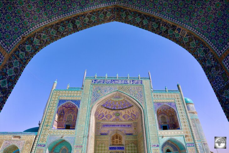


.")


 was a 15th-century Sufi of the Naqshbandi order from the city of Balkh The Green Mosque in Balkh, Afghanistan, where Abu Nasr Parsa is buried.")
 in Balkh.")


, in Bamyan and Kabul is a member of the Tajik ethnic group.")


 and my driver, Jaleel, at the Jumairah restaurant in Kabul.")


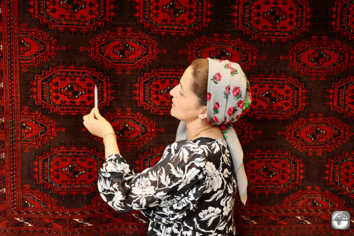


 which is 301 square metres in area and weighs 1.2 tons.")


 region.")


, which serves as a visa authorisation letter for Turkmenistan.")
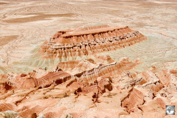
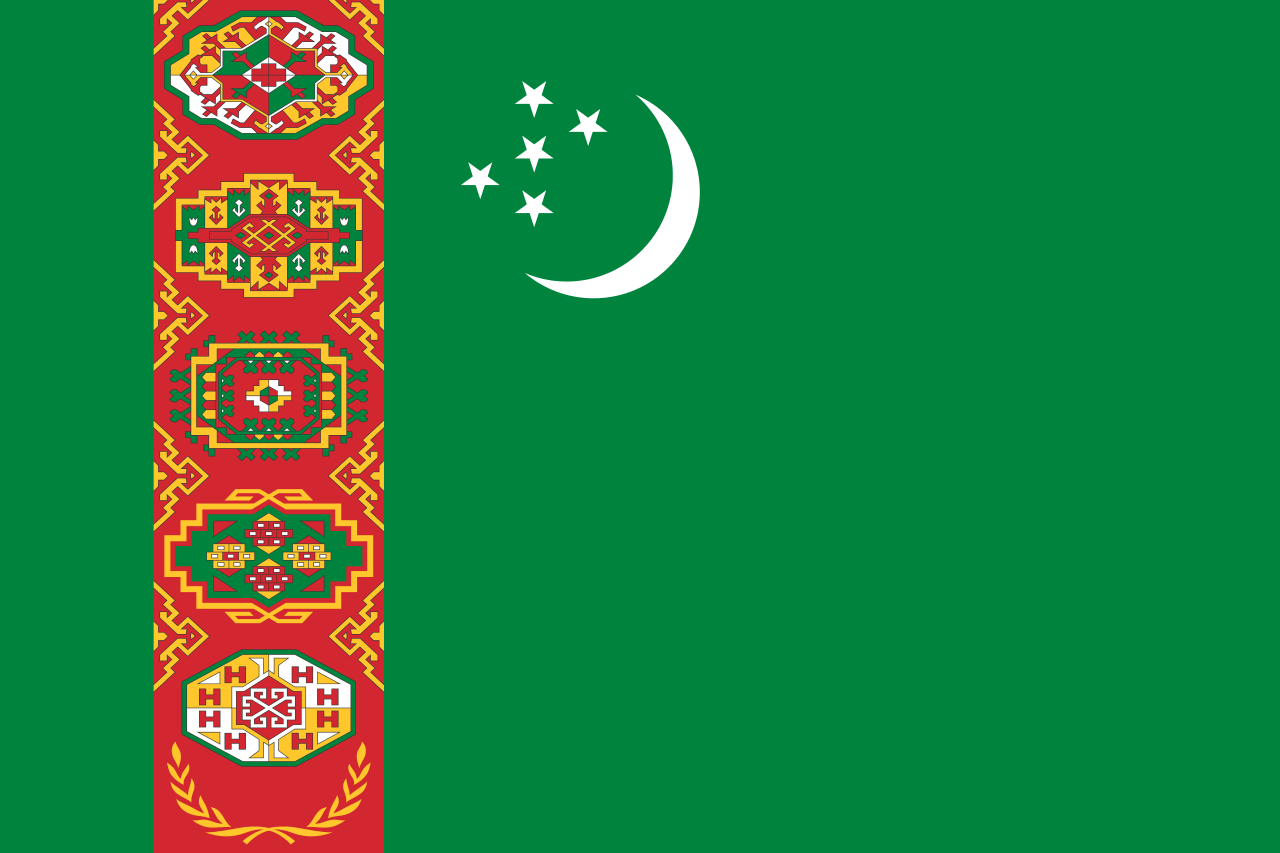


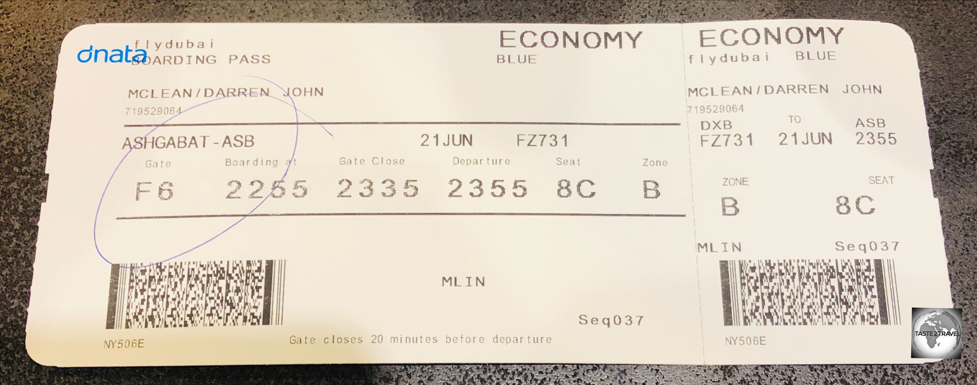
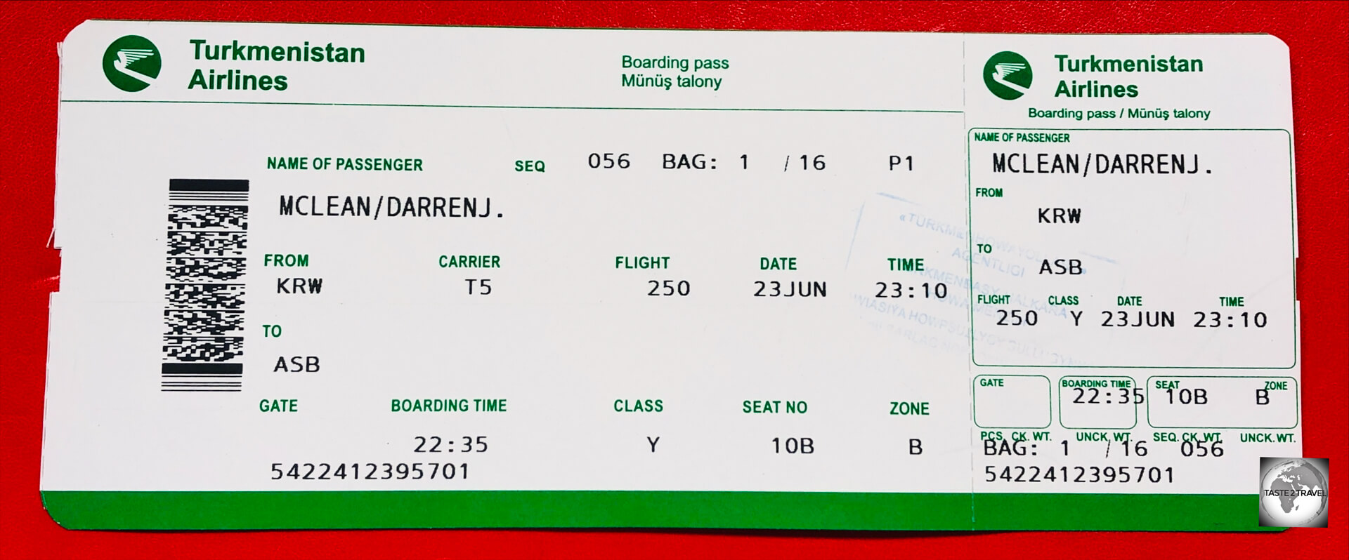

 in height.")


 with two fellow guides at the Buddha Dordenma temple.")


 and driver. Thukten.")


 was reopened in 2020.")
.")


, posing next to a giant phallus in a Lobesa giftshop.")


.")


 is a highlight of Bhutan.")


 in length.")
.")


.")
.")
.")
.")


.")


 at the Sangchhen Dorji Lhuendrup Nunnery.")
 in the background.")


 from across the Paro River.")
 and guide (right) – Thukten and Jamyang respectively.")


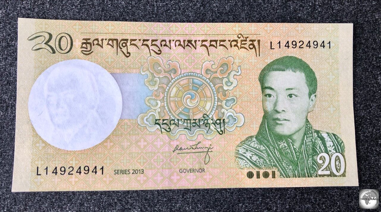


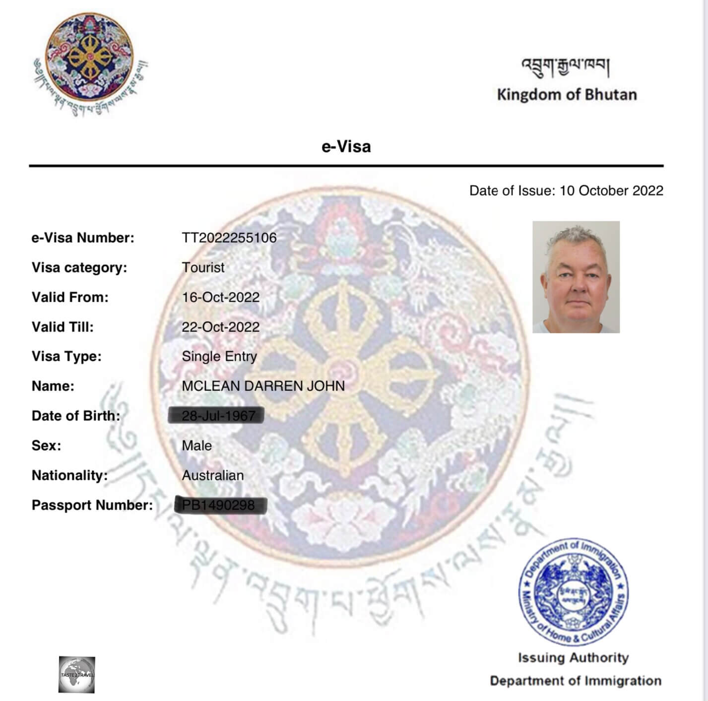


 is a highlight of the bustling Baghdad souk.")


 Iraqi 250 dinar banknotes.")


 Minaret.")


 minaret.")