Brazil and Guianas Travel Guide
Welcome to the taste2travel Brazil and Guianas Travel Guide!
Introduction
This Brazil and Guianas Travel Guide details a 3,000 kilometre (1,865 mile) overland journey between the Brazilian Amazonian cities of Macapá and Manaus via French Guiana, Suriname, Guyana and Venezuela.
After two years of meandering through most parts of South America, the one region I had yet to explore was the remote and little-visited north-eastern corner of the continent – home to the three Guianas; French Guiana, Suriname and Guyana.
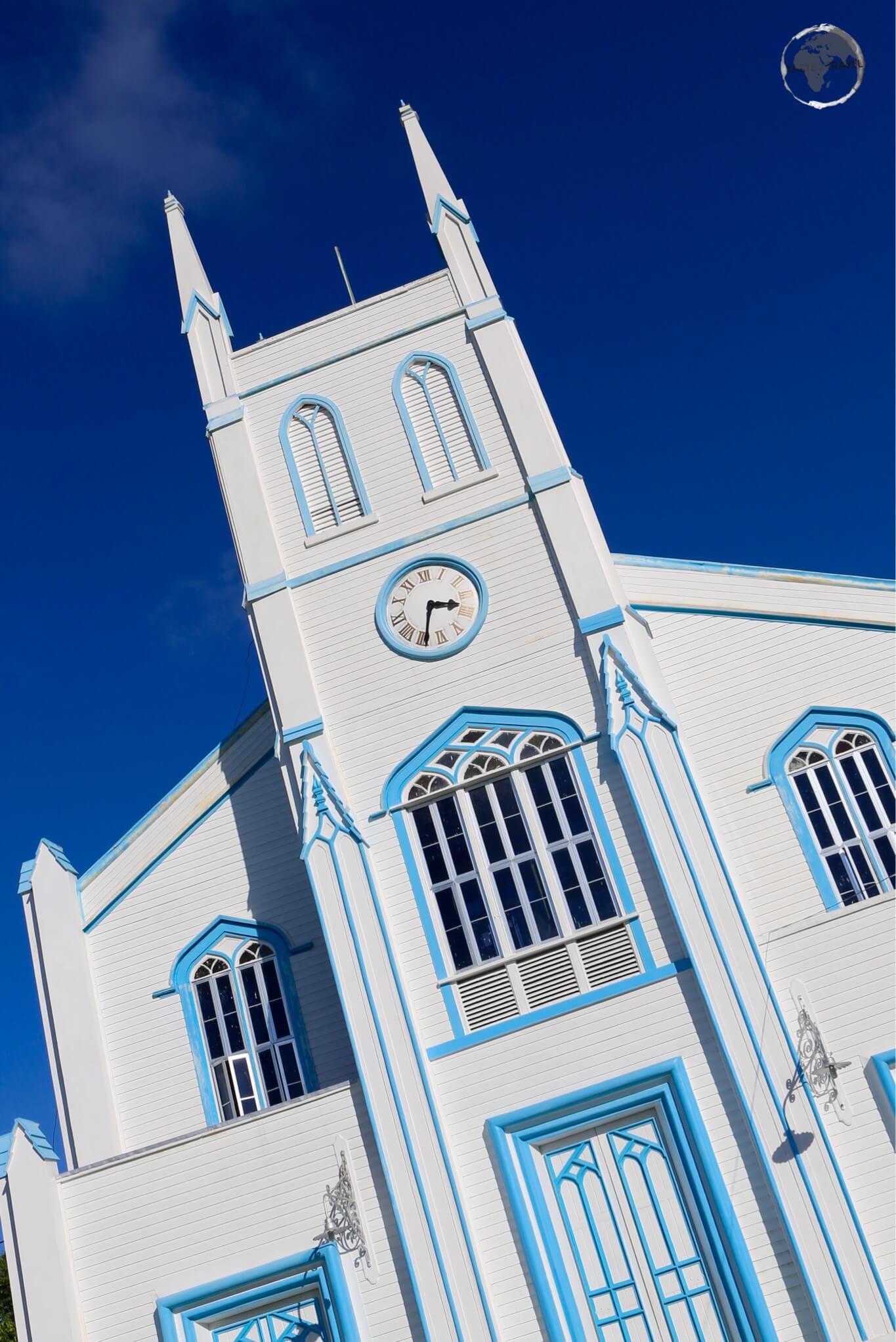
In Cayenne, French Guiana, Carnival is celebrated from January to March each year.
In many respects, the three Guiana’s are an anomaly within South America. On a continent comprised mostly of Latino people who live in former Spanish colonies (and one Portuguese colony), this triumvirate is comprised of Guyana – a former British colony; Suriname a former Dutch colony and French Guiana – a French territory (and a distant outpost of the European Union).
The differences between the Guiana’s and the rest of South America are not only linguistic but cultural. With a combined population of less than 1.5 million (most of whom live along a narrow coastal corridor), the citizens of the Guiana’s face north to the Atlantic Ocean and look to their Caribbean neighbours for cultural references.
While Brazil and French Guiana are separated by the narrow Oyapok river, they are culturally worlds apart, with Cayenne having a distinctly Caribbean air.
Both Guyana and Suriname are members of Caricom (The Caribbean Community) with Guyana hosting the organisation’s headquarters in Georgetown.

The biggest mosque in Suriname is located on the Keizerstraat in Paramaribo.
Despite their small populations (Guyana: 773,000 / Suriname: 558,000), ethnic diversity is high due to the fact that the British and Dutch realised they couldn’t rely on the native Indian population as a labour force for their sugar plantations, so they imported African slaves. Once slavery had been abolished, imported indentured labourers from British India were introduced.
Christ Church in Georgetown, Guyana.
The Dutch also added Indonesian (Javanese) workers from the Dutch East Indies into the mix in Suriname. Through the centuries, the populations mixed, making for an interesting mélange. Walk the streets of Georgetown or Paramaribo and you’ll find churches, mosques, Hindu temples and (in the case of Paramaribo) a synagogue on the same street.

A map of the Guyana shield.
Source: Wikipedia
Adding to this feeling of ‘otherness’, the Guiana’s are isolated from their southern neighbours by a vast, dense rainforest. Development in the region has been hampered by the impossible terrain – created by the immense Guyana Shield – a series of mountain ranges and highlands punctuated by deep gorges and valley’s, seemingly designed to conserve the interior’s impenetrability. It’s due to this geographical feature that such spectacular waterfalls as Angel (Venezuela) and Kaieteur (Guyana) exist.

A rainbow over Kaieteur Falls, Guyana.
The difficult landscape has also hindered the development of road infrastructure in the region, with just one asphalt road connecting Brazil to French Guiana (along the coast) and one long, enduring gravel road connecting Guyana to Brazil through the remote and sparsely populated interior.

The ‘highway’ connecting Guyana with Brazil passes through the Iwokrama forest in Guyana.
When borders were created in the region, the many wide rivers made for easy demarcation lines. If you follow the coastal route from Brazil to Venezuela, you’ll first cross the Oyapok River (the only one which has been bridged) into French Guyana, then the Maroni River into Suriname, then finally, the Corentyne River into Guyana.
Guyana and Venezuela share a remote and isolated land border but, for more than a century, Venezuela has disputed the present border, instead claiming all the territory as far east as the Essequibo River. You can read more about this dispute in my Essequibo Travel Guide.

Girls walking along the riverbank of the Essequibo in Bartica, Guyana.
Air services from the Guiana’s to other parts of South America are also limited. Despite billing itself as the ‘Gateway to South America‘, Cheddi Jagan International airport (Georgetown) only offers air connections (within South America) to neighbouring Suriname.
Services between Suriname (Paramaribo) and Brazil (Belém) are offered three times a week by Surinam Airways (via Cayenne) and once a week (Sunday) by the Brazilian carrier GOL. Azul Brazilian Airlines provides connections between Cayenne and Belém every Sunday and Cayenne and Fortaleza on Saturday.
If you wish to get off the well-beaten South American gringo trail, the three Guiana’s offer something completely different. From dramatic waterfalls, virgin rainforests, immense rivers, abundant wildlife and an ethnic potpourri, traveling here is a rewarding and fulfilling experience – and in most places you’ll encounter few, if any, other tourists.
Location

A map showing the original five Guianas.
Source: Wikipedia
The area covered by this report is known as the Guyana’s (also spelt: Guiana’s) – a vast tropical region in the North-East of South America which is bounded in the west by the Orinoco river (Venezuela) and in the east by the Amazon river (Brazil).
The name Guyana is derived from the Amerindian language, meaning “land of many waters” – a direct reference to the many large rivers which bisect the region, draining the Guyana Shield, eventually flowing into the Atlantic ocean.
Passenger speedboats on the Pomeroon River in the riverside town of Charity, Guyana. In the ‘Land of Many Waters’, many communities are accessible only by boat.
In colonial times, every colonial power of importance had its own Guiana – these were (in geographical order from west to east):
- Spanish Guiana – now the Guayana region of Venezuela
- British Guiana – now the sovereign nation of Guyana
- Dutch Guiana – now the sovereign nation of Suriname
- French Guiana – now a French department known in French as ‘Guyane’
- Portuguese Guiana – now the Brazilian state of Amapa
When Guyana declared independence, it changed its name from British Guiana to Guyana.
History
Pre-Columbian Era
Prior to European colonisation of the region, the Guiana’s were populated by native Arawak Indians. It was these Indians who immigrated from the Orinoco (Venezuela) and Essequibo (Guyana) river basin, establishing the first settlements throughout the Caribbean islands.
The Arawaks were eventually supplanted in the Caribbean by the more aggressive Carib Indians, who also originated from the Guiana’s.
European Era
The first European to discover the north-east coast of South America was Christopher Columbus in 1498. Columbus didn’t make any claims at the time and it wasn’t until the end of the 16th century when Sir Walter Raleigh published an account of his search for “Manoa“, the legendary city of the king known as El Dorado (the City of Gold), that interest in the region developed.

A world map showing the two hemispheres as defined by the Treaty of Tordesillas.
Source: The New York Times.
The 1494 Treaty of Tordesillas (a papal edict) divided the world into two spheres of control between Spain and Portugal. One of the dividing meridian lines passed through the Guiana’s, with Spain owning everything to the west and Portugal owning everything to the east.
While these two powers were busy developing their colonies to the south (and the Portuguese were busy expanding Brazil further west into the Spanish hemisphere), the protestant Dutch and English, who didn’t recognise the papal edict, established settlements along the fertile coast of the Guiana’s.
In the early 17th century, Protestant plantations sprang up along the fertile Guyanan coast-lands. Ironically, it was the Dutch who first settled Guyana (formerly British Guiana), while the British were the first to colonize Suriname (which would become Dutch Guiana).
France settled what was left, and the three powers proceeded to fight over and swap their Guyana territories like they did their nearby Caribbean possessions. The Spanish and Portuguese viewed settlement of the region as a violation of the treaty and repeatedly attacked and destroyed the settlements.

The Ministry of Finance building anchors one side of Independence Square in Paramaribo.
All the colonies along the Guiana coast were converted to profitable sugar plantations during the seventeenth and eighteenth centuries. However, war continued to be waged among the Dutch, French and British until a final peace agreement was signed in 1814 – the Convention of London – which heavily favoured the British.
Post-convention, the French retained French Guiana, while the Dutch retained Suriname but were forced to give up Berbice, Essequibo, and Demerara; these colonies were consolidated under a British administration and would be known after 1831 as British Guiana.

Entrance to prison cells at a former French penal colony on Îles du Salut, French Guiana.
After 1814, the Guiana’s came to be recognized individually as British Guiana, French Guiana, and Dutch Guiana. British Guiana became independent of the United Kingdom on 26 May 1966, changing it’s name to Guyana.
In 1975, Suriname left the Kingdom of the Netherlands in 1975, gaining its independence while French Guiana continues to remain a territory of France and is – by default – a part of the European Union.
Generous annual subsidies from Paris ensure that any calls for independence don’t ever gain traction, however residents occasionally protest against the high cost of prices in the territory (compared to France).
Currencies

The official currency of Brazil – Brazilian Reals.
The following currencies are mentioned in this guide:
- The Brazilian Real (R$) is the official currency of Brazil. Click here to view the current exchange rate against USD$1.
- The Euro (€) is the official currency of French Guyana. Click here to view the current exchange rate against USD$1.
- The Suriname Dollar (S$) is the official currency of Suriname. Click here to view the current exchange rate against USD$1.
- The Guyana Dollar (GYD$) is the official currency of Guyana. Click here to view the current exchange rate against USD$1.
- The Venezuelan Bolívar (VEF) is the official currency of Venezuela. Click here to view the official government exchange rate against USD$1.
Note: Due to hyperinflation in Venezuela, the unofficial exchange rate is changing constantly. You can check the current rate at dolartoday.com

The Surinamese dollar.
Journey Map
A 3,000 kilometre (1,865 mile) odyssey from one Amazon city to another, via the Guiana’s.
Destinations
Macapá (Brazil)

View of the Amazon River from Fortaleza de São José de Macapá.
Introduction
It’s actually easier to reach Macapá from neighbouring French Guiana than from the rest of Brazil, thanks to a highway that connects the city with Cayenne, the capital.
Macapá is strategically located on the northern channel of the Amazon River, near its mouth on the Atlantic ocean. At 325 kilometres (202 miles) across, the mouth is the widest in the world and effectively isolates Macapá from the rest of Brazil. The city has no land connections to other parts of Brazil, except other cities in Amapá state and French Guiana.
I arrived in the capital of Amapá state after spending a leisurely 24-hours crossing the mouth of the river on a slow boat from Belém (see the ‘Getting There – Boat‘ section below for details on the journey). During the colonial period the state was called Portuguese Guiana and so it was fitting that Macapá should serve as the launch pad for my foray into the other Guiana’s.
Macapá (pop: 500,000) is a relaxed, laid-back capital and, while not brimming with attractions, is a pleasant enough place to spend time recuperating between journeys. I spent two days in the city before boarding a night bus to Oiapoque on the French Guiana border.
Sightseeing

Fortalzeza de Sao Jose de Macapá.
The main attraction in Macapá is the sprawling ruin of the fort – Fortalzeza de Sao Jose de Macapá. The fort was built at the mouth of the Amazon River by the Portuguese from 1764 to 1782 as a defence against the French who took control of what is now French Guiana in 1677. Entrance to the fort is free and while all information is in Portuguese, the sweeping views of the Amazon river require no translation.

The Marco Zero monument in Macapá indicates the Equatorial line.
Located 6 kilometres from downtown on Avenue Equatorial, the Marco Zero monument was built to mark the position of the equator, which cuts through the city.
Where else can you stand on the equator? Or stand in both hemispheres? Or hop/ skip over the equator?
The 30 metre tall tower has a large open circle at its top. Twice a year, at the spring and autumn equinoxes, the sun aligns with that circle, focusing a line of sunlight along the equator.
Accommodation
Macapá offers a good selection of accommodation catering to all budgets from hostels to 4-star hotels. While in town, I stayed at the 4-star Hotel Do Forte, which is one of the better hotels in town. Located downtown, this comfortable, clean and modern hotel is a short walk from restaurants, bars and attractions such as the fort and the river. You can book properties using booking.com
Eating Out
Sleepy Macapá offers a surprisingly good number of restaurants with the standout being the Amazonas Peixaria. Overlooking the Amazon river, this is a good place to eat local fish and sample Amazonian cuisine.
Getting There/ Away
Air
A slow boat from Belém to Macapá takes 24 hours, while a flight takes just 55 minutes (but is nowhere near as adventurous). Not surprisingly, many people choose to fly to Macapá, which is served by Alberto Alcolumbre International Airport (located 3 kilometres north-west of downtown).
The following airlines provide regular flights to/ from Macapá:
Boat

On-board the M/V Sao Francisco de Paula leaving Belém for Macapá, a journey of 24 hours.
From Belém
Slow boats travel twice a week from Belém, departing every Wednesday and Saturday at 10:00 am, arriving 24 hours later in Macapá’s port neighbourhood of Santana.
I traveled on the M/V Sao Francisco de Paula, paying R$225 for a berth in a private cabin – hammock space is available for R$120. Food and drinks are available on board.
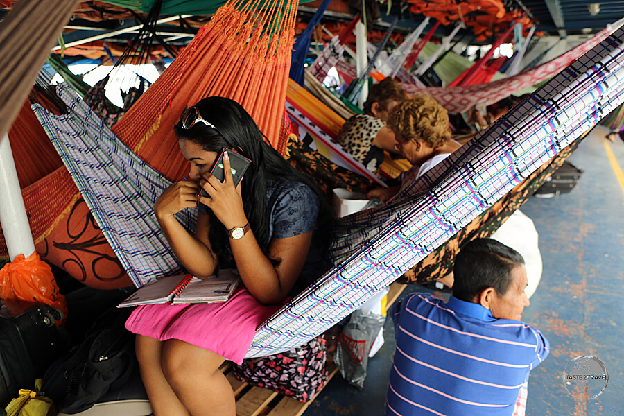
The very crowded ‘hammock-class’ on the M/V Sao Francisco de Paula which connects Macapá and Belém.
From Macapá
The M/V Sao Francisco de Paula, returns to Belém from Macapá (Santana) twice a week, completing the journey in 24 hours.
Land
The road network in Amapá state is disconnected from the rest of Brazil, so long distance bus services are limited. The most useful connection for travelers are the two nightly Amazontur buses which make the 600-kilometre journey north along route BR156 to the border town of Oiapoque.
The town is located on the banks of the Oyapok river, slightly upstream from St. Georges (French Guiana). Buses depart from Macapá bus station at 5:00 pm and 6:00 pm.
My bus seemed to cover the distance in record time, arriving very early (5:00 am) at the tiny Oiapoque bus station. It was great to have arrived early but the Brazilian immigration office wouldn’t open until 8:00 am so I had no option but to sleep on a bench at the bus station until the border opened.

Built at a cost of US$50 million, the very grand Oiapoque bridge connects Brazil and French Guiana – the only land connection throughout the Guiana’s.
The border crossing over the Oyapok river is the only one in the Guiana’s which can be made via a bridge. The Oiapoque bridge is a grand construction which was completed in 2011 at a cost of US$50 million but – due to politics between Brazil and France – was not opened until March of 2017. It’s the only land connection between Brazil and France – or Brazil and the European Union.
If you arrive at the border in the morning, it’s best to take breakfast in St. Georges (please refer to my French Guiana Travel Guide) where you’ll find French-style cafés, pâtisseries and boulangeries – much better than the standard Brazilian breakfast of chocolate cake.
French Guiana

Located in downtown Cayenne, Place du Coq is named after the rooster which sits atop a column in the middle of the square.
For all details on French Guiana – including Sightseeing, Accommodation, Eating Out, Getting There & Away, please refer to my French Guiana Travel Guide.
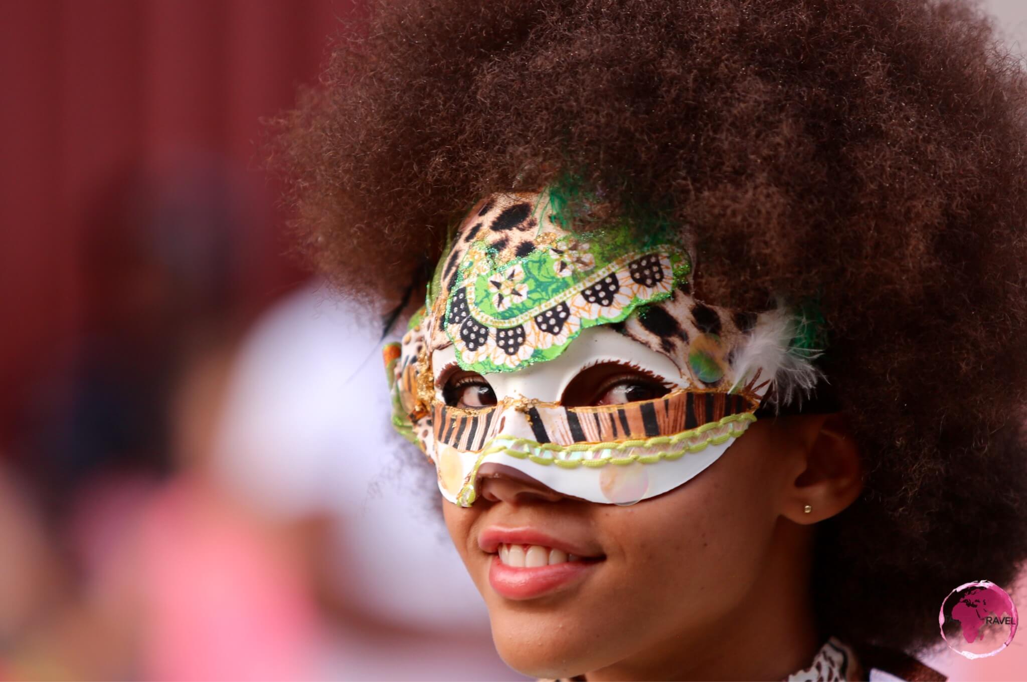
Cayenne Carnival

A Cayenne Carnival Participant.
French Guiana is home to the world’s longest running Carnival celebration, which is held every year between Epiphany (early January) and Ash Wednesday (February or March).
The celebrations include a very photogenic parade, which is held every Sunday afternoon in Cayenne. For more on this, please refer to my Cayenne Carnival report.
Suriname

Dutch-style colonial buildings in the UNESCO-listed old town of Paramaribo.
For all details on Suriname – including Sightseeing, Accommodation, Eating Out, Getting There & Away, please refer to my Suriname Travel Guide.
Guyana

The majestic and awe-inspiring, Kaieteur Falls – a truly spectacular sight.
I am currently sitting in my favourite Georgetown cafe – The Oasis Café – writing this guide. I first came to Guyana a few years ago and have returned many times since.
While the capital of Georgetown is less-than-appealing, the real attractions of Guyana lie in the remote, unexplored interior – a vast pristine wilderness full of incredible, dramatic nature and abundant wildlife.
The country receives very few tourists but offers so much for those who are adventurous and don’t mind for-going their creature comforts.
All details detailing my journey across Guyana – from the border of Suriname to Georgetown then south through the vast, empty interior to Lethem and the Brazilian border are covered in my Guyana Travel Guide. Details on all border crossing are included in the guide.
Essequibo Region

Father and daughter swimming at Lake Capoey
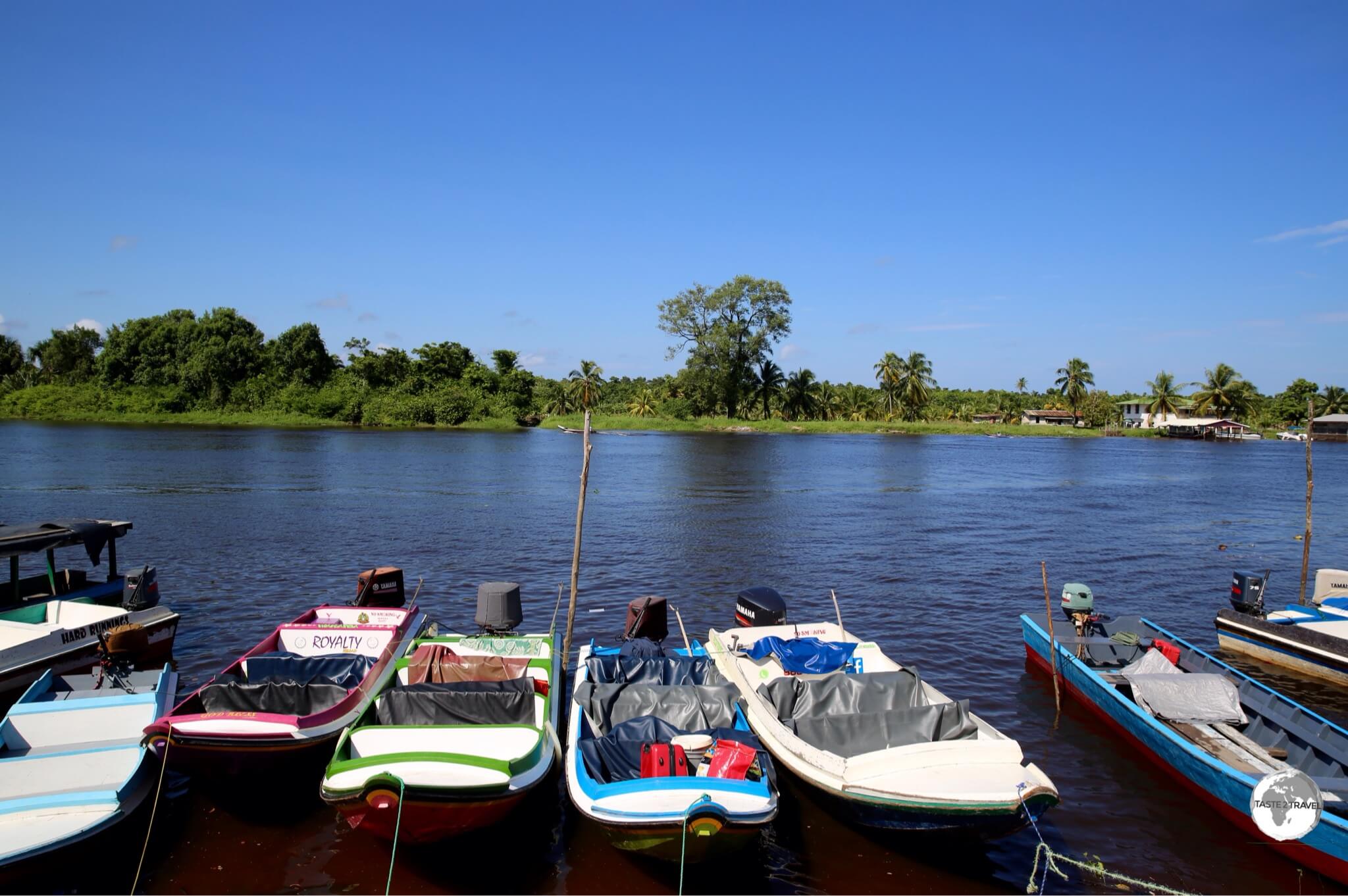
There are plenty of opportunities to get off the beaten track in remote Guyana. One fascinating area worth exploring is the Essequibo region. Named after the mighty Essequibo river (the 2nd largest in South America), there are few roads in this part of the world, with most journeys being made in small wooden boats which bounce their way across the choppy surfaces of wide, tea-stained coloured rivers.
For more information on this little-visited part of the world, please refer to my Essequibo Travel Guide.
Boa Vista (Brazil)
Introduction
Boa Vista is the capital of Roraima state, the northern-most state of Brazil and the only Brazilian state capital located entirely north of the Equator (Macapá is on the Equator).
Despite it’s size (pop: 300 000), this clean, green, planned city has a quiet, relaxed, orderly air about it and is a pleasant place to spend a couple of days. Founded more than a century ago, the city has the aspects of a planned capital, with wide modern streets and traffic circles.
Sightseeing
What Boa Vista lacks in historical sights, it makes up for with it’s many green, open spaces. The joy of spending time in the city comes from meandering around the relaxed downtown area or taking a sunset cruise on the Branco river.
Accommodation
There’s no shortage of accommodation options in this cosmopolitan metropolis, from budget hostels to fancy hotels. While in town I treated myself and stayed at the very comfortable Aipana Plaza Hotel which is located downtown and features modern, stylish rooms and a beautiful swimming pool (a perfect way to cool off in this normally hot town).
Eating Out
Brazilians know a thing or two about BBQ (Churrascaria) and Boa Vista is home to some great Churrascaria’s. My favourite is Churrascaria Bhuritys, where succulent meats are served in a semi-formal dining room by attentive, friendly staff.
Getting There/ Away
Air
Boa Vista is served by the Boa Vista International Airport, which has the distinction of being the northern-most Brazilian airport served by scheduled flights. The following airlines provide services:
Land
Boa Vista is an important transport junction, providing daily bus connections to Manaus, Venezuela and Guyana.
To/ From Manaus:
Frequent buses run between Boa Vista and Manaus with the 746 kilometre journey (along route BR174) taking approximately 12-13 hours. Three different companies offer multiple daily trips with fares ranging from R$157 – R$210. The first bus departs Boa Vista at 09:00, arriving in Manaus at 21:30. You can book tickets online here.
To Venezuela:
Asatur offer one daily bus between Boa Vista and the Brazilian border town of Pacaraima, 214 kilometres to the north. The bus departs Boa Vista at 07:30, and travels north along BR174, arriving at the border at 11:02. Tickets cost R$30 and can be purchased online here.
The bus station in Pacaraima is a short stroll from the border post. It’s best to walk across the border before taking a taxi the 12 kilometres into the Venezuelan town of Santa Elena. Please refer to my Venezuela (Gran Sabana) Travel Guide for more on this crossing.
If the bus isn’t convenient, there are plenty of (faster) shared taxis shuttling between Boa Vista and Pacaraima. Taxi’s depart from Terminal Coimbe, charging R$40 per person.
From Venezuela:
The same Asatur bus returns to Boa Vista, departing from Pacaraima bus station at 15:00, arriving in Boa Vista at 18:32. If you miss the bus there are plenty of shared taxis.
To/From Guyana:
At the end of BR401, 124 kilometres north-east of Boa Vista, is the sleepy Brazilian border town of Bonfim. This town of 12,000 lies on the Takutu River across from Lethem, Guyana. The Takutu River Bridge (open from 7 am to 7 pm) links Brazil and Guyana, with the immigration posts for each country being on opposite sides of the bridge. The bridge includes a neat lane-changing design to switch vehicles from the left side of the road onto the right side or vice-versa.
If you’re arriving in Brazil from Guyana (and have completed the grueling overnight journey through the rainforest from Georgetown to Lethem), you’ll be happy to know that the road from Bonfim to Boa Vista is a top class, fully paved, fast highway.
Amatur operate four buses a day between Boa Vista bus station and Bonfim bus station (with an extra stop at the Brazilian border post). Tickets for the 2 hour journey cost R$18. Current bus times are:
- Boa Vista to Bonfim: 7:00AM, 10:00AM, 2:00PM, 4:30PM
- Bonfim to Boa Vista: 7:00AM, 10:00AM, 2:00PM, 4:30PM
Shared taxis also run between Boa Vista and Bonfim, completing the journey in one hour and charging R$25 per person.
If you are traveling into Guyana, please refer to my Guyana Travel Guide.
Santa Elena (Venezuela)

Jasper Creek Waterfalls.
While in Boa Vista, I decided to make a side trip to the north, crossing into Venezuela to visit the picturesque Gran Sabana (Grand Savannah) region. The border town of Santa Elena provides lots of services for travelers, making it an ideal base for exploring this remote corner of the country.
You can read more on the sights of the Gran Sabana in my Venezuela (Gran Sabana) Travel Guide.
Manaus (Brazil)

Manaus Opera House
Introduction
With 2.1 million inhabitants, Manaus is the largest city on the Amazon (the 2nd largest is Belém with 1.5 million) and it’s busiest port.
The city is located on the banks of the Rio Negro (the largest left tributary of the Amazon River and, the largest black-water river in the world) a few miles before it meets the Rio Solimões to form the Amazon River proper. The two rivers flow side by side for many miles, different in colour, mixing in eddies: the “Meeting of the Waters.”
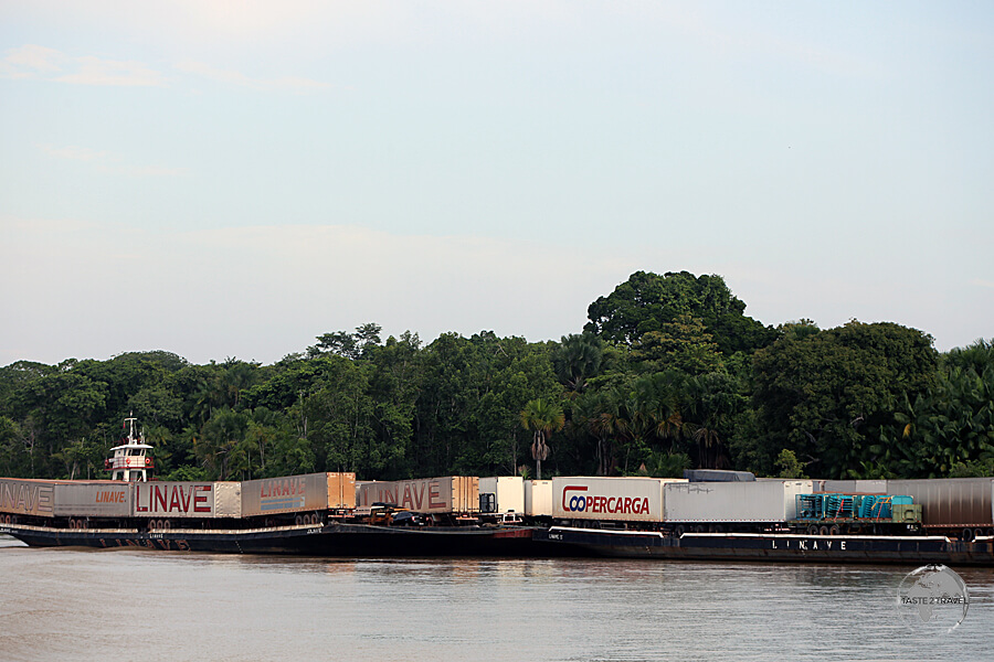
Despite being situated 1,400 km (900 miles) upriver from the Atlantic Ocean, the Amazon is navigable for ocean-going vessels and the main economic engine of Manaus is the Duty Free port and the Manaus Free Economic Zone.

A long way from the sea – 1,400 km upriver, an ocean-going freighter approaches Manaus port.
During colonial times, great wealth was generated from rubber plantations during the period known as the Amazon Rubber Boom (1879 to 1912).
The proceeds from this boom were used to build magnificent buildings, including a copy of the Grand Opera de Paris – the Teatro Amazonas. Other monuments from this period are the Mercado Municipal, a copy of the famous market halls Les Halles in Paris, and the arts centre Palacio Rio Negro.
Apart from a wealth of history and sights, Manaus serves as a regional travel hub offering onward travel possibilities to Boa Vista, Guyana and Venezuela.
If you’re spending time meandering along the river, Manaus is the best place to take timeout, offering a good choice of accommodation, fine restaurants, bars and cafes and the biggest shopping mall on the Amazon – Amazonas Shopping.
Sightseeing
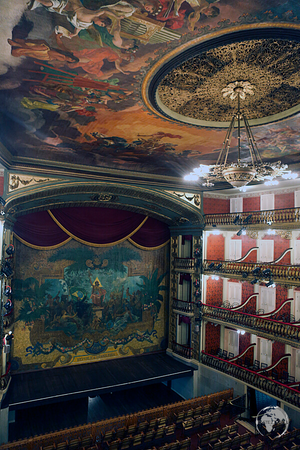
Theatro Amazonas

The opulent interior of the Theatro Amazonas, Manaus.
This spectacular theatre is a ‘must see’ in Manaus. Constructed during the years of the rubber boom, when the city was awash with money, no expense was spared on its construction with the roof tiles being imported from Alsace, the steel walls from Glasgow and Carrara marble from Italy.
The dome is covered with 36,000 decorated ceramic tiles painted in the colours of the national flag of Brazil. Concerts are held often and tickets are very affordable at about US$10 each. I saw an amazing concert which showcased the culture of the Amazon, definitely a highlight of my stay!

The Theatro Amazonas, Manaus.
Mercado Municipal – This ‘touristy’ riverside market is very clean and organised. It’s a good place to buy souvenirs or to have a refreshing fruit juice (made from amazing Amazonian fruits).
Meeting of the Waters

The ‘Meeting of the Waters’, down-river from Manaus.
The Meeting of the Waters is composed of water from the Rio Negro and Rio Solimões Rivers. They meet up to form the Lower Amazon River, but do not mix together initially. This amazing phenomenon stretches for 6 km (3.7 mi) and is caused by irreconcilable differences in the water properties between the two rivers.

Our boat from Manaus to Santarém passing through the ‘Meeting of the Waters’.
The Rio Negro, as the name implies, is a river of water that looks nearly black. It is relatively clear of sediment but has obtained its tea-like colour from large quantities of plant material steeping in the water as it comes down through the jungles of Colombia. The water has an average temperature of 28 degrees Celsius (82.4 degrees Fahrenheit) and flows slowly at about 2 kilometres per hour (1.24 mph).
Accommodation
The best place to stay is in the historic old town where you have a good selection of guest houses, restaurants, bars and cafes and everything is within walking distance.
I stayed at the wonderful Boutique Hotel Casa Teatro which is across the road from the Opera house and in close proximity to all the sights in the old town. The neighbourhood is very pedestrian friendly with loads of dining and entertainment options.
If you prefer something more modern, there are many international chain hotels in the new town. There are plenty of options on booking.com
Eating Out
There is no shortage of good restaurants in Manaus, including a quirky revolving restaurant which is located on the top of the Taj Mahal Hotel. The décor is very 1970’s and the restaurant is tired and worn. It all feels like you’re on the set of a vintage James Bond movie set – waiting for the bad guys to arrive. The food, service and views are worthwhile and besides – where else can you eat in a revolving restaurant in the jungle?
Shopping
Manaus offers the same sort of shopping opportunities you would expect to find in any large metropolis. Something that is unexpected in the middle of the jungle is the glitzy, modern shopping mall – Amazonas Shopping – a short taxi ride from downtown. Whatever you need, you’ll find it here, along with a good selection of restaurants.
Getting There/ Away
Air
If you don’t fancy spending days traveling on a slow boat along the Amazon river (or if you’re not arriving on a bus from Boa Vista) then flying is your only other option for reaching this remote jungle metropolis. Flights arrive at Manaus International Airport – Eduardo Gomes, which is located 13 kilometres (8 miles) west of downtown.
The following airlines provide regular services:
- American Airlines – flies to/ from Miami
- Azul Brazilian Airlines – flies to/ from Belém, Belo Horizonte-Confins, Boa Vista, Campinas, Cuiabá, Fortaleza, Parintins, Porto Velho, Santarém, Tabatinga, Tefé
- Avior Airlines – flies to/ from Barcelona (Venezuela)
- Copa Airlines – flies to/ from Panama City–Tocumen
- Gol Airlines – flies to/ from Belém, Belo Horizonte, Boa Vista, Buenos Aires-Ezeiza, Brasília, Campo Grande, Cruzeiro do Sul, Cuiabá, Curitiba, Fortaleza, Foz do Iguaçu, Porto Alegre, Porto Velho, Recife, Rio Branco, Rio de Janeiro-Galeão, Salvador da Bahia, Santarém, São Luís, São Paulo-Guarulhos
- LATAM Brasil – flies to/ from Belém, Boa Vista, Brasília, Fortaleza, Miami, Salvador da Bahia, São Paulo-Guarulhos
- MAP Linhas Aéreas – flies to/ from Altamira, Belém, Carauari, Eirunepé, Lábrea, Parintins, Santarém, Tefé
- TAP Air Portugal – flies to/ from Lisbon
- Total Linhas Aéreas – flies to/ from Carauari, Coari, Porto Urucu
A Lost Connection
The national airline of Curaçao, Insel Air, used to provide a very convenient connection from Manaus to Aruba. A great way of getting from the jungle onto a white-sand, Caribbean beach in just a few hours.
From the middle of the Amazon jungle to the white-sand beaches of the Caribbean, the Insel air flight was a dream connection for travellers but was never of interest to locals. As such, the flights were never well patronised and not surprisingly the service was terminated.
I once took this flight which I shared with just one other passenger. The Captain personally came to thank us for flying.

My Insel Air flight from Manaus to Aruba. I shared the flight with one other passenger.
Land
Despite the fanciful lines often drawn onto road maps of Brazil, there are no roads connecting Manaus with the rest of Brazil – except for route BR174 which runs north to the Venezuelan border via Boa Vista (capital of Roraima state). This asphalt highway is in excellent condition, and the buses which ply the route are comfortable and fast.
To Boa Vista:
Frequent night buses run between Manaus and Boa Vista with the 746 kilometre journey taking approximately 12-13 hours. Three different companies offer multiple daily trips with fares ranging from R$157 – R$210. Eucatur offer the only daytime service which departs Manaus at 10:00, arriving in Boa Vista at 21:55. You can book tickets online here.
To Venezuela:
The Venezuelan border is 960 kilometres north of Manaus at the end of BR174. Any journey to the border will require a change of transport in Boa Vista (please refer to the ‘Boa Vista – Getting There‘ section for more details).
To Guyana:
There are no direct transport options from Manaus to Guyana. Like Venezuela, you will first need to travel to Boa Vista then take a bus or shared taxi to the border town of Bonfim then cross the Takutu River Bridge, entering Guyana at the town of Lethem (please refer to the ‘Boa Vista – Getting There‘ section for more details).
Boat
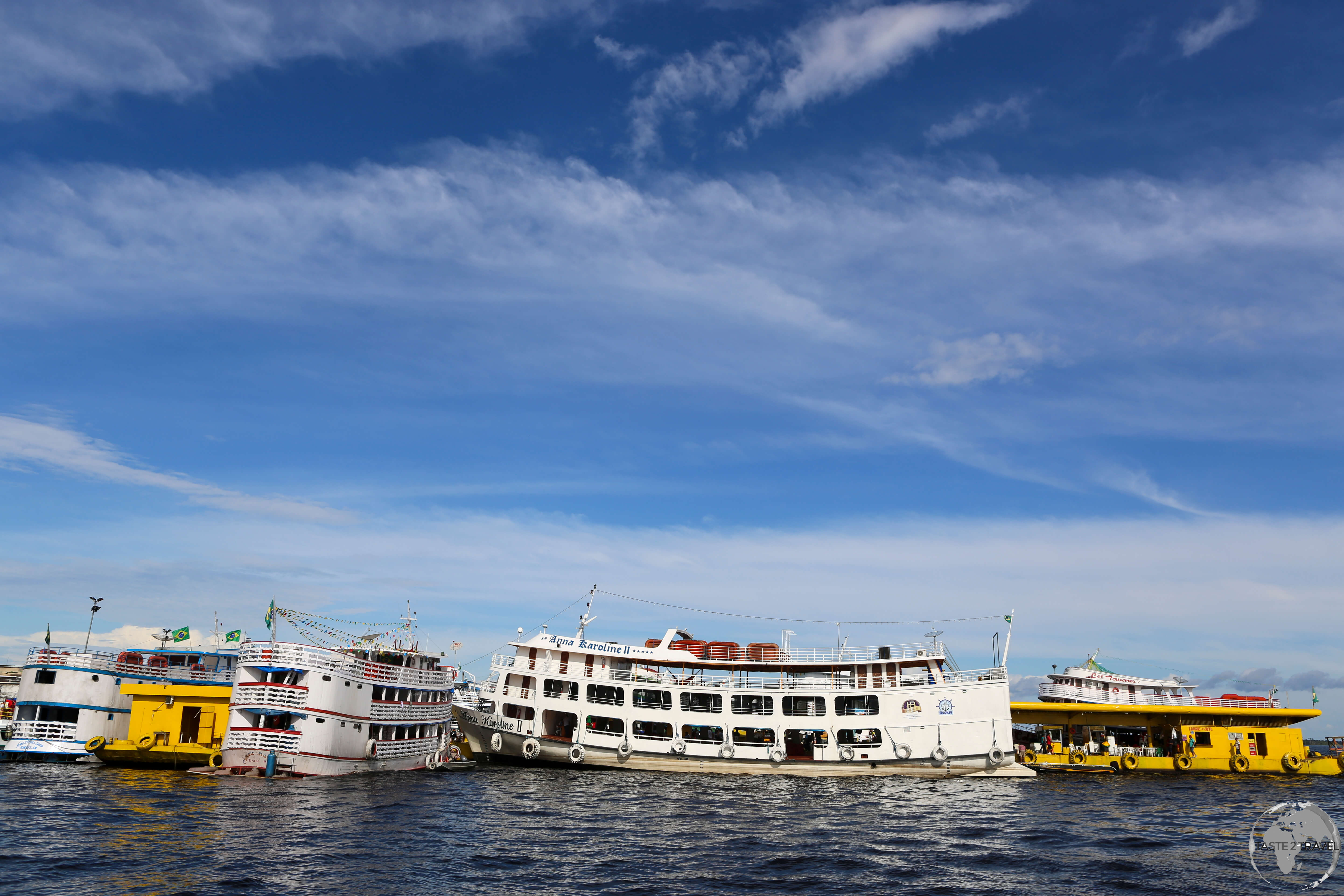
Amazon river ‘slow’ boats docked in Manaus.
Manaus is the busiest port on the Amazon with regular boats departing to all points along the river. Tickets should be purchased in advance from the ticket offices at the dock.
Slow boats:

My deluxe cabin on the ‘MV Amazonia’, a slow boat which carried me from Santarém to Belém in 48 hours.
Slow boats depart from the chaotic and crowded docks in downtown Manaus. Departures include:
- Manaus to Tabatinga: The up-river journey can take anywhere from 5-7 days. The cost for hammock space is R$330 while a cabin costs R$414 per person (two sharing). Meals and drinks are included.
- Manaus to Santarém: The down-river journey takes about 30 hours. The cost for hammock space is R$80 while a cabin costs R$700 per person. Meals and drinks are not included.
- Manaus to Belém: The down-river journey takes 80 hours with hammock space costing R$220. Meals and drinks are not included.

The captain of my slow boat from Manaus to Santarém.
Fast boats:

Rocketing along the Amazon river on a fast boat from Tabatinga to Manaus.
Currently four fast boats a week operate between Manaus and the border town of Tabatinga, completing the 1,628 kilometres (1011 miles) journey in 36 hours. Each boat offers comfortable aircraft-style seats, clean bathrooms and all inclusive meals which are served at your seat.
All boats depart from the ‘Terminal Ajato‘ wharf in Manaus as per the following timetable (current at March 2018):
- The MV Expresso Madame Cris: Departs Thursday at 06:00 am (R$550 per seat)
- The MV Expresso Gloria de Deus III: Departs Friday at 06:00 am (R$600)
- The MV Expresso Cidade de Manaquiri: Departs Sunday at 06:00 am (R$600)
- The MV Expresso Crystal I: Departs Tuesday at 06:00 am (R$600)
The company previously operated a fast boat from Manaus to Santarém but unfortunately suspended their service, leaving passengers at the mercy of the slow (30 hours) boats.

A meal served in my seat on the fast boat from Tabatinga to Manaus.
Seating on the boats is limited so it’s best to book tickets in advance on their website (only available in Portuguese) or from their ticket office at the wharf in Manaus. If booking from the wharf you’ll need to show your passport.
Getting to Colombia/ Peru

The kayak journey through an Amazon swamp to the Marasha Nature Reserve which lies in Peru opposite Leticia (Colombia).
If you wish to travel by river to Leticia (Colombia) or Iquitos (Peru), you’ll first need to travel from Manaus upriver to the Brazilian border town of Tabatinga. At this point the three countries converge and while in this area, movement between the countries is unrestricted. However, when you do decide to leave, you’ll need to be stamped out of the country you’re exiting and stamped into the country in which you’ll continue your travels.
The Brazilian immigration office is located on Avenida da Amizade. This avenue continues, uninterrupted, across the border into Leticia.
The Colombian immigration office is at the airport, so if you’re flying in and moving on to a different country you should get your passport stamped when you land.
The Peruvian immigration office is on the muddy island of Santa Rosa, which can be reached in 10 minutes by boat from either Tabatinga or Leticia. Boats to Iquitos (Peru) arrive and depart from here.
If you must spend anytime in the border area, Leticia offers the best accommodation and dining options and is much more pleasant than either Tabatinga or Santa Rosa.
To Colombia
At Tabatinga you can simply walk across the border (or take a taxi) into neighbouring Leticia.
From Leticia airport, there are regular flights to Bogota.
To Peru
Exploring the Amazon around Iquitos.
Boats travel upriver to Iquitos from tiny settlement of Santa Rosa, which is located across the river from Leticia and Tabatinga. You have a choice of taking either a fast boat (13 hours) or a slow boat (4 days):
Fast boat to Iquitos
Three different companies (Transtur, Golfinho & Flipper), operate daily (except Monday) fast boats from Santa Rosa to Iquitos, covering the 486 kilometre (302 mile) journey in 13 hours. Tickets cost 200 Peruvian Soles (US$70) with the boats departing Santa Rosa at 4:00 am – yes that is AM! If you’re staying in Tabatinga or Leticia you’ll need to take a boat across to Santa Rosa at 3:00 am.
Note: If you are taking the 4:00 am fast boat to Iquitos, you need to get your Peruvian entry stamp the day before departure as the immigration office will be closed at the time of your departure and you will not be allowed on the boat without a Peruvian entry stamp.
I made the journey with (and would certainly recommend) Transporte Golfinho who have departures for Iquitos three times a week (Tuesday, Thursday and Saturday). Tickets can be purchased from their office in Tabatinga:
Transporte Golfinho
Address: Av. Marechal Mallet N° 306
E-mail: jrcbra@hotmail.com
Slow Boat to Iquitos
If you prefer to embark on a more enduring adventure, slow boats depart from Santa Rosa each evening (except Thursday), reaching Iquitos four days later. Essentially cargo boats, the 2nd floor is used to transport passengers who must supply their own hammock. Tickets cost 80 Peruvian Soles (US$25).
From Iquitos you can then continue your journey into Peru by either:
- Taking one of the regular daily flights from Iquitos airport to Lima.
- Or – for the die hard overlander’s – taking a four day slow boat further up the Amazon to the town of Pucallpa where you can finally connect with the Peruvian road network.
Visa Requirements
[mks_accordion]
[mks_accordion_item title=”Brazil“]
Brazil provides visa-free access for a period of 90 days to 93 different nationalities, however this does not include Australian, Canadian or United States passport holders, who must apply for a visa in advance. You can check your requirements here.
A new e-visa process is now available for holders of Australian, Canadian, Japanese and United States passports. The processing time for the e-visa is 5 days, with the visa valid for multiple visits (not exceeding 90 days per year) over a two year period.
More information, including a link to the online form, can be found here:
https://www.brazilevisas.com
[/mks_accordion_item]
[mks_accordion_item title=”French Guiana“]
While French Guiana is a territory of France, it applies its own visa policy. One key difference from the policy of France is that French Guiana places restrictions on Brazilian passport holders who wish to travel there.
You can check your requirements here.
[/mks_accordion_item]
[mks_accordion_item title=”Guyana“]
Citizens of 54 countries and territories are provided visa free access to Guyana for a period of 1,3 or 6 months, with most nationalities receiving a 3 month stay.
You can check your requirements here.
[/mks_accordion_item]
[mks_accordion_item title=”Suriname“]
Few nationalities are granted visa-free access to Suriname with many required to apply for a visa in advance or apply for a Tourist card (valid for single entry only).
You can check your requirements here.
[/mks_accordion_item]
[mks_accordion_item title=”Venezuela“]
Citizens of 70 countries and territories are provided visa free access to Venezuela for a period of 90 days.
You can check your requirements here.
[/mks_accordion_item]
[/mks_accordion]
The end of this meandering journey!
Safe Travels!
You might also like…

A painting of the ‘Tres Fronteras’ (Three Frontiers) region, which encompasses the point on the Amazon river where Colombia, Peru and Brazil converge.
The journey in this region continues in my Amazon River Guides:
That’s the end of this Travel Guide.
Safe Travels!
Darren
Follow me on Instagram:
Further Reading
Other travel reports from the region include:
Macapa to Manaus via the Guianas Macapa to Manaus via the Guianas Macapa to Manaus via the Guianas Macapa to Manaus via the Guianas Macapa to Manaus via the Guianas Macapa to Manaus via the Guianas Macapa to Manaus via the Guianas Macapa to Manaus via the Guianas Macapa to Manaus via the Guianas Macapa to Manaus via the Guianas Macapa to Manaus via the Guianas Macapa to Manaus via the Guianas Macapa to Manaus via the Guianas Macapa to Manaus via the Guianas Macapa to Manaus via the Guianas Macapa to Manaus via the Guianas Macapa to Manaus via the Guianas Macapa to Manaus via the Guianas Macapa to Manaus via the Guianas


 exhibits priceless artefacts from the Moche culture.")


 was built by the Moche sometime between 1 and 600 AD.")


, Casa Urquiaga in Trujillo houses a collection of gold and ceramics from the Chimu and Moche empires.")


, a Chimú period pyramid, Trujillo, Peru")


, a large adobe brick structure built by the Moche people on the outskirts of Trujillo, northern Peru.")


, a reed raft which dates from ancient times.")


 is an active lighthouse set in parkland on high cliffs above the Pacific Ocean, in Miraflores a district of Lima, Peru.")


 is a great adobe and clay pyramid which was built around 500 AD as a ceremonial centre.")


, and include figurative designs of animals, plants and geometric shapes.")

 in length.")

 and 65.8 metres (216 ft) wide, one of 70 zoomorphic Nazca Lines figures.")

 and the 65-metre long 'Hands' (right).")

 and the Company of Jesus (right).")

.")

 at the Coricancha (The Golden Temple), which was the most important temple in the Inca Empire, in Cusco, Peru.")


.")


 northeast of Cusco.")
 and 3,514 metres (11,529 ft).")


, 17 km north-west of Cusco.")


 mountain ridge.")
.")
 northwest of Cusco, Peru.")

 mountain ridge.")


.")


, near the Peruvian city of Puno.")


 northwest of Arequipa, the Colca river (bottom-left) flows through the Colca canyon, which, at 2,000 metres in depth, is one of the deepest canyons in the world.")


.")

 and can stand an impressive 1.2 metres (4 ft) tall.")

 volcano in the Andes of southern Peru, about 70 kilometres northwest of Arequipa.")

 in the 'Salinas y Aguada Blanca National Reserve' which is located in the Andes, near Arequipa, at an elevation of 3,500 m (11,500 ft).")

, stretches the entire length of the central 'Plaza de Armas'.")
, columns line the courtyard of the Jesuit 'Iglesia de la Compania de Jesus' (Company of Jesus church) in Arequipa, Peru")


, in Iquitos. Peru. Designed by Gustav Eiffel and manufactured in France, it was shipped to Iquitos as a kit, where it was assembled.")