Norfolk Island Travel Guide
Welcome to the taste2travel Norfolk Island Travel Guide!
Date Visited: November 2020
Introduction
Enchanting Norfolk Island may be small in size, but it’s huge on options. From swimming at pristine beaches to snorkelling, birdwatching, hiking, scuba diving on spectacular reefs, surfing in stunning Anson bay to deep-sea fishing or exploring a UNESCO World Heritage site.
The island packs a lot in and that’s before you start rubbing shoulders with the friendly locals – descendants of those rebellious mutineers from the HMS Bounty. Norfolk Island is a rewarding destination for those who make the journey to this remote corner of the Pacific Ocean.

Sunset at Anson Bay, on the west coast of Norfolk Island.
Norfolk Island has long been on my travel wish list but other, more exotic and distant destinations, kept getting in the way. The current COVID-19 pandemic, which has resulted in a ban on Australians travelling overseas, created a window of opportunity for me to finally visit the island. I’m happy it did!
It seems I’m not alone, with tourism to the island booming since Australians cannot travel overseas, but they can travel to Norfolk Island which is an ‘overseas’ Australian territory.
Tourism arrivals on the island are continually increasing, with Air New Zealand, the only carrier flying to the island, recently adding more flights to cope with demand.

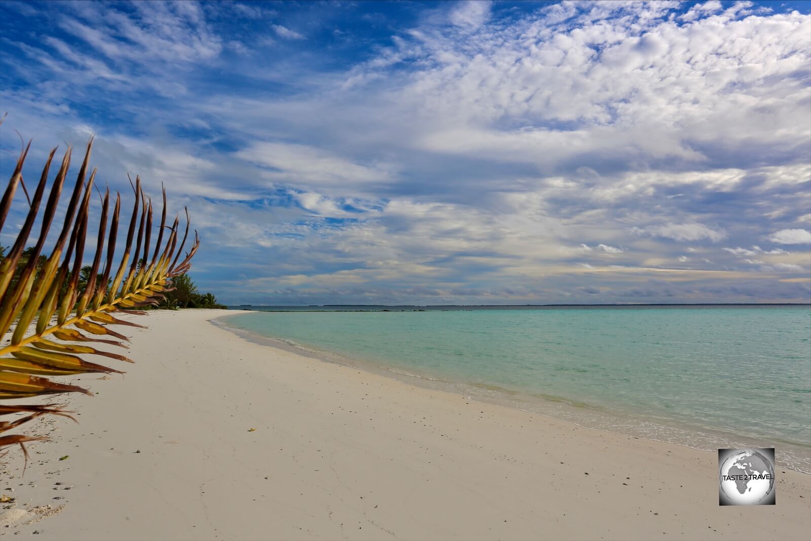
A view of Emily Bay, the most popular swimming beach on Norfolk Island.
A trip to Norfolk Island from Sydney or Brisbane, the only two departure points to the island, allows visitors to breeze through the deserted international terminals on the mainland, to once again experience the joy of flying (on a two-hour flight over the Pacific Ocean), before disembarking onto the tarmac at an ‘overseas’ destination.
After your holiday, you then return back to Australia without the hassle of being subjected to a mandatory, and expensive, 14-day quarantine program. Nice!

A view of the south coast of Norfolk Island from Headstone Point.
Once on the island, visitors are spoilt for choice with Norfolk Island offering activities for all age groups and energy levels.
While the majority of travellers to Norfolk Island are elderly Australians – who appreciate the relaxed, slower pace of life on the island – there are plenty of activities for the more energetic.

Passing through this spectacular basalt archway on the north coast provided access to our scuba diving sites.
The underwater, volcanic formations, which lie submerged in the pristine waters that surround Norfolk Island, make for spectacular scuba diving. Amazing snorkelling can be found at many of the beaches, while the beautiful Anson Bay is a favourite beach for surfers.

A fluffy Masked Booby chick on Norfolk Island.
On land, hiking trails, ranging from easy to difficult, cling precariously to the edges of high coastal cliffs, offering breath-taking views out to sea. It’s on these trails you’ll encounter nesting seabirds.
Other hiking trails meander through the lush, green, interior forests of the Norfolk Island National Park. It’s along these trails that birdwatchers can spot the various endemic birds which have evolved in isolation over millennia.

Completed in 1835, the Commissariat Store in Kingston is one of the best examples of Georgian architecture in the Southern Hemisphere.
History enthusiasts will love exploring the Kingston and Arthur’s Vale UNESCO World Heritage Site, the most intact convict penal settlement in the Southern Hemisphere.
Then there is the fascinating story of modern settlement on the island with the descendants of the HMS Bounty mutineers relocating to Norfolk Island from an overcrowded Pitcairn Island.

Thanksgiving Food Festival in Kingston. Norfolk Island’s Thanksgiving is based on the American tradition, being introduced to the island by visiting, 19th-century, American whalers.
About half of the islanders today can trace their roots back to Pitcairn Island. Far from being mutinous, Norfolk Islanders are friendly, pleasant and welcoming. While driving on the island, other drivers you pass will wave at you, and it’s polite to return the wave – it’s call the Norfolk wave!

A gravestone of an executed convict at the Kingston cemetery.
Despite being just 34.6 square kilometres (13.4 square miles), I spent a busy nine days on the Island and would recommend at least that amount of time in order to fully explore this sub-tropical, pristine, emerald isle.
Location
Norfolk Island is located in the Pacific Ocean between New Zealand and New Caledonia (click to read my travel guide) – 1,412 kilometres (877 mi) east of Australia at roughly the same latitude as Evans Head in northern New South Wales.

A view of Philip Island (background) and Nepean Island (middle) from Norfolk Island.
Together with neighbouring Nepean Island, and the more distant Philip Island, both of which are uninhabited, the three islands collectively form the Territory of Norfolk Island.
Like Norfolk Island, the mountainous Philip Island is volcanic in origin while flat Nepean Island is a raised slab of limestone seabed.
Norfolk Island is the eroded remnant of a basaltic volcano active around 2.5 to 3 million years ago. It forms the highest point on the Norfolk Ridge, part of the submerged micro-continent of Zealandia.

A map of Norfolk Island adorns a souvenir plate.
The Norfolk Ridge extends from New Caledonia to New Zealand. The central section of this north-south oriented ridge is 1,000 kilometres (600 miles) long and 70 kilometres (40 miles) wide, and is almost entirely submerged. Only the volcanic tops of Norfolk and Philip islands break the surface of the Pacific Ocean.
Zealandia

The mostly submerged micro-continent of Zealandia.
Source: Wikipedia.
The almost entirely submerged Zealandia is a mass of continental crust that subsided after breaking away from Gondwanaland between 83–79 million years ago.
It’s believed that this landmass, which extends from New Caledonia to New Zealand, may have been completely submerged around 23 million years ago. Today, 94% remains submerged beneath the Pacific Ocean with New Zealand being the largest part of Zealandia that is above sea level, followed by New Caledonia.
People
There have been three periods of settlement on Norfolk Island – Polynesian; British and the Pitcairn Islanders.
Polynesian Settlement
Archaeological evidence shows that the island was inhabited by Polynesian settlers between the 13th and 15th centuries. It is unknown why this settlement ended but the island was uninhabited when the British arrived in 1788.
British Settlement

A view of the Old Military Barracks and other historic buildings in the UNESCO World Heritage listed Kingston and Arthur’s Vale Historic Area (KAVHA).
In March 1788, just five weeks after the First Fleet arrived in Sydney, the British established a settlement on Norfolk Island. It was chosen for settlement because Captain Cook, who first visited Norfolk Island in 1774, had identified the towering Norfolk Island pines as being useful for ships masts and the local flax as good for sails. Both plants turned out to be unsuitable for these purposes.
However, the island’s fertile volcanic soil and mild climate made it ideal for agriculture and farming, and Norfolk Island became a key source of produce for the newly-established Sydney colony.
Both convicts and free settlers made Norfolk Island their home until 1814, when the island was abandoned due to its perilous landing sites, isolation, and the fact that the Sydney colony was now established and didn’t need supplies from Norfolk Island.
The island lay abandoned from 1814 until 1825 at which time a decision was made to establish a convict penal settlement on the island. This marked the start of a dark period in Norfolk’s history, with the island becoming infamous around the world for the harsh treatment prisoners received.
During this period, ambitious building works were commissioned in Kingston. Many of these buildings have been restored and form the Kingston and Arthur’s Vale UNESCO World Heritage Site.
The second penal settlement began to be wound down by the British government after 1847 and the last convicts were removed to Tasmania in May 1855. The island was then entered into the British Crowns’ register of ‘Abandoned Lands‘.
Pitcairn Islanders
Meanwhile, on the other side of the Pacific – 6,271 km to the east of Norfolk Island, the descendants of the HMS Bounty mutineers had outgrown their home on tiny Pitcairn Island which is just 5 km2 (1.9 square miles) in area.
Following appeals to the British crown, Queen Victoria allocated Norfolk Island as a new settlement site for the Pitcairn Islanders.
On the 3rd of May 1856, a British government-supplied ship relocated 194 Pitcairn Islanders to Norfolk Island, who arrived at their new home on the 8th of June 1856.
The Pitcairn Islanders originally lived in the abandoned convict buildings in Kingston before moving to their own 50-acre land grants, where they built homes and farms.
The descendants of the Pitcairn Islanders now make up about a half of the island’s population, and a walk through the rows of headstones in the islands’ one cemetery in Kingston show those who were direct descendants of the Bounty mutineers, with numerous gravestones bearing the surnames of Christian, Quintal, McCoy, Adams and Young.
The rest of the population is made up of Australian and New Zealand expats and a small number of people from other countries, especially neighbouring Pacific nations. The current population is about 1800.
Mutiny on the Bounty

A model of the ‘HMS Bounty’ at the Norfolk Island museum.
The story of modern settlement on Norfolk Island starts with the events which happened off the coast of Tonga on the 28th of April 1789 – the day that a Mutiny took place on the HMS Bounty.
The story of the HMS Bounty starts twenty years earlier, in 1769, when Captain James Cook discovered Breadfruit while visiting the island of Tahiti. At the time, the British government was searching for food crops which could be grown in the Caribbean to support their growing number of slaves.

After being discovered on Tahiti by Captain James Cook, Breadfruit was transported to the Caribbean by William Bligh.
Captain Cook, recognising the potential of breadfruit (which he referred to as ‘bread growing on a tree‘), proposed to King George III to commission a special expedition to transport breadfruit trees from Tahiti to the Caribbean.
In 1787, William Bligh, who had a reputation for being harsh and rude to his subordinates, was appointed Captain of the HMS Bounty and instructed by the Royal Crown to transport over 1,000 breadfruit trees from Tahiti to the Caribbean.
In December 1787, the HMS Bounty left England for Tahiti. Due to storms at Cape Horn, which prevented the Bounty from passing under South America, Bligh had no choice but to change course, approaching Tahiti via South Africa and the Southern Ocean, south of Australia. This added months to the journey and saw mounting tensions between Bligh and his crew, especially first-mate Christian Fletcher, escalate further.

Inside Fletcher’s Mutiny Cyclorama, Norfolk Island. A 360° panoramic painting which depicts the story of the Mutiny on the Bounty and the Norfolk Island people.
Source: Fletcher’s Mutiny Cyclorama.
After a 10-month journey, the Bounty arrived in Tahiti in October 1788 and remained there for more than five months. On Tahiti, the crew enjoyed an idyllic life in a lush, tropical paradise and also fell in love with local Tahitian woman. Needless to say, when the time came to depart, the crew were very reluctant to leave.
On April 4, 1789, the Bounty departed Tahiti with its store of 1000 breadfruit saplings. On April 28, near to Tonga, Christian and 25 petty officers and seamen seized the ship, forcing Bligh and his loyalists into a small longboat.
They should have perished at sea, but incredibly, under Bligh’s command, the crew were able to reach the city of Kupang (today in Indonesian West Timor) – 5,800 km to the west of Tonga.
Bligh eventually returned to England and, as determined as ever, sailed once again to Tahiti to collect more Breadfruit saplings and deliver them to the Caribbean. Today, thanks to Bligh’s efforts, Breadfruit is a staple throughout the Caribbean and Central/ South America.
Further Reading: You can see one of the original Breadfruit trees, which was planted by Bligh in the Kingstown Botanical gardens, in my St. Vincent and Grenadines Travel Guide.
Meanwhile, Christian and his men attempted to establish themselves on the island of Tubuai in French Polynesia. Unsuccessful, they returned to Tahiti where 16 mutineers decided to stay. Their time on Tahiti was limited as they were soon captured by the British and returned to England to face justice.

The original kettle from the HMS Bounty which was once used on Pitcairn Island and is now on display at the Norfolk Island museum.
Fletcher Christian and eight others, together with six Tahitian men, a dozen Tahitian women, and a child, decided to search the South Pacific for a safe haven. In January 1790, the Bounty arrived at the uninhabited Pitcairn Island, more than 1,600-km east of Tahiti.
Sixty-six years later, the small community had grown to a point where tiny Pitcairn could no longer sustain them, hence the relocation to Norfolk Island where today the descendants of those original Mutineers comprise around 50% of the population.
Politics

A park in Burnt Pine displays the handprints of islanders who have put their ‘Hands Up for Democracy’.
Controversy has always existed as to the exact status of Norfolk Island. Despite the island’s status as a self-governing territory of Australia, some Islanders claim that it was actually granted full independence at the time Queen Victoria granted permission to Pitcairn Islanders to re-settle on the island in 1856.
At that time, Norfolk Island was established as a colony separate from New South Wales but under the administration of that colony’s governor. In 1914 the UK handed Norfolk Island over to Australia to administer as an external territory, but as a distinct and separate settlement.

The Five Demands from the Norfolk Island democracy movement.
On the 19th of March 2015, the Australian government announced that self-governance for the island would be revoked by the Commonwealth and replaced by a local council with the state of New South Wales providing services to the island.
The reason given for this controversial move was that the island had never gained self-sufficiency and was being heavily subsidised by the Commonwealth, by apparently $12.5 million in 2015 alone. It meant residents would have to start paying Australian income tax, but they would also be covered by Australian welfare schemes.
Today, an active democracy movement exists which is fighting for full democracy to be restored to the island. In Burnt Pine, the ‘Centre for Democracy‘ is happy to explain the democracy demands of islanders to any curious visitor.
Also, in Burnt Pine, a small park has been created where the hand-prints of many islanders, who have ‘put their hands up for democracy‘, are displayed.
A protestor’s tent embassy has also been established on the grounds of the old Military barracks in Kingston.
Flag

The flag of Norfolk Island features a Norfolk Island pine.
The flag of Norfolk Island, which was approved for use by the Norfolk Island council in 1979, features a Norfolk Island pine in a central white stripe between two green stripes.

The flag of Nigeria.
The flag’s geometry is a triband with the central white stripe slightly wider than the two outer green stripes. The flag is very similar in design to the flag of Nigeria.

The Norfolk Island flag, fluttering in front of a row of Norfolk Island pines in Kingston.
Currency

The slowly disappearing Australian dollar is the official currency of Norfolk Island.
The official currency of Norfolk Island is the Australian dollar (A$), which trades under the international currency code of AUD.
Having the distinction of being the world’s first polymer currency, the currency is issued in bank notes of $5, $10, $20, $50 and $100. The dollar is divided into 100 cents (c), with coins being issued in denominations of 5c, 10c, 20c and 50c, $1 and $2.
All bank notes are printing in Melbourne by Note Printing Australia (a division of the Reserve Bank of Australia), who also print polymer bank notes for Central banks around the globe.
Banking services on the island are provided by the Commonwealth Bank of Australia which offers one modern branch, with an ATM, on the main street of Burnt Pine.
Like mainland Australia, most transactions on Norfolk Island are cashless with credit cards being widely accepted.
To check the current exchange rate between the Australian dollar and the US dollar, click here.
Costs
Since many items are imported from mainland Australia, costs on Norfolk Island are slightly higher than Australia.
One item which is noticeably more expensive is petrol which costs A$2.14 per litre. Thankfully distances are small so, after a week of driving my rental car, I needed to top-up with just half a tank of fuel which still cost me about A$55.
Most goods on the island arrive by boat from Australia, but as the boat comes every 6 weeks, supermarket shelves can become bare towards the end of the delivery cycle.
Where possible, its best to buy local fruit and vegetables and self-cater. My apartment included a fully equipped kitchen where I could prepare the freshest of local produce, all of which is organic and full of flavour – much tastier than produce sold in Australian supermarkets!
A good shopping option is the weekly Farmers’ market which is held on the grounds of the Norfolk Island Visitors centre each weekend.
As you drive around the island, many locals have a produce box at their front gate where they sell homemade jams, chutneys, pickles, sauces and fresh fruit and vegetables. These are always unattended with payment made into an honesty box – making these one of the last places on the island where cash is required!
Philately
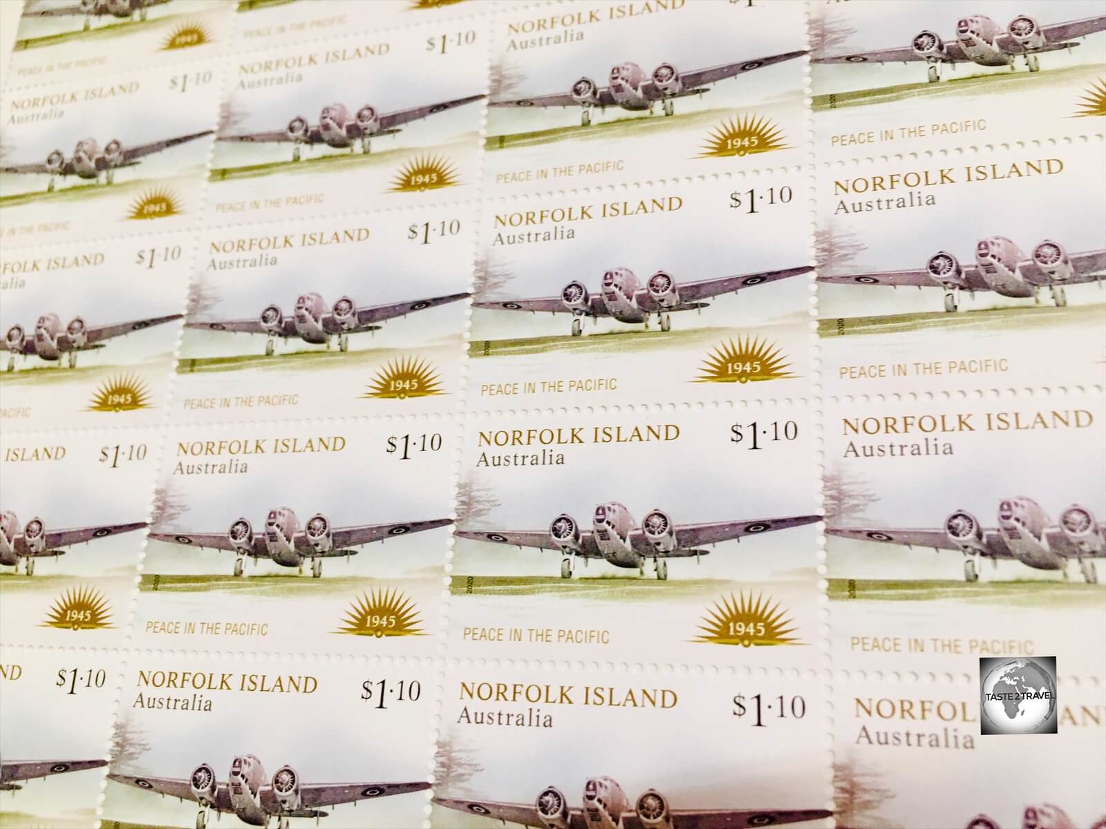
Norfolk Island Stamps – “Peace in the Pacific”.
Norfolk Island issues its own postal stamps and operates its own postal service. Rates are charged at the same rates as those in Australia with stamps being supplied by Australia Post, who also sell Norfolk Island stamps online.
Stamps from either Norfolk Island or Australia are valid for postage in either location. Stamps can be purchased at the one post office in Burnt Pine which is tucked away in the back corner of the P&R Grocery store.
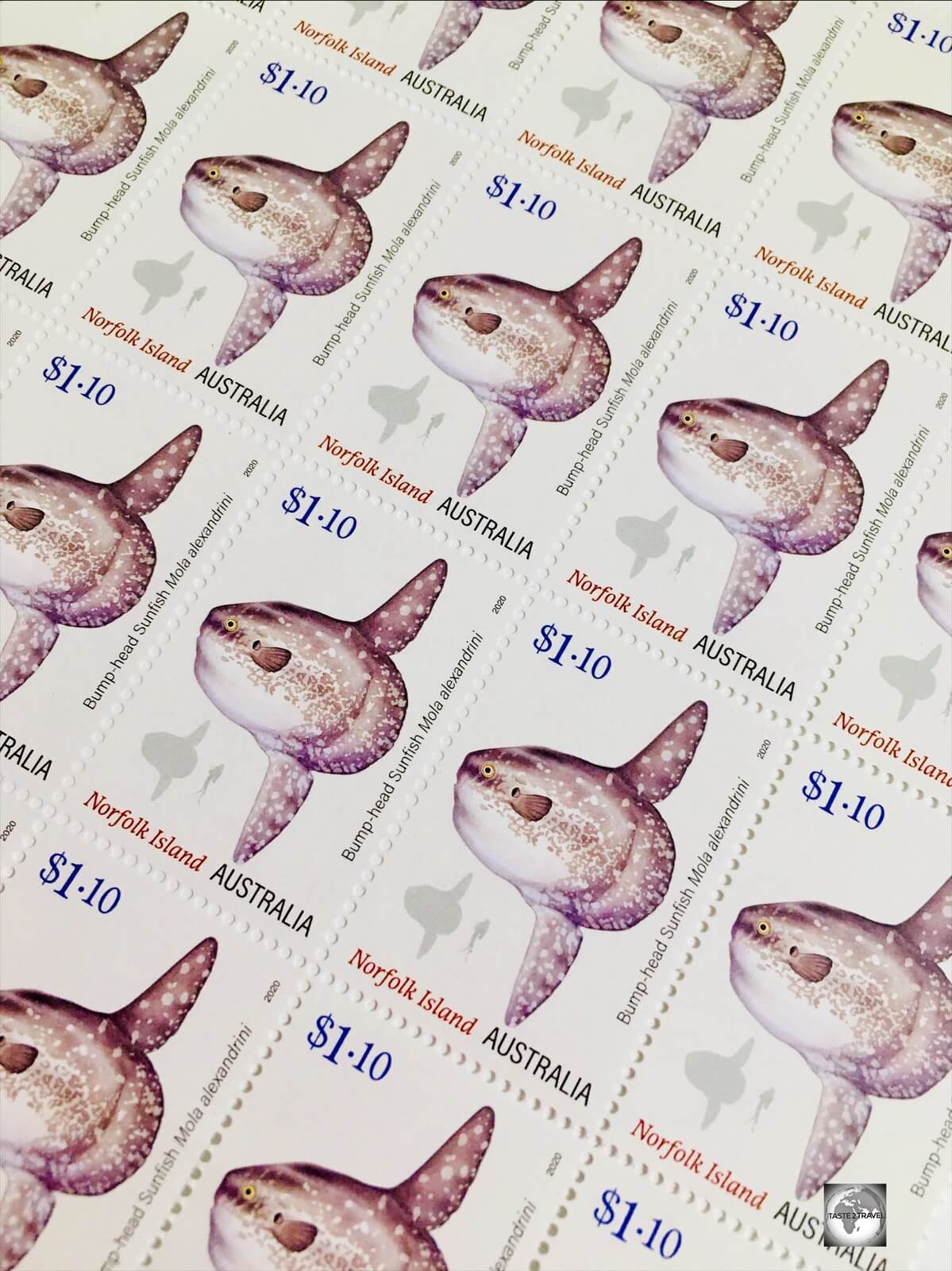
Norfolk Island Stamps – “Bump-head Sunfish”.
Unlike many other Pacific Islands, who have flooded the stamp market with irrelevant stamp issues (e.g., “Lunar Landing”, “Disneyland Characters”, “Michael Jackson” etc), the commemorative and definitive stamps issued by Australia Post for Norfolk Island are highly relevant, featuring local fauna, flora, history and society.

Norfolk Island Stamps – “Early Botanical Art”.
Connectivity
Terrible!
Unless you have roaming enabled on your phone, you’ll find yourself in a network black hole on Norfolk Island!
Australian Telco’s, such as Optus and Telstra, have no presence on the island with all network and data services provided by the local operator, Norfolk Telecom, who offer a rather slow 2G network, although this is being upgraded to 4G. The scheduled ‘go-live’ date for the new 4G network is the 12th of January, 2021.
Wi-Fi

Wi-Fi coverage on Norfolk Island is limited, with free Wi-Fi normally offered by your accommodation provider. Local SIM cards can be purchased from Norfolk Telecom who offer a selection of data plans.
In Burnt Pine, the RSL club is the only place which offers free Wi-Fi while Norfolk Telecom operate a hotspot throughout the village, which is available to paid subscribers.
Flora

A view of Norfolk Island from Mount Pitt, the 2nd highest point in the Norfolk Island National Park.
As is the case with so many islands which have evolved in isolation, Norfolk Island is home to plants and animals found nowhere else in the world. Of the 200 native plants found on the island, 40 are endemic.
While much of the island has been cleared of its original vegetation, the Norfolk Island National Park, Botanic Garden and 100 Acres reserve are home to most of the island’s remaining natural areas. These three reserves offer hiking trails which allow you to explore these natural wonderlands.
Norfolk Island Pine

Beautiful Emily Bay is surrounded by a forest of Norfolk Island pines.
The best known symbol of Norfolk Island is the iconic Norfolk Island pine (Araucaria heterophylla). Featured on everything from the territorial flag, stamps, souvenirs and so much more, the ubiquitous Norfolk Island pine is a common sight across the island.

A row of trunks from an avenue of mature Norfolk Island pines at Puppy’s Point.
With its classic ‘Christmas tree’ appearance, the Norfolk Island pine was always destined to be a popular ornamental tree and is now cultivated around the world.
It’s especially popular in Australia where rows of Norfolk Island pines line various beaches. The tree is ideal for coastal environments, being able to grow well in sandy soil and having a high tolerance of salt and wind.

Norfolk Island is a very green and clean destination with Norfolk Island pines framing every view.
Young Norfolk Island pines have upward-pointing branches which act to catch rainwater, directing it towards the trunk and hence the roots, while older trees have downward-pointing branches which have the opposite effect.

A Norfolk Island pine festooned with lichen Usnea.
Some pines are covered with lichen Usnea (aka ‘old man’s beard’) which give them the appearance of a Christmas tree covered in tinsel. For those who have spent time in the deep south of the United States, Usnea is very similar to Spanish moss. Like other lichens, Usnea often grows on sick or dying trees due to the pre-existing loss of canopy leaves, allowing for greater photosynthesis by the lichen’s algae.
Norfolk Island Hibiscus

The Norfolk Island Hibiscus.
Native to Norfolk Island, the Norfolk Island Hibiscus (also known as White Oak) is a common sight on the island, found along roadsides and hiking trails.
Thanks to its pretty flower and highly adaptable, hardy nature, the Norfolk Island Hibiscus, has been cultivated around the world, in tropical, sub-tropical and temperate areas, both in coastal and inland zones. Reaching more than 20 metres in height, the hibiscus is hardy to salt spray and is therefore excellent for coastal gardens.
Also in the hibiscus family is the Philip Island Hibiscus (Hibiscus insularis) which is endemic to Philip Island but can be found in gardens on Norfolk Island.
Norfolk Tree Fern

Towering, Norfolk Tree Ferns, in the 100 Acres Reserve on Norfolk Island.
Soaring to a height of 20 metres (66 ft) or more, the Norfolk Tree Fern is listed in the Guinness Book of Records as the tallest fern in the world.
Endemic to Norfolk Island, and once extensive on the island, prior to European settlement, the fern today can be found in the gullies of the Norfolk Island National Park, Botanic garden and the 100 Acres reserve.
Fauna

The endemic Norfolk Island green parrot in the Botanical garden.
Norfolk Island has no endemic mammals, and its only native mammals, two species of bats, are now extinct on the island.
There are 116 bird species on the island, some of which are endemic. The best places to look for birds are the along the hiking trails in the Botanical garden, the National park and the 100 Acres reserve.
Bird Watching Tour

“Norfolk Island … the birds” by Margaret Christian.
If you have any interest in birdwatching, the best thing you can do on Norfolk Island is to book a birdwatching tour with the local bird expert – Margaret Christian, who is the author of the book ‘Norfolk Island … the birds‘, the most comprehensive guide to the birds of Norfolk Island. Tours with Margaret can be booked through the Norfolk Island Visitors’ centre.
Originally from mainland Australia, Margaret has lived on Norfolk Island for many years and is married to a descendant of Fletcher Christian. Margaret’s tours are informative and entertaining and, at no stage, was there any suggestion of a mutiny happening in her mini-bus, with everyone enjoying the tour.

A Masked Booby chick on the north coast of Norfolk Island.
Morning tea, which consisted of a freshly baked coconut cake and hot drinks, was served on the lawn at Margaret’s beautiful seaside property which is situated atop the sea cliffs which line the north coast of the island. The grassy grounds around her home are the favoured nesting grounds for Masked Boobies, with lots of fluffy chicks present during my visit.
Norfolk Island Green Parrot

The Norfolk Island green parrot can be found in the Botanical garden and the National park.
The most iconic of the birds is the endemic Norfolk Island green parrot. Once a common species, the green parrot was near to extinction in the late 1970’s due to habitat loss and the killing of eggs and young by rats and feral cats.
A concerted effort to reduce rat and cat populations by trapping, and the ongoing culling of the more aggressive (introduced) Crimson Rosella has resulted in an increase in the green parrot population.
Crimson Rosella (Red Parrot)

A Crimson rosella, known locally as a Red parrot, sitting in a Norfolk Island pine.
A native of mainland Australia, Crimson rosellas were first taken to Norfolk Island as cage birds during the first penal settlement. Known locally as Red parrots, they were reported in the wild as early as 1838.
As the number of Crimson rosellas increased on the island, the number of Green parrots declined. The more aggressive Crimson rosella acts like a playground bully, invading the nesting hollows of green parrots and deliberately smashing its eggs.
Currently, a culling program is underway to reduce the number of Crimson rosellas which is being conducted by a National Parks ranger armed with a shot gun. Photographing them is difficult because they are very weary of anyone pointing anything at them.
While the culling program is beneficial for the green parrot, some locals are against it as they like to see the colourful Crimson rosellas in their gardens.
Norfolk Island Grey Fantail

A Norfolk Island Grey Fantail on the Mount Bates hiking trail.
Found in gardens and forests across the island, the curious and mischievous Norfolk Island Grey Fantail never sits still, flitting their fan-like tail as they move.
Although endemic, the Norfolk Island Grey Fantail is very similar to the varieties of grey fantails which inhabit the mainland of Australia. Fantails are found all over Australia except for the central desert areas.
The fantail isn’t shy and will often follow you as you walk along hiking trials or might even buzz you just for fun. Thanks to its boldness, the fantail is the easiest of birds to photograph, perching directly in front of you while you get your perfect shot.
Masked Booby

An adult Masked Booby on Norfolk Island.
Norfolk Island is a seabirds’ paradise, boasting access to the abundant ocean and safe nesting sites high on the steep volcanic cliffs and the numerous offshore islets.
Masked boobies, one of six species of boobies, are a common sight on the island, where they nest, on the ground, between August and February. These large and distinctive seabirds have a white body, black tail and a small black mask around their large yellowish beak.

Striking a pose! A fluffy Masked Booby chick on Norfolk Island.
The female lays two eggs in a shallow depression on flat ground away from vegetation. New-born chicks, which are covered in white downy feathers, grow quickly, becoming nearly as big as their parents during their initial growth spurt. A favourite nesting site on Norfolk Island is at the end of Fisherman’s Lane, overlooking the north coast.

A Masked Booby adult and chick at a nesting site at the end of Fisherman’s Lane.
The chicks are born featherless, but are soon covered in white down. In an act known as siblicide the second born chick generally does not survive and is killed by its elder sibling.
Further Reading: Interested in viewing other species of Boobies? You can view Blue-footed boobies, Red-footed boobies and Nazca boobies (which are the Masked Booby in the western Pacific) in my Galapagos Islands Travel Guide.
You can view the Brown Booby in my Cayman Islands Travel Guide.
White Tern

A nesting adult White Tern in the 100 Acres reserve.
The White Tern is a common sight on most Pacific islands including Norfolk Island, to which it migrates to nest. The White Tern normally leaves the island in May to spend several months at sea, flying constantly before returning in mid-August to mate. The best place to see nesting terns is at the 100 Acres reserve.
A wide-spread seabird, the White tern is unique in that the female lays only one egg per clutch in whatever suitable depression she can find on a tree branch. Why waste time and energy building a nest when you can simply lay your egg directly onto a branch?

A White tern chick, clinging onto its branch for dear life, in the 100 Acres reserve.
If the egg isn’t blown off the tree, it stands a good chance of surviving and a fluffy chick will be born. Unable to fly, the chick must then hang onto the branch, which is often located in areas prone to gale-force winds, for the first two months of its life. Yes – two months!
After this time, and provided it hasn’t been blown off its perch, it is fully independent and able to fly.
Further Reading: In my Tuvalu Travel Guide, you can view more White terns, including one which was nesting outside the room of my guest house.
Red-tailed Tropic Bird

This curious Red-tailed tropicbird kept ‘buzzing’ me as I stood and photographed it on the sea cliffs at the 100 Acres reserve.
The Red-tailed tropicbird is one of three species of tropicbird which can be found on tropical islands around the world. The birds nest on Norfolk Island and are easily viewed in the 100 Acres Reserve where they build their nests on cliff faces and in protected crevices.
They can be seen performing acrobatics offshore from the reserve and, being curious, can fly close to investigate you.
Further Reading: Another of this species, the White-tailed tropicbird, can be viewed in my Bermuda Travel Guide.
Sacred Kingfisher

A Sacred Kingfisher at Balls Bay on Norfolk Island.
The dazzlingly beautiful Sacred Kingfisher can often be seen sitting on wire fences on the side of the road as you drive around Norfolk Island. The local name for the Kingfisher is ‘nuffka’, which literally means ‘Norfolker‘.
Sporting turquoise-coloured plumage with white underparts, the Sacred Kingfisher can be found throughout Australasia, the Pacific region, New Guinea and eastern Indonesia.
Norfolk Robin

A juvenile male Norfolk robin on Norfolk Island.
Endemic to Norfolk Island, the Norfolk robin, also known as the Norfolk Island scarlet robin, can be seen as a scarlet-coloured flash, darting through the forests of the Norfolk Island National park.
Juvenile males have rust-coloured breast feathers while mature males have bright red feathers.
White-faced heron

A White-faced heron on the golf course at Norfolk Island.
The White-faced heron is a common bird throughout most of Australasia, and has been recorded on Norfolk Island as a permanent resident for more than 100 years.
Scuba Diving

While the diving was a highlight, the boat journey along the dramatic north coast was one of the highlights of my visit to Norfolk Island.
For various reasons, Norfolk Island is a scuba divers paradise! The waters which surround the island lie within the Norfolk Marine Park which extends 700 km (430 mi) in a north–south direction and covers an area of 188,444 km2 (72,759 square mi), which means no commercial fishing anywhere.

A view of Cathedral Rock, a volcanic formation which features soaring basalt columns and a very narrow pass-through passage.
The island has no rivers, which means no rainwater runoff disturbing the clarity of the pristine water, and an absence of industry on the island means no industrial pollution.

The numerous dive sites of Norfolk Island feature submerged, ancient volcanic formations including many caverns and swim-throughs.
Source: Norfolk Island Diving.
The one dive business on Norfolk Island is Norfolk Island Diving which is operated by the wonderfully laid-back, fully competent and always calm, Mitch.

The protected reefs which surround Norfolk Island are full of fish and healthy soft and hard corals.
Source: Norfolk Island Diving.
You can contact Mitch through the Norfolk Island Diving website, the Norfolk Island Visitors’ centre or through his wife Sharyn Quintal, who is the owner of the Prinke Eco Store.
A two-tank dive with Norfolk Island Diving costs A$200.

Mitch and my two dive buddies, Sara and John, admiring the impressive views along the north coast of Norfolk Island.
Due to the fact that there is no safe harbour on Norfolk Island, all boats, including the dive boat, are lowered into the sea using a newly installed winch on Cascade pier.

Lowering our dive boat into the sea at Cascade pier.
From Cascade pier it’s a short 10-minute boat ride to the nearest dive sites.

We passed through this impressive volcanic archway on the way to one of our dives sites.
The boat ride along the spectacular north coast is a highlight in itself, with breath-taking, towering volcanic rock formations lining the way, including one basalt archway which we cruised through.

The boat ride to and from our dives sites was yet another amazing experience on incredible Norfolk Island.
Underwater, it gets even better with lots of ancient, submerged volcanic structures to explore, which include a number of amazing swim-throughs.
Sightseeing

Distances on Norfolk Island are short, with most places being a 10-minute drive from Burnt Pine.
Norfolk Island is approximately 8 kilometres by 6 kilometres in size. Most places on the island are a 5 to 10-minute drive from Burnt Pine, with little traffic, except for the occasional cow on the road. After 9 days of zipping around the island in my rental car, I’d consumed half a tank of fuel.
Norfolk Island Museum Pass

The Norfolk Island Museum Pass provides multiple entries into five properties as well as two guided Tag-a-long tours.
If you’re planning to visit a few museums, it’s best to purchase the Norfolk Island Museum Pass which, for A$35, provides access to four museums, the Norfolk Island Research centre and two guided Tag-a-long tours.
The passes can only be purchased from the Royal Engineers Office (R.E.O) bookshop which is located next to Kingston pier. The bookshop is also the departure point for the daily Tag-a-long tours which are guided tours, led by a guide who drives a mini-bus (for those without a car) while those with cars, tag along behind the bus in a convoy, which is the only thing on Norfolk Island which resembles rush hour traffic.
Burnt Pine

More like a village, Burnt Pine is the one and only town on Norfolk Island.
The one town on Norfolk Island, tiny Burnt Pine is more ‘village’ than ‘town’. The main street, Taylors road, which is lined with duty free shops and gift stores, is also home to one bank, one post office, one supermarket, three clubs (RSL, Bowling and Leagues), two petrol stations, six cafes and a few tour companies/ travel agents.
An important stop for any new arrival is the Norfolk Island Visitors’ centre which is housed in the Bicentennial Complex on Taylors road. The friendly staff at the centre will provide you with a map and suggest a suitable itinerary for your visit. They can also make reservations for any activities you wish to do. The grounds of the centre host a Farmers’ market each weekend.
Fletcher’s Mutiny Cyclorama

Inside Fletcher’s Mutiny Cyclorama, Norfolk Island. A 360° panoramic painting which depicts the story of the Mutiny on the Bounty and the Norfolk Island people. Source: Fletcher’s Mutiny Cyclorama.
Fletcher’s Mutiny Cyclorama is an amazing artwork which viewers walk inside to experience history in a unique way. The artwork is a large 360° continuous panoramic painting which completely surrounds the viewer and extends onto the floor. Painted in a realistic style and in perspective, the painting creates the feeling of being there in the scene. Realistic foreground props add a further optical illusion.
Inspiration to create this type of painting, based on the popular 18th century style of attraction, came from one of Fletcher Christians descendants. Marie Bailey, a 6th generation descendant of Christian, saw a cyclorama in Canada and thought it would be a wonderful way to depict the story of her famous ancestor and the Mutiny on the Bounty which led to the settlement of Pitcairn and Norfolk Islands.
Norfolk Island artists Tracey Yager and Sue Draper undertook the design, research and painting of the circular artwork, a two-year project. The attraction was completed in October 2002 and since then has become a popular way for people to learn the story of the Norfolk Islanders history and heritage.
Housed in the same complex, the excellent Hilli Restaurant & Cafe (see the ‘Eating Out‘ section for more details) provides one of the finer dining experiences on Norfolk Island.
Kingston
Kingston is the administrative centre of Norfolk Island and has the distinction of being the second-oldest settlement in Australia, founded a little over a month after Sydney.
It’s also the heart of the UNESCO World Heritage listed Kingston and Arthur’s Vale Historic Area (KAVHA) which includes the ruins of the former convict penal settlement and a number of restored buildings from that settlement.
Queen Elizabeth Lookout

Located on Rooty hill, the Queen Elizabeth Lookout is the best place to gain an overview of the Kingston and Arthur’s Vale Historic Area (KAVHA).
The best place to gain an appreciation of historic Kingston is from the Queen Elizabeth lookout which is located on Rooty Hill road.
The lookout provides panoramic views of the historical houses along Quality Row which were built during the 2nd Convict settlement. The lookout was opened on the 11th of February 1974 by Queen Elizabeth II during her visit to the island.
Norfolk Island New Gaol

Remains of the main gate of the New Gaol in Kingston.
The convict precinct in Kingston was located along the sea front, under the watchful eye of the authorities on the nearby hill. The largest walled compound in this precinct is the New Gaol which was built in 1847. The ruins of the five pentagonal wings remain as does the impressive entrance gate and surrounding walls.
Commissariat Store

The former Commissariat Store today houses a museum and the All-Saints Church.
One of the main sights on Quality Row, the Commissariat Store was completed in 1835 and originally housed a liquor store and a general store in the basement, a storeroom and meal room on the 1st floor, an engineer’s store on the 2nd floor and a grain store on the 3rd floor.
In 1874 the building was converted into the All-Saints Church, but not before removing the 2nd floor to create a church with a higher ceiling.
The basement is home to the Norfolk Island Commissariat Store museum which features displays detailing the first and second settlements on the island.

The Commissariat Store was protected by fortified stoned walls.
Norfolk Island Cenotaph

Inaugurated in 1929, the Norfolk Island Cenotaph was originally erected to commemorate those who died in service or were killed in action in World War One.
Across the road from the Commissariat Store, the Norfolk Island Cenotaph was originally erected to commemorate the lives of those who died during WWI.
The men of Norfolk Island have fought and died in many wars alongside the British, including the Boar war (11 Oct 1899 – 31 May 1902) which is also included on the memorial.
Pier Store Museum

The canon from the HMS Bounty is one of the main exhibits at the Norfolk Island Pier Store museum.
The Norfolk Island Pier Store museum focuses on the third settlement on Norfolk Island – the arrival of the Pitcairn Islanders.
Displays include relics from the HMS Bounty, including a canon, wedding ring, iron kettle and an ironstone platter. All of these were removed from the Bounty for use on Pitcairn Island and were then carried to Norfolk Island.
The Crank Mill

The Crank mill was built in 1827 to serve as the Commissariat granary.
Located next to the Pier Store in the convict precinct, the Crank mill was originally built in 1827 as the Commissariat Granary. A decade later a Crank was installed for the “punishment of men in irons”.
The crank was powered by around 100 convicts, who would work all day, under tortuous conditions, milling flour for the settlement.
Kingston Pier

Historic Kingston pier was constructed between 1839 and 1849 by convicts who worked in waist-deep water while wearing iron leg-chains.
Kingston Pier is located adjacent to the original landing site of Lt Phillip Gidley King, who first set foot on Norfolk Island in March 1788, just six weeks after the founding of the new colony in Sydney, Australia.

A view of Kingston Pier from the original landing place where Lt Phillip Gidley King first stepped ashore Norfolk Island in 1788.
The pier was built between 1839 and 1849 using limestone cut from the reef. The original design called for a longer pier but conditions proved impossible for the convicts who worked ‘up to their armpits‘ in rough seas while wearing leg irons.
Kingston Boatyard

A retired ‘Lighter’ boat in the Kingston boatyard.
Next to Kingston Pier is the Kingston boatshed and boatyard. During the penal settlement, the boatshed served as the Police Office. The boatyard is now home to some retired ‘Lighter’ boats which were used in the past to transfer goods to the island from ships moored offshore.
HMS Sirius Museum

A memorial to the HMS Sirius outside the HMS Sirius museum in Kingston.
Located in the former Protestant Chapel, in the compound adjacent to the New Gaol, the HMS Sirius museum is dedicated to the HMS Sirius, flagship of the First Fleet, which was wrecked just offshore in 1790.
No. 10 Quality Row Museum

Considered a 1st class house, the property at No.10 Quality Row has been converted into a museum.
Fully restored in the 1980’s, No. 10 Quality Row was built as the residence for the Foreman of the Works and was completed in 1844. Its first inhabitants, Thomas Seller and Robert Orford, were responsible for the building programmes in Kingston. Today it serves as a museum which provides an insight into life on the island during the 2nd penal settlement.
The house includes period furnishings and a curious trap-door which is installed in the bedroom between two beds. Outside, the grounds features a beautiful colonial period garden including a Red Hibiscus (front-left corner of garden) which is over 150 years old.

A trapdoor in the bedroom at the No.10 Quality Row museum.
No. 9 Quality Row

The beautifully restored “No. 9 Quality Row House” is home to the KAVHA Research and Information Centre.
Located next door, the fully restored Georgian house at No. 9 Quality Row is home to the KAVHA Research and Information Centre. The centre, which maintains a microfilm collection of original records dating back to 1788, is open to everyone and can assist those who wish to trace ancestors.
Norfolk Island Cemetery

Reminders of the convict penal settlement, including those who were executed, can be found in historic Kingston.
Norfolk Island has just one cemetery, located at Kingston, on the shores of the aptly named Cemetery Bay. All burials on the island, from the first settlement to the present day, have taken place here.
With such a turbulent past, a visit to the cemetery is a must, with gravestones from the 2nd settlement for those convicts who were executed, soldiers who were killed by convicts, civilians who were brutally murdered and other gruesome, tragic endings.

A gravestone in the Kingston cemetery for Dinah Adams, the eldest daughter of John Adams, one of the Bounty mutineers.
Gravestones from the 3rd settlement (the Pitcairn Islanders) are grouped together, with rows for members from the Christian, Quintal and McCoy families.

The gravesite of Colleen McCullough, a famous Australian author who was a prominent resident of Norfolk Island.
One of the more famous recent residents of Norfolk Island, the Australian author – Colleen McCullough – is also buried in the cemetery in a very simple, unpretentious grave.
Murderers’ Mound

Located outside the eastern fence of the cemetery is ‘Murderers’ Mound’ – a mass grave.
Located outside the eastern fence of the cemetery (overlooking Cemetery bay), a raised mound of earth is the final resting place of twelve convicts who were executed for their involvement in the ‘Cooking Pot Riot‘.
Cemetery Bay

Cemetery Bay offers good bathing and snorkelling.
Adjacent to the cemetery is the aptly named Cemetery bay which is a popular swimming and snorkelling beach.

A view of Cemetery bay which is adjacent to the cemetery.
Norfolk Island Golf Club

Located in Kingston, the picturesque Norfolk Island Golf course is popular with residents and visitors.
Also next to the Cemetery is the very popular and picturesque Norfolk Island Golf Club which has the distinction of being the only golf course in the world located within a UNESCO World Heritage Site.
The lush, green, course is surrounded by the Pacific Ocean and features plenty of Norfolk Island pine trees as obstacles. The course is popular with locals and visitors, many of whom haul their golf bags to the island.
The golf club is housed in an historic building, at No 1. Quality Row, which was constructed in 1841 as the residence of the Stipendiary magistrate.
Bloody Bridge

A view of the convict-built Bloody Bridge on Norfolk Island.
Located a short drive beyond the cemetery, the gory-sounding Bloody Bridge was built during the 2nd settlement by convicts, to provide a safe passage over a stream which was prone to flooding.
The reason for its name is believed to be based on a story about the death of a convict work-gang overseer. Apparently, during construction, the convicts killed the overseer and entombed him in the bridge. The next day the replacement overseer saw blood oozing from the bridge.
The Salthouse

Built in 1846, the Salthouse at Emily Bay was designed to retain sea water which was evaporated to form salt.
Salt was a valuable commodity for any remote settlement, especially being used to preserve meat. The Salthouse at Emily bay was designed to retain sea water, which was then partially evaporated, before being moved into salt pans where the evaporation process was sped up using fire.
For snorkellers, the reef in front of the Salthouse offers excellent snorkelling.
Emily Bay and Lone Pine

A view of Emily Bay, the most popular swimming beach on Norfolk Island.
Emily bay is the best swimming beach on Norfolk Island and offers very good snorkelling on either side of the bay.

A view of Emily Bay and the iconic Lone pine at Point Hunter.
How old is the iconic Lone Pine at Point Hunter? Apparently, it was featured in the first artist drawing of Emily bay which was painted by a member of the original landing party in 1788.

Swimming at beautiful Emily Bay should be done on a daily basis.
Slaughter Bay

A view of Slaughter bay which offers excellent snorkelling.
Located next to Emily bay, the much rockier Slaughter Bay offers excellent snorkelling.
West Coast
Hundred Acres Reserve

The Hundred Acres Reserve is home to some impressive flora, including a number of towering Moreton Bay figs.
Located opposite an impressive row of towering Moreton Bay fig trees on Headstone road, the Hundred Acres Reserve is the largest remaining coastal Norfolk Pine and White Oak tree forest on the island.

A view of the South Coast of Norfolk Island from the 100 Acres Reserve.
The reserve features a circuitous hiking trail which descends to coastal cliffs where Red-tailed tropic birds and Mutton-birds build their nests. During the day, Red-tailed tropic birds can be seen performing their usual acrobatics offshore.

A soaring Red-tailed Tropicbird at the 100 Acres Reserve.
The trail through the forest passes under towering Norfolk Island pines, where White terns lay their eggs on exposed branches and Black Noddy birds’ nest on the higher branches.
Headstone Point

The memorial headstone at Headstone Point.
Named after a memorial marker for two soldiers who drowned while fishing in 1850, and whose bodies were never found, Headstone Point offers panoramic views from the top of 70-metre-high cliffs which rise above the west coast.

The view from the lookout at Headstone Point.
St. Barnabas Chapel

Completed in 1880, the very fine St. Barnabas Chapel was the principal church of the Church of England’s missionary work in Melanesia.
The beautiful St. Barnabas Chapel is all that remains of the once large Melanesian Mission which was established on Norfolk Island by the Church of England from 1866-1924.
Completed in 1880, the impressive stone chapel was built as a memorial to Bishop Patterson who was killed by natives in the Solomon Islands in 1871. It is considered one of the finest historic buildings in the South Pacific.

Part of the stained-glass rose window in St. Barnabas Chapel.
The opulent internal fittings include an incredible stained-glass rose window designed by Sir Edward Burne-Jones who also designed the four windows in the apse which depict the four evangelists.

The wooden ceiling of St Barnabas Chapel was built to resemble the upturned hull of a boat.
The impressive wooden ceiling was built to resemble the upturned hull of a ship and is much more impressive when you know it has been assembled without the use of nails.

The 350 Willis pipe organ was built by Henry Willis & Sons of London in 1880 and shipped to the island in pieces.
The floor of the chapel is made from coloured marble which was shipped to the island in pieces and assembled like a giant jigsaw puzzle, which was also the case for the pipe organ.
Puppy’s Point

A view of the west coast of Norfolk Island from Puppy’s Point Lookout.
Puppy’s Point offers stunning views of the west coast and the sea and apparently gets its name from the fact that the point looks like a dog when viewed from the sea.
Anson Bay

Anson bay is a popular surfing beach and the best place to view a sunset on Norfolk Island.
Located at the top of the west coast, the dramatically situated Anson bay is the one surf beach on the Norfolk Island. Access is via a steep and windy pedestrian trail which descends down to the beach from the roadside carpark (near to where this photo was taken).
The sun sets directly in front of the beach, making this the best place on Norfolk Island to view sunset.
Interior & North Coast
Norfolk Island National Park & Botanic Garden

The best view of Norfolk Island is from the lookout on Mount Pitt, which is part of the Norfolk Island National Park.
Occupying a 6.50 km2 (2.51 square mi) section of the interior, the Norfolk Island National Park and the Botanical Gardens were established in 1984 and are a highlight for those who have any interest in the fauna and flora of the island.
The highest points on the island, Mount Bates and Mount Pitt, offer the best views over the island and are a great place to get your bearings. You can drive to the summit of Mount Pitt, while Mount Bates is accessed via a hiking trail.
Captain Cook’s Monument

The Captain Cook monument and scenic lookout stand at the spot on the northern coast where Captain James Cook and his officers landed in 1774.
Located at the end of a lonely road on the north coast, the Captain Cook monument and lookout stand at the spot close to where Captain James Cook and his officers landed in 1774.
An obelisk, which was completed in 1953, commemorates the discovery of the uninhabited island by Cook. Beyond the obelisk, a lookout provides the most stunning views of the islands off the north coast which serve as breeding grounds for nesting seabirds.

A view of the north coast of Norfolk Island from Captain Cook’s lookout with the islands of (l-r) Bird Rock, Green Pool and Cathedral Rock.
Cascade Pier

There are no mooring facilities at Norfolk Island so vessels must be winched out of the water after every use.
Located on the spectacular north coast, Cascade pier is the 2nd of the two piers on Norfolk Island, and is the landing point for all shipments to the island. It is also the arrival point for all cruise ship passengers who are transferred to shore by tenders.
Due to the fact that there is no safe harbour on the island, all vessels are winched in and out of the water after every use. The photo above shows our dive boat being removed from the water after our scuba diving.
The Australian government has recently spent millions of dollars rebuilding the pier and installing a new, larger winch.
East Coast
Ball Bay

A view of Ball Bay on the east coast of Norfolk Island.
Ball bay is named after Rear-Admiral Henry Lidgbird Ball who discovered Lord Howe Island and was entrusted with shipping the first group of settlers from Botany Bay to Norfolk Island in 1788.
The bay is home to the island’s petroleum storage facility with tanker supply ships mooring offshore and refilling the tanks via a floating pipe.
Two Chimneys Wines

The small vineyard at Two Chimneys Wines on Norfolk Island.
Established in 2003, Two Chimneys Wines is the first and only winery on Norfolk Island.
The small vineyard is planted with five varieties of grape which allows the winery to produce a small amount of red, white and sparkling wines, all of which are available for tasting and purchase at their cellar door.

A selection of wines from Two Chimneys Wines, the only winery on Norfolk Island.
Two Chimneys Lookout

A view over the east coast of Norfolk Island from Two Chimneys reserve.
Around the corner from the winery, the road dead-ends at the Two Chimneys reserve which offers panoramic views over the east coast.
Accommodation

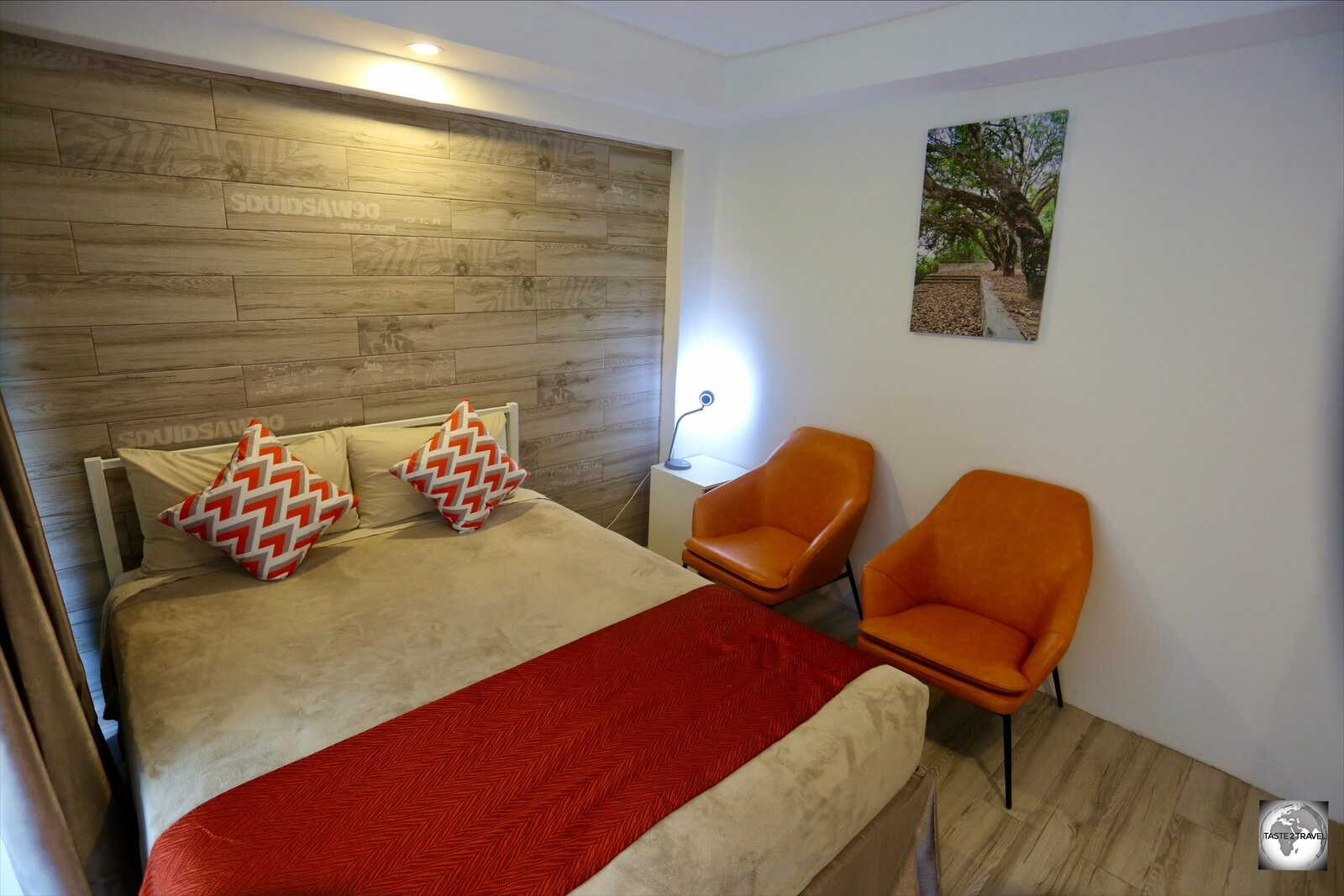
One of two bedrooms in my unit at the Cumberland Resort and Spa with a private garden and sitting area out the back.
For such a small island, Norfolk Island offers a wealth of accommodation options ranging from guest houses, hotels, self-contained apartments, cottages and more with all price categories covered. A useful starting point is the Accommodation directory on the Norfolk Island Visitors’ centre website.
Most options are located in and around Burnt Pine, while further afield, various properties offer panoramic views of the islands’ dramatic coastal scenery.
Accommodation providers will arrange airport shuttle services, often through a local tour company, which often includes a complimentary half-day island tour.

The living room in my spacious unit at the Cumberland Resort and Spa.
While on Norfolk Island, I stayed for eight nights in a self-contained, 2-bedroom/ 2-bathroom apartment at the wonderful Cumberland Resort and Spa which is located in Burnt Pine. For a single traveller, it was way too much space, but I lapped it up!

The fully equipped kitchen in my unit at the Cumberland Resort and Spa.
The Cumberland offers a variety of room options with rates available on their website. I booked my room using booking.com which offered a discounted price at the time. While I stayed as a single guest, my apartment could comfortably accommodate 4 people and included a large outdoor area at the front and rear of the apartment and a large BBQ.

The outdoor area of my unit at the Cumberland Resort and Spa, which included a BBQ.
One of my bathrooms included a spa bath while a heated pool was also available for use.

One of two bathrooms, in my unit at the Cumberland Resort and Spa, which included a spa bath.
My room rate included a Resort rental car for which I had to pay the compulsory Norfolk Island insurance charge of A$32 per day.

Exploring Norfolk Island in my rental car from the Cumberland Resort and Spa.
I enjoyed my stay at the Cumberland Resort and Spa and definitively didn’t want to leave. If you want a home-away-from-home on Norfolk Island, which is a short walk from downtown Burnt Pine and includes excellent service and amenities, then the Cumberland Resort and Spa is highly recommended!
Eating Out
Food Glorious Food!
Food doesn’t come any more glorious than the flavour-packed, organic produce that is grown in the rich volcanic soil of Norfolk Island. Forget the bland supermarket produce found on mainland Australia, biting into anything grown on Norfolk Island is a pleasure for your taste buds.
Sampling this produce can be done at any of the local restaurants and cafes listed here.
Restaurants
The Homestead

Norfolk Island Trumpeter fish served in a Thai curry sauce at The Homestead restaurant.
If you choose just one place on Norfolk Island for dinner, it should be The Homestead restaurant, which is set in a beautifully restored island home, among the towering Moreton Bay figs adjacent to the 100 Acres reserve. This is the restaurant of choice whenever the island administrator hosts a dinner function for a visiting VIP.
The menu includes simple, local produce which is cooked on a wood-fuelled Argentinian Perilla grill, which infuses the food with a maximum of flavour. Meals are served with a side of homemade sourdough bread – Norfolk’s only wood-fired sourdough!
For dinner, I chose the grilled local Trumpeter fish which was served in a Thai curry sauce. It was divine!
The Homestead is open Thursday to Sunday for dinner.
Bounty Bar & Grill

Norfolk Island Scotch fillet served at the Bounty Bar & Grill.
As you drive around Norfolk Island, you can’t help but notice the numerous cows grazing on the side of the road, although occasionally they wander onto the road and they know they have right-of-way!
If seeing all these cows makes you hungry for some island beef, the best place to head is the Bounty Bar & Grill where the selection of steaks will have even the keenest of carnivores salivating. I ordered a 300-gram Scotch Fillet which was cooked to pink perfection.

The perfect end to a meal, Kahlua Crème brûlée, served at the Bounty Bar & Grill.
The desserts are also worth mentioning, especially the Kahlua crème brûlée and, unlike most other places on the island, where kitchens close around 8 pm, the Bounty kicks on a little later.
Hilli Restaurant & Cafe

The warm and inviting Hilli restaurant and cafe on Norfolk Island, the perfect place for a lazy lunch.
Attached to the Cyclorama complex on Queen Elizabeth Ave, the Hilli Restaurant & Cafe is open Friday, Saturday, Sunday and Mondays for lunch and dinner. ‘

The exposed walls of the Hilli restaurant were once typical of all homes on Norfolk Island.
The word ‘hilli‘ is a Norfolk Island word which describes a feeling of laziness, which is fitting for a restaurant that encourages you to unwind and relax over a lazy lunch.
One feature to note is the open, exposed walls which were once typical of all homes on the island – before the arrival of gyprock plasterboard.

Devonshire tea at the Hilli restaurant.
Prior to lunch, the Hilli restaurant offers a Devonshire Tea Service from 10 am, which features the most amazing scones, served with locally made Guava jelly and cream.
Norfolk Island Bowling Club
Located on the main street of Burnt Pine, the Norfolk Island Bowling club is the nicest of the three clubs in town. The modern restaurant serves standard club food with the kitchen closing at 8 pm.
Norfolk Island RSL Club

The Norfolk Island RSL is a popular place for food, drinks, entertainment and free Wi-Fi!
Also located on the main street of Burnt Pine, a short walk from the Bowling club, the Norfolk Island RSL club is one of the liveliest places on the island with live music, meat-tray raffles and meals served until 8 pm. It’s also the only place in town offering free wi-fi.
Cafés
The Olive

Breakfast at The Olive cafe on Norfolk Island.
As far as cafes go, The Olive is the main game in town. Located in downtown Burnt Pine, there is good reason this is the busiest cafe in town. From the excellent coffee to the amazing menu, The Olive never disappoints!
Especially recommended is their Coconut Bread which is served ‘Banoffee-pie-style’ with a thick slice of coconut bread, topped with sliced bananas, which are drizzled with caramel sauce then topped with whipped cream. All with zero calories of course!

The coffee loyalty card at The Olive cafe.
If you’re on the island for any length of time, it’s worth picking up the coffee loyalty card at The Olive which entitles you to a free coffee after 6 purchases!
High Tide Kitchen
Located on the main street of Burnt Pine, the High Tide Kitchen is a modern restaurant/ cafe which is open from 7:30 am to 5 pm. Most cafes on the island close around 2 pm so this is an ideal option if you’re looking for a late-afternoon caffeine kick!
The menu includes wraps, sandwiches, pasta, hamburgers, local fish and chips, cakes, milkshakes and much more.
Cafe Tempo
Located in the heart of downtown Burnt Pine, Cafe Tempo is open from 7:30 am to 4:00 pm, seven days a week and offers a menu brimming with tasty breakfast and lunch options.
The Golden Orb Bookshop & Cafe

The Golden Orb Bookshop & Cafe on Norfolk Island.
If you have any interest in Scuba Diving, you need to meet Jack, the owner of the Golden Orb Bookshop & Cafe which is located in the heart of Burnt Pine and is open from 7:00 am, 5 days a week (closed on Mondays and Tuesdays).
Jack could be described as the Jacques Cousteau of Norfolk Island. Now retired from diving, Jack told me he has done more than 5,000 dives around the island. In the corner of the cafe is an antique diving tank with an old BCD-type apparatus attached. A true diving relic, Jack used this equipment on dives during the 1960’s.
Aside from fascinating diving tales, Jack is a master Barista, serving very good coffee while his wife cooks up a storm in the kitchen. As per the name, the cafe is also a bookshop which stocks every book every written on or about Norfolk Island. This is a favourite cafe with locals who like to gather around the big, communal outdoor table.
Prinke Eco Store

Sharyn (left) and Claire Quintal, the co-founders of Prinke Eco Store, at the Thanksgiving Food Festival in Kingston.
Under the command of the wonderful Sharyn Quintal, the Prinke Eco Store’s goal is to reduce waste on Norfolk Island. If you want a takeaway coffee, it’ll be served in a pottery cup which you are required to return to the store.
While no food is served, the organic coffee is full of flavour and Sharyn offers a small selection of organic, vegan sweet treats. I especially recommend the Brazilian Chocolate bar!
The shop serves as the island’s supplier of bulk organic foods with locals arriving with containers which they fill with homemade granola, nuts, herbs, spices and more. Apart from food, you’ll find some locally made products such as handmade soaps.
Bars

Beer tasting at the Norfolk Island Brewery.
The bar scene on Norfolk Island consists of three clubs – the RSL club, Bowling club and the Leagues club which line the main street of Burnt Pine, all of which wind down around 8:30 pm.
Two restaurants offer bars – the Bounty Grill & Bar and the Castaway restaurant which is the home of Norfolk Island Brewing the only brewery on the island.
At the time of my visit, there were seven craft beers available for tasting. In the interest of research, I tasted all 7! My favourite was the Coffee Dunkle, a dark, German-style beer with a strong coffee taste – the espresso-martini of the craft beer world.
Friday is the best evening for a beer tasting when the Castaway restaurant serves wood-fired pizzas, which pair perfectly with the craft beers. Reservations are recommended as pizza bases are limited!
Visa Requirements

A Norfolk Island souvenir passport stamp, issued by the Norfolk Island Visitors’ centre in Burnt Pine.
Travel to Norfolk Island from Australia is considered domestic travel. There are no entry formalities on the island however a photo ID is required for travel. While many people travel with their driver’s licence, it’s best to take your passport in case your flight there or back is diverted to another country.
By carrying your passport, you can also get a souvenir passport stamp from the Norfolk Island Visitors’ centre in Burnt Pine.
Rather annoyingly, although the flight is considered ‘domestic’, you need to complete an Australian arrival card to enter Norfolk Island and then, on the return trip, you need to complete a 2nd Australian arrival card to re-enter Australia! You also need to pass through immigration and customs upon arrival in Australia! Crazy!
You can check the current visa policy of Australia on Wikipedia.
Getting There

Onboard Air NZ flight NZ912 from Sydney to Norfolk Island.
Air
Norfolk Island Airport (IATA: NLK) is the only airport on Norfolk Island. The original aerodrome was constructed in 1942 following a request to the Australian government from the United States Department of Defence which wanted an aerodrome for use by its heavy bombers during WWII.
The aerodrome was constructed by volunteers from New South Wales government departments and a team of 300 islanders. A second, cross-runway, was added in February, 1943.

The terminal at Norfolk Island Airport.
Controversially, the construction of the runways necessitated the destruction of Pine Avenue, a local landmark which consisted of about 500 towering Norfolk Island pines. The airport occupies about 80% of the best farmland on the island!

An Air NZ flight arriving at Norfolk Island airport.
Flights to the island are operated by Air New Zealand with several flights each week connecting the island to Sydney and Brisbane.

Normally bustling with travellers, a deserted International terminal at Sydney International airport during the Covid-19 pandemic. The flight to Norfolk Island was one of just 12 flights departing that day.
Travelling from Australia to Norfolk Island is considered domestic travel, however, all flights operate from the International terminals in Sydney and Brisbane.

Departing Norfolk Island on Air New Zealand.
The following airlines operate scheduled services to/from Norfolk Island:

Departing Norfolk Island on Air New Zealand.
Airport Transport
Shuttle services from/to the airport are provided by accommodation operators who often use the services of local tour companies such as Baunti Tours or Pinetree Tours.
Sea
Occasional cruise ships call at Norfolk Island with ships mooring offshore from Cascade pier, and local tenders providing shuttle services to shore. You can check the current cruise ship schedule here.
Getting Around

Cows grazing around my rental car on Norfolk Island.
Public Transport
There is no public transport on Norfolk Island.
Taxi
There is one taxi available on the island, Uber Steve, who can be contacted at +672 3 53840. Despite his name, you will not find Steve on Uber!
Rental Car
The best way to maximise your time on Norfolk Island is with a rental car. Driving is very relaxed with roads mostly free of traffic and cars able to park almost anywhere.
Norfolk Island is very laid-back! A place where locals don’t lock their cars and often leave their keys in the ignition with their windows wound down. It’s all very relaxed, everyone knows everyone and if someone did steal a car, where would they go?

A Norfolk Island license plate.
While driving on the island there are a few special road rules to note:
- Cows have right of way!
- The speed limit around the island is 50km/hr, while in Burnt Pine it’s 40km/hr. Cow grids on all approach roads mark the town limits and it’s here where the speed zone changes.
- Driving is on the left-hand side of the road.
- Seatbelts are compulsory.
- The school zone speed limit is 30km/h which applies between the hours of 8.00am and 3.30pm during school days.
Apart from a handful of rental agents, many accommodation providers also offer rental cars. While on the island, I rented a car through my hotel – Cumberland Resort and Spa.
Car rental agents include:
That’s the end of my travel guide for Norfolk Island. I look forward to your feedback should you use this in planning a trip to the island.
Safe Travels!
Darren
Follow me on Instagram:
Further Reading
Following is a list of my travel reports from the Pacific region:
Norfolk Island Travel Guide Norfolk Island Travel Guide Norfolk Island Travel Guide Norfolk Island Travel Guide Norfolk Island Travel Guide
Norfolk Island Travel Guide Norfolk Island Travel Guide Norfolk Island Travel Guide Norfolk Island Travel Guide Norfolk Island Travel Guide
Norfolk Island Travel Guide Norfolk Island Travel Guide Norfolk Island Travel Guide Norfolk Island Travel Guide Norfolk Island Travel Guide
Norfolk Island Travel Guide Norfolk Island Travel Guide Norfolk Island Travel Guide Norfolk Island Travel Guide Norfolk Island Travel Guide
Norfolk Island Travel Guide Norfolk Island Travel Guide Norfolk Island Travel Guide Norfolk Island Travel Guide Norfolk Island Travel Guide
Norfolk Island Travel Guide


 gold coin at Perth Mint.")


 Islands.")

 Islands.")
 Islands.")


 Islands.")
 Islands, showing the circular shape of the barrier islands.")
 Islands.")
 Islands.")

 Islands.")

 Islands.")

 Islands license plate.")
 airport terminal on West Island.")
 Islands.")


 Islands.")
 above sea level, this concrete platform on South Island, marks the highest point on the Cocos (Keeling) Islands.")


 Islands.")


 Islands.")

 Islands flying on Home Island.")
 Islands.")
 Islands.")


 Islands.")


 Islands.")
 Islands.")

 Islands.")
 Islands.")
 Islands.")

 Islands.")

 Islands.")
 Islands.")


 Islands.")


 Islands.")
 Islands.")
 Islands.")
 Islands.")
 Islands.")


 Islands.")
 Islands.")
 Islands.")

 Islands.")


 Islands.")


 at Bicheno beach on the east coast of Tasmania.")


.")
.")


 temperate forest which lines the banks of the remote Gordon River.")


 at Strahan.")


 above sea level.")


 - a highlight of the capital, Hobart.")
.")
.")
 in Hobart.")


