Galápagos Islands Travel Guide
Welcome to the taste2travel Galápagos Islands Travel Guide!
Introduction
Formerly known as the Islas Encantadas (the Enchanted Isles), the Galápagos Islands are today a popular tourist destination, easily reached via a two-hour flight from the Ecuadorian mainland. Despite their easy accessibility and popularity (200,000 tourists visit annually), the islands still maintain their enchantment.

A Nazca Booby gathering nest material at Punta Suarez, Española Island.
“Without tourism, the Galápagos would not exist.” Sir David Attenborough
Tourism is the economic mainstay of the Galápagos Islands and has played a critical role in their conservation. The Ecuadorian government generates a lot of revenue from them and has an interest in preserving this unique, pristine environment – one of the few places left on the planet where the human footprint is kept to a minimum.

A glistening Galápagos Sea Lion on the beach at Punta Pitt, San Cristóbal Island.
Located on the Equator, a thousand kilometres off the coast of Ecuador, this remote, volcanic archipelago is home to an abundance of unique, endemic, wildlife. Giant tortoises, iguanas, fur seals, sea lions, penguins and 26 species of native birds co-exist on islands whose environments range from barren and arid (on the smaller islands) to lush, green, cloud-forest (on the larger islands).
The Santa Fe land iguana is endemic to Santa Fe Island.
All of the animals that call the Galápagos home arrived here either by swimming, floating or flying and over the years adapted to their unique environment by modifying themselves. It was the study of these animals, and their adaptation to this unique environment that lead Charles Darwin to publish his Natural Selection Theory after he journeyed here on the H.M.S. Beagle.

A Galapagos land iguana on South Plaza Island.
Today these animals can be viewed at close range in their natural habitat, making a journey to the Galápagos Islands a truly rewarding experience.

A Galápagos Sea lion basking in the midday sun on Santa Fe island.
Cruising in the Galápagos

Map of the Galápagos Islands.
Source: Wikipedia
I travelled for 5 days/ 4 nights aboard the MV Santa Cruz (operated by Metropolitan Touring) on their ‘Eastern‘ Itinerary.
The company offers three different Galapagos itineraries which cover the Eastern, Northern and Western islands. The current brochure (for the newer MV Santa Cruz II) can be accessed here.
I booked my trip last minute from the Galapagos Travel Centre in downtown Quito, securing a slightly reduced rate.

My cruise ship in the Galapagos, the MV Santa Cruz at Punta Pitt, San Cristóbal Island.
The MV Santa Cruz is a luxury cruise ship, with a capacity for ninety passengers. The ship was manned by a crew of enthusiastic personnel who provided amazing meals, service and entertainment. Also on-board were a team of expert naturalist guides, who conducted guided walks twice a day on the various islands.
The cruise was an unforgettable experience and one I would recommend to nature lovers and photographers. If your budget will support it, I would suggest taking a cruise rather than remaining fixed on land.
Location
Puerto Baquerizo Moreno, Ecuador
Distributed on either side of the Equator, a thousand kilometres off the coast of Ecuador, the Galápagos are an archipelago of nineteen volcanic islands, two of which (Isabela and Fernandina) are still being formed.
One of 24 provinces of Ecuador, the islands cover a territory of 8,010 square kilometres (3,093 square miles), 97% of which is allocated to the Galápagos National Park (a UNESCO World Heritage Site), with the remaining 3% supporting a population of 30,000.
Humboldt Current

Traveling from Antarctica, the cold Humboldt current sweeps north along the west coast of South America then moves west along the Equator to the Galapagos Islands.
Source: Wikipedia
Why is it you can find the Galápagos Sea Lion and the Galápagos Penguin (the only penguin found north of the Equator) living in this equatorial part of the world? These creatures, which are normally found in cooler regions much further south, can survive due to the cool water temperatures and the abundant marine life which is carried to the islands on the Humboldt current.

A Galápagos Sea lion pup on the beach at Punta Suarez. The presence of sea lions on the equator is all due to the cold waters of the Humboldt current.
Named after a Prussian naturalist – Alexander von Humboldt (one of the first scientists to visit South America) – the Humboldt is a cold ocean current of low salinity and one of the major nutrient systems of the world (accounting for about 20% of the world’s annual fish catch), bringing marine life up into the surface waters of the ocean.
The current sweeps north from the southern tip of Chile along the west coast of South America (where it is also known as the Peru current) before sweeping west for a thousand kilometres along the Equator to the Galápagos islands.
History
Pre-Columbian Era
In 1952, two Norwegians – Thor Heyerdahl (who would later lead the Kon-tiki expedition) and Arne Skjølsvold conducted an archaeological study on various islands throughout the archipelago. While they found many pieces of pre-Inca pottery, ceramics and even a flute – they didn’t find any human remains, suggesting the islands were never settled during the pre-Colombian era.
European Era
A Galápagos tortoise on Santa Cruz Island.
The first European to make contact with the islands was Fray Tomás de Berlanga, a Spaniard and the fourth Bishop of Panama, whose vessel drifted off course on the 10th of March 1535 while he was sailing from Panama to Peru to settle a dispute between the conquistador Francisco Pizarro and his lieutenants.
The islands first appeared on Spanish maps in 1570 and were named “Insulae de los Galopegos” (Islands of the Tortoises) in reference to the giant tortoises which the Spaniards encountered.
The islands remained uninhabited until 1807, when an Irish sailor – Patrick Watkins – found himself marooned on Floreana island. He survived for two years by hunting, growing vegetables and trading with passing whaling boats until he eventually managed to steal a boat and sail east to Guayaquil on the South American mainland.
Huge Sperm whale populations later attracted American and European whaling ships to the islands.
Ecuadorian Era
Ecuador annexed the Galápagos Islands on the 12th of February 1832, naming them (of course!) the Archipelago of Ecuador with the first Ecuadorian settlers arriving later the same year.
During the early 20th century, a cash-strapped Ecuador offered to sell the islands to a suitable buyer. The United States was interested in purchasing them with the view to use them as a military base to guard the newly-built Panama canal. Chile also expressed interest in purchasing the islands.
The islands were never sold and in the 1920’s and 1930’s, European settlers arrived – attracted to the islands by incentives offered by the Ecuadorian government, which included receiving twenty hectares each of free land, the right to maintain their citizenship, freedom from taxation for the first ten years, and the right to hunt and fish freely on all uninhabited islands.
During WWII the Ecuadorian government authorised the United States to establish a naval base on Baltra Island (today home to one of the two airports in the archipelago) which allowed the Americans to defend the Panama canal.
In 1959, the centenary year of Charles Darwin’s publication of On the Origin of Species, the Ecuadorian government declared 97.5% of the archipelago’s land area a National park, excepting areas already populated.
The islands were opened to tourism the following year and today attract in excess of 200,000 visitors. Tourism is undeniably the economic lifeblood of the islands.
Charles Darwin

A Cactus finch (a member of the Darwin finch family) feeding off a Prickly Pear cactus on South Plaza Island.
If one person can be credited for putting the Galápagos islands on the world map then it must be Charles Darwin. Born in 1809 in Shewsbury, England, a freshly-graduated Darwin convinced Captain Robert FitzRoy to let him join him aboard the H.M.S. Beagle as the ship’s Naturalist and Geologist.
In December, 1831 – at the tender age of 22 – Darwin set sail from England aboard the Beagle, a navy ship whose mission was to map harbour approaches throughout the world, information the English authorities desired so that they could increase trade throughout their expanding empire.

A playful Galápagos Sea lion on South Plaza Island.
Darwin viewed the invitation as an opportunity to explore different countries and the geological secrets they held and, upon arrival in the Galápagos, was initially more interested in the active volcanoes than the wildlife.
During the voyage through the Galápagos, Darwin collected Finches from different islands. He took these back to London where a senior ornithologist advised him that he had actually collected fourteen different species of the bird. Even though they all looked similar in size, there were subtle differences in the shape of their beaks, coloration, and behaviour. Today these birds, collectively, are known as the Darwin Finch.
It was this discovery that led Darwin on a quest for answers and it was through his findings that the natural selection theory was developed and published by him. His book, “On the Origin of Species”, is today considered to be the foundation of evolutionary biology and has immortalised himself and the Galápagos Islands.
People

The bustling fish market at Puerto Ayora on Santa Cruz Island, one of the few Galapagos Islands which is populated.
When people think of the Galápagos Islands, they imagine wild, untamed, uninhabited landscapes brimming with unique wildlife. While this romantic image applies to 97% of the territory, there are approximately 30,000 local inhabitants who call the Galápagos home.
Most residents live on the islands of Santa Cruz and San Cristóbal – with 12,000 inhabitants in the main town of Puerto Ayora (Santa Cruz). Apart from Santa Cruz and San Cristóbal, small populations exist on the islands of Baltra, Floreana and Isabela.
In 1972, the islands supported a population of 3,500 people, but increased migration from the mainland has seen the population increase to levels the government now considers to be ample. Today, there are tight controls on the movement of people to/ from the islands, with all visitors required to purchase the INGALA Transit Control Card prior to arrival – see the ‘Getting There’ section below for more.
Currency

The U.S. Dollar is the official currency of Ecuador.
Following the 1998–99 financial crisis, and as a last resort to prevent hyperinflation, the Ecuadorian government formally adopted the U.S. Dollar as the country’s official currency.
The dollar was already in widespread informal use in the financial system and replaced the battered local currency – the Sucre – which had been in circulation for more than a hundred years.
While the dollar is the official currency, you should ensure you carry lots of small bills and coins as large bills (anything more than $20) are normally refused by merchants/ vendors. ATM’s dispense higher denomination bills but these should be immediately broken-down inside the bank.
Flag

The flag of the Galapagos Islands.
Although a part of Ecuador, the Galapagos Islands does have its own flag which is a horizontal tricolor combination of green, white and blue.
It is believed that the flag was first hoisted for the San Christobal Republic in 1851, on the island of San Christobal, long before the islands become a province of Ecuador in 1973.
The green represents the fertile highlands found on a few of the higher islands, while the white represents the emptiness of the semi-arid lowlands which comprise most of the Galápagos surface. The blue symbolises the Pacific ocean which surrounds the islands.

The flag of Ecuador.
Sightseeing
Day 1
Quito to San Cristóbal Island
Having purchased my whole Galápagos experience just 48-hours earlier from the Galapagos Travel Centre in downtown Quito, I made my way early on a Saturday morning to Quito airport to check in for my flight to San Cristóbal island, one of the two gateways to the Galápagos.
Our flight flew from a cold and foggy Quito (elevation 2,850 m/ 9,350 ft) to a hot and steamy Guayaquil (less than an hour away on the coast), then – after a brief stop to board more passengers – out into the Pacific ocean, arriving two hours later in the middle of nowhere on a sunny and dry San Cristóbal island.
After paying our Galápagos National Park entrance fee (USD$100) we exited the airport to be greeted by staff members from our cruise ship – the MV Santa Cruz, who transferred us to the ship from the dock of the provincial capital – Puerto Baquerizo Moreno.
Punta Pitt (San Cristóbal Island)

View of the MV Santa Cruz from Punta Pitt, San Cristóbal Island.
“On September 15 (1835), land was sighted: it turned out to be Mount Pitt, part of San Cristóbal Island” Wrote Charles Darwin on the first sighting of the Galápagos Islands from the H.M.S. Beagle.

A Marine Iguana at Punta Pitt, San Cristóbal Island.
After boarding the ship, we were required to participate in a safety drill prior to leaving for our first destination – Punta Pitt (Pitt Point). Located on the north-eastern tip of San Cristóbal island, this eroded volcanic cone was the first land sighted by Darwin from the Beagle.

A Galápagos Sea Lion emerging from the sea at Punta Pitt.
When arriving at the different islands, you make either a ‘wet‘ landing (exiting the dinghy into the water) or a ‘dry‘ landing (exiting the dinghy onto dry land). Punta Pitt was a wet landing onto a beautiful olive-coloured sandy beach, which was lined with lazy Galápagos Sea Lions, enjoying the afternoon sun.

Red-orange Galápagos carpet-weed adds a splash of colour to the otherwise arid landscape at Punta Pitt.
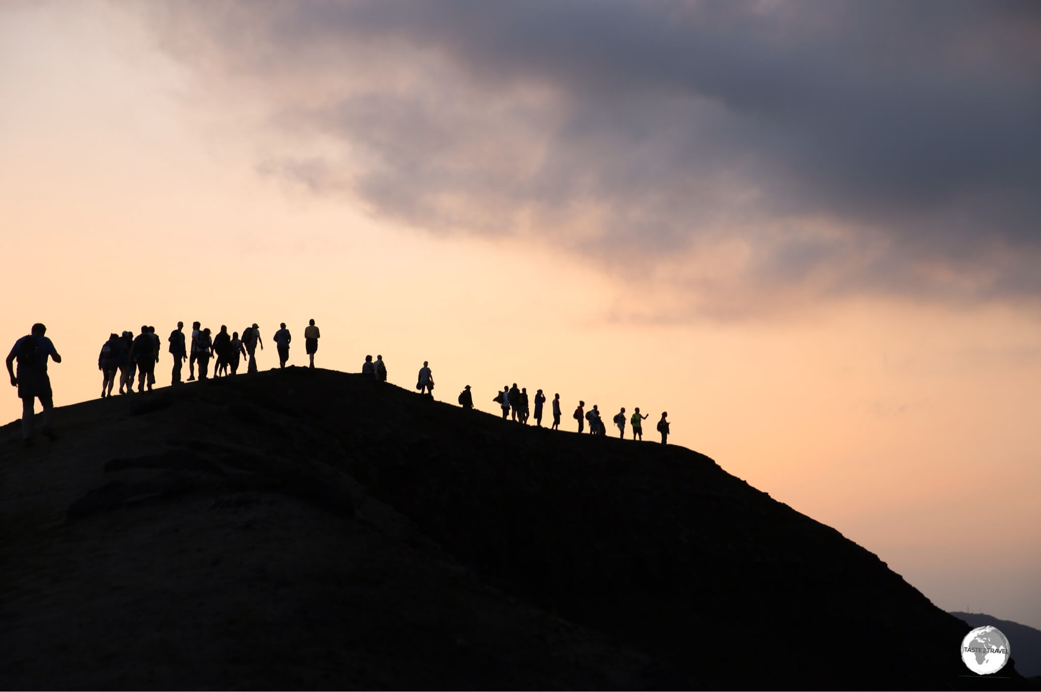
The passengers were separated into small groups and then led on a hike along a 3-km long trail through a ravine then up to the summit of the cone, which afforded panoramic views of the point.

Hiking in the ravine at Punta Pitt, San Cristóbal Island.
Along the trail we saw Iguana’s, Finches, Boobies (this is the only site in the Galapagos where the three species of boobies can be found together), Mockingbird’s, Frigates and more.
At sunset we returned to the ship for dinner and sailed through the evening to our next destination – Santa Fe island.
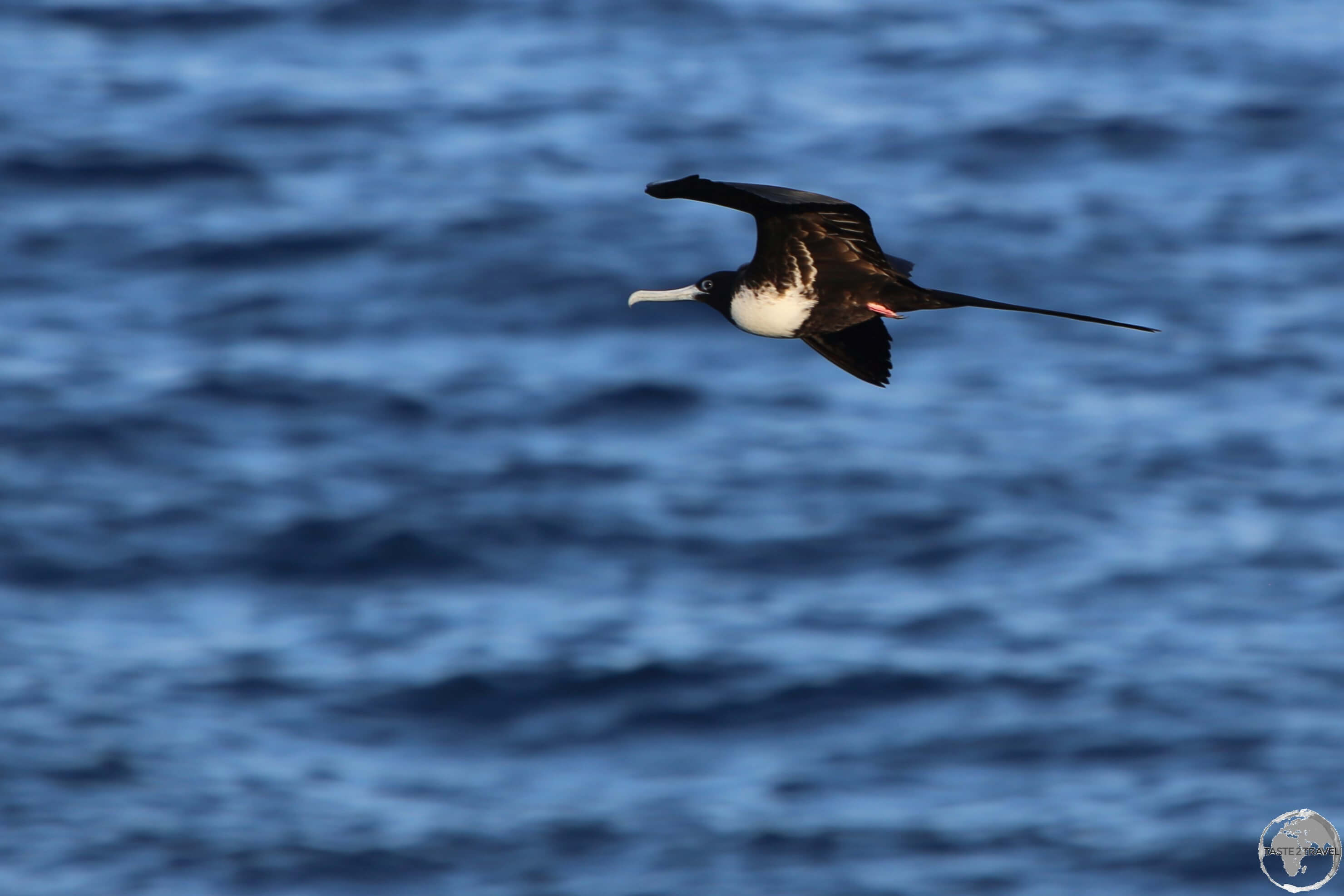
A female Frigate bird flying off the coast of Punta Pitt, San Cristóbal Island.
Day 2
Santa Fe Island

Galapagos Sea Lions relaxing on the shores of Barrington Bay, Santa Fe Island.
As was the pattern during the cruise – the light of a new day offered the sight of a new island and so, after breakfast, we travelled by dinghy to Santa Fe island, where we made a wet landing on an idyllic white-sand beach (Barrington Bay) which was populated by many lethargic Galápagos Sea Lions.

A Galápagos Sea lion pup sleeping on a slab of basalt rock at Barrington Bay, Santa Fe Island.
Santa Fe is comprised of some of the oldest basaltic rocks of the archipelago, which contrasted brilliantly with the white-sand beach. This black, smooth, volcanic stone provides an ideal resting place for Galápagos sea lion pups.

The endemic Santa Fe Lava Lizard on the sand at Barrington Bay, Santa Fe Island.
The warm sands of Barrington Bay attract the endemic Santa Fe Lava Lizard who enjoy relaxing on the warm sand. Only found on Santa Fe, males and females differ from each other in size, shape, and coloration.
Adult males are larger and have a brownish body with scattered black blotches and white spots, as well as a distinctive black throat and a black chest. Adult females have bright orange cheek patches and a black mark at the shoulder level.

A dazzlingly orange “Galapagos Sally Lightfoot Crab” at Barrington Bay, Santa Fe Island.
From the beach we hiked in small groups along a rocky trail, which climbed from the bay up to coastal cliffs which offered panoramic views of the cove.
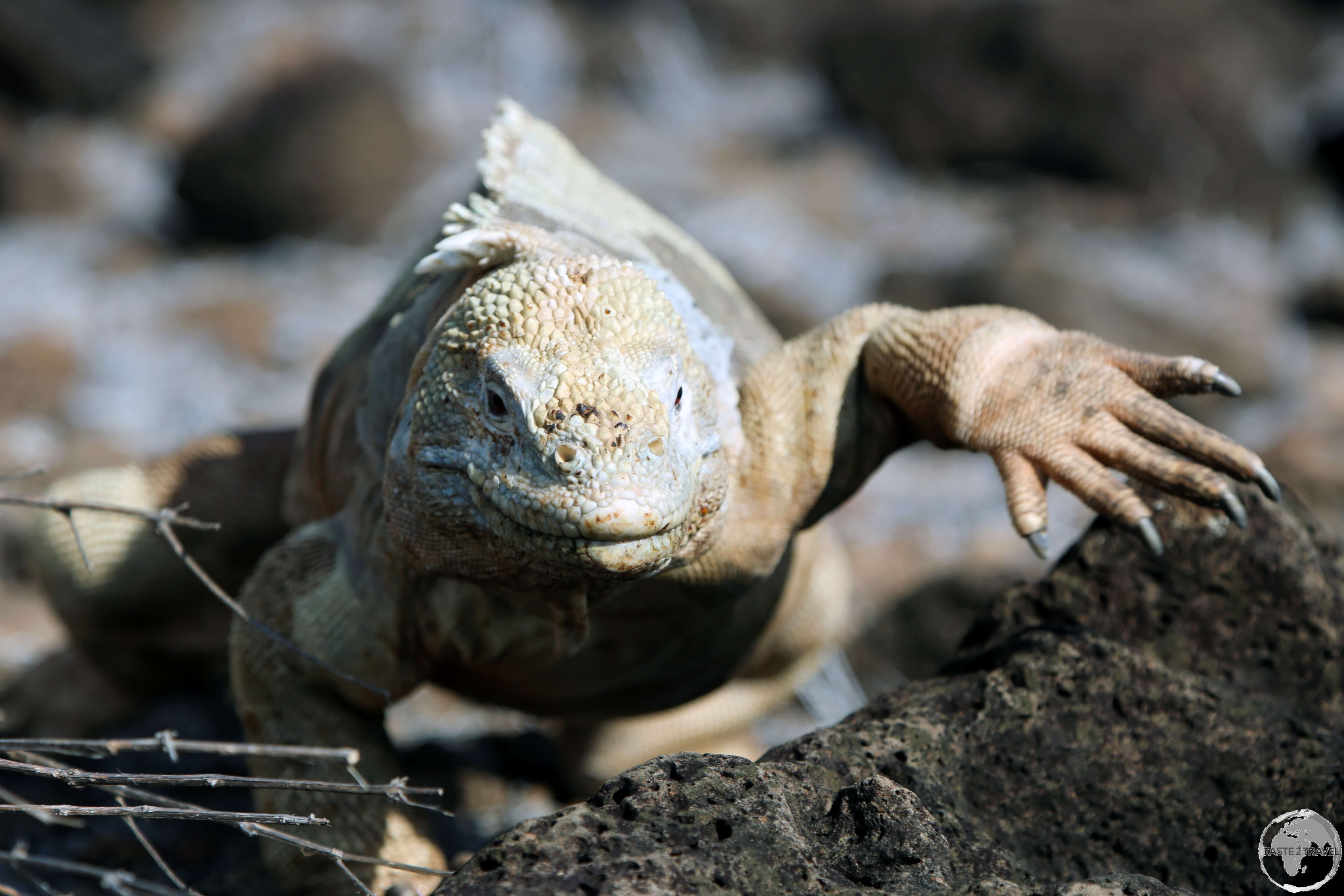
Along the way, the trail passed over a plateau which is the best place to spot the endemic Santa Fe land iguana or Barrington land iguana which are uniquely beige in colour.

Santa Fe island is home to the endemic Santa Fe land iguana.
The main source of food for the iguana’s are the flowers and leaves of the giant prickly pear cactus which cover this barren island, a food source which is unfortunately being consumed at a less-than-sustainable rate.

“Fifty shades of beige!” – the Santa Fe land iguana is a common site on Santa Fe Island.
After the hike we returned to the beach where we snorkelled in the crystal-clear waters of Barrington Bay. The added attraction of snorkeling just offshore from a group of sea lions is that they are curious and friendly and will join you in the water – constantly swimming rings around you! Snorkelling with the playful sea lions was one of the highlights of the trip.
After an incredible morning on Santa Fe island, we returned to the ship for lunch while the boat sailed onto our afternoon destination, South Plaza island.
South Plaza Island

The MV Santa Cruz moored outside the channel on South Plaza island.
Following lunch on day 2, we travelled by dinghy to South Plaza Island where we made a dry landing at a small dock in a protected channel. The turquoise water in the channel was in stark contrast to the white sand and black lava of the shoreline.
As we made our way ashore, we were greeted by the sight of a Galápagos Sea lion mother who had just given birth to a young pup.

An opportunistic Yellow Warbler feasts on the discarded placenta from a newly born sea lion pup on South Plaza island.
While the mother was busy licking the placenta off the new-born pup, a couple of yellow-warblers were also busy feeding off the discarded placenta. In this arid, hostile environment, food is food!

An adolescent Galápagos Sea lion at South Plaza Island.
South Plaza is home to a large colony of 1000+ Galapagos sea lions, many of which are retired, battle scarred male sea lions who mingle with young adolescent males.

The yellow flowers of the Prickly-pear cactus are a favourite meal for Galapagos land iguanas on South Plaza Island.
From the dock, we hiked along an easy trail through a forest of Prickly Pear cacti which is a popular food source for the resident Galapagos land iguana (Conolophus subcristatus).

A very colourful Galapagos land iguana on South Plaza Island.
Land iguanas can grow to over a metre in length, with males weighing up to 13.6 kilograms! In terms of food, land iguanas eat low growing plants, shrubs, fallen fruits and cactus pads – these provide the necessary water to sustain them through drier periods.

A Galapagos land iguana on South Plaza Island.
While hiking, we met a team of American researchers who were studying the iguana and their diet. Apparently, their insatiable craving for the flower of the prickly pear cactus means the cactus is unable to reproduce, which threatens a key food source for the iguanas.

A Galapagos land iguana on South Plaza Island devouring a cactus.
The iguanas are over-consuming their main source of food, which could lead to its extinction, and thereby threatening their own survival!

A male Galapagos land iguana on South Plaza Island.
From the cactus forest, we passed patches of red-orange Galápagos carpet-weed before reaching sea cliffs where we could observe nesting Blue-footed boobies, Nazcar boobies, frigates, swallow-tailed gulls and shear-waters gliding on the thermals.

A Blue-footed Booby on South Plaza Island.
One of the more comical creatures in the Galapagos are the “boobies”, a species of birds whose name is derived from the Spanish word “bobo”, which translates to clumsy. This was because it referred to the comical way that boobies walk.
There are three different types of boobies in the Galapagos, the Red-footed Booby; Blue-footed Booby and the Nazca Booby, all of which are easily distinguished thanks to their distinctive colours.

A Galápagos Brown Pelican on South Plaza island.
Endemic to the islands, the Galápagos brown pelican is a common sight on South Plaza island. Its population is estimated at a few thousand pairs that breed throughout the year.

A Swallow-tailed gull on South Plaza island.
The Swallow-tailed gull is one of the most attractive and distinctive looking birds in the Galapagos islands. It has the distinction of being the world’s only nocturnal gull, using highly developed night vision to hunt in the dark.
The defining feature of a swallow-tailed gull is its eye ring, which changes colour depending on breeding status. Breeding adults can be recognised by their bright orange/red eye ring, while non-breeding adults have a black eye-ring.

A Swallow-tailed gull chick in its nest on South Plaza island.
Lazing on the lava rocks along the clifftop, basking in the afternoon sun, were groups of Marine iguanas. These unique creatures are the only lizard that’ll frequent the sea although they live on land, as they eat a diet consisting mainly of seaweed grown on the sides of rocks. It’s an abundant food source, to which their blunt heads are well-adapted.
Unlike the the land iguana, the marine iguana also has sharp claws which allows it to grab onto plant material while underwater.

Juvenile Marine iguanas are coloured black, slowly changing colour as they mature.
Marine iguanas change colour as they mature. The young are typically black, slowly picking up many colours when they age – red, green, grey, usually differing depending on the island they live on.
Day 3
Santa Cruz Island
Puerto Ayora

A Pelican lands his catch at the fish market in Puerto Ayora.
Day three was spent on the principal island of Santa Cruz, where we docked in downtown Puerto Ayora, which is located on the southern shore of the island. With a population of 12,000 – Puerto Ayora is the principal town in the Galápagos and is named in honour of Isidro Ayora, an Ecuadorian president.

A Galápagos Sea lion competes with Pelicans for fish scraps at the fish market in Puerto Ayora on Santa Cruz Island.
If you plan on basing yourself on land while in the Galapagos, Puerto Ayora offers the best range of services and facilities for tourists. We spent the morning exploring the town, including the fish market where sea lions and pelicans fought each other for scraps.
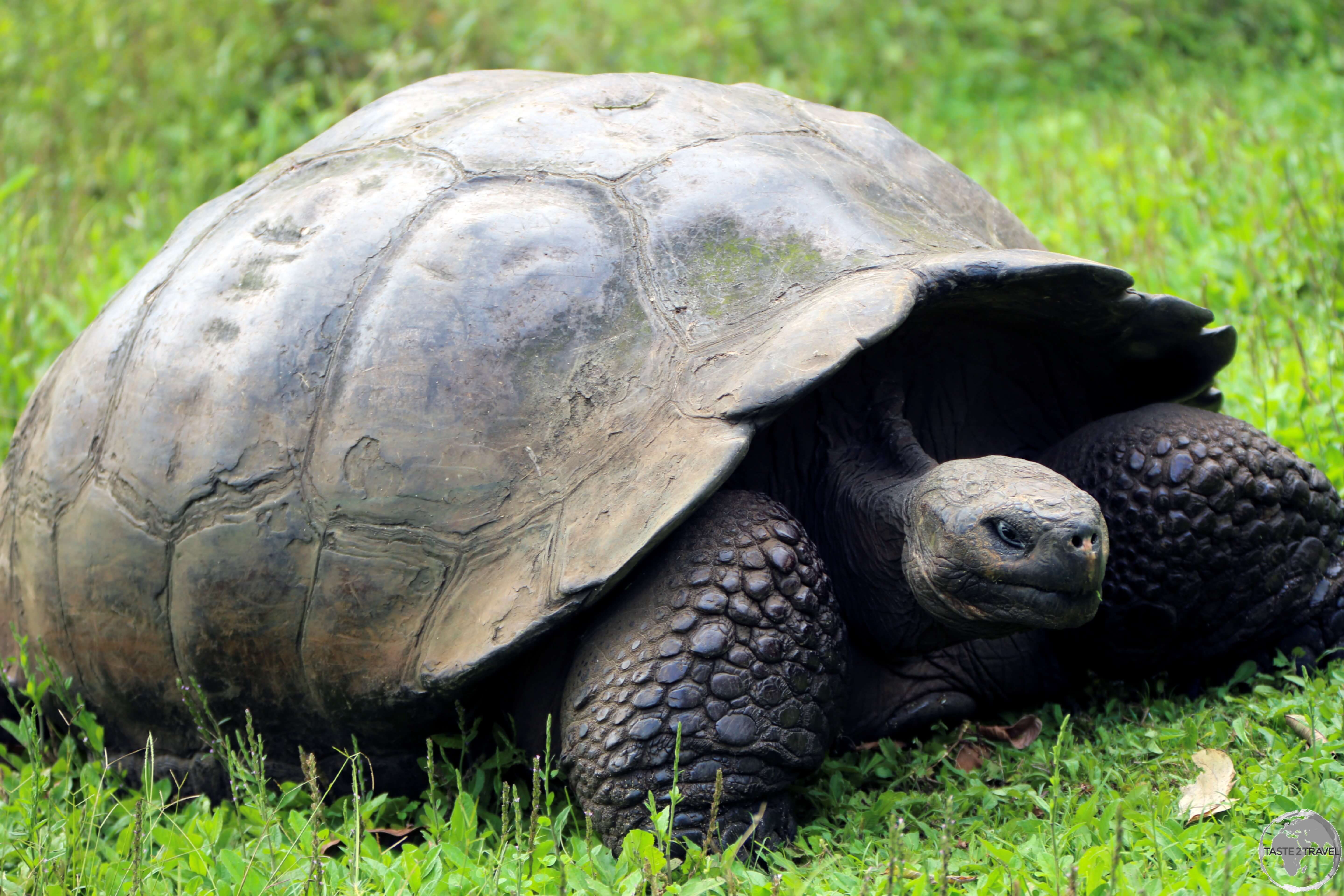
Galapagos Giant Tortoise

The Galapagos Giant tortoise, such as this one on Santa Cruz Island, can survive in different habitats, from dry lowlands to humid highlands.
A short walk from town is the Charles Darwin Research Station (CDRS), which is renown for its Galapagos Giant tortoise breeding program. The centre also serves as the headquarters for the Galápagos National park. The most famous resident of the centre was Lonesome George who was bought to the centre from Pinta Island. George was the last known individual of the ‘Pinta‘ tortoise species but died in 2012 at an estimated age of 100.

Weighing up to 400 kg (880 lb), the Galapagos Giant tortoise is the largest tortoise on the planet.
The Galápagos tortoises are native to seven of the Galápagos Islands. With lifespans in the wild of over 100 years, it is one of the longest-lived vertebrates. Spanish explorers, who discovered the islands in the 16th century, named them after the Spanish Galápago, meaning “tortoise”.
The current total population of Galapagos Giant tortoises is estimated to be 20,000 individuals.

The Galapagos Giant tortoise loves to feed on grass which is plentiful in the lush highlands of Santa Cruz island.
For lunch, we headed to a restaurant located in the lush, cool highlands of Santa Cruz, a completely different ecosystem from any we had so far seen.
The highlands contain mist-covered forests, underground lava tunnels and the Rancho Primicias Tortoise Reserve, which is home to a number of wandering Galapagos Giant tortoises.

The Galapagos Giant tortoise moves at an average a speed of 0.18 miles per hour.
Lava Tunnel

A perfect construction by Mother Nature – a lava tunnel on Santa Cruz Island.
After Rancho Primicias Tortoise Reserve, we descended into an amazing subterranean world – a lava tunnel. Huge underground lava tunnels perforate Santa Cruz, and in places extend for several kilometres.

Exploring a perfectly formed lava tunnel on Santa Cruz Island.
Like all islands in the Galapagos, Santa Cruz is volcanic in origin. The tunnels, or tubes, were formed when cooler outer parts of lava flows hardened into thick rock walls, providing insulation to keep a flow going inside; eventually the flow subsided, leaving long, perfectly shaped, empty tunnels easily big enough to walk down.

Galápagos wild tomatoes growing in the highlands of Santa Cruz Island.
Before sunset we returned to the ship for dinner then set an overnight course to Española island, 100-km to the south.
Day 4
The morning of day four brought us to the very southern island of Española. We spent the entire day on the island, making two landings; a morning landing at Punta Suarez and an afternoon landing at Gardener Bay.
Punta Suarez (Española Island)

Wildlife everywhere at Punta Suarez, with an Española Mockingbird standing on top of a marine iguana and a Nazcar booby in the background.
After breakfast we travelled by dinghy to Punta Suarez, which is located on the western tip of Española Island. Truly remote, Punta Suarez offers a bonanza of wildlife with colonies of blue-footed and Nazca boobies nesting in among a multitude of Galapagos sea lions, large marine iguanas, oystercatchers, Española Mockingbirds, lava lizards and the impressive Galapagos hawk.

An Española Mockingbird at Punta Suarez, Española Island.
Endemic to Española Island, the Española Mockingbird is very inquisitive and has almost no fear of people. Lone birds or small groups race around beaches boldly inspecting almost everything they encounter including shells, sea lions, marine iguanas, cameras, and anything else you might leave laying around. This feathered mischief also feeds off of bugs carried on the backs of iguanas and can often be seen perched on top of one.

An Española Lava lizard, sunning itself at Punta Suarez.
The warm sands on the beach at Punta Suarez attract the endemic Española Lava Lizard which is one of nine species of lava lizards endemic to the Galapagos Islands.

A Blue-footed Booby at Punta Suarez.
From the beach, a walking trail of about 4 km (2 miles) in length passes among colonies of blue-footed and Nazca boobies. From May to December, the island serves as a nesting site for Albatross, although none were present during our visit.

A Nazca Booby mother preening her chick at Punta Suarez, Española Island.
At the time of our visit, several, new-born, Nazca chicks were being tended to by their mothers. The largest out of the three booby species, and arguably the most handsome, the Nazca booby was previously thought to be a subspecies of the masked booby, but recently considered as a separate species.

A male Nazca Booby at Punta Suarez, Española Island.
Male Nazca boobies have yellow or orange beaks, while the female’s beak is far paler and has a more pinkish tone, while Nazca chicks have black beaks.

A very fluffy Nazca Booby chick at Punta Suarez, Española Island.
During breeding season, the female will often lay two eggs rather than one. This is because Nazca boobies undergo an unusual process called obligate siblicide. The process occurs when one of the two siblings hatched grows larger and stronger than the other. As a result, the smaller and weaker chick will be killed and removed from the nest.

A male Nazca Booby with his fluffy young chick at Punta Suarez, Española Island.
The walking trail ending at a plateau with fantastic views of coastal cliffs and a blowhole known as “El Soplador” (the blower) which sprays water some 25 metres (75 feet) into the air.

A view of the coastline of Española Island and “El Soplador” (the blower) which sprays water some 25 metres (75 feet) into the air.
Española Island is located in the extreme southeast of the Galapagos archipelago, about a 12-hour boat trip from Santa Cruz Island. Along with Santa Fe Island, Española Island is considered to be one of the oldest of the Galapagos islands, at approximately four million years.
The climate of the island is very dry, and – due to its flatness – receives only a few centimetres of rain per year.

A view of the rugged coastline of Española Island with a smaller blow hole in the distance.
From the cliffs, we had an aerial view of the many rock pools below. In one of those pools, a marine iguana could be seen swimming from one side to another, giving a ride to a hitchhiking Galapagos Sally Lightfoot crab. Truly survival of the fittest!

Truly bizarre! A Galápagos Sally Lightfoot crab hitches a ride on the back of a Marine Iguana on Española Island.
As if riding on its back wasn’t intrusive enough, the crab eventually perched itself on the head of the iguana.

A Galápagos Sally Lightfoot crab hitching a ride on the head of a Marine Iguana on Española Island.
Why this unusual behaviour? The Sally Lightfoot Crab primarily eats algae but is also known to dine on dead critters, organic trash, and more. In the Galapagos Islands, these crabs have a symbiotic relationship with the native marine iguanas, picking parasites off the iguanas for food while the iguanas get clean.

A highly coloured individual of the Marine Iguana subspecies endemic to Española Island.
The Galápagos marine iguana, is a species of iguana found only on the Galápagos Islands and is unique among modern lizards, in that it is a marine reptile that has the ability to forage in the sea for algae, which makes up almost all of its diet.
Large males are able to dive to find this food source, while females and smaller males feed during low tide in the intertidal zone. The subspecies found on Española Island (A. c. venustissimus) is especially colourful and is known as the ‘Christmas tree’ iguana.
After our morning excursion on Española Island, we returned to the ship for lunch then cruised further along the island to our afternoon stop – Gardener Bay.
Gardener Bay (Española Island)

Sea lions bask lazily on Gardner Bay, a white-sand beach which is one of the longest in Galapagos.
Located on the north coast of Española Island, stunning Gardener Bay is home to one of the longest stretches of (powder white) sand in the Galapagos.
There are no walking trails at Gardener Bay so, after making a wet landing onto the white-sand beach (one of the longest in the Galápagos), we were free to relax, swim or wander.

A view of the MV Santa Cruz from Gardener Bay, Española Island.
The beach is a perfect spot for snorkeling, and its possible to snorkel out to the smaller Tortuga Islet (Turtle Rock), a small island which sits offshore from the bay and is surrounded by an array of marine life. While I snorkelled, playful and curious sea lions swam around me – an incredible experience.

Galápagos Sea lions relaxing on the beach at Gardener Bay with Tortuga Islet (Turtle Rock) in the background.
One of the main attractions of Gardener Bay is the large colony of Galapagos sea lions which haul out on the pristine, white-sand beach.
The Galapagos sea lion is a species that primarily breeds in the Galapagos Islands. They are one of two types of seal found in Galapagos and are part of the eared seal family – having external ear pinnae.

A Galápagos Sea Lion pup feeding at Gardener Bay on Española Island.
They are not ‘true’ seals, as they are able to rotate their hind flipper under their pelvic girdle and lack the characteristic long, finger-like claws of true seals. The configuration of their pelvic girdle allows them to ‘gallop’ across land, reaching speeds exceeding that of a running person on rocky terrain.

The poorly camouflaged Galápagos Sally Lightfoot crab at Gardener Bay.
The basalt rocks at Gardner Bay are the favoured haunt for the very orange Galápagos Sally Lightfoot crab. The origin of their name is still debated but some say it was named after a Caribbean dancer which would be fitting for a creature that is very nimble and light on its feet. These guys can out-manoeuvre almost anything.
At sunset, we returned to the boat for our final dinner and an evening of drinks and entertainment by the crew. Overnight we cruised north to Baltra Island – ready for our disembarkation the following day.
Day 5
On the last day we landed on Baltra island and were transferred to Baltra airport where we boarded our flight back to the mainland.
The end of an amazing adventure.
Accommodation
While in the islands, you have a choice of being accommodated on land or at sea or both.
Land
Land-based accommodation can be found on 4 different islands with ample properties catering for all budgets.
- Santa Cruz Island – Lots of accommodation options in the main town of Puerto Ayora, which is located one hour from neighbouring Baltra island and Baltra airport.
- San Cristóbal Island – The provincial capital of Puerto Baquerizo Moreno is next to San Cristóbal airport and has a good selection of accommodation, especially backpacker hostels.
- Isabela Island – The islands main settlement of Puerto Villamil is located on its south-eastern shore, two hours south-west of Puerto Ayora by speedboat. This town of 2,000 souls offers a small number of accommodation options.
- Floreana island – Located two hours south of Puerto Ayora by speedboat, this island of 300 inhabitants contains a small collection of beach-side guest houses with Wittmer Lodge (home to the pioneering Wittmer family – among the first foreign settlers in the Galápagos) being the most notable.
Hotels can be booked using OTA’s (Online Travel Agents) such as booking.com or Airbnb. Another good resource is the Hotels page on the Galapagos Islands website.
Sea
The best way to maximise your time whilst in the region is to travel by cruise ship. Travelling by ship allows you to venture to more remote islands without needing to return to a land base at the end of each day. An additional convenience is that most of the long sea voyages are completed overnight while you sleep in your cosy cabin, allowing you to awake each morning to a filling breakfast before setting out to explore another magical, wildlife-filled island.
I travelled with Metropolitan Touring and would highly recommend them, however there are many other companies offering cruise ship experiences, many of which are listed on the Galapagos Islands website.
Eating Out
If you’re staying on land you will find no shortage of restaurants in Puerto Ayora and a more limited number of options on San Cristóbal, Isabela and Floreana islands.
If you’re travelling by cruise ship you will be on a full board package. Meals on the MV Santa Cruz were served in a semi-formal dining room, were always plentiful and included a ‘fine-dining’ dinner each evening. If it wasn’t for the twice daily hikes, I would have gained weight from all the amazing food.
Visa Requirements

Ecuadorian Passport Stamp.
Ecuadorian immigration formalities are taken care of on the mainland and the good news is that the visa policy of Ecuador is one of the most lenient in the world, with almost all nationalities being granted a 90-day stay upon arrival.
Getting There
Air

The Ecuadorian metropolis of Guayaquil is the gateway to the Galápagos Islands.
There are two airports serving the Galápagos islands – San Cristóbal and Baltra. There are no direct international flights to the islands, with all flights departing from the Ecuadorian capital of Quito and the coastal metropolis of Guayaquil. Three airlines offer daily flights (2 hours) from the mainland to the islands, providing easy access to this remote archipelago.
San Cristóbal Airport
Located on the island of the same name, San Cristóbal Airport (IATA: SCY) is one of two gateways to the islands, lying in the south-east of the archipelago.
The following airlines provide services to/ from San Cristóbal:
Baltra Airport
Seymour Airport – aka Baltra Airport – (IATA: GPS) is located on the island of the same name and is a one-hour journey from downtown Puerto Ayora on neighbouring Santa Cruz.
The following airlines provide services to/ from Baltra:
Galápagos Environmental/ Immigration Controls
Given the fragile ecosystem of the Galápagos, the government has taken several measures to help conserve the Islands’ ecology and to control migration to the province.
Prior to checking in for your flight at Quito or Guayaquil airports, you will first need to report to the INGALA counter where you will be required to complete a form and pay USD$10 for the issue of an INGALA Transit Control Card. This card is designed to help control migration to the islands and is to be surrendered upon departure from the islands.
After being issued with your INGALA card, you then proceed to the SICGAL (Galápagos quarantine) inspection area, where your luggage will be checked to ensure you are not carrying anything organic to the islands. Once you have completed this screening process you proceed to the airline counter to check in for your flight.
Once you’re in the air, the flight attendants will spray the cabin with an insecticide to further reduce the chance of introducing unwanted bugs to the islands.
Upon arrival in the Galápagos, you’re required to step on a wet mat (which sterilises the soles of your shoes) prior to exiting the airport.
Galápagos National Park Fees
When you arrive at the airport in the Galápagos all tourists are required to pay a National Park Entrance Fee which currently costs USD$100 for foreign adults and USD$50 for children under 12 years of age.
Getting Around
Air
Inter-island flights are operated by Emetebe who provide connections between San Cristobal, Baltra (for Santa Cruz) and Isabela islands.
Sea

The MV Santa Cruz approaching Punta Pitt, San Cristóbal island.
Ferry Galapagos offers inter-island ferry services between Santa Cruz and the islands of Isabela, Floreana and San Cristóbal.
That’s the end of my Galápagos Islands Travel guide.
Safe Travels!
Darren
Follow me on Instagram:
Further Reading
Other travel reports from the Pacific region:
Galápagos Islands Travel Guide Galápagos Islands Travel Guide Galápagos Islands Travel Guide Galápagos Islands Travel Guide Galápagos Islands Travel Guide Galápagos Islands Travel Guide Galápagos Islands Travel Guide Galápagos Islands Travel Guide Galápagos Islands Travel Guide Galápagos Islands Travel Guide Galápagos Islands Travel Guide Galápagos Islands Travel Guide Galápagos Islands Travel Guide Galápagos Islands Travel Guide Galápagos Islands Travel Guide